

Crisscrossing the Camino: 5 Weeks in Northern Spain Part 6 - La Rioja and Navarra
Laguardia
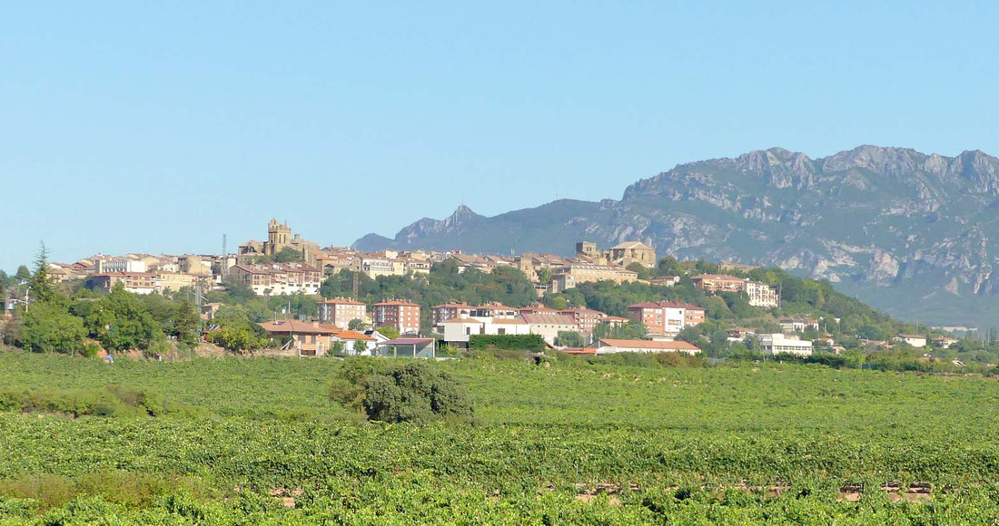

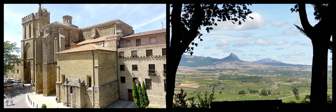

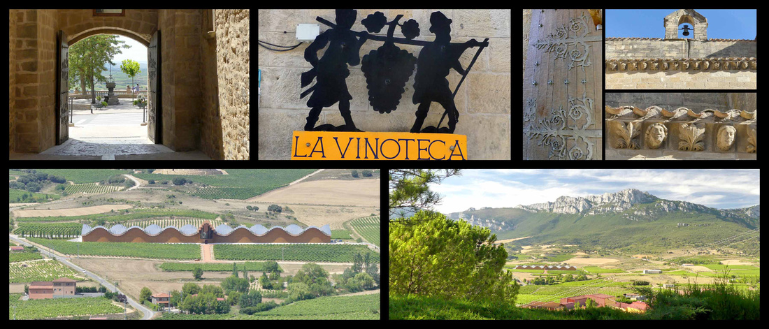
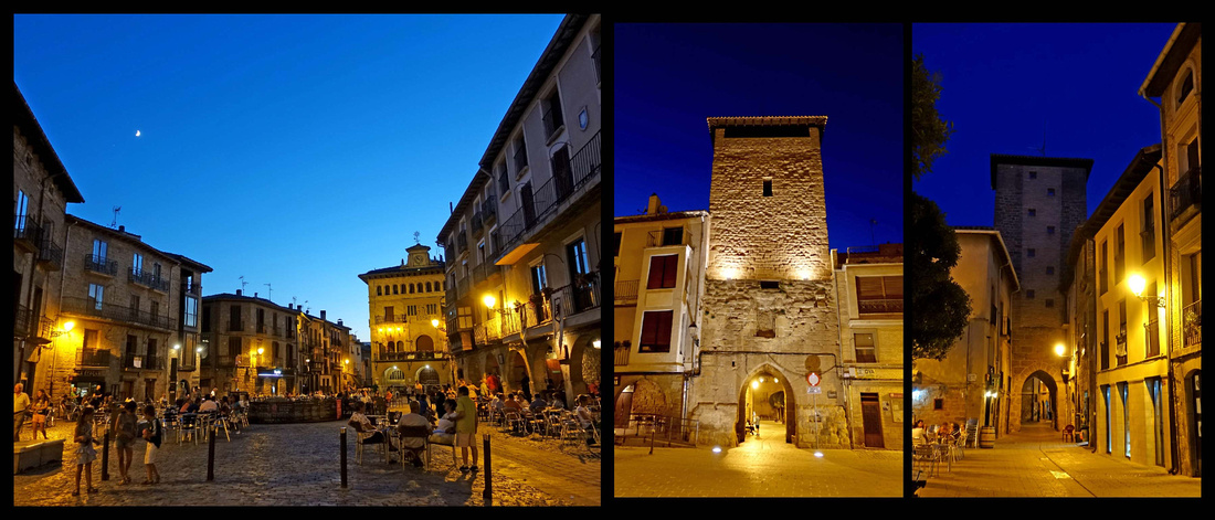
Laguardia, population 1500, sits at the top of a hill, its tightly packed stone buildings enclosed by massive stone walls. From the walls are views of the valley below and the Sierra de Cantabria mountain range behind it. The town is surrounded by vineyards on all sides, there are bodegas everywhere. The core of the economy in Laguardia focuses on the world of viticulture, Laguardia is the capital of one of the most famous wine regions of Spain, Rioja Alavesa. Basque speakers call the town 'Guardia'.
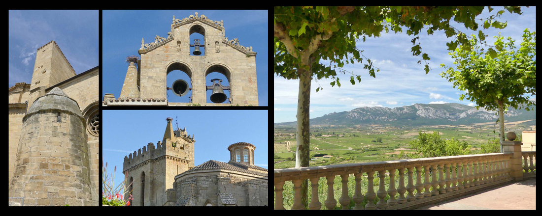
 Iglesia San Juan Mirador on west side of town
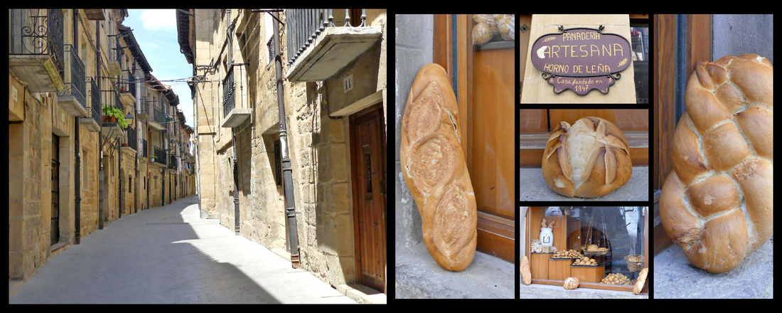
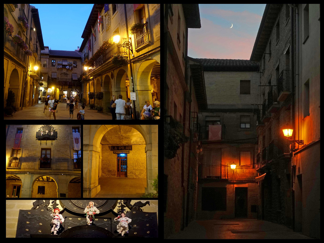
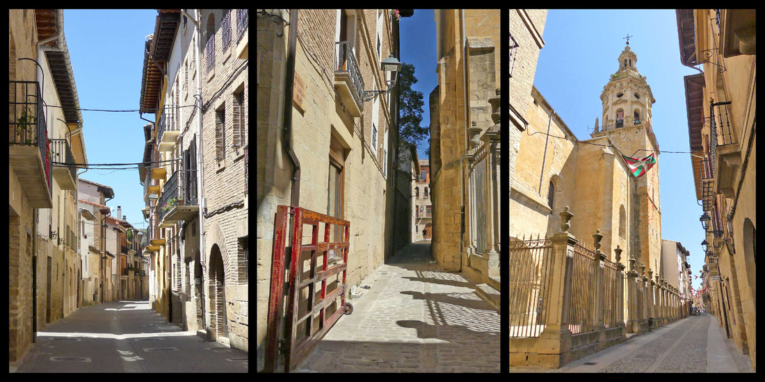
The town itself is totally pedestrianized, very narrow streets (about 3 streets run the length of the town, a few more short cross streets; the town is very narrow). You can walk up and down every street in less than an hour.
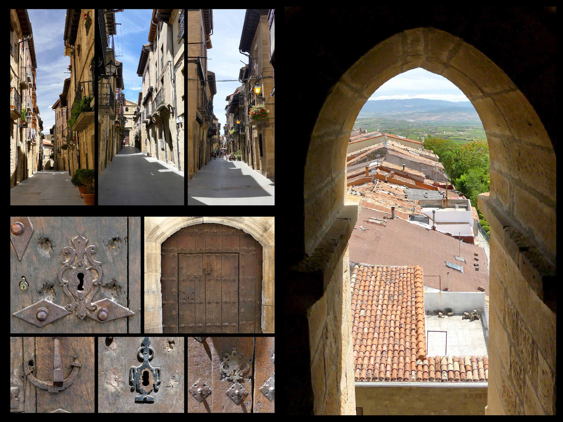

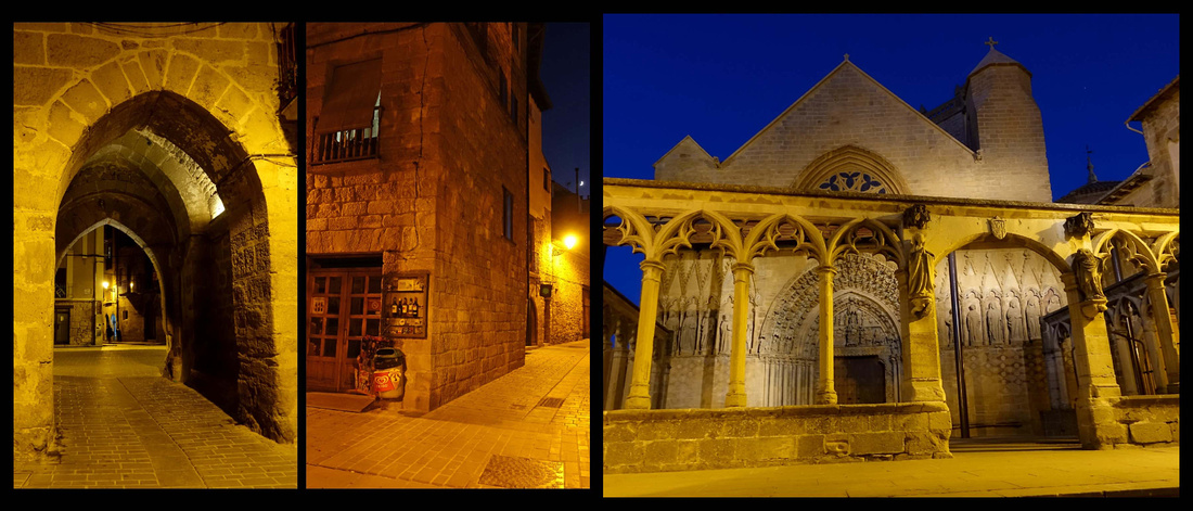
During its tumultuous medieval past, the rock beneath the streets was carved into a maze of tunnels for shelter and escape routes when the town was under attack. Today some of these house wine cellars. There is the Romanesque church of San Juan Bautista at the one end of the village and the church of Santa María de los Reyes at the other, originally probably a Templar monastery. Next to it is the Tower of Santa Maria, which has a Gothic façade with a portico finished in the fourteenth century. It is one of the few preserved polychrome portals in Spain. The tower can be climbed for great views (€2). In the center of town is Plaza Mayor, a tiny square with arcaded buildings on both sides, both the old and new town halls. The old town hall has a clock, which opens up and automated figures perform a regional dance.

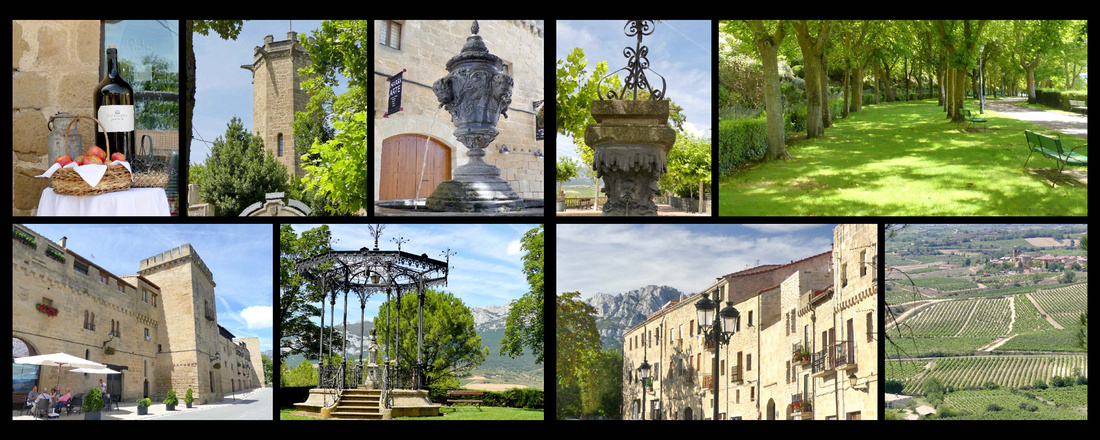

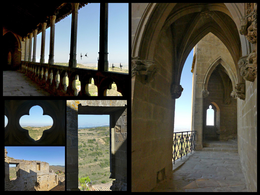
Walls on eastern side of town Promenade and view from it on western side of town
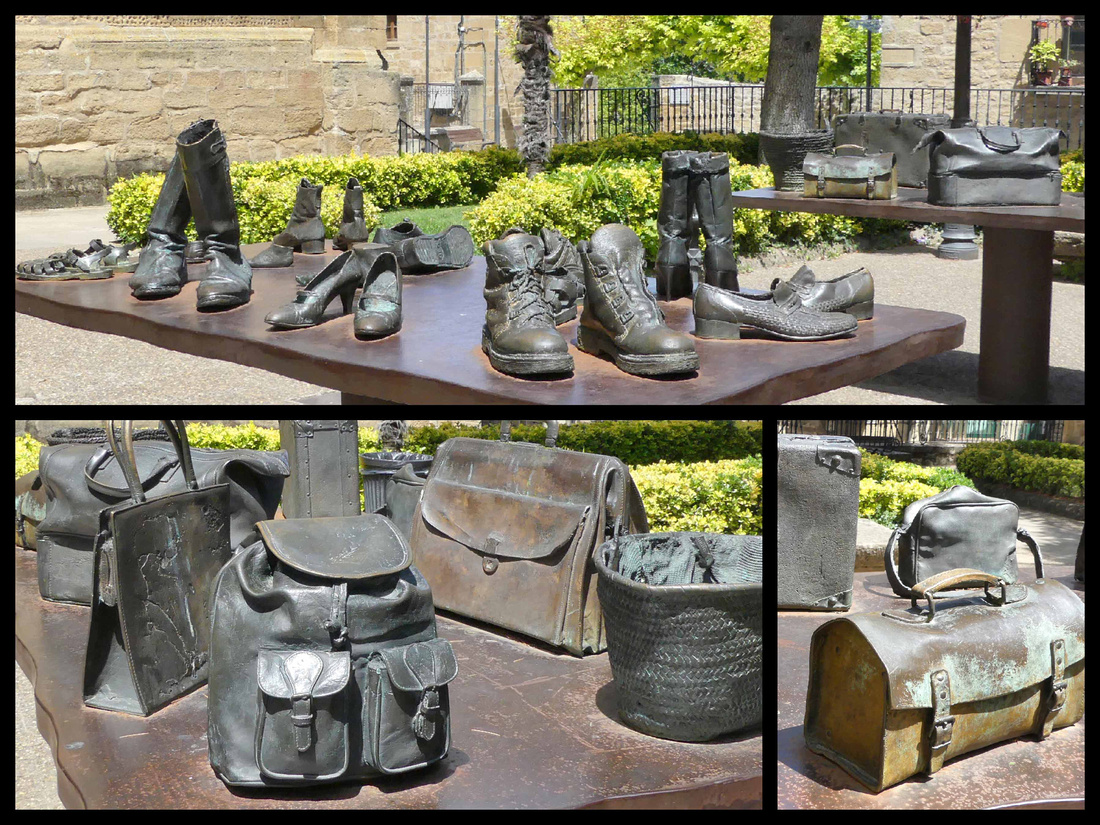
There’s a nice promenade around the tip of the town, benches, tree shaded, great views. A little square near the church of Santa Maria had an interesting sculpture – two bronze tables, one filled with bronze shoes and the other with bronze bags/suitcases/backpacks. It’s by Koco Rico titled 'Viajeros/Bidaiariak Izenekoa' (“Travelers”) “The basic idea of this sculpture is the journey and the evocation of it (of the land that leaves us and of which we leave) reflect on how an object related to traveling, such as shoes or a suitcase, can make us relive different situations and moments.” It was lovely.

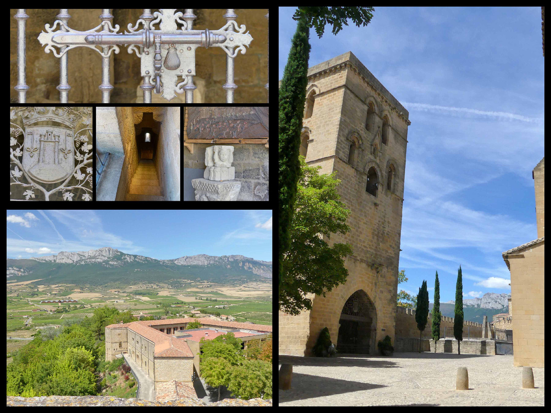
 Tower next to Santa Maria and view from it

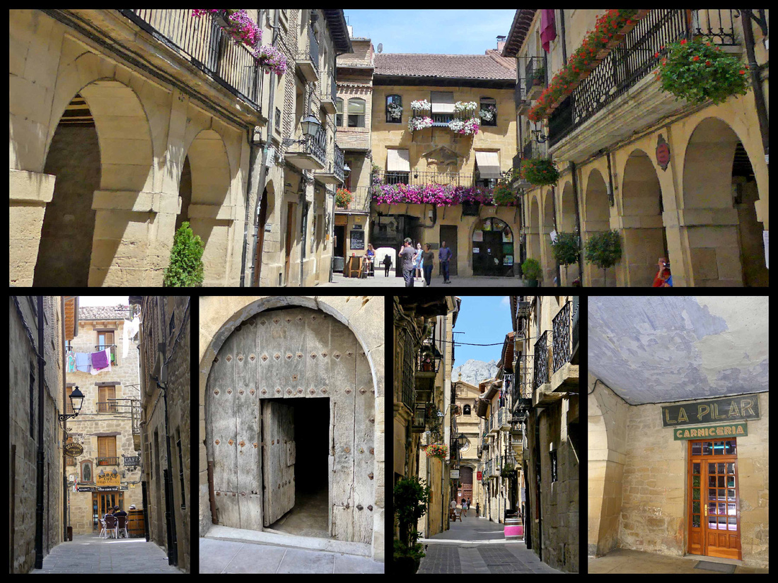

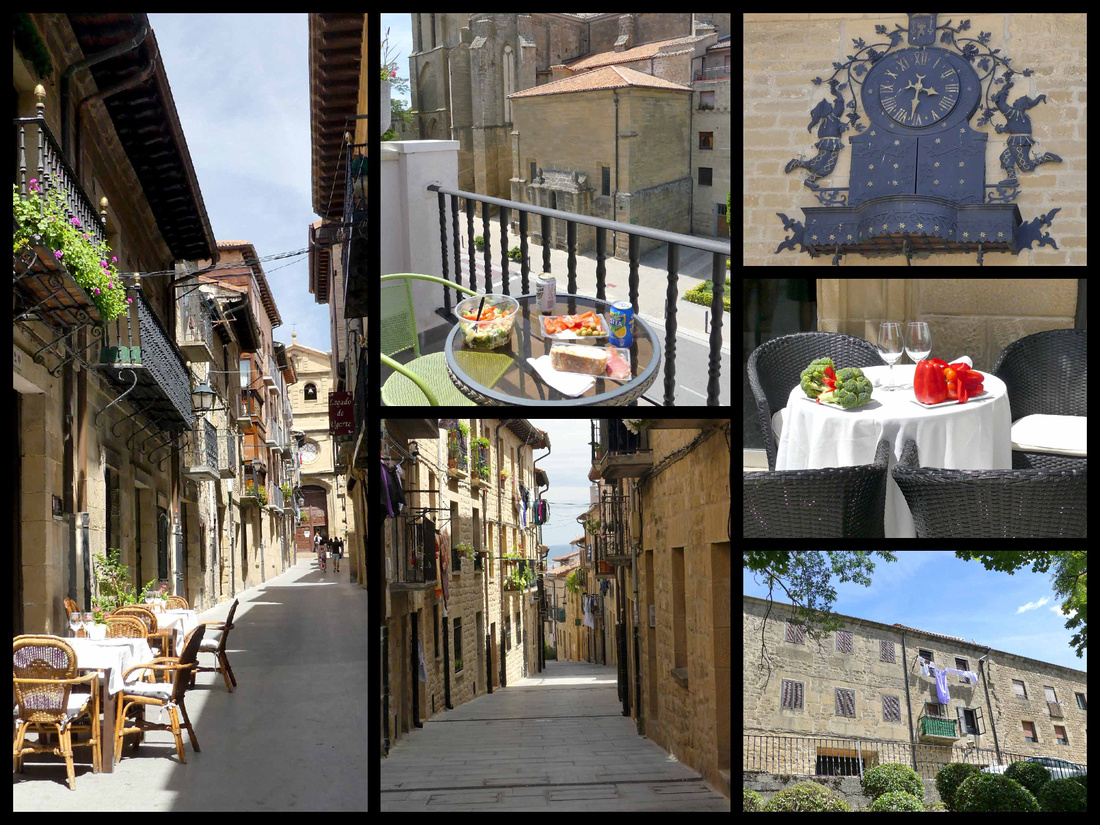

There were two or three touristy shops, a few wine stores, a couple of butchers and bakeries and one small grocery store where, in addition to groceries and produce, you could purchase all types of wine, including some unlabeled Rosé for €1.49 a bottle. We couldn’t resist, although the corkscrew we had to buy to get into the wine cost three times as much as the wine did. It was at least as good as your average Rosé. While we were there we put together a picnic dinner an ate on our balcony, just meters from the church and town walls and watched the stone change color as the sun went lower. Then we walked over to the mirador on the western edge of town for sunset.
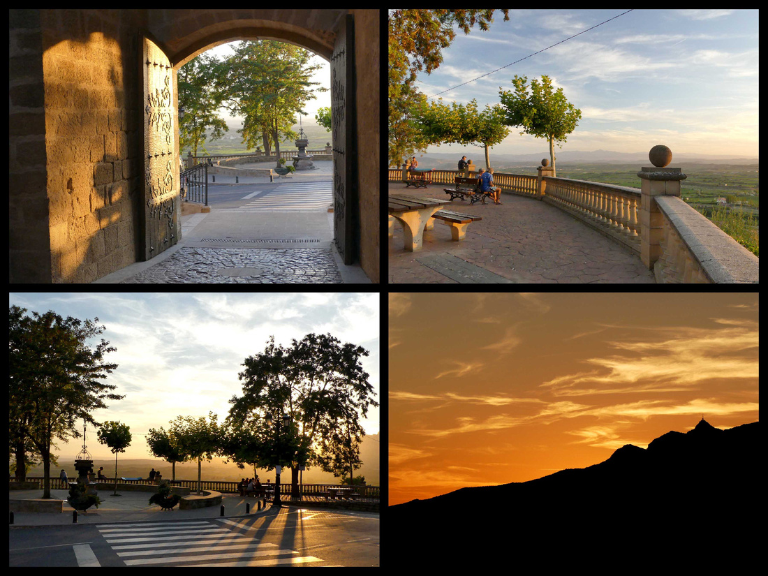

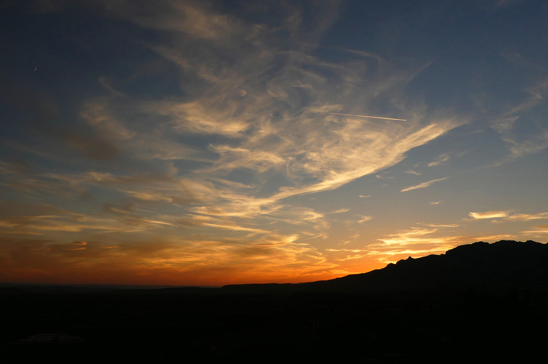

The view of the sun setting over the mountains from the promenade was spectacular and in the warm evening the town came alive with people of all ages, children playing games and riding tricycles, parents and grandparents enjoying wine or dinner at one of the restaurants lining the streets, or just sitting in the main plaza.



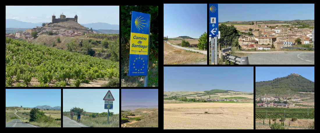
The drive from Laguardia to Puente La Reina is pretty straightforward. Mostly stayed on the N roads, which followed the Camino. Saw a good number of walkers. Passed a few cute stone villages. Watched as the Camino went along the road and then would cut through fields for a while and reappear on the road. Slightly hilly, mostly wheat fields and vineyards. Not un-pretty landscape, but would get bored after a few hours of what takes more like a few days to walk. The route goes through Logorno and a few other sizeable towns, which are easily passed in a car but walking through them didn’t look like fun.
One very picturesque stone village, Sansol sits just where the Camino leaves the road and goes off into hayfields

Puente La Reina [Camino Frances]
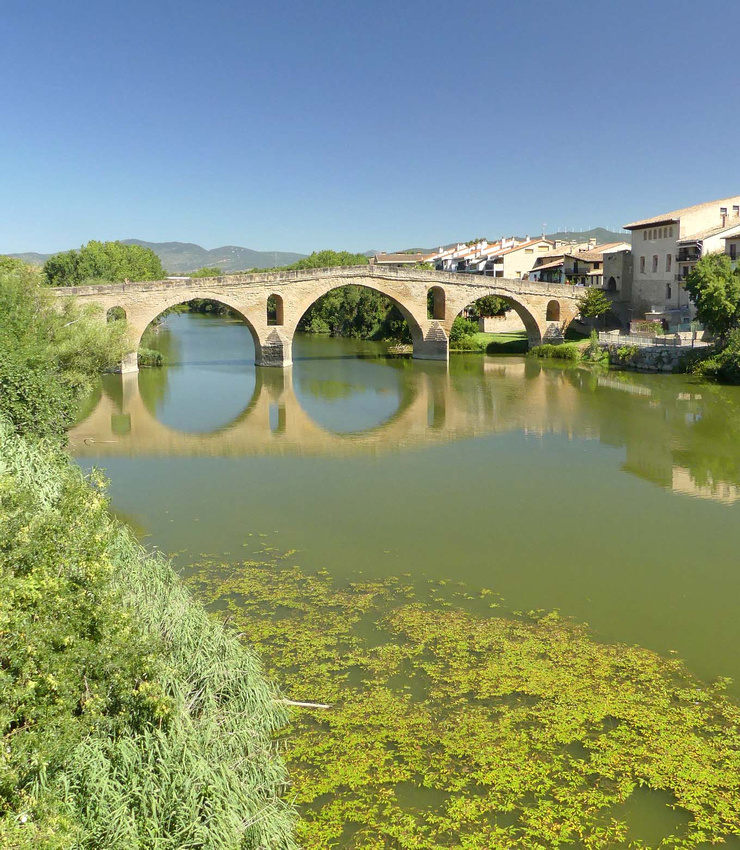

The six arched medieval bridge has carried multitudes of pilgrims over the river. Over the centuries they approached from Roncesvalles to the north and Aragon to the east and then united to take the one main route, Camino Francé, west to Santiago de Compostela. Their first stop here was at the late Romanesque Iglesia del Crucifijo, erected by the Knights Templar. In Spanish literally the "bridge of the Queen”. Queen Muniadona, wife of King Sancho III built the six-arched bridge over the Río Arga for the use of pilgrims on their way to Santiago. The bridge, Puente de los Peregrinos, is Romanesque and reflects beautifully in the river.
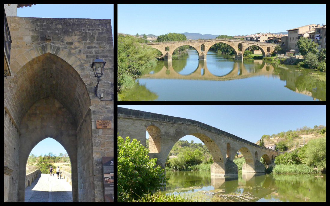

There are several architectural gems such as the churches of the Crucifix, St. James and St. Peter and beautiful buildings peppered with details of the influence of the Pilgrim's Way. The town isn’t built around a castle as is the case in many medieval towns, instead it’s more of a medieval mall concept: the main street, Rúa Mayor, is the Camino, leading you past churches and shops before putting you on the bridge. Alfonso I, king of Navarre, designed it this way to attract Camino traffic and commerce in the 11th century. The goal was for Navarre to get settlers to beef up a sleepy Basque wheat-farming settlement and push back the northern expansion of Moorish rule. This is one of those places where you realize the story of the Camino is not just a spiritual one, but also one of political interests, immigration issues, developer power plays, and tourism opportunists. Still, what they left behind is beautiful.
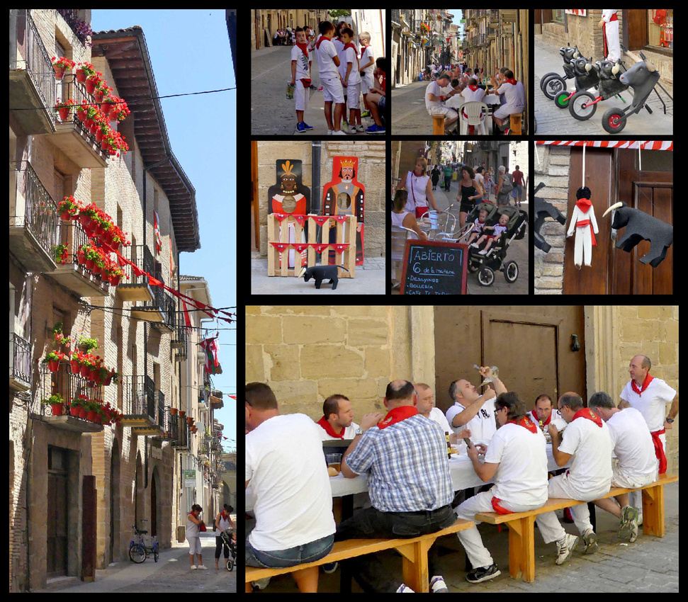
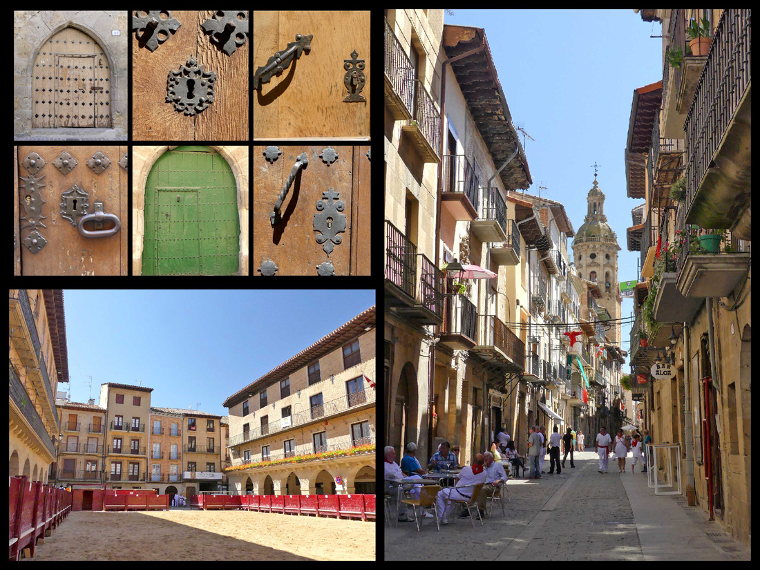
 We found parking in Puente La Reina with no problem and walked through the town. First thing we noticed was that 90% of the people were dressed in white with red trim. At first I thought they were going to Pamplona but then we realized there were so many of them it had to be local (plus Pamlona’s festival/running of the bulls had been over for more than a week). We finally found signs saying Puente La Reina’s festival is July 25-29th. They appear to have a tiny bull ring right in the main square –there was sand and pretty substantial walls and bleachers. Then we noticed there were large gates closing off the side streets (so the bulls must run through the main street to the main square). But the main street was currently full of restaurant tables and people eating and drinking (despite it being 11am). Everyone in white and red, even babies and grandpas. As we were leaving town there was the beginning of a parade.


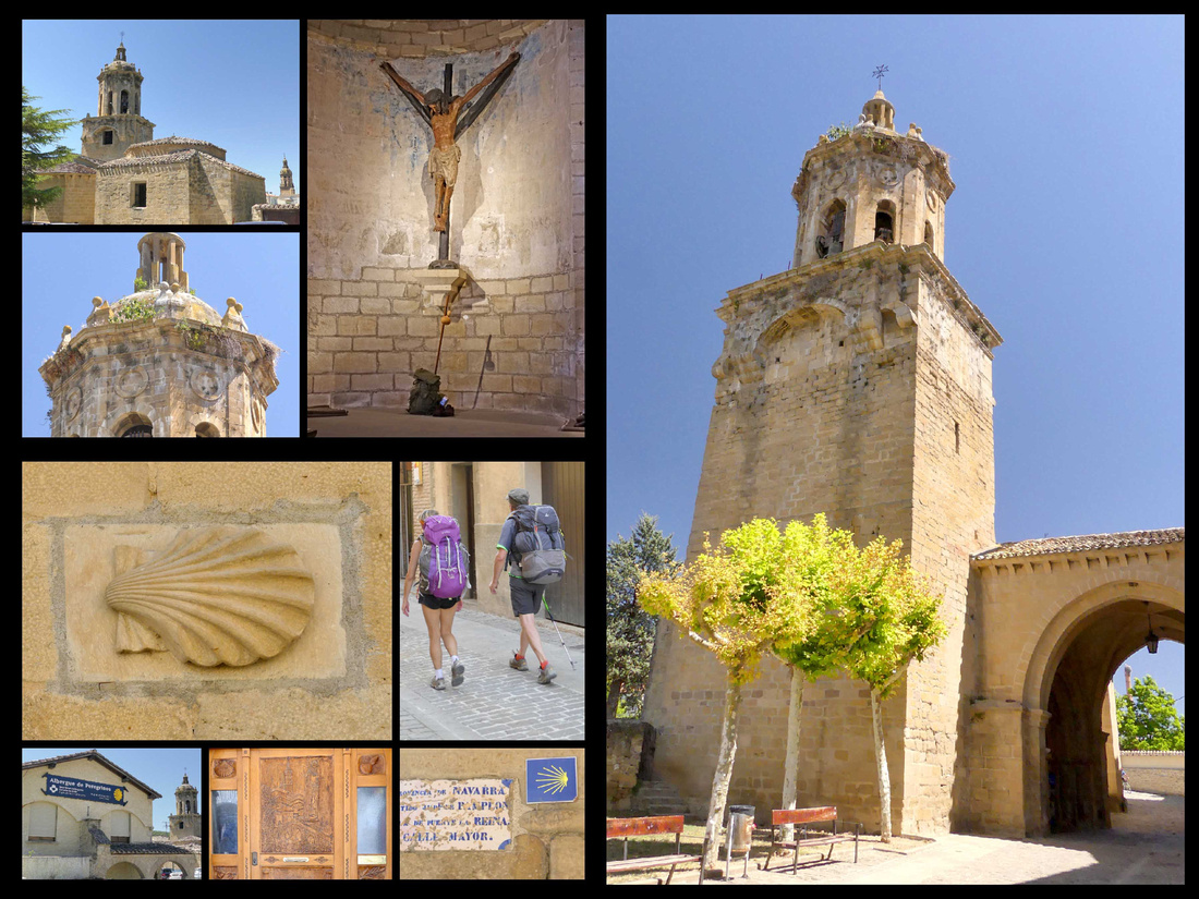
The Church of the Crucifixion at the far end of town, is next to the Pilgrim Hostal and the Pilgrim monument (which is apparently the base of an old crucifix). The church has a backpack and walking staff right under the crucifix near the altar.

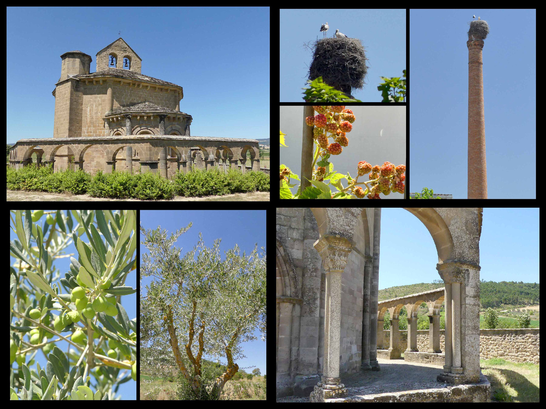
Heading south from Puente LaReina, a couple km past town I spotted a round stone church in the middle of a cornfield and we pulled off – there was a parking lot and a few people. It was just lovely, was actually hexagonal with a kind of round cloister all around it. Unfortunately it was closed but it was great to just walk around it. It’s the Church of Saint Mary of Eunate, a 12th century Romanesque church with links to the Knights Templar. Its octagonal plan and the fact that it is not located in a present-day village but in the countryside contribute to its enigmatic nature. I was just saying ‘why is this not in a guidebook’ and then as we were leaving a tour bus pulled in. Guess it’s in Spanish guidebooks. While there were lots of great things I saw on this trip, my extensive research meant that there were few surprises, so the fact that I just ‘spotted’ this one added to the experience.

Olite [Jacobean route of the Camino Frances]
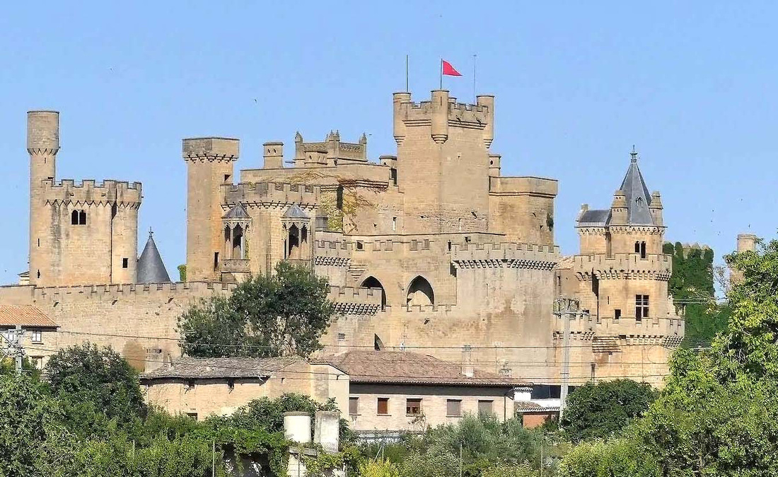

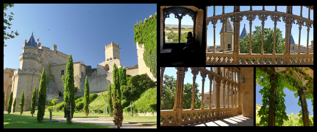

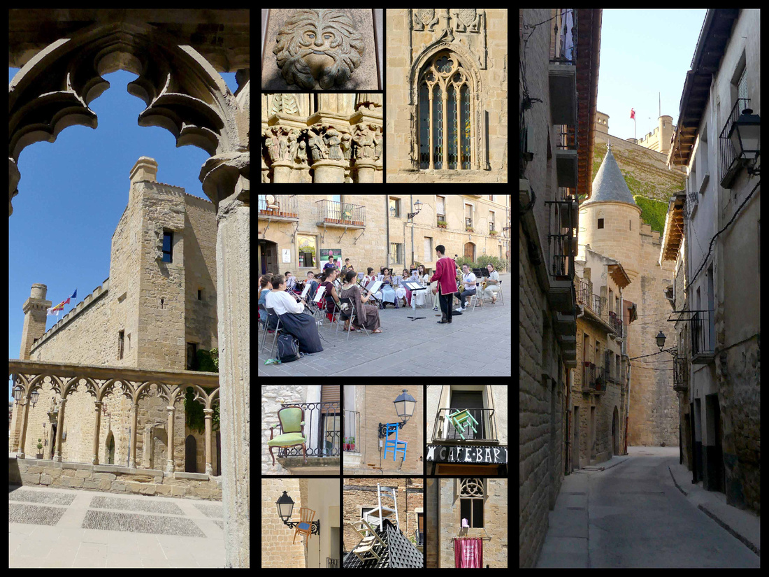
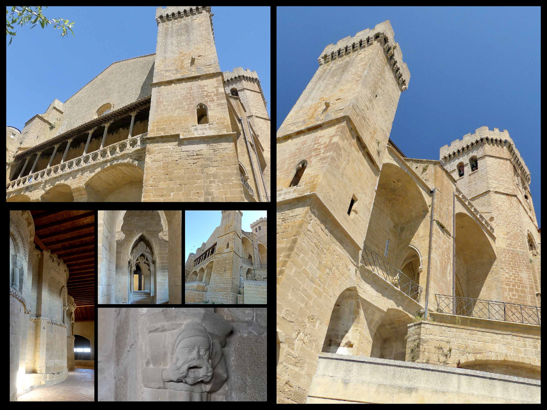
Olite, population 3500, is a pleasant little town in the center of Navarre that was the seat of the Royal Court of the kingdom in the Middle Ages with an exceptional medieval castle complex known as the Palacio Real. There are crenelated towers and square towers and round towers and turrets and annexes, it just keeps rambling.
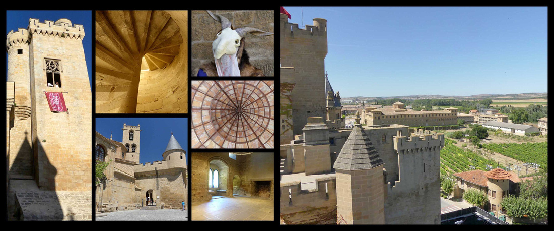

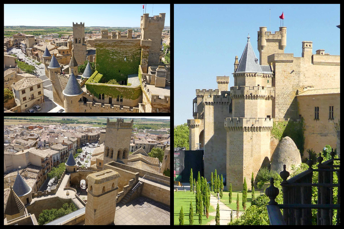

Left: views from the Castle towers Right: view of the castle from the balcony of our room at Hotel Merindad
Declared a national monument in 1925, the castle is the best example of civil Gothic architecture in Navarre and one of the most notable in Europe. There are lots of towers to climb (I think there were 12), each offering spectacular views of the rest of the castle, the town & the surrounding vineyards. There are interior rooms, courtyards (one completely covered in ivy), and balconies. The original part of the castle is now a Parador, the rest of it, the main parts, are open for visits. It’s been highly renovated (but very faithful to it’s original appearance), sometimes castles less recently renovated have more charm, but the renovations were well done and it really does look like a fairy tale castle. There are photos of it from before renovations. If you like to fantasize being a medieval knight or princess this is the place to go.
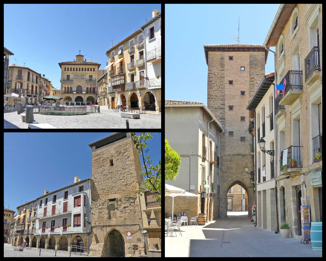


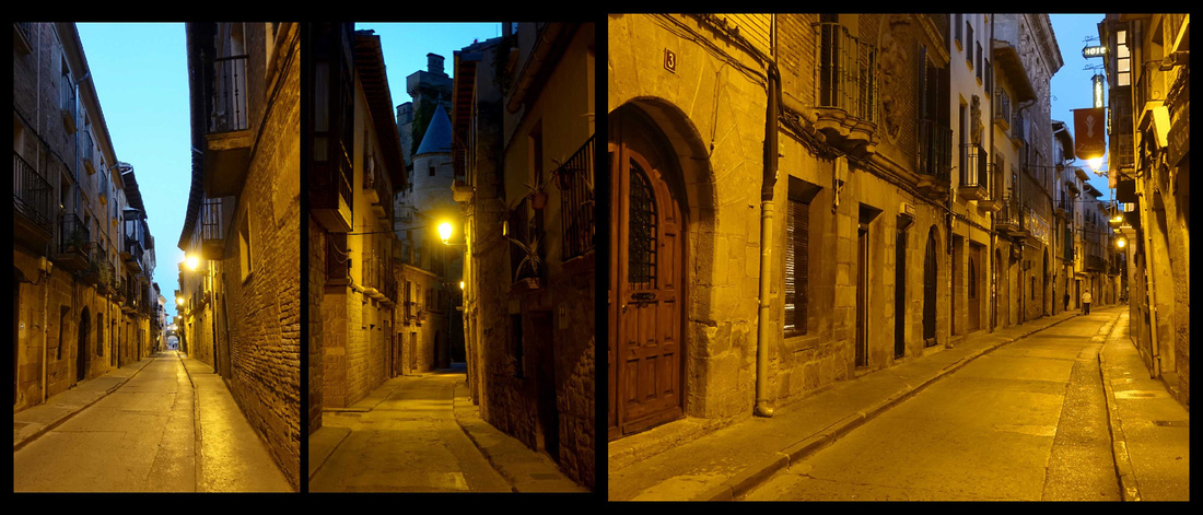
The old town of Olite itself is enclosed by it’s medieval gates, with one main plaza and a couple of smaller ones, a nice watch tower in the center, a pretty town hall, several streets of stone buildings. Hardly any tourists and of the few that were there, most were Spanish (although we met an American family, which felt strange since we had hardly heard any English at all in days). There is a more modern town surrounding the old town, but it’s small and unobtrusive. And the old town itself has plenty of cafes and restaurants, a small grocery store and a couple of coffee shops right out of the 1950s with amazing croissants and pastries (and of course great coffee). There are bodegas all around the town.


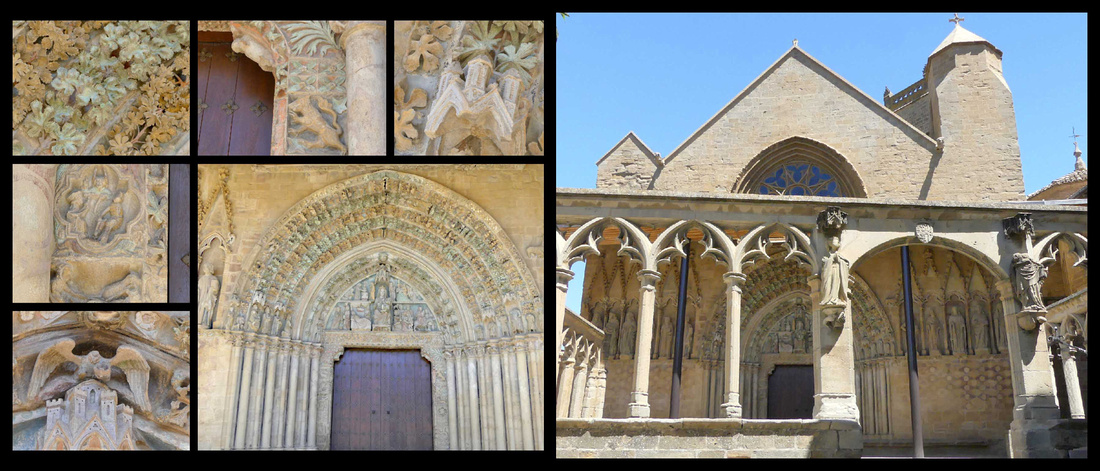
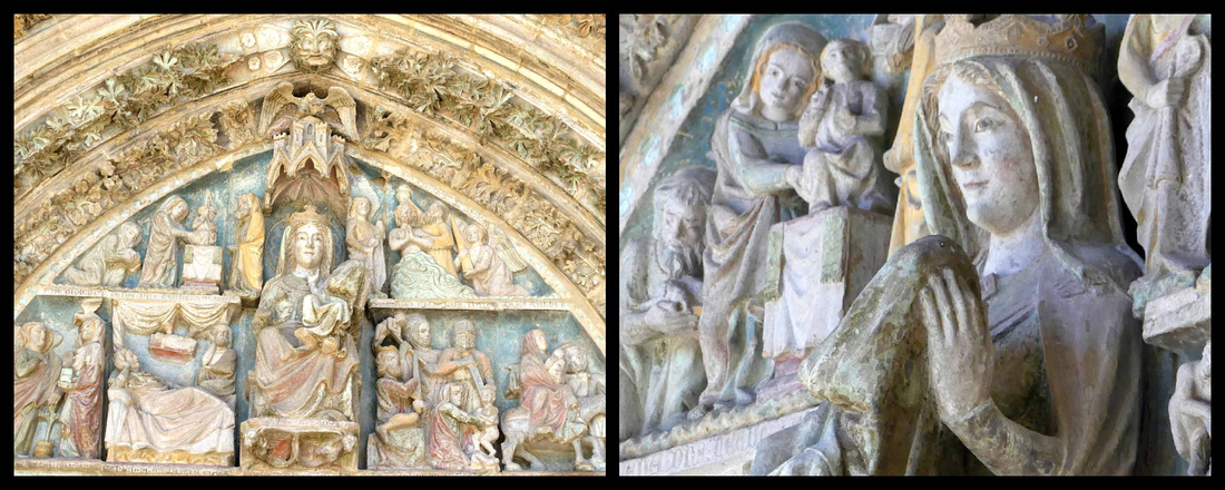
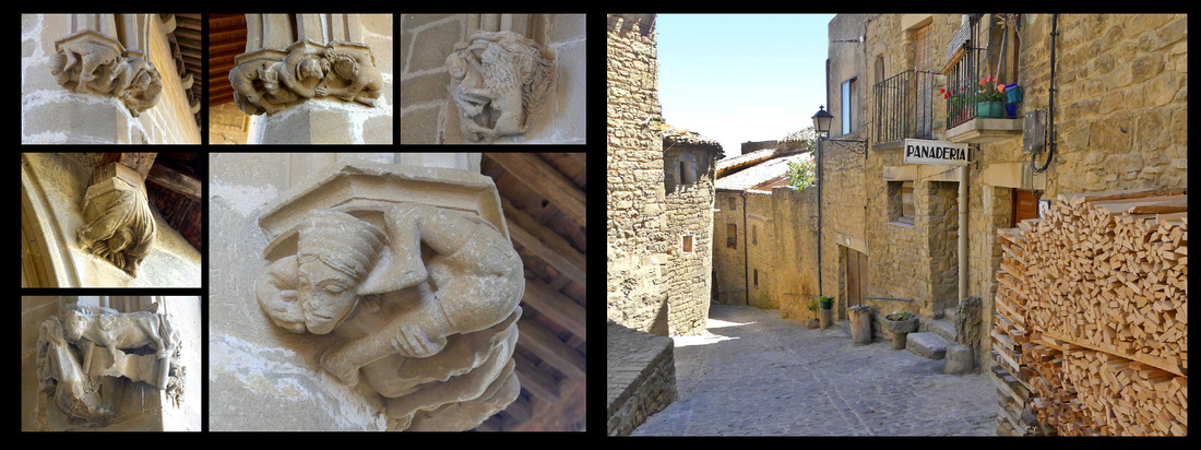
Sort of attached to/ integrated into the castle is the Iglesia de Santa Maria la Real, which has a superbly detailed Gothic (12th century) portal, set in a sort of cloister like ruin. The carving over the door is amazing and still has remnants of paint. In addition to the usual collection of saints there is a 3-D sculpture of the Virgin and baby and a lot of other things – animals, people, castles, flowers, scrolls, gargoyles. Really beautiful and interesting.






Ujue
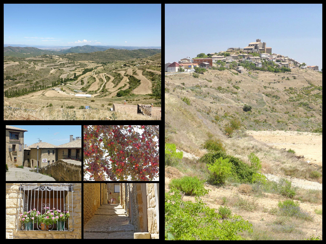
 Perched above concentric terraces harboring apple and almond trees, Ujué, population 198, was founded in the early days of the Navarran monarchy in the ninth century AD. The beautiful walled settlement was ennobled by Carlos I, who built much of the sanctuary complex that perches atop the hill. The Santuario de Santa María seems part castle and part church – the church is sort of surrounded by a castle like enclosure, so from the outside it looks like a castle, but inside it’s really just a church. There are some great sculptings and fabulous views of the countryside, extending to Olite in the west and the Pyrenees in the east. It’s free to visit; there were two people just leaving and other than that we saw no one else in the hour or so we were there.


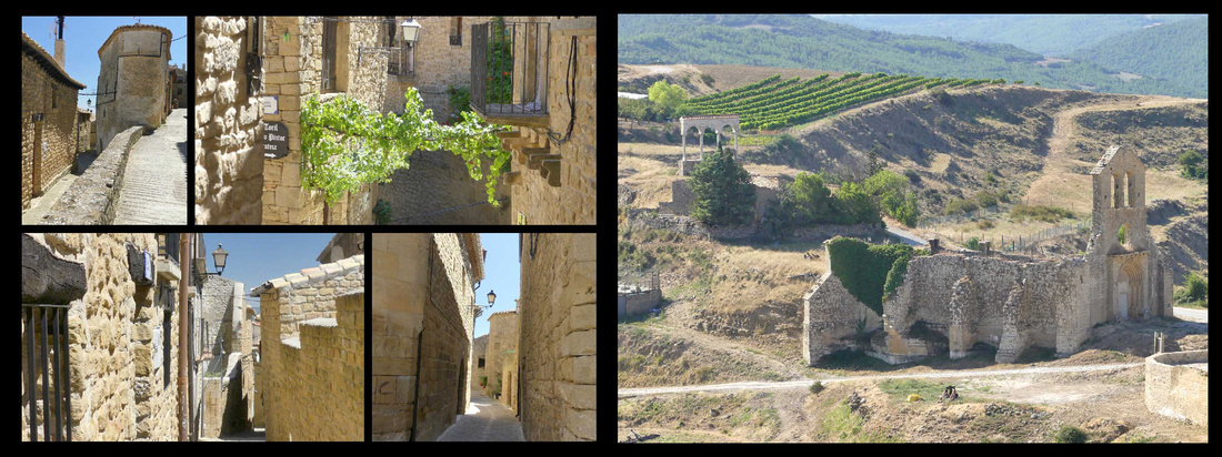
In fact, we hardly saw any people in the village itself, totally built of honey colored stone, really does looks like it was frozen in time from the middle ages. One shop had some local produce (honey, wine, etc.) and we saw one bakery and a couple of restaurants. That was it. Just a few cobbled streets full of stone houses. The occasional satellite dish implies there may be some 21st century people hiding in the houses, but it really does feel very medieval.

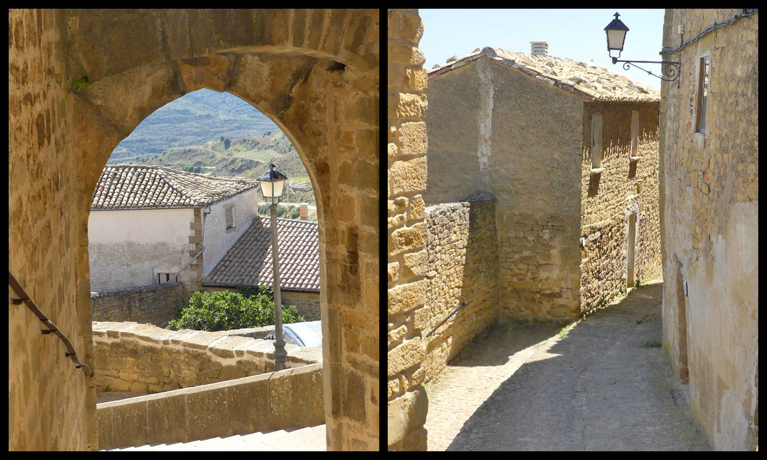


The road up to Ujué starts from the attractive little village of San Martín de Unx, and offers great views of the town from a distance.
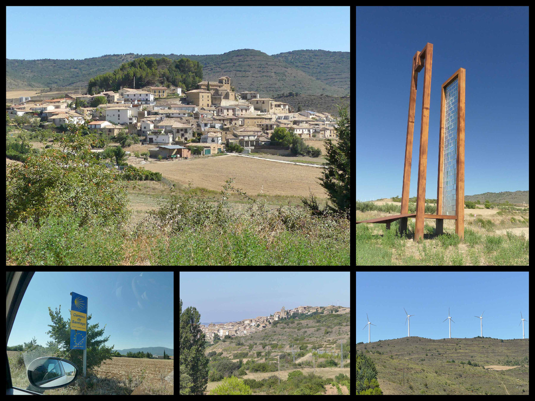

Top left: a hilltown on the N132 between St Martin de Unx and Yesa (interesting modern tower/sculpture on the side of the road). Lower cener: St Martin de Unx
Castillo Javillero
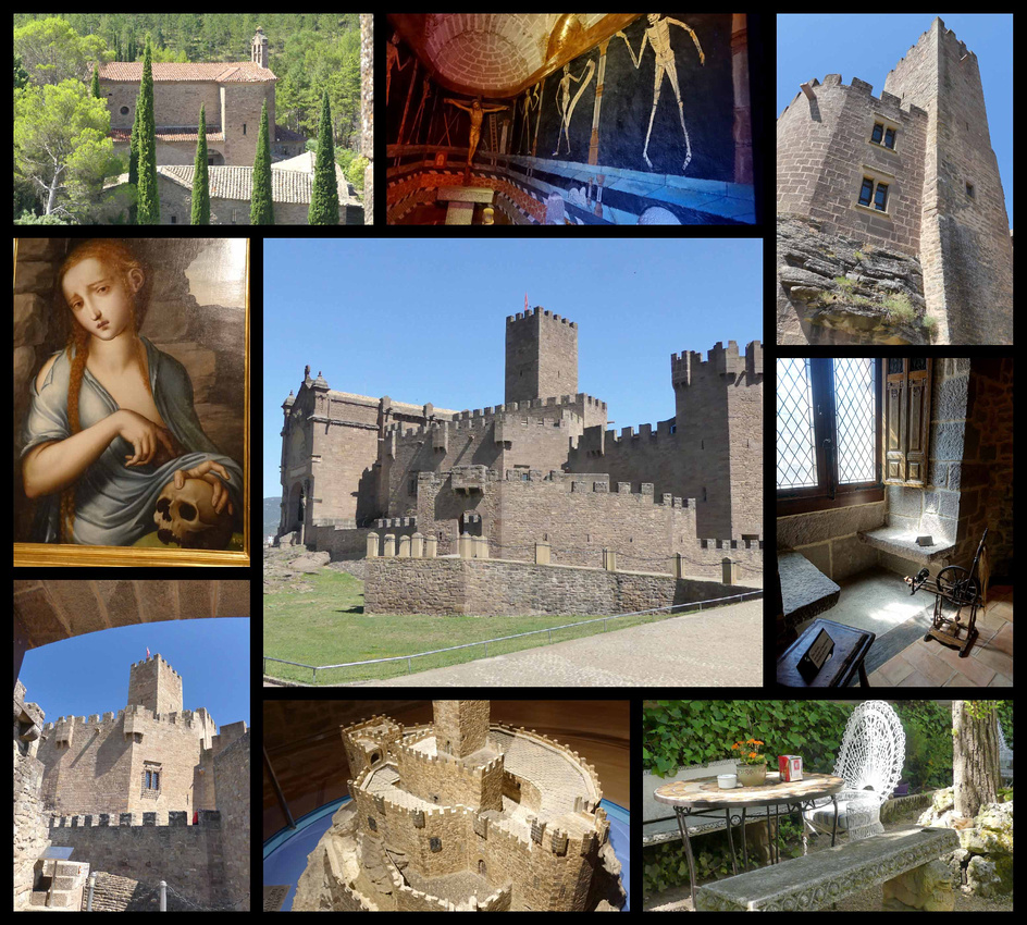
 Continuing past St Martin de Unx, we next visited Castillo Javillero. The castle dates from the 11th century, but owes its present look to restoration work carried out in 1952. Francisco Javier (Xavier), patron of Navarre, was born here in 1506. Along with Ignatius Loyola, he founded the order of the Society of Jesus (the Jesuits) in the mid-16th century and thus he is a ‘big deal’ among Catholics (there was one tour bus full of people when we were there, and parking for several more). So most of the castle is dedicated to exhibits about his life. A silhouette of crenelated towers, the Castle of Javier, is more impressive from the outside. It’s very highly renovated and feels much more like a museum about Saint Javier than a ‘castle’. Even if you are not interested in religious history the mural depicting the ‘dance of death’ was kind of interesting. However there is a drawbridge, towers, dungeons, machicolations, embrasures and arrow slits. The castle well signposted off the N-240 (near Yesa).
Leyre Monastery
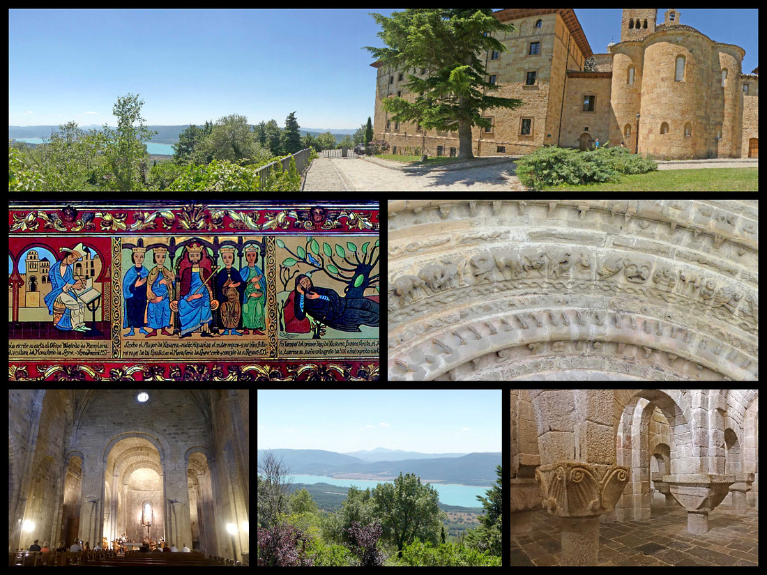
 Slightly disappointed by Castillo Javillero, we almost skipped the Monasterio de San Salvador of Leyre figuring it too might not live up to what we had read about it, but since we spent less than an hour at the castle we continued on to the Monastery and were very glad we did. It’s 16km (10 miles) east of Sangüesa, perched on the side of a mountain of the same name, overlooking the Yesa Dam. The monastery is 4km (2½ miles) from Yesa, which itself is on N-240. Take N-240 into Yesa, then follow an uphill road marked LEYRE 2½ miles to the monastery. From the outside the monastery is not all that exceptional but it’s setting above the turquoise lake (actually a reservoir) is stunning.
It consists of a monastery building where monks still live so that part is not able to be visited, a section which is now a hotel, the church itself, and the crypt. There were very few people around when we were there, but apparently it can get swamped at times (large parking lot). There is a small (modern) building that serves as a gift shop and ticket office. We were given a key and told to unlock the door to both the church and the crypt, being sure to lock ourselves IN while we visited. "And oh, by the way in 15 minutes in the church the monks will be singing, you can still go in just don’t walk around too much”.
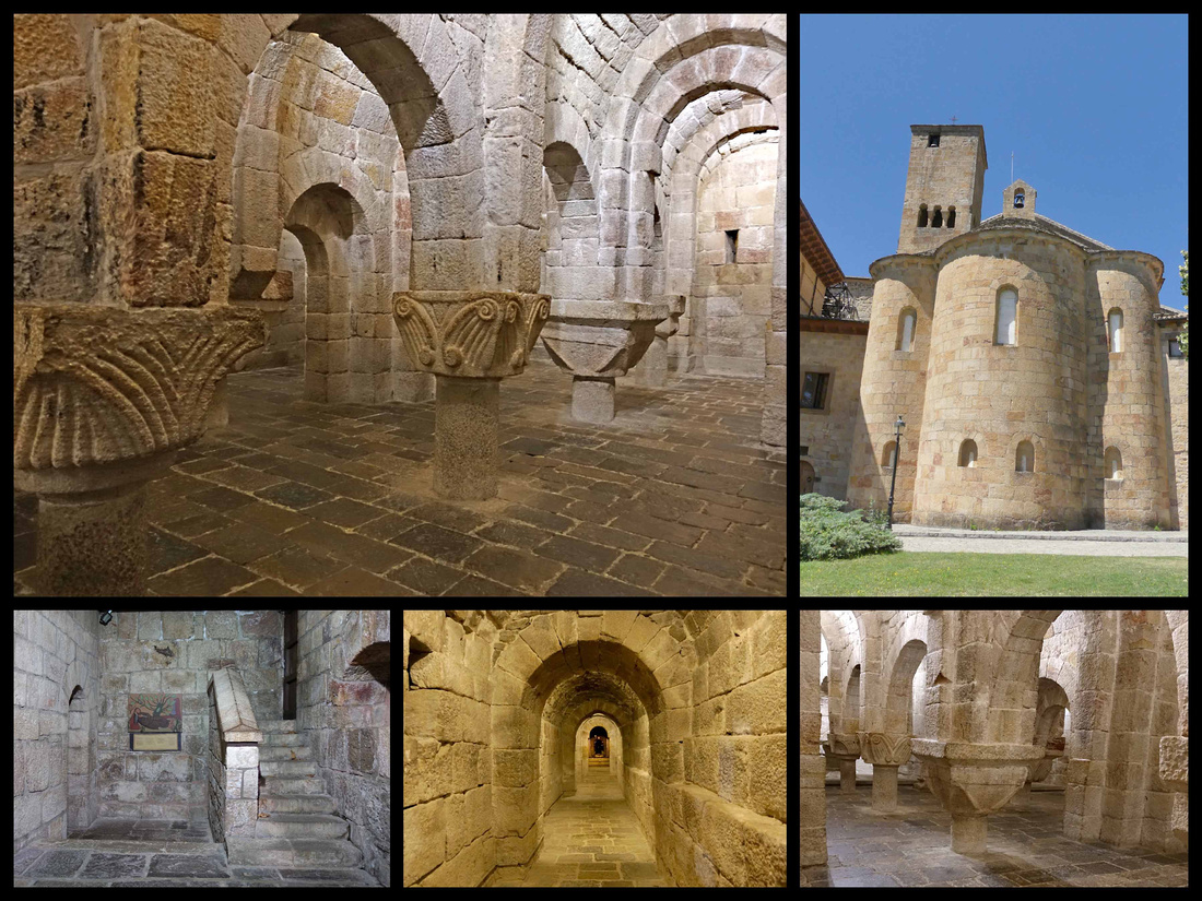

Kind of scary to lock ourselves into a crypt but it was beautiful and very atmospheric in there and we were the only ones there. Nicely lit and the lock is modern so not really afraid we’d get locked inside, (still after my experience in Barcelona that time when I got locked in a cloister....) The crypt is part of the original 11th century pre-Romanesque church, consecrated in 1057 and is considered a major work of Romanesque art. The stone altar and ram-horned columns suggest darker ritual purposes. The columns all different and are very short – it’s strange to have the capitals at waist height. Next to the crypt is a tunnel leading to an image of San Virila – a former abbot. Then we went around to the church, same deal with the key. But in addition to the monks, who were indeed chanting, there were ten or fifteen tourists sitting and watching. Pretty cool. And the setting with the Pyrenees foothills on one side and a beautiful turquoise lake down below was very nice.
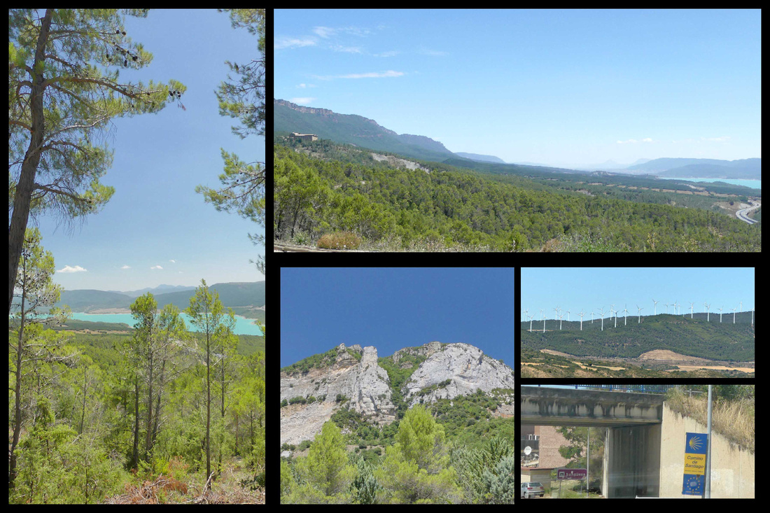

Barderas Reales Desert Park
The Bardenas Reales is one of only a few deserts in Europe and is definitely the most impressive. When researching the trip I came across pictures of it, and since it was on our way and I love deserts (I'm a huge fan of Death Valley National Park) we decided to stop. We visited it on our last day, between Olite and Madrid and it was definitely worth a couple hours. However, compared to the U.S. southwest it was a bit of a let down.
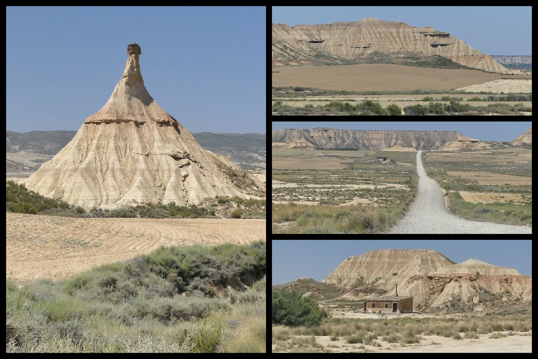

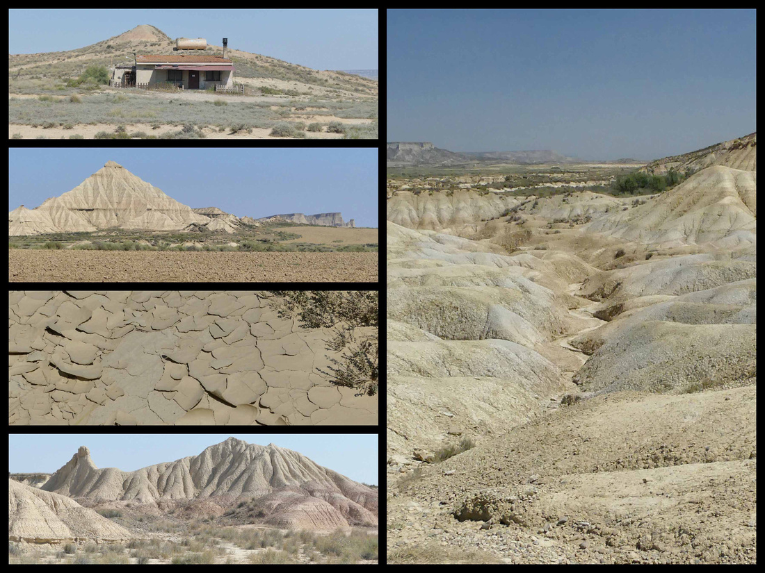
Technically semi-desert; a violently rugged expanse of white gypsum flats and scrawny sheep grazing on what little spiky foliage survives. It’s a popular location for filmmaking: eg the Bond film The World is not Enough was made here. The information center and main entrance to the park can be accessed from the road N- 134 just south (approximately 3km) from the town of Arguedas. This is the best entrance since the road is paved, pavement ends after the Info Center. At the information center (WCs and vending machine with cold drinks) we were given a map and told the road is fine for all cars, just go slow, it should take about 1 ½ hours to do the circuit, plus stops. The road is certainly very dusty, but totally fine to drive in our Fiat 500.
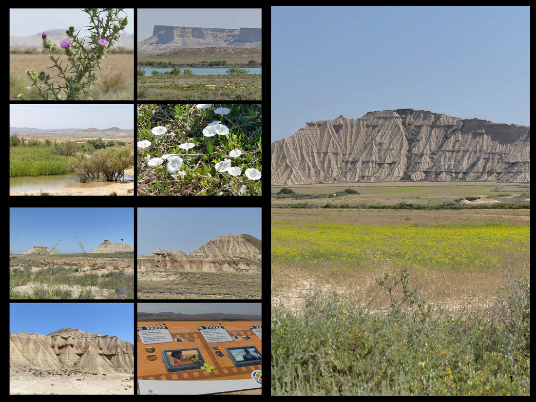

There are several unique geological formations and some lovely landscapes. These landscapes are the result of a very special climate made up of hot summers, cold winters and long dry periods interrupted by heavy rain. There is also a particular wind current that runs through the area, called “cierzo.” The difference of pressure between the Cantabrian and the Mediterranean Seas generates a current of strong wind that flows along with the Ebro River. The “cierzo” wind is responsible for the unique, abrupt landscapes, canyons and plateaus, produced by its erosion on the soil, which mainly consists of clay, chalk and sandstone.
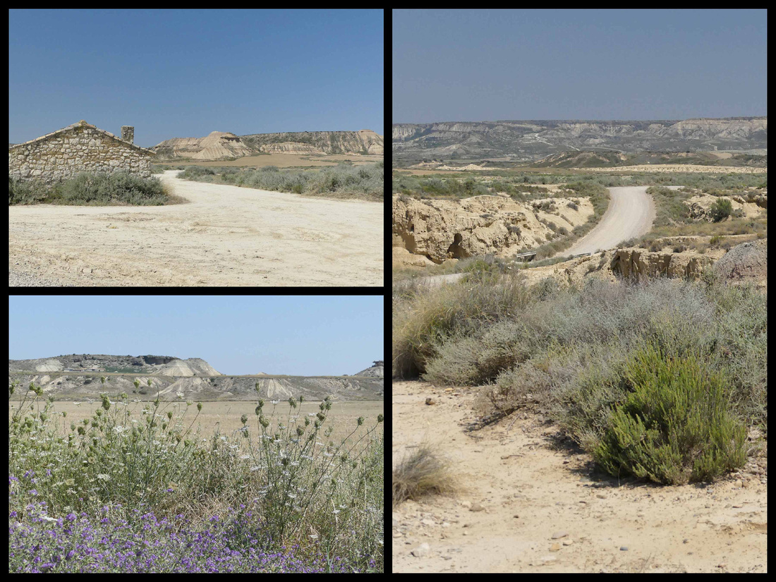

It was certainly beautiful in that ‘desert’ way, but if you’ve been to the desert southwest of the US it was pretty underwhelming. The mesas and other geologic features are tiny, probably a tenth the height of most of the stuff in the US deserts, kind of like desert miniature. The most impressive is Cabezo Castildetierra which is featured on all the posters and postcards and does look very otherworldly. There were the ruins of some old buildings (can’t imagine anyone living here) and plenty of places to pull off the road to take pictures and walk around, but I didn’t see any actual paths or places where you could do hikes, not that we would have, given it was 99 degrees and sunny. There were some nice wild flowers, a lake a distance off the road, and something which we think might have been rice growing (which would be weird).

The entrance road in from the main highway (before the visitor center) features some ranches with nice cows and bulls.
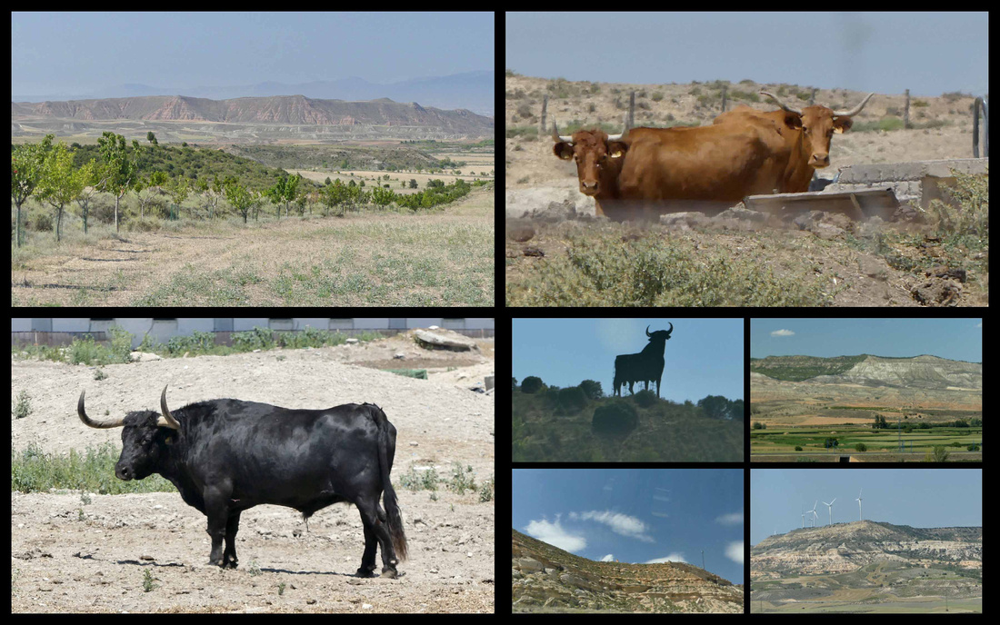
 Top left and right and lower left: Barderas Real Lower right: the highway back to Madrid
It was definitely worth a few hours (from the main highway and back the detour took us about 3 hours) if you are anywhere around there.