

Crisscrossing the Camino: 5 weeks in Northern Spain Part 5: Coastal villages & the Picos

Coastal Galicia, Asturias and Cantabria - The westernmost half of the north coast of Spain is an area of rolling green hills wedged between the sea and the Picos de Europe mountain range. Much more reminiscent of British Isles than Spain, the scenery is beautiful - in some cases spectacular - and there are picturesque villages and towns every few miles. The A8 highway runs all along the coast (and is fast and free) but most of the time it was more enjoyable to follow the N634. The Camino del Norte follows this route.
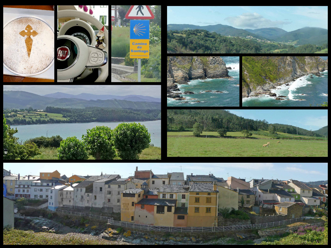
Coastal Galicia - top left: Santiago cake; center left: view from our room at Hotel O Cabazo in Ribadeo, bottom: Rinlo
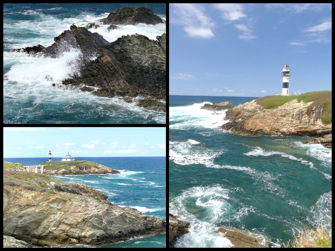
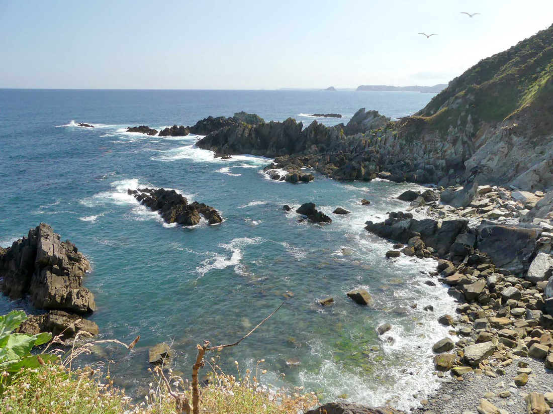
Praia das Catedrais - About 7 km west of Ribadeo (along either the N634 or the local beach road) is the tiny village of Rinlo. I have no idea what the population there is but we didn’t even see any shops, just a collection of houses. And from there it’s just another km to Cathedral Beach/ Praia das Catedrais (large signs on the N634, can’t miss it). There are a couple of medium sized parking lots, a small café/bar, and some WCs. It’s apparently the second most visited place in Galicia after Santiago de Compostela itself.
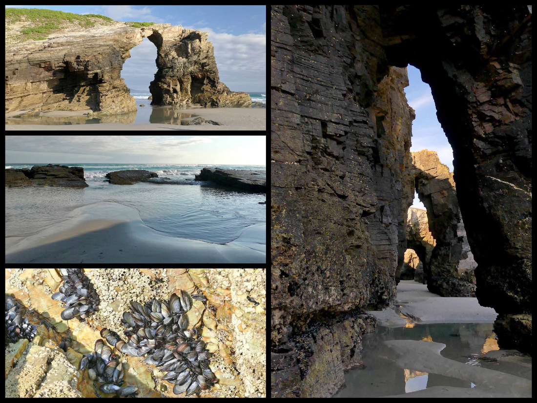
Constant pounding from the Atlantic Ocean has sculpted this astounding work of natural art into contours resembling cathedrals. Small vaulted caves, resembling medieval Gothic architecture, are strewn all along this particular section of shore, giving Cathedral Beach its iconic name. The entire beach is under water except at low tide so it can only be visited for a few hours twice a day. Not only are the cliffs, caves and rock formations unusual and beautiful, but the rocks themselves are a gorgeous array of colors, and numerous tidal pools are interesting shades of turquoise and pink. The place is just beautiful (usually comes up near the top of the list of most beautiful beaches in Europe) and that, combined with the limited amount of time people can visit result in some pretty awful crowds. Because of this the local authorities have restricted access and require reservations during the summer. Registration online is free and easy.
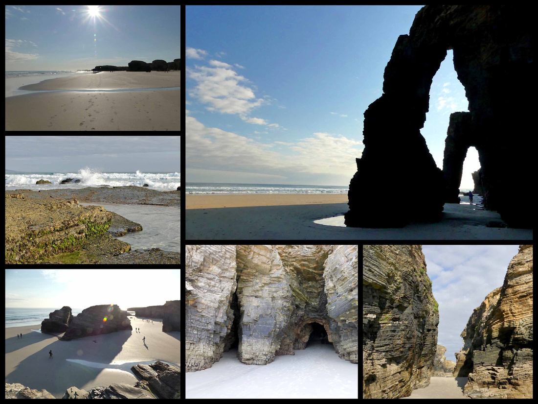
A combination of luck and good planning resulted in our having a great experience. I checked the tide charts (available on line, months in advance) and was able to organize our visit on a day when low tide was at 9:00 – meaning the best time to visit would be between 7 and 11:00. We got there shortly after 8:00 and there was no one checking reservations, and although there were some people already on the beach it was largely empty. By the time we left around 9:30 there was a line to check reservations, two tour buses in the parking lot and loads of people. But we had a wonderful visit.
Ribadeo - [Camino del Norte]
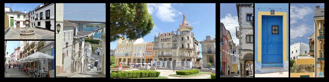
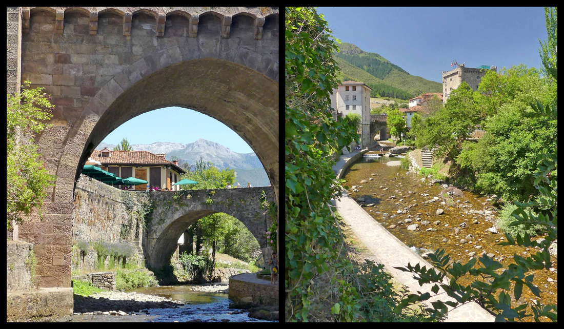
Perched on the broad ría of the same name, Ribadeo, population 8000, is the last coastal town in Galicia before Asturias. There is a nice main square, Praza de Espana, with attractive buildings, some with glass balconies, plus the “Tower of Moreno” a 1915 building that looks like it belongs in Barcelona. There are a few pedestrianized shopping streets and an‘old town’ consisting of a few streets with somewhat older houses. The main part of town is considerably higher elevation than the harbor/marina. It’s not a bad walk but apparently it bothered enough residents that they built a transportation tower with elevator to help people up the 40 meter elevation change. The building housing it is of stone, designed to look like sea rocks. The marina itself is a mix of active fishing boats and leisure boats. A major feature is a tall bridge which carries the A8 highway across the ria.
 Old town streets, center: Tower of Moreno
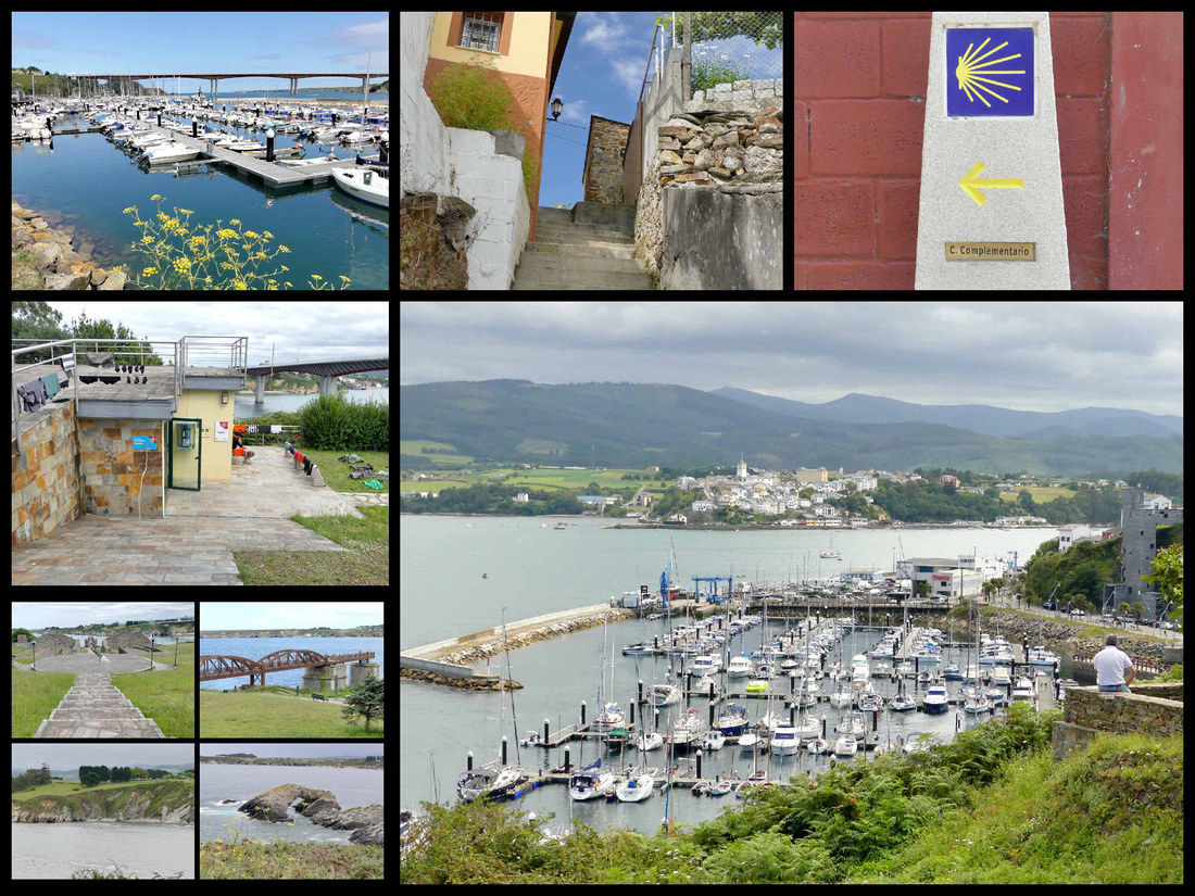
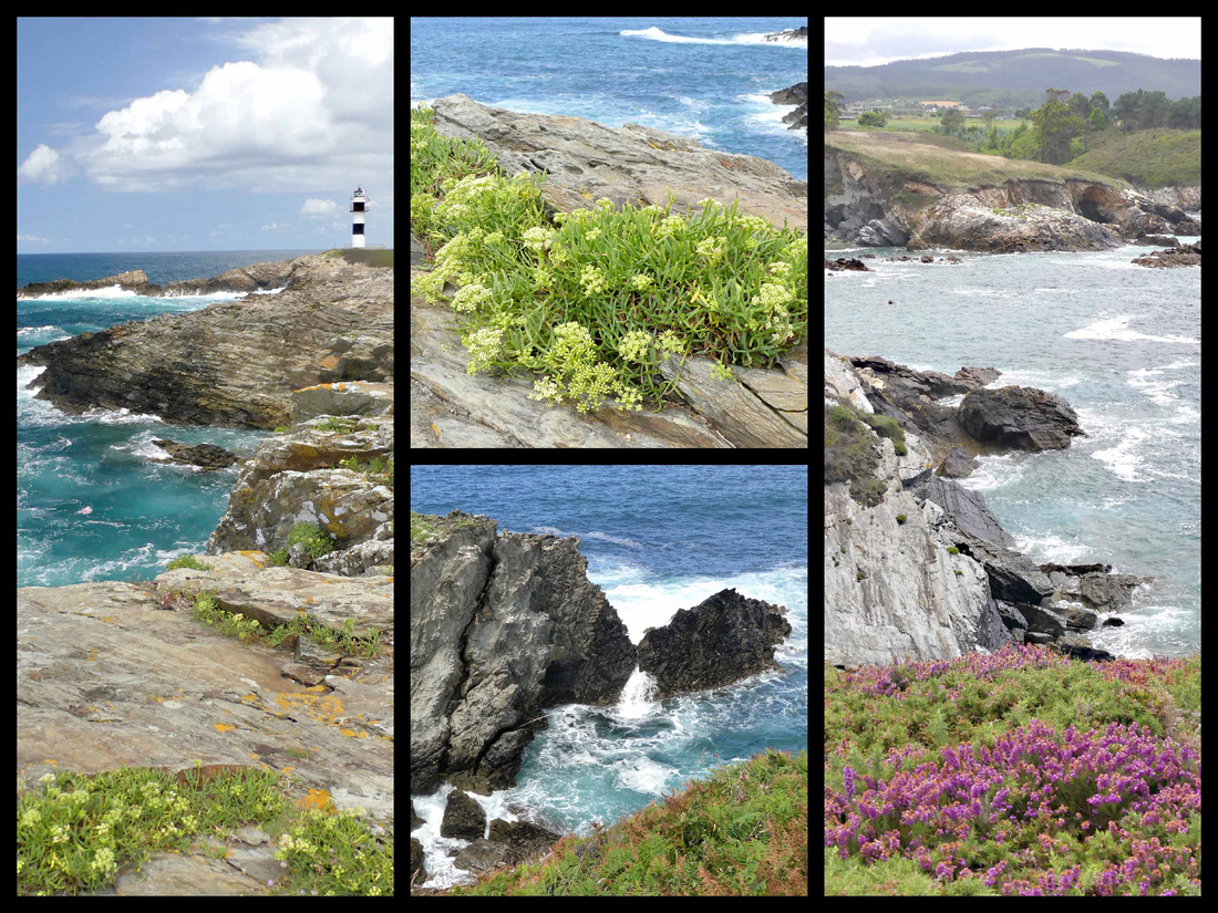
There is a great lighthouse about 2 miles from the center of town, easily walked via a paved path along the ria. The lighthouse sits on a tiny island just offshore, Isle Pancha. All along the walk out there, and then past the lighthouse, the water changes from grey to dark blue to turquoise and there are some impressive rock formations. The Camino del Norte goes through Ribadeo, the concentration of Camino signs seemed especially high here, seemed to be one every few feet. On the path to the lighthouse was a tiny albergue (looked more like a hut) with a bunch of pilgrims hanging out their laundry.
Cudillero - [Camino del Norte]
This tiny village (population 5300) is so cute and colorful it could almost be on the Amalfi Coast. By far the most picturesque village we saw anywhere on the north coast of Spain. For centuries it’s been a fishing village and there is still an active fishing fleet. The houses cascade down the hillside to a tiny port on a narrow inlet. Despite its touristy feel, Cudillero is reasonably relaxed, even in mid-July. The surrounding coastline is a dramatic sequence of sheer cliffs and fine beaches. It had everything: seaside setting with lovely harbor with pretty little boats and a nice lighthouse, and a town wrapped around the harbor and climbing up the steep hills. There are walks with steps going up all around the town, with bright blue painted railings (could be on a Greek island) up to several miradors with great 360-degree views of the water and the town. All along the walks are nicely kept flowers. The paths were fairly well marked, although that wasn’t really necessary as you could pretty much see the entire town from wherever you were. There’s a 16th century church, a lighthouse, an open-air fruit/veggie/ miscellaneous market down by the water and a small main square (actually more of a rectangle) full of seafood restaurants and cafes. Mostly its houses (some, but by no means all, of which are now B&Bs), some painted bright colors, others white with colorful trim (the colors supposedly correspond to each family’s fishing boats, which are the same color. I read about this in other villages on the Northern Spain coast). We hiked as far up as you could go, all around the town, down by the water and had a drink and snack at a café on the main square and were still ‘done’ in about three hours. You can smell the sea and hear the violin player down by the harbor; the music carries all the way up to the top of the town. Sea gulls swooping below you. Sound of waves, scent of sea air. Lots of restaurants down by the harbor, in that way it’s like any ‘tourist’ summer town. But no big hotels, no tour groups, no one spoke English, not one English menu anywhere.

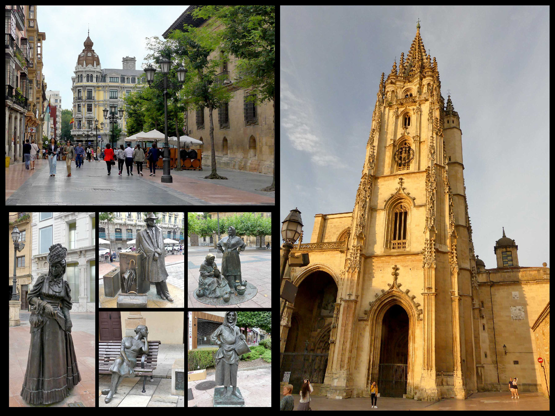
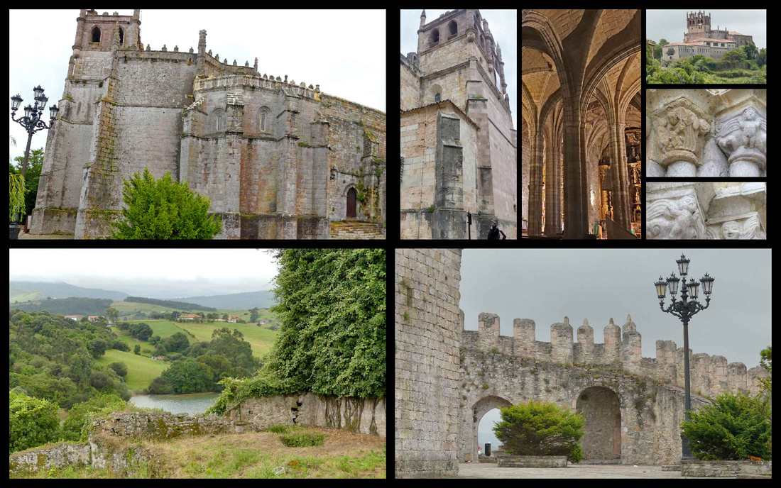
Oviedo [Camino Primitivo] (Monuments of Oviedo and the Kingdom of Asturias UNESCO)
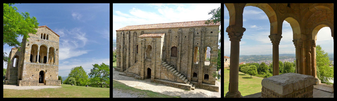
Mostly cut off from the rest of Christian Europe by the Muslim invasion, the tiny kingdom that emerged in the 8th century Asturias gave rise to a unique style of art and architecture. It was a precursor to the Romanesque, the first architectural style to be used across Europe since the fall of the Roman Empire. Abandoning the distinctive horseshoe arches from Visigothic times, Asturian architects reached further back and drew on the simple, semicircular Roman arch and threw it in everywhere it could fit: vaulted ceilings, windows, doors, and halls. The fact that these buildings have lasted 1,200 years more or less intact, despite wars and bad weather, is just as fascinating as their unique architectural style. The 14 buildings, mostly churches (and collectively a UNESCO World Heritage site) that survive from the two centuries of the Asturian kingdom all have straight lines and floor plans – no apses or cylinders – although their semicircular arches are obvious forerunners of the style that would later be known as Romanesque. Another precursor of the Romanesque style is the complete vaulting of the nave. Roman and Visigoth elements are visible. In many cases the bases and capitals of columns with their Corinthian or floral motifs were simply cannibalized from earlier structures. Another adaptation, which owes something to developments in Muslim Spain, was the use of lattice windows. They appear purely as a design effect, since their Eastern progenitors were inspired by the desire to maintain privacy from the outside world – hardly an issue in a church. There are three main examples of this ‘Pre-Romanesque’ style building in Oviedo.
 Santa Maria de Naranco
Santa María de Naranco and San Miguel de Lillo, collectively known as Los Monumentos, overlook the city on Naranco hill to the northwest. There’s a good view over Oviedo, which, unfortunately, isn’t super-attractive from up here, but is backed by beautiful mountains and the immediate area is lovely and peaceful. Santa Maria (842-850) was designed not as a church but as a hunting lodge. Architecturally, the open porticos at both ends are most interesting – an innovation developed much later in Byzantine churches. The columns in the upper hall could almost be carved from bone or ivory, such is the skill of the stonework. Balconies at either end add to the lightness of the design. A range of sculptural motifs, many of them depicting alarming animals, decorate the hall, and have been attributed to Visigothic and Byzantine influences. Underneath the hall is another chamber variously identified as a crypt, bathhouse, and servants’ quarters. San Miguel de Lillo is a couple hundred metres beyond Santa Maria, built of soft golden sandstone and red tiles. It is half of a 9th century structure, the other half collapsed. There are window grills carved from single slabs of limestone and superb Byzantine style carved doorframes.
San Miguel de Lillo
The buildings can only be entered with a guide, there are tours (Spanish only) every half hour (3€). It’s a short, well marked drive from the center of Oviedo (not so easy going back down as the center of Oviedo is rather large and confusing). It looks like it would take at least an hour to walk up there, I think there is a public bus that stops up there, but not terribly frequent).
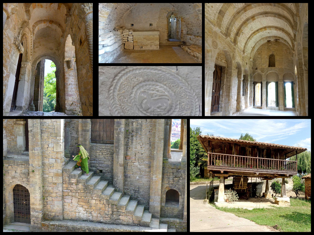 Top and left: Santa Maria de Naranco Bottom right: An 'hórreo', a typical granary for drying grain, this one located down the path from Santa Maria
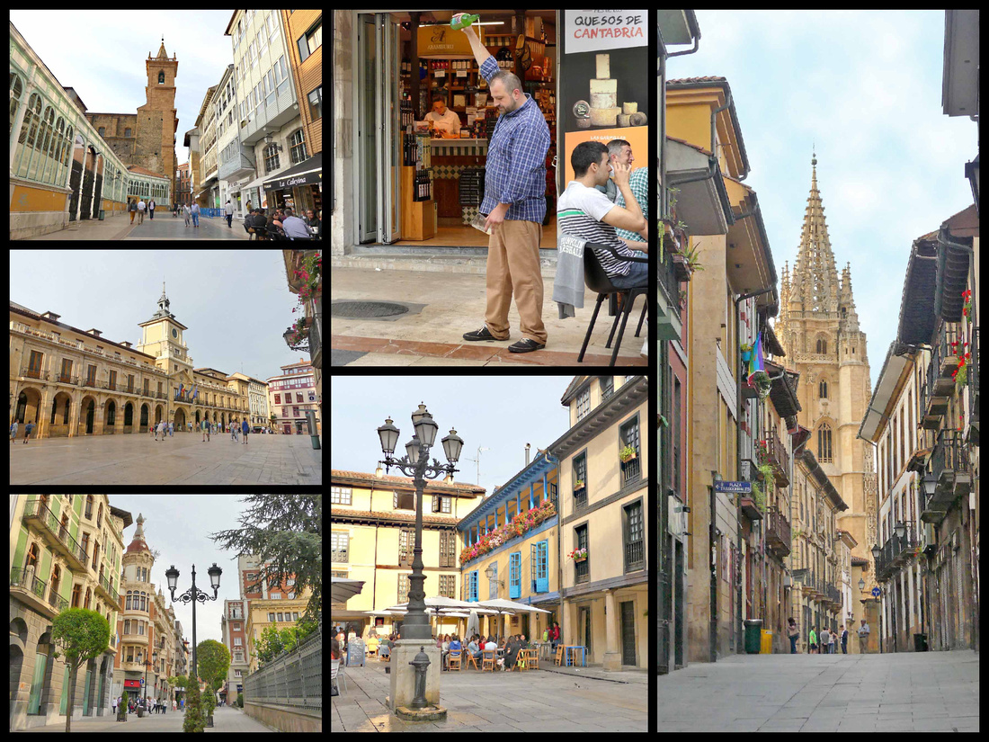
The ‘modern’ town of Oviedo, population 275,000, looked pleasant enough though not anything very special, but the old town was nicer than I expected with a very nice cathedral on the large pleasant Plaza Alfonso II El Casto. Next to the cathedral are the remains of the pre-Romanesque Iglesia de San Tirso. Plaza de la Constitucion features the old city hall (ayuntamiento) and next to that the market building is turquoise metal and glass. The Cimadevilla, the oldest part of the historic quarter has an unusual Plaza de Trascorrales. Bronze sculptures were scattered around town – a lady sitting on a bench, a couple old women with pots and jugs, a fashionable lady in 19th century attire near the cathedral.
The old town had a lively atmosphere with numerous restaurants and siderias – which is a form of hard cider (often from crabapples) which seems to be as popular as wine in Asturias, Galicia and Basques regions. All over the region we saw waiters pouring the sidra by holding the bottle high in one hand and the glass low in the other. The reason for this is that cider becomes flat quickly so pouring it from a height of about 3 feet aerates it (natural carbonation). You only pour one gulp at a time. There are also devices that sit on tables that accomplish this, but the dramatic flare of the waiter pouring the cider is more impressive.
Ribadesella [Camino del Norte]
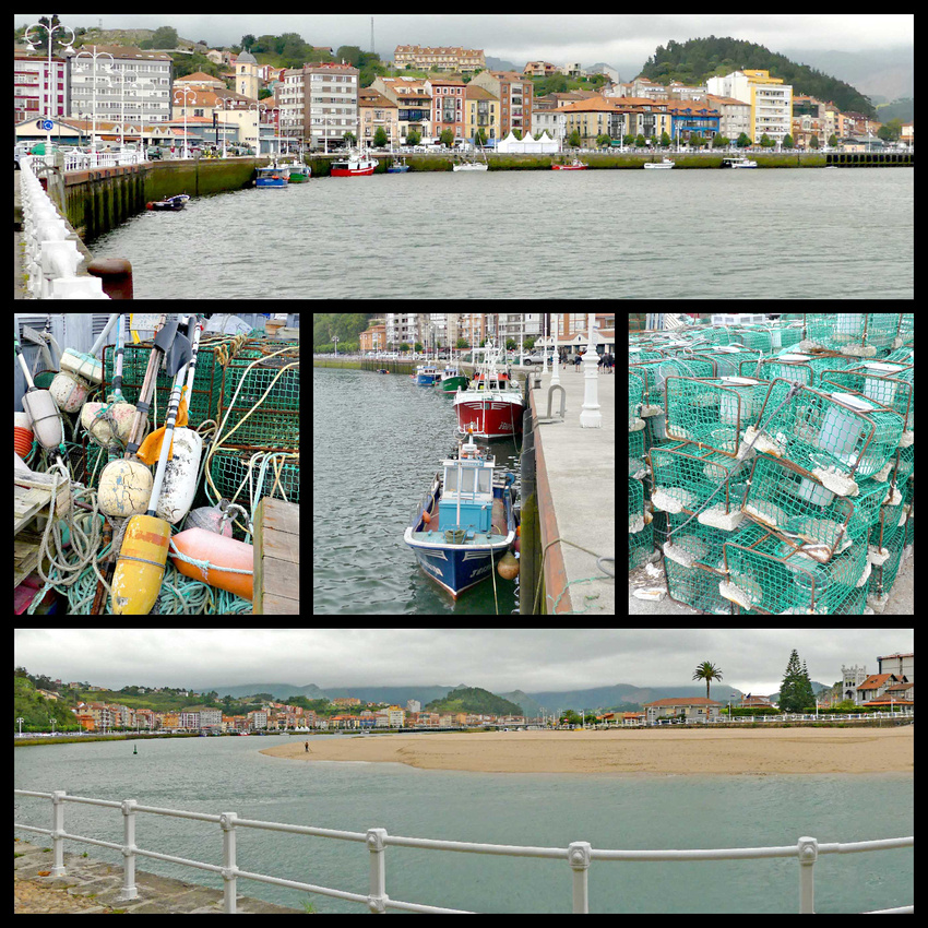
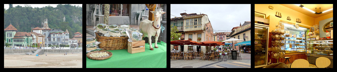
Ribadesella, population 6000, is an unaffected old port town, split into two by the Sella river, and bridged by a long causeway. The reasonably attractive old town, is crammed between the hills to the east and the river, and consists of several stone streets, running parallel to the fishing harbor. Across the river from the main part of town is a small peninsula of land between the river and ocean, which is lined with the 19th -century mansions of the fanciful type called Indianos—multi-story places with towers, etc. built by locals who made their fortunes in the new world and brought the money back to build their dream houses in their native land. There is a paved waterfront promenade going from the town center out to a point overlooking the beach, Playa Santa Marina. The ocean side beach had pretty good surf and there were quite a lot of surfers in the water, despite the cool cloudy weather, but the beach was mostly deserted. The inner harbor has a few working fishing boats (lobster/crab catching baskets stacked along the waterfront). I think the most impressive thing about Ribaesella is the setting, wedged as it is in such a narrow space between the mountains and the sea. Unfortunately I’m not sure that can be appreciated from within the town itself (the photos I’ve seen of it were probably taken by plane), but definitely not on a cloudy day. There were several bars and restaurants including one tiny coffee/pastry shop right out of the 1950s where we got amazing café con leche and croissants. There was also a cheese market going on in the main plaza with about two dozen vendors selling all kinds of local cheeses.
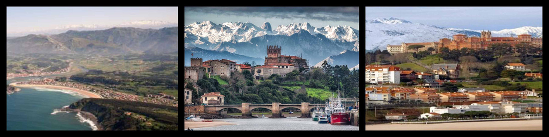
Picos de Europa
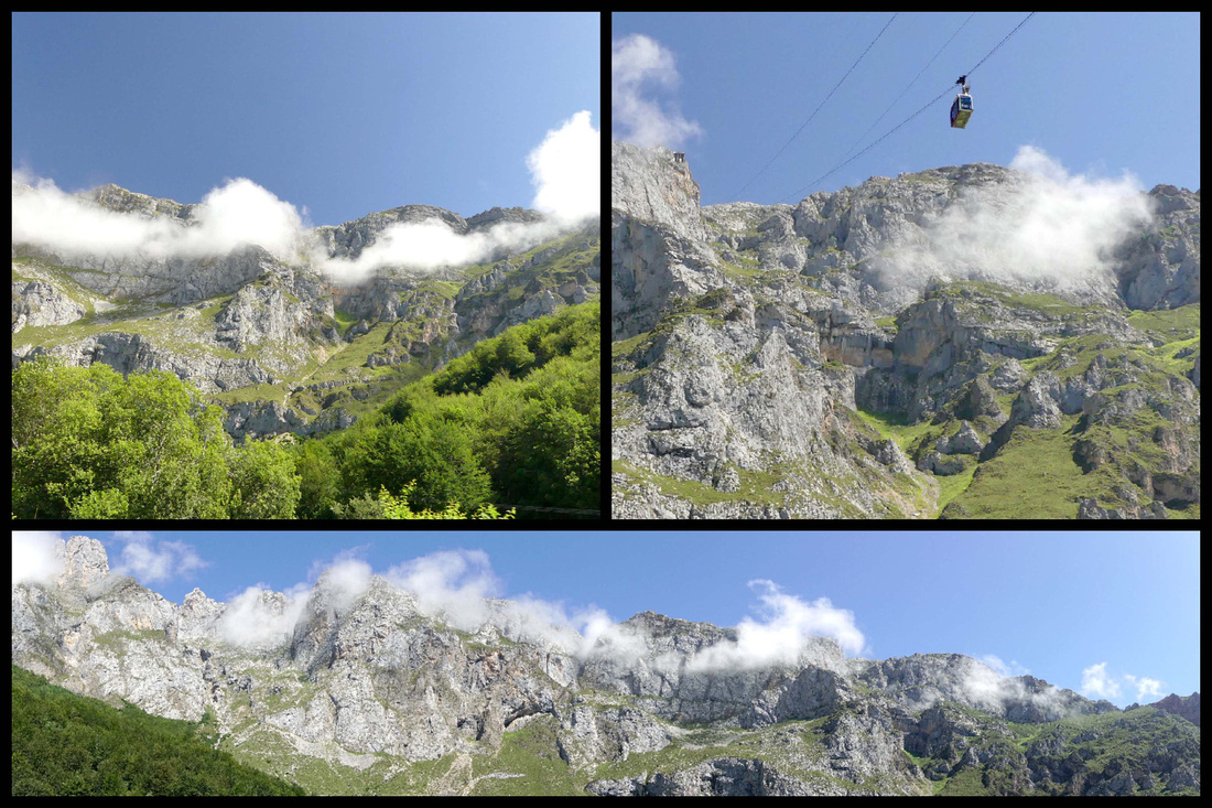
A relatively small stretch of cut-glass high mountain peaks (the steepest in Spain) just 15 miles inland from the ocean. The ‘best’ part is the Cantabrian part which contains the region’s most accessible and enjoyable bits: the scenic drive through La Hermida Gorge, the charming mountain town of Potes, and the views from Fuente De, home to the longest single span cable car in Europe. Rising more than 2,590m (8,500 ft.), they are not high by alpine standards, but their proximity to the sea makes their height especially awesome. During the Middle Ages, they were passable only with great difficulty. (The ancient Romans constructed a north-south road whose stones are still visible in some places.)
La Hermida Gorge
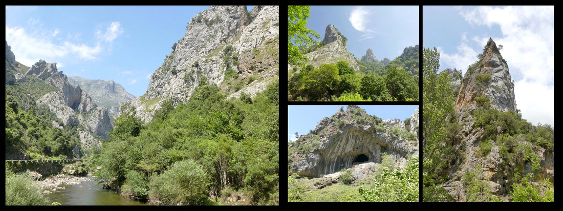
Leaving the coastal A8 at Unquera you drive along the N-621 through a pleasant river valley and the suddenly enter La Hermida Gorge with surprisingly high and close mountains on all sides, a now much narrower river still running along the road. It’s about a 45 minute, beautiful drive to the town of Potes, the only town of any size in the Picos. At Potes you can turn onto the CA-185 to Fuente De, where the road dead-ends about a half hour later at the foot of the highest peaks in the Picos, or you can continue south on the N-621 (which would eventually bring you down near Leon). All the roads in the area are small, winding and gorgeous – even in cloudy weather, and in the sunshine they rival the Alps – actually look a lot like the Dolomites.
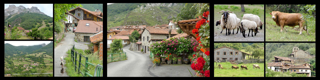
We were there less than two full days, had some serious clouds the first day but absolutely gorgeous sunshine the second. After checking out Potes (and checking in to the hotel) we drove south on the narrow winding N-621, turning off at LaVega onto the really narrow winding road, past the village of Dobres, that ends at a cute little village of Cucayo. There are two tunnels through the edge of mountain peaks that you go through just before the village. I have no idea how people got there before those tunnels. We noticed some hiking and mountain bike trails, a few farms with chickens and sheep, and some houses. You turn around and go back down to Potes the way you went up, no other way. It was a pleasant drive in the clouds, I bet it would be spectacular with blue sky.
Our second day was gorgeous blue sky with puffy white clouds playing hide and seek with the peaks. We drove to Fuente De. The road stops at Fuente Dé, and it’s not hard to see why; there’s a massive semicircle of rock ahead; a spectacular natural wall that rises 800 m and is almost sheer. It is named Fuente Dé because this is where the Deva springs from the ground; there’s little here apart from two hotels, a campsite and a cable-car station. Fuente De is not a real town, just the end of the road and the station for the cable car (cafeteria, souvenir shop and ticket office). The large grassy parking lot was only half full, there were lots of people sitting in the sun on the grass by the cafeteria building and a short line waiting to go up the cable car. We got on the considerably longer (20 minutes) line to buy the tickets only to discover the wait for the cable car was two and a half hours! Having seen photos from the top we decided it wasn’t any better than what we were looking at right there and we wanted to see some more of the area and get to Santillana while the sun was still out so we skipped it.
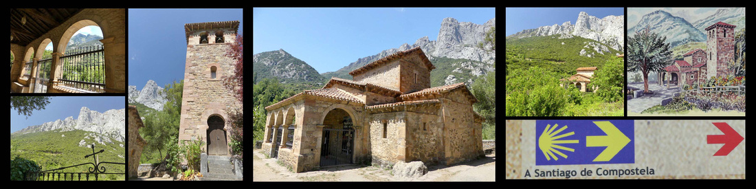
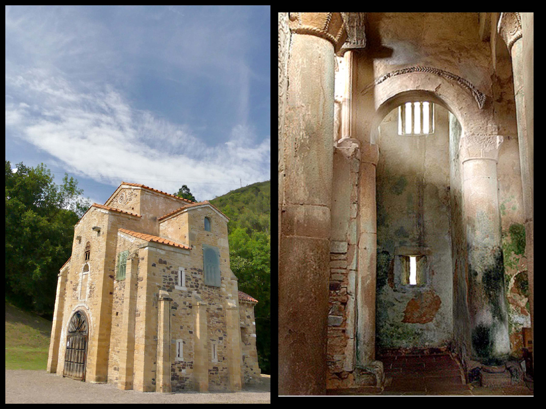
Santa Maria Lebena
After another stop in Potes we drove back up La Hermida Gorge stopping (8km north of Potes) at the church of Santa Maria Lebeña, a 10th century chapel in a little valley surrounded by high peaks, full of vineyards. It is the main pre-Romanesque monument of Cantabria and one of the most important of the style denominated Mozárabe. Some people consider it the best example of Arabized Christian architecture in Europe, with Islamic-inspired geometric motifs. Continued the drive north on the N621 through La Hermida Gorge – just incredible tall mountains rising right from the road, in some places part of the mountain kind of arches over the road, just barely high enough for a car. At some places the river is right next to the road, several stone bridges crisscrossing it. In a lot of ways it reminded me of Yosemite, in others of the desert southwest only the mountains are greyish white. But the sky was blue and the trees green and overall very pretty.
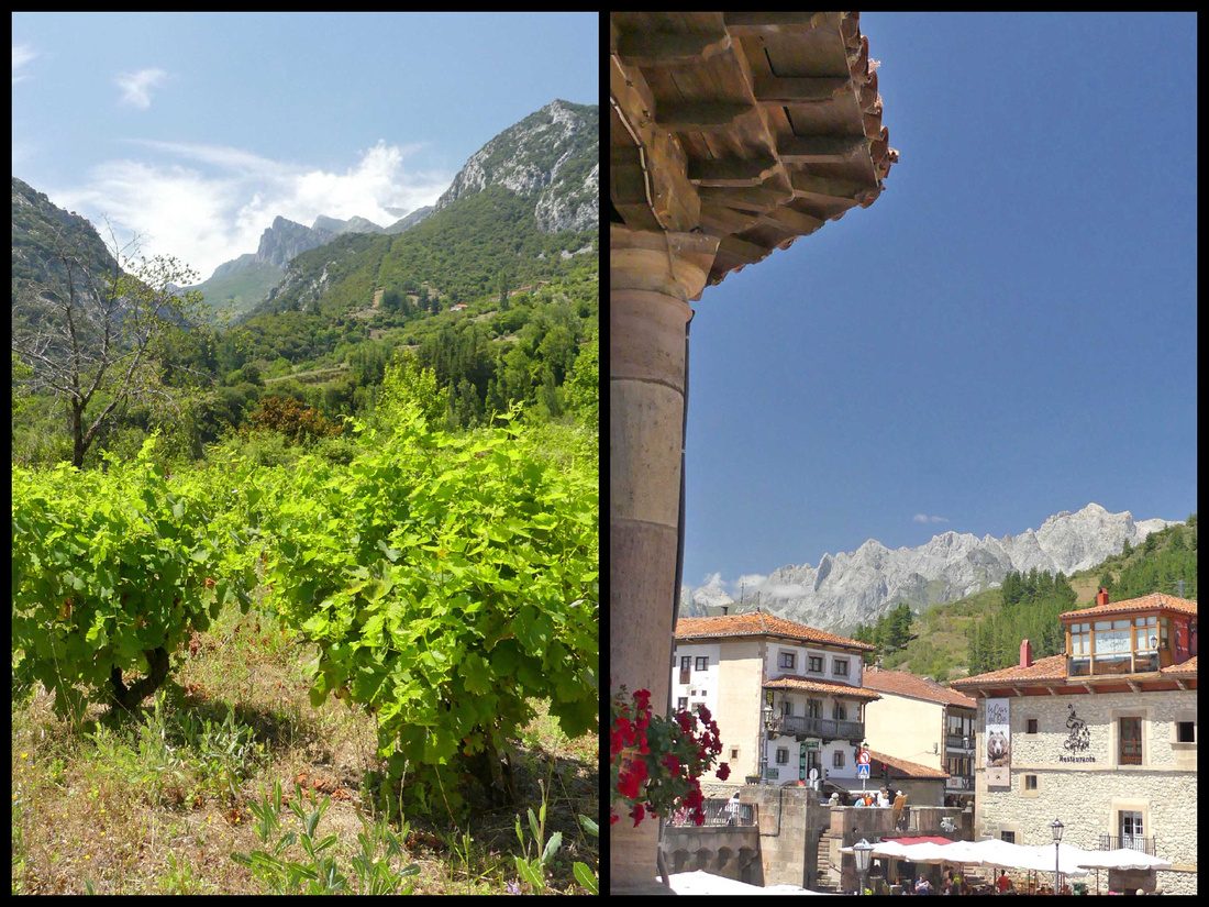
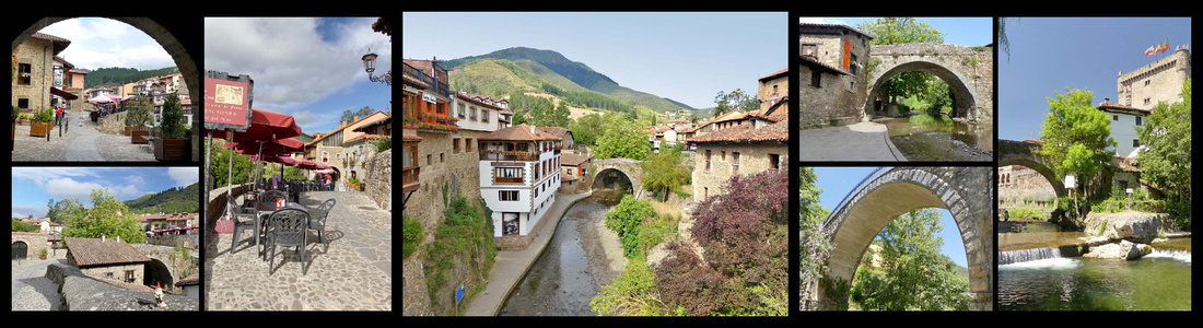
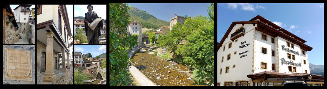
Potes [Camino Lebaniego]
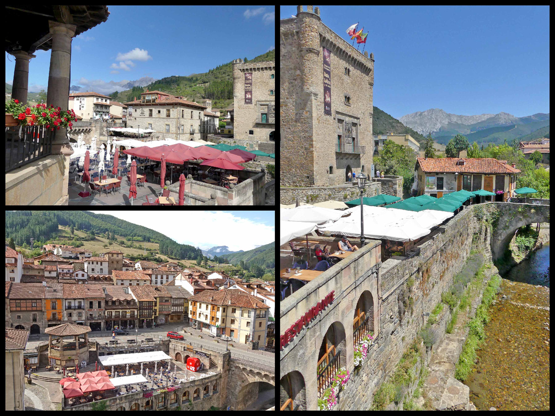
A picturesque town that felt larger than a population of 1500, although there really is just one main street. It sits at the intersection of four valleys surrounded by mountains, with a river running through the center, spanned by three stone bridges. In the center of town is the Torre del Infantado, a 14th century castle like tower, overlooking the main plaza, which is full of restaurant tables/umbrellas. There are walkways along the river through out the town, both down at river level and up at town level. Though mostly restaurants and souvenir shops, there is a fairly large supermarket (good for picnic supplies) and a couple of bakeries. We were passing one and the smell of bread was overwhelming so we stepped in. She had just taken out an oven full of baguettes and we bought one (for 30 cents!), still warm, and had it for our picnic lunch an hour or so later, the best bread I ever ate. Although most of the restaurants were ‘local’ fare, there was one Mexican Restaurant, we had dinner there and it was one of the best meals of the trip.
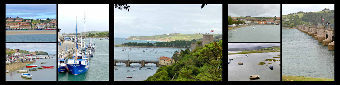
Ribadesella in Asturias, and Comillas and San Vicente in Cantabria, are three small towns wedged in the narrow strip of land between the Picos and the sea, photographs of all of them are interesting but were mostly taken from boats offshore or from the air, and the setting of the towns is hard to appreciate from within them. Not quite as 'charming' or picturesque as Cudillero or Santilanna, they were all worth short visits.
Postcard views of: left Ribadesella center: San Vicente de Barquera right: Comillas
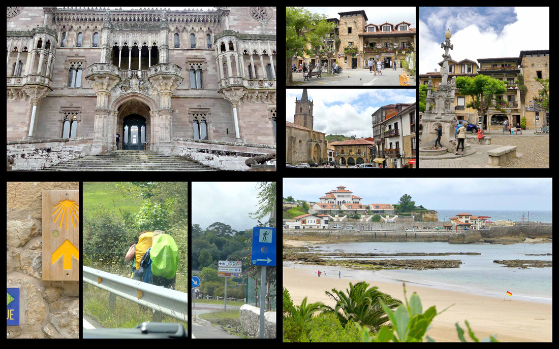
San Vicente de Barquera [Camino del Norte]
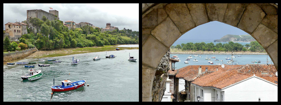
A long, dramatic (Roman) bridge over a bay leads to San Vicente de la Barquerea. The seaside town overlooks a boat filled harbor. Marooned on both sides by the sea, inland, dark green, forested hills rise towards the Picos de Europa. The town itself, a thriving fishing port with a string of locally famed seafood restaurants, is functional rather than pretty, with not all that much left of its historic core. But a short climb up from the modern town brings you to the remnants of the hilltop medieval town. At one end of the ridge, is a Renaissance ducal palace and a Romanesque-Gothic church, Santa María de los Ángeles. The church was built in the 13th century, when Romanesque was going pointy, and it’s an interesting example of this phase. There are good views from here over the river estuary and the long bridge crossing it and in the other direction of the green hills – looks a lot more like Wales than Spain in that direction. A five-minute walk to the other end of the ridge is the castle, in reasonably good shape but not especially compelling, nice views of ocean though.
Comillas [Camino del Norte]
Another twenty minutes east, Comillas feels a bit like a large hill town, with twisty lanes clambering down to the sea. Definitely not as undeniably charming as Santillana (has not grasped the idea of ‘pedestrianized’), the beach-side road is lined with tacky tourist hotels. It does have cobbled streets and squares with ancestral houses, towers and Modernist style buildings, but the cars everywhere certainly detract from the overall ambience. It’s also feels considerably larger (despite websites giving it a smaller population than Santillana). It does have several impressive buildings.
Top left: Sobrellano Palace Top right: town center Bottom left: pilgrims on the Camino Bottom right: Comillas Beach
At the end of the 19th century, Comillas was chosen by the royal family as their holiday destination, and the city was decked out accordingly. The main royal court building, Sobrellano Palace is in neo-Gothic style and stunning from the outside. Close by is an impressive Gaudi building, El Capricho, clad in green and gold sunflower tiles, with turrets and iron balconies and a bronze of Gaudi sitting on a bench outside admiring his work. The huge Pontifical University building, the location of the International Centre for Higher Education in Spanish, (aims to become the international center for the study of Spanish and Spanish-language teaching) was built as a theological college in avant-garde style. It sits up on a hill and can be seen from all over town, and is guarded by a nice gate entrance. Heading down towards the beach from the university is a cemetery with art nouveau Guardian Angel (1895) built on the ruins of an ancient burial ground and 15th century church. The beach and small marina are nice enough, though nothing special compared to the rest of the region.
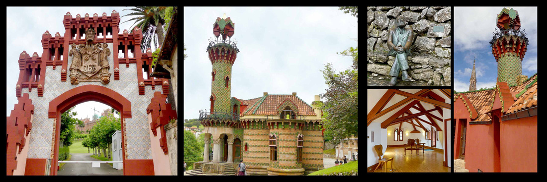
Left: University Center and right: El Capricho
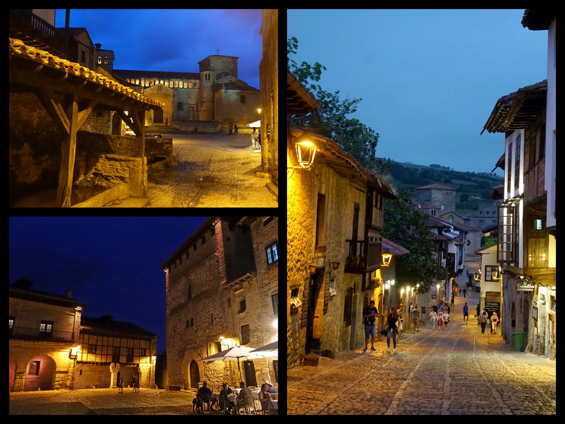
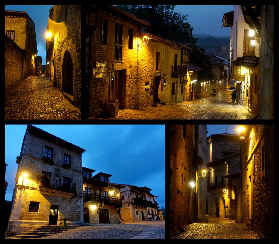
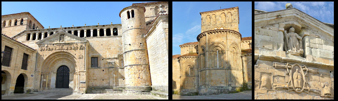
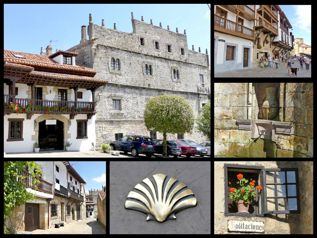
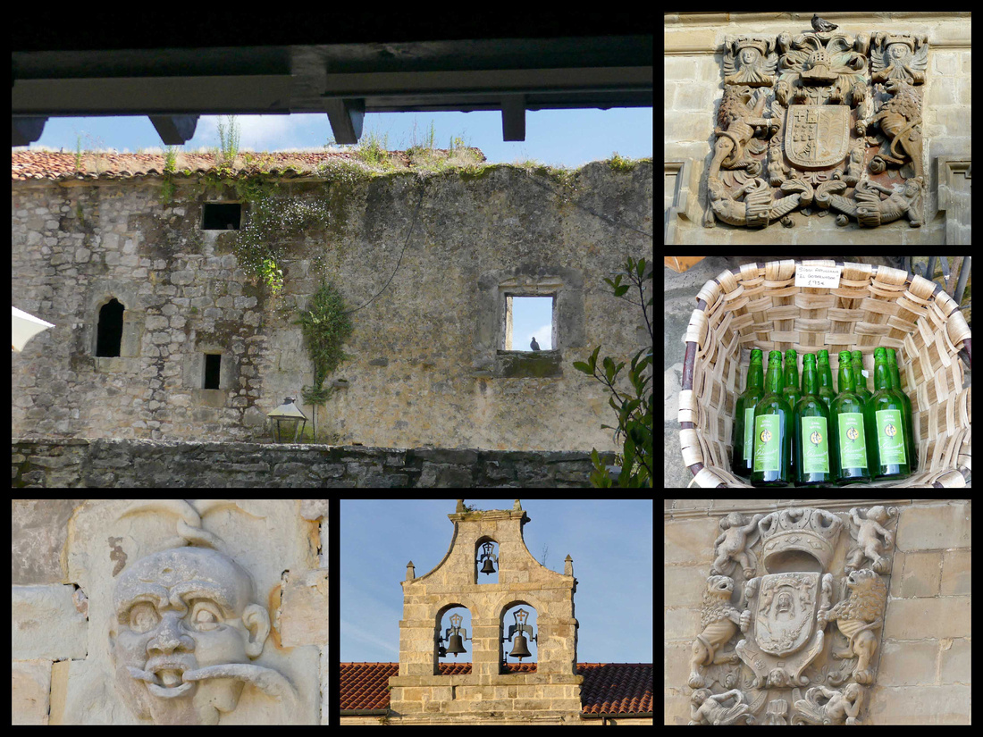
Santillana del Mar [Camino del Norte]
Santillana, population 4000, is a little stone village with charming time-warp qualities that have (barely) survived the stampede of multinational tour groups here to see the village and visit the nearby Altamira Caves. Jean-Paul Sartre called Santillana "the prettiest village in Spain”. In spite of all the tour buses, Santillana retains its medieval atmosphere. It is three cobbled streets and a couple of squares, climbing up and over mild hills from where the village meets the main road. Referring to its literal translation, the locals call it the “town of the three lies” – as it isn’t very holy (santi) nor particularly flat (llana), and despite the del Mar actually stands a few kilometres back from the sea. A monastery houses the relics of St. Juliana. Some say the name Santillana is a contraction of "Santa Juliana."
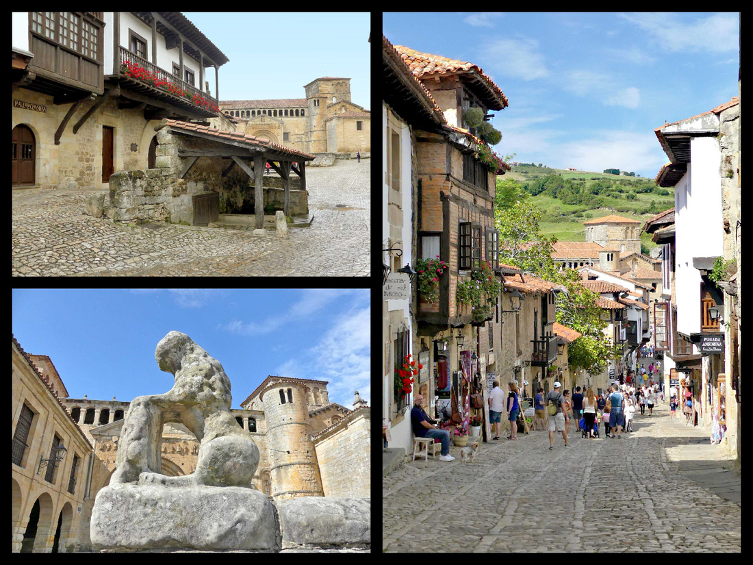
Outrageously picturesque but the crowds in summer have unquestionably diminished its appeal. Its cobbled lanes abound in gorgeous sandstone buildings with flowery overhanging balconies, while the farms and fields on the adjacent hillsides give it a lovely rural atmosphere. Strolling is a delight, even if most of its ochre-colored buildings now hold restaurants, hotels or souvenir shops. It’s definitely worth staying overnight, as the bulk of the visitors are on day trips, and the emptier the town, the more atmospheric it is. At dusk, and for a few hours in the morning it was delightfully un-crowded (although delivery trucks kind of mar the ‘picturesque’ quality). And while it was certainly full of people mid day, there really weren’t many tour groups, it was mostly individuals. One morning I went out quite early – I think it was between 7 and 8 – and it was just me, a couple of dog walkers, and some Camino pilgrims.
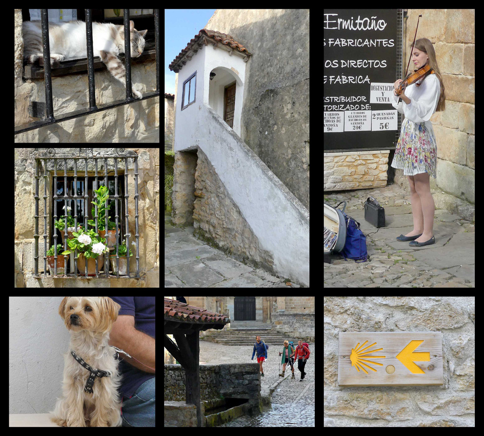
Top Right: Klara Gomboc, violinist (we bought several of her CDs, beautiful arrangements of classical and modern compositions) www.laviolinista.es/en/index.php
The main street (which seems to have three names, Calle Carrera, Calle Canton, and Calle Rio) runs down hill to the 800-year-old cathedral, Colegiata de Santa Juliana. The current Romanesque building replaced a former Benedictine monastery in the 12th century. An arcaded gallery runs high above the portal, and a round bell tower is to the right, two towers behind that, and an arcaded porch to one side. Wonderfully asymmetric. The entrance to the church interior and the cloister is around to the side. It’s a beautiful building, on a ‘human’ scale, and takes on different shades of gold or honey color depending on the light. It has a slightly neglected appearance, which I think adds to its charm. The cloister, while small, has some really impressive carvings on the capitals.
On the street just before the church is an interesting old well with a tile roof. This part of the street is called Calle del Río, which gets its name from a stream running through town to the fountain here.
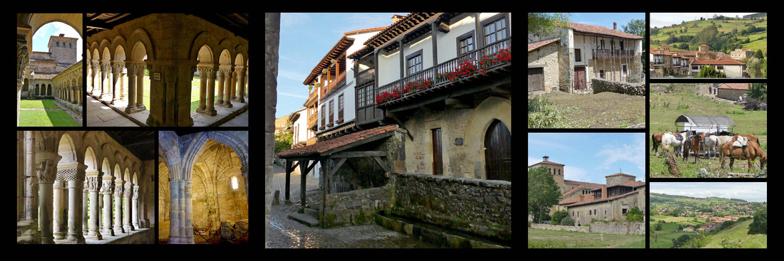
The houses in town (14th-18th Century) are mostly stone and timber, many with wooden balconies, some with iron balconies, and there are several grandiose palacios emblazoned with coats-of-arms (in some cases hugely oversized). The main square, which is at the end of the other main street, Calle Juan Infante, is Plaza Mayor, home to the Ayuntamiento, the Parador (in Casa de los Barreda-Bracho), the Torre de Don Borja, and the Torre del Merino. Around behind the church is the Palacio de los Velarde, a grey stone 16th century Renaissance style building that looks somewhat castle like.
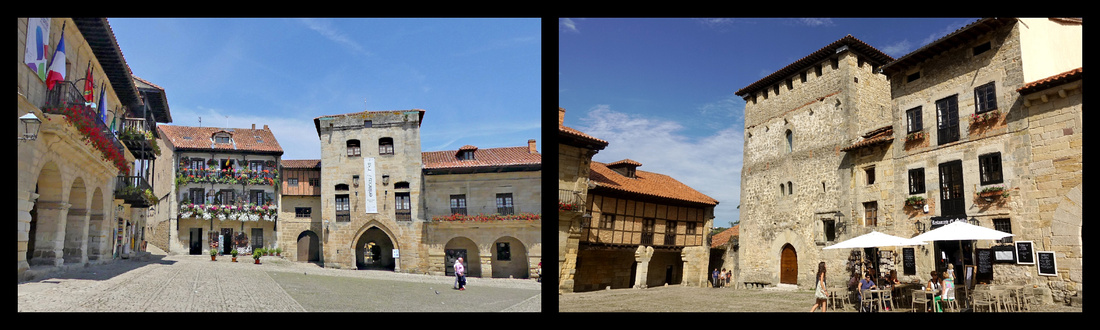
Plaza Mayor
Cuevas de Altamira –a UNESCO World Heritage Site . The bison, wild boar, horses and other animals on the ceiling at Altamira are the largest known group of “polychromes” (figures painted using several colors of pigment – ochers, manganese oxides, charcoal, iron carbonate). The two most important sites in the world are Altamira and Lascaux in France. About 2.5km from the center of Santillana is the cave, famous for prehistoric paintings dating from the end of the Ice Age, (14,000 years ago) that have caused these caves to be called the "Sistine Chapel of prehistoric art." These ancient depictions of bison and horses, painted vividly in reds and blacks on the caves' ceilings, were not discovered until the late 19th century. Once their authenticity was established, scholars and laypersons flocked to see these works of art. Severe damage was caused by the bacteria brought in by so many visitors, so now the Research Center and Museum of Altamira no longer allows visitors but has created a replica, which along with the museum can be visited. http://museodealtamira.mcu.es closed Mondays, 3€,
Museo de Altamira and the Neocueva are located a few hundred feet from the original caves. On exhibit is a perfect replica of the cave, complete with precisely realistic copies of the original murals. The replica was created by computerized digital-transfer technology; the so-called "neocave" contains every crack and indentation of the original. The highlight is the array of 21 red bison in the Polychrome Chamber. The exhibition begins with an excellent overview of prehistoric hominids so you can get your Neanderthals sorted from your Cro-Magnons before moving on to more specific displays about the Altamira epoch and ways of life at the time.
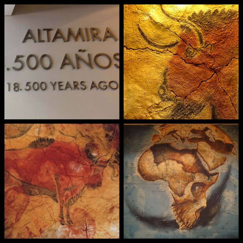
The ticket booth is outside the main entrance and when we were there (10am in July) the wait to buy tickets was exactly one hour and then our timed ticket was for one hour later. You get a timed ticket for viewing the neocueva, the museum you can see anytime. So you could choose any time later in the day, and leave and return if you didn’t want to wait. But we found one hour to be just about the right amount of time to see the displays in the museum. The museum is small – really only three medium sized rooms, but full of displays, videos, and plaques with information (all in English as well as Spanish). Most of the videos were self-explanatory so there was no talking in any language. Then you queue up and are ushered into a small room (20 people at a time, staggered about every 10 minutes) to watch a 5-minute video and then you walk through the cave. Pretty amazing, the whole ceiling is covered. As you enter the cave you see where the people spent most of their time (the large entrance area, with exterior light) and then down a few steps into the darker part of the cave where the paintings were. You only get about 5 minutes in there but there’s just the one space so it doesn’t take long, but it sure was pretty amazing.