A great place to stay in Bologna is B&B Ambra, a ten minute walk from the train station, 15 minutes from Piazza Maggorie. It's on a main street Via Irnerio, just off Via Independzia, but was very quiet. The owner, Ambra, was there to greet us. She speaks almost no English but tried really hard to explain things (and my husband loved to practice his Italian - I have no idea how well they actually communicated but both seemed to be having fun). The B&B consists of about 6 ensuite guest rooms and one shared kitchen/dining room space. Everything is brand new and immaculate. Ambra makes breakfast each morning - yogurt, bread/toast, coffee, tea, cakes, fresh fruit. All this is also available throughout the day if you want, and there is a separate fridge to store food you buy elsewhere if you need to. The B&B is on the 5th floor of the building but there is a lift - although it's old and a little hard to figure out. Booked through booking.com, €80/night double.
BOLOGNA
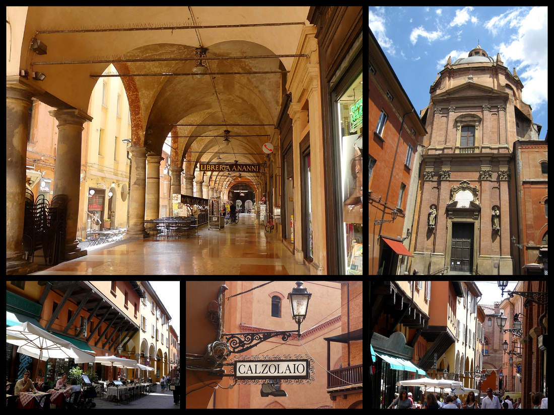
Though a major Italian city, Bologna, population 375,000, feels smaller. The center is very medieval in plan, a jumble of red brick buildings, hulking towers, tiled roofs and stone balconies. The university makes up one-fifth of the city's population making for an interesting contrast between a very young human vibe and very old architectural atmosphere. The university, founded in 1088 (beats out Oxford, by 6 years) is the oldest university in the world. Bologna is the only city in which the most important tombs are not those of religious or civic leaders but of professors.
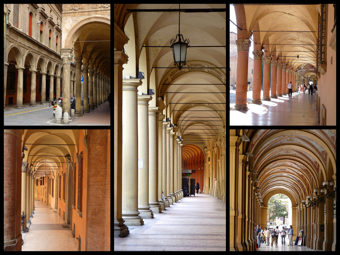
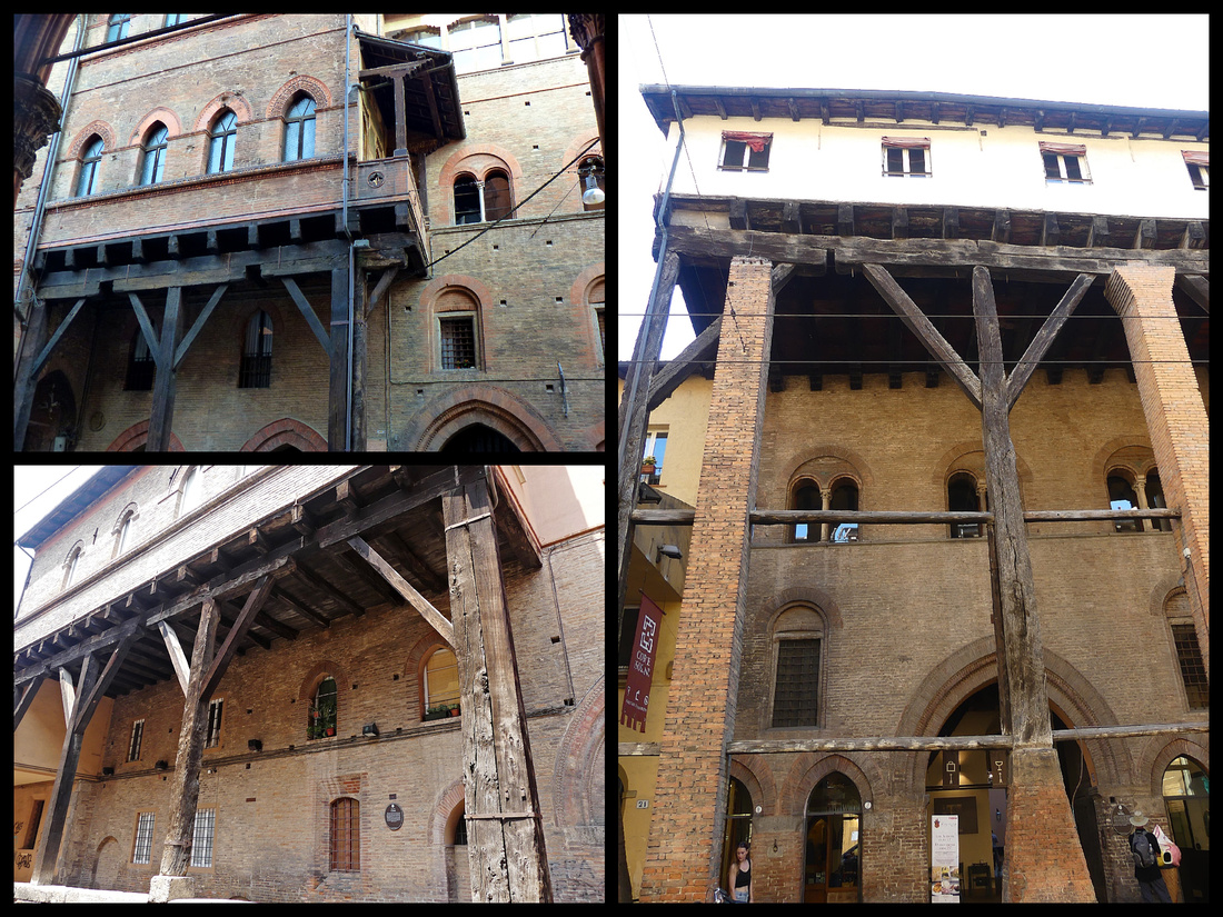
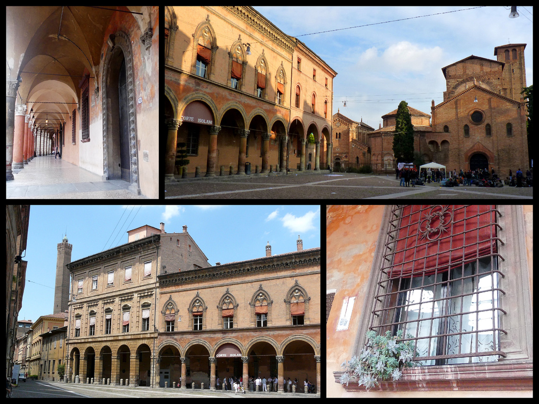
The most outstanding feature is the porticos - 40 km of them– besides being visually extremely interesting, they provide great shelter from both rain and scorching sun and no city in the world has more of them. They have been nominated as a UNESCO world heritage site. Porticos were first built in the late Middle Ages. The origin of porticos is the sporto, a protruding wooden structure which was built in order to extend the inner living space of the upper floors. These structures then grew bigger and heavier, so that it was necessary to prop them up with wooden beams which inevitably occupied the street. The streets were soon so crowded with porticos that the city council decided to lay down some official rules. While other cities had banned the portico, in Bologna it became compulsory as a public space. Statutes established that all new houses should have a portico and set out the minimum measures, for example the height should be 7 feet in order to allow the passage of a man riding his horse.
Some examples of these first porticos are the wooden portico of Isolani House (19, Strada Maggiore) photo below right, the one of Palazzo Grassi (12, via Marsala) lower left and the portico of the Reggiani – Seracchioli Houses (Piazza della Mercanzia) upper left.
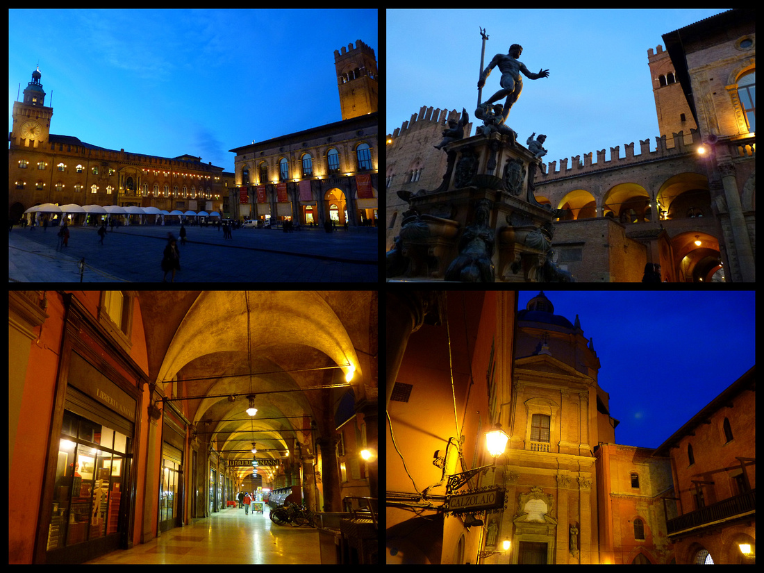
Piazza Maggiore & Piazza Netetuno – are two adjoining main squares, rimmed by beautiful medieval fortress looking palazzos – Palazzo Comunale (1287-1425) on one side and the adjoining Palazzo del Podesta/Palazzo di Re Enzo (1212-1484) on the other and the Basilica di San Petronio (1390). The cathedral was originally intended to be much larger but money ran out and the result is the cathedral looks ‘unfinished’. In the center of the piazza is the Fontana di Nettuno (1566) (Neptune Fountain), one of the most extraordinary fountains in Europe. Viewed as irreverent by some, "indecent" by the Catholic Church, and magnificent by those with more liberal tastes, the 16th century fountain depicts Neptune with rippling muscles, a trident in one arm, and a heavy foot on the head of a dolphin. The church tried to force the sculptor, Giambologna to manipulate Neptune's left arm to cover his monumental endowment. Giambologna's defenders denounced this as "artistic castration." Around his feet are four highly erotic cherubs, also with dolphins. At the base of the fountain, four very sensual sirens spout streams of water from their breasts.
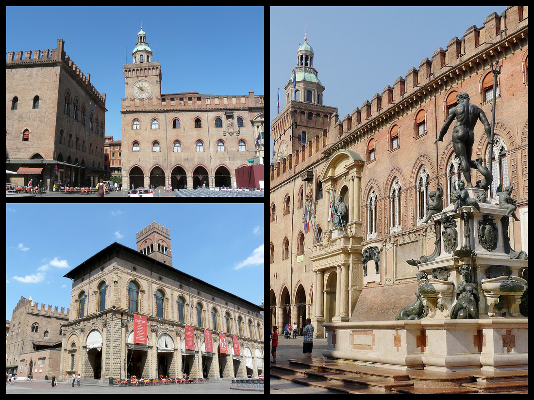 Upper left: Palazo Comunale Lower left: Pallazo dei Podesta Right: Palazo Comunale with the Neptune fountain
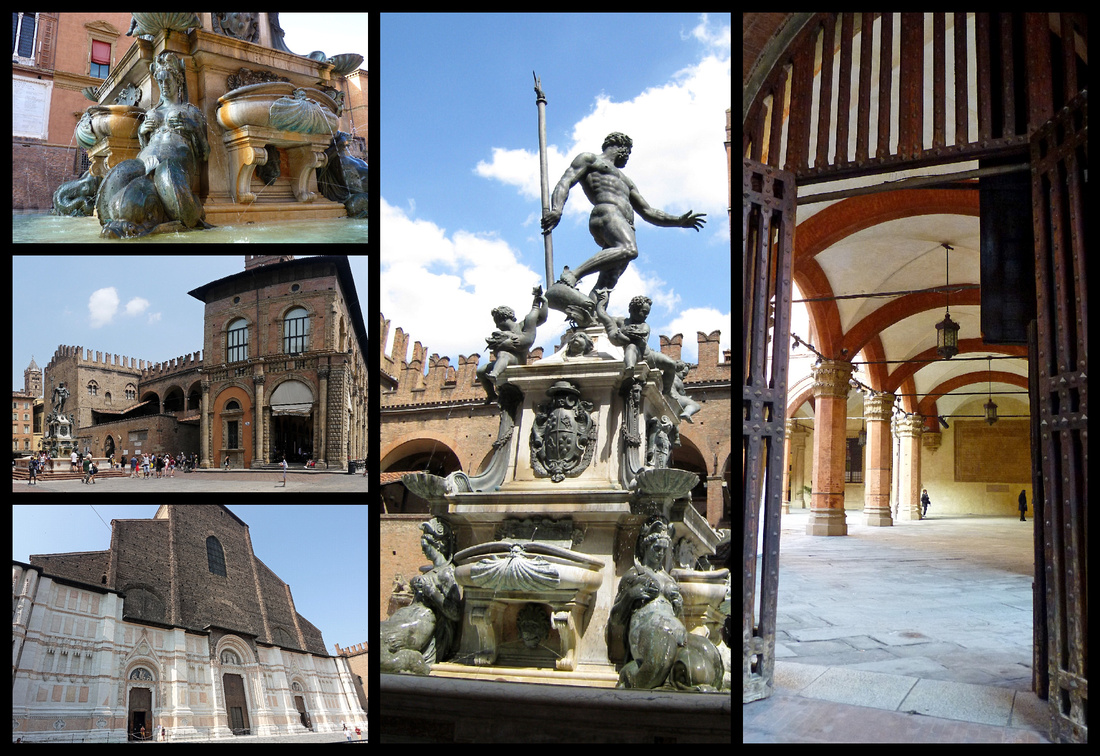
Left top: Neptune Fountain; center: Palazzo dei Podesta; bottom: Cathedral Center: Neptune Fountain Right: Palazzo Comunale
Via Clavature is one of the two main pedestrianized 'restaurant' streets. The Church of Santa Maria della Vita is here, as well as the Portico della Morte which translates to 'Portico of Death'. The nearby Hospital of Death was very popular among medical students who used the corpses of executed men to make anatomy studies in the nearby Palazzo dell'Archiginnasio. The street runs from the Piazza Maggiore to via Castiglione and Piazza della Mercanzia with the Palazzo della Mercanzia and across the lane one of the original wooden porticos - of the Reggiani – Seracchioli Houses. The whole area could be a movie set.
 Via Clavature - top left Portico della Morte; top right: Church of Santa Maria della Vita
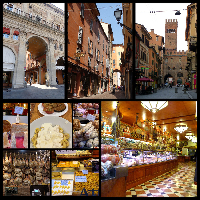
Via Clavature and the nearby Via Caprari are home to many restaurants and food shops including A.F. Tamburini, which features local cuisine including tortellini which was 'invented' in Bologna. The Emilia Romagna is known as the 'breadbasket' of Italy and is home to lasagna and ravioli as well as tortellini and several other pastas.
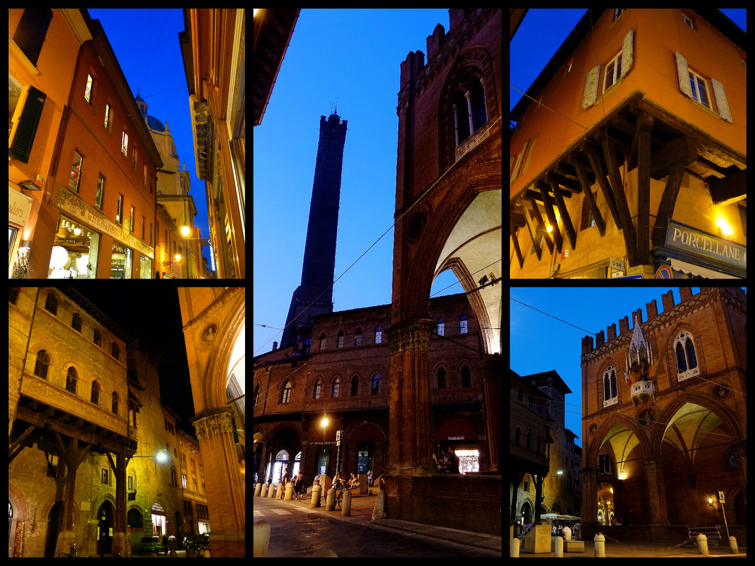
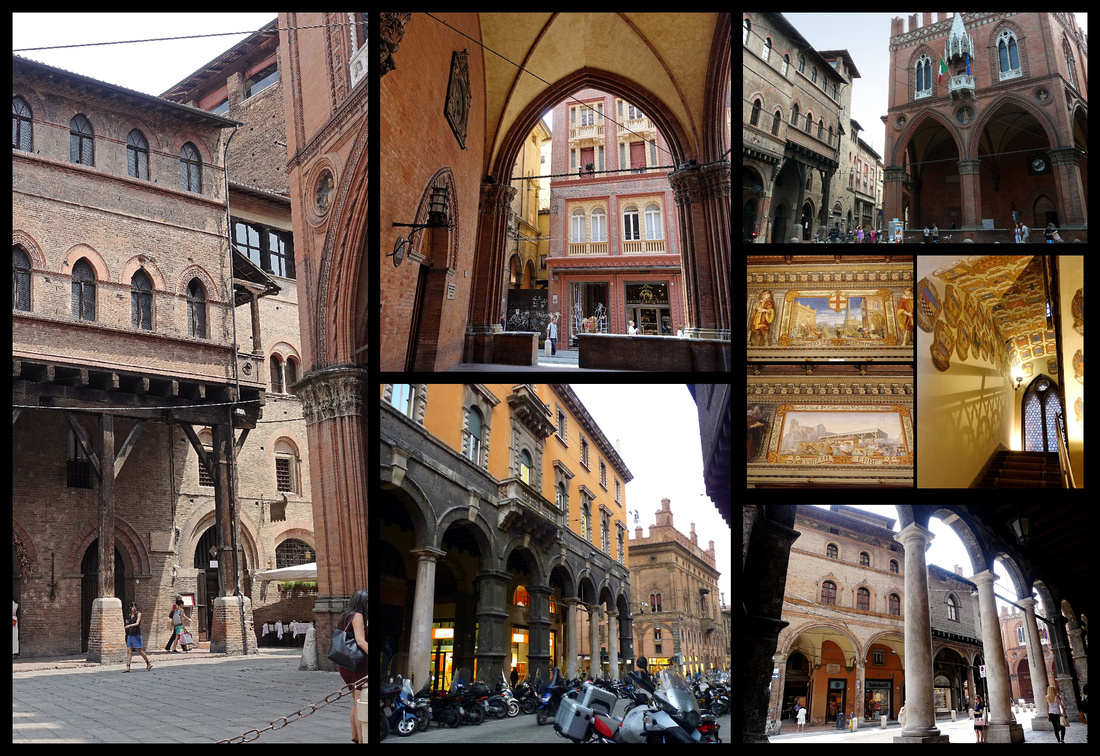 Left: Reggiani-Seracchioli Houses with original wooden portico Center & right top & right middle: Palazzo della Mercanzia
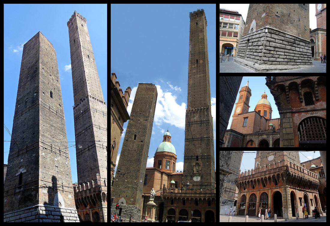
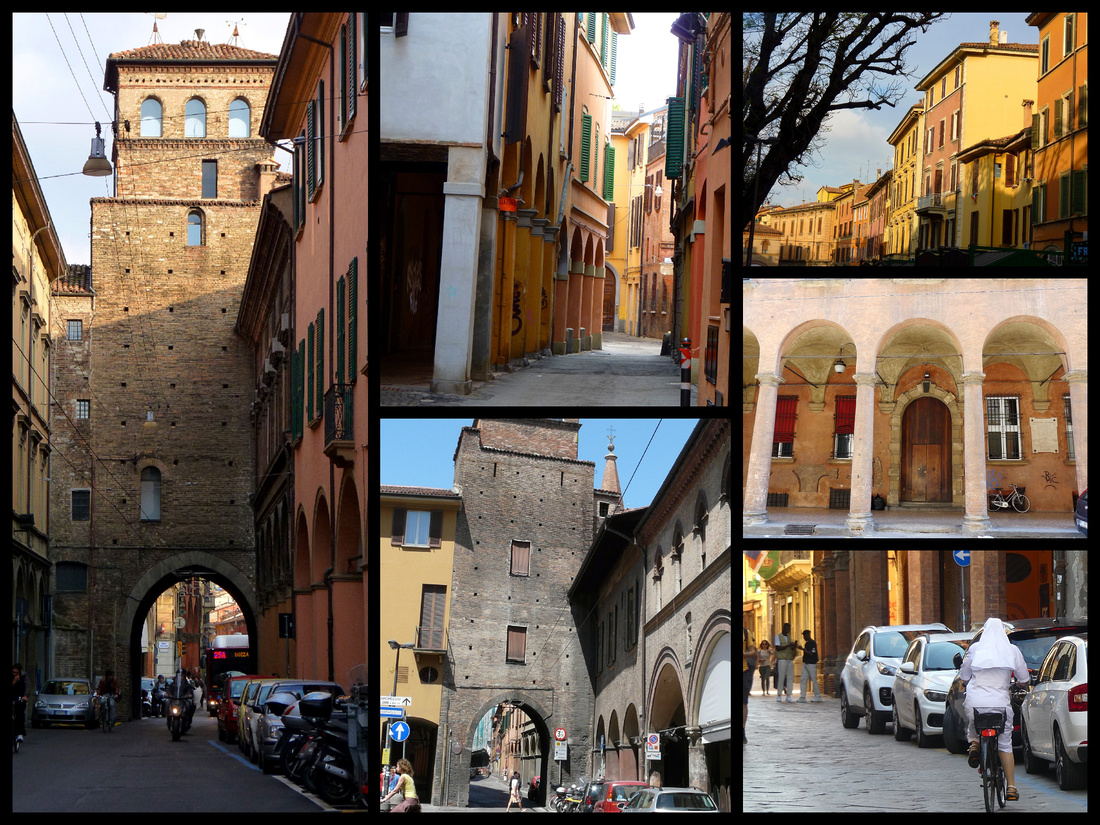
Le Due Torre - Two landmark towers, mentioned by Dante in The Inferno, on Piazza di Porta Ravegnana. Built by patricians in the 12th Century, these leaning towers, the symbol of Bologna, are definitely gravity defying. In the Middle Ages, Bologna had dozens of these towers. The more powerful the family was, the taller its tower was; only 60 remain out of more than 200 that once stood. Torre Garisenda, late 11th Century, tilts 10 feet off perpendicular, was shortened to 165 feet in the 1300s. Torre degli Asinelli (circa 1109) is 320 feet tall and leans 7½ feet. Torre degli Asinelli can be climbed and it is one of the more strenuous tower climbs in Europe with 500 narrow, wooden steps, but an impressive view over Bologna. The Church of San Bartolomeo, overshadowed, literally and figuratively is right behind the two towers.
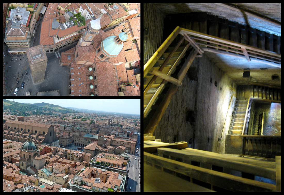 View from the top and some of the many flights of stairs leading up to it
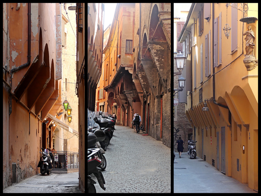
Typical medieval streets in central Bologna
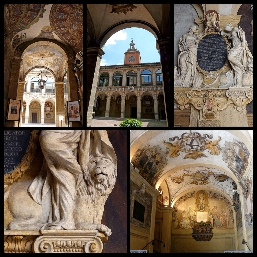
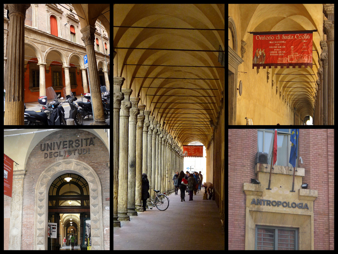
Archiginnasio, which features a long porticoed façade, was once the main building of the university. Just behind the cathedral it is still one of the most impressive buildings in the city. Beautiful arcaded courtyard with lots of frescoes and sculptures. Today it houses the municipal library and anatomical theater.
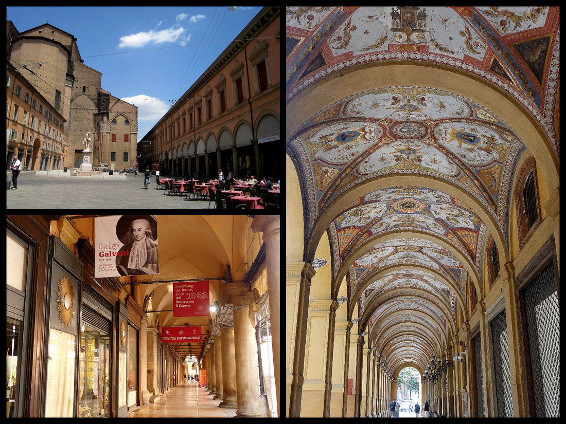
The Archiginnasio is on Piazza Galvani (top left). Bottom left: inside the porticoed facade. Right: via Carbonesi's porticos have beautifully painted ceilings.
Piazza San Stefano Southeast of the Due Torri, Via Santo Stefano leads down to its medieval gateway past a complex of four – but originally seven – churches, collectively known as Santo Stefano. The interlocking ecclesiastical structure's architecture spans centuries and incorporates Romanesque, Lombard and ancient Roman elements. It's an attractive complex set in a wide triangular shaped piazza at the conjunction of several narrow porticoed streets. It looks so medieval it could be a movie set - in fact a movie was actually being shot when I was there.
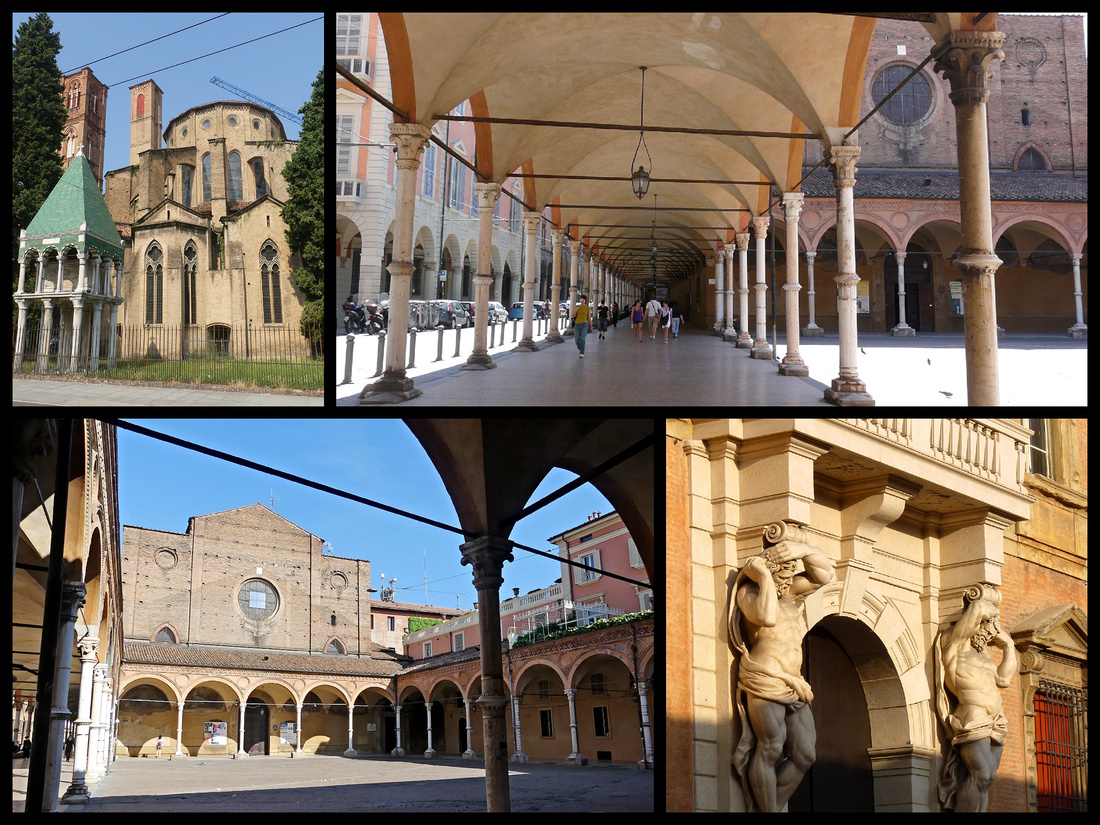 Top left: Church of San Domenico Top right and bottom left: Santa Maria dei Servi
Via San Vitale and Piazza Verdi
The University of Bologna is not only the oldest university in the world (1088) but is still one of the leading academic institutions in Europe. It was the first place of study to use the term universitas for the corporations of students and masters, which came to define the institution (especially its famous law school). There are currently 11 schools within the university. The university's emblem carries the motto "Alma mater" studiorum ("nourishing mother of studies")
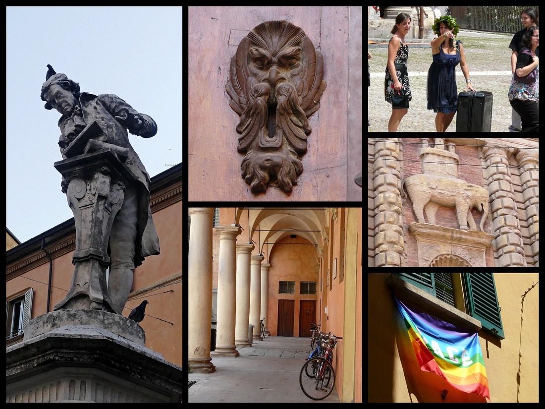
Above Left: Statue of a professor with books Center and lower right: Miscellaneous parts of the university
Upper right: When a student graduates from the university they are 'crowned' with laurel leaf wreaths. It signifies receiving your 'laurea' or degree and is a tradition all over Italy.
Interesting, but not really a ‘must do’ is the Sanctuary of San Luca. The church itself, is not special at all, many in Bologna center are as interesting. It was built in 1723 on the site of an older church. But it’s location, 300 meters up a hill outside the center reached by the longest continuous portico in the world, is. The arcade is 3.8 km long and consists of 666 arches and was built between 1674 and 1793. Google says it can be walked from the city center in an hour and a quarter but you’d have to be hoofing it pretty good to accomplish that. It took us 1½ hours to walk downhill. Most people take the tourist train from Piazza Maggiore. Normally we would definitely have walked it, but as a concession to the 101-degree heat we took the train up and walked down. Really, walking the porticos was by far more interesting than visiting the church itself.
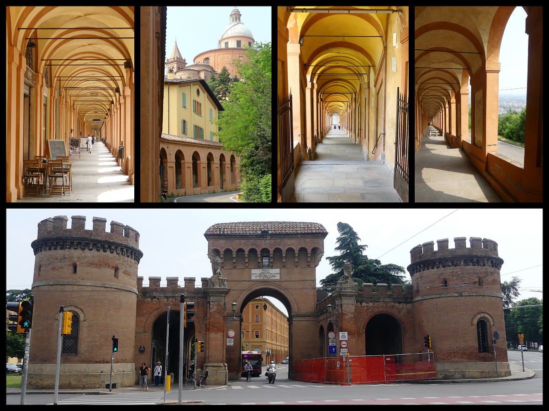
Above top: the portios leading to San Luca Bottom: Porta Saragozza, one of the ancient gates to the city sits across the street from the start of the porticos
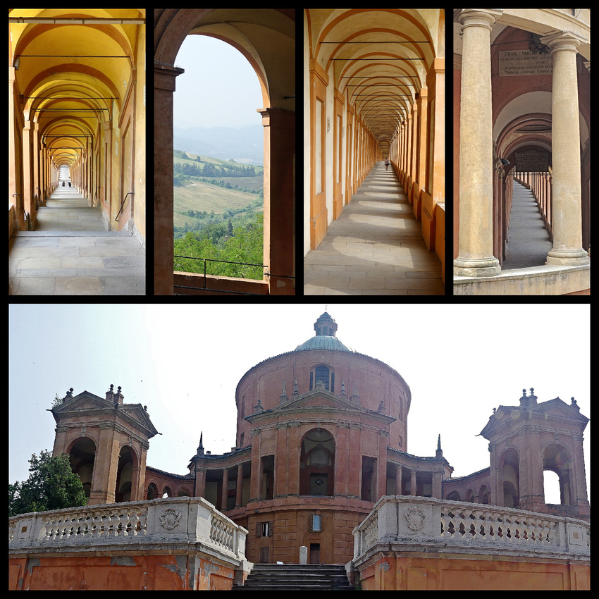
Above Top: San Luca Porticos Bottom: Church of San Luca
Above: Sanctuary of San Luca and it's porticos
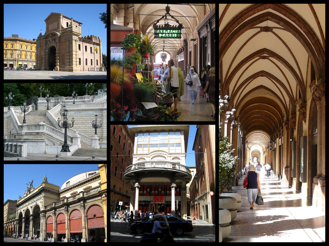
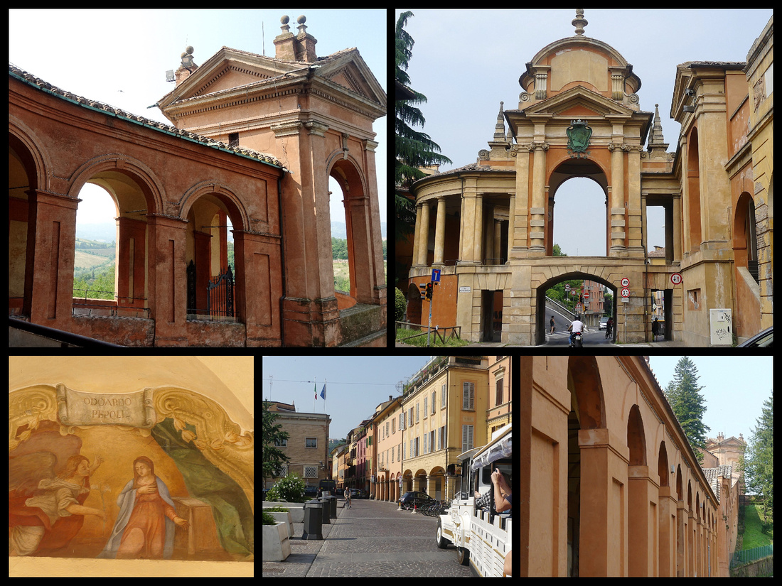
Left top: Bologna town gate Left middle: Parco della Montagnola stairs Left & center bottom: Via dell Indipendenza
FERRARA
Ferrara, (population 134,000), is another UNESCO world heritage site: “Ferrara, which grew up around a ford over the River Po, became an intellectual and artistic centre that attracted the greatest minds of the Italian Renaissance in the 15th & 16th C. The humanist concept of the 'ideal city' came to life here in the neighbourhoods built from 1492 onwards by Biagio Rossetti according to the new principles of perspective. The completion of this project marked the birth of modern town planning and influenced its subsequent development.”
Ferrara, only ½ hour train from Bologna, is another town I had previously visited and really loved. Only a 20-minute walk to the center. The main street, Via Cavour, which is the way Google says to go and is the obvious way, is a busy street and less pleasant than Via Cassoli & Via Garibaldi which is mostly pedestrianized and comes out right opposite the cathedral. I liked Ferrara as much as I did the last time, nice vibe, lots of bicycles, busy enough but not too much so. Although it certainly has a tourism industry, Ferrara is not on the typical itinerary, which makes it perfect for those who want to get off the beaten path of Venice-Florence-Rome and soak in some authentic northern Italian culture. It's characterized by twisting medieval cobble stoned streets, a Duomo with a Gothic facade, and a castle complete with towers, moat, and drawbridges. The genuine masterpiece though is the city itself. Half medieval, half Renaissance.
In the center of town, the 13th century crenellated Palazzo Municipio (aka Palazzo Comunale) was the first residence of the Este family, built between 1245 and 1481. On one side is the Torre della Vittorio, in the center is the main gateway, the other side is Lo Scalone d'Onore. Directly opposite, through the gateway is Cathedral of Saint George/ Duomo, (1135-1250). Two recumbent lions guard the entrance. The south side of the cathedral is interesting, the loggia dei Merciai, lined with medieval shops with overhanging arcades (today with modern stores) along the rectangular Piazza Trento e Trieste. The pink and white stripped bell tower is at the far end of the cathedral (and thus the piazza).
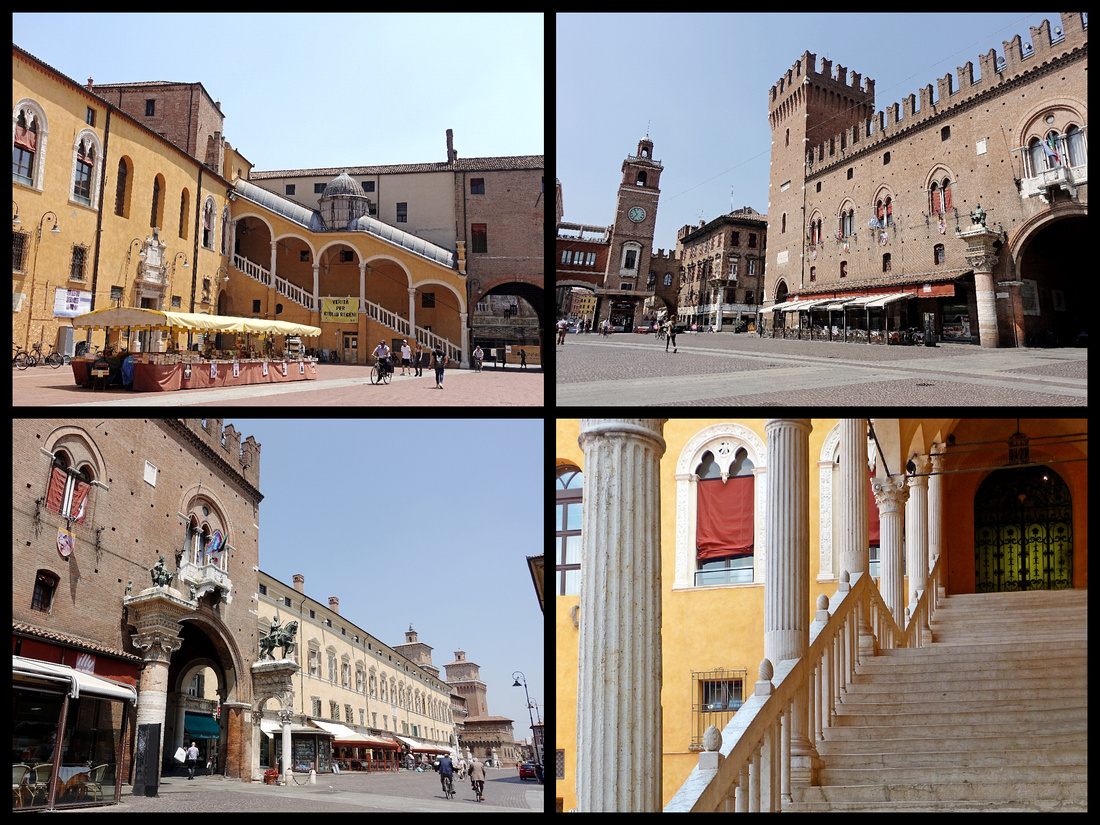 Palazzo Comunale Top left and bottom right - interior courtyard Top right and bottom left - exterior
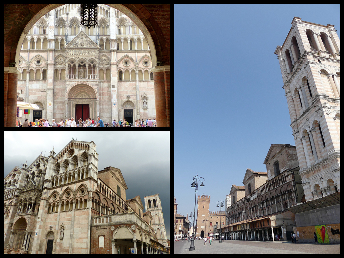 Left top and bottom: Front facade of Ferrara's Duomo Right: side and bell tower from Piazza Trento e Trieste
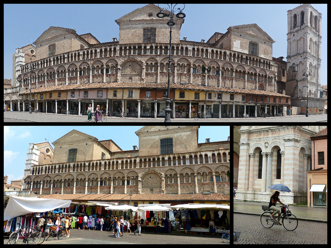
Above: Piazza Trento e Trieste
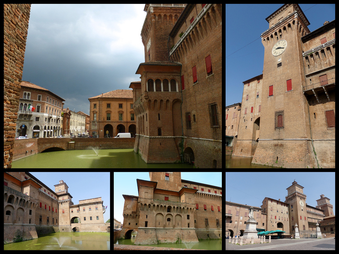
Casstello Ertense, large and impressive for a city center castle, has drawbridges and a large courtyard that you wander for free but to climb the tower you have to buy admission to the museum (€12 and reportedly not that interesting, most of the building is now offices). But from the outside it’s very impressive, especially with the moat full of green water. Built between 1385 and 1554 with four massive towers it was a suitable symbol for the ruling Estes family: cold and menacing on the outside, lavishly decorated within. The public rooms are grand, but deep within are dungeons where enemies of the state were held in wretched conditions—a function these quarters served as recently as 1943, when antifascist prisoners were detained there. It was here, in 1425, in the marital bedchamber and the dungeons, that Niccolò d'Este had his second wife and her lover - his own son, Ugo - murdered for an alleged affair. This venting of medieval righteous anger is perhaps understandable until you learn that he himself boasted of sleeping with 800 women.
Just opposite the cathedral is the cathedral museum, with an equally perfect medieval cloister (free) at the entrance to the Cathedral Museum. Ferrara has many cloisters, most of which were built in convents. Five hundred years ago, Ferrara, like all other Italian cities, was so nervous about female sexuality that as soon as respectable women reached the age of menstruation they were either married off or - more likely, given how expensive dowries were by this time - incarcerated in convents. "Christ is the only son-in-law who doesn't cause me any trouble," wrote the great Ferrarese Renaissance patron Isabella d'Este, after walling up two of her own daughters for safety.
But while no one can deny the appalling unfairness of the practice, it was not all terrible. Sisters, nieces, aunts and cousins within a family would all have been nuns - and, bearing in mind the forced marriages, abusive husbands, lack of birth control and death toll from childbirth outside the walls, convents could be sanctuaries as well as prisons. The more you dig, the more a portrait emerges of small republics of women with their own dramatic ebb and flow of power. Sarah Dunant wrote a novel, Sacred Hearts, set in Ferrara about this, and reading it before a visit really helped bring alive medieval Ferrera.
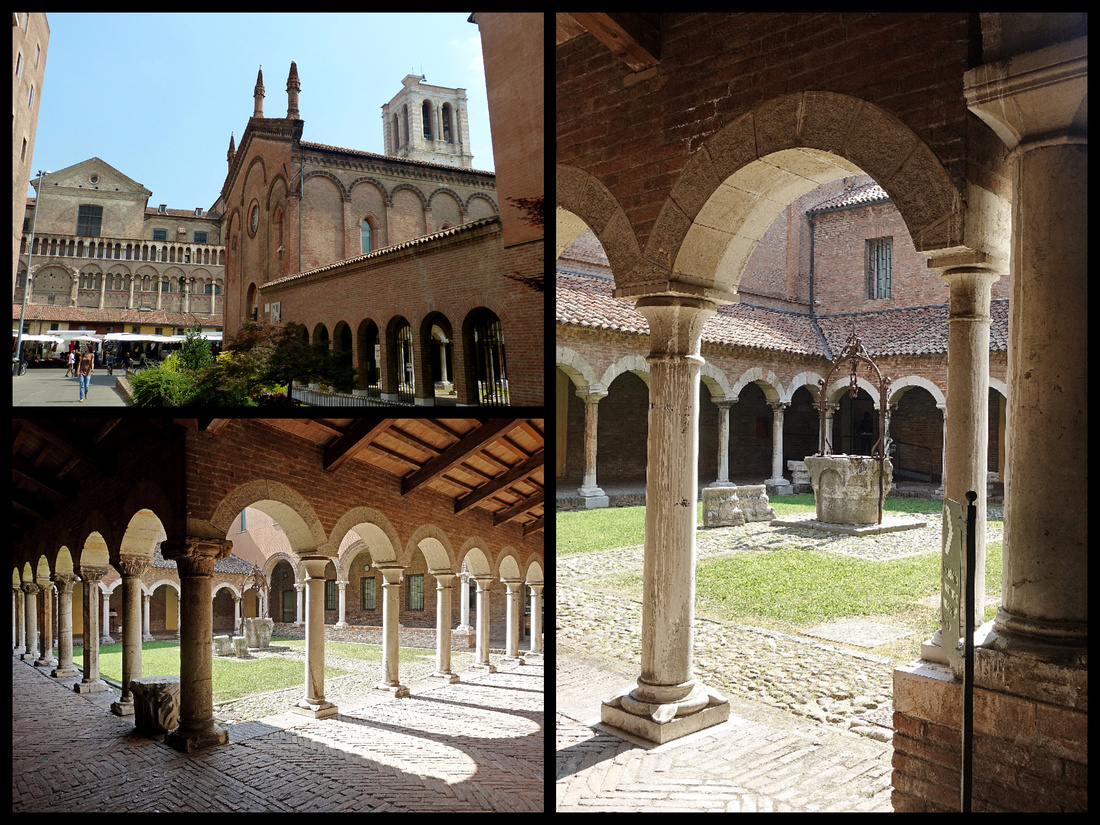
Above: Cathedral Museum and cloister
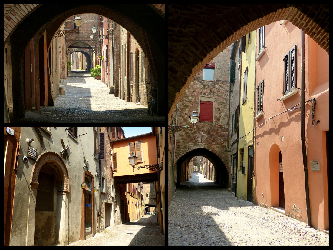
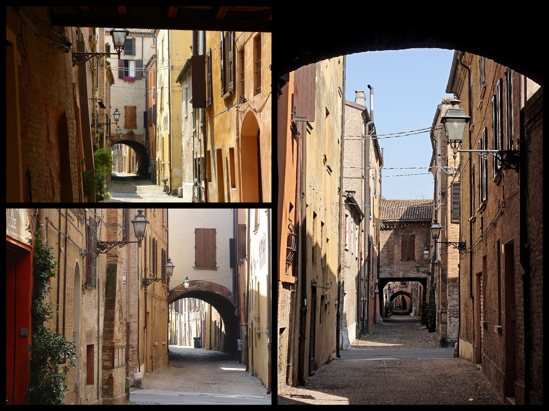
A porticoed pedestrian shopping street leads off Piazza Trento e Trieste to the Via delle Volte, one of the best preserved medieval streets in Europe. Full of arches (volte means arches) over a narrow cobblestone alley, the arches originally joined the merchant’s houses on the south side of the street with the warehouses on the north. The street used to run parallel to the River Po, which is now much further away.
 Not far from the center is Casa Romei, one of the best-preserved Renaissance buildings in Ferrara (where Lucrezi Borgia spent much of her time). The exterior is a huge, austere brick building but inside is a beautiful courtyard with two story arcades, 16th century rooms, frescoes, etc. Unfortunately Casa Romei was closed on Thursday morning. Fortunately I visited it the last time I was there so didn’t care that much. But the other palazzo which I had wanted to but didn’t get to on my last visit, Palazzo Schifanoi, was closed for renovations this time. And it’s about a mile each way walk from the center. Oh well.
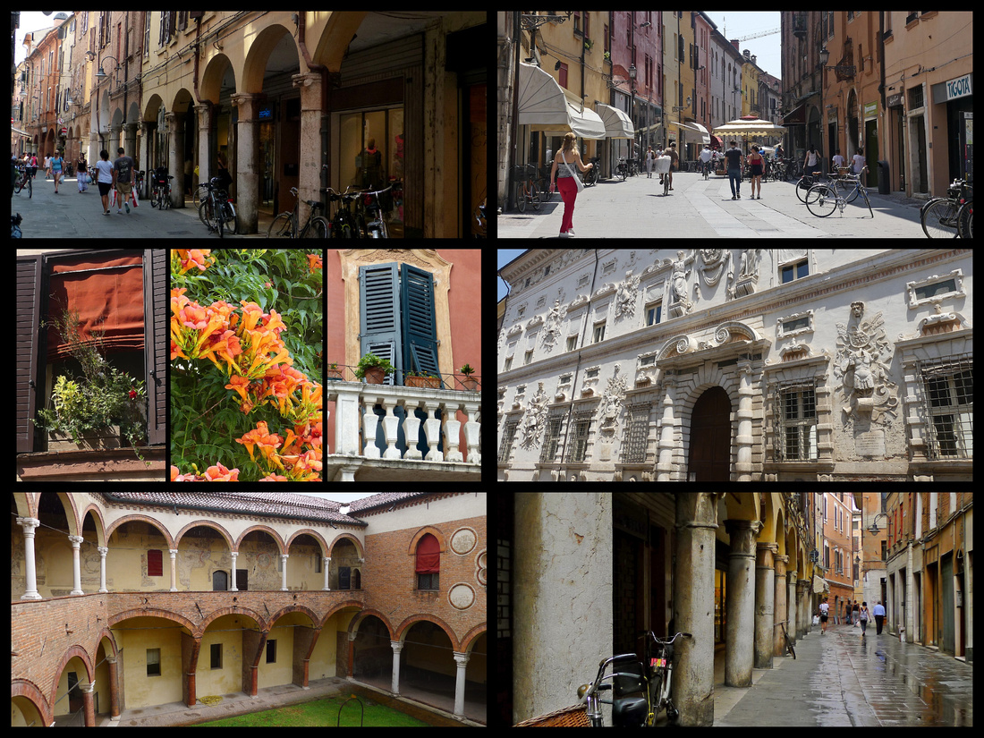 Above left lower: Casa Romei Other photos above: streets of central Ferrara
Modena and Parma – Trains between Bologna and Modena and Parma are frequent – usually 3 per hour so we didn’t have to worry about schedules. We took regional trains and they vary between fairly modern, air-conditioned trains to the older blue/green boxy shaped trains that supposedly now are also air-conditioned but aren’t really so people open the windows and the blue curtains flap in the wind and during a heat wave can be really uncomfortable.
I had been to both Parma and Modena previously. Although I loved Modena the first time I was there, the Duomo was undergoing extensive renovation and I wanted to see it completed. And I had been underwhelmed by Parma, which many people love so wanted to give that a second chance.
MODENA
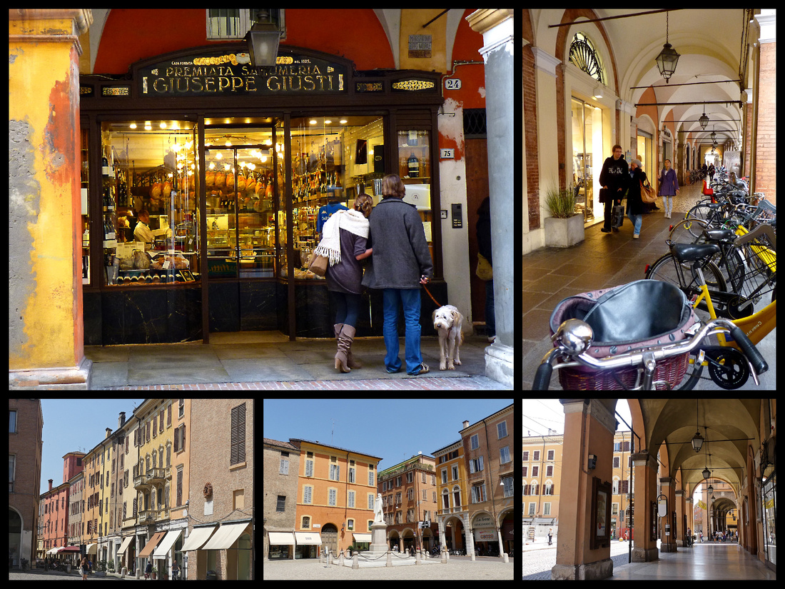
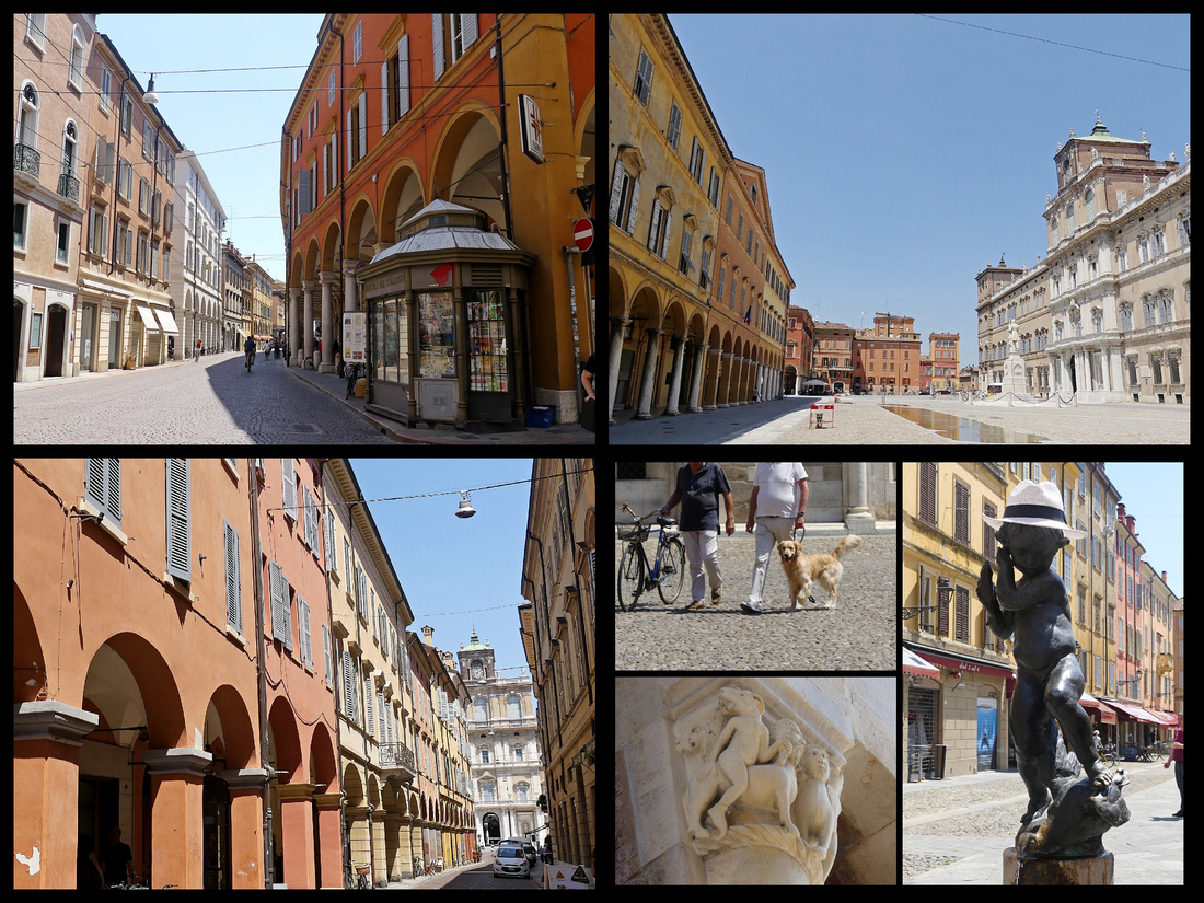
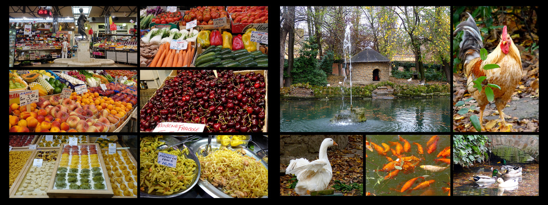
Modena’s town center is a UNESCO site (“12th century architectural complex of a medieval Christian town”). It feels much smaller than it’s population (185,000) suggests, a ten minute walk from the train to the town center, filled with arcaded streets, kind of a mini Bologna. Lovely, laid back atmosphere. It has lots of porticos and a magnificent main square and a number of claims to fame: cars such as Ferrari, Lamborghini and Maserati are tied to the town; the late Pavarotti was a native and is buried in his family plot; the area's balsamic vinegar, aged up to 40 years, has become a cult product; and the cathedral is considered one of the finest Romanesque buildings in Italy. The cathedral, both interior and exterior (all sides) is quite beautiful. There’s also a large covered market and a nice park. During five hours there we saw one small tour group and very few other tourists.
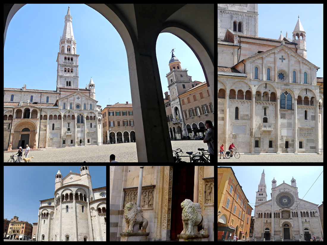
Above top and left: The Duomo on the main Piazza Grande; Bottom right: the 'front' of the cathedral is actually behind Piazza Grande
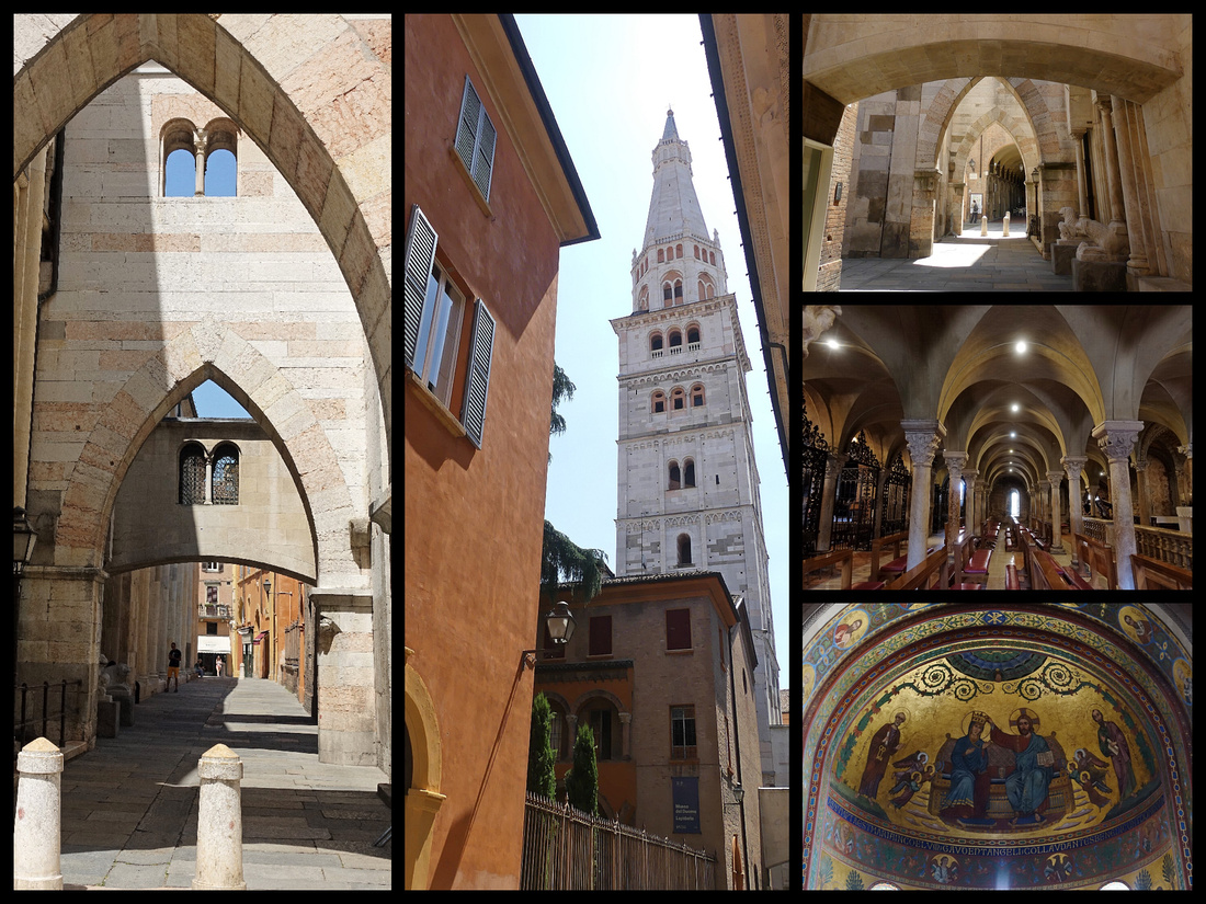 Side, bell tower and interior of Duomo
PARMA
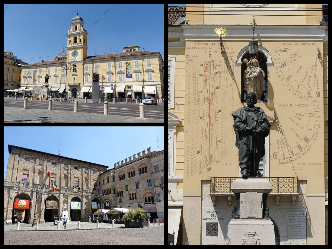
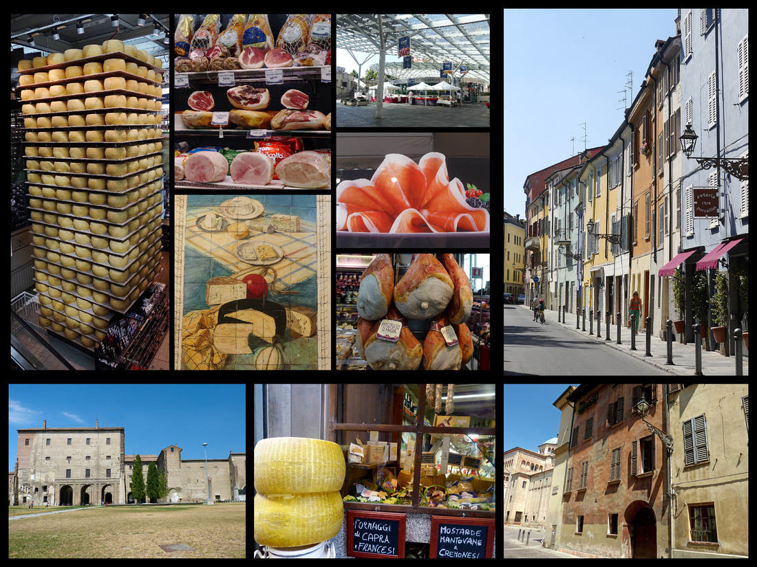
Parma, (population 194,000) is famous for prosciutto ham and parmagiano cheese is one of the most prosperous cities in Italy. Piazza Garibaldi, the main square, is home to Palazzo del Governatore, Baroque and Neoclassical, begun in the 1200s a major government building for hundreds of years. It spans the whole width of the square – the central bell tower has an interesting clock face.
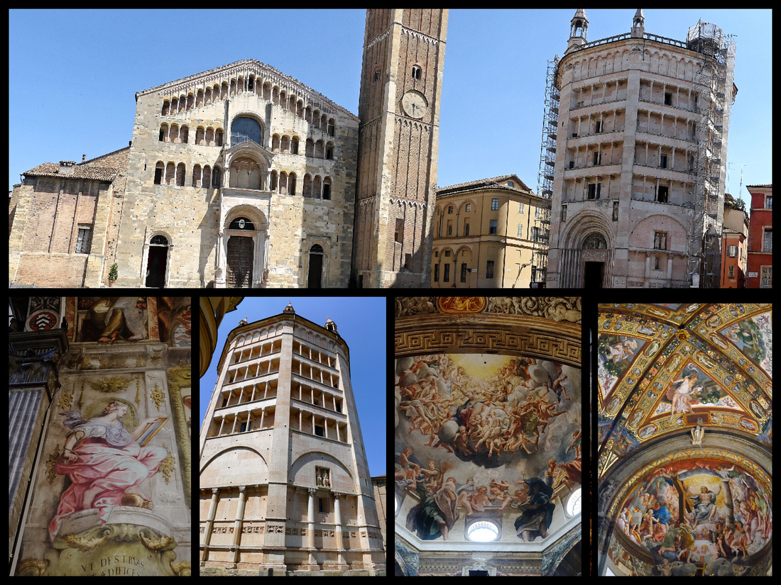
Nearby Piazza del Duomo contains the cathedral (Romanesque, 11th-12th Century, with two stone lions guarding the main door) and the Battistero, and the Palazzo del Vescovado (Bishop's Palace). The Duomo’s octagonal cupola was frescoed by a master of light and color, Correggio, one of Italy's greatest painters of the High Renaissance.
Behind the Duomo is the baroque church of San Giovanni (Renaissance) with more impressive art.
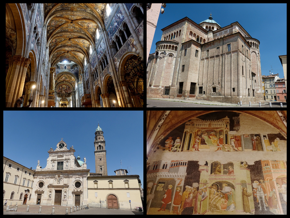 Above: top left & bottom right: interior of Duomo Top right: back side of Duomo Lower left: San Giovanni
But I had the same impression I did the first time I was there – when it was also very hot and sunny – the place has no vibe to it. The center is clean and there are some nice buildings but that it’s. The Duomo (free) is “OK”, quite small as Duomos go, San Giovani Evangalista, the church behind the Duomo is dark and the art work didn’t do anything for me. (I did have a great limone gelato there). We wandered around looking for shops selling parma cheese and ham but surprisingly didn’t find any till we were heading back to the station and found the large enclosed market – which was a really nice (but very modern) place.
During our week in Italy, the only place we went that I had not been to before was Brisighella (and Faenza). It had been on our itinerary during a previous trip but we ran out of time and it sounded interesting so I was determined we’d get to it this time. Trains from Bologna to Faenza are frequent (30-45 minutes) but although the train from there to Brisighella is only about 10 minutes, they are not frequent, so some planning was involved to make it work.
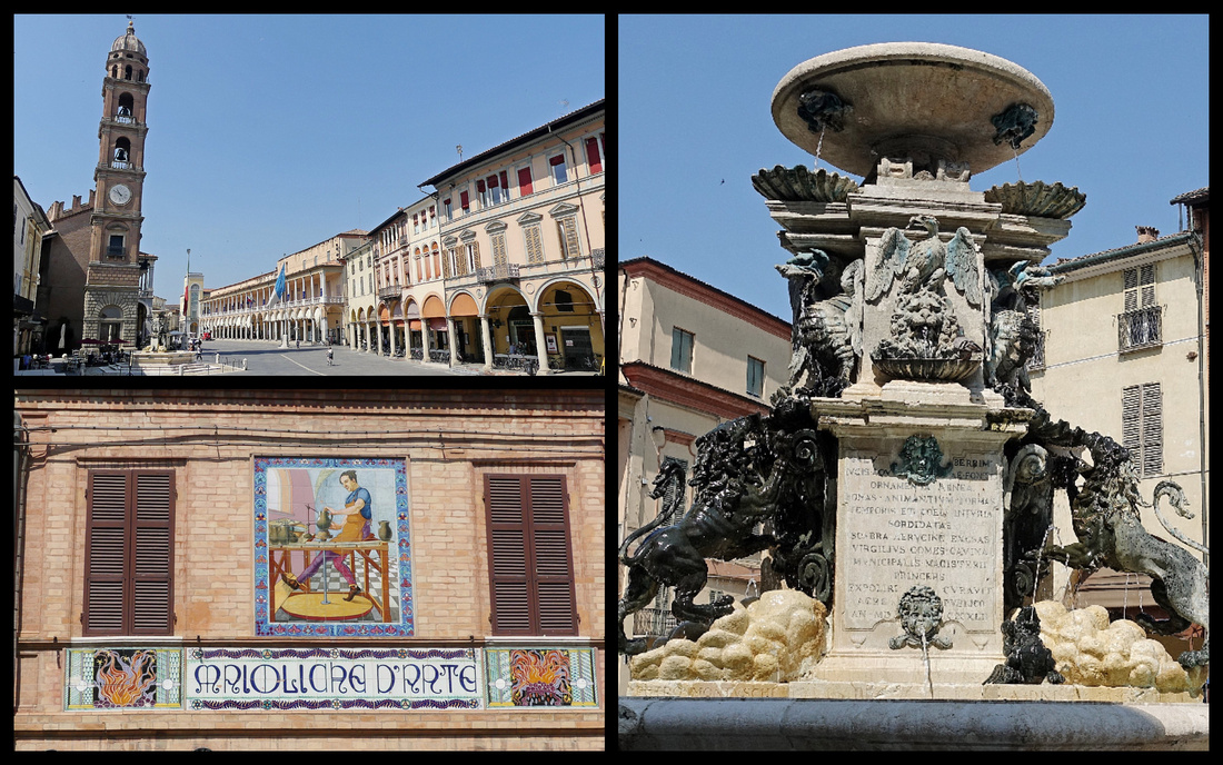
FAENZA
A town of about 60,000, half an hour from Bologna is virtually unknown by tourists except for it’s one claim to fame - The ceramics of Faenza is called majolica-ware (or “Faenza glazed”), referring to ceramics with a glassy coating made opaque with tin oxide. The style originated on the Spanish island of Mallorca and the name has become synonymous with ceramics in various languages, including French (faïance) and English (faience). The International Museum of Ceramics is there but surprisingly there were only a few shops selling ceramics. Besides ceramics, Faenza's architectural attractions are concentrated in the two contiguous main squares: Piazza del Popolo, lined with porticoes, the Palazzo del Podesta and the town hall, and Piazza della Libert with the Tuscan style Renaissance cathedral (1474), There is also a nice bell tower and an especially nice fountain– instead of the usual fish and cherubs there were four impressive lions and dragons - beautiful. There was a cheap clothing market in the smaller square behind the main ones. Not much to do after appreciating the fountain, bell tower and rest of the piazza so we headed for the International Museum of Ceramics but were sidetracked by a ceramic store and ended up buying a small Faenza tray – (but hey, I haven’t bought ceramics in years and this is where ‘faience’ ware comes from). By the time we got to the actual museum we decided we really didn’t have time for it (cost €14 to enter so we’d want to stay a while I figured) since we had to make the train. We figured we could stop on the way back from Brisighella since we had to change trains anyway but by then we were too hot and tired.
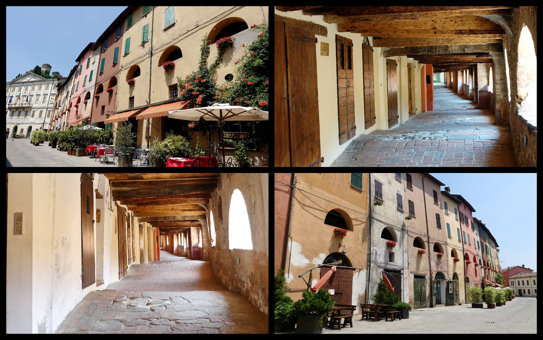
BRISIGHELLA
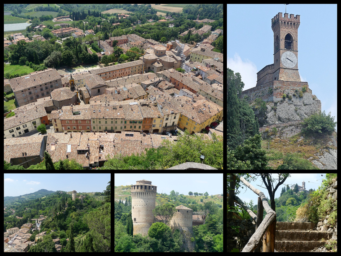
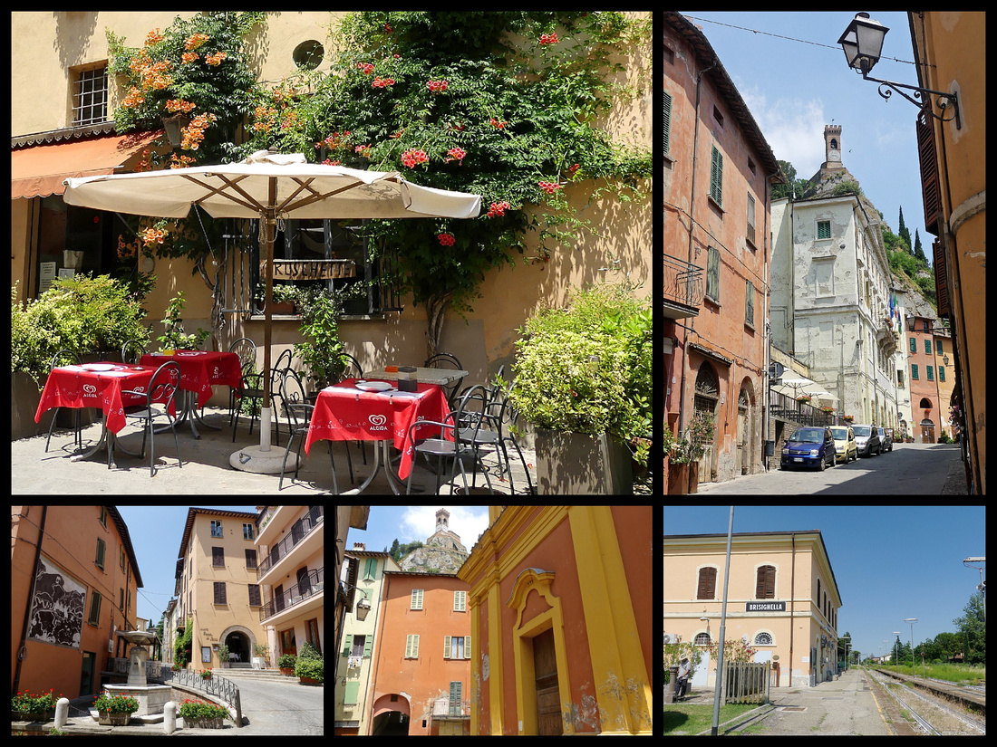
(population 7,800) town center is just a 5 minute or so walk from the tiny (unmanned) train station. A medieval spa town, also virtually unknown to Americans. The medieval quarter has an unusual silhouette, surrounded by three rocky pinnacles one topped by the rocca (fortress), another by an unusual clock tower (only 6 numbers), and the third, a small church, amidst the greenery of the Romagna Apennines. It’s “One of Italy’s Most Beautiful Villages”. It really is a cute village with some atmospheric buildings forming a curved main street. There’s a small TI, which was open and had very friendly people in it who kept commenting on how unusual it was to have American visitors. Turns out the Rocco and Clock Tower are only open on weekends except in July and August, and while the close to 100 degree temperatures certainly felt like mid summer, it was still June.
Other than the three hills, the main attraction is the Via degli Asini,(Street of the Donkey) aka Antica Via del Borgo, a street built into the town wall (which is composed of houses) with light provided by open arches. This raised, covered passageway was built in the 12th century to protect the donkeys carrying chalk/gypsum from the quarries. It has heavy wooden beamed ceiling and brick/cobbled pavement. Very nice, about 2 minutes long.
Then we marched in the blazing heat up 400+ steps to the closed clock tower. There are nice views and I’d read there was nothing significant inside the clock tower anyway. It’s way up high (thus the 400+ steps) but the tower itself is not very tall. Nice view of the Rocco across the town (1310, restored by the Venetians in the 16th Century) on the next hill, and the chapel (18th Century) on the third.
We started hiking up to the Rocco but decided it wasn’t worth it given the heat and the fact that we’d just seen the view from the clock tower. This all took just over an hour and of course the choice of trains back were in one hour (not enough) or 3 or 5 hours. So we went to one of the few bars/cafes that was open for a drink and wandered around the largely deserted village a bit more getting back to the station only about 15 minutes early. Only the train was delayed so it was over a half hour. Back in Faenza we got a ticket for the next train to Bologna only it required a change in Imola. So a lot of waiting for and being on trains today. Some were air-conditioned beautifully, some hardly at all. They were all regional.
]]>
Istrian Peninsula / Plitvice Lakes / Dalmatian Coast
This was our second trip to Croatia, the first - 9 years ago - started in Dubrovnik and went up to Split. This time we started in Rovinj and went down to Split.
We arrived in Rovinj via ferry from Venice and spent 6 nights there, visiting Pula and Porec by bus and then renting a car to visit some of the Istrian hill towns. Then we drove to the Plitvice Lakes, and on to Zadar where we dropped the car and spent one night. We took a bus to Sibenik, another night and then to Split where we caught a ferry to Hvar island for two nights. Back in Split we spent three nights, doing one day trip to Brac island.
We took the ferry from Venice to Rovinj. Unfortunately it was a hydrofoil type with hundreds of airplane type seats and dirty windows; luggage had to be thrown into massive piles that you were not able to access during the trip. No sitting out on deck with the wind in your hair watching Venice as you sailed away. It took almost four hours and you had to arrive an hour early (so they said) to go though security and board. So not the greatest experience, but it was faster than the other options.
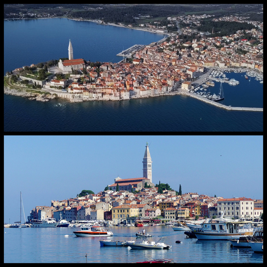
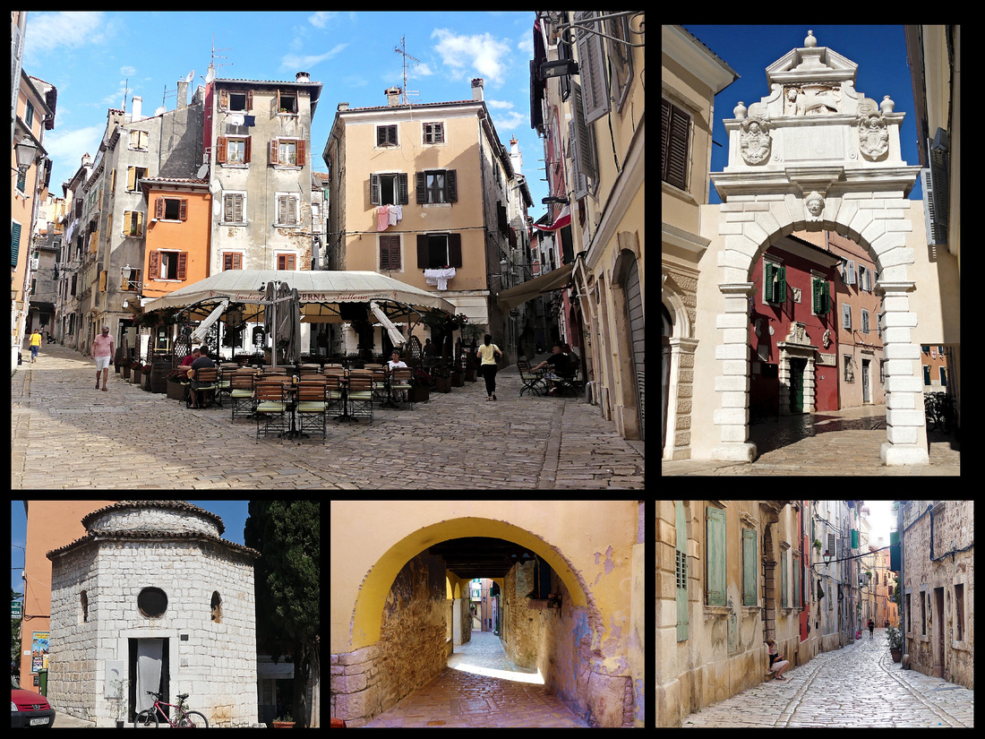
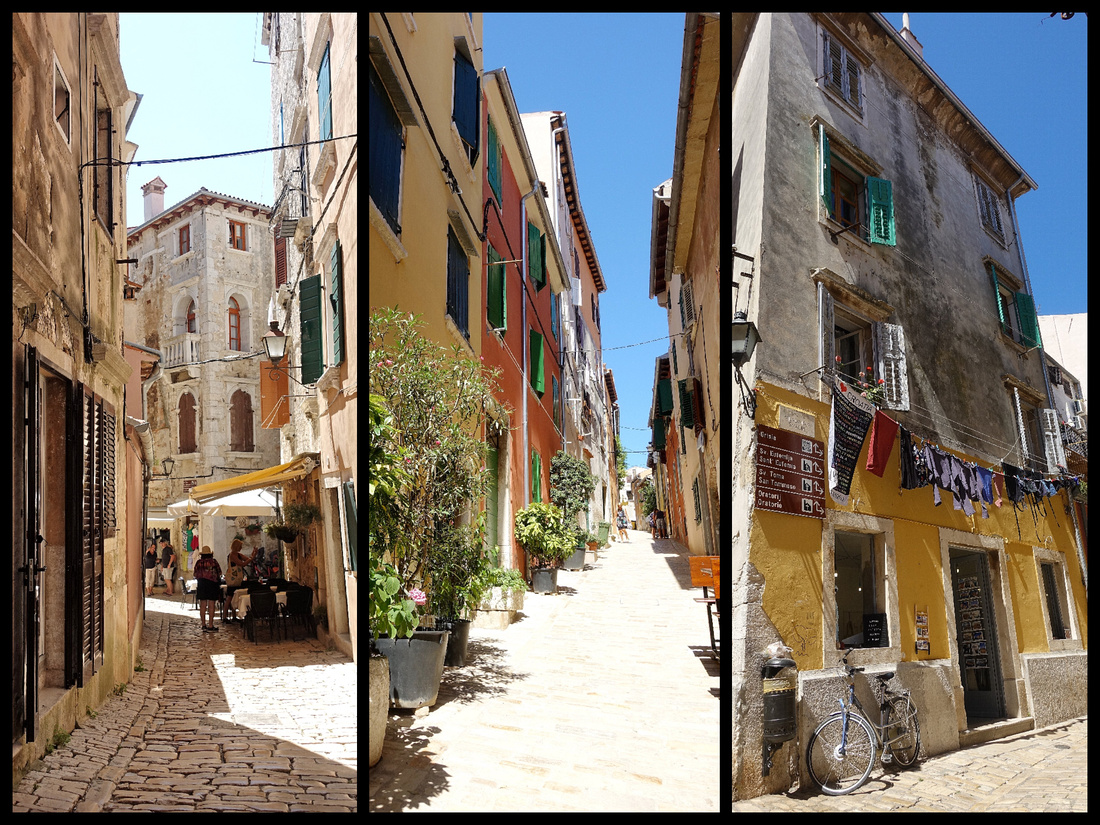
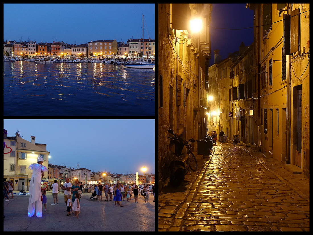
ROVINJ (population 14,000) certainly is rather charming. From the air, its location on a promontory makes it look like a fairy-tale village suspended on a pillow of bright blue sea; at ground level, it looks like the quintessential Italian fishing village. Central Rovinj once was an islet, in 1763 the channel separating it from the mainland was filled in. Shiny smooth stone ‘streets’ (pedestrianized) all lead up to converge at the church of St. Euphemia. A large number of the buildings are restaurants, stores or ‘sobe’s /apartments but everything is very well kept. If you don’t shop you can pretty much cover the center in an hour. The harbor is jammed with small boats, you almost can’t see the water there are so many of them. The promenade leads all the way around and into the newer parts of town with nice views back to the old town/ peninsula, it is also lined with restaurants. There looked to be way more shops and restaurants than tourists. Rovinj was part of the Venetian Republic for over 500 years, and is the most Italian town in Croatia: there's an Italian high school, Italian is widely spoken, and street signs are bilingual.
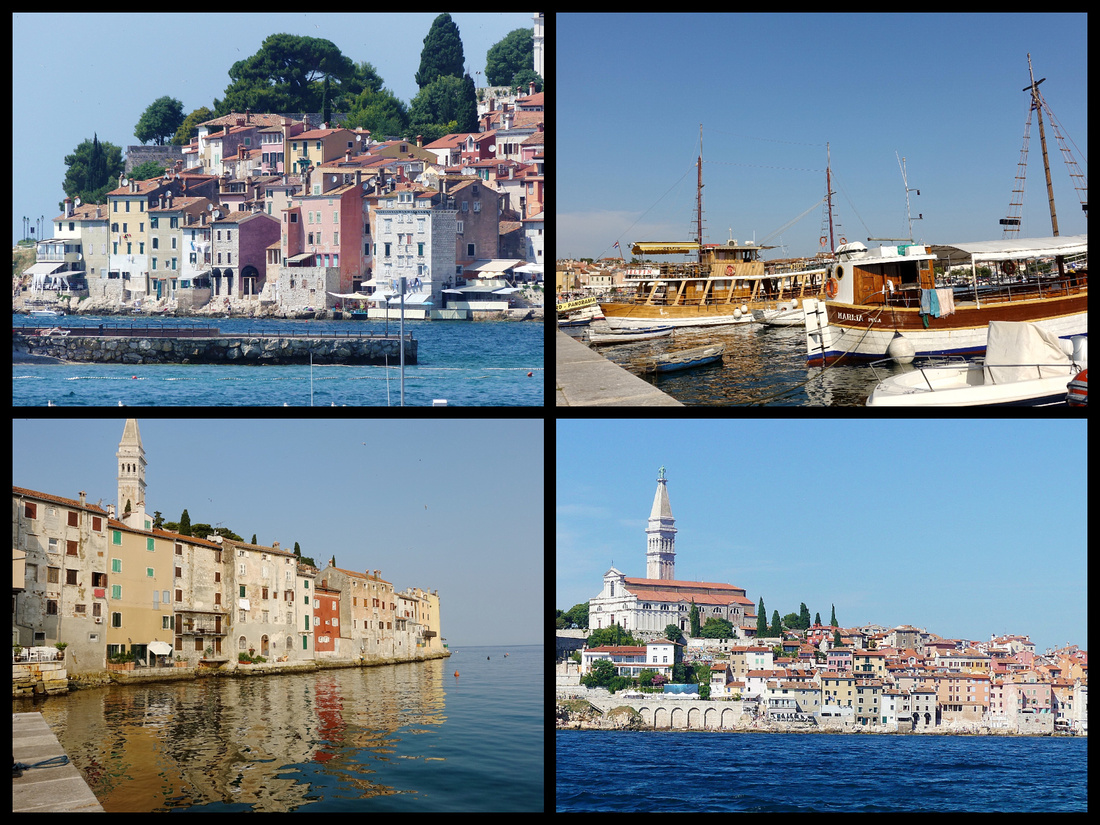
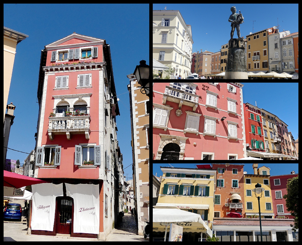
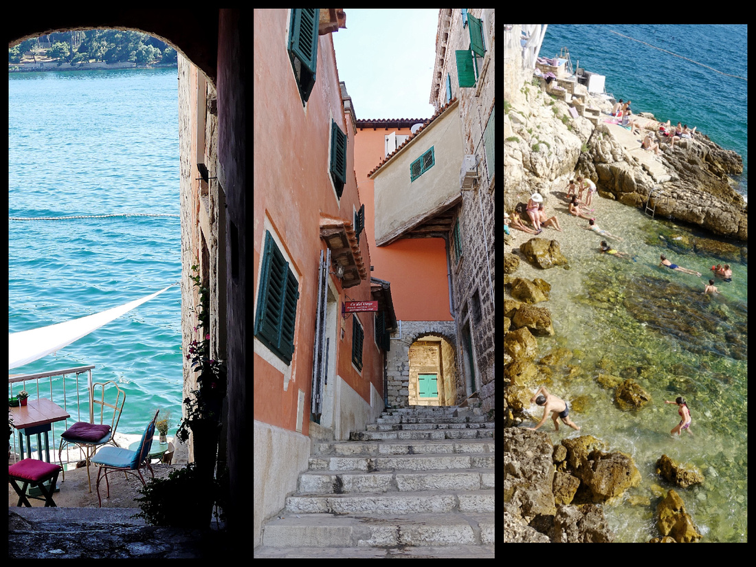
There are wide waterfront promenades almost all around the old ‘island’ part (and extending onto the mainland) – except one section where the old houses reach right down to the water. The main square is Trg M. Tita featuring the Balbi Arch (1679) entrance way into the old town. Due to the war between the Venetians and the Turks it has the Venetian Lion on one side and a Turkish face on the other. This is the most elaborate of what were once 7 gates into the old town. A little ways along the waterfront promenade from the main square are two remaining stone archways (gates), St. Benedict gate (seashore gate) and St. Cross gate (naval gate), both 1589.
St. Euphemia Church [Crkva Sv Eufemije] and its campanile dominate the skyline. Inside the 16th Century baroque church, the remains of Rovinj's patron saint are said to lie within a 6th century sarcophagus. (The wall engraving just to the right of the entrance is St. Euphemia holding Rovinj in her arms.) The adjacent bell tower was built 50 years earlier and is one of the highest campaniles in Istria, a replica of the bell tower of St. Mark’s Basilica in Venice. It is topped with a copper statue of St. Euphemia. The people of Rovinj made St. Euphemia a patron saint of the city along with St. George after the stone sarcophagus containing her body mysteriously showed up on their shores.
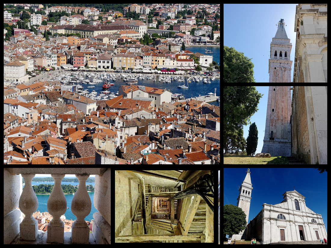
 Above center: Stones steps lead to one of the original town gates, through which is the street to the Volti Studio Apartment where we stayed
“Modern” Rovinj stretches onto the mainland, and along a larger harbor, then onto some beach area. The ‘hill’ is covered with a group of five luxury hotels with shared pools, waterfront, tennis courts, lawns, etc. A long promenade connects this area with old Rovinj. I think this is where most of the tourists to Rovinj stay, just venturing into the old town for dinner. We only went through there because the car rental pick up was there. I'm really glad we stayed smack in the center of the old town.
A lot of the accommodations in Croatia are B&Bs, or small apartments or 'sobes'. We spent our six nights at the "Volti Studios Apartment", booked on booking.com for €73/night. A 5 minute walk from main square, extremely charming stone street through stone arch to get to it. The apartment is lovely and spacious with couch, loveseat, huge TV, modern kitchen, comfortable bed. Lots of space to spread out. All very recently renovated and super clean. Window looks out on a stone airshaft so no view (of anything) but if you look up you can at least see sky and daylight gets in, and at least there are no stairs to climb.
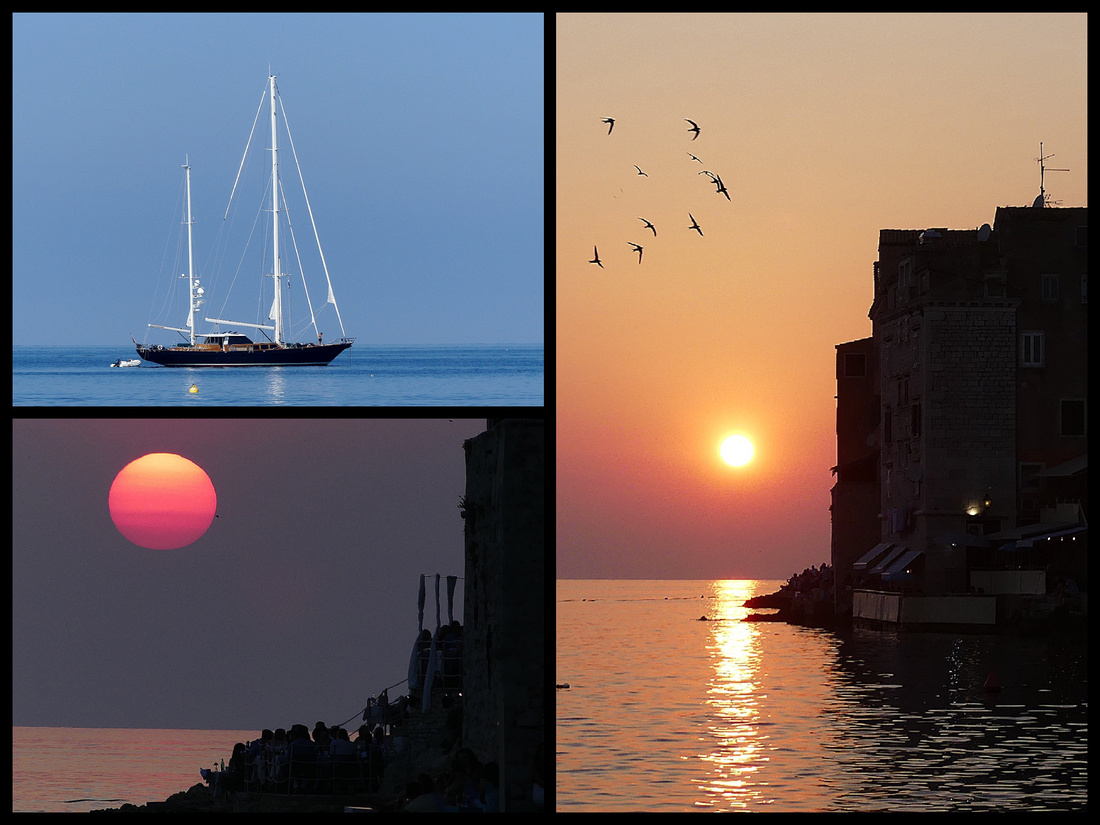
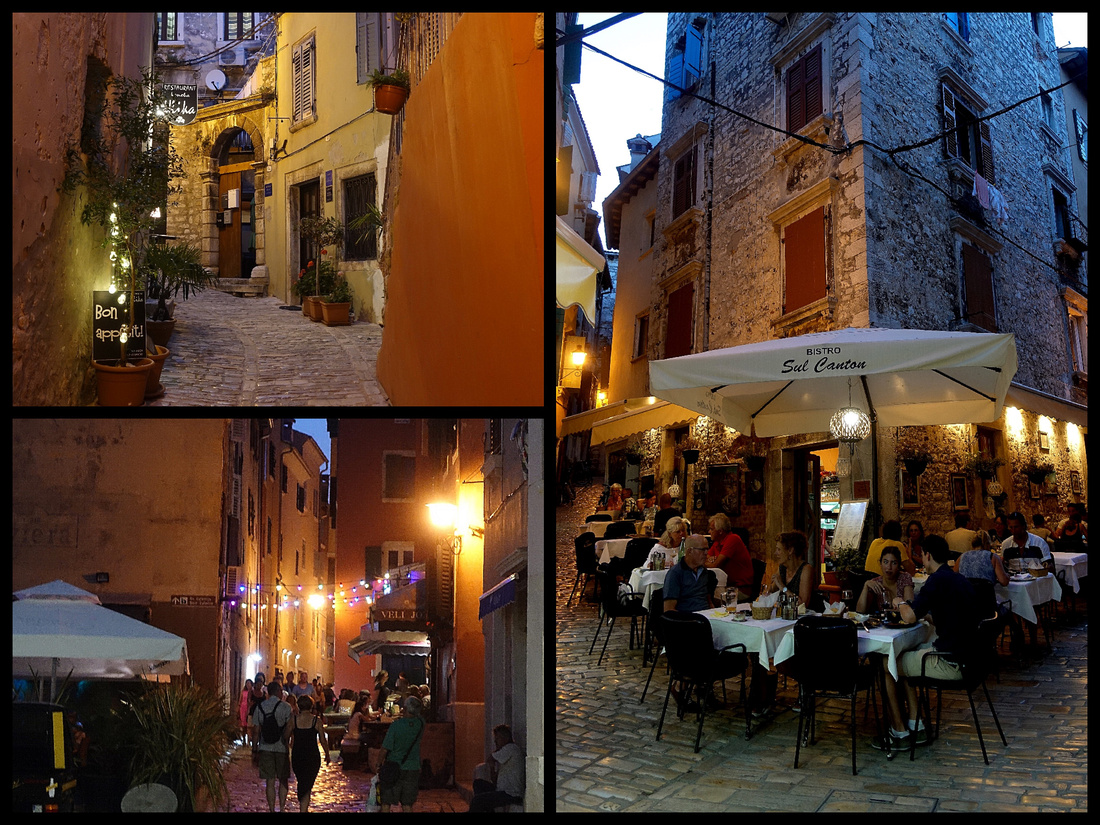
We had 6 nights but didn't arrive till late the first day so really just five full days. One day we spent in Rovinj just enjoying the town, took a boat ride out into the surrounding islands. The other four days we did day trips but which worked out great as Rovinj itself is the best (I think) place on the Istrian peninsula to base. Great selection of restaurants for dinner, beautiful sunsets, and a lovely vibe in the evening along the waterfront and through the golden cobblestone lanes.
PULA
One day we took the bus to Pula. It's about a 45 minute bus ride through some olive groves and vineyards but mostly rural/suburban areas, with occasional glimpses of the sea. We spent about 5 hours there including a quick lunch.
PULA is a small city (population 59,000) and not terribly attractive, and the vistas of the sea are ruined by shipping cranes and industrial stuff. But the sites are definitely worth seeing, and the pedestrianized center is pleasant enough.
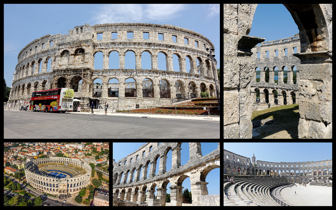
The Roman amphitheater is definitely the highlight. Built from local limestone it accommodated 20,000 spectators. The 30 Meter high outer wall is almost intact but the stone spectator seats were removed in the middle ages. You can still see the slabs used to secure the fabric canopy, which protected spectators from the sun. The underground chambers, once used to house the wild beasts and to drag away dead gladiators, now contain displays of amphorae and equipment used in the production of olive oil.
The other major attraction is the Temple of Augustus & Old Town Hall / Forum - 2 BC. with six Corinthian columns, a small but perfectly proportioned temple which survived the Christian era by being converted into a church. It was once one of a pair of matching temples fronting the Forum – but all that survives of its twin, the Temple of Diana, was incorporated into the rear wall of the 13th -C city hall (1296) next door, which is a mixture of styles including Romanesque and Renaissance.
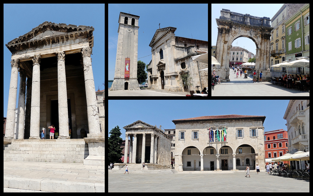 Above left: Temple of Augustus Top center: Katedrala Svete Marije Top right: Triumphal Arch of Sergius Lower right: Temple and town hall
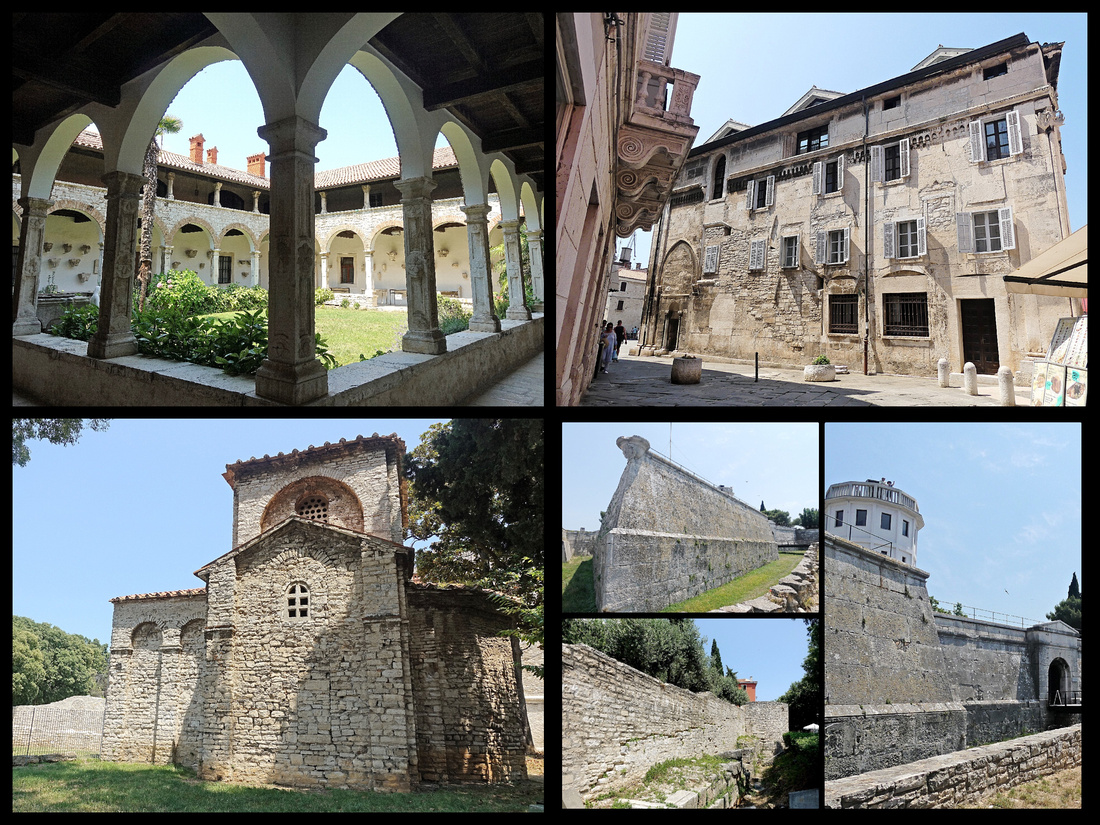 Above top left: Franciscan monastery top right: old town of Pula Lower left: Basilica Marija formoza Lower right: Citadel
The Citadel is a star-shaped Venetian fortress, with 4 bastions, built during the 17th Century. Highest point in town but the view is not great, and as Venetian fortresses go it’s average at best.
Katedrala Svete Marije - 4th Century, added to until the 15th, Pula's cathedral still has fragments of 5th & 6th Century mosaics in its floor. The main altar is a Roman sarcophagus. In front of the cathedral is a freestanding Baroque style Bell Tower, late 17th Century from stone blocks taken from the Roman Amphitheater.
Franjevacki Samostan - Franciscan monastery, 1285, Set into the floor of a Gothic chamber accessed via the Romanesque cloister is a Roman mosaic featuring a hippocampus (fish-tailed horse) and a swastika.
Basilica of Marija Formoza - is one of the most significant Early Christian monuments of the Byzantine art and architecture in Croatia. 6th C. It was commissioned by Archbishop of Ravenna, who also had San Vitale erected, in Ravenna. A large portion of its inventory was shipped to Venice, where it was used in building the St. Mark's Library and the Doge's Palace.
Triumphal Arch of Sergius, also known as the Golden Gate (Zlatna vrata) erected in 27 BC. The outer side is lavishly ornamented with columns and friezes. It stood at the entrance to the Roman town, the walls of which can still be partly seen nearby
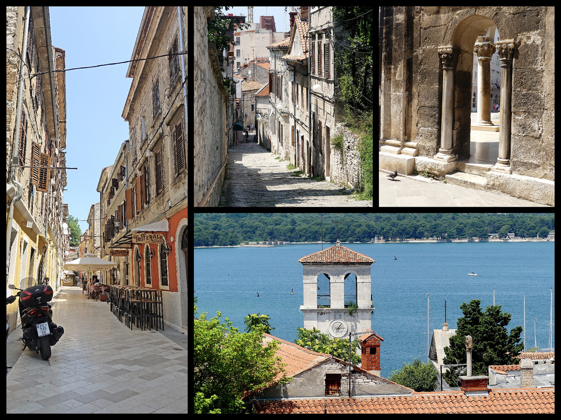 Above: Streets of Pula's old town center
POREC
Porec (population 17,000) is another easy day trip, via bus, from Rovinj. It's also on a little peninsula like Rovinj but has no hill so not quite as striking a profile and less ‘charming’ but very well kept, lots of flowers, totally pedestrian center. Some very nice Venetian buildings and one great “Roman” house. Also a few remnants of Roman columns. A nice ‘riva’ promenade all the way around the old town, unlike Rovinj where some of the waterfront is houses built right on the water (which makes for a better image from afar but not quite as interesting to walk around).

At the far end of the Decumanus street, very close to the Marafor square, is the Romanesque House, (above center) a two-story building, one of the few surviving examples of residential architecture of the Romanesque period. The house was built in the 13th Century but has been renovated and expanded multiple times, and the last major alterations were carried out probably in the 18th Century. Despite numerous interventions over time, the house has maintained the fundamental characteristics of Romanesque residential architecture. It is built from simple rough cut blocks. Window on the main facade is of a typical Romanesque biforium. On the ground floor, there was a barn, and a stone staircase leads to the first floor and the large room with a fireplace.
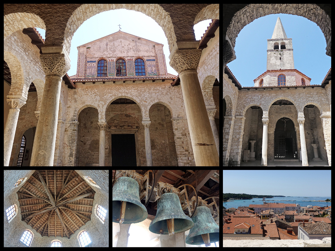
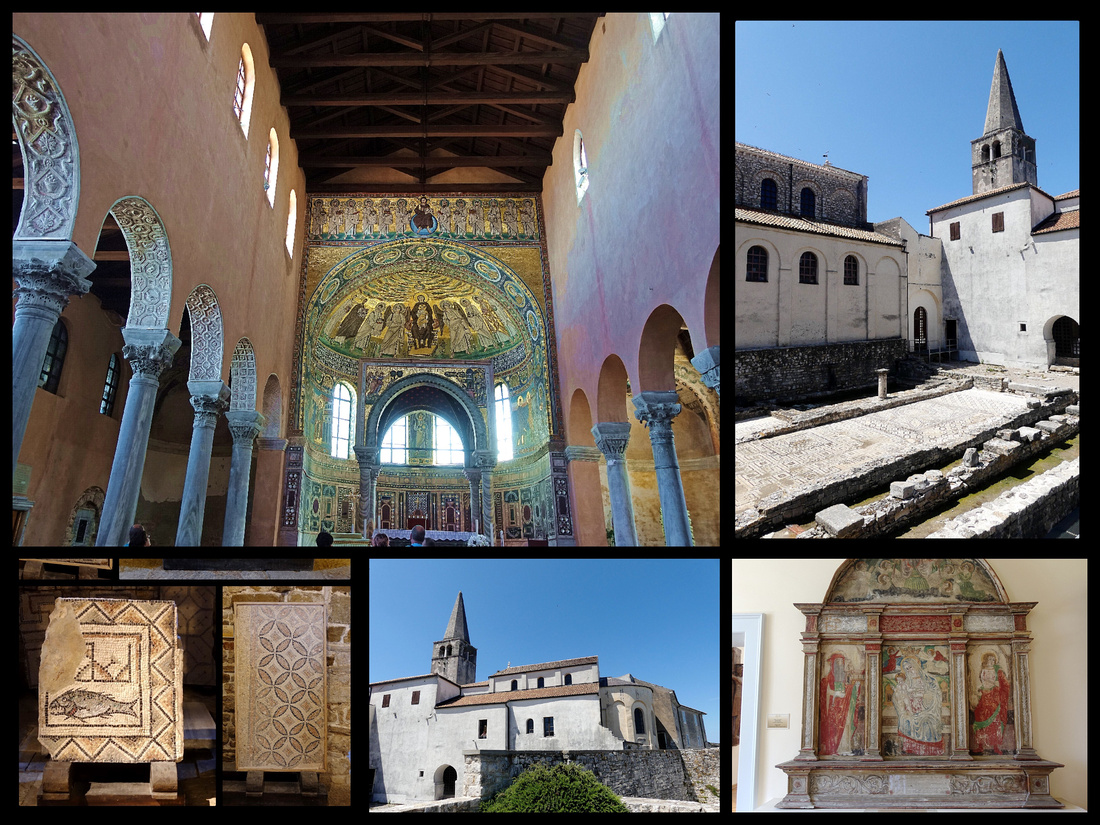
The main event, the UNESO listed 6th Century Episcopal Complex of the Euphrasian Basilica where Christianity was established as early as the 4th Century, constitutes the most complete surviving complex of its type. The basilica, atrium, baptistery and episcopal palace are outstanding examples of religious architecture, while the basilica itself combines classical and Byzantine elements in an exceptional manner. The glittering 6th Century mosaics in the apse of the church are the highlights.
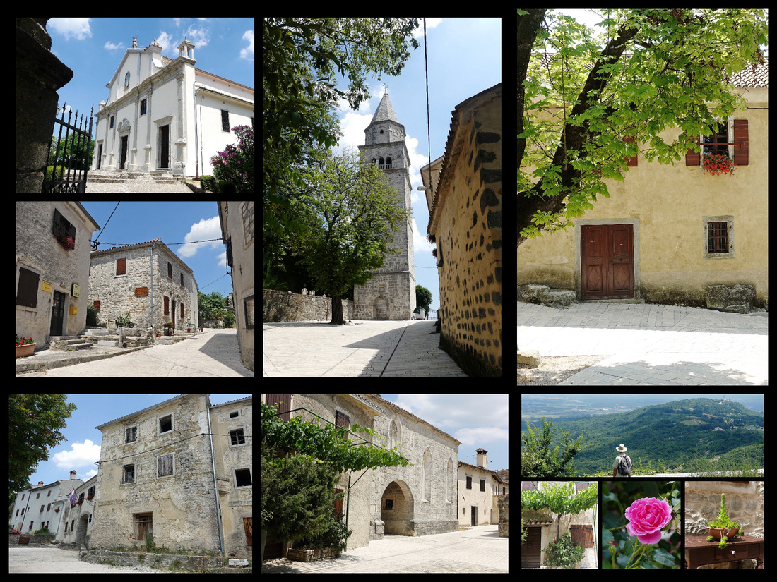
ISTRIAN HILL TOWNS
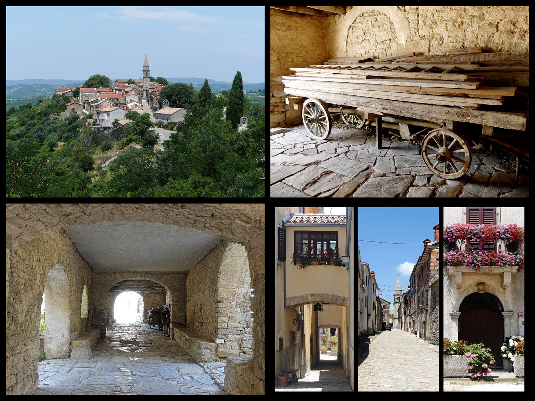
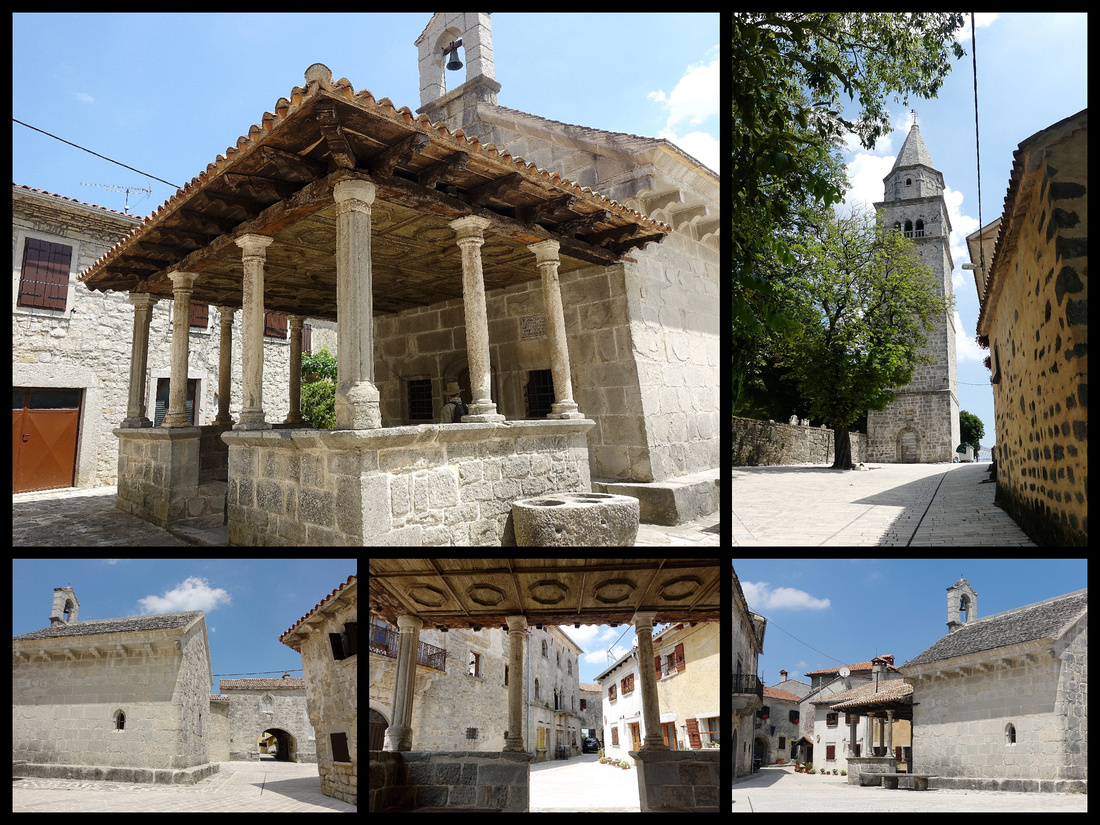
On our fourth day we rented a car and spent the next two days visiting several hill towns on the Istrian Peninsula. We did Groznjan, Montovun and Opratalj one day and Hum, Draguc, and Gracisce the next, both days returning to Rovinj late afternoon for dinner, sunset and enjoying the town in the warm evening.
Guide books claim Istria is like “Tuscany 20 years ago before being spoiled by the tourists”. It is lovely, some of the scenery is very pretty and there are several interesting, pretty hill towns. But the scenery is not as dramatic as Tuscany – think long vistas with vineyards and fields of sunflowers broken by curving roads lined with cypress trees and a stone house in the distance. Didn’t see any of that. And while the hill towns do have charm, and pretty stone buildings on pretty stone streets, many of the Italian hill towns have more interesting buildings, piazzas, and settings – the ‘bones’ of a town need to be there to give it that certain something – although the atmosphere can certainly be lessened by groups of tourists and too many post card shops. The Istrian hill towns had virtually no post card shops.
The distances between towns in Istria are short and the roads good, but many of the little towns are not easy to get to from each other so it takes a lot longer than you might think. The Google maps app can be annoying and with “directions” turned on it seems almost worse than useless. But by just following the route to the destination (little blue ball showing where you are) it does help. We found the first town, Groznyan with no trouble, parking was free and easy – lots of spaces along the approach road (and a small lot at the top).
Grožnjan , population 736, is certainly charming, all honey colored stone – the streets and the buildings. There are a few stores with local crafts/ jewelry and several with olive oil and truffle products. Not the absolute best hill town but it’s up there. Quite small though and not many tourists, usually just a few on each street.
In the 1950's Grožnjan was almost a ghost town when a group of artists decided to renovate the houses and started to live in the town. Today most of inhabitants are artists and there are almost 200 of them. But obviously the town is almost entirely given over to tourists. No tour groups. We had walked every street in about an hour.
We got a little lost looking for the next town, Montovun, (I’m actually blaming that on google maps, in this case it would have been better just following the signs). The approach road there is very new and widened – we suspected for tour buses - and there were indeed at least a couple. First thing you come to is a fairly large parking lot that seemed to be filling up quickly. There is a booth across the street to pay (20 krona) and right next to it a booth to buy shuttle bus tickets (another 20 krona per person) to avoid the 20-minute up hill walk.
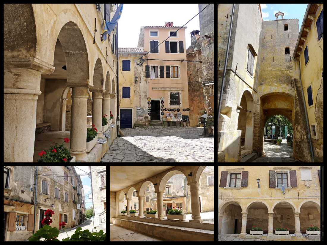
Montovun , population 983, looks like the quintessential hill town as you approach with a wall and a bell tower and houses spilling down the hillside. It also has a more interesting history – Roman and medieval – and is surrounded by ramparts which you can pay to walk on although you can get the views without paying. There is an impressive entrance gate, then another smaller one. A large watch/bell tower that is impressive but not open to climb. Several restaurants.
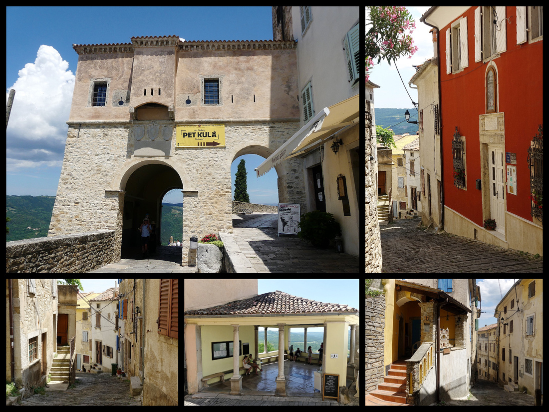
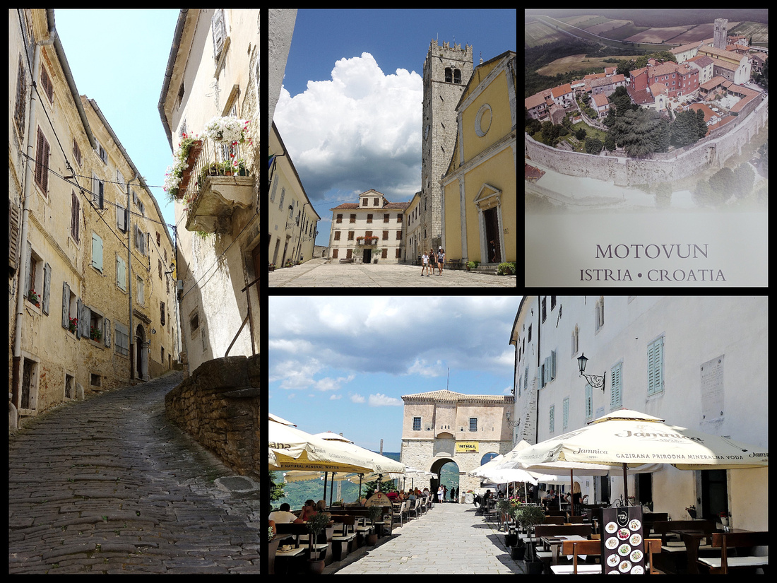
And one long nice street with no shops or restaurants. Lots more tourists here, though nothing you could call crowded, but they all remained by the gates and restaurants because walking down (and I do mean down) the one long street we only saw a couple people (and some cats). We had lunch at one of the restaurants by the main gate – fabulous views of the surrounding valley and river and hills on the other side.
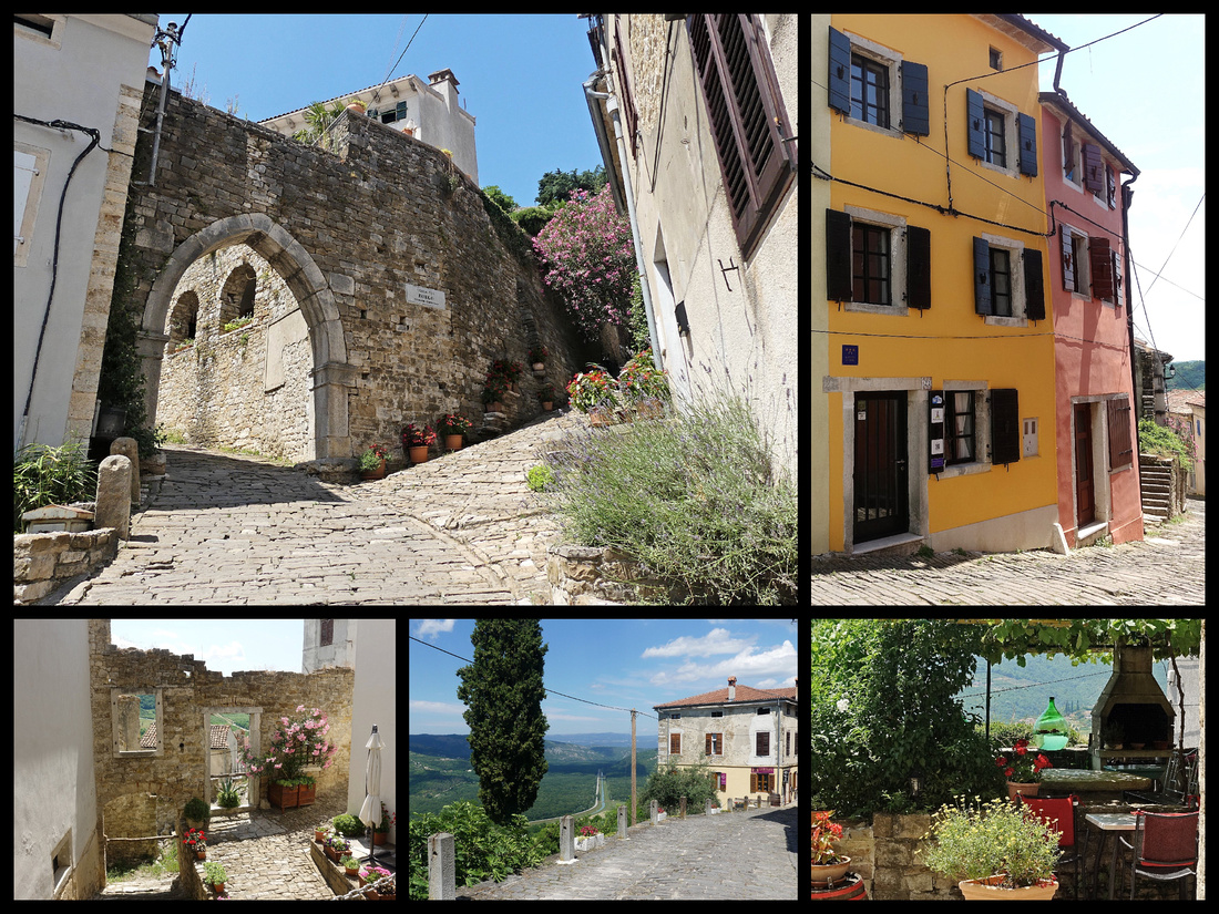
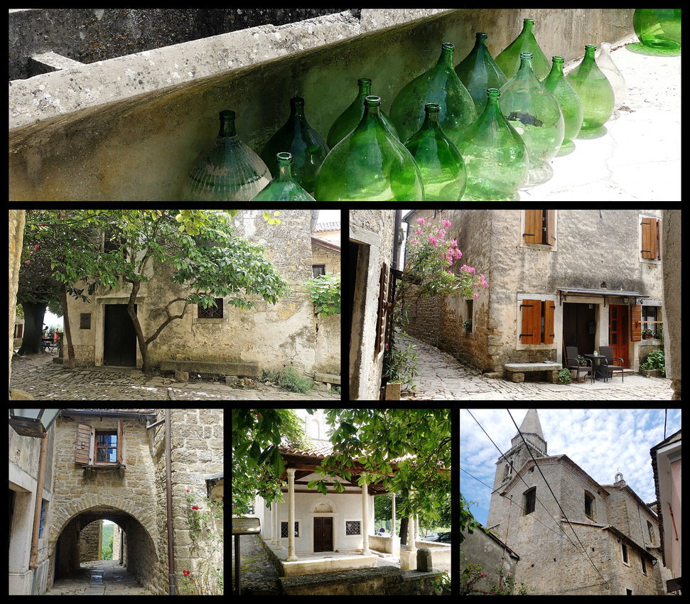
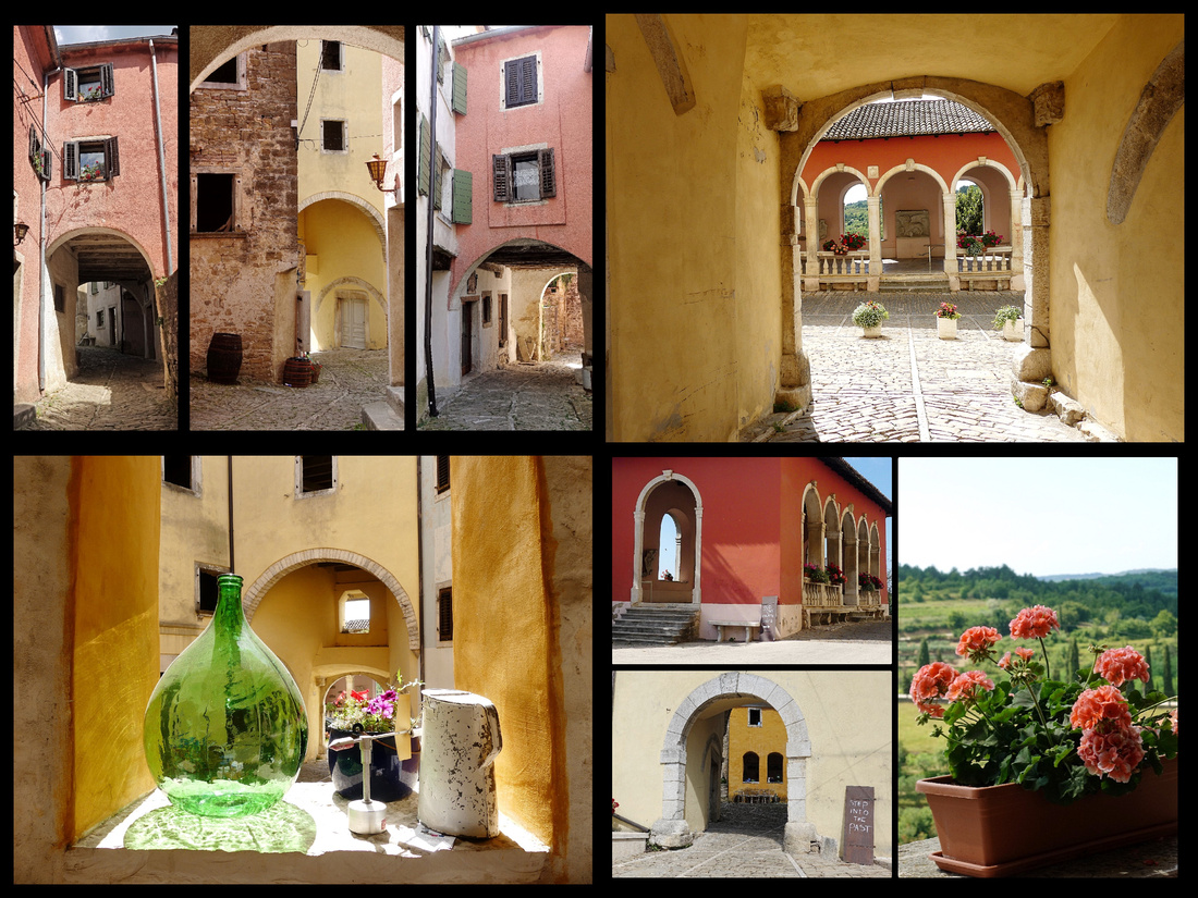
Almost directly across the valley from Montovun is Opratalj, which gets almost no tourists at all. It’s a very narrow winding road, takes 20 minutes to go 6km but it was worth it. One small parking lot (about 20 spaces, only 4 cars in it) and then a short flat walk to the main ‘feature’, a pink Venetian style loggia. Very nice, great views of vineyards and olive groves. Then a rather nice yellow gate into the town.
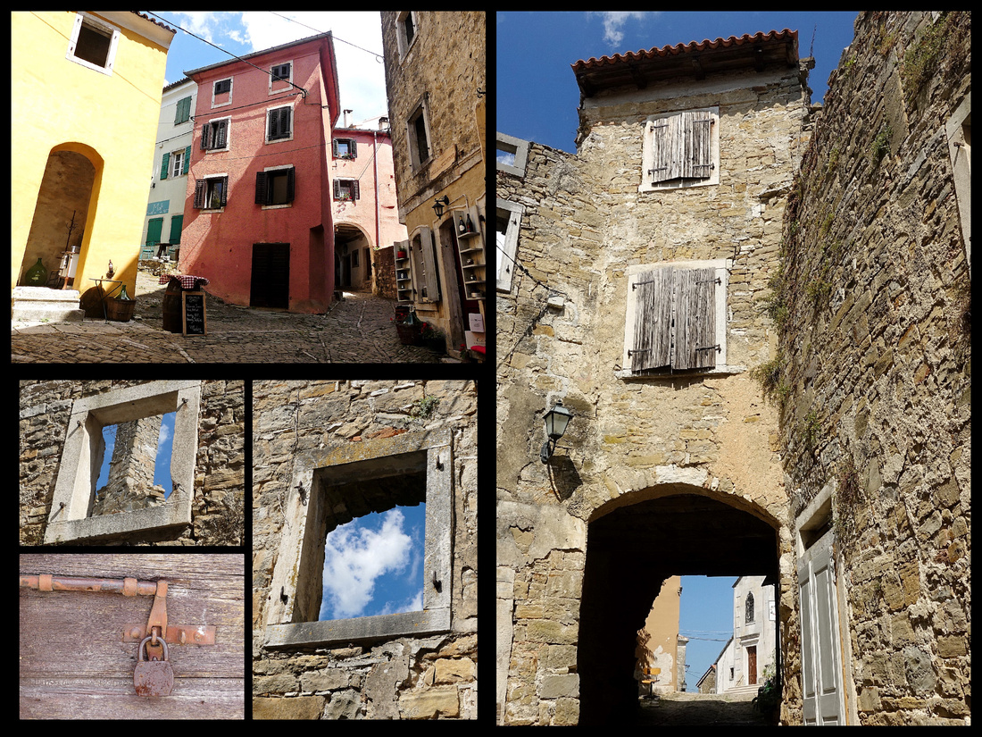
Opratalj , population 850, is mostly still in ruins, only a very few buildings have been restored and are lived in. About 3 or 4 small shops (only one was open). But very atmospheric, the whole place. Loved it. We talked to the woman in the one shop – she makes all the crafts and takes photos which she makes into post cards. I bought two cards for 25 krona and she said it was her first sale of the day (it was 4 pm). She said volunteers of townspeople are slowly cleaning up the ruins and she actually left her shop (open) to show us a path to what once was a street with houses – you could still see wall paintings in what were once buildings but are now ruins.

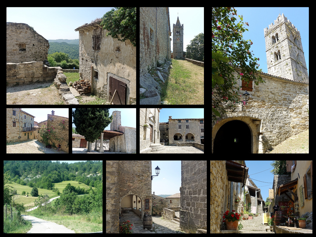
HUM The road to Hum, population 30, though paved, is as narrow as a driveway and takes about 20 minutes to drive from the highway. We didn’t see another car the whole time till just before the town. But they do expect tourists, there is a guy manning a booth as you enter the town collecting 10 kona, then you park wherever. There were about 4 other cars there. We did see a significant sized ‘lot’ and a sign for tour buses so they must get them at times. The day we were there however there were literally less than a dozen other tourists (2 couples, 2 families with a couple kids). It’s cute enough but if it weren’t in the Guinness Book of World Records for “World’s smallest town” no one would bother cause there are plenty of other towns just as cute. There were three shops selling truffle related items (cheese, oils, beer) –which also had nice body oils and lotions, Istrian brandy, and a few local crafts. My husband, who is a beer snob and samples beer everywhere he goes, could not even drink the truffle beer, it was so bad.
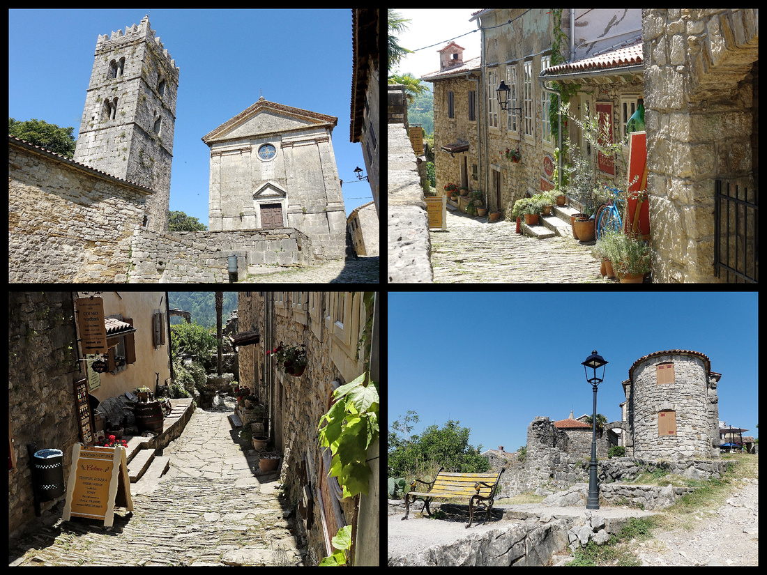
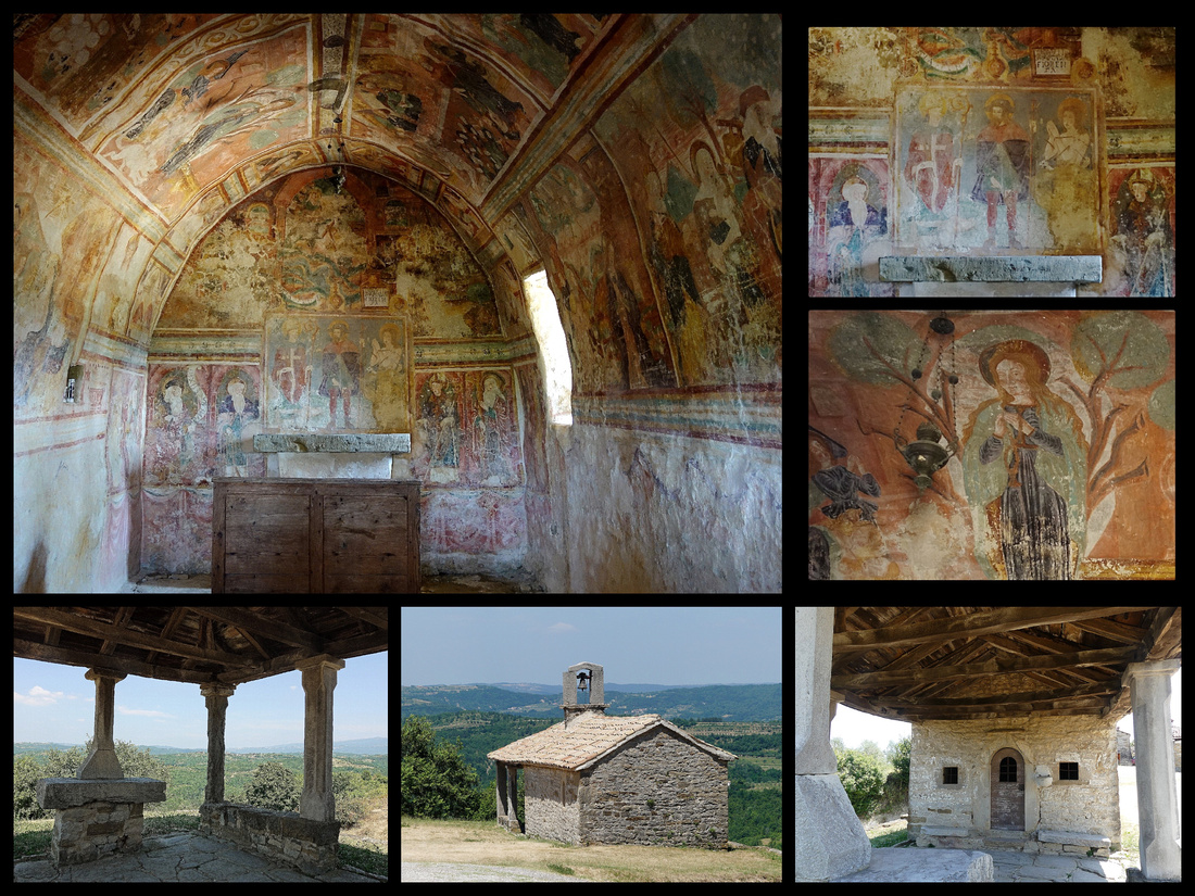
DRAGUC Then on to Draguc, full time population 68 – back to the highway, one exit (10 minutes) and then another 15 minutes up a slightly wider road than the road to Hum. Draguc is also moderately cute but wouldn’t be worth the effort except that one tiny chapel, at the far end of town (meaning a 5 minute walk from where you enter) has amazing frescoes covering the walls and ceilings. I had read about this in a trip report somewhere, if you didn’t know about it you’d never find it. The church was locked but there were windows with just iron bars so you could look inside. If I didn’t have a good camera to get shots of it though I wouldn’t have been able to really see good enough to appreciate it. The photos came out pretty good.
Then another ½ hour (the map app on the phone turned out to be very useful here, not sure we could have done it with paper maps and signs alone) on to Gračišće, population 1384. This was the least interesting of the towns we visited. There is one nice loggia and a few charming buildings but the pavement in the whole town is new and the streets fairly wide and the charm is just not there. There are some great views in the distance though.
Most of these towns have an interesting mix of recently renovated and almost entirely 'in ruins' buildings. Clearly the Istrian hill-towns are just ‘waking up’. There weren’t even 2% the number of tourists there are in Tuscan hill towns in July. In that respect it’s great. There was no sign that any of the towns other than Montovun and Hum have ever seen a tour group. But the ambiance, the architecture, the scenery – none of it is Tuscan quality and never will be. So of course you could say this area is more ‘authentic’ – the few tourist shops are run by locals selling only local products, they aren’t overrun by tourists. But while certainly very pleasant, the ‘bones’ of the place – the towns, the buildings, the vistas – just doesn’t really compete with Tuscany. One thing I did notice was there was great lavender in all the towns, including Rovinj.
PLITVICE LAKES
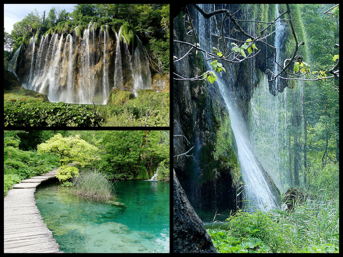
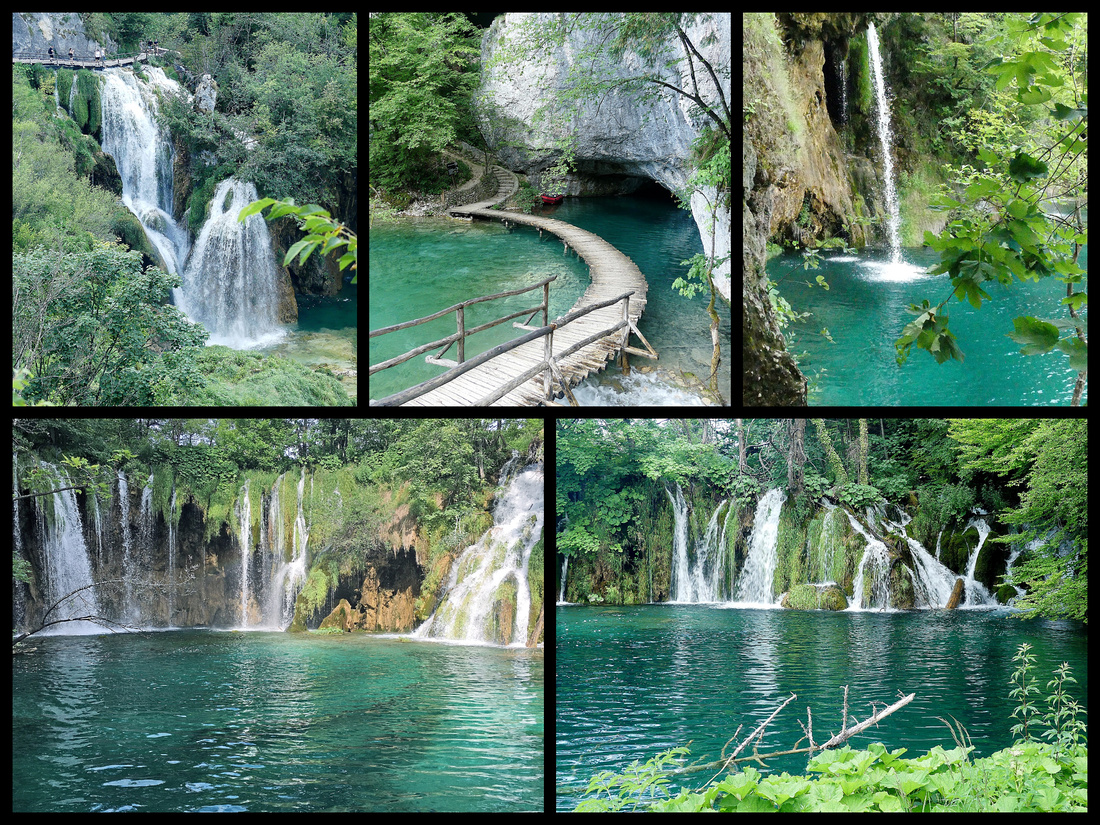
Plitvice Lakes National Park UNESCO World Heritage Site– Beautiful, glad I went, but sorry to say it did not live up to our expectations. Perhaps the problem is that the reviews were so wonderful it was hard to live up to. Or maybe they were all written by people living in Kansas or Houston who have never seen a wooded area with lakes and waterfalls. Some of the water was a very nice shade of turquoise but a lot of it was just ‘normal lake dark greenish’. There are a lot of waterfalls, most of them quite small but a few taller ones. The fact that there are so many, that they link together a lot of small lakes and ponds (and one medium size lake) and the boardwalks connecting it all are certainly nice. It was very pleasant. But words like amazing, extraordinary, and incredible were not words I’d use to describe it. Everything was back lit in the afternoon (we got there at 3:30) and there were a lot of clouds around so it wasn’t sunny the whole time (but certainly wasn’t a ‘cloudy day’ either). It’s better in the morning light – the color of the water is probably the best thing and that is better early in the day.
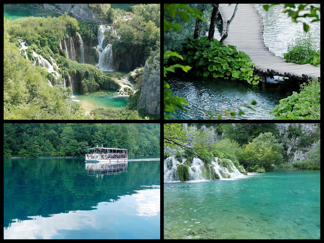
Signage is terrible. Only after you’ve done it does the map make any sense. One entrance the trails are lettered (A, B, etc.) and the other entrance they are numbered. Very few signs on the trails. You just kind of go. We started at Entrance 1 and in about 45 minutes got to the boat which goes across the big lake. Pleasant but unspectacular 20 minute ride. Then you need to take another boat across a much shorter part of the lake (5 minutes) to start the next section of trail. That one loops around back to the boat to return to Entrance 2, or keeps going and there is a shuttle train you can take to get back. Of course you can walk along paths much further but to see most of the water falls you follow the ‘popular’ trails that mostly use boardwalks and some woodland paths.
The good news is that I would hardly call it crowded (a Saturday and Sunday in July). Certain portions of the boardwalks did have people taking selfies or photos of their friends and being inconsiderate of others, and of course some people are just oblivious to others around them and insisted on walking two across. The boardwalk is barely wide enough for one person in each direction to pass without someone being forced to take a swim. But much of the time we were alone on a stretch.
Starting this summer (2019) they had on-line timed reservations and implied that if you did not have one it was likely you wouldn't be able to enter. That might be true mid day or on certain days, but when we got there for our 16:00 reserved entrance (price is reduced after 4 pm, and we had read it's much less crowded then) people were certainly just showing up without tickets and were able to buy them on the spot. Even though there was hardly anyone on line to enter, we had to wait till exactly 4pm before they let us in.
If you stay in one of the three 'official' hotels you can get your ticket stamped to go back in the following day for free. We stayed at Hotel Bellevue, great location right near Entrance 2, free parking (and they drove us to Entrance 1 which we had inadvertently booked entrance for - you must enter at the specific entrance you have a ticket for). Booking.com, 82€ night/double. Hotel Bellevue is right out of the 1970s and while it hasn't been updated since, it was clean and comfortable enough. Lots of tour groups staying there. There are not a lot of food options - the hotel next to the Bellevue has an expensive restaurant that serves dinner, both entrances have hamburger type food, and the road leading to Split has several places to eat about 20 minutes away.
ZADAR
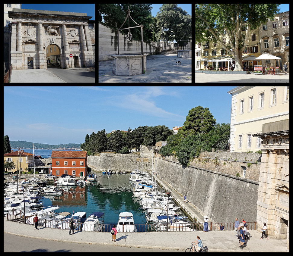
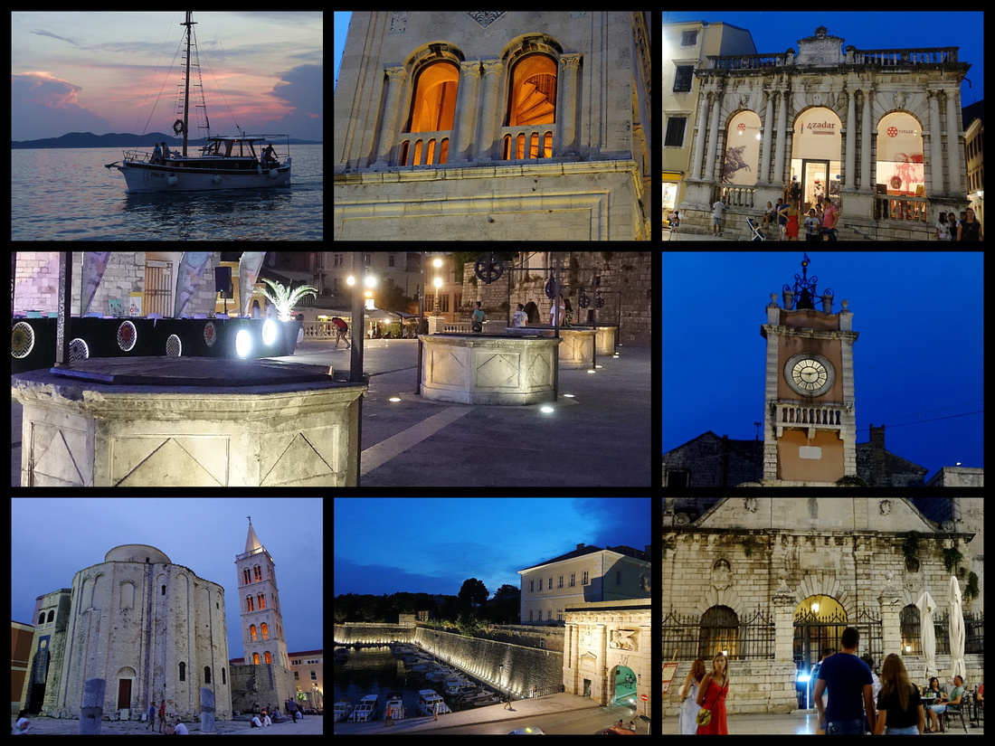
Zadar, population 75,000, is surrounded by industrial sprawl but the old center is on a peninsula (rectangular instead of oval like the others) and has a lot of very interesting ‘stuff’. Venetian walls and town gates, Romanesque and Byzantine churches, Roman columns and ruins, a modern ‘sea organ’ and a device that soaks up the sun and then plays lights at night, several interesting churches. It was heavily damaged in WW II and the post war buildings are mixed in among the old buildings so architecturally it’s not an ‘ensemble’ type town, even in the heart of the old town, but it’s pleasant enough and the ‘sights’ are very worthwhile with a nice vibe.
We only spent one night - so about 24 hours - in Zadar which I felt was just about right. I'm glad I had more than a few hour stop over, but I felt after 24 hours I had seen all I wanted to. We stayed at 'Hotel Zara Palace' (booking.com, €72 night/double). It's not exactly a hotel, and it's definitely not a palace, it's a few rooms, but they are very nice, newly renovated and comfortable. And just off the main square. No reception desk but texting with the host he was there to greet us and give us the keys.
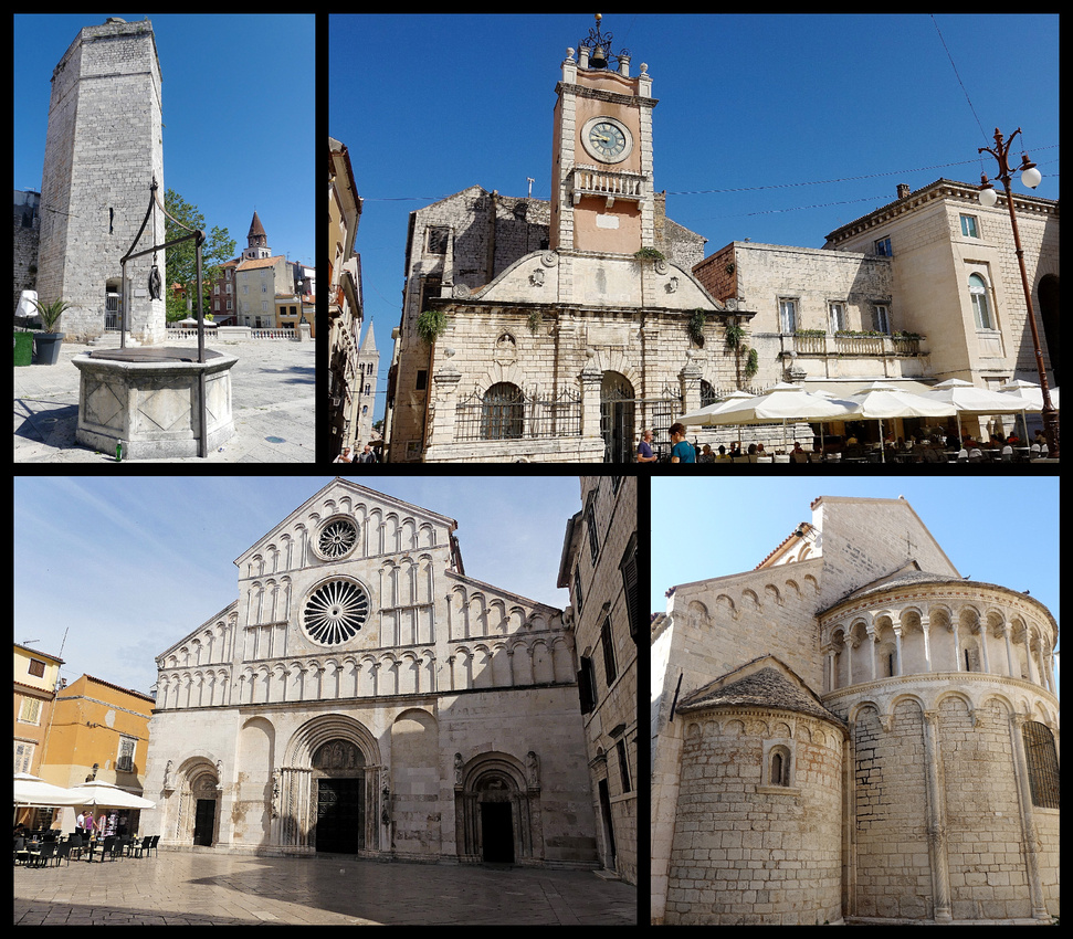
Zadar’s walls were originally built to keep out the invading forces from Turkey, and it successfully did its job, allowing the city to maintain its independence, with the walls never being breached. They are now a UNESCO world heritage site. There are still several of the original gates into the old town through the walls. The most impressive is the ‘Port Gate’ (Llucka vrata) fashioned from a Roman triumphal arch into a Renaissance grand entrance topped with a Venetian Lion. It sits beside the little Fosa harbor. Just inside this gate is Five Wells Square, 16th Century, featuring five identical wells in a line. This square, like many place we saw on this trip, was featured in Game of Thrones.
The Riva is a seaside promenade that encircles the old town peninsula and features two interesting things. The Sea Organ (Morske orgulue) (built in 2005) looks like a set of wide steps going down into the sea but is designed so that the action of the waves pushes water through them creating ‘music’ (sounded more like the ‘song’ of a sea creature than actual music). Just past that is the ‘Greeting to the Sun/Pozdrav Suncu’ a 22 meter diameter solar panel in the pavement that ‘charges’ during the day and spews colored light patterns after dark.
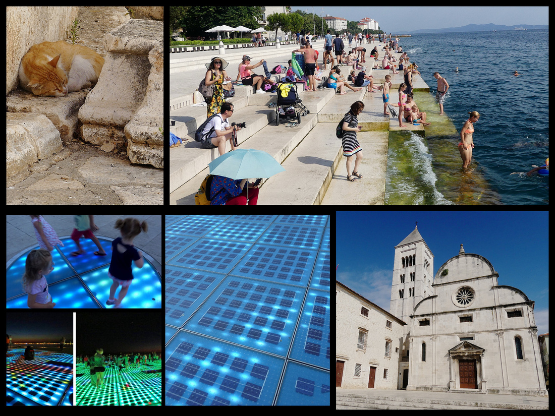 Above top right: The Sea Organ Lower right: Crkva svete Marije Lower left: "Greeting to the Sun'
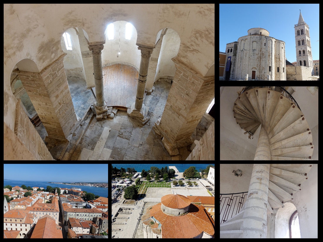
The Church of St Donat/Crkva svetog Donata is a 9th century Byzantine round church with remnants of columns and other stone pieces the Romans left behind. The 3 story cavernous interior is beautiful. Just behind it is the bell tower of the Cathedral of St Anastasia/Katedrala svete Stosije, 12th Century Romanesque. Views from the top of the tower include the entire old town (where the Roman street plan is still very evident) and the top of St Donat.
The main square, Narodni trg has been the center of public life in Zadar since the Renaissance. The ‘City Guard’ (Gradska straza) from 1562 is on the north side, the City Loggia (Gradska loza) on the south side is from the 13th century though rebuilt in 1565, and the Ghirardini Palace on the third side is Romanesque with a Gothic balcony.
 Above top left: Five Wells Square Top Right: Narodni Trg Lower left: Katedrala svete Stosije Lower right: St. Chrysogonus
SIBENIK
Šibenik is not one of those places that people mention when listing ‘must see’ destinations in Croatia. Mostly I’d heard about people stopping briefly to see the UNESCO listed cathedral when heading north from Split. But it made a convenient stop over between Zadar and Split and the photos I’d seen made me feel it might be worth it. So since expectations were not that high they were easily met and surpassed. While Šibenik doesn’t quite rank up there with Split or Dubrovnik, I think it is just as impressive as the more popular towns of Trogir and Zadar.
We took a bus from Zadar, having dropped off the car when we arrived there. We had one night, so again, about 24 hours. And like Zadar, I felt that was just about right. I'm glad I saw it in the evening and the morning and had time to explore the town and not just see the Cathedral, but you don't really need more than 24 hours. We stayed at another "room" found on booking.com (€72 night/double). Almost impossible to find, even with google maps, but once we did it was very comfortable. Palace Rialto Rooms. An old building, right in the center of the old town, with a collection of several ensuite rooms. In this case we never saw the 'host', they texted us a code which was used to gain entry.
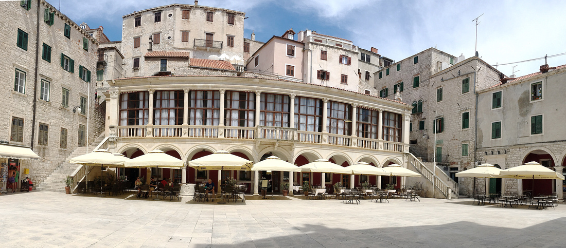
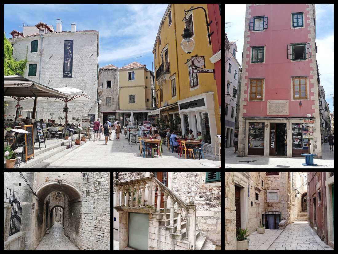
Šibenik, population 34,000, offers a change of pace from Dalmatia’s strong Italianate influences since its origins are pure Croatian rather than Roman. Šibenik’s old town is described as a typical Mediterranean medieval city, with a collection of churches, noble palaces, and centuries old Dalmatian stone houses separated by narrow alleyways. The old town is very well preserved and totally charming.
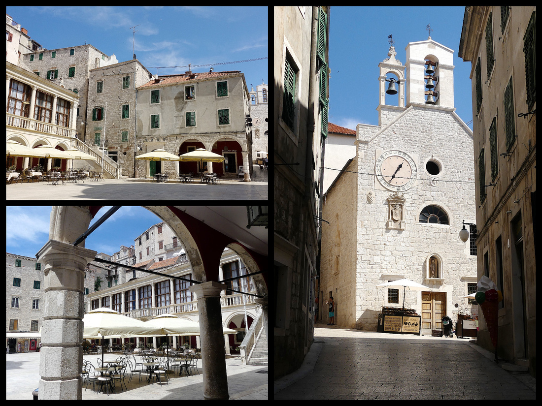
The old town is not very large but it’s full of stone streets – narrow, winding and many stepped, lined with stone buildings. Many of the buildings have beautiful detailing, statues, plaques, stone carvings. Lots of tiny churches tucked away. Small squares all over the place. The waterfront has a nice wide riva with restaurants on one side, boats on the other.
 But Šibenik is mostly known for the Cathedral of St. James (Katedrala Sv Jakova), a UNESCO World Heritage site built by the Venetians in the 15th and 16th centuries and is made entirely out of stone. In fact it is the only European cathedral constructed using only stone. The exterior of the cathedral is magnificent and the centerpiece of one of the most beautiful squares in Croatia. Across the square lies City Hall (Gradska vijecnica), a 16th century Renaissance building that looks like it was transplanted from Venice. Both the cathedral and the square were settings for Game of Thrones.
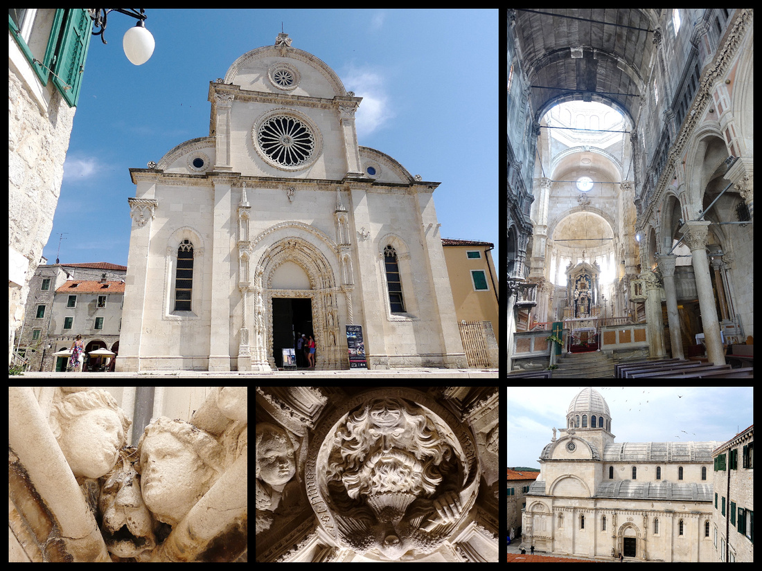
The other main ‘sites’ are the fortresses. There are actually 4 of them but a couple are a ways out of town. The main one, St Michael's, sits right above the old town and can be seen from below. Concerts are held there in summer so it’s filled with modern seats. St Nichola's Fortress, a little out of town, is also a site of major importance, protecting the area from invasion after its construction in 1525 and is being listed as a UNESCO site along with the cathedral.
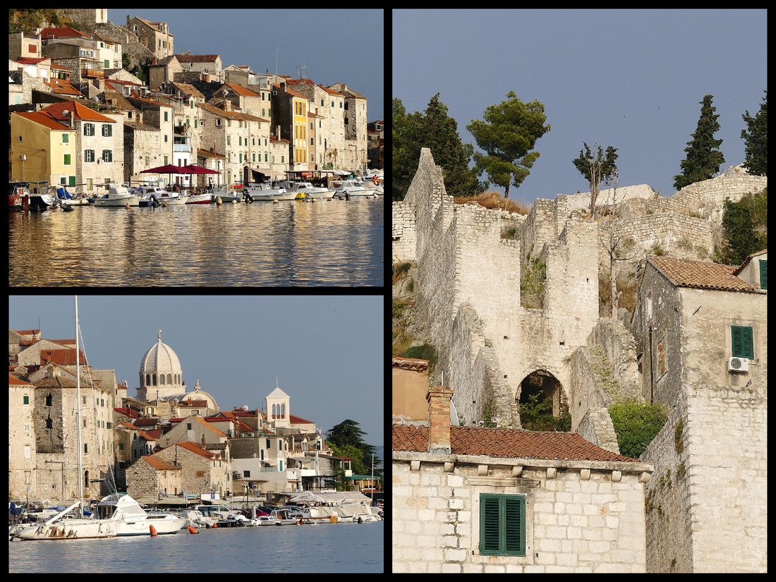
Past the main part of town, the riva becomes a tad shabby, the boats are just small fishing boats and ‘local’ pleasure craft. But continue far enough and around the bend and the view back to the town spilling down the hill from the fortress is amazing. Especially with the sun on it late in the day.
The only real negatives about both Zadar and, to a lesser extent, Sibenik (and probably the reason they aren’t higher up on the ‘tourist’ trail) – is they haven’t done a good job integrating the modern with the old. Within feet of the Roman Forum in Zadar or the UNESCO cathedral in Sibenik you see ugly 1950s style apartment buildings in not very good shape. You can walk around the old towns and find ugly buildings within steps of a church built over a thousand years ago. Makes the ambiance less than it could be. It seems a lot of other places in Europe have done a better job of preserving the ‘flavor’ of their town’s historic centers (though most still have plenty of modern stores, businesses and living quarters). Sibenik's center if much better in this respect than Zadar's, but there is some of that along the water front in Sibenik as well. The outskirts of both towns are industrial sprawl.
]]>We spent two nights on the island, deciding to base in Stari Grad town rather than the more popular (and supposedly wilder) Hvar Town but did a day trip on our one full day over to Hvar Town.
HVAR ISLAND - STARI GRAD, HVAR TOWN, AND THE STARI GRAD PLAIN
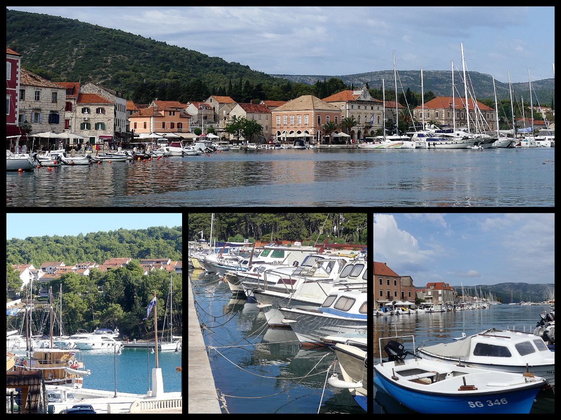
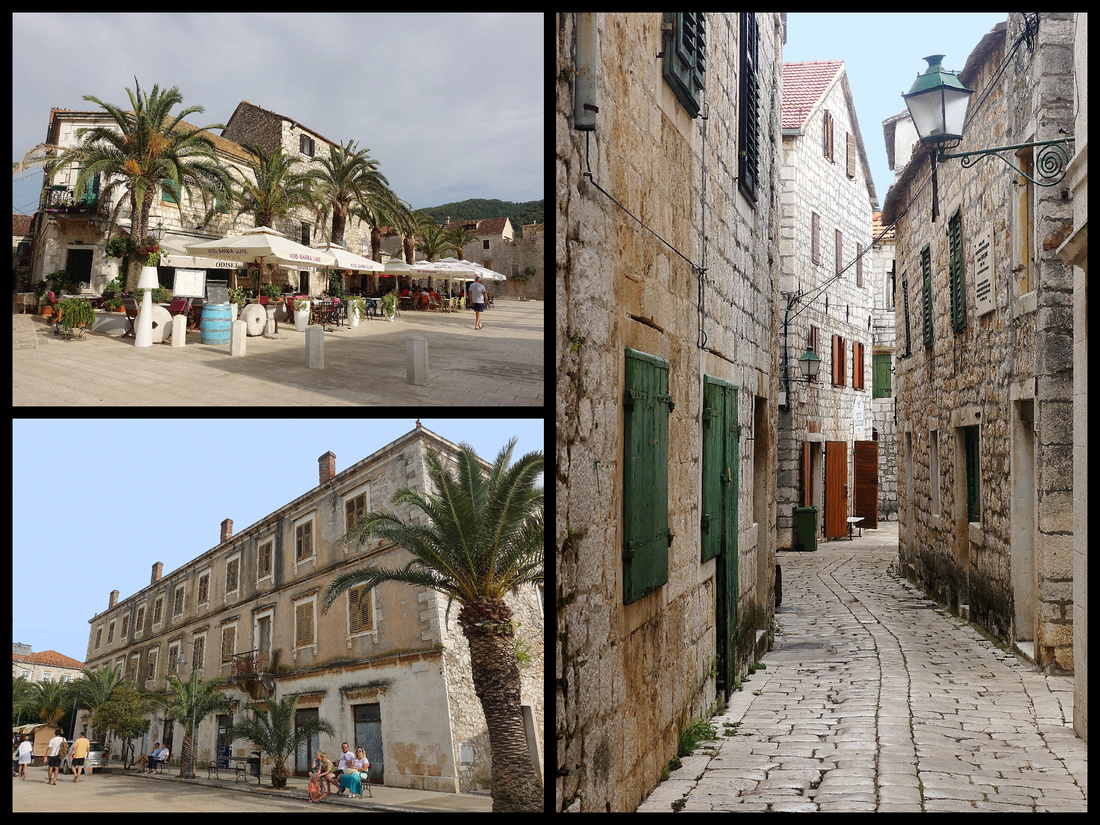
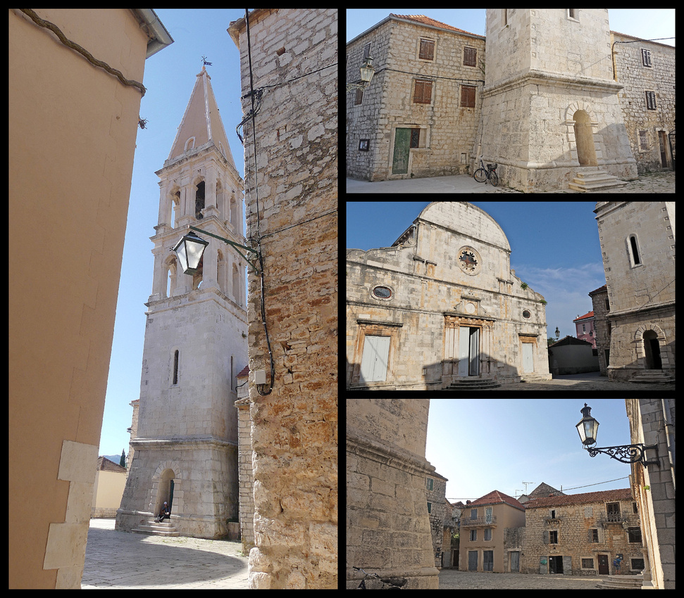
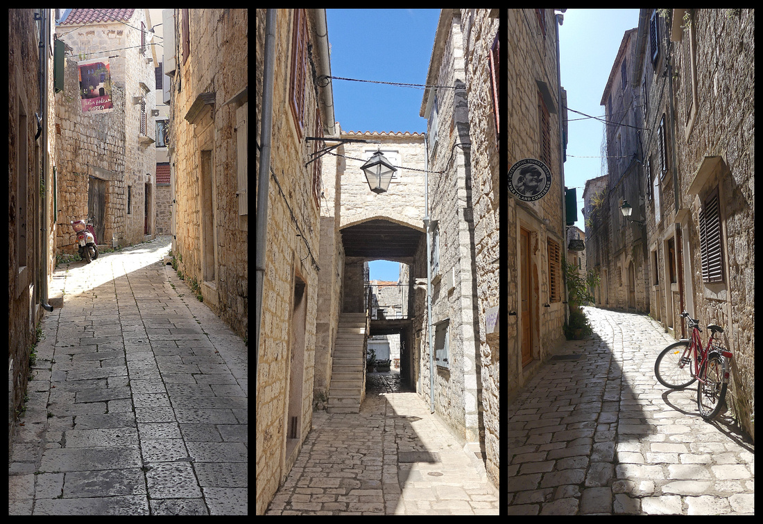
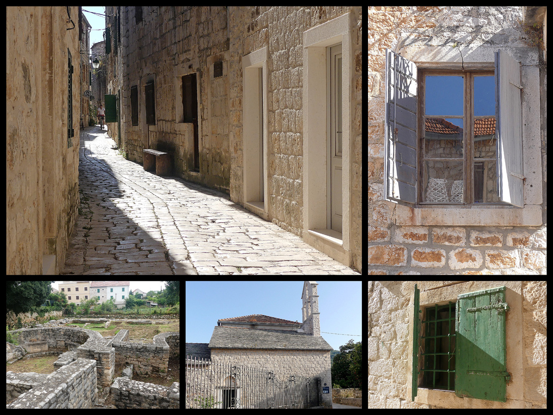
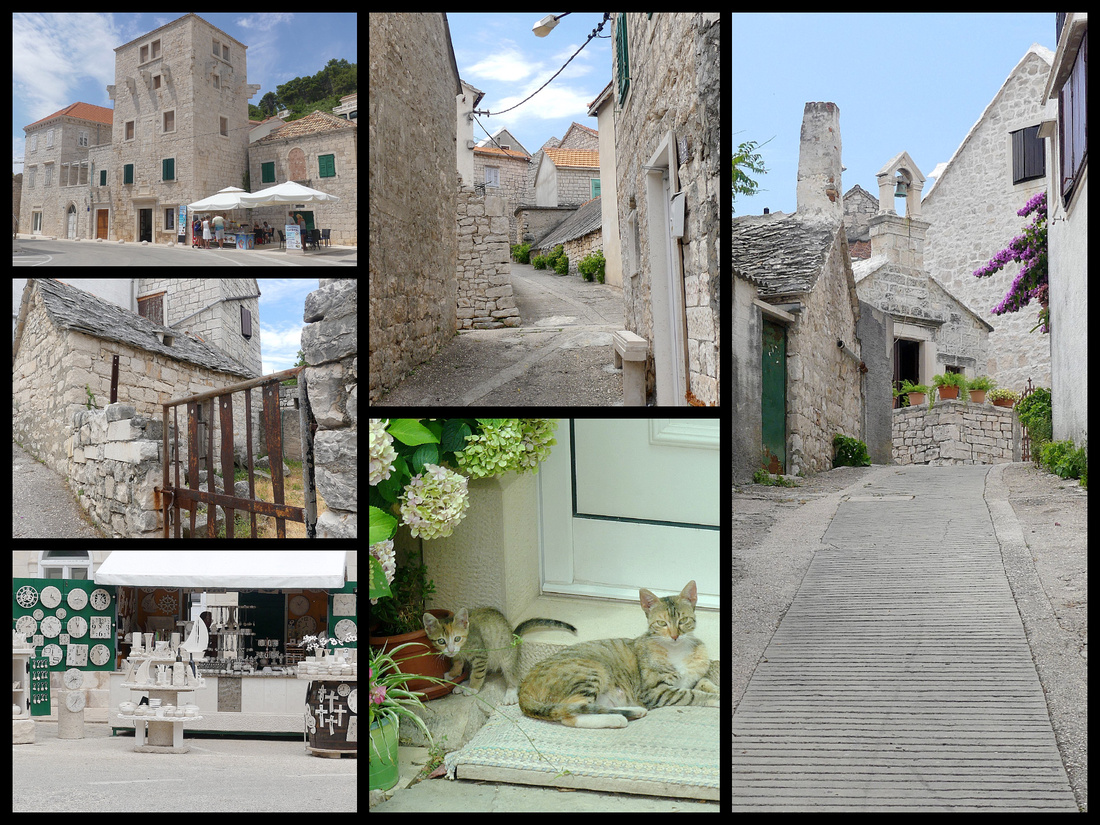
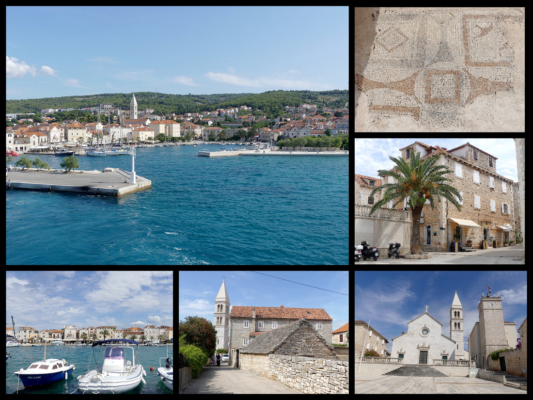
Hvar Island’s Stari Grad is more picturesque than I expected; given that all you hear about is Hvar town, I figured Stari Grad, population 1140, wouldn't be much. But there’s a small actual stone 'old town' with several lanes and a couple small squares, one with a church and bell tower that can be climbed. There’s a promenade all along the rectangular shaped harbor, the first part of which is full of expensive yachts and sailboats, but then a lot more much smaller little fishing and day boats. Tons of restaurants, few kiosks selling jewelry and clothes but definitely not a shopping mecca. Lots of ice cream, crepe stands, etc. There are two grocery stores and several bakeries.
We stayed in "Apartment Lomar" (booking.com, €58 night/double). It's a house in a residential section of Stari Grad with two 'apartments" on the second floor, above the host's apartment. Just one room but spacious, with kitchenette and a small balcony. About a 10 minute walk to the waterfront. The host was very friendly, one night his wife made cherry strudel and brought us some. When we were leaving for the ferry back to Split he drove us to the ferry terminal (which was about a 20 minute walk).
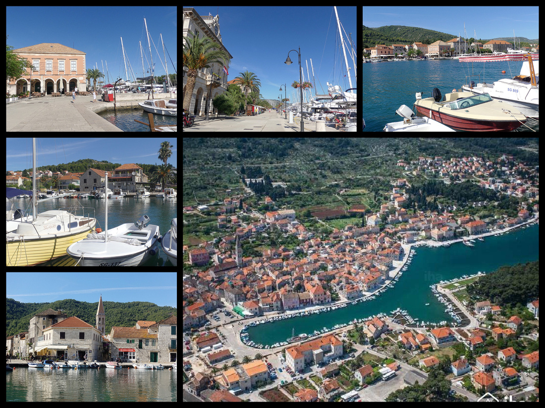 Above top and left photos - Stari Grad harbor Lower right: aerial view of Stari Grad from a postcard
Stari Grad (Which translates to "Old Town"), is the oldest place on the island, founded by the Ancient Greeks in 385 BC as an independent polis of Pharos. Still visible are some of the Greek Walls behind the small church of St John (just past the main church with detached bell tower) – the foundation of which was built with stone from the Greek wall.
While there were plenty of sleek sailboats/yachts and a few that looked like ‘party’ boats, overall the atmosphere in Stari Grad is quiet. Plenty of families, people on beach holiday. No glitz or glamour at all.
Hvar Island is billed as a “lush, sunny Shangri-la, with more hours of sunshine (2,724) than any other place in Croatia.” So it makes sense that after 15 days of total sunshine all day every day, we get a cloudy day (with a bit of drizzle) in Hvar.
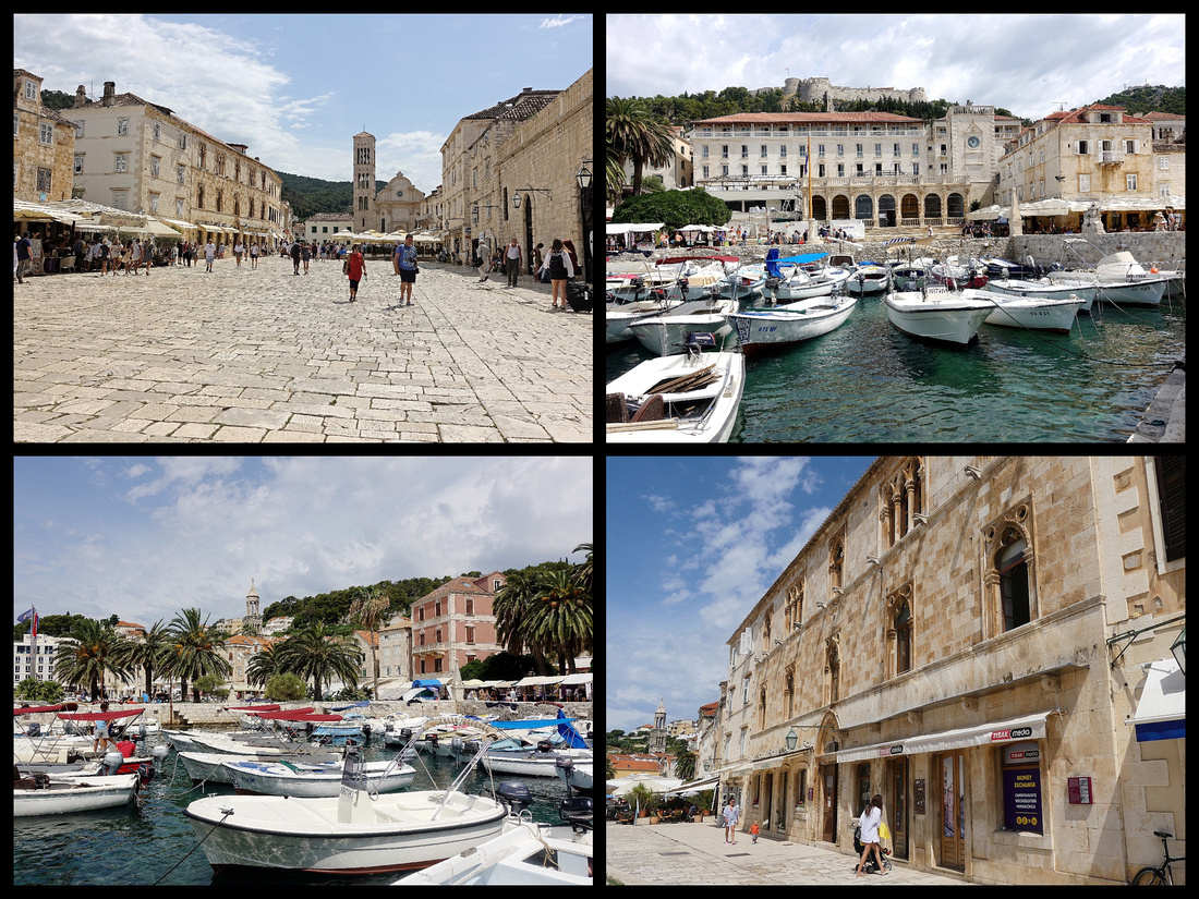
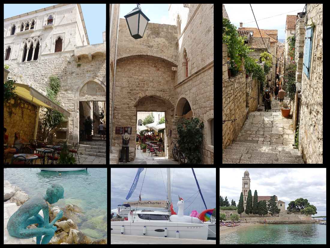
Most people know Hvar because of Hvar Town, (population 4,200) intensively (but tastefully) developed as a tourist resort. The island's capital is famed for it’s party vibe but it is also one of the Adriatic's best preserved historic towns. The center is totally pedestrianized and wraps around the harbor with stepped narrow streets, honey colored stone houses and a number of Venetian palaces and a small Renaissance cathedral (St Stephen) which stands on the largest square in Dalmatia. It’s bell tower is Venetian. Overlooking it all is the Fortress.
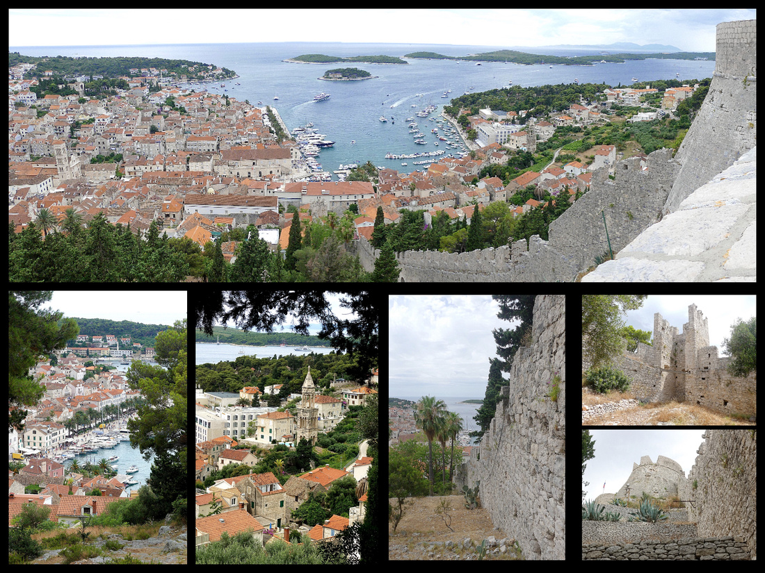
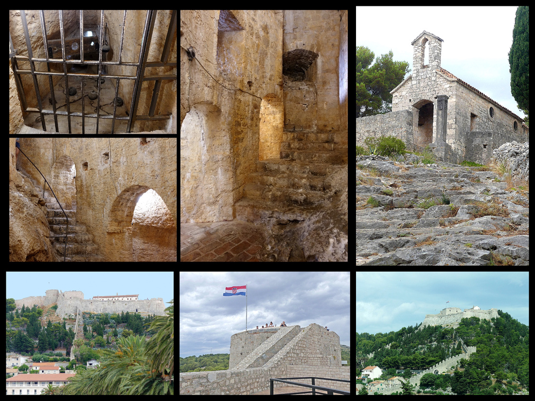
We climbed up to the fortress which is a really nice climb (about 20 minutes) through a “Mediterranean” Garden with lots of giant aloe and cactus to the fortress itself (50 kuna) which is very well preserved and the views really are wonderful- even on a cloudy day – offshore are the Pakleni islands and Vis is the distance. I especially loved the underground prison.
Fortiza (Spanjola) Construction of the current fortress began in 1282 shortly after the town turned to the Venetians for protection against the pirates rampaging through the Adriatic. The town financed the construction from the proceeds of selling salt. At one point in the 14th century, Spanish engineers participated in the project which is how the fort acquired its nickname, Spanjola. Largely intact stretches of defensive wall plunge down the hillside towards the town below. Its striking position perched on top of a 100m high hill makes it hard to miss, which of course was the point. Hvar was a lynch pin of the Venetian empire. Together with the town walls, Fortiza protected the town for centuries.
When Turks attacked the town in 1571, the entire population took shelter within the fort as the town was plundered and set on fire. Only eight years later however, a lightening bolt struck the fort igniting a store of gunpowder which blew up and caused substantial damage to the fort.
Hvar town is charming even in mid summer –I don’t know about evenings when it is party central, but mid day it’s a typical tourist town. Busier for sure than Stari Grad but it’s larger and has much more of tourist interest. I would say the percentage of “childless 20 and 30 somethings” is about 70% compared to Stari Grad (and other places in Croatia) where it’s more like 30% - the rest being people with kids and people over 40. But otherwise I didn’t see any more evidence of the RAF (rich and famous) than anywhere else. There were plenty of snazzy yachts in Stari Grad (and elsewhere) as well. The other main difference in Hvar Town from elsewhere was the prices. Jewelry store prices were 2-4 times higher for things that I’d been seeing elsewhere and not much of it was new or different. Prices for food near the harbor were double (pizza slice €4/30 kuna vs €2/15, ice cream scoop 16kuna vs 10 everywhere else in Croatia).
But Hvar Island is a UNESCO World Heritage site for the Stari Grad Plain – “a cultural landscape that has remained practically intact since it was first colonized by Ionian Greeks from Paros in the 4th century BC. The original agricultural activity of this fertile plain, mainly centering on grapes and olives, has been maintained. The landscape features ancient stone walls and small stone shelters, and bears testimony to the ancient geometrical system of land division used by the ancient Greeks, the chora which has remained virtually intact over 24 centuries.”
We took the bus from Stari Grad which takes between 20 and 40 minutes depending on the number of stops it makes. It goes through the beautiful Stari Grad Plain and along the coast. Slightly lusher than most Greek islands but otherwise very similar – grapes, olives, lots of stone walls.
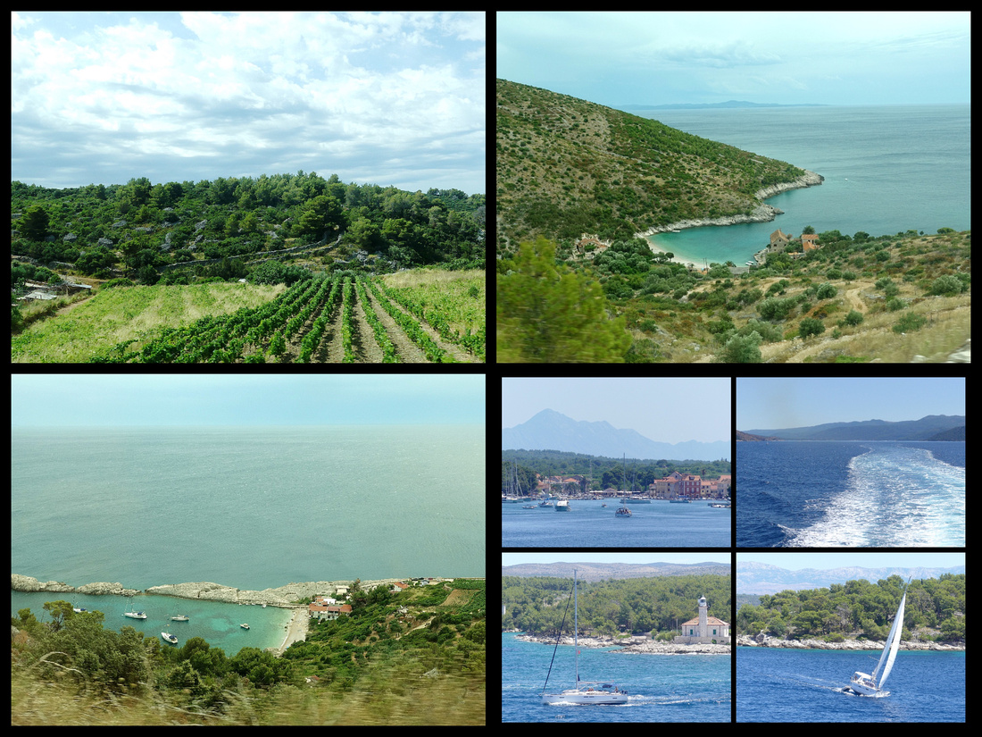
BRAC ISLAND - SUPETAR & PUCISCA
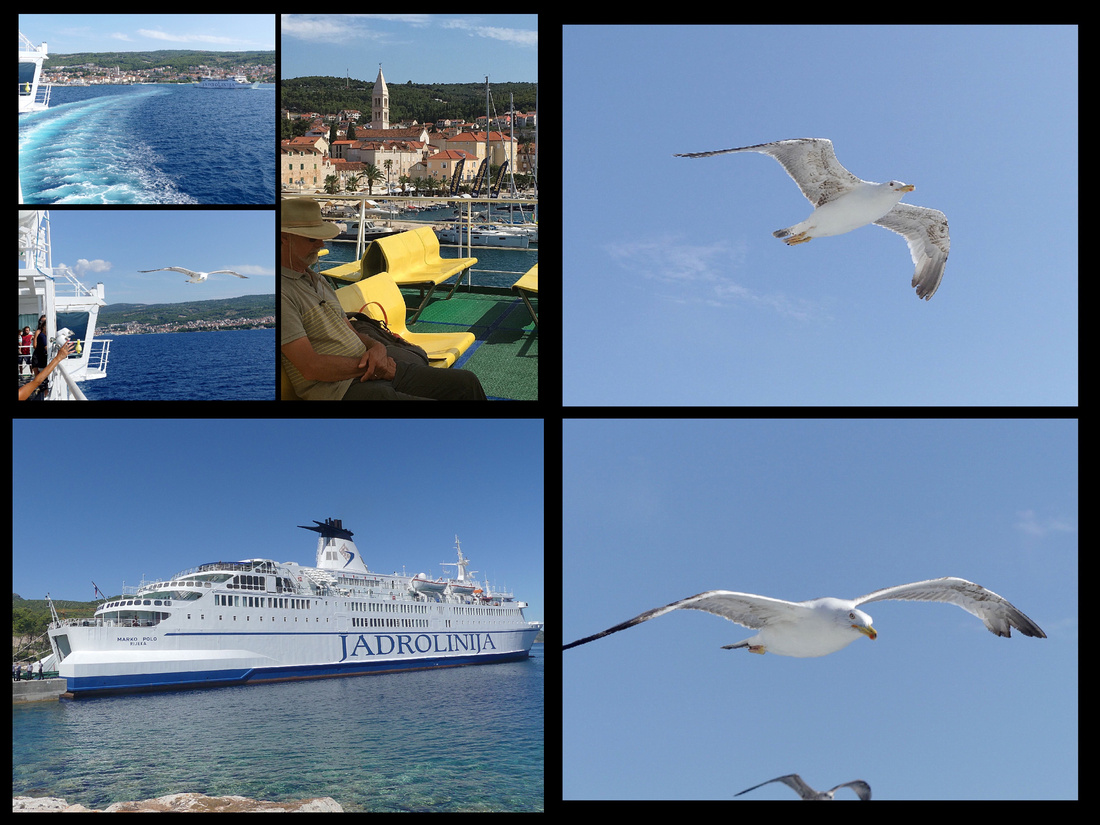
One of our days in Split we did a day trip to the island of Brac, the the longest and also the closest of the central Dalmatia islands to the mainland, only about a 45 minute ferry ride (a 'ferry' as opposed to a catamaran, so choice of inside or outside seating). Despite it's proximity to Split it is less touristed than Hvar or Kocula. The ferry puts into the town of Supetar but the place I really wanted to visit was the town of Pucisca, listed on several "most beautiful villages in Europe" lists. It's a half hour bus ride between the towns but the scenery is lovely, passing through vineyards, olive groves and along turquoise blue inlets with good views of the mountains on the mainland not that far away across the water. Alot of zigging and zagging but the bus trip was worth it.
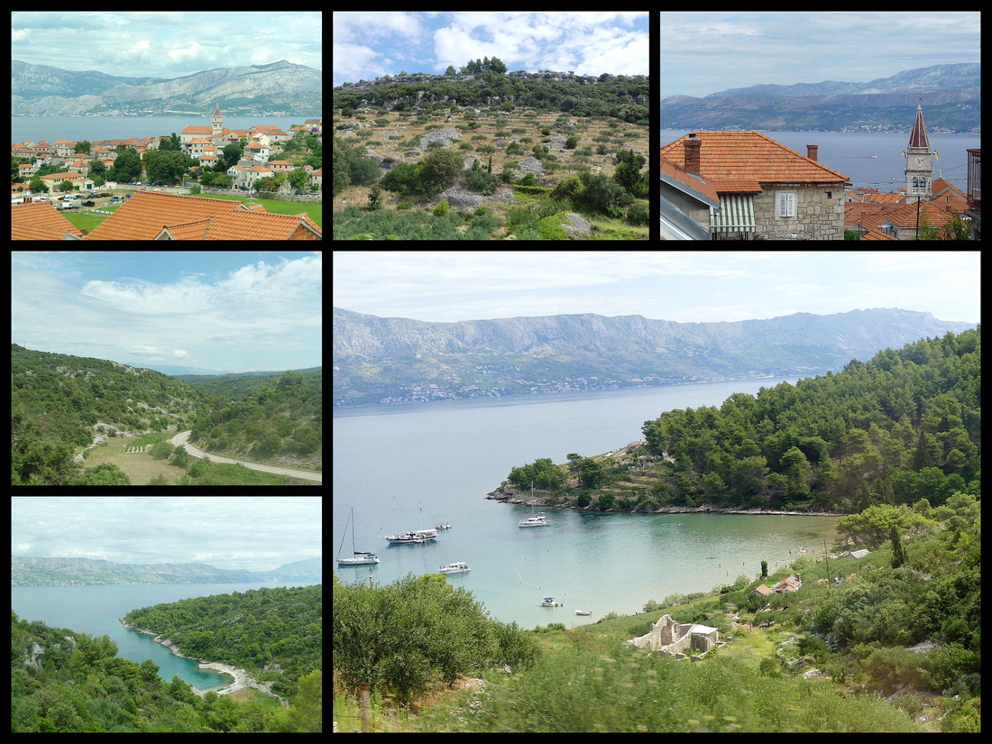
PUCISCA - population 1706, really is an adorable village with an lovely harbor. It's long and narrow with a couple of offshoots, the water is an amazing turquoise color and the town's buildings climbing up a gentle hill on both sides. There isn't a lot to the town, just a couple of restaurants, one church and a few lanes of stone houses, but somehow it all comes together to form a really picturesque place.
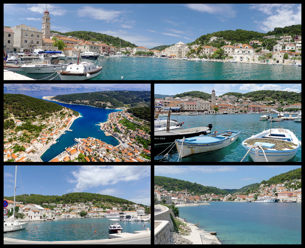
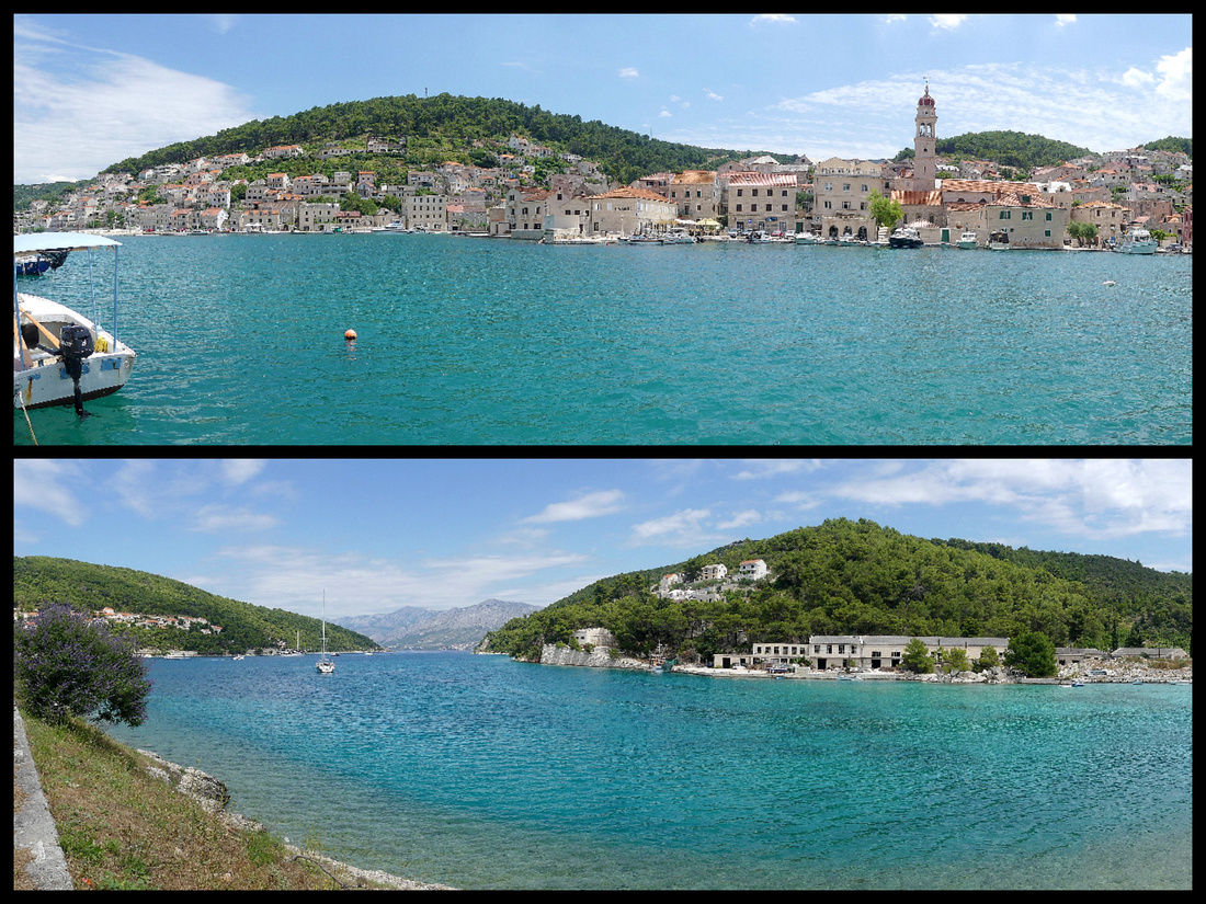
Brac Island is famous as the source of the white stone that built Diocletian's Palace and also the White House in Washington DC. The only 'tourist shops' we saw were selling items made of the very white Brac stone.
SUPETAR - with a population of 3500, is the largest town and main port of entry. It has a few medieval back streets with stone houses, a small pleasure boat harbor lined with a few restaurants and postcard shops and a beach. The baroque church of the Annunciation just off the harbor stands on the site of an early-Christian basilica, St Peter's, from which a mosaic and a number of old tombs were preserved. The basilica burned down and was rebuilt in 1604 and again in 1729.
SPLIT
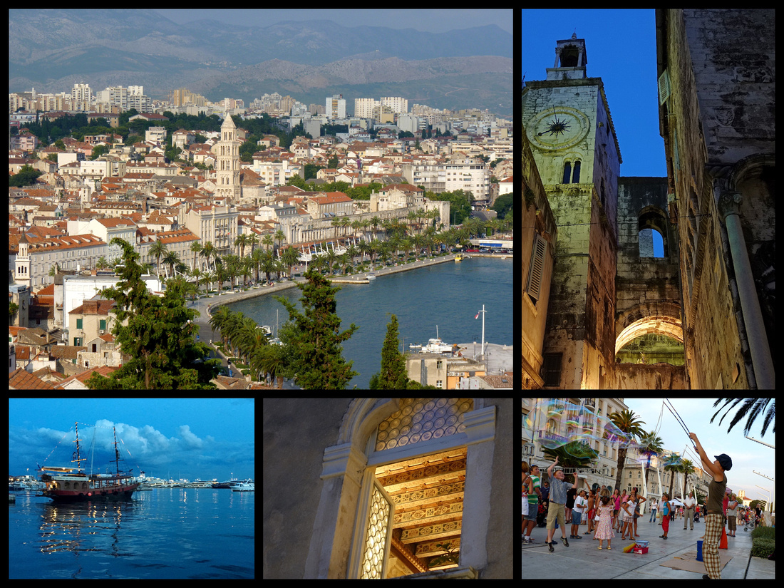
We spent three nights in Split, and despite being the only place on this trip that we had been on our last visit to Croatia, we found plenty to keep us busy, with only the one day trip to Brac. We stayed at the 'Dosoud Studios' booked on booking.com. At €126 night/double it tied with Venice as the most expensive place we stayed the entire five weeks. The 'Studios' consists of just three rooms, one on each floor of a lovely old building smack in the center of Diocletian Palace, just off Vocni Trg. Ensuite, and with a kitchenette, the room was comfortable enough though nothing special, but the view from the room was amazing. Unfortunately the 'beat/techno' music coming from the bar in the square below was pretty loud.
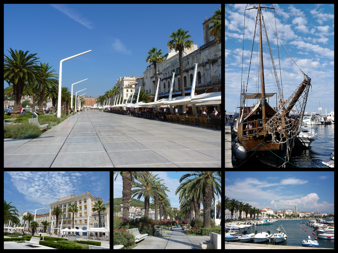
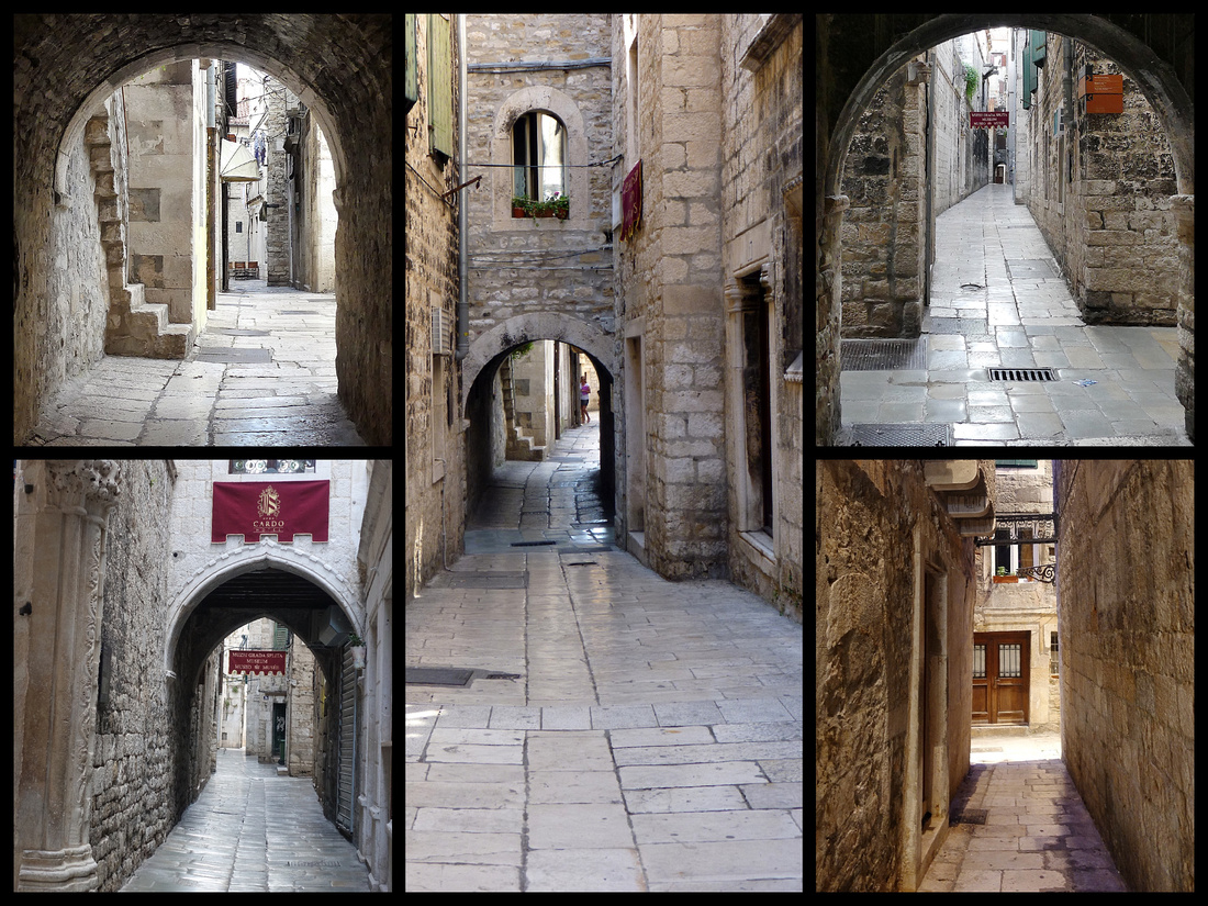
The largest Croatian city on the Adriatic coast (population 220,000), Split is a busy transportation hub, but it's old town, surrounding it's harbor is small enough to walk across in half an hour. All along the harbor is the Riva, a broad, lively pedestrian promenade with flowers, palm trees, benches and views out to the water on one side, and the buildings of the old town, including Diocletian's Palace, along the other side.
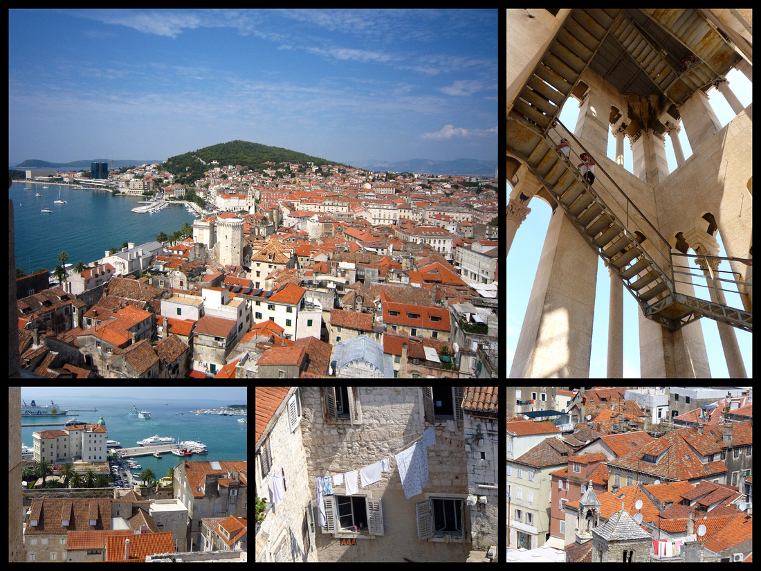
The center of the old town, and occupying a large portion of it, is Diocletian's Palace, a UNESCO World Heritage Site. Split has had many rulers over the centuries: Byzantine, Croatian, Franks, Venetians and Austrian-Hungarian, but it is most famous for the palace built by Roman emperor Diocletian (AD 245-313), known for his persecution of early Christians, as his retirement home in AD 300. The palace has been lived in almost continuously since then, gradually having been transformed into an entire city within the palace walls including houses, churches and municipal buildings. Despite being Roman and almost two thousand years old, it is not a ruin, having been built upon and inhabited continuously. Originally the complex would have housed a population of 8000 to 10,000 people. The ground plan of the palace is an irregular rectangle with towers projecting from the western, northern, and eastern facades. Only the southern facade, which rose out of the sea, was unfortified. In the center, a monumental court, called the Perystile, formed the northern access to the imperial apartments.
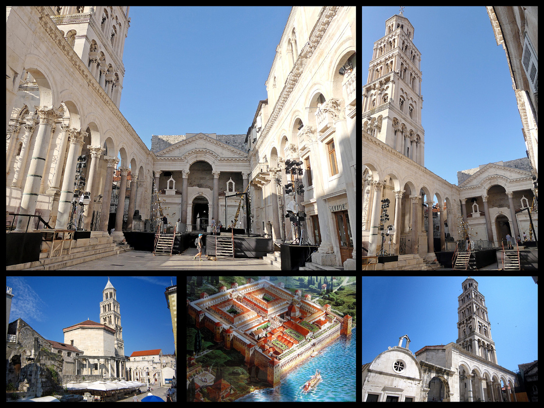
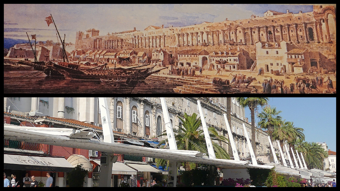
Above top photo - painting of what Diocletian's Palace and the waterfront looked like back in the day lower photo: the Riva today, you can just make out the columns of Diocletian's palace still embedded in the building
To one side of the Perystile is Cathedral of St Domnius (Katedrala svetog Dujma) entered through an arch guarded by two Romanesque lions with a collection of human figures riding on their backs. On the right looms the six-storey campanile, begun in the 13th Century but not finished until 1908, and featuring one of the ricketiest bell tower staircases in Europe. Inside, the dome is ringed by two levels of Corinthian columns dating from the 1st Century BC. The cathedral was originally built as Diocletian's tomb. Over the centuries, the building was converted into a Catholic church. Since the original building was built at the time when Christianity was still illegal, this is the oldest cathedral in the World. (And probably one of the smallest too.) This is also one of the rare cathedrals in the world that has portraits not of the saints - but of torturers of early Christians! The sphinx in front of the cathedral dates to 1500BC and is one of a pair brought from Egypt by Diocletian to stand guard over the mausoleum he built there for himself.
The small Crkvica Sv Roka (Chapel of St Rocco) beside the cathedral, 16th century, is used now as the tourist information office.
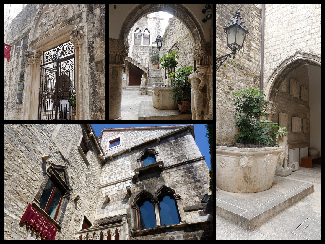
The center of the palace, and thus the center of Split's old town, is a maze of stone streets lined with houses and palaces. The 'best' is the Papalic Palce, now the City Museum, a typical example of the Gothic town houses built by Splits' 15th century aristocracy. A carved gateway leads from the street to a secluded, ivy covered courtyard entrance with a stone well.
There are four 'gates' or entrances into the Palace. The unmarked and inconspicuous Bronze Gate is the southern entry from the Riva into Diocletian’s Palace basement. Before land was reclaimed for the Riva, the gate led directly to the Adriatic Sea. Once inside the basement, visitors can walk up the steep staircase directly into the Peristyle or enter the rest of the basement. While the current ground level of the palace looks like a medieval city, the basement level retains the Roman floor plan. This is the only part of the place which charges a fee to enter but is very well preserved and is the only part of the palace where you feel like you are in a Roman building.
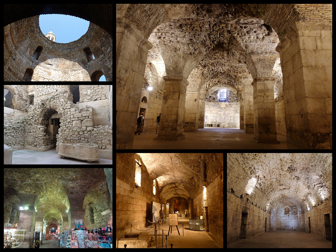
The eastern gate, known as the Silver Gate features a wall of arched windows. The gate has seen numerous modifications throughout history, as evidenced by the varying walls around it but attempts have been made to restore the Silver Gate as best as possible to its original construction. Outside the Silver Gate is Split's fruit and vegetable market.
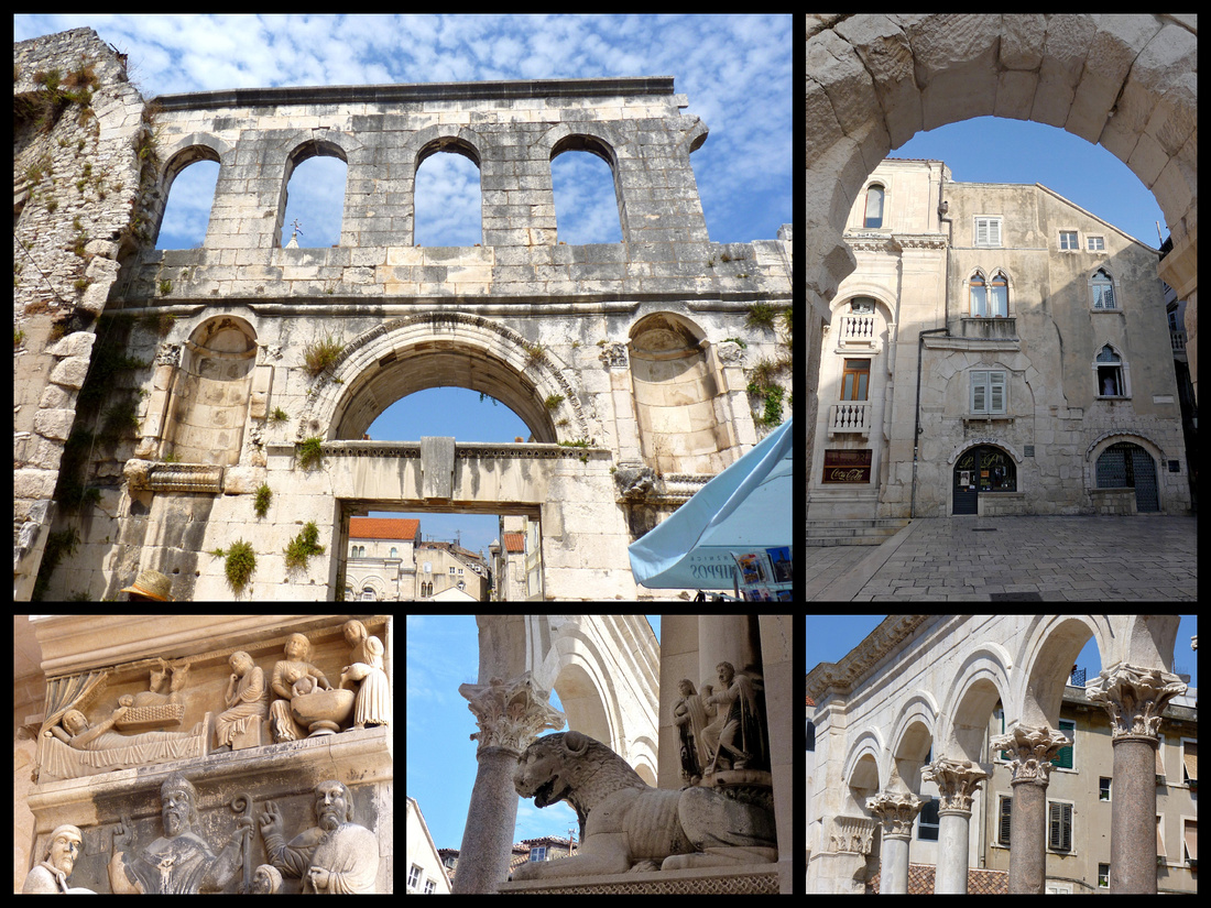
The Golden Gate (Zlatna Vrata) is on the north side and was the main landward entrances and is the best preserved. Outside the gate is the 28-foot-tall statue of the 10th-century Bishop of Nin. It’s said that rubbing his toe brings good luck!
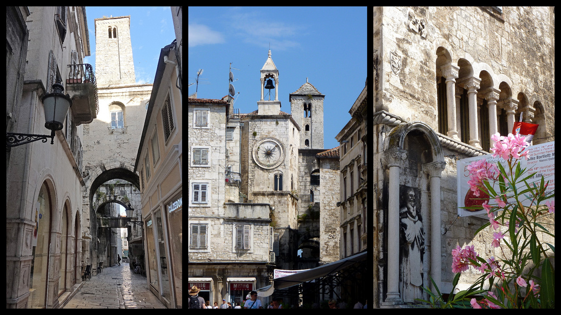
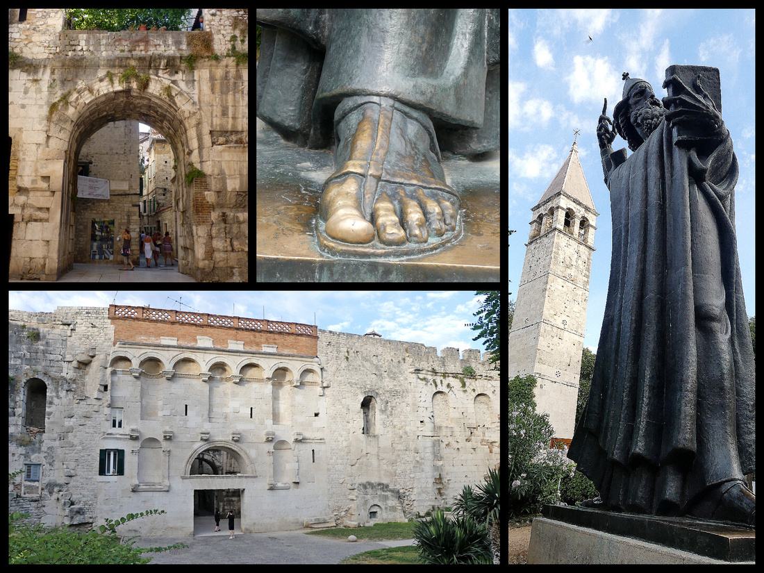 The Iron Gate (Željezna vrata) on the western side leads to Narodni Trg/ Pjaca – aka People’s Square with a Romanesque house with a tower containing a 15th Century Renaissance clock with Roman numerals in 24 parts. Above the tower is a small Gothic belfry. This square replaced the Peristyle as the city's main square in the 14th Century, with the remains of a medieval sundial, behind which looms a taller, older belfry. One side of the square is dominated by the 15th Century Town Hall (Gradska vijećnica), with a ground-floor loggia of three large pointed arches supported by stumpy pillars.
 Above top left: the building housing Dosud House Studios; top right: Narodni Trg lower left: Town Hall stone balcony lower right: view from our room
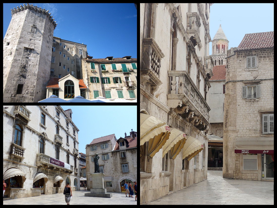
Almost adjacent to Narodni Trg is Vocni trg (Fruit Square) (all three photos above). In the center is a large statue of Marko Marulic and on one side is an octagonal tower that once formed part of the 15th century Venetian castle, a passageway next to it leads out to the Riva. Dominating the square is the Milesi Palace, 18th century and one of the best examples of Baroque architecture on the Dalmatian coast.
The other major square is Trg Republic featuring the Prokurative (which means portico), forming three sides of the square - neo-Renaissance city council buildings incorporating some of the same architectural details as were used in Venice's St Mark's Square. This marks the far edge of Split's old town.
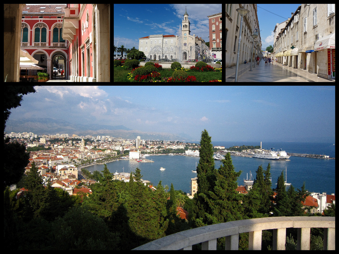
West of here is the 'modern' yacht harbor and the beginning of Marjan hill residential area.
Overall I'm glad I chose to re-visit Spit. It has such an interesting history and Diocletian's palace and the setting on the Adriatic are wonderful. However, we noticed far more bars and discos - and tour groups - and glitzy chain stores -than the last time we were in Split - and way more than any other place we visited in Croatia this trip. It seems like Split is becoming like Hvar Town (or Ibiza) and catering to the clubbing scene, which is too bad as it's such an historic city. Drunk partiers don’t care about the location, they just want booze and beach and clubbing at night so they should just go to places with good beaches and leave historic towns alone. Despite that we enjoyed our time there and for any visitor to the central Dalmatian coast (or just even to Croatia) Split is definitely a 'must see'.
]]>
LYON
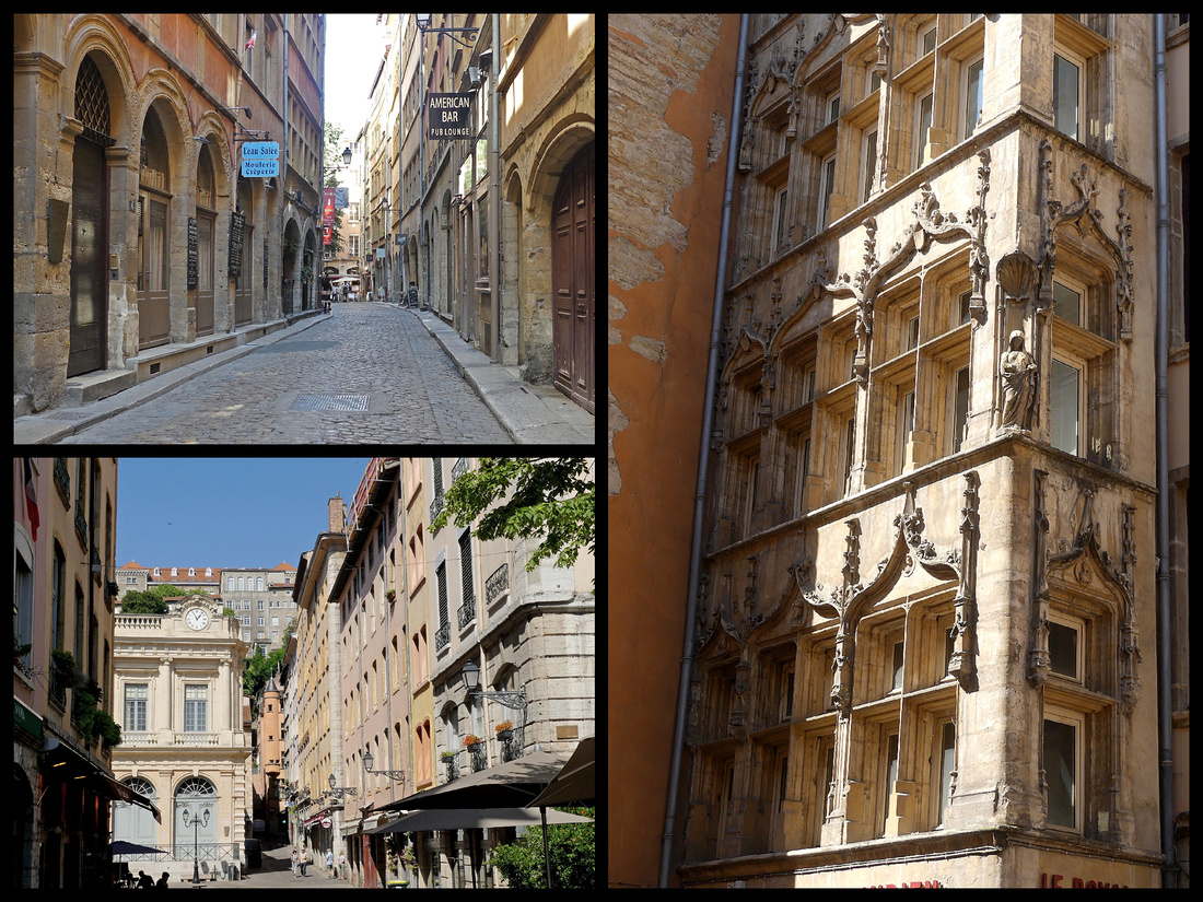
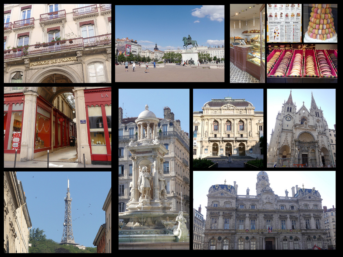
With a population of 500,000 Lyon is the 3rd largest city in France. It’s a UNESCO world heritage site for its old town, Vieux Lyon, and it’s traboules. Lyon has a nice setting at the confluence of the Rhone and Saone Rivers. The large island between them, Presque’ile, has several squares linked by pedestrian streets with a vaguely ‘Parisian’ like look. Unfortunately most were in the process of being re-paved and everything was torn up with construction equipment and a lot of jack hammering going on. Even without that, the comparison with Paris would be marginal. But the view of old Lyon across the Saone River is lovely.
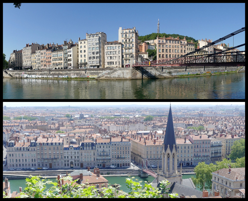
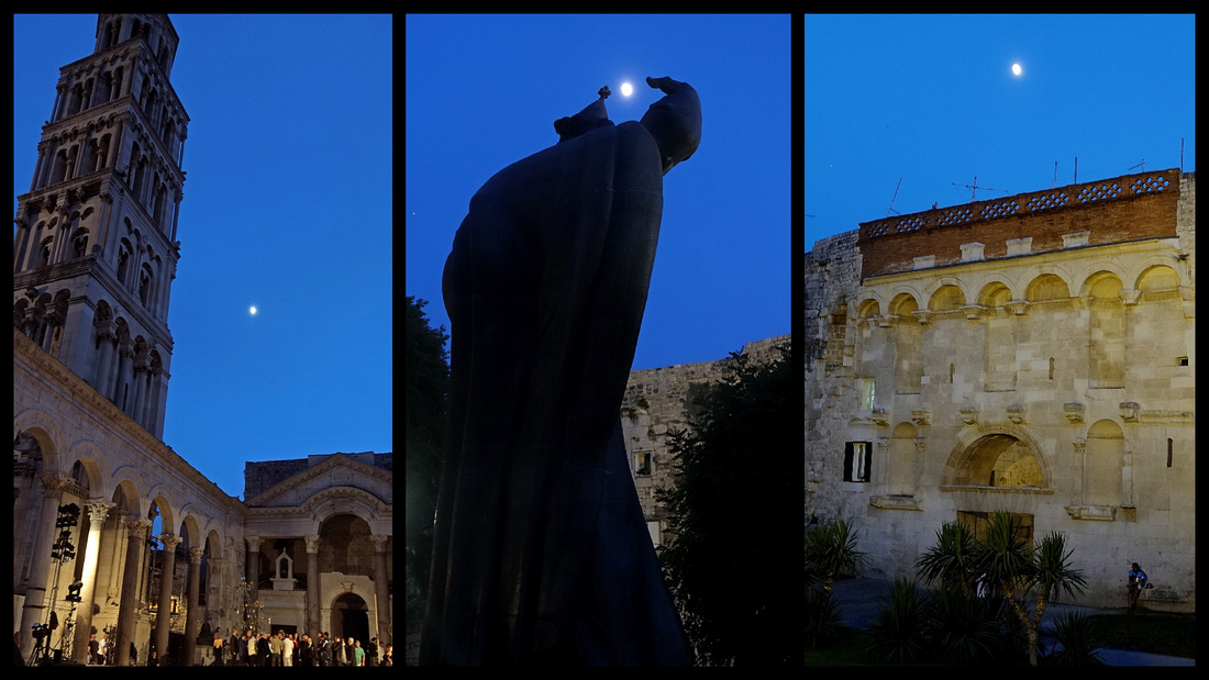
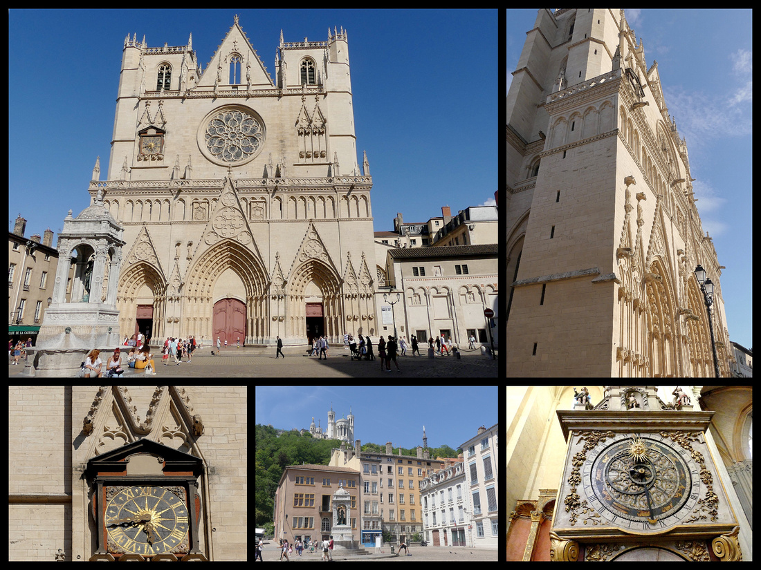
Vieux Lyon - Reached by one of the three passerelles (footbridges) crossing the Saône from the Presqu’île, Vieux Lyon is made up of what was once three villages - churches and the ‘neighborhood’ around each (now all blend together) - St-Jean, St-Georges and St-Paul, at the base of the hill of Fourvière. Cobbled, pedestrianized streets lined with Renaissance and medieval facades really does have ‘Old World’ ambience. Place Neuve Saint-Jean, is the main square. The cathedral’s main façade lacks most of its statuary as a result of various wars but is still impressive and the 13th Century stained glass and rose window are in perfect condition. The most interesting thing is the 14th Century astronomical clock, capable of computing moveable feast days (such as Easter) till the year 2019.
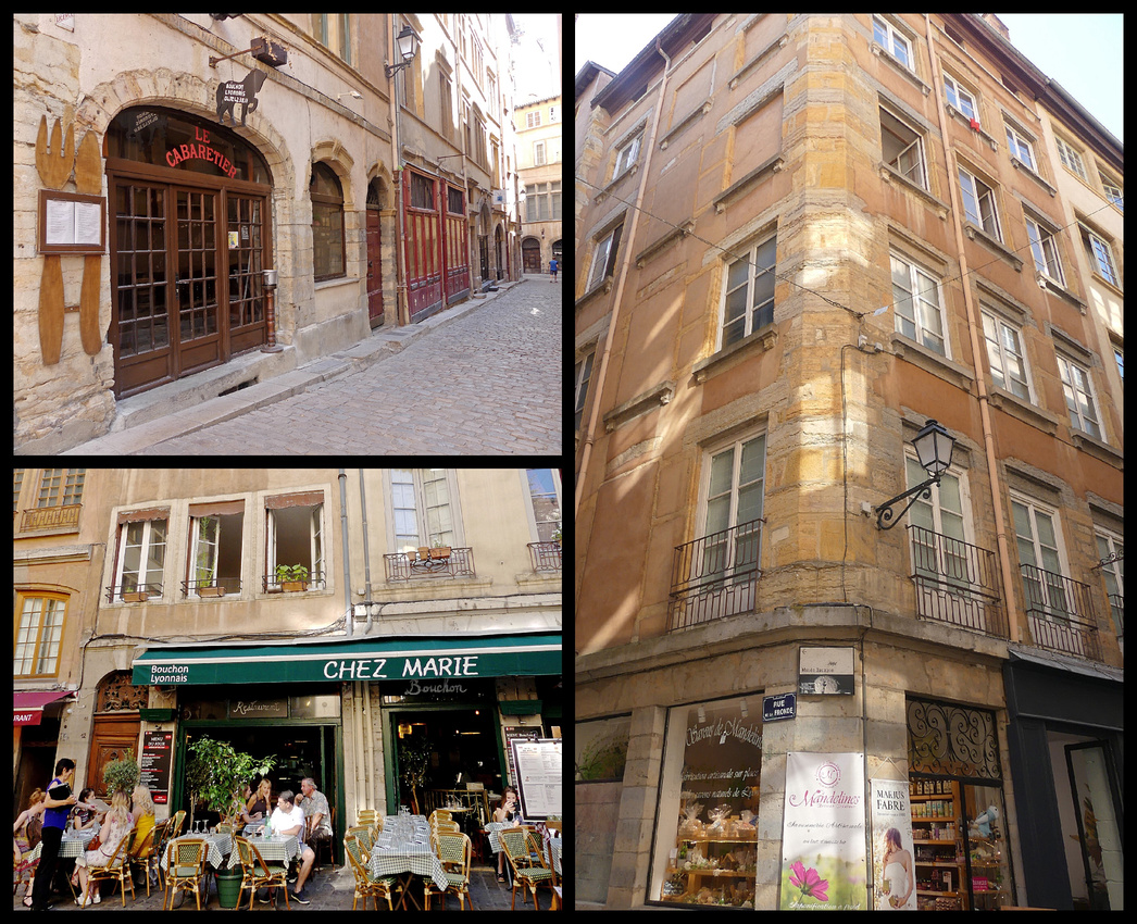
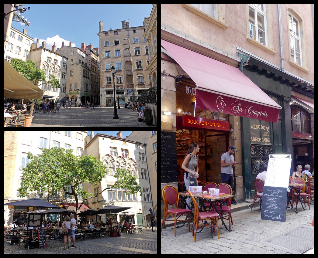
Lyon is considered by some to be the gastronomic capital of France. Throughout the city, but especially in Vieux Lyon are bouchons. A bouchon is a type of restaurant that serves traditional Lyonnaise cuisine.The forbearers of these bouchons were the taverns or inns where silk merchants stopped in the 17th and 18th centuries to have a meal, clean their horses, and, perhaps, rest overnight. They derived their name because the term bouchon was used then to describe the twisted straw brushes used to clean the horses. Each of these restaurants typically served only one main plate, such as roast pork, cheese with herbs, sausages, or duck pate. Today there are no longer any horses around but these eateries have menus that offer many of the same traditional dishes, usually several choices.
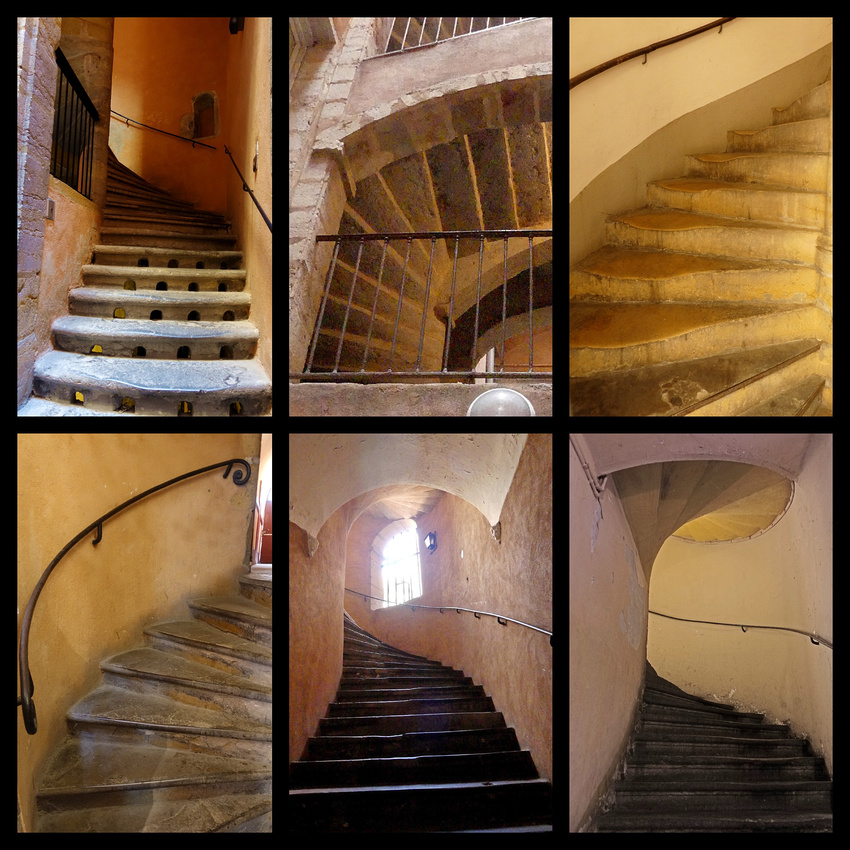
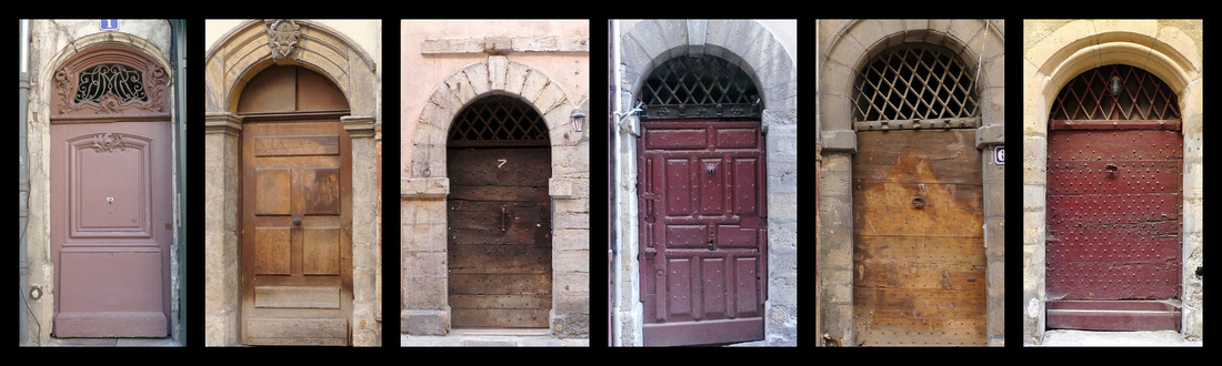
Traboules – The highlight of Lyon for me was the traboules – they are essentially shortcuts linking streets, which provided shelter from rain when reams of silk — a key industry in historic Lyon — were moved from one place to the next. Many are various shades of pastel colors, with medieval stonework, arches, loggias, spiral stone staircases. Other cities have them but Lyon has the most, and many are open to the public even though they are the entrances to private apartments. Most of those are marked with the bronze plaque that indicates anything in Lyon of historic interest, but not all. I had googled the addresses and the ones I found were all indeed open to the public as long as you were brave enough to push open a door that looked like a private entrance, and then push the light button. 6 Rue Trois Maries (actually enter from other side), 3 Place St Paul, 54 rue St jean, 28 rue St Jean. While tourist maps have locations and many tour groups visit them, most had very few people in them when I was there, you are expected to be quiet and respectful for the sake of the people who actually live there. They are so ‘hidden’ that they were used by the French resistance during WWll.

The other highlights of Lyon are up on Fouviere Hill. Reached by a funicular (same ticket as the metro) – or a steep walk up streets or stairs – at the top is a hulking, ornate wedding cake of a church, the Basilique Notre-Dame de Fourvière which was built, like the Sacré-Coeur in Paris, in the aftermath of the 1871 Commune to emphasize the defeat of the godless socialists. And like the Sacré-Coeur, its hilltop position has become a defining element in the city’s skyline. The interior has marble statues, stained glass and gold and turquoise mosaic wall panels. The crypt has some nice stonework and an ornate turquoise mosaic ceiling in the apse.
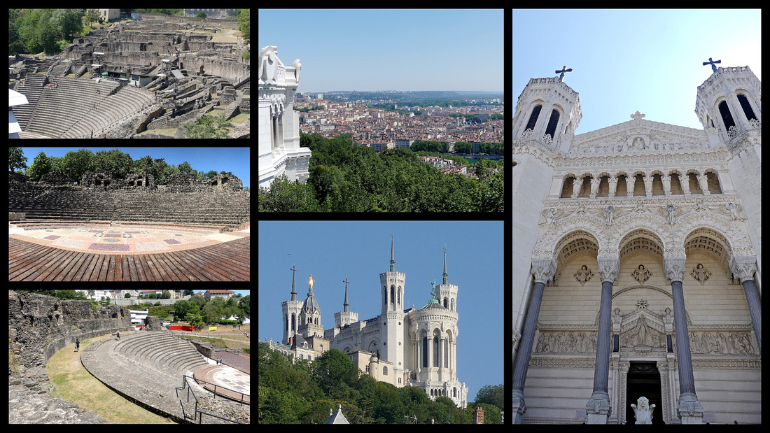
Halfway down the hill is Musée Gallo-Romain. Alongside the museum, dug into the hillside, are the substantial remains of two ruined theatres – the larger of which was built by Augustus in 15 BC and extended in the second century by Hadrian to seat 10,000 spectators. The theaters are free to enter and you can walk all around and in them (except for the section with the staging, as in almost every Roman theater in Europe these days, the centers are filled with staging for performances during the summer).
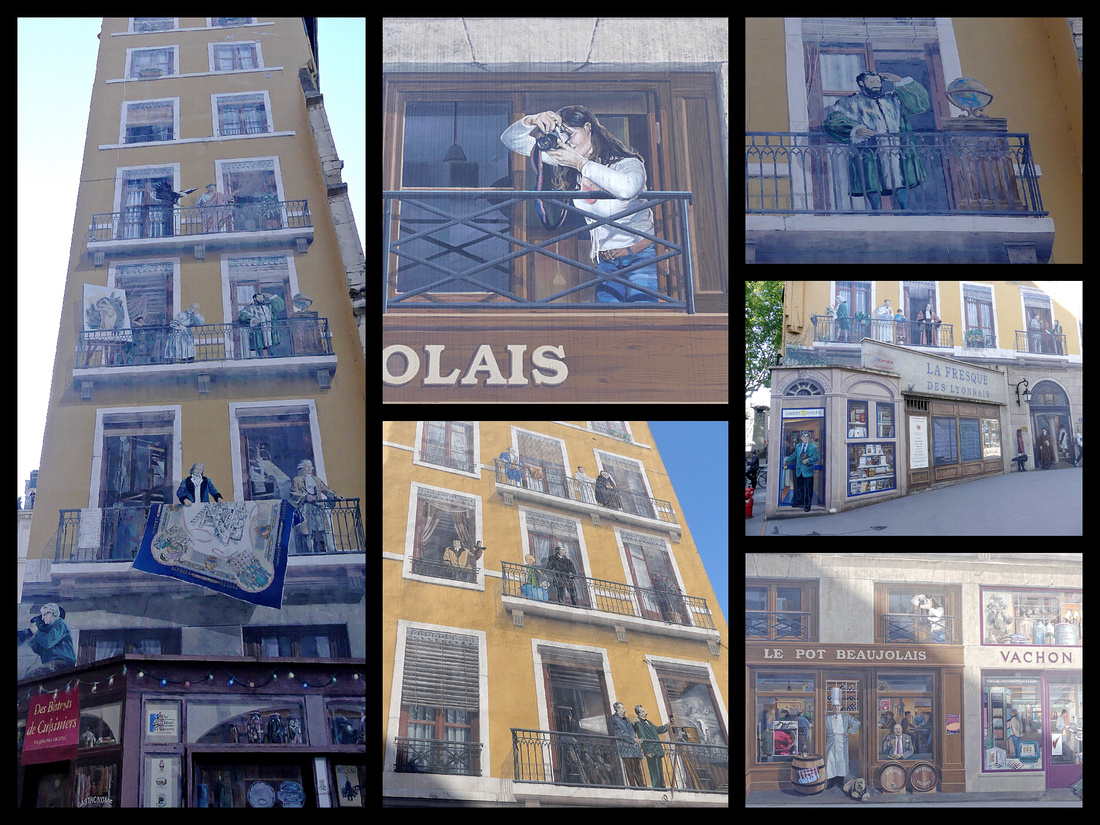
Fresque des Lyonnais (Mural of Lyon)- is a building mural covering the back and side of a bright yellow building on the bank of the Saône, just across a foot bridge from Vieux Lyon. It consists of 24 historic and six contemporary figures, with the modern-day characters painted at street-level to represent them interacting amongst today’s residents and visitors.
Presque'ile is the center of Lyon, a peninsula between the Rhone and Saone rivers. While Vieux Lyon feels medieval, Presque'ile feels like a mini Paris. There are a string of impressive squares, the central and largest of which is Place Bellecour. (The third section of Lyon, 'Part-Dieu', is the modern business section, home to the main rail station).
At the tip of Presqe'ile, is the Musee Conflulences, one of the best anthropology museums I've seen. It's not huge, the permanent exhibit is on the top floor and consists of five large rooms: The Origin of the species and our world (big bang theory and evolution), Species (who we are and what is our place in the world), definition of human identity and the link between humanity and animality (Some wonderful taxidermy animals); Societies (how we organize, exchange and create everything); an Eternities (visions of the beyond and how humans view/treat the passing between two worlds (death). A wonderful look at most aspects of physical and cultural anthropology. Everything is in English as well as French. The building the museum is housed in(built in 2014) is spectacular as well - looks like a space ship.
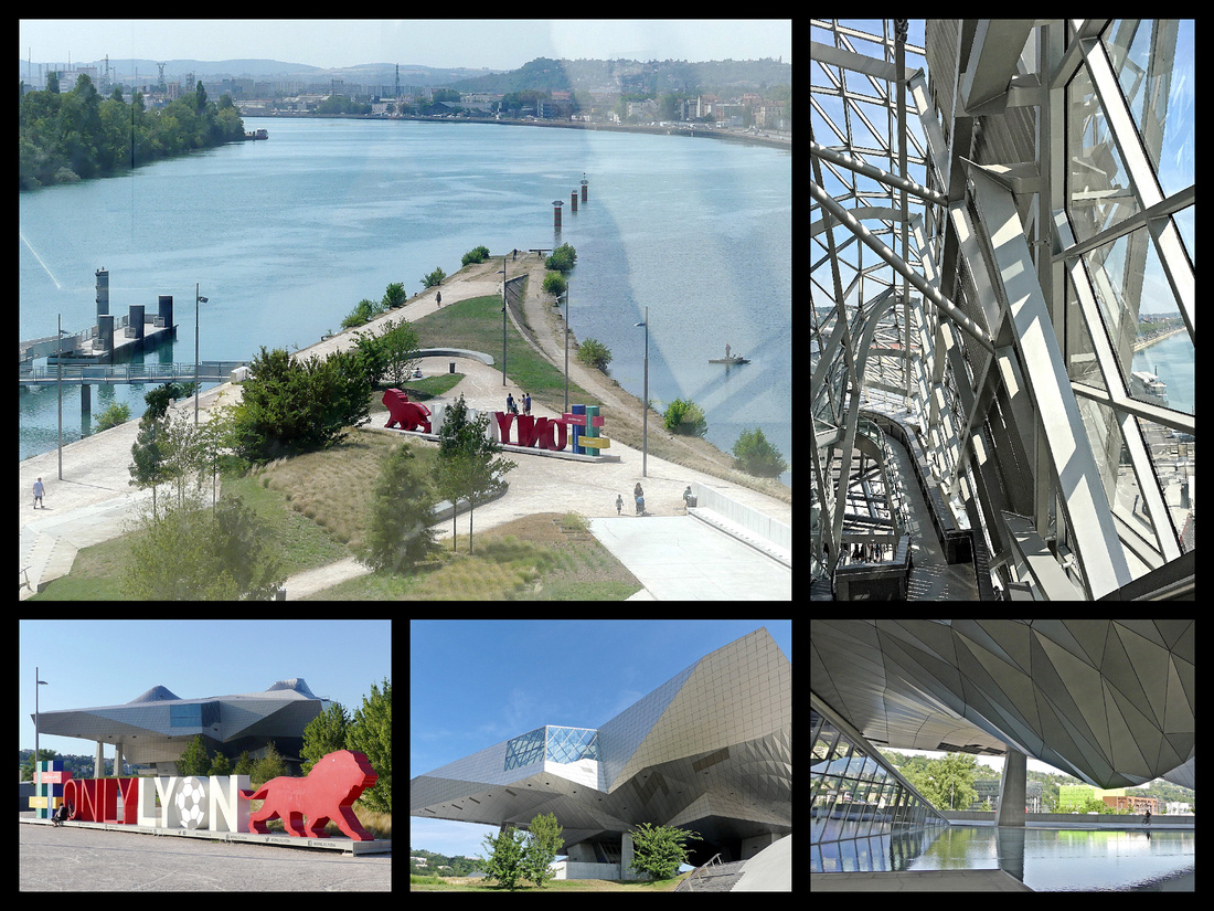
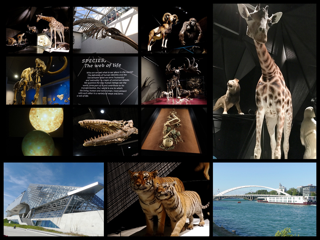
Reading opinions on travel forums and blogs, Lyon is frequently dismissed as 'not worth it', or 'boring'. While I'm glad I visited, and really enjoyed Vieux Lyon (and Musee Confluences), I have to admit it's not at the top of my list of favorite places in France. I think part of this is due to the fact the Presque'ile was undergoing major construction so many of it's streets and squares (and tram Line 1) were all torn up and not at all pretty or enjoyable. I felt three days was adequate and I don't have the urge to go back (unlike almost everywhere else in France).
After three weeks of staying in B&B's and small apartments, in Lyon we stayed in a convenient and comfortable, but soulless, chain hotel - Quality Suites Lyon Confluence. I chose it because of it's location near Perrache train station (arriving and departing ease and day trips) and right on Tram Line 1 (which was not in use due to construction, so that didn't work out). Booking.com, 88€ night/double.
PEROUGES
An easy enough day excursion by train from Lyon Part-Dieu train station to Meximieux Pérouges station, 30 minute walk from old town, flat except for the last 10 minutes up the hill. There are trains every 2 hours or so. The station there looks to have been shut for years but has kiosks to buy tickets, though given how well they work it’s best to get return tickets before leaving Lyon. About €8 per person each way, takes about ½ hour. We ended up getting the 10:12-10:45 there and the 16:16-16:48 back. No signs at the station as to where the town is but turn left and eventually you see signs for “Medieval Perouges”.
As we were walking towards the old town a French couple must have thought we looked lost because they started to tell us which way to go and began walking with us. When we said we didn’t speak French he said “London?” and I said ‘no, United States’, he really lit up, pointed to his hat (which said “Seals”) and said he was a French GI. Then he made some remark about Trump, (and my husband replied, in French, that Trump was a pig) which this guy thought was hysterical. This man and his wife (who smiled a lot but never said anything) kept walking with us for several minutes, chattering nonstop, most of which we didn’t understand (he did say Bill Clinton had been there). Anyway, they seemed to really like Americans, shook our hands as they were turning down a different street, wished us a good trip.
Pérouges is a village on a small hill of cobbled alleyways and ancient stone houses, an immaculate work of conservation (including all utilities buried) that really makes you feel like you stepped back into medieval times. Its charm has not gone unnoticed by the film industry (The Three Musketeers, 1961 and several others were filmed there).
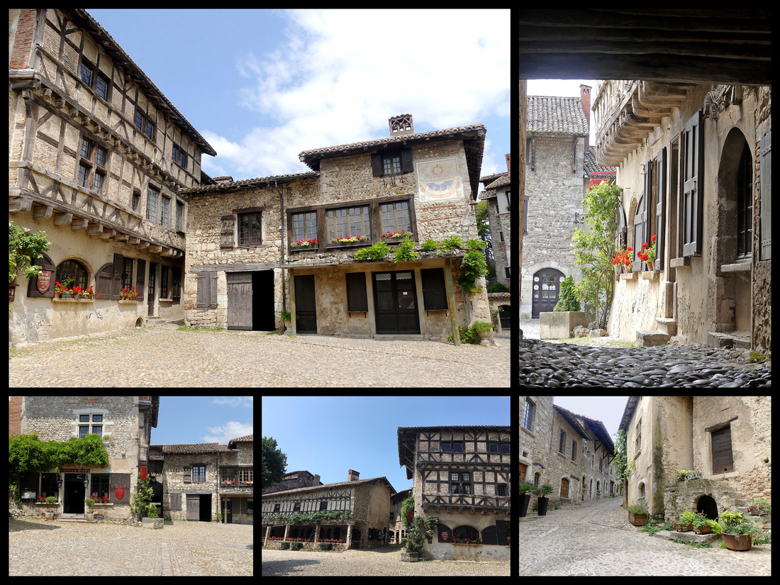
The streets and the buildings are all kind of a light grey/honey color stone. There are two gated entrances “Porte d’en Bas” (bottom door) and “Porte d’en Haut” (upper door) and a street that encircles the village, a couple of alleys and a main square, La Place de la Halle. The main square is the site of a majestic linden tree planted during the French Revolution, 1792. Because of this, the plaza is also known as the liberty tree – La Place du Tilleul. Some buildings in the village are clearly not in use but everything is very well cared for. A few tourist shops but nothing tacky. A few restaurants, no fast food. One museum/tower (€5 entry) with so-so views (it’s not very high) and a nice medieval interior (several huge fire places), some weaving paraphernalia, various old objects.
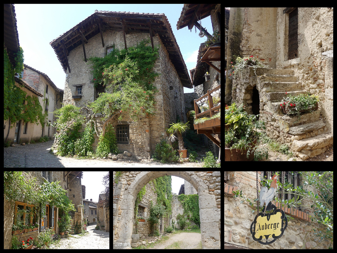
The town was originally founded in the 1100’s by a Gallic colony returning from Perugia, Italy resulting in the French name of “Pérouges.” By the 14th and 15th centuries, the town was inhabited by craftsmen, primarily wine-makers, linen weavers, and farmers. It was on the road between Lyon and Geneva. By the end of the 18th century, there were nearly 1,500 residents. The textile industry came to a halt in the 19th century when railroads bypassed the town, resulting in a precipitous population drop to just 90 people. This is also the reason modern building or renovations never occurred.
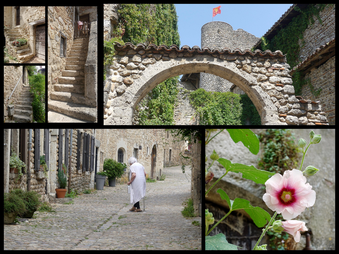
We ate lunch at 'Relais de la Tour' on the main square. The price fixed lunch included a ‘buffet’ of charcuterie and crudités, main dish of ham and mashed potatoes in a mushroom cream sauce or chicken and green beans, and a dessert buffet (dark chocolate mouse, Chantilly, ice cream, tarts). My huband got a “Pression medieval” (medieval beer). Total €37. Very breezy but nice in the sun and the setting was gorgeous.
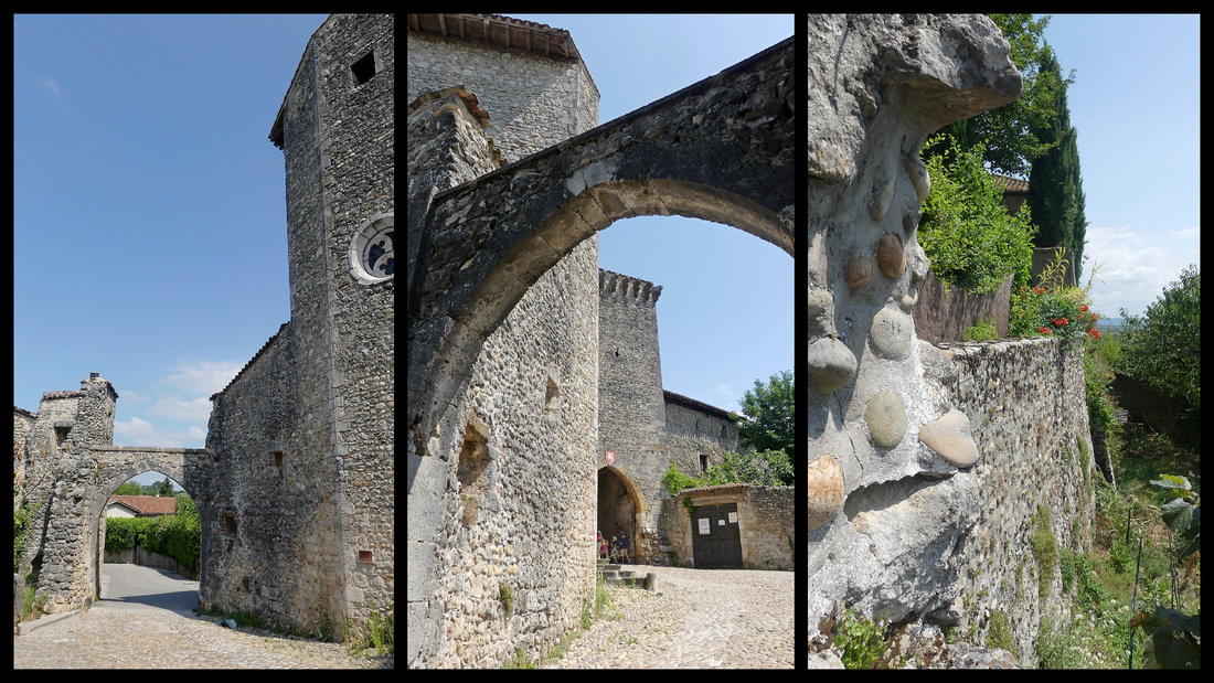
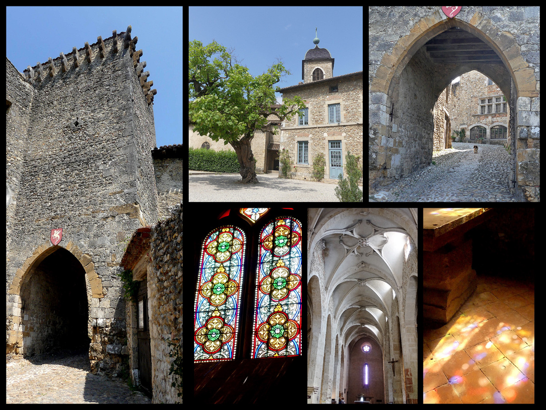
We were there 10:45-16:16 so 5 ½ hours but at least an hour of that was the walk up and back. You really ‘need’ about 3 hours to see the village (we walked around it 3 times) and have an hour-long lunch. There were a few other tourists around, but no crowds at all. As we were leaving we wondered why tour groups didn’t invade this place, it’s so picturesque. Then we saw two, Viking River Cruise tour buses heading in as we were walking back to the train.
VIENNE is another very easy day trip from Lyon (train stops in both Part-Dieux and Perrache stations in Lyon), ½ hour to Vienne, €7, two or three trains per hour. The gare in Vienne is a short walk from the sites. Vienne is known for its abundance of Roman ruins, many of which are just fragments but there are a lot of them, scattered about the city and able to be seen for free. The most exceptional is the Temple of August and Livia, on Place du Palais (site of the Roman forum), 1st Century BC, completely intact just sitting there like any other building. Along with the Maison Carrée in Nîmes, it is one of the two best examples of a Roman edifice of this kind in France. It was well preserved because the temple became a church around the 6th Century and the portico was bricked up, restored in the 19th Century.
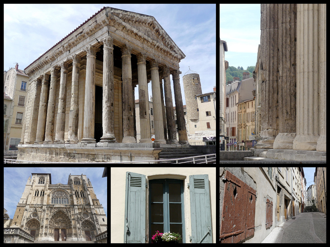
There’s also a theater but it was ‘closed’ for performances so I couldn’t even look at it. But free and always open is the Jardin Archeologique de Cybele, a public garden littered with Roman fragments including a large wall, various terraces and the foundation of several houses, and two large perpendicular archways that would have opened onto the forum.
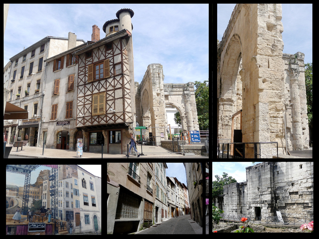
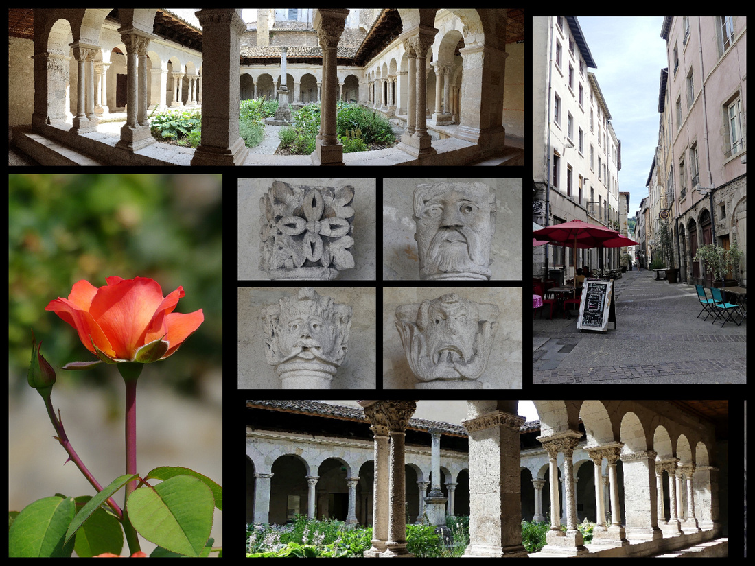 There’s also a couple of impressive churches, Cathedrale St Maurice is huge with intricate stonework on the front, and St Andres le Bas has a very pretty cloister with some well preserved stone carvings. Vienne the city is kind of a dump, not horrible but if it weren’t for the roman ruins it would not be on the tourist map at all. Two hours was plenty.
DIJON
DIJON is the most gorgeous, most French city I’ve ever seen. Perfect size – although the entire city has a population of 150,000, most of the old center is pedestrianized, a mixture of gorgeous medieval half-timbered houses and elaborate French Renaissance facades, almost every street and square is impeccable. The town has a walking tour, “The Owl’s Tour” which has brass plaques in the pavement all along it and numbered plaques in front of the most historic buildings. The TI sells a booklet with information corresponding to each number It’s called the “Owl’s Tour” because the Owl is the symbol of Dijon.
“The historic center of Dijon has been listed as a World Heritage site by UNESCO as well as the ‘climate’ that grow vines on the slopes of the Côte de Nuits and the Côte de Beaune in the Côte d’Or département, Burgundy. Burgundy wine has been produced from the High Middle-Ages and Dijon, the capital of Burgendy, was the trading centre from where the wine activity was managed. The town has kept many marks of its rich pasts in churches, palaces, townhouses and monuments.”
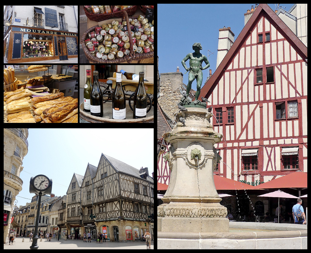
Above top left: products of Dijon including burgundy wine, bread, and of course Dijon mustard; right: the wine fountain in Place Francois Rude; lower left: the main pedestrianized street through old Dijon, Rue de la Liberte
The most interesting square is Place Francois Rude, in the center of the pedestrian area, a strangely shaped charming square, with timber-framed houses, an old fashioned carousel, and a fountain with the figure of a wine-grower treading the grapes. The fountain only provides water, except during wine festivals when, at least historically, actual wine flowed.
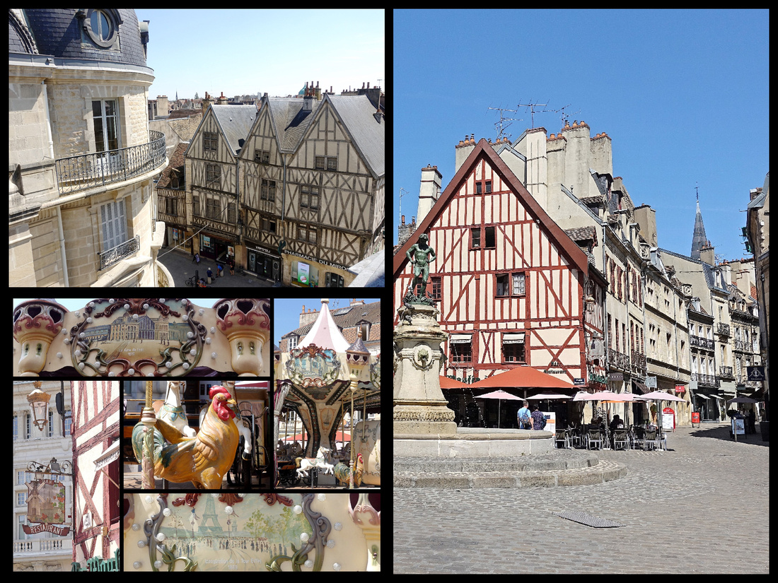
Above top left: view from my hotel room; Right: Place Francois Rude with Rue des Forges leading off it; lower left: the carousel on Place Francois Rude
Leading off Place Francois Rude is Rue des Forges, a narrow street with several exquisite houses.
#40 Hotel Aubriot, 13th Century (originally the money exchange)
#38 Maison Maillard (Milsand), 1560, remarkable Renaissance façade, heavily decorated
#34 Hotel Chambellan, 1490, Gothic flamboyance on the courtyard side
#56 Hotel Morel-Sauvergrain, 15th Century
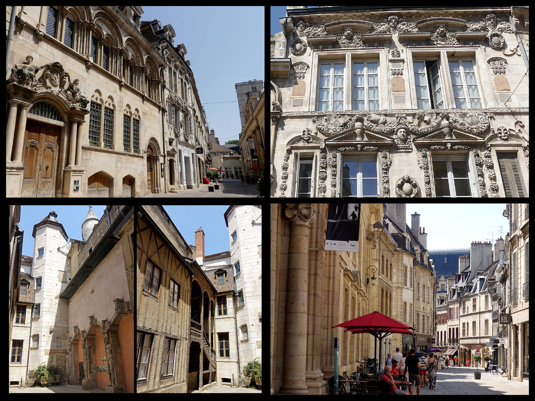 Above top left: Hotel Aubriot; top right: Maison Maillard; Lower left: courtyard of Hotel Chambellan; Lower right: Rue des Forges
The end of Rue des Forges opens up to another square, Place Notre Dame, on one side of which is the back of the Palais des Duc, housing the TI office, and the other side of which is the Cathedral Notre Dame. The original Gothic structure of Notre Dame dates to the 13th Century, with an unusual façade decorated with three large arches and rows of false gargoyles and crowned by “Jacquemart”, the bell which was taken from Flanders after the war of 1383. Originally it was just the male figure, the female was added in 1651 and the male child in 1714 and finally the female child in 1884. Only a few of the many gargoyles are original. Around the back of the church is The Owl of Notre Dame de Dijon, the city’s symbol and unofficial talisman, a stone carving on an otherwise unremarkable corner of the church, and if you touch him with your left hand and make a wish, your wish will come true. Not original to the church, the owl was added—no one knows why or by whom—during construction of a more modern chapel (and by European church standards, “modern” means early 16th Century). Here the narrow pedestrian street is called Rue de la Chouette, “Owl Street.”
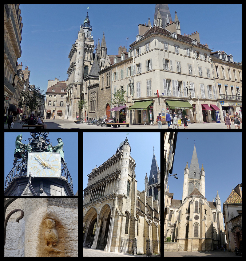
Architecturally suggestive of the city’s former glories, are the lavish townhouses of the rich burghers. These abound in the streets behind the duke’s palace, most notably on rue de la Chouette. Some are half-timbered, with storeys projecting over the street, others are in more formal and imposing Renaissance stone. Around the side corner of Notre Dame (just past the owl) is Maison Milliere – 1483 merchant house with original medieval appearance: a street stall on ground level and family living quarters above. The cat and the owl on the roof are 20th Century. Beyond that, L’Hotel de Vogue is a 17th Century town house (courtyard and garden of which were used in the film “Cyrano de Bergerac” with Gerard Depardieu).
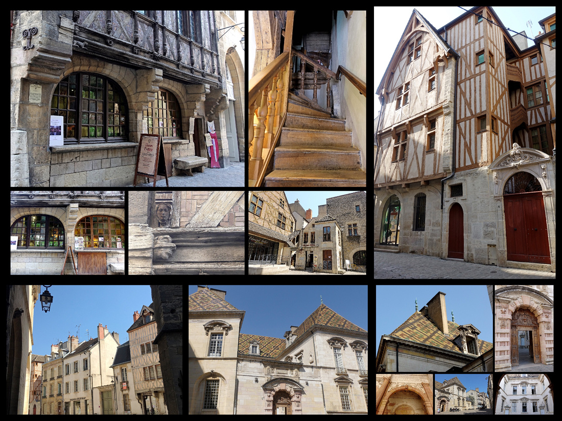
Above top left photos: Maison Milliere; Lower center and right: L’Hotel de Vogue
Around the corner is Rue Verrerie which is the antiques dealers quarter, typical of the middle ages with well-aligned houses, corbelled wooden-beamed walls and arcades.
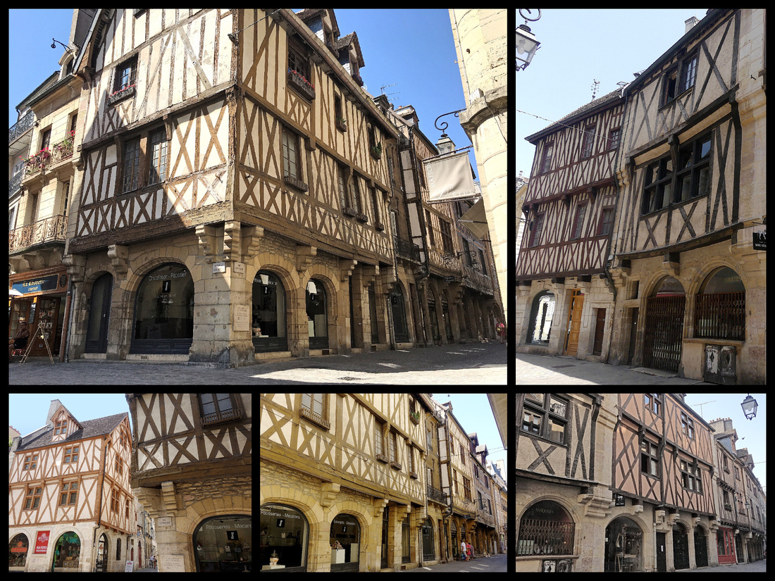
At the opposite end of Rue Verrerie is Place des Ducs-de-Bourgogne, a charming little shady square with a large fountain just behind the Palais des Ducs with the Tour Philippe le Bon (15th century, 316 steps). A couple of different passages lead through the Palais to Place de la Liberation.
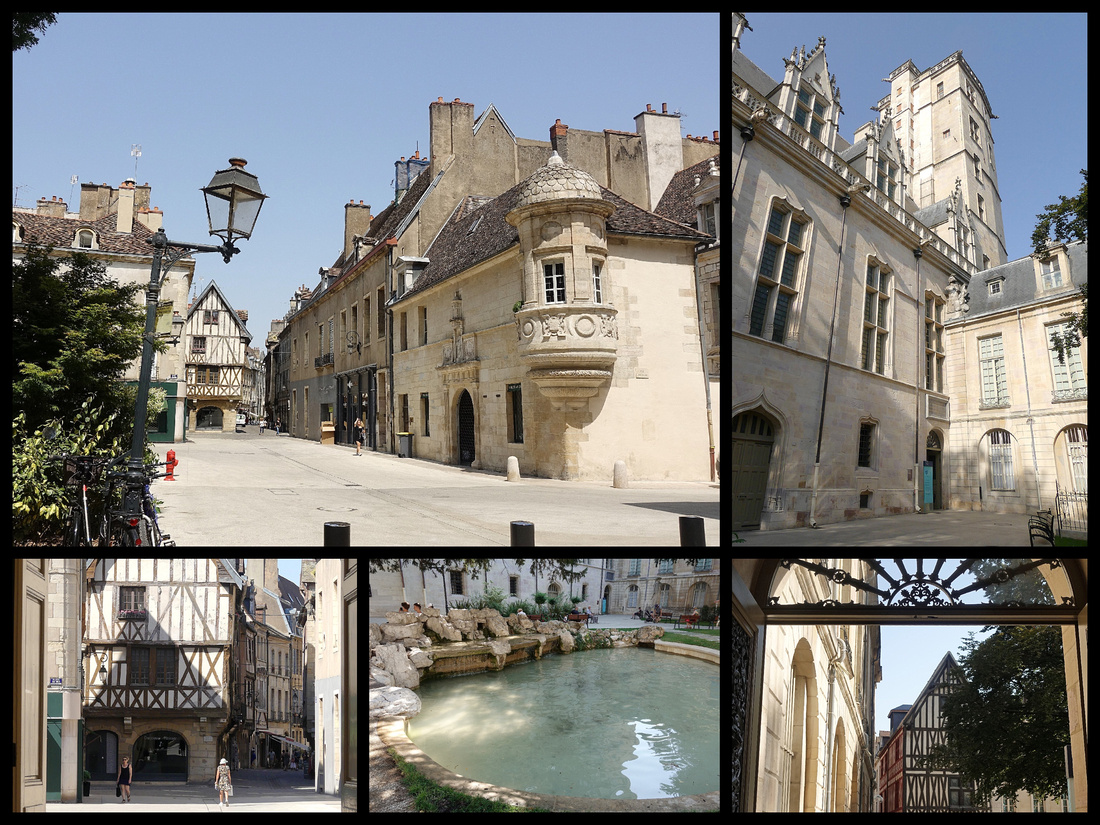
Palais des Duc et Des Etats de Bourgogne was originally built in 1366, reconstructed in the 17th Century by Mansart, the Versailles architect, finished in the 19th Century. Capped with an elaborate tile roof, the complex is arranged around a trio of courtyards. The oldest section is the Ancien Palais des Ducs de Bourgogne, erected in the 14th and 15th Centuries. The newer section is the Palais des Etats de Bourgogne, constructed in the 17th and 18th Centuries for the Burgundian parliament. The Chapelle des Elus (free access via the tourist office) dates from 1738. Today the palace is la mairie (the town hall); all of its newer sections and much of its older sections are reserved for the municipal government and not open to the public. Tour de Bar 1365, is the oldest part, facing the tower is the old palace kitchen, with six grand fireplaces. It was designed according to the model of a medieval dungeon. The east wing houses the Musee des Beaux Arts.

Above top: Place de la Liberation Lower photos: Palais des Duc
Place de la Liberation is the semi circular grand square designed in 1685 by Mansart to receive the equestrian statue of King Louis the XIV; today features several pavement fountains that are lit in bright colors at dark. The statue was melted down to make canons for the revolutionaries in 1792.
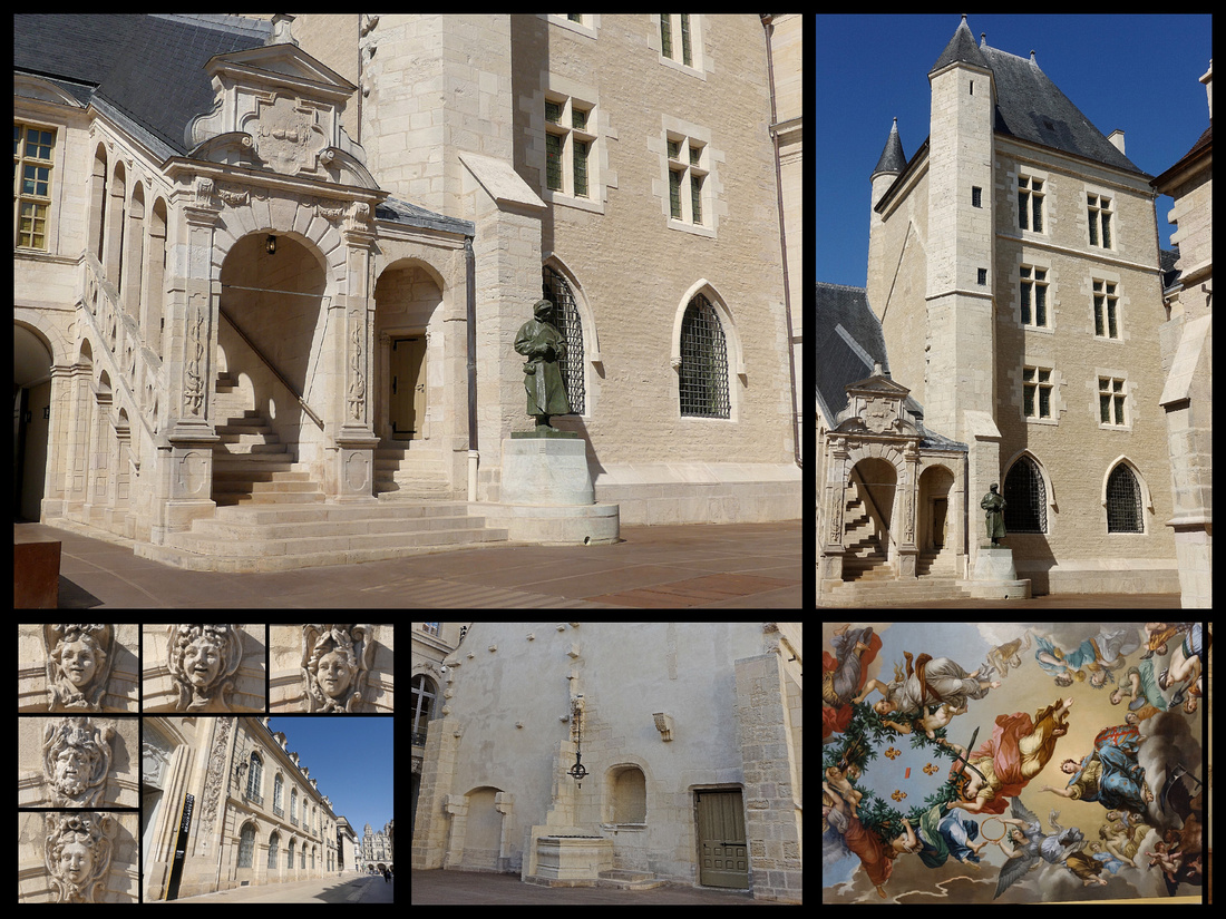
Place du Theatre – The theater is Neo-Classical, 19th Century. Across the street is La Nef, a former abbey church of St-Etienne (now a cultural center), and down the street is Eglise St-Michel which began as Gothic but whose façade is Italian Renaissance.
Palais de Justice – designed for the old Burgundy Parliament in the 16th Century
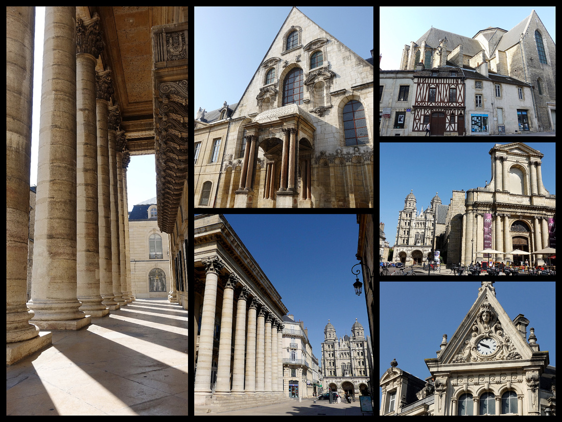 Above left: Theater; Top center: Palais de Justice; Top right: back of La Nef ; Middle right: La Nef in the foreground, St Michael in the background
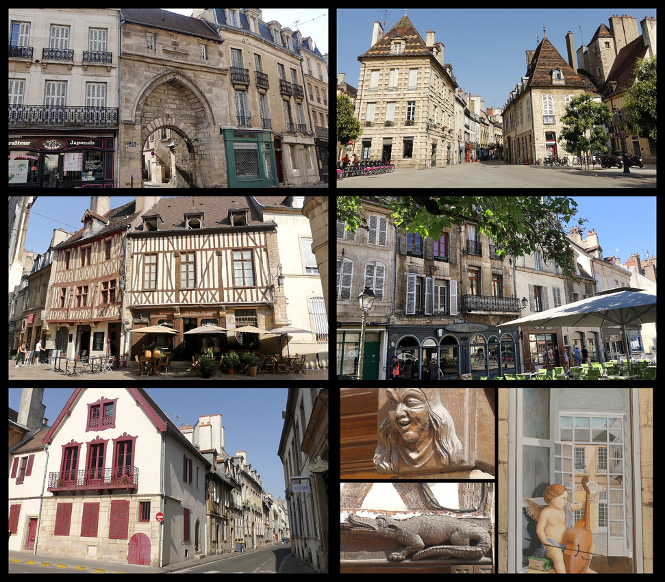
Saint-Benigne – The second major church in Dijon besides Notre Dame, Saint Benigne is Burgundian Gothic with a flamboyant polychrome roof and has the highest bell tower in Dijon. Inside it is a fairly typical, average sized catholic church, made nicer by the sun coming through the stained glass and music (recorded, not live, but lovely female voices). The highlight though, and the only part that charges a fee (€2), is the circular 6th century crypt.
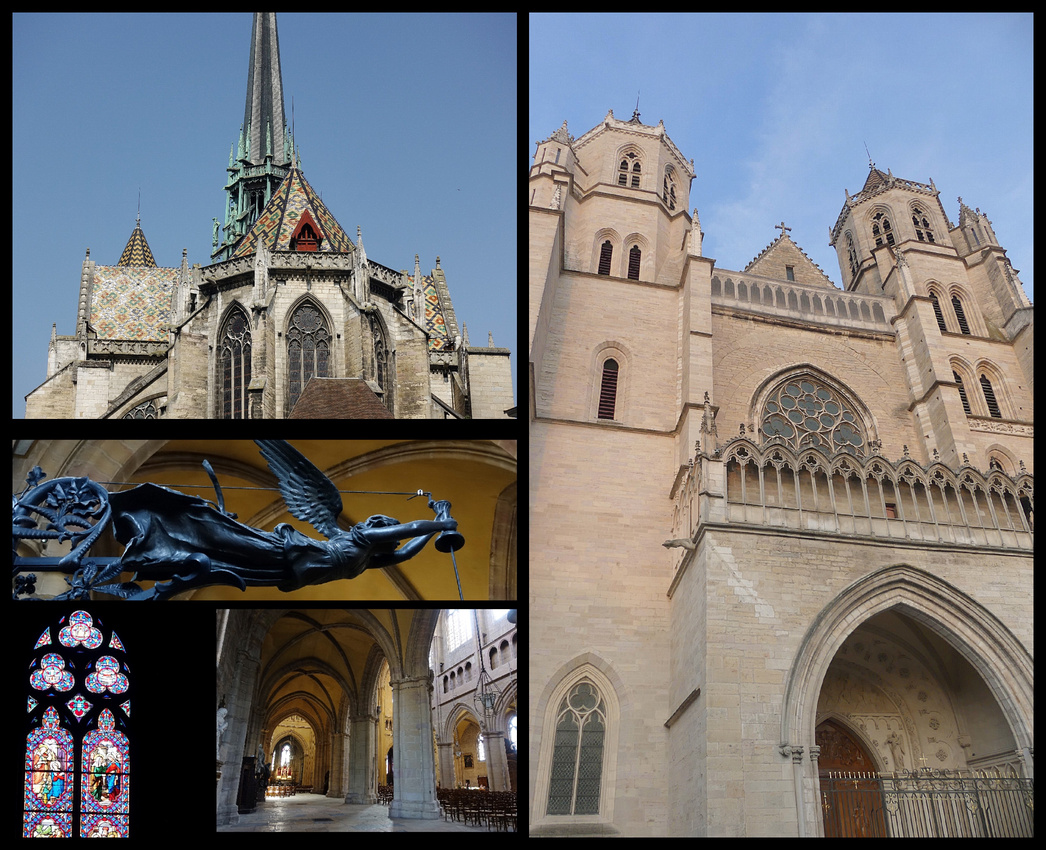
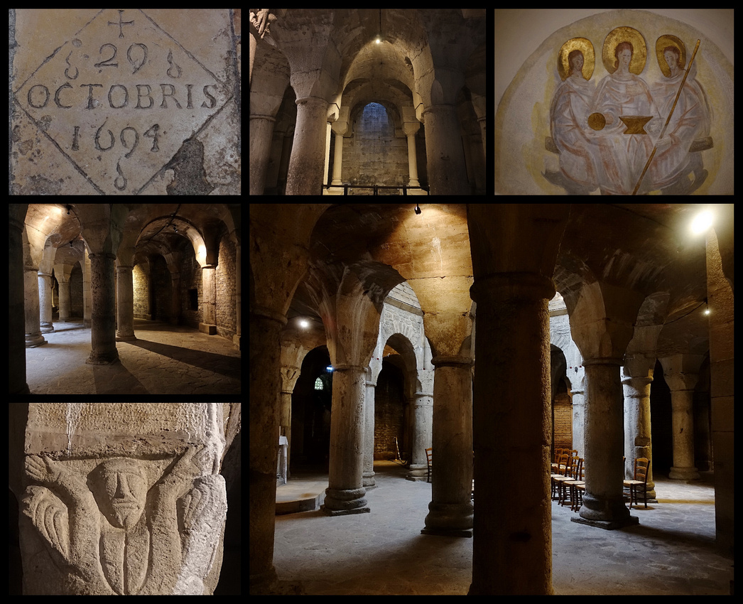
In the abbey next door is the Archaeology Museum. The lowest level has Roman statuary and other carvings, none in particularly great condition but for a free museum of this size they were quite good. The next level is full of graceful columns and arches, the top level had displays on evolution.
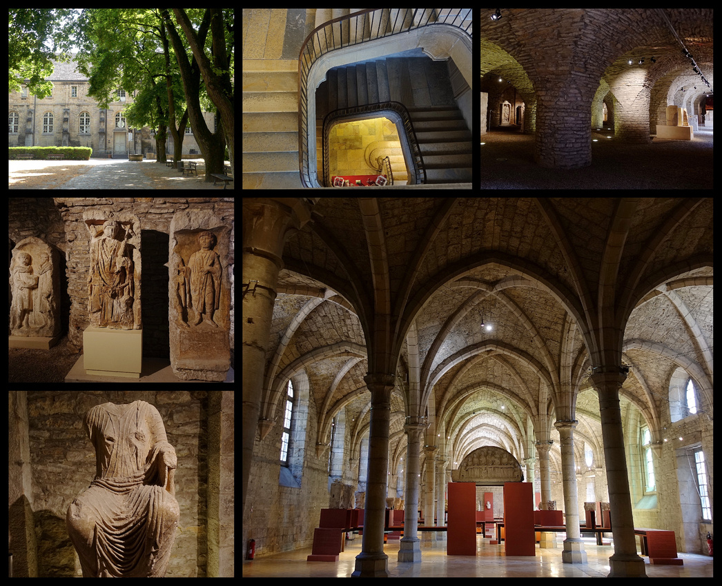
Nearby the Couvent des Bernadines houses the Musee de la View Bourguignonne (Museum of Burguandian Life) a collection of rural ethnography costumes, furniture, etc depicting daily life from the 18th-20th centuries. There are also recreations of 11 shops that used to be in Dijon including a pharmacy, grocery, hat shop, clock maker, etc. The cloister of the convent is austere but nice.
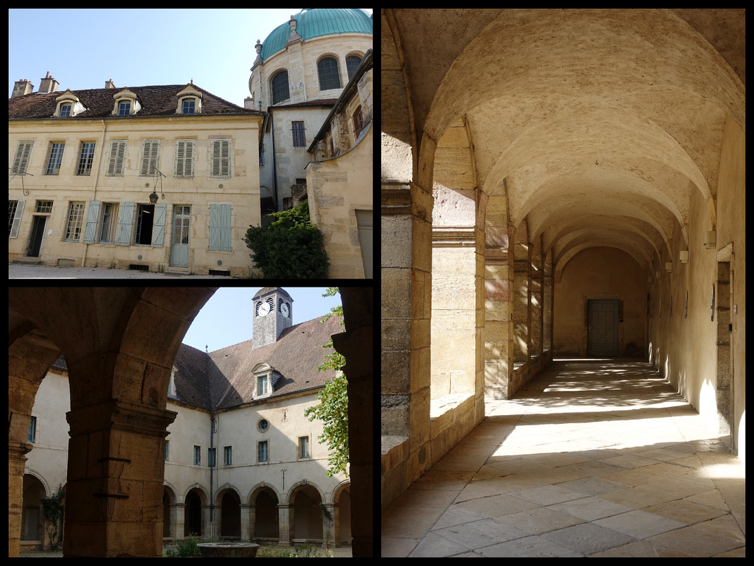
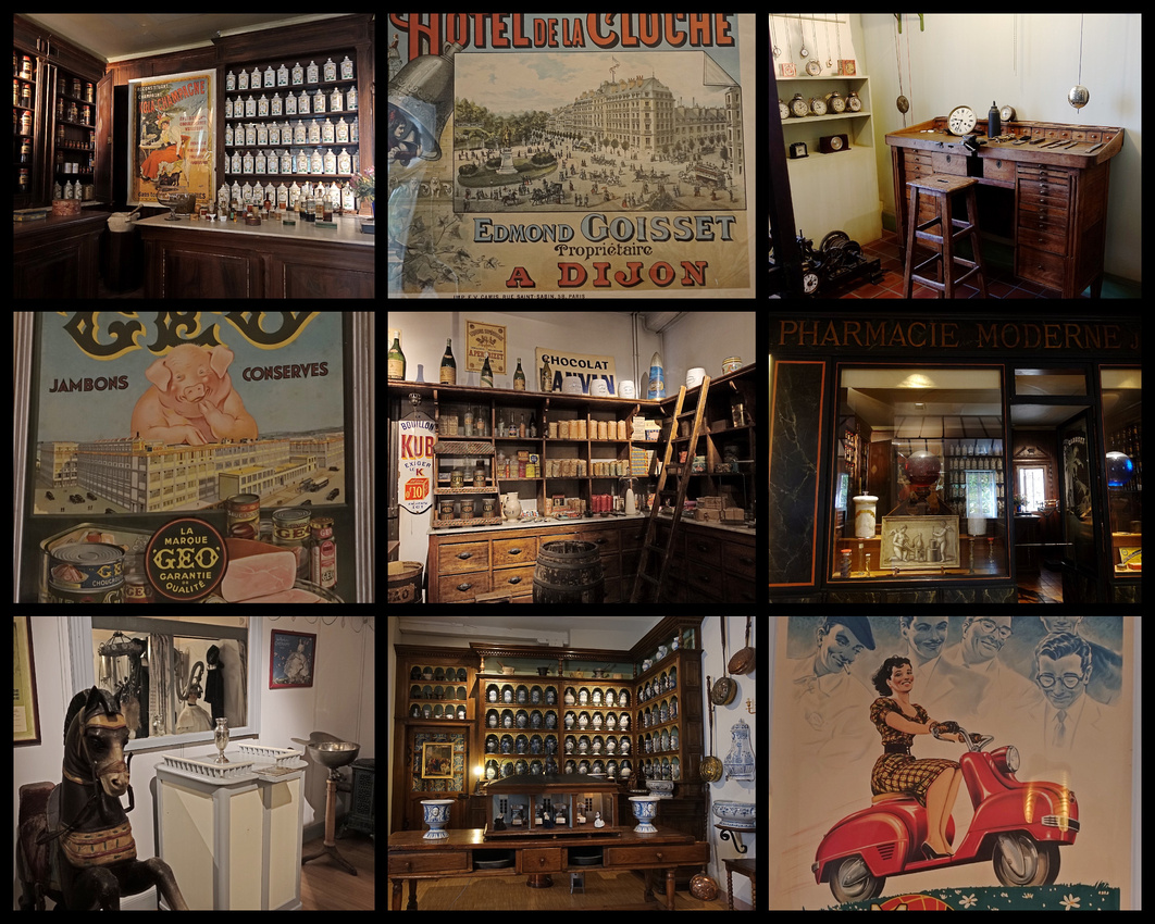
Musee des Beaux Arts – also free – pretty decent art museum for a city this size. Mostly French artists I’ve never heard of, none of the ‘major’ works but a nice variety of, some of which I liked and it is housed in one of the best preserved medieval palaces in France. Some of the rooms have been done over and look like generic museum rooms, but a few are preserved as palace rooms. There are middle ages and Renaissance works plus contemporary pieces all kind of jumbled together which was actually more interesting than confusing. The tombs are the most well known.
A short walk from the Dijon Gare is the Jardin Darcy the town's first pubic garden . The garden features a lovely pool of blue-green water and is guarded by a "white bear" sculpture. Across the street is the Hotel de la Cloche, from the 15th century. And across the square from that is, Porte Guillaume, an 18th century triumphal arch, originally part of the town ramparts which were torn down in the 19th century leaving it standing alone in the middle of the square. Rue de la Liberte, the major pedestrian shopping street through the old city begins here.
One block north of Rue de la Liberte, Place Grangier is the site of the Hotel des Postes and an Art Nouveau building – totally different architectural styles designed at the same time by the same architect. Just past this is the Dijon Market, built in 1873. Athough housed in an impressive glass and iron building, unfortunately as European markets go, it was a dud.
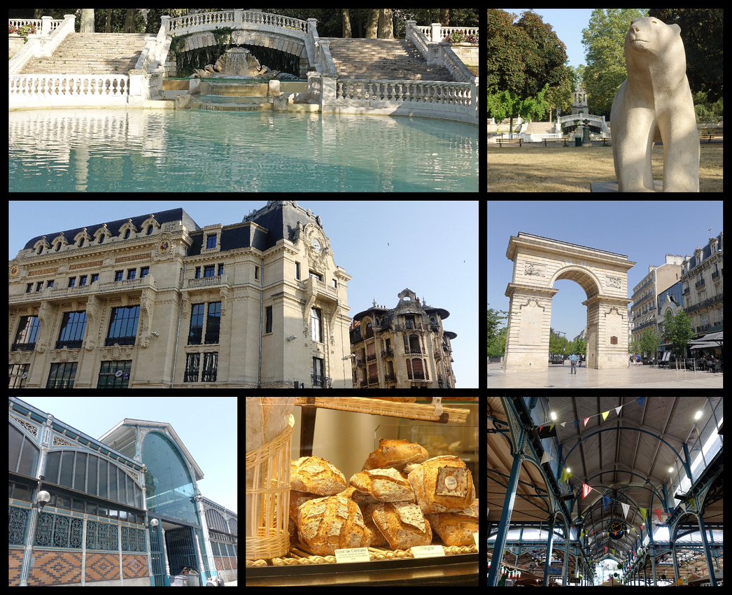 Above top: Jardin Darcy; Middle left: Hotel des Postes with the art nouveau building beside it; Middle right: Port Guillaume Lower: Dijon Market
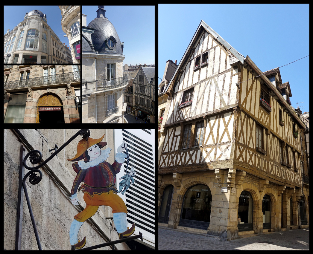
Above left: City Loft Apartments entrance and view from my room.
Dijon is a beautiful little city, just large enough that you don't get bored in an hour, small enough to know your way around the center easily enough. Even with doing the Owl walking tour, visiting three museums, two churches and a crypt two days was plenty. It would make a wonderful place to base to do day trips to the surrounding region.
I stayed at the "City Loft Apartments", which for €71 night/single was one of the best bargains of the trip. The room was gigantic, with a kitchenette, right in the center of the old town (ten minute walk from the train station) with a fabulous view.
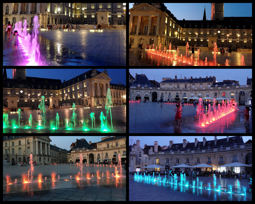
Place de la Liberation with it's multiple pavement fountains was lit with alternating colors in the evening, children were playing in the fountains (the high temperature while I was in Dijon was 102 F), the square is surrounded by restaurants with outside seating and was a lovely place to be in evening watching the sky turn deep blue and the lights come on the magnificent buildings turning them golden.
]]>
Marseille is Frances second largest city (population 869,000) after Paris, France's largest port, and the oldest city, having been founded by the Greeks in 600 BC.
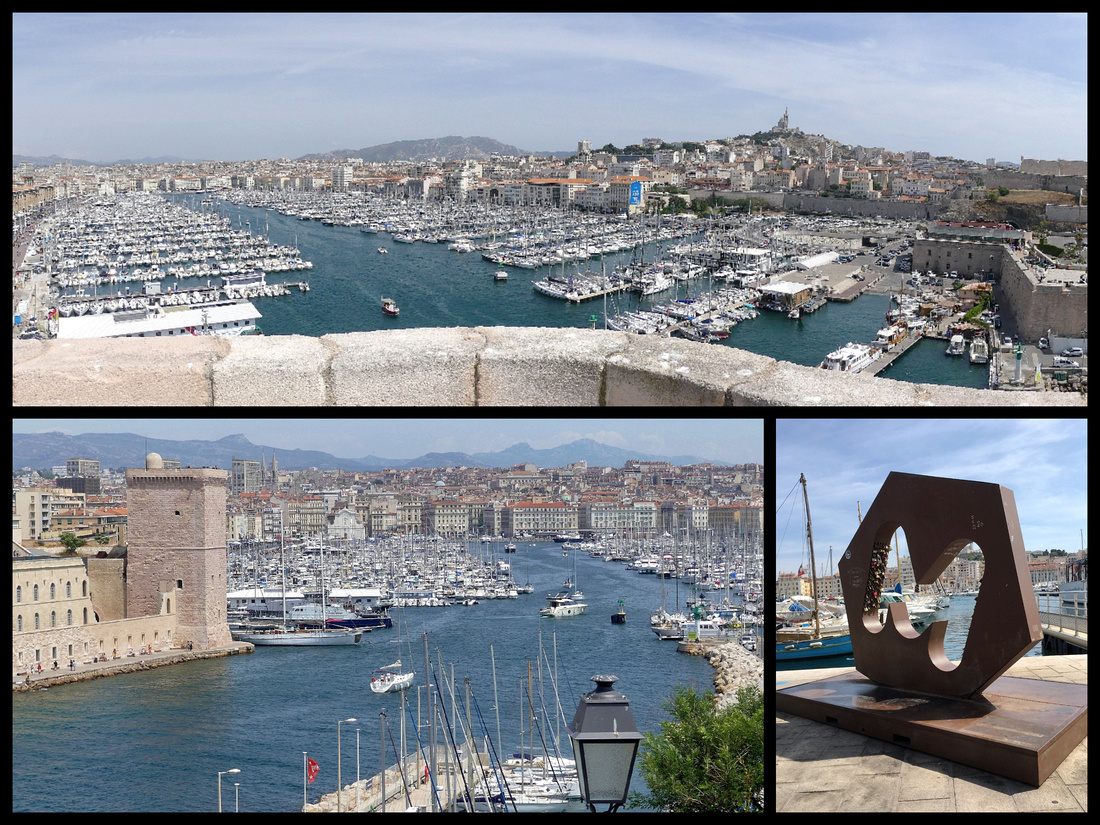
I arrived in Marseille at the main train station, Gare St Charles, a beautiful 19th century station (but totally modern inside, bright and clean). As you exit there’s a view of the city below you and a ‘monumental’ grand staircase – art nouveau with gorgeous lampposts and statues and palm trees. At the bottom of the stairs Boulevard d’Athenes is a bit gritty but lively with every imaginable ethnic market and eatery, the aroma was exotic and enticing. Short walk to La Canebiere, the main thoroughfare that runs down to Vieux Port. And then there’s the port, really huge for an ‘old’ harbor. Rectangular shaped with a wide promenade on three sides and full of every imaginable kind of boat. Marseille has the feeling of a combination of Palermo, Genoa, Athens, Paris and New York. It's long had a reputation for being 'seedy' but while it is certainly a bit 'gritty' the central part felt totally safe, the setting on the Mediterranean is beautiful, and I thoroughly enjoyed my week there.
I stayed at the 'Residhotel', essentially hotel but all the rooms have kitchenettes. Great location, literally a half block from the top of the Vieux Port, 2 quick metro stops from the train station ( or 20 minute walk). Not upscale or fancy but clean and comfortable, kitchenette had stove, fridge and microwave. Booked it on booking.com 82€ night/single (but it was a double room).
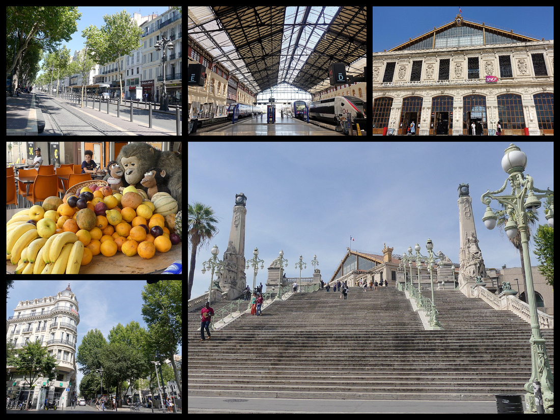
Vieux Port – The head of the port is Quai des Belges where fishing boats still unload their catch for sale every morning. There is also a new modern ‘feature’ – a huge mirror canopy suspended high above the pavement– “Le Ombriere” provides shade and adds visual interest. In the evening this quai is full of street performers and people selling stuff on blankets laid out on the pavement – hats, electronics, etc. as well as hair braiding, henna tattooing, and people selling mint tea.
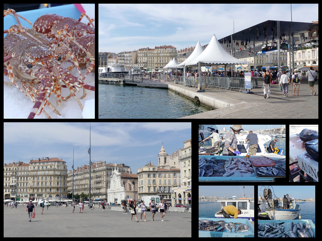
The north side of the port, below Le Panier, Quai du Port, has a large pedestrianized promenade, lined with craft tents of people selling local produce and crafts (soap is a BIG thing in Marseille). The first few buildings are very Parisian (La Samaritine) looking, the rest are 20th century, except the Hotel de Ville, 1673, Genoan Baroque with a huge bust of King Louis XIV and colorful flags. Just behind that is a large square (little kids playing soccer) with several other old buildings: La Maison Diamantee -1570 with carved faceted stones on the façade, Pavillon Daviel, 18th Century former courthouse in Provencal style, and Hotel Dieu – originally a hospital, rebuilt in the 18th Century and now a luxury hotel. And just up the hill from these is the Accoules Church, the second oldest in Marseille, the main part was demolished during the revolution but the bell tower remains. Le Panier district begins here.
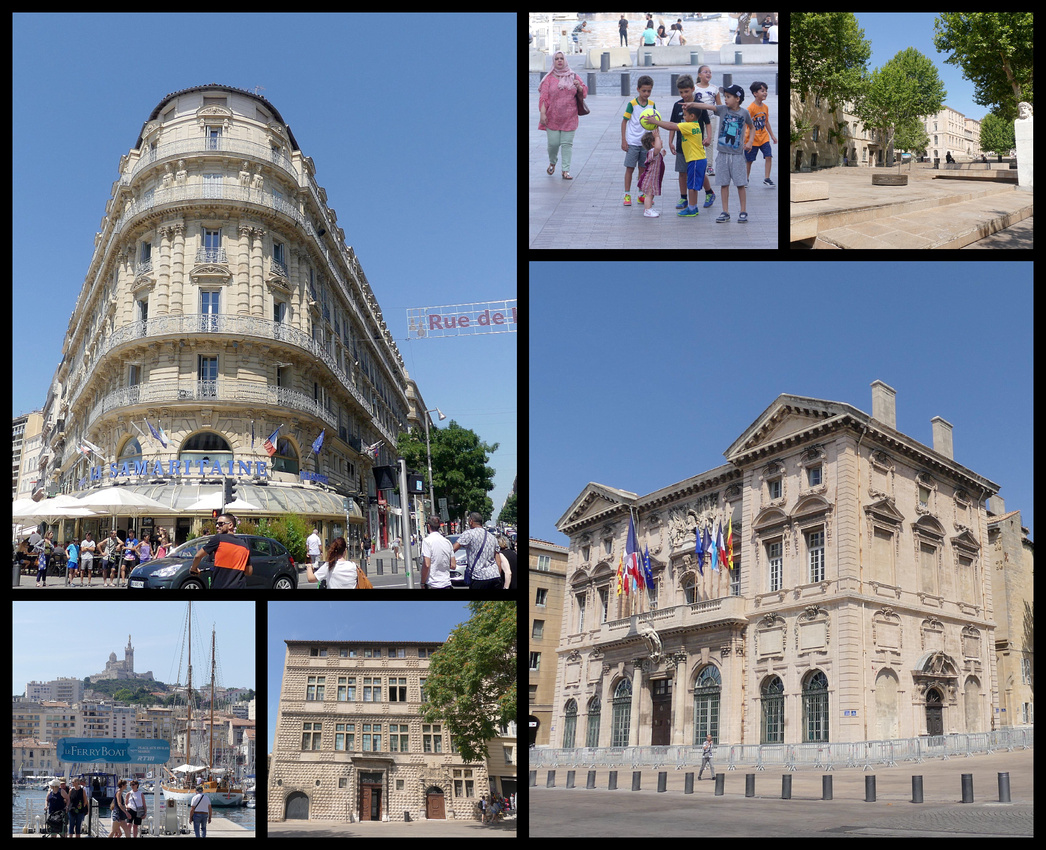
The opposite side, Quai de Rive Neuve has more car lanes, less sidewalk but both sides are lined with restaurants, bars, cafes. The buildings around the harbor are for the most part not terribly interesting. I did find Bar de la Marine, (#15 Quai de Rive Neuve), a 1930s sailor's haunt with an old zinc bar and a mezzanine that was the scene of the salty barkeeper’s saga in the 1932 film Fany and of Jamie’s proposal in 'Love Actually'. There are a couple of larger squares just inland from Quai de Rive Neuve, Place auix Huiles and Place Thiers. 'Le ferry boat' crosses the harbor midway, from in front of the Hotel de Ville, takes 10 minutes and costs 50 cents, and has been a feature of Le Vieux Port for ages. And it does cut down on a good bit of walking if needing to get from one side to the other.
Le Musee Du Savon - the museum of soap. Savon de Marseille is a traditional hard soap made from vegetable oils that has been produced around Marseille for about 600 years. The first documented soap maker was recorded there in 1370. By 1688, Louis XIV introduced regulations limiting the use of the name savon de Marseille to olive oil based soaps. By the 1920s there were 132 soap companies but today there are just 5. Traditionally, the soap is made by mixing sea water from the Mediterranean, olive oil, and the alkaline ash from sea plants in a large cauldron, then heated for several days, stirring constantly. It is then poured into a mold, cut into bars and stamped. The whole process can take up to a month. The museum is privately owned by a guy who has had soap makers in his family for generations. He charges €2 but gives you a ticket you then take next door for a bar of soap worth €1.75 so the museum is effectively free. Small but well done. Soap seems to be the primary souvenir sold all over the city.
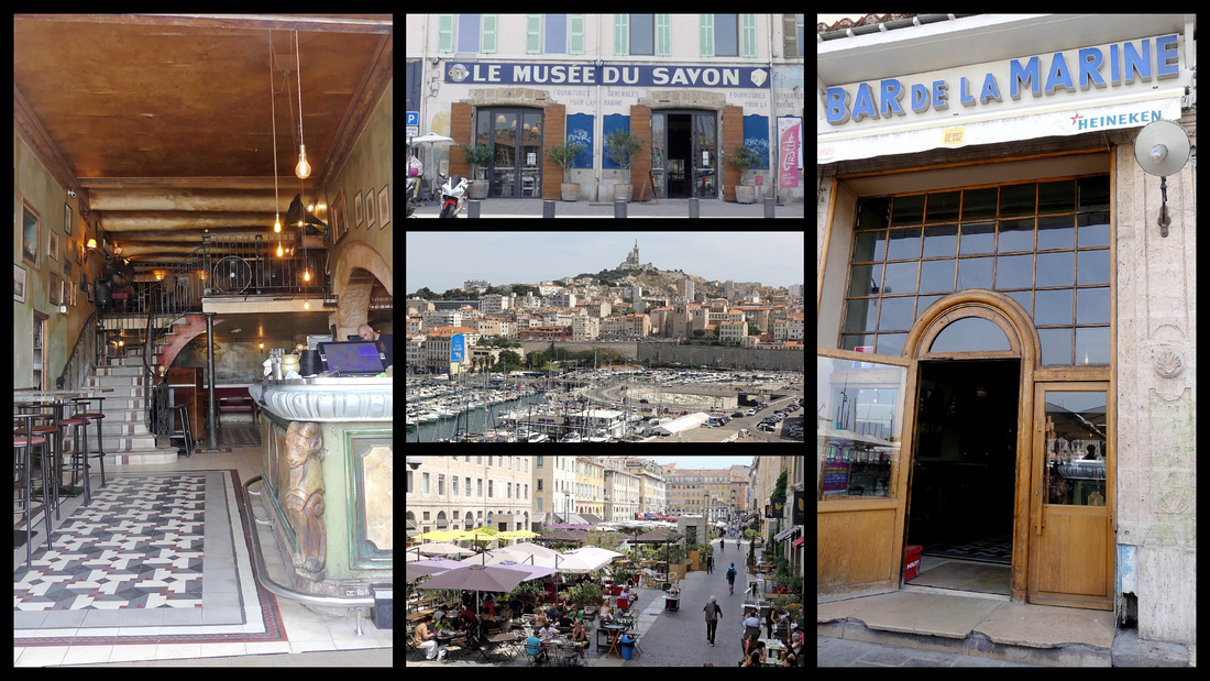
Fort St Jean was built in 1660 by Louis 14th and is beautifully restored. It houses the Museum of European and Mediterranean Cultures, for which you need a ticket, but you can explore the whole fort, including climbing the keep and ramparts and courtyard for free. More fabulous views. The site of the fort has been occupied since Antiquity and in the 13th Century the order of the Knights Hospitallers of St John (future Knights of Malta) built the original fort.
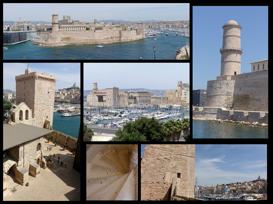
Le Panier – when the Greeks landed in Marseille 2600 years ago this is where they landed. No signs of Greeks today (there is a mural depicting their arrival, near the cathedral) but it is the oldest neighborhood with narrow, steep (and more often than not, stepped) streets lined with tall houses in various states of disrepair giving the area that ‘colorful shabby’ ambiance. Lots and lots of street art – murals everywhere. Lots of regular graffiti as well but there is so much of it, and most of it so well done that it really ads rather than detracts. Flowers in flower boxes and pots, laundry flapping in the breeze. Several small tree lined squares – Place de Lenche, Place des Treize Cantons, Place des Moulins, Place de Pistoles. A few cafes, some art galleries, a few shops – mostly quirky, nothing very upscale but all very interesting. Le Panier means ‘the basket’. This area was a melting pot where immigrants from Naples, Corsica, Catalonia and rest of the Mediterranean coast mingle with the French West Indies, Africa and Vietnam. The Panier became a working-class district when the Marseille middle-class decided to move out in the 17th century to relocate in the new districts, the people who remained largely made their living from the sea – fishermen and sailors.
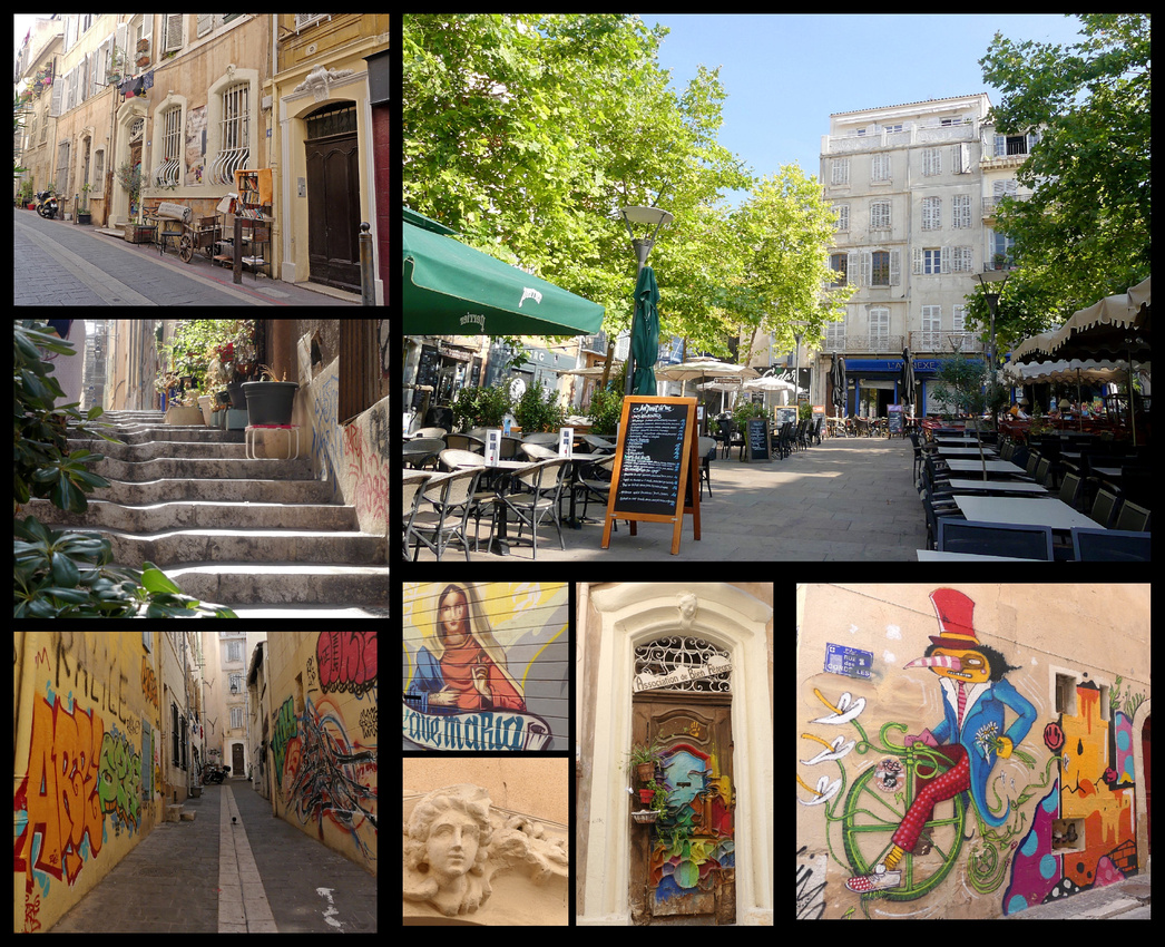
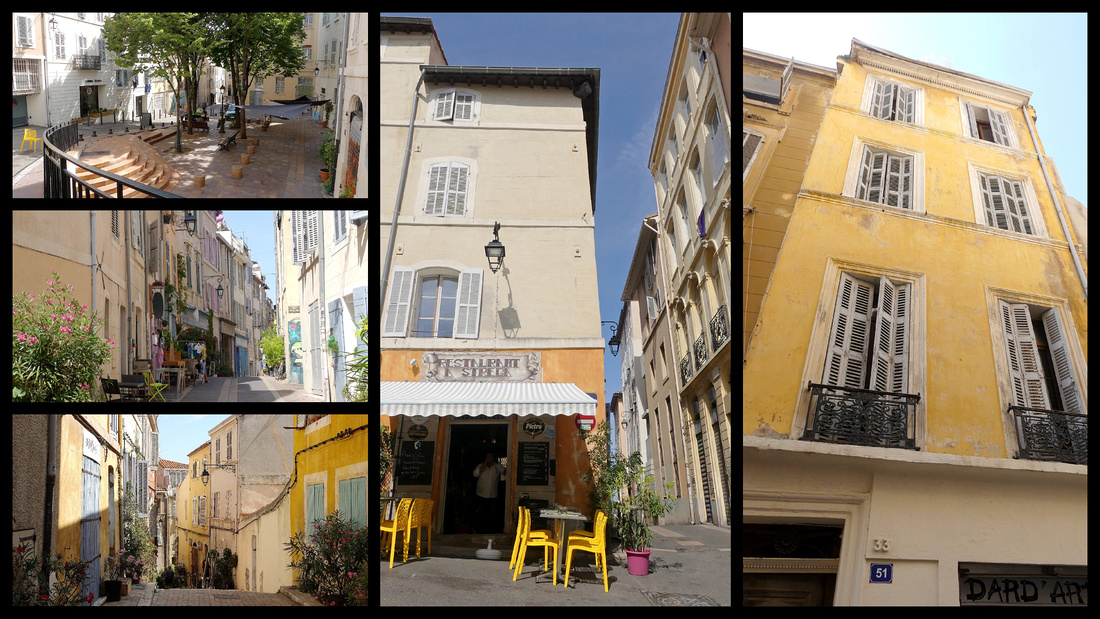
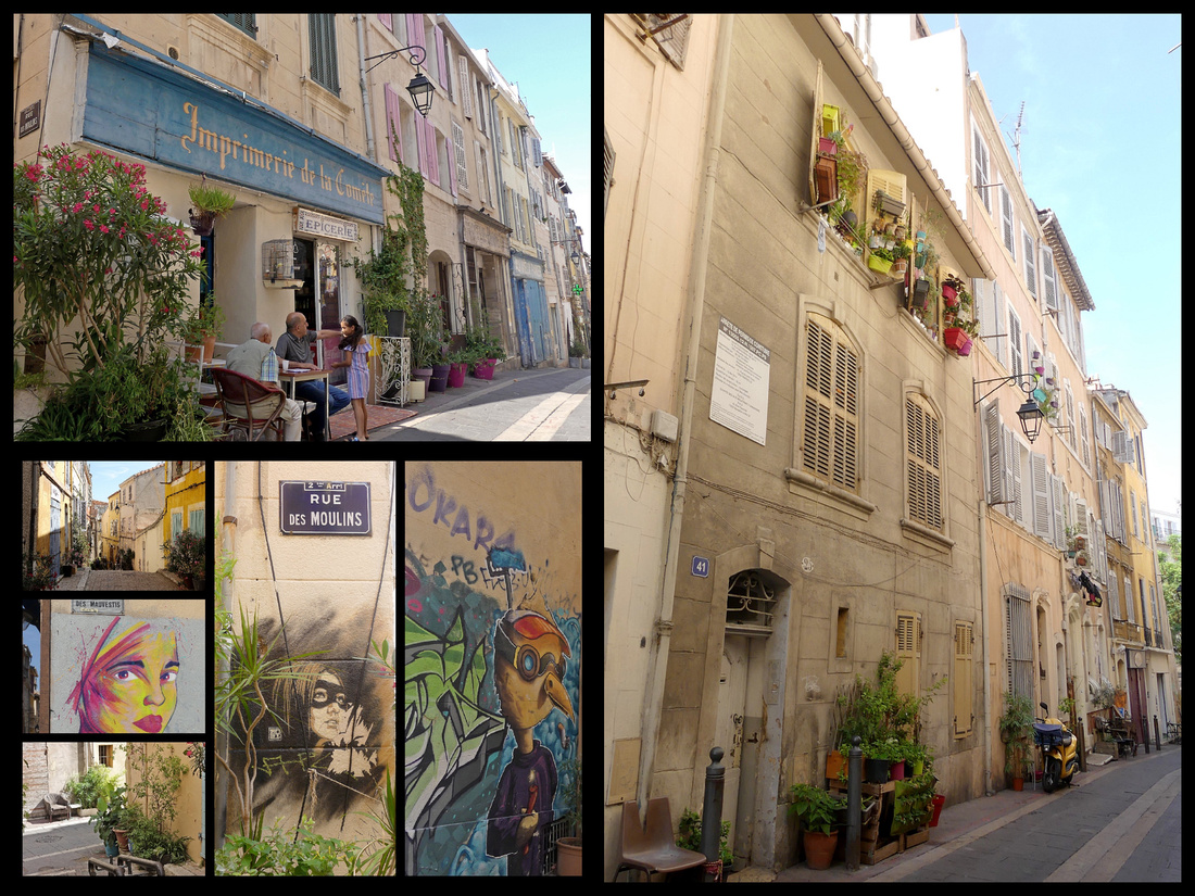
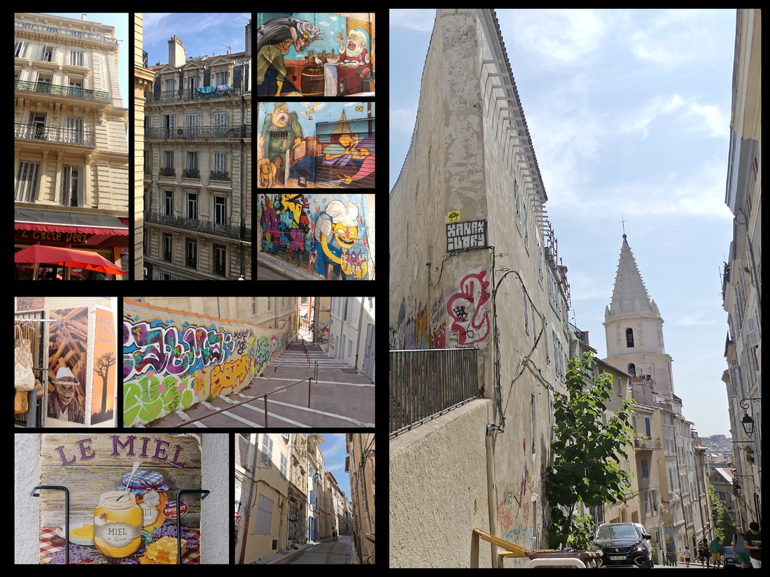
Above top left: View from my hotel, street art in the lane near it; Right: Accoules Church tower from La Panier
One of the major ‘sites’ in the area is the Cathedrale de la Major - Roman Byzantine finished in the 19th C. Largest built in France since the Middle Ages. Right next to it is the 12th century Romanesque Church it replaced. Opposite the two cathedrals, on esplanade de la Touret, a mural illustrates the ancient Greeks arriving at Marseille, and at the end of the esplanade, opposite Fort St Jean is the small Romanesque Church of St Laurent, built on the site of a Greek Temple of Apollo.
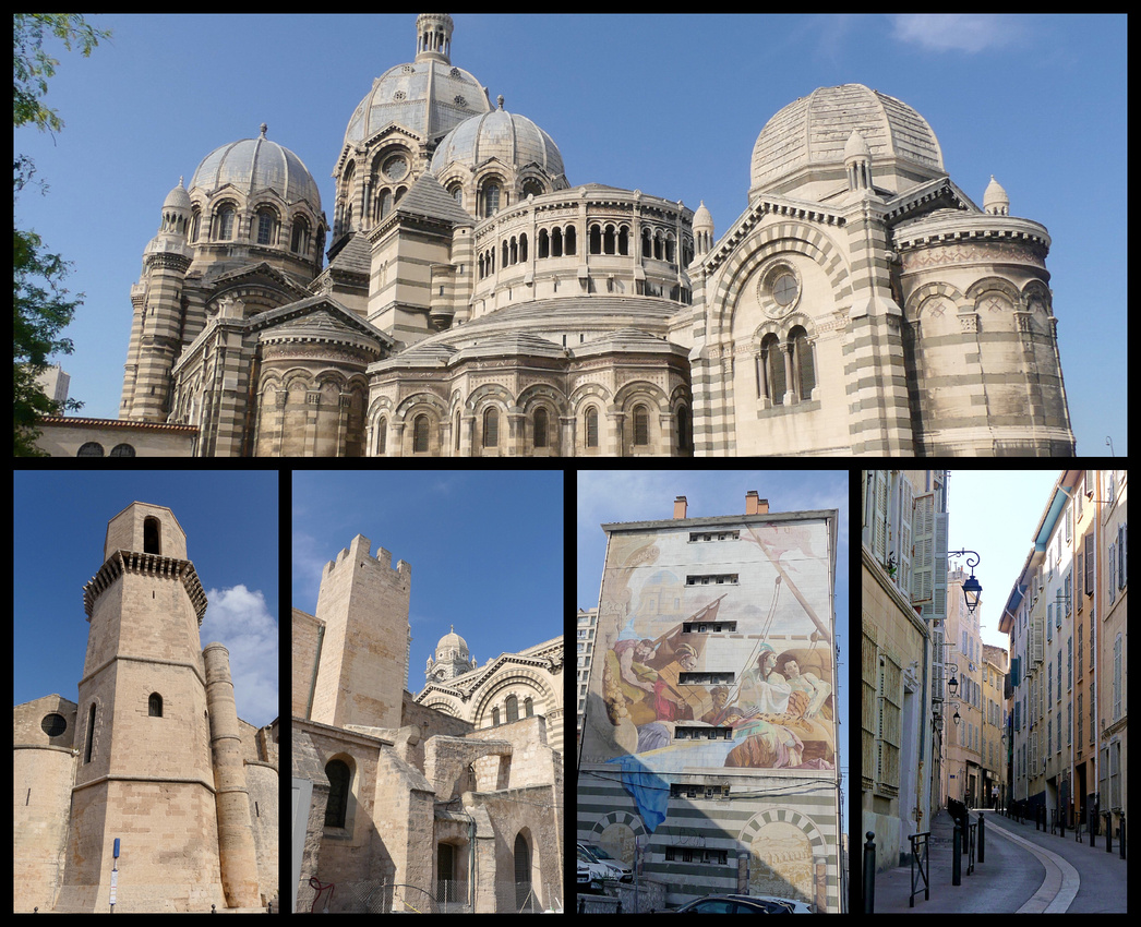
Above top: Cathedrale de la Major Lower left: St Laurent; 12th Century church in front of Cathedrale de la Major; Mural of Greeks arriving in Marseille
The other major site is the Vieille Charité, Marseille's architectural gem. Built between 1671 and 1749 to care for the city's paupers and sick, this former hospice is a masterpiece of Italian Baroque. It consists of a rectangle of arcades on three stories nestled around a courtyard with a Baroque chapel with unique oval shaped dome) in the center. The complex houses several museums for which you need a ticket, but you can explore the building (all three levels) and courtyard for free.
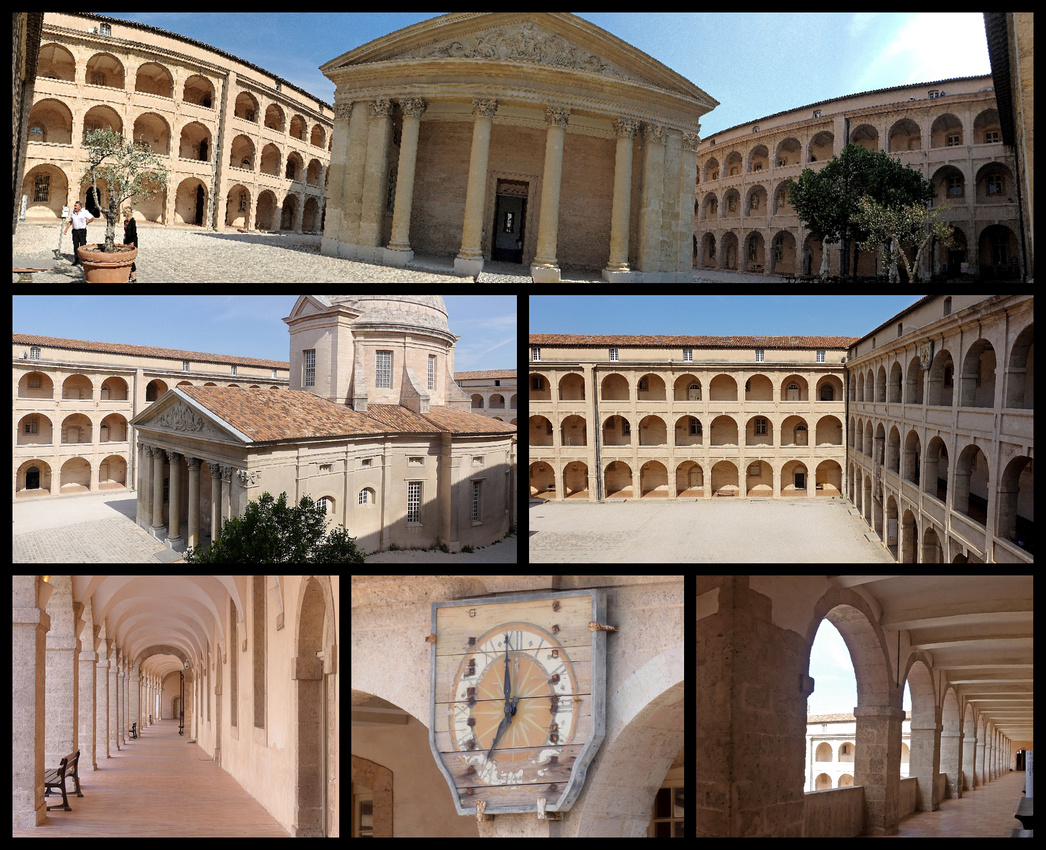
The major ‘site’ on north side of the harbor is Notre Dame de la Garde, high on the hill which can be seen from virtually everywhere in the city (in fact it was the first thing I saw coming out of the train station). Neo-Byzantine finished in the mid 1800s. Notre Dame de la Gard was built on the foundations of an ancient fort at the highest natural point in Marseille, a 149 meter (489 ft) limestone outcropping. Originally an enlargement of a medieval chapel, it was transformed into a new structure in neo-Byzantine style in 1852. This is where sailors went to thank God for surviving shipwrecks and there are model boats (and one airplane) suspended from the ceiling and paintings of ships and the sea on the walls. Beautiful mosaics and marble work. The interior is nowhere near as large as it appears (you can see the basilica from virtually everywhere in Marseille). The 11 meter tall gold Madonna and child topping the huge bellower makes it seem larger than it is. The views are of course, stunning and include all of the Vieux Port, the Chateau d’If in the harbor and the beginning of the calanques.
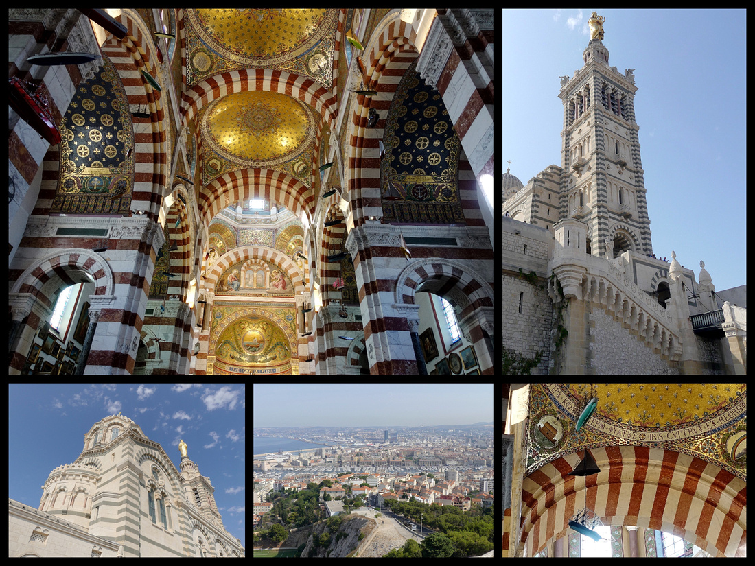
Abbaye St-Victor, a genuinely superb ancient church. The above ground portion of the abbey dates from the 11th to 14th centuries and looks like a fortress, but the main interest is in the spooky 5th century crypt. Marseille's oldest church (1600 hundred years, one of the oldest in France), was originally part of a monastery founded in the 5th Century, the church was enlarged and fortified – a vital requirement given its position outside the city walls – over a period of two hundred years from the middle of the 10th Century. It looks like a more like a fortress than a church. The crypt is a fascinating, crumbling warren containing several chapels and passages, and a series of antique, pagan and Christian sarcophagi. Much larger than most crypts, it’s essentially the same size as the church above. Free. Crypt €2.
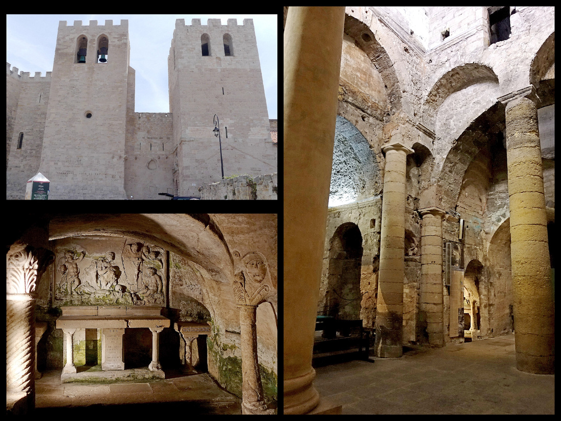
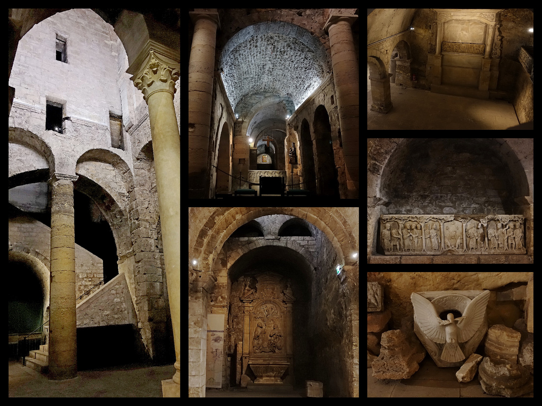
Both sides of the harbor are guarded by massive fortresses. The north side has Fort St Nicholas, massive but largely in ruin. It was built in 1660 on the orders of Louis XIV. The site itself is even older and once held a tower used to operate the chain that closed the entrance to the port. It was taken as a trophy by an army from Aragon in 1423 and is now in Valencia cathedral in Spain. When Napoleon built the Palais du Pharo the fort was cut in two to allow for a road and has been in ruin since.
Just beyond Fort St Nicholas is the Palais and Jardin du Pharo. Château du Pharo, built in the 1860s by Napoleon III for his empress (now a convention center) is surrounded by a nice park with drop-dead gorgeous of the whole port and the much more impressive Fort St Jean across the harbor.
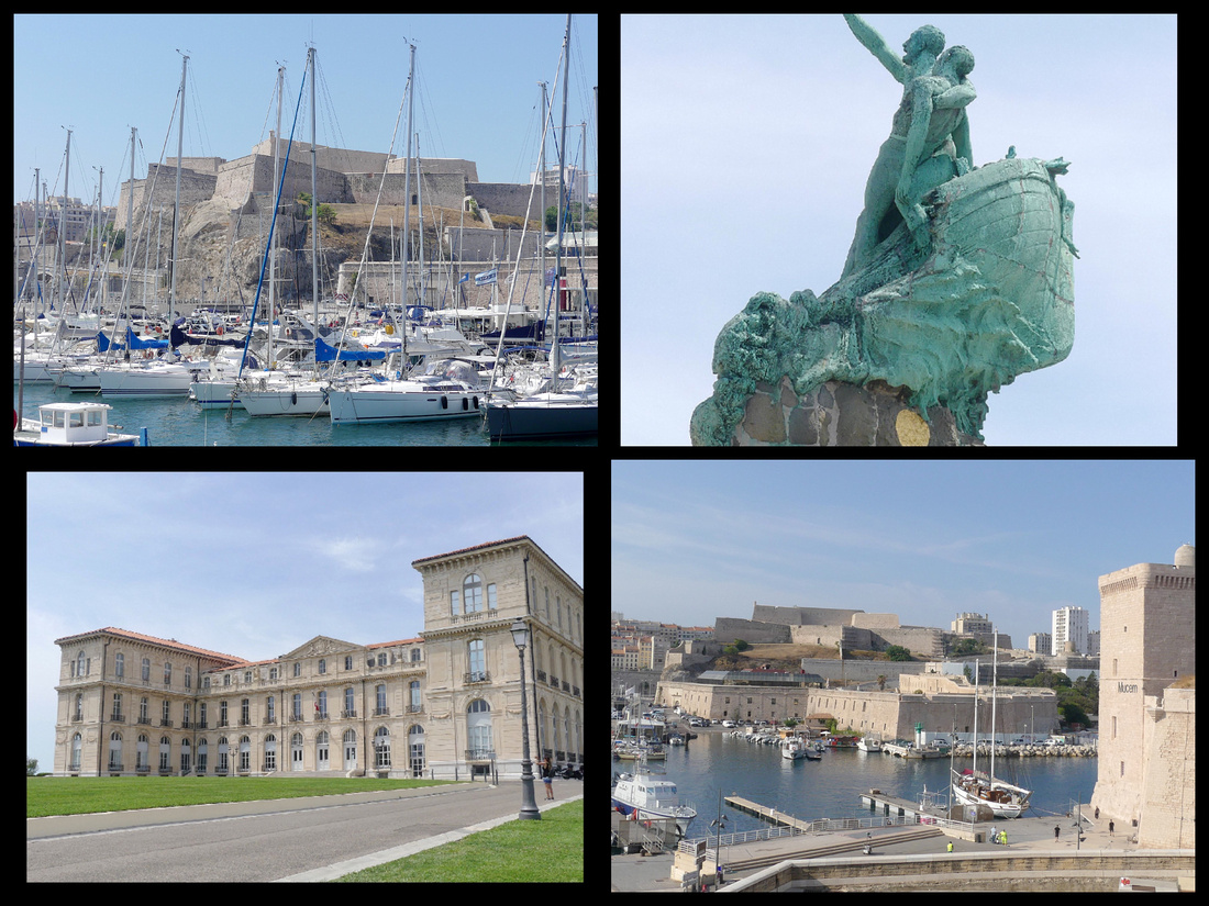
Vallon des Auffes, along the Corniche President John F Kennedy, is the nearest Marseille gets to being picturesque, with small fishing boats beached on the rocks and narrow stairways leading nowhere. There are steps from the road down under the bridge to the harbor. The vallon is a three arch bridge over an inlet from the sea to a tiny harbor.
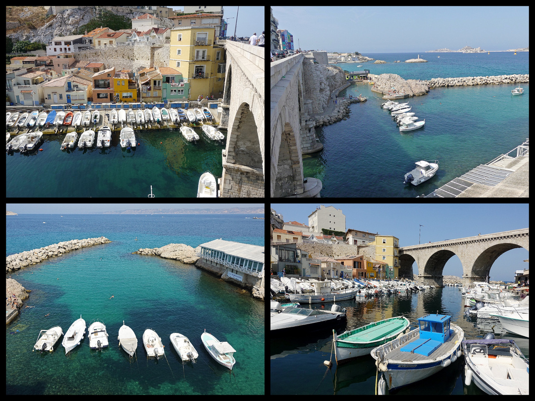
I had read that the Corniche President John F. Kennedy was 'dominated' by elegant late 19th century Belle Epoque villas. Not quite, there are a few but mostly it's 20th century rather homely buildings, but the view of the water is fabulous, multi shades of blue and green, white rock. There are a couple of small ‘beach’ areas (the one actual beach is further down the road), some boats, views out to Chateau d’If. Worth taking the bus to the area and walking along the cornice for a ways but would be a boring walk to try to walk there from the city center or to walk further than the Vallon des Auffes, as it goes inland for quite a ways. Bus 83 is frequent and takes 10 minutes from Vieux Port.
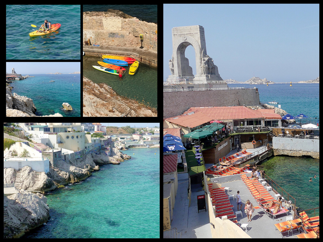
Calanques National Park Boat trip. (€30, 3¼ hours), departs at the top corner of the Vieux Port (2 minute walk from the hotel). There are two options, the ‘grand’, which I did, and the ‘petite’ (24€, 2¼ hr). About 3 of each per day unless the seas are too rough and then they cancel. Boats holds between 150 and 200 with upper deck outside and lower deck in and outside seating. Goes right by, but doesn’t stop at, Chateau d’If, famous as the site of the prison in the Count of Monte Cristo. The National Park consists of the coast between Marseille and Cassis and much of it lies within Marseille city limits which makes it the only European National Park within an urban area (though after the first ten minutes of the boat ride you would never know).
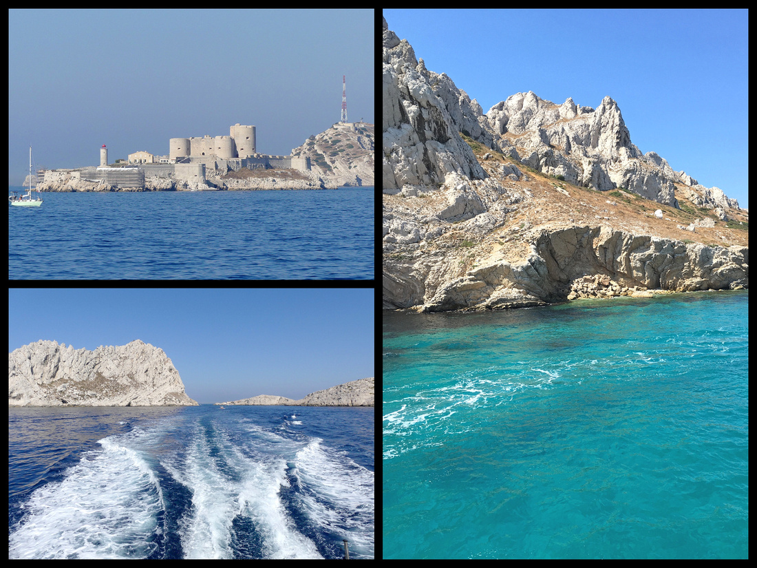
The word calanque comes from the Provençal cala, meaning "steep slopes." Fjord like coastal valleys create steep inlets. They're similar to fiords, created by glaciers, but these gorges have been created by the raging sea. Cliff faces overhang the sea which attracts rock climbers and deep-sea divers. The coves cut deep into limestone rock walls, forming pools of seawater that are as calm as lakes. Because the light reflects off the white limestone, the water appears a stunning turquoise color. It has the highest maritime cliffs in Europe.
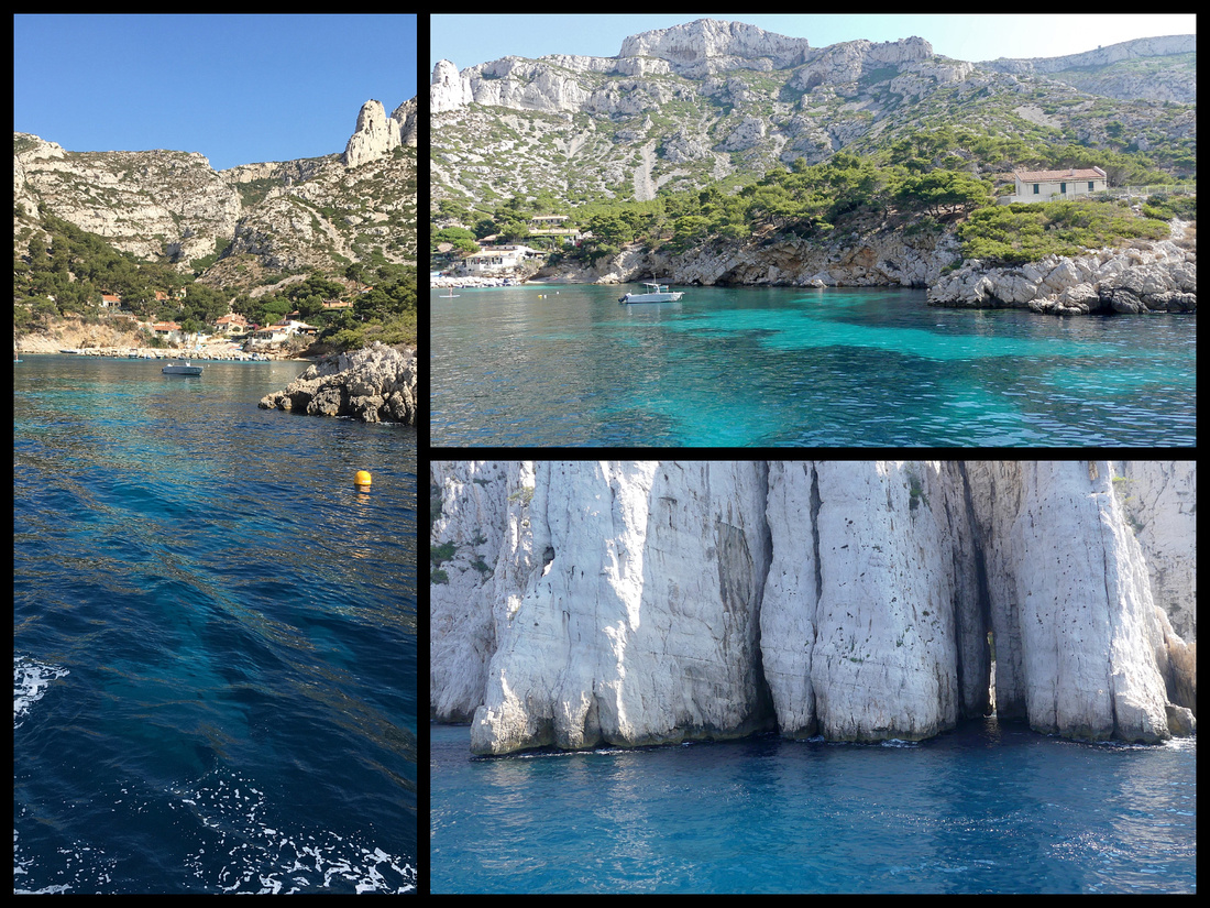
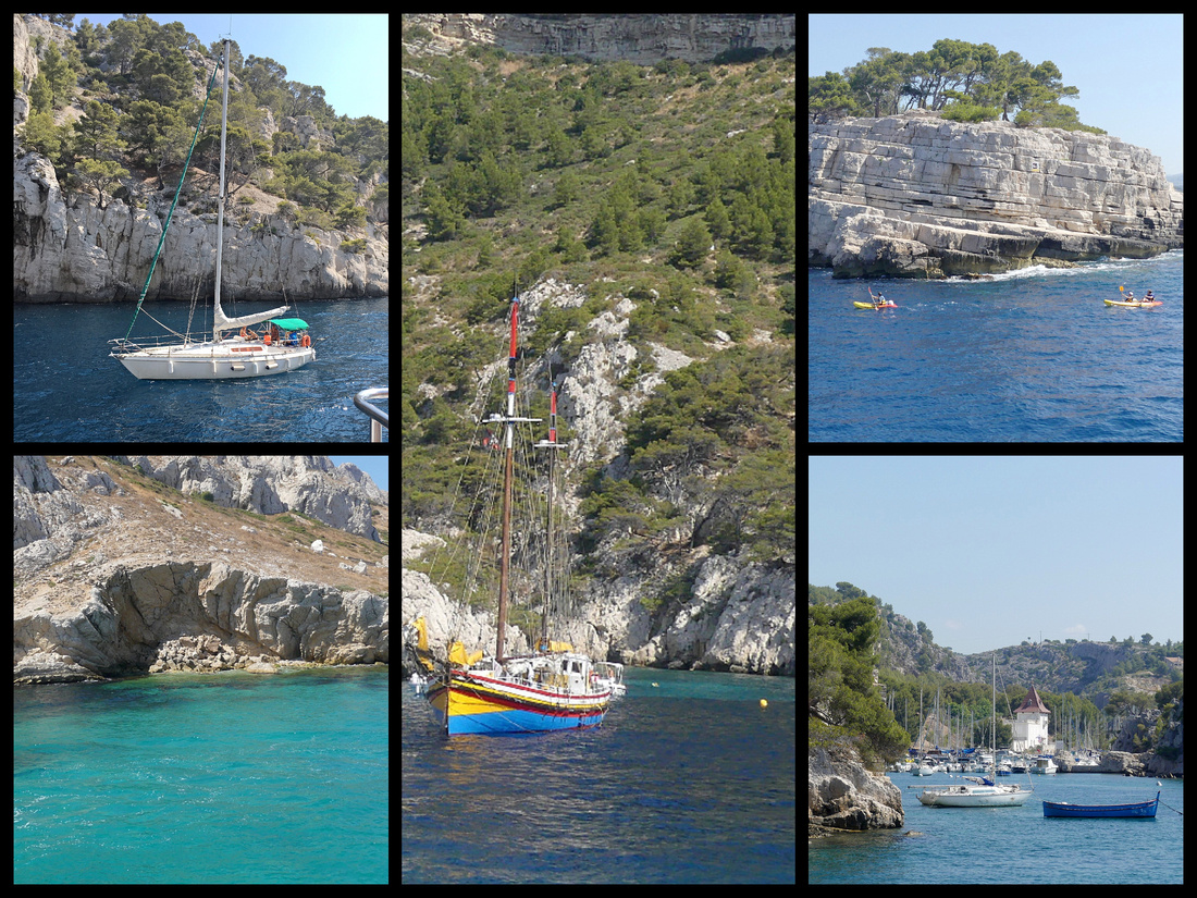
CASSIS
One day I took a bus to Cassis, just up the coast from Marseille. I had see it from the boat ride and read that it was
“A picture perfect fishing village guarded by ruins of a medieval castle (1381) (Chateau de Cassis, now a luxury hotel). The prettiest coastal town in Provence. Pastel cubist houses frame the port, unadulterated charm.” That pretty much does describe it. Certainly a tourist town these days with plenty of boats, some of them might actually be used for fishing, the majority are pleasure craft but some are really cute. And tons of excursion boats into the calanques. Besides the delightful harbor lined with restaurants and shops, there is a large beach and a few picturesque back streets.
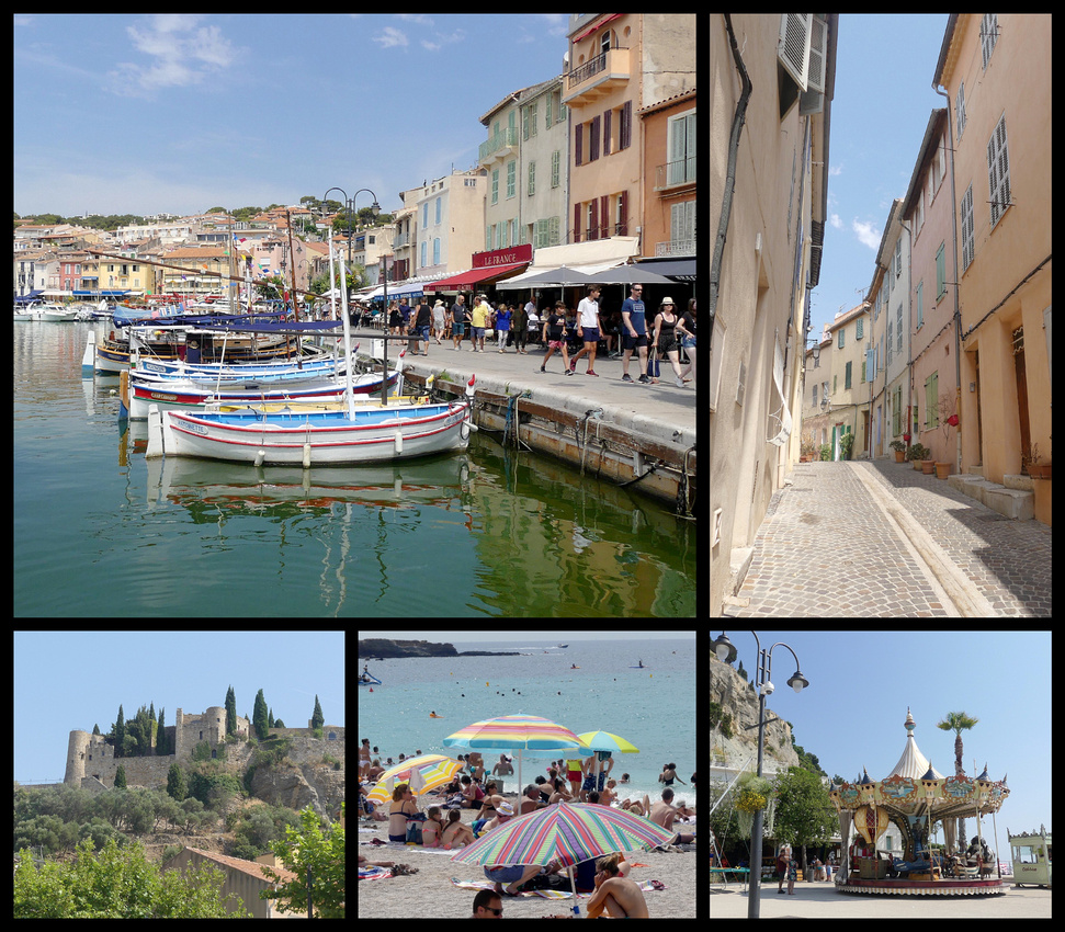
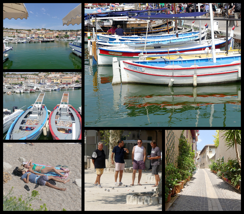
Since Cassis is the end point of the calanques boat tour from Marseille that I took the other day,(and with the help of the map) I knew Calanque de Port-Miou – a long narrow calanque completely lined with sailboats – was just around the point from Cassis town harbor. With a handy map from the TI I hiked up there, took less than an hour and does have gorgeous views if you walk out onto the rocks far enough (tad scary but probably pretty safe). You can hike to several other clanque from Cassis but the map says they are 3 or more hours.
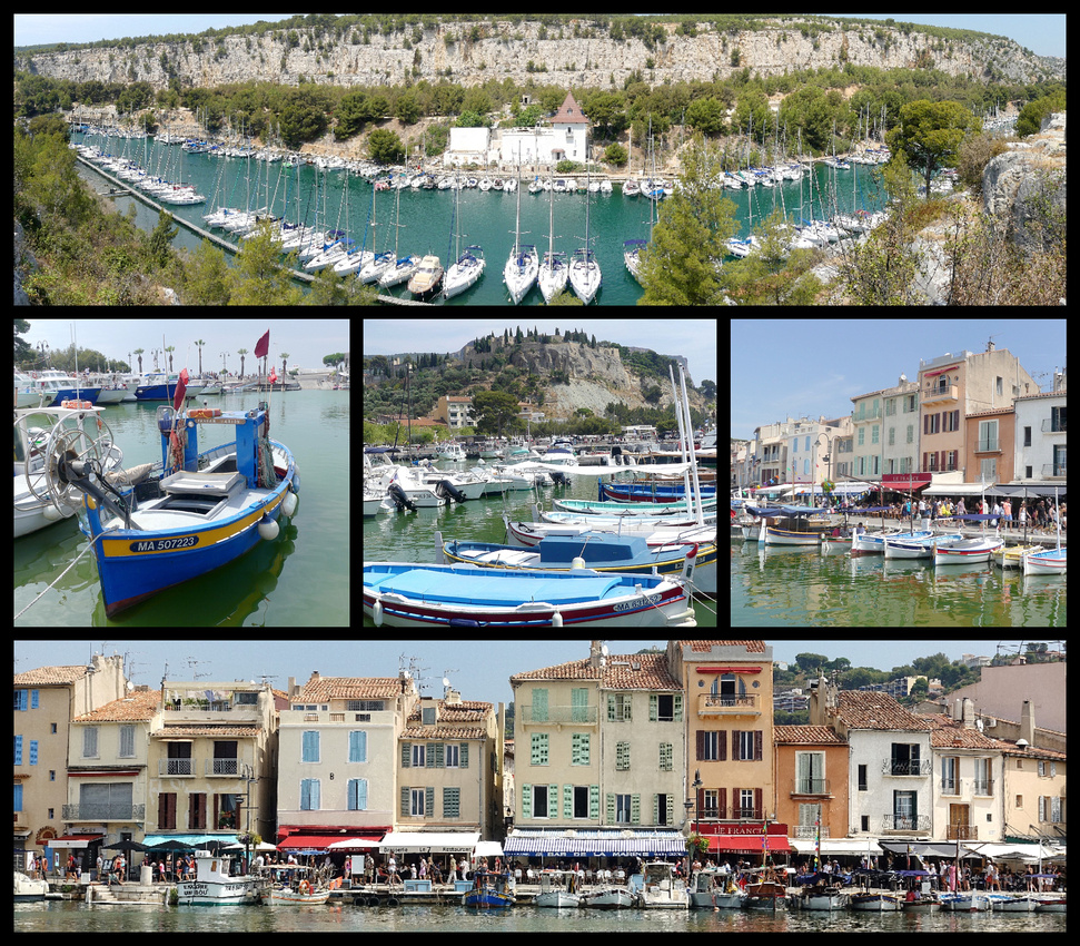
Back at the harbor I looked over the restaurant selection (plenty in all price ranges) and decided on crepes at an outdoor restaurant right on the water. Great food and great people watching.
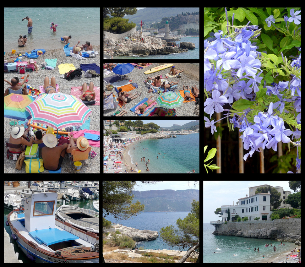
NIMES
Despite being in the Languedoc-Roussillon region (Marseille is in Provence), Nimes, population 148,000, is only a one-hour train ride away. If it weren’t for the Roman monuments (and they ARE outstanding and reason enough to go) Nimes would just be another medium sized city. It’s well kept, there are several parks, lots of pedestrianized shopping streets and a few nice squares. The street leading from the train station to the arena is itself almost a park with lots of trees and benches. There are sycamore trees, cicadas – you know you are in Provence - but the buildings in Nimes are sort of ‘hum’ and it just doesn’t have much character. Good thing it has those Roman monuments. That makes it definitely worth a visit.
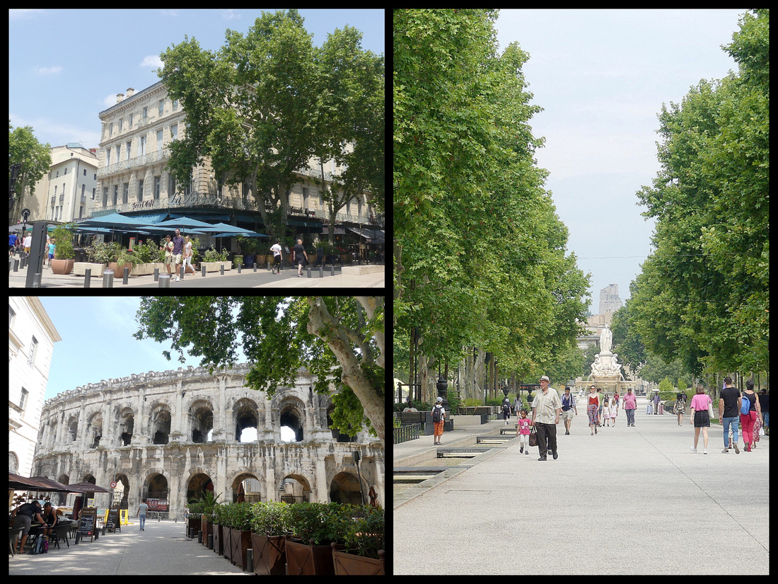
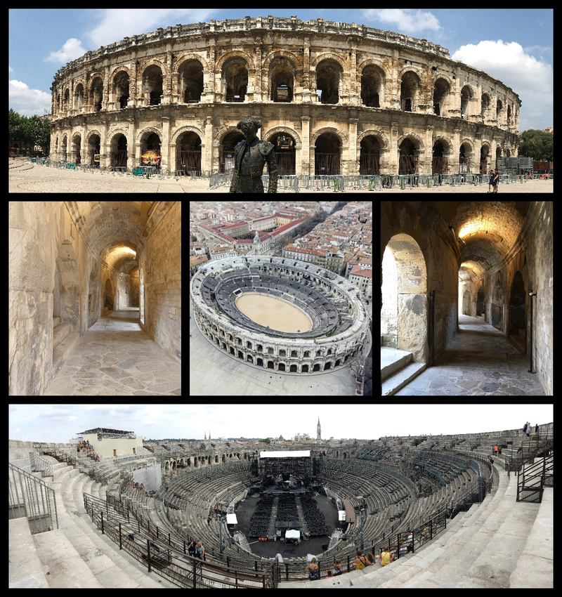
Arènes (Amphitheater) - 1st C AD. Could seat 24,000 spectators, It is 20th in size but supposedly #1 in state of preservation of all the existing Roman amphitheaters. The 60 graceful arches of the exterior are embellished in the lower part with pilasters and in the upper part with decorative Doric half-columns. The Amphitheater was perfectly designed to handle the crowds; there are 124 exits that allowed the entire audience to exit within a few minutes. (In comparison in terms of size: Nimes 133x101, Pula 132x105, Arles 136x 109, Rome 189x156, Verona 152x123). The Amphitheater was transformed into a fortress in the 5th Century and then a knight's castle during the Middle Ages. Now restored to its original purpose – which of course means modern seating and staging that does detract from the picture. Still it is pretty amazing how large and complete it is.
Maison Carree - one of few, fully preserved classical Roman temples remaining in the world. 1st Century BC. Inspired by the temples of Apollo and Mars Ultor in Rome, features harmonious classical proportions. Although there are modern buildings surrounding it, there is enough space left around it that the building can be appreciated. The facade of Corinthian columns is decorated with acanthus and a staircase of 15 steps leading up to the porticoed pronaos (entrance to the temple). It inspired builders of La Madeleine in Paris, and Thomas Jefferson’s Virginia Capitol building. The interior however has not been restored, it houses a theatre showing a video on the history of Nimes, every half hour.
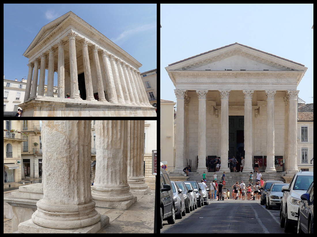
Strolling through town the first square you come to is Place du Marché, which features two figures from the Nîmes coat of arms: a crocodile and a palm tree, symbolizing the Emperor August’s defeat of his arch rival Marc Antony and his lover Cleopatra, Queen of Egypt. The crocodile sits in the middle of a fountain and there is a large palm tree in the center of the square (which is much more a rectangle) has lots of pavement cafes and restaurants. Nearby Place Aux Herbes, is the prettiest square with Notre Dame et Saint Castor Cathedral. There has been a religious building here since the Roman temple of Augustus, and the northwest tower and a few arches on the facade were constructed in the 1100s. The rest of the building has a 19th Century neo-gothic design, If you study the cathedral’s facade you can make out a row of holes above your head to the left of the portal; these were made by medieval market sellers, who would fix their stalls into the wall, as Place Aux Herbes was the old market square. The third square is Place/Tour de l’Horloge, a 500 year old square with a clock tower rebuilt in the 18th Century.
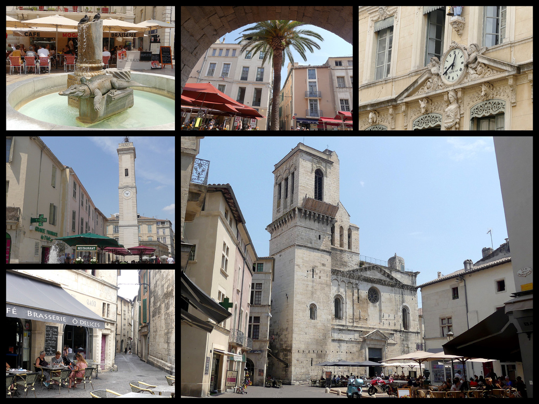
Jardins de la Fontaine – Although the gardens are 18th Century they are built around the water source where ancient Nîmes was founded. There are regal balustrades, broad stairways, statues and marble vases, but also Roman monuments – the Temple of Diane and Tour Magne are both in ‘semi’ ruin but are impressive nonetheless. When the Jardins de la Fontaine opened in 1745 it was one of Europe’s first public parks, and came about after attempts to channel the natural spring led to the discovery of the temple. On the top of the hill is the 36-meter-tall Tour Magne with 140 steps to the top. Tour Magne dates to 15 BC and was once part of the city's ancient ramparts. The street leading from just past Maison Carree to the park is the Quai de la Fontaine. The canal flows from the spring below Les Jardins de la Fontaine and forms a lovely canal in the center of a plane tree lined street with several small bridges over it.
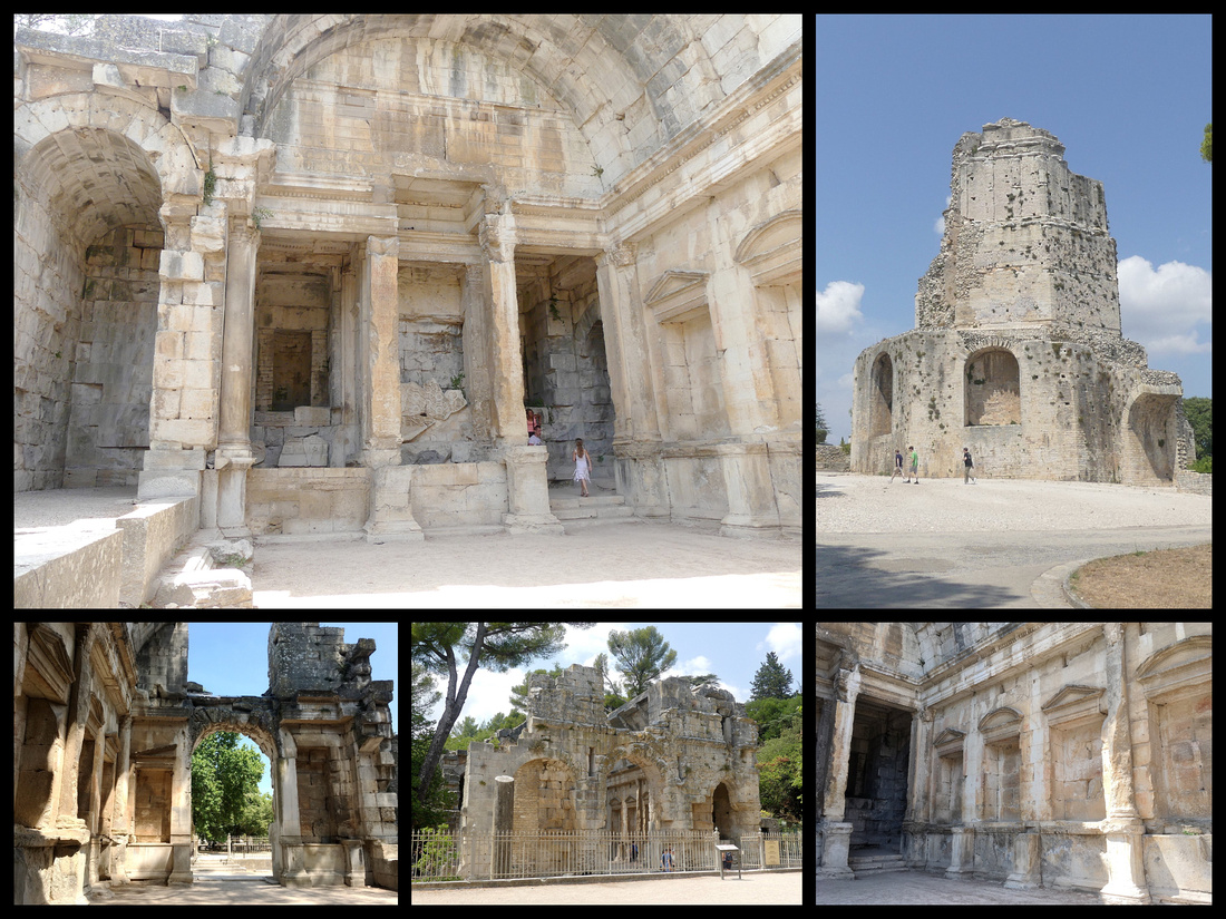
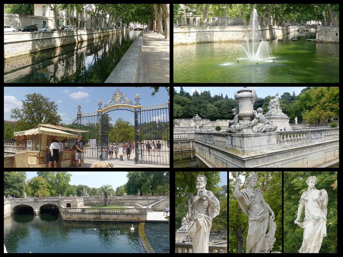
]]>
I had a little over two weeks in Spain in March and had beautiful sunny weather, highs in the 70s all but three days. The focus of the trip was to spend time on the islands of Mallorca and Ibiza and to visit Tarragona and Valencia but in between we had three nights in Barcelona. I had been to Barcelona on previous trips but my traveling companion had not and really wanted to see as much of Barcelona as possible in the short time we had. Without really intending to, this became the third spring break trip in a row that we visited a major European city in a very short amount of time and were able to see a lot of the major 'sites' in a really enjoyable way. We essentially spent a day in the Gothic old town center (and waterfront and Parc de la Ciutadella) and another in the Modernista Eixample. We also spent a few hours on Monjuic. Due to the limited amount of time and very long queues we didn't go inside Sagrada Familia, Casa Mila, or Park Guell, etc. Photos of those are from my previous trips (2006 and 2010).
Barcelona is Spain's second largest city (population 3 million) but the center with most of the sites is small enough that it can be walked in a couple of days and the metro is easy to navigate and goes everywhere else. Barcelona is far older than Madrid. Back when Madrid was still a small, Moorish outpost Barcelona controlled a large Mediterranean empire. The Moors did control it for a time but far shorter than elsewhere in Spain so Barcelona has had a different set of historical forces shaping it than the other places in Spain and in many ways looks different. There are two distinct sections to the city center, the original part, called 'Barri Gotic' with remnants going back to Roman times, with lots of medieval buildings remaining, and the 'newer' part famed for some of the best Modernisme buildings in Europe (known elsewhere as Art Nouveau) - especially those by it's most famous architect, Antonio Gaudi.
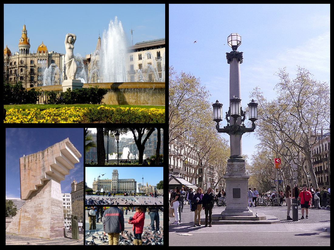 Above Left: Place Catalunya Right: the start of Las Ramblas
Placa Catalunya is the central point of Barcelona, a large central square (actually it's round) one of the largest in Europe. In the center are two illuminated fountains, many statues and plenty of people performing (formally and informally). Around the square are large department stores including El Corte Ingles, (supermarket in basement, 9th floor terrace cafeteria with view). In front of El Corte Ingles is the Aerobus to the airport, the metro and the main tourist information office. La Rambla goes south to the old town and Passeig de Gracia and Rambla de Catalunya lead north to the Eixample.
Les Ramblas is a tree-lined, almost one mile long boulevard, one of the most famous streets in Spain - full of buskers and tourists, lined with hotels, cafes, and flower stalls. The name, derived from the Arabic ramla (or "sand"), refers to the bed of the seasonal stream which once flowed here. In the dry season, the channel was used as a road, and by the 14th C this had been paved over, a link between the harbor and the old town. In the 19th C, benches and plane trees were added, overlooked by stately balconied buildings, and today – in a city choked with traffic – this wide swath is still given over to pedestrians (with narrow vehicle lanes on each side).
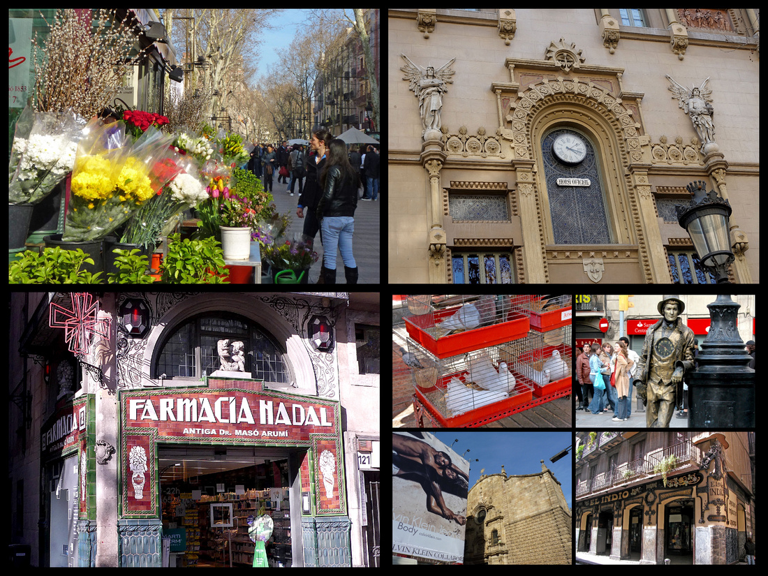
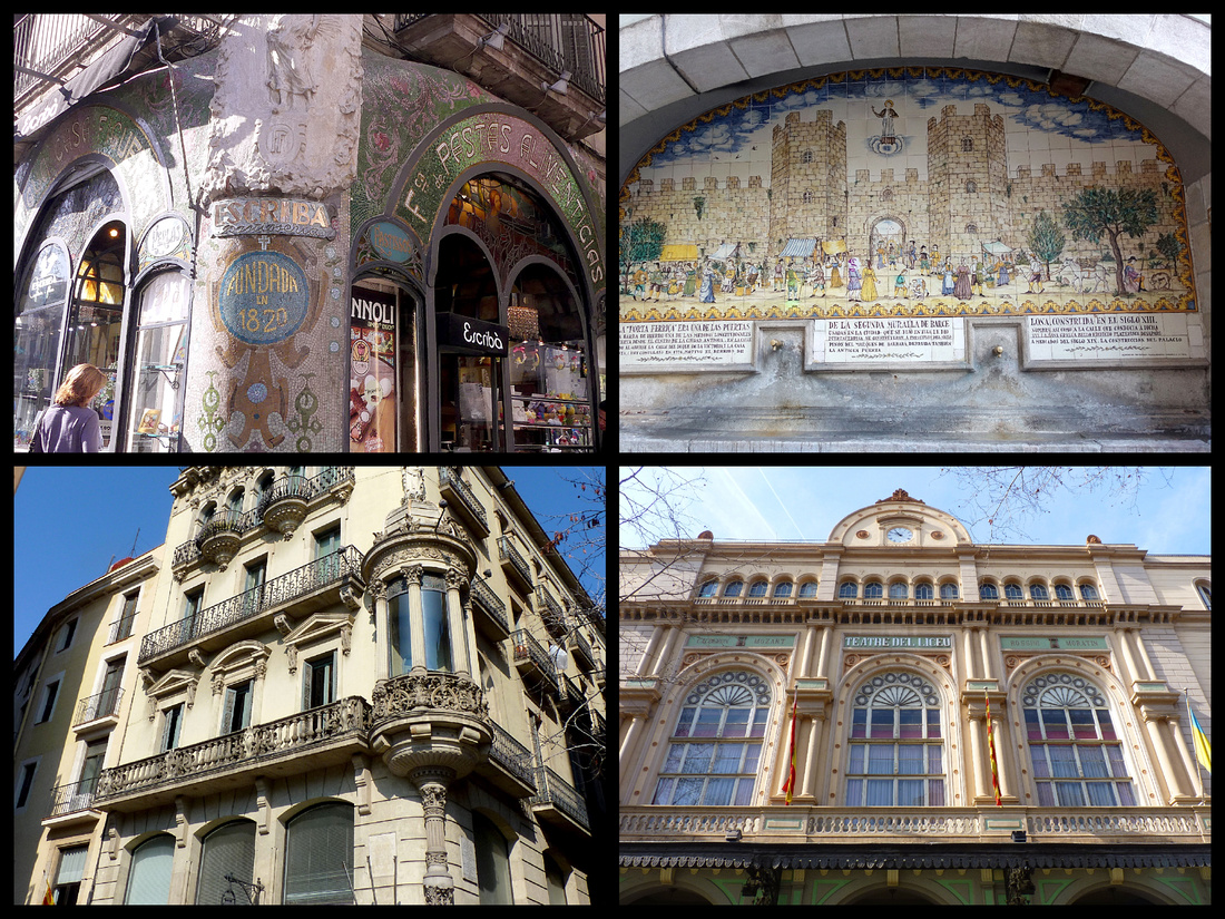
At the corner of one of the side streets off Las Ramblas, Carrer Portaferrissa, a shopping street lined with, among other things, several confectionary shops, is a fountain with a ceramic tile backdrop portraying the 13th century city walls and the gate which used to be there. Just across from there another side street leads to one of the highlights of Barcelona, La Boqueria (Mercat Sant Joseph), Barcelona's main market. There have been permanent food stalls here since 1840 and it was roofed over in 1914. There are hundreds of stalls selling fruits, veggies, meats, seafood, etc. plus a huge assortment of places selling prepared foods, several bars and restaurants. When the market was founded it was in one of the gates of the city walls where farmers from surrounding villages brought their products to sell.
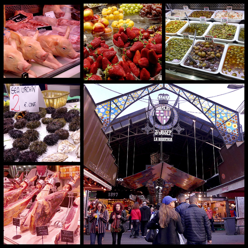
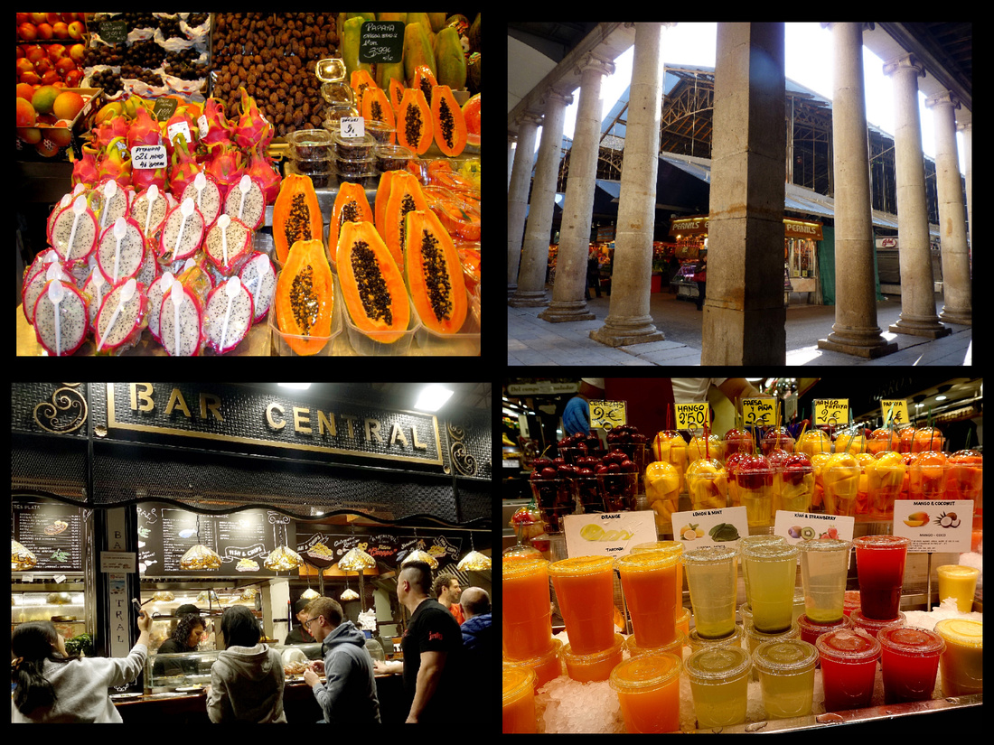
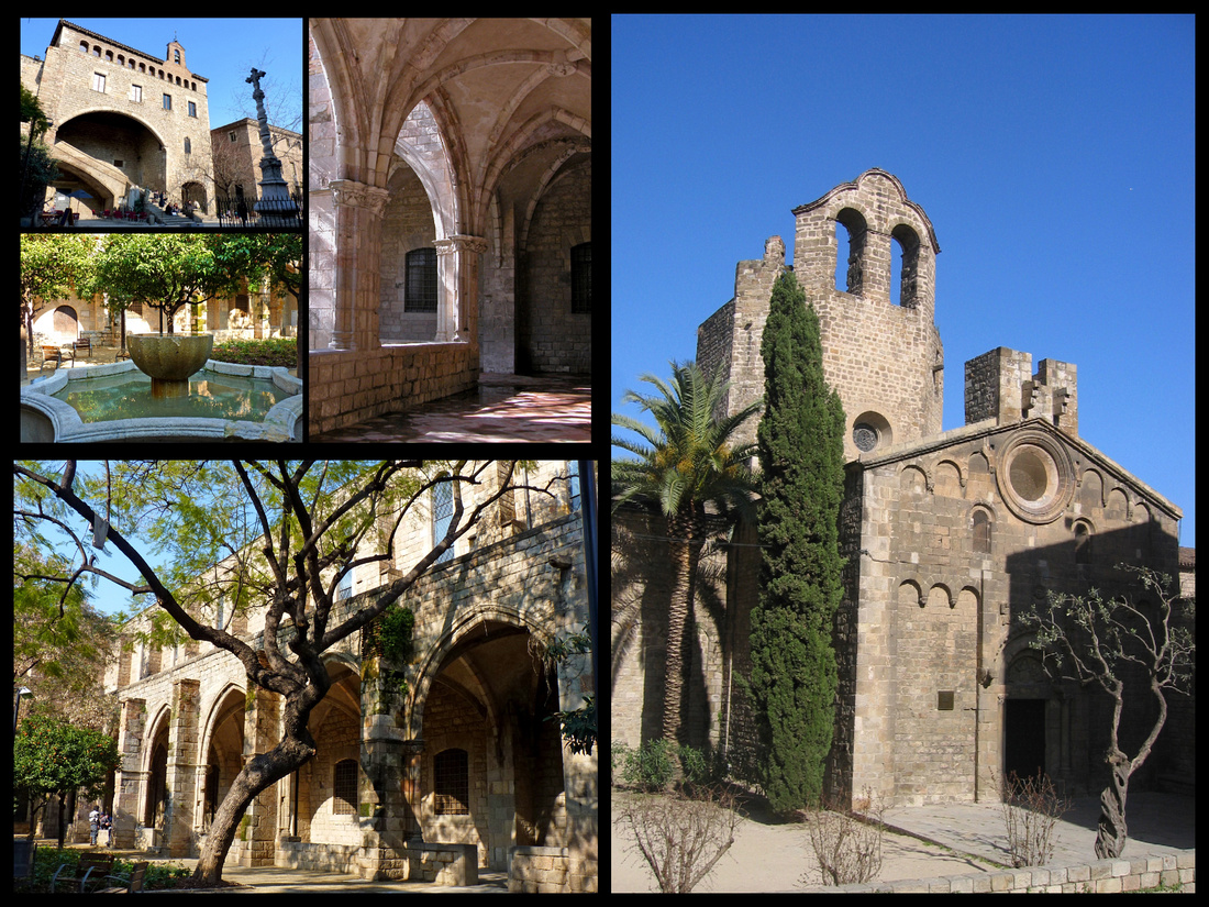
Above Left: Antic Hospital de la Santa Creu Right: Sant Pau del Camp
Antic Hospital de la Santa Creu is one of the oldest hospitals in the world, founded in 1024 and rebuilt here in 1401 with the intention of concentrating all the sick of Barcelona in one place. In the 16th C it had 500 beds, in the 17th it had 5000. Relocated in 1926 to the Modernista masterpiece near Sagrada Famila. One of the last patients to die at the hospital before it moved was Gaudi.
Sant Pau del Camp is Barcelona’s oldest church, built in 1127 (with some elements from the 6th C), surrounded by an olive tree, a cypress and a palm tree, it has faded Romanesque carvings on the façade plus a tranquil 13th C cloister. When it was built it was outside the city walls, as "del camp" (in the fields) suggests. The church is a kind of hulking shape, a reflection of the defensive mentality of Barcelona’s early Christians, for whom the church served as spiritual and physical refuge during an era of Moorish sackings and invasions.
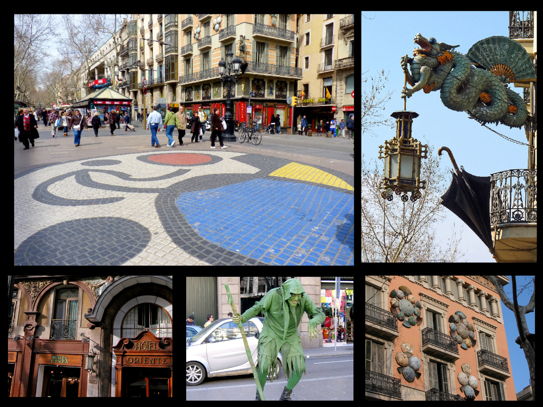
Above Top Left: Placa de la Boqueria in the center of Las Ramblas Right: Casa Bruno Quadros
Placa de la Boqueria marks the midway of La Rambla. There is a widening and absence of trees and in the center of the pavement is an anchor mosaic, a reminder of the city’s attachment to the sea, created by Joan Miro.
Casa Bruno Quadros A former umbrella makers, designed in 1885 includes a Chinese dragon with a parasol, Egyptian balconies and galleries, and a Peking lantern -- exotic touches all very much in vogue at the time of the Universal Exposition of 1888.
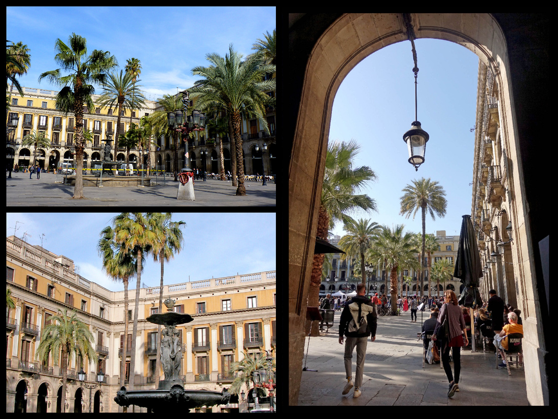
Above: Placa Reial
Placa Reial, a palm tree filled square can be reached through an arcaded lane off Las Ramblas. It’s Barcelona’s only square designed as a set piece, modeled after Madrid’s Plaza Major. An elegant Italianate neoclassical square has Gaudí's first public works: two helmeted lamp posts. The fountain in the middle depicts the Three Graces.
East of Las Ramblas is the "Barri Gòtic", the Ciutat Vella, or old city, one of the most evocative sites in Spain. Narrow winding streets (almost entirely pedestrianized) , with gurgling fountains, vintage stores, and ancient fortifications are contained in an area that was once entirely enclosed by 4th C Roman walls, but what you see today dates principally from the 14th C. Contained within this jumble of streets is a series of neighborhoods – originally separate medieval parishes and settlements – that retain certain distinct characteristics today. The greatest concentration of interest is in the area which curls out from around the cathedral.
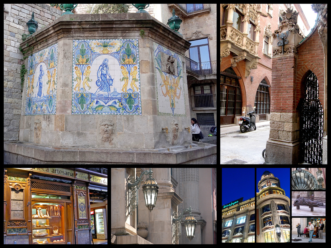
Above: Avinguda del Portal de l’Angel is the pedestrianized main shopping street leading from Placa Catalunya into the Barri Gotic. A large art nouveau building on the corner of C. Santa Anna houses a branch of El Cortes Ingles. Further down the street there is a three sided fountain above which are tile paintings of blue pitcher bearers.
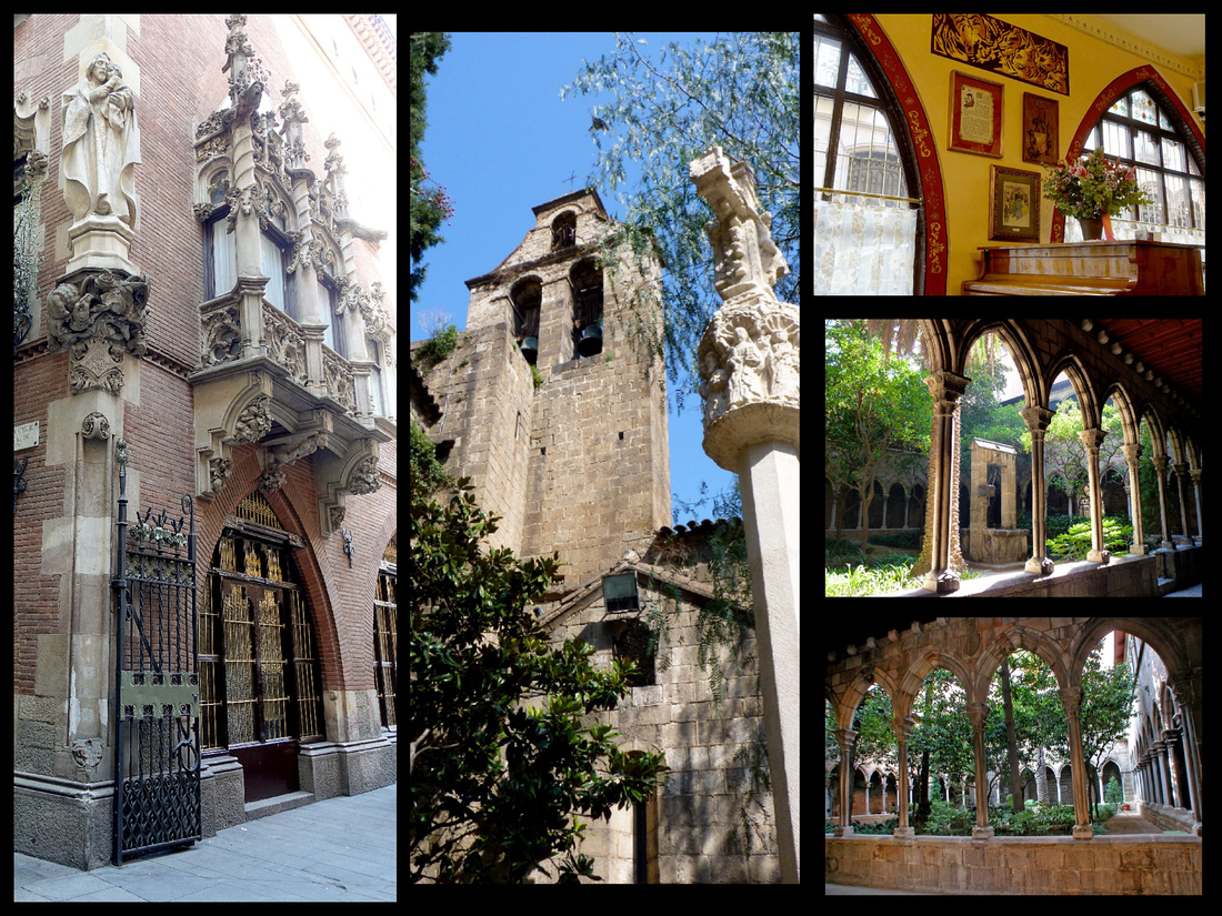
Above - Left and top right: "The 4 Cats" Center and lower right: Santa Ana
The Church of Santa Ana, through a half hidden doorway off Carrer Santa Ana. The Romanesque church (1300) is in a small triangular courtyard. At the far end of the main aisle of the nave is an opening to the Gothic cloister where delicate columned arches frame the garden. Founded by the Knights of Templar in the early 12th C.
Casa Marti-Els Quatre Gats Built in 1896, this Art Nouveau building houses the ‘Quatre Gats’ café (Four Cats, slang for “just a few guys” but also recalling the Chat Noir in Paris). The exterior is decorated with Eusebi Arnau sculptures. The one on the corner is St Jordi and the dragon. The interior is hung with reproductions of famous Ramon Casas paintings. It was a bohemian taverna that provided much of the impetus for the city’s cultural life in the early 20th Century. Picasso’s first exhibition was held here. Today it has one of the best eating experiences in Barcelona, lunch consisting of three courses plus wine for €20.
Placa Nova/ Placa de la Seu are two squares which run together to form the largest square in the Barri Gotic, in front of the Cathedral and also features one of the main Roman gates to the old city, the Portal del Bisbe, or Bishop’s Gate. The two cylindrical towers date from the 1st Century BC but the name came later, from the nearby 18th Century Bishop’s Palace. Fragments of the Roman wall are visible in several parts of the walls and towers that extends from the Bishops Palace on the right to the House of the Pia Almonia on the left, beyond the steps leading up to the Cathedral. The sculpted letters spell out “Barcino” the Roman name for the city. An antiques market takes place in front of the cathedral on Thursdays.
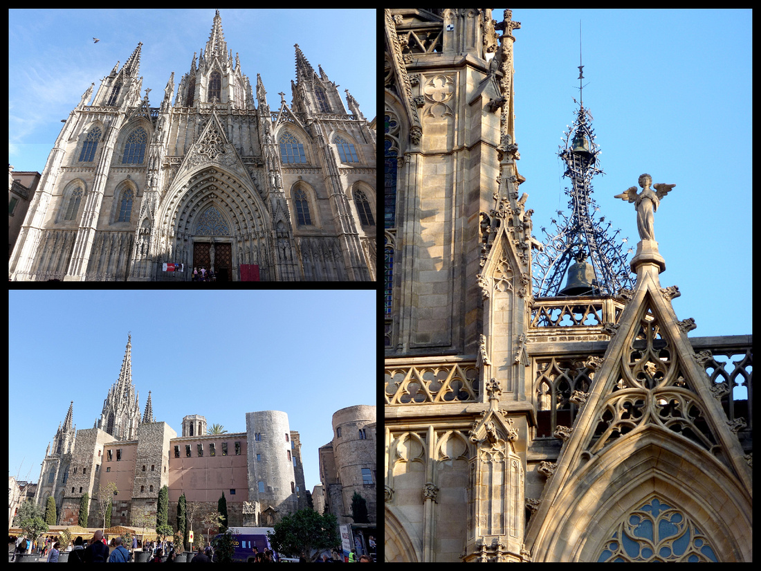
Above: The Cathedral (Le Sue) and Placa Nova/Placa La Seu
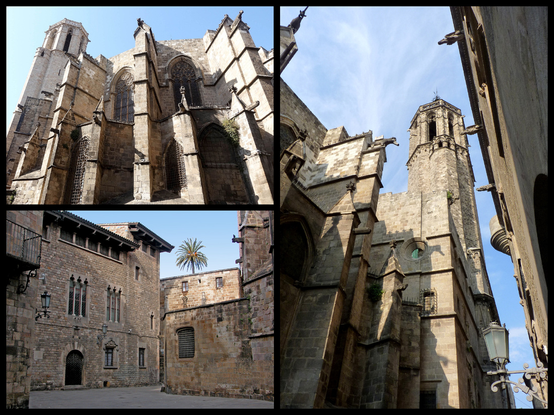
Above: Back and side of the cathedral
Barcelona’s Cathedral: La Seu With its large bell towers, blending of medieval and Renaissance styles, beautiful cloister, and Gothic arches, ranks as one of the most impressive cathedrals in Spain. Located on a site previously occupied by a Roman temple, the current building was begun in 1298. The Cathedral, named for La Seu, or See, the seat of the bishopric, was mostly finished by 1450, with the spire and neo-Gothic west facade added in 1892.
This is reputedly the darkest of all the world's great cathedrals, even at high noon, the nave is enveloped by shadows. The spacious interior, characteristic of Catalan Gothic buildings, is supported by buttresses. These provide walls for 28 richly ornamented chapels. While the main part of the church is fairly plain, the chapels show great wealth. They were sponsored by local guilds and provided a kind of advertising to illiterate worshipers. The most unique part of the cathedral is the 14th Century (1385) cloister which looks over a lush garden with palm trees, magnolias and is home to white geese, descendents of those who have lived there for five centuries. There is a fountain named after the geese – Font de les Oques. During festivals a dancing egg bounces in the fountain – the egg known as l’ou com balla symbolizes fertility. A tiny statue of St George slaying the dragon stands in the garden. There are 13 geese (13 in memory of Eulalia, a 13 year old girl, tortured 13 times by the Romans for her faith, crucified, and later sainted).
Outside, the apse is heavily buttressed and there are octagonal towers above the transept. The western bell tower has scrolled ironwork and a weather vane. Beneath it, animal gargoyles on top of the buttresses – unicorn, elephant, ram, dog, camel.
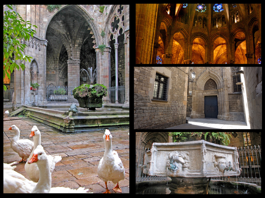
Palau Reial Major, The Royal Palace, on Kings Square (Placa del Rei), a block behind the apse of the cathedral. This plaza is widely considered the oldest and most beautiful space in the Gothic Quarter. Long held to be the scene of Columbus's triumphal return from his first voyage to the New World -- the precise spot where Ferdinand and Isabella received him is purportedly on the stairs fanning out from the corner of the square. The Palace features 13th Century triple recess arches with 14th Century rose windows. The silhouette of the box shaped Renaissance 15th Century Torre Mirador del Rei Martí (King Martin's Watchtower) with five tiers of round arches is an outstanding feature of the palace. The 14th Century Capilla Reial de Santa Àgueda (Royal Chapel of St. Agatha) is on the right side of the stairway and uses the Roman wall as it’s north side. The main room of the Palau is the Saló del Tinell, a magnificent banquet hall built in 1362. The Spanish Inquisition met here. Palau del Lloctinent (Lieutenant's Palace) is across Placa del Rei. 16th Century, façade (facing Placa del Rei).
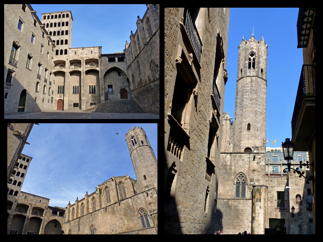
Casa de lArdiaca (Archdeacon's Residence) built in the 15th century on Roman ruins has one of the nicest patios in the city with a tall, elegant palm tree growing out of the center and a moss covered fountain in a tiled courtyard. The building houses the Municipal History Archives. It is just to the side of the main entrance to the cathedral.
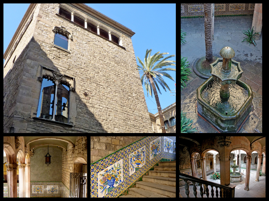
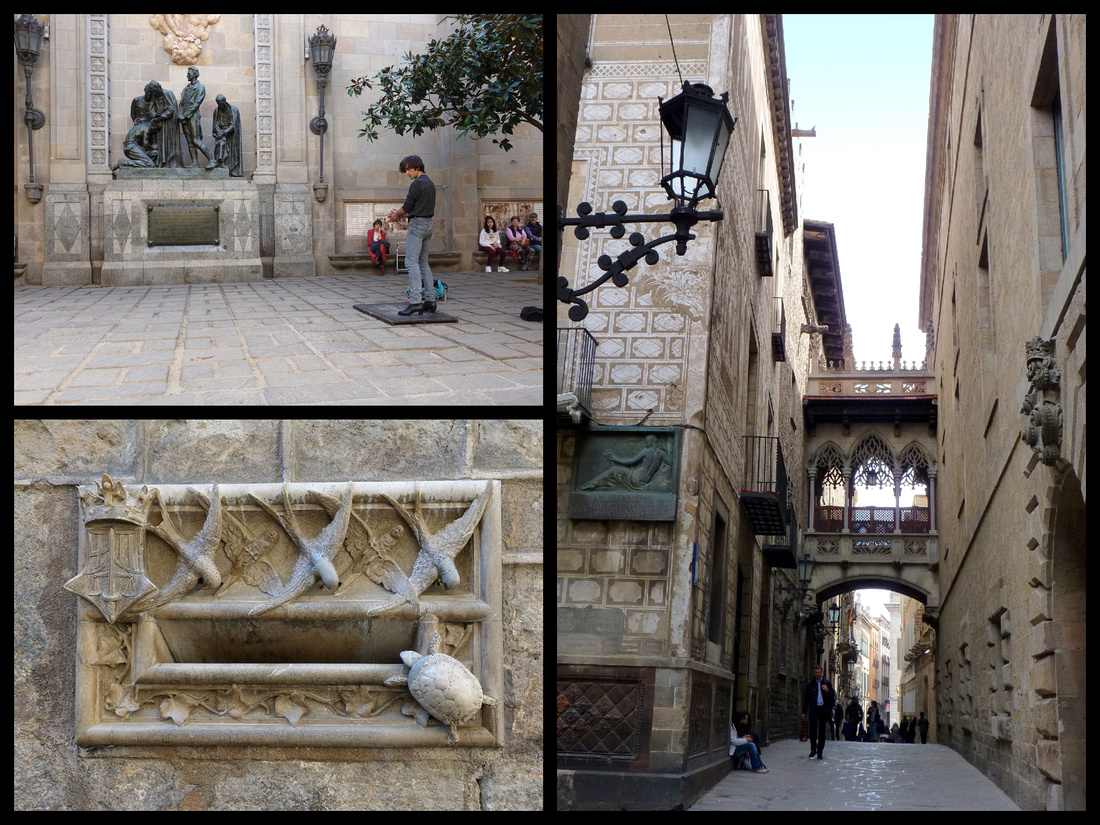
Above: Top Left: a Flamenco dancer in the tiny square, Placa de Garriga Bachs, next to the cathedral.
Right: Barcelona's "Bridge of Sighs", a pseudo Gothic passageway between two buildings on Carrer del Bisbe Iruita, built in 1928.
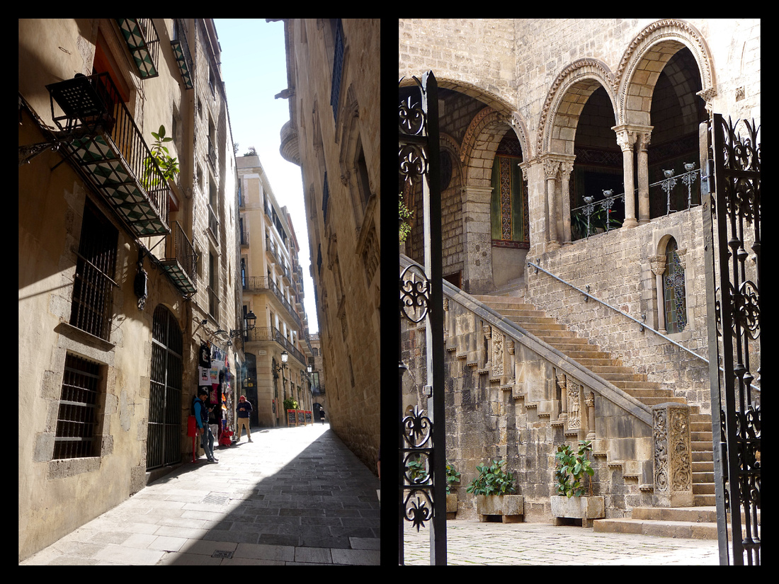
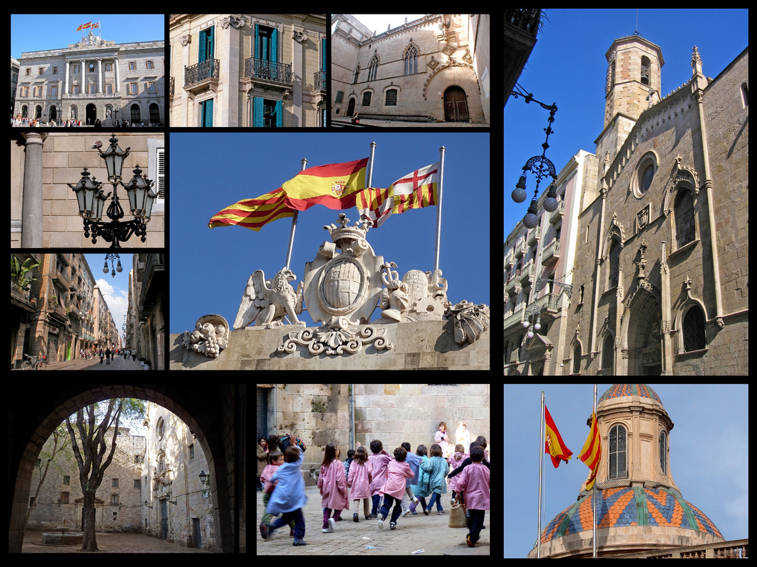
Above: Placa de Sant Jaume, Palau de la Generalitat, Carrer Ferran and Iglesia San Jaume.
Bottom Left & Center: Placa Sant Felip Neri
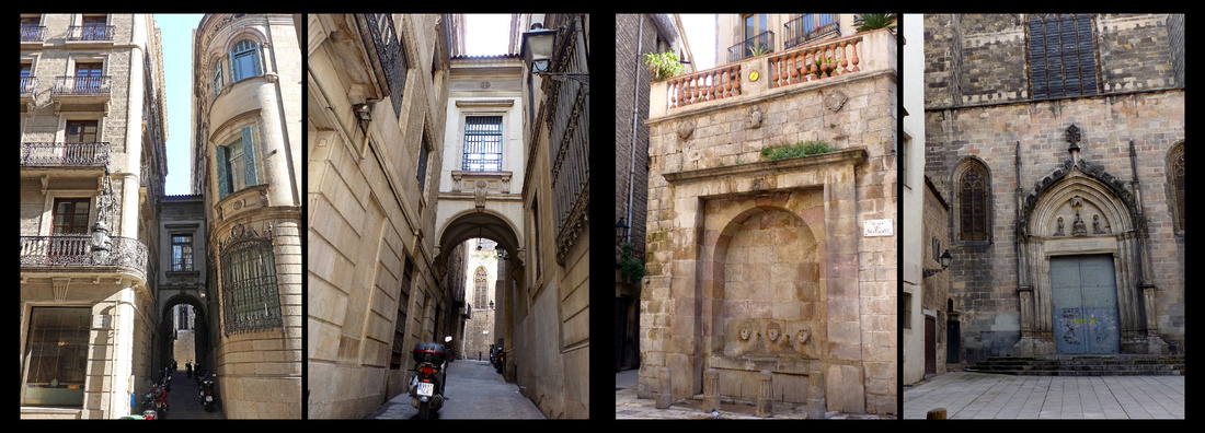
Above: From Placa Sant Jaume, Carrer Hercules leads to Placa St Just, one of Barcelona's hidden gems, home to one of the oldest parish churches in Barcelona, built about two centuries before Columbus discovered America. In addition to the (usually closed) entrance to the church there is a fountain with three faces.
Palau de la Musica Catalana Built in 1908, this theater has one of the best modernist interiors in a town known for it’s modernist architecture. The decoration includes busts of Wagner, Beethoven and Bach. A disciple of Rodin, Miquel Blay, sculpted the huge corner exterior group that projects like a figurehead on a ship with a knight and damsel emerging from a cloud of legendary figures that celebrate Catalan popular song. Inviting arches lead into the 2000 seat hall full of stained glass and ceramics including a huge stained glass skylight. It’s the only concert hall in Europe to be naturally lit. A UNESCO site. Attending a performance of a Catalan Guitar trio was a highlight of our trip. The music was very nice, but being in those surroundings was incredible.
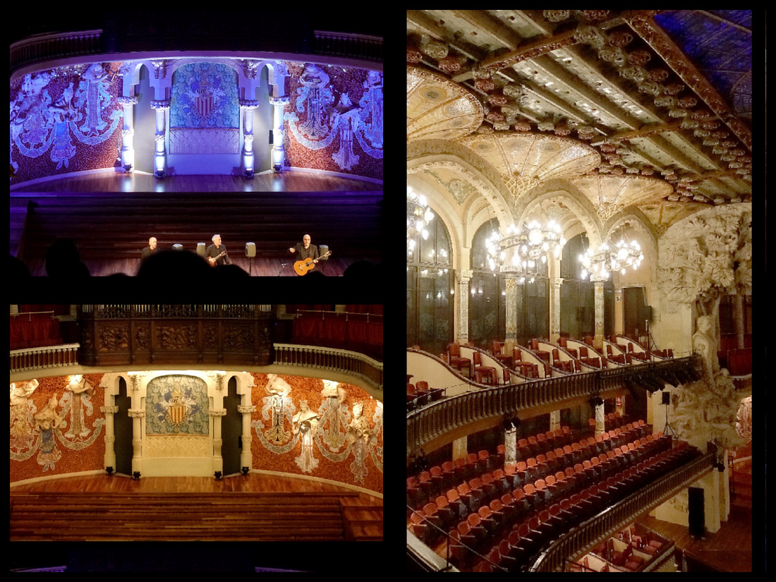
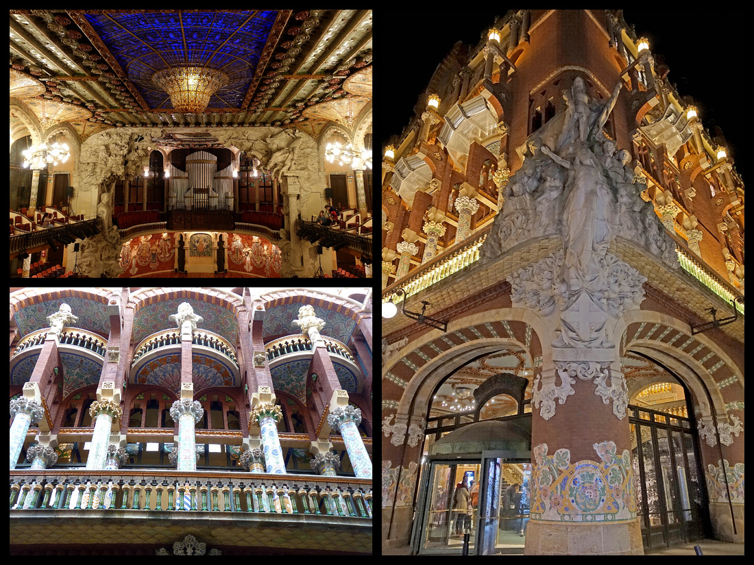
La Ribera / El Born In the old tradesmen’s quarter the street names echo the crafts they practiced: Argenteria (silversmith), Mirallers (mirror makers), Sombrerers (hatters). This was the old maritime district and C de L’Argenteria the main road to the port. In the days before Barceloneta the sea washed up this far. Bacilica de la Merce, 1267 but heavily remodeled in Baroque times. The Placa by the church is often deserted except for an early 19th C statue of Neptune with four sphinxes. The interior streets of the area are narrow alleys but running along side is the Passeig Picasso, a wide boulevard with stately mansions across which is Parc de la Ciutadella.
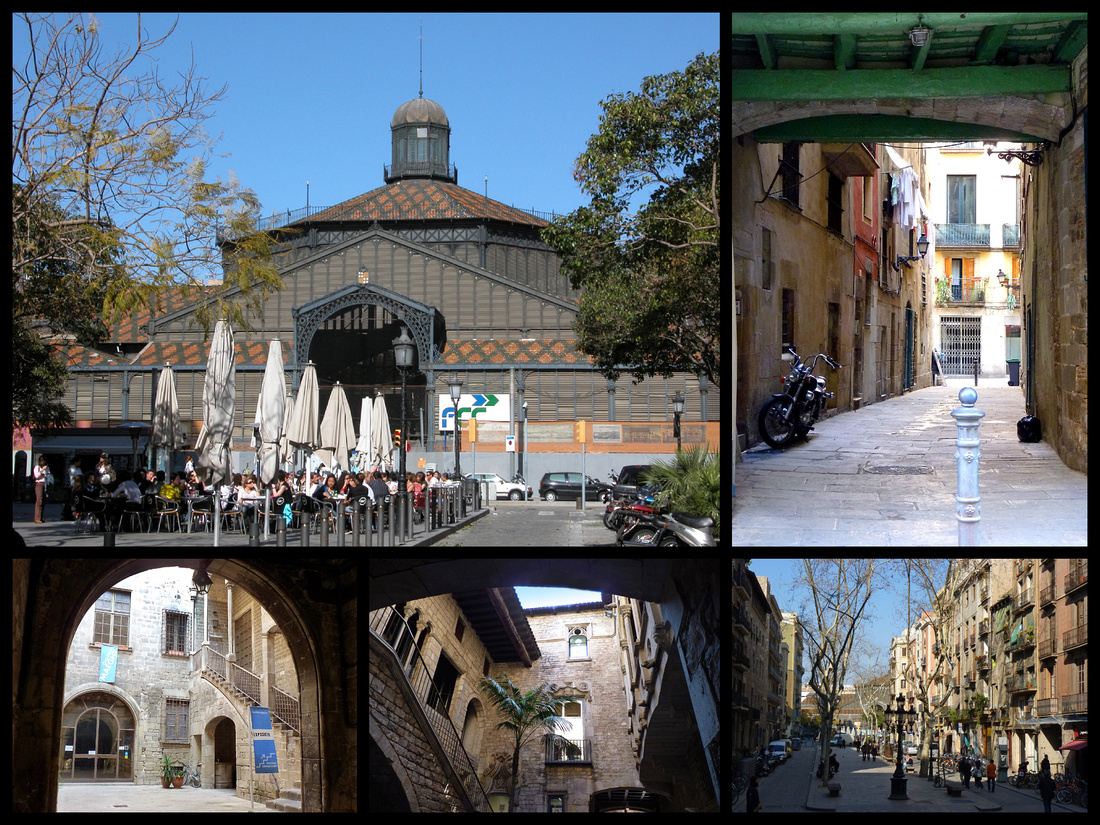
Above: Top Left - Mercat del Born Bottom Left and Center: Picasso Museum courtyard
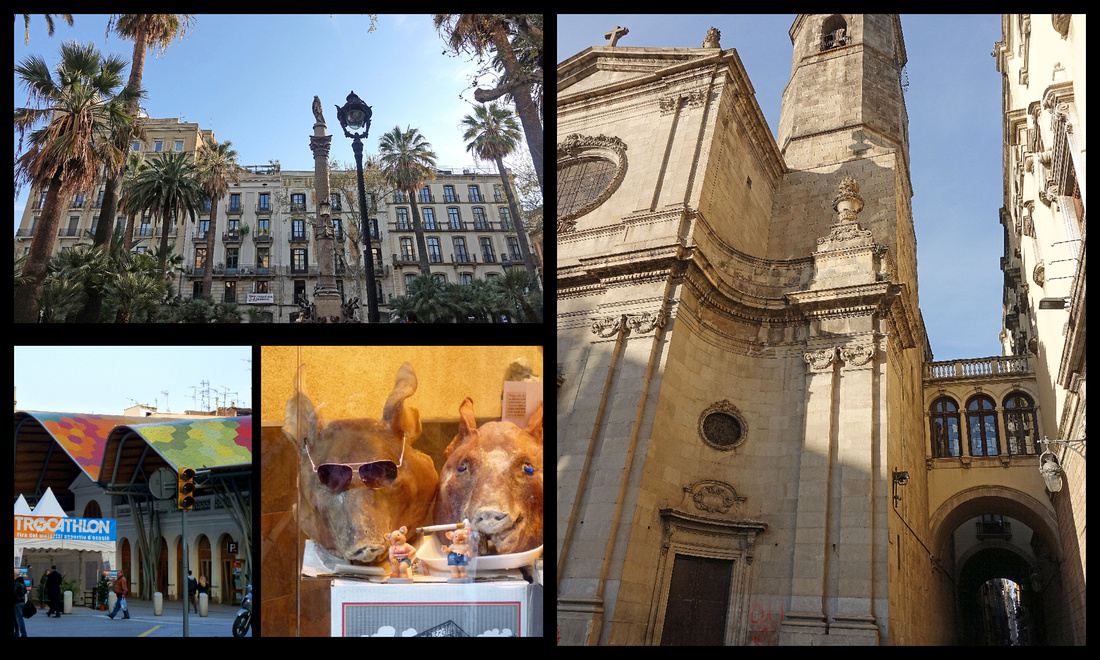
Above - Right: La Merce Top Left: small square near La Merce Lower left: Mercat Santa Caterina (1848)
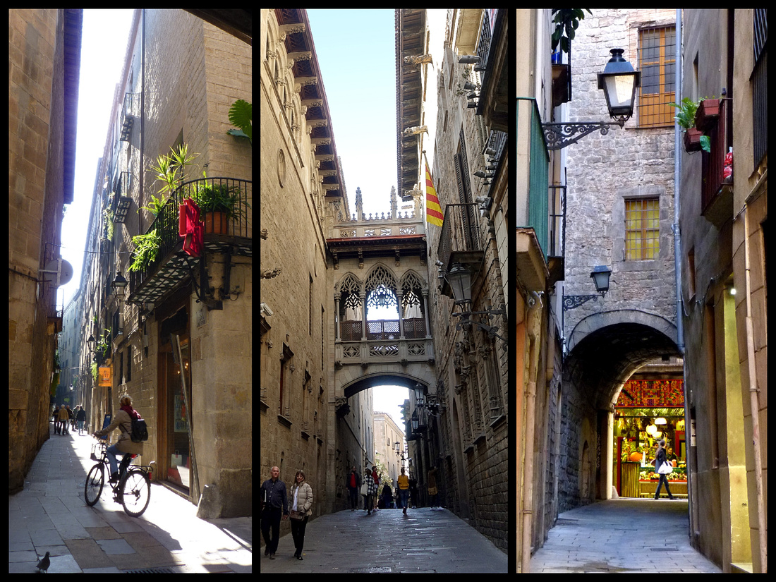
Above: Old town streets of Barcelona, they are among my favorite old towns of any city in Europe.
Parc de la Ciutadella was once the site of a Bourbon fortress, now a formal park, with a zoo and museums as well as paths and gardens. It was transformed in 1888 from a military citadel into a park for the Universal Exhibition (World’s Fair). There is a lake and a huge ornamental Baroque fountain: La Cascada, designed by Josep Fontsere who was assisted by a young Gaudi.
Placa d’Armes, in the center near the zoo, was the old parade ground, now a formal garden with a Rodinesque nude (1907) slumped over the weight of sin. The square has the only surviving buildings from the Ciutadella: a chapel, the Governor’s Palace and the Arsenal.
A tropical cast iron greenhouse with a wood lattice roof, the Umbracle (1884), and the Hivernacle, a pink walled iron and glass open-ended conservatory sit on the Passeig Tilers next to the Museu de Geologia.
Just inside the main entrance is a castle-like building intended for use as the exhibition’s café-restaurant, dubbed the Castell dels Tres Dragons, it became a centre for modernista arts and crafts and is now the Museu de Zoologia.
The stately Triumphal Arch (Arc de Triomf) at the top of the park was built as the main entrance to the Universal Exhibition of 1888. The Passeig de Lluis Companys joins the arch to the Citadel Park – these long rectangular gardens are similar to the Tuillieries in Paris except for the ugly apartment blocks to the side.
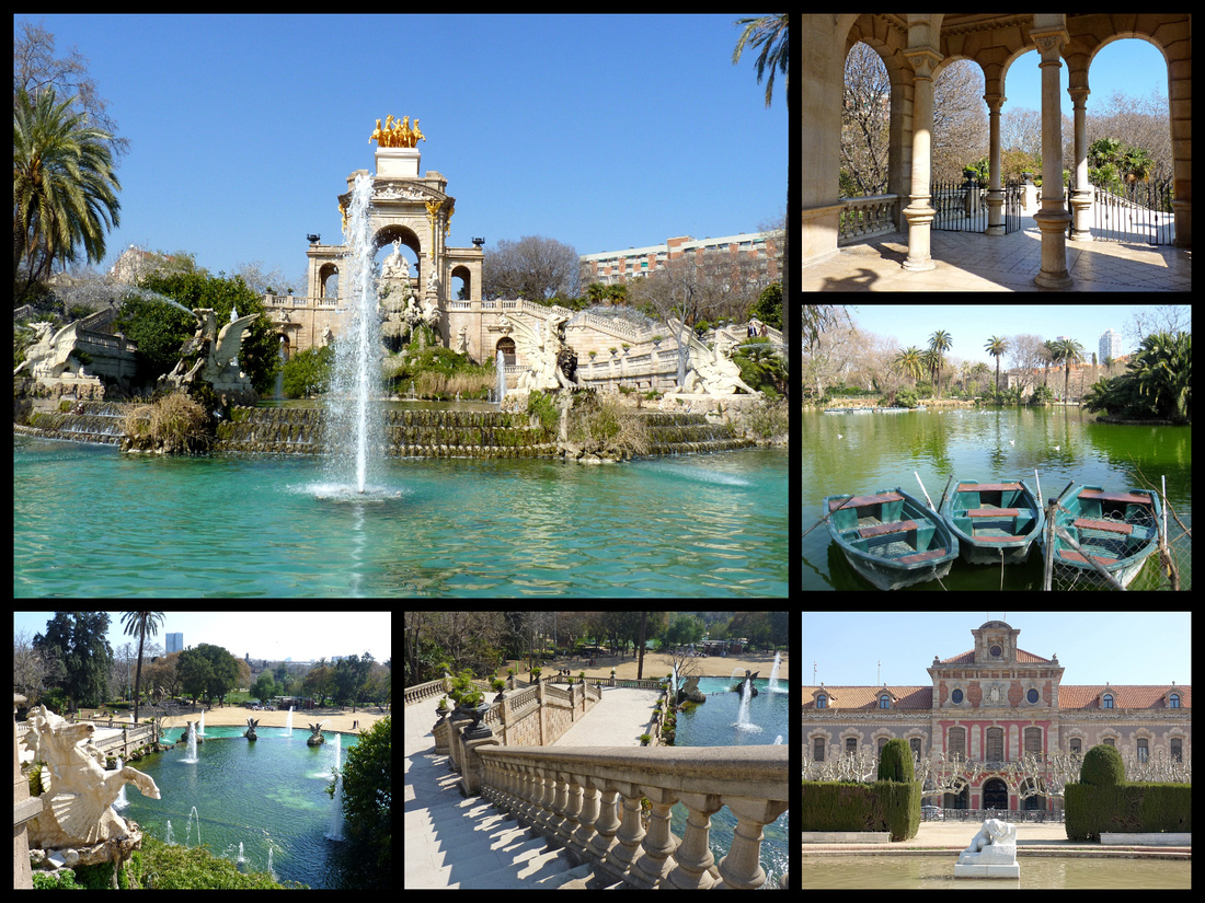
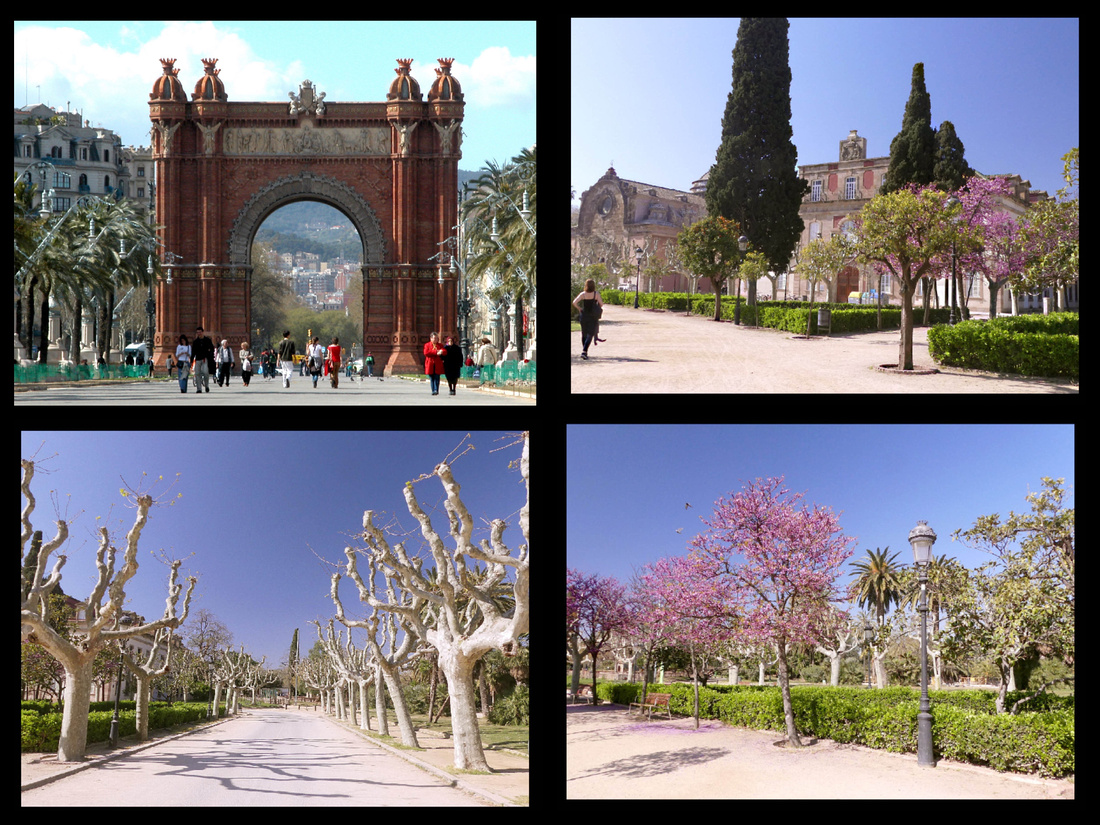
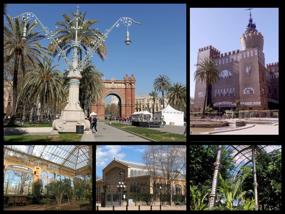
Barcelona's marina stretches the length of Passeig de Joan de Borbó, and encompasses large pedestrian wharves (molls), including Moll de la Fusta – the city's old timber wharf which has been landscaped with benches and trees. Just beyond the Lichtenstein sculpture Barcelona Head, aka "El Cap", is the huge Post Office building/ Correusi (1927) (on Via Laietana) with uneven towers.
From Moll de la Fusta, a swing bridge, La Rambla del Mar, leads across the harbor to Moll d’Espanya and the area known as Port Vell (old port) where some of the most exclusive yachts in the Mediterranean winter. The main thing on the Moll d’Espanya is the leisure complex known as Maremàgnum – with shops and restaurants. The soaring glass lines of the complex are tempered by the undulating wooden walkways. Attractions here include a multi screen cinema (IMAX), and L'Aquàrium, one of the largest in Europe.
El Transbordador Aeri del Port is the cable car which goes from the tower at the end of Passeig Joan de Borbo, connects with the Torre de San Sebastian on the Moll de Barceloneta, the tower of Jaume I in the boat terminal, and the Torre de Miramar on Montjuic.
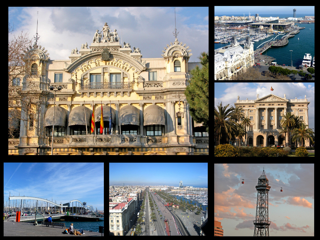
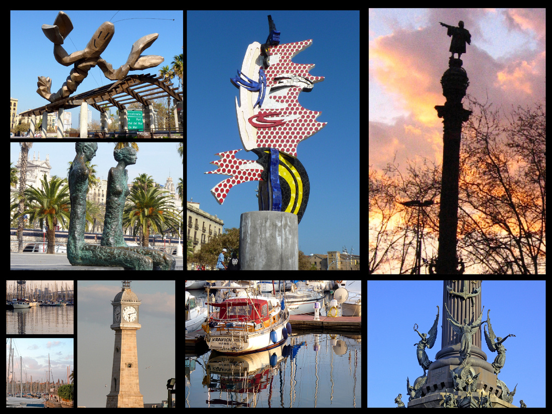
Above - Moll de la Fusta Center top "el Cap" Right: Monument a Colom
Monument a Colom - A 60 metre column at the foot of Las Ramblas built for the 1888 exhibition to commerate the fact that Columbus returned from his famous voyage to the New World to Barcelona. You can take a (very tiny) lift to the top for great views of Barcelona.
Once Barcelona's pungent fishing port, Barceloneta retains a bit of maritime flavor, with narrow streets and lines of laundry snapping in the breeze. The area was laid out in 1755, by a French military engineer as a fishing community in an area that had previously been mud flats. It was designed in uniform style to make crowd control easier. The main reason most people come here now are the seafood restaurants. It’s a short walk from Barceloneta to the beach. Barcelona’s Beach starts at the tip of the peninsula and stretches for 2.5 miles up the coast to the Olimpic Port. Palm trees, cement walkways, tons of sand – all were installed in the mid 1980’s in preparation for the 1992 Summer Olympics. The area was previously all warehouses and industrial slums. The whole area is called Parc de Mar- port Olimpic. Frank Gehry’s goldfish sculpture is in front of Barcelona’s first skyscraper, the Hotel Arts.
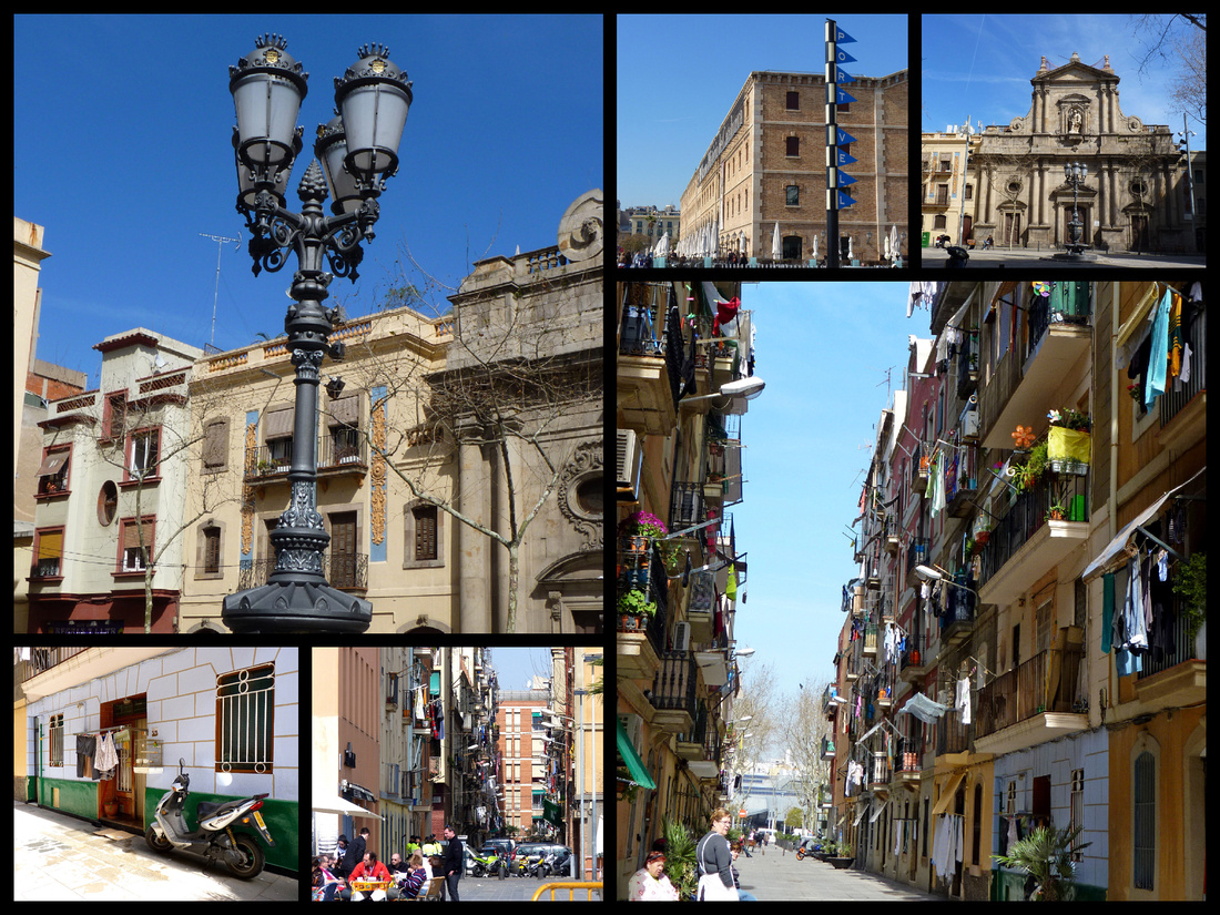
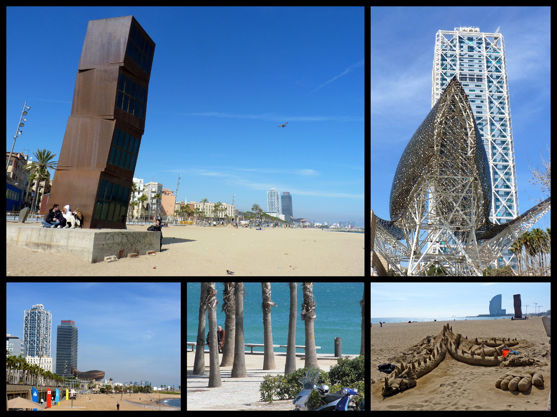
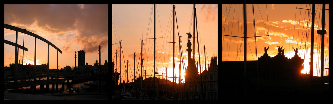
EIXAMPLE
Barcelona grew more prosperous and crowded throughout the 19th C, and by the 1850s it was clear that the city had to expand beyond Plaça de Catalunya. The plan that was accepted was that of an engineer, Ildefons Cerdà, who drew up a grid-shaped new town to the north, intersected by long, straight streets and cut by broad, angled avenues. Work started in 1859 on what became known in Catalan as the EIXAMPLE, or "Widening". Barcelona snipped off the building corners to create light and spacious eight-sided squares at every intersection. The plan, which was never completely carried out, was to have each 20 block area have it’s own hospital and large park. Each 10 block area would have it’s own schools, markets, etc. The hollow area formed by the buildings in each block would form a neighborhood park. The Eixample is still the city's main shopping and business district, spreading out on either side of the two principal and parallel streets, Passeig de Gràcia and Rambla de Catalunya, both of which cut northwest from the Plaça de Catalunya.
As the money in the city moved north, so did a new class of modernista architects who began to pepper the Eixample with ever-more striking examples of their work, commissioned by status-conscious merchants and businessmen. These buildings turn the Eixample into a huge urban museum around which it's a pleasure to wander. No architect was as fantastical as Antoni Gaudí (1852-1926), the foremost proponent of Catalan modernismo. This eccentric genius conceived buildings as "visions." A recluse and a celibate bachelor, he lived out his own fantasy. Nothing is more stunning than his Sagrada Familia, Barcelona's best-known landmark, a cathedral on which Gaudí labored for the last 43 years of his life before he was tragically killed by a tram in 1926. If it's ever finished, "The Sacred Family" will be Europe's largest cathedral.
UNESCO World Heritage Lists seven properties built by Gaudí in or near Barcelona including Parque Güell, Palacio Güell, Casa Mila, Casa Vicens, Sagrada Familia, Casa Batlló, and the Crypt in Colonia Güell.
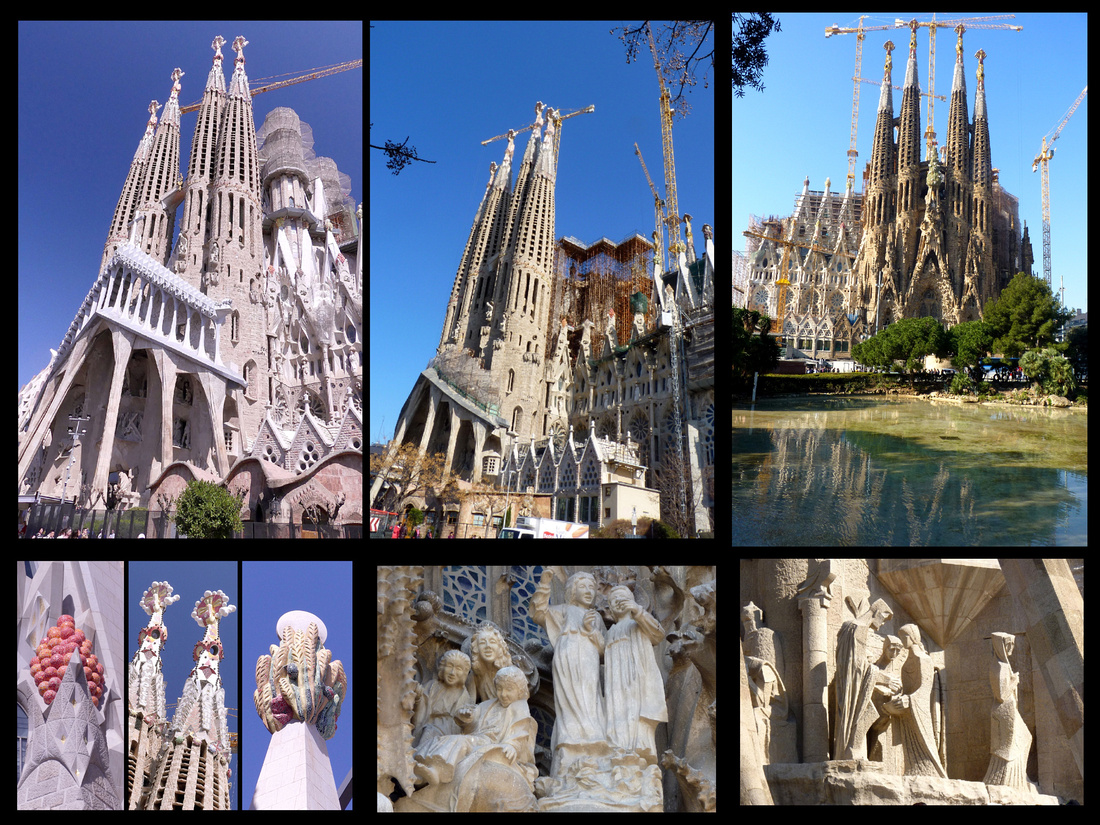
Above - Top left (2019) and top center (2010) show that progress is being made on the cathedral.
La Sagrada Família has become a symbol for the city, and was one of the few churches (along with the cathedral) left untouched by the orgy of church burning which followed the 1936 revolution (although they did burn all the plans Gaudi had left for it’s completion). Begun in 1882 and still very incomplete at Gaudí's death in 1926, this incredible church--the Church of the Holy Family--is a languid, amorphous structure -Art Nouveau run rampant (although George Orwell called it the ugliest building in the world). Work continues on the structure, but without any sure idea of what Gaudí intended. Some say that the church will be completed by the mid-21st Century. Gaudi was only 31 and had not yet been recognized as an accomplished architect when he was chosen to work on it. He worked on the project on and off for 43 years. By then the trend had moved away from Modernisme and money ran low. He sold everything including his home and moved into a hut on the construction site. After his death work continued slowly for the next 75 years but now interest in Gaudi has grown and money is pouring in. It’s the most visited site in Barcelona and the entrance fees of 1.5 million annual visitors are financing an acceleration in the building.
Although basically Gothic in plan Gaudi wanted no buttresses, or “crutches” as he called them. He fussed over every detail and when a bishop asked him why he worried so much about the tops of the towers, Gaudi replied, “the angles will see them”. It was conceived as nothing short of a Bible in stone, a gigantic representation of the entire history of Christianity. Gaudí's plans called for three immense facades, the lateral (Nativity and Passion) facades presently visible on the northeast and southwest sides of the church, and the even larger Glory facade (as yet unbegun) designed as the building's main entry, facing southeast over Carrer de Mallorca. Presently there are eight towers standing. The current spires will be the two sides of the church, the front and back spires – even further apart – haven’t been stared yet. The crypt of the cathedral features a small museum of the architect's scale models.
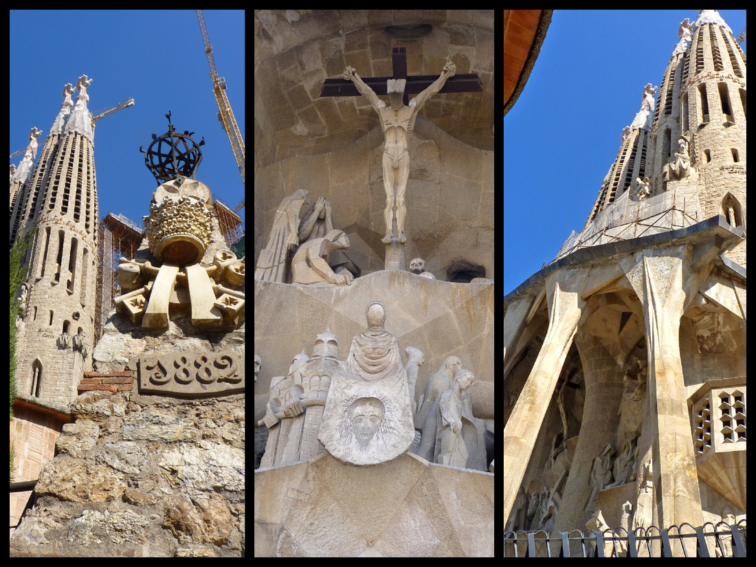
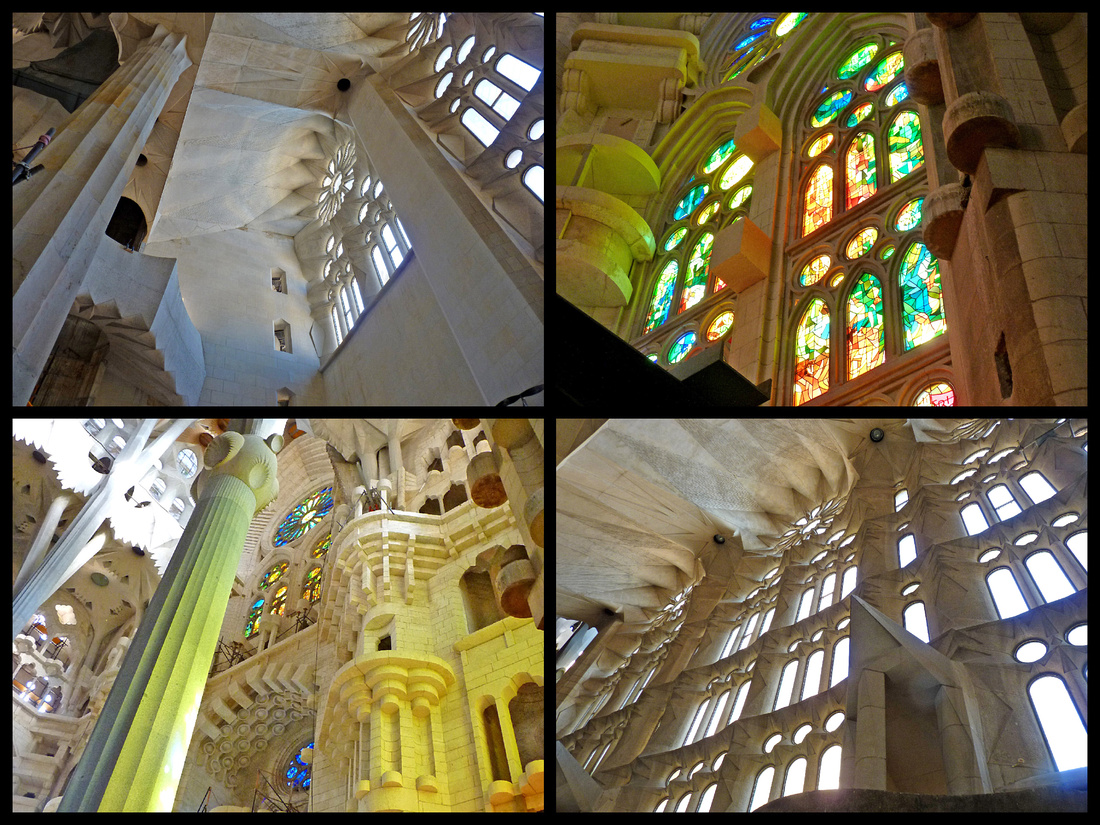
Hospital de la Santa Creu i de Sant Pau - Certainly one of the most beautiful hospital complexes in the world, a 10-minute walk from the Sagrada Família. Work started on the hospital in 1902, to replace the ageing hospital building in the old town (which still stands) with a large, modern and planned series of hospital departments and wards. The buildings are surrounded by gardens and everywhere, turrets and towers sport bright ceramic tiles, little domes, mosaics and lavishly decorated with sculptures, stained glass windows and elaborately wrought iron lamps. It consists of 26 pavilions built on a “human scale” covering nine whole blocks and connected with underground service tunnels. Hospital de Sant Pau is notable for its Mudejar motifs and sylvan plantings. The complex won architect Lluís Domènech i Montaner his third Barcelona "Best Building" award, in 1912. (His previous two were for the Palau de la Música Catalana and Casa Lleó Morera.) The Moderniste enthusiasm for nature is apparent here; the architect believed patients are more apt to recover if they are surrounded by trees and flowers, rather than ensconced in sterile hospital wards.
The hospital complex ceased to function as a real hospital in 2009. A new hospital was built in 2003 located just behind this campus.
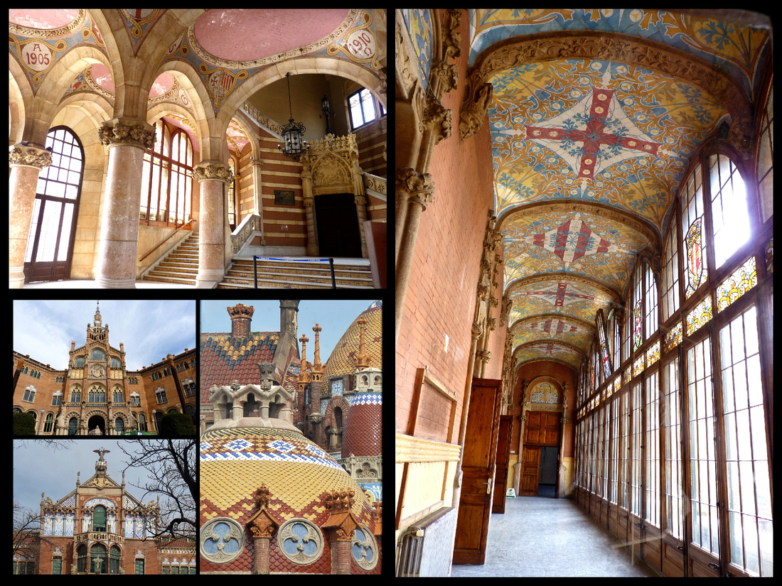
A few blocks from Placa Catalunya along Passeig de Gracia is the block known as Mansana de la Discordia, block of dischord, works by not just one great architect but three.
Casa Lleo Morera, Passeig de Graca #35, whose dominant turret resembles a melting wedding cake atop a sea of esoteric ornamentation that includes models of a lion (lleo) and mulberry bush (morera). Built in 1864, it was one of the first in the area. The corner has an ethereal ceramic cupola. The ground floor was designed to house a photographer’s studio so the building has nymphs holding a gramophone as a symbol of bourgeois leisure, another holding an electric bulb and the third a camera. The lions and the mulberry tree adorning the balcony are a play on the family name – Lleo I Morea.
Casa Amatller, Passeig de Graca #41, completed in 1898, has a stepped gable, richly glittered with blue, pink and cream tiles. Its shape in reference to Flanders, once an unwilling colony of Spain (like Catalunya). Between the two doorways are St. George battling the dragon, watched by a swooning princess plus soulful figures representing painting, sculpture, architecture and music, monkeys hammer away at iron while rabbits stow the finished product. A bespectacled donkey engrossed in a book while his friend twiddles with a camera are references to architect Amatller’s love of reading and his photographic interest. Frogs blow glass and pigs play potter by the third window. A window decoration culminates in an almond tree, a play on the family name, with a curling letter “A” surrounded by almond leaves.
Casa Batllo, Passeig de Graca #43, an older building given a facelift by Gaudi in 1904. Barcelona’s biggest allegory of St George and the dragon, covered with a rippling blue skin of ceramic plaques. The roof is the dragons back and the characteristic Gaudi pinnacle with its bulb dome and cross is St George’s lance piercing the dragon. The trencadi-covered chimneys, invisible from the ground are the dragon’s multi-spiked tail. The first floor is the dragon’s lair, the first balcony depicts the rose which grew from its blood, while the other balconies hint at the skulls and tibia in its larder. The balconies of delicate wrought iron look like fishing nets tossed in the air. It’s known affectionately by Catalans as the casa dels ossos (house of bones) -- and sometimes alternatively the casa del drach (house of the dragon).
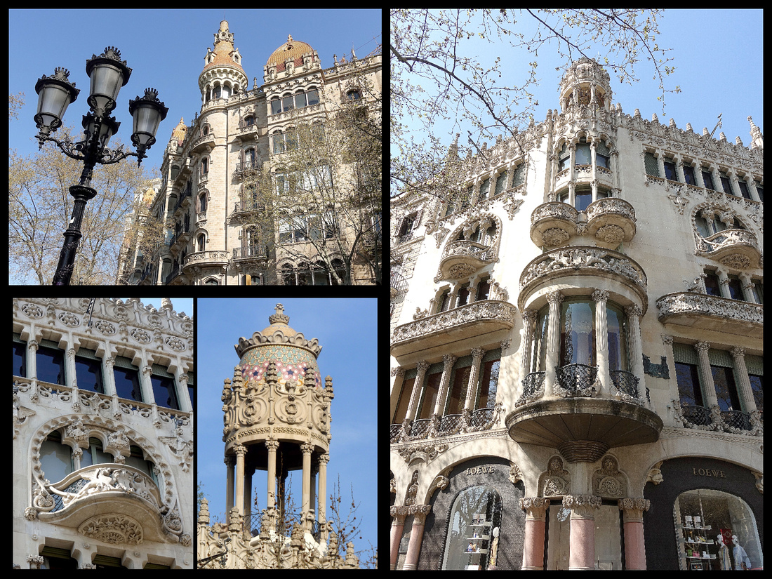
Above: Top Left: Casa Pascuali i Pons (corner of Placa Catalunya) Other photos: Casa Lleo Morera
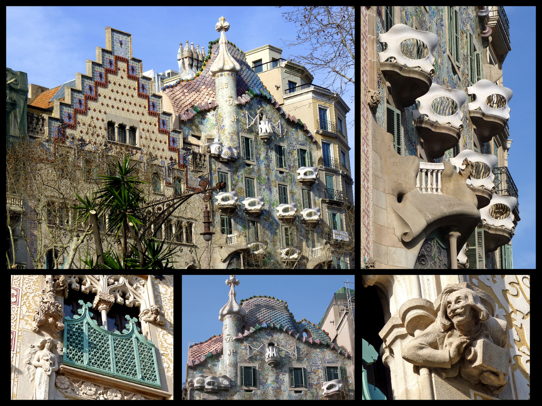
Above: Casa Amatlier and Casa Batlo
Casa Mila - Begun in 1905 this building is, after La Sagrada Família, Gaudí's most extraordinary work. Nicknamed La Pedrea (stone quarry), its more sculpture than building, like a cliff sculpted by waves. No two balconies are alike. Topped by chimneys so eerie they were nicknamed espantabruxes (witch-scarers), the building was unveiled in 1910 to the horror of local residents. Gaudí's rooftop chimney park, alternately interpreted as veiled Saharan women or helmeted warriors. Espai Gaudi – the attic - is a wavy tunnel of parabolic arches that gives the impression of being inside the rib cage of a dragon – what the princess would have seen if St Jordi hadn’t arrived in time. Inside the attic are excellent critical displays of Gaudí's works from all over Spain, as well as explanations of theories and techniques, including a spectacular upside-down model (a reproduction of the original in the Sagrada Família museum) of the Güell family crypt. The Pis de la Pedrera apartment is an interesting look into the life of a family that lived in La Pedrera in the early 20th C. Everything from the bathroom to the kitchen is filled with reminders of how rapidly and completely life has changed in the last 75 years. People still live in the other apartments. On the ground level is a dreamily painted entrance courtyard.
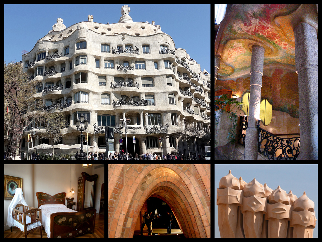
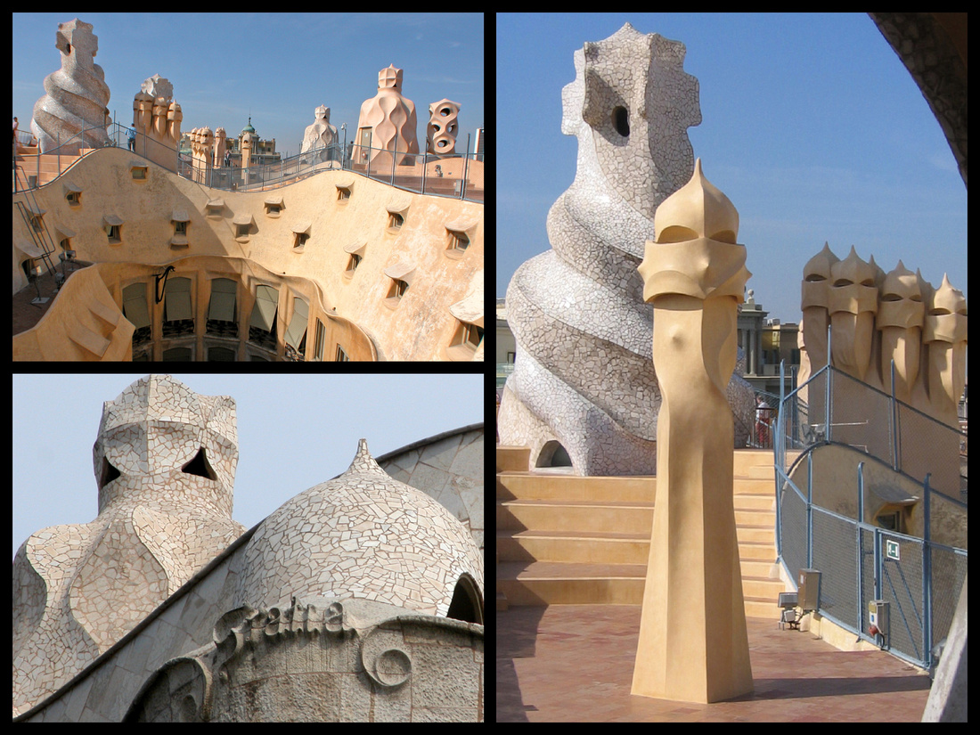
Above: Casa Mila
Rambla de Catalunya is one of the Eixample’s main shopping streets. It is the district's most attractive avenue, largely pedestrianized and sporting benches and open-air cafés. At the corner of Rambla de Catalunya and Avinguda Diagonal is Casa Sera, moderniste but with Renaissance elements. Just in front of it is one of the more interesting sculptures in Barcelona, "the Coquetta", a lounging giraffe.
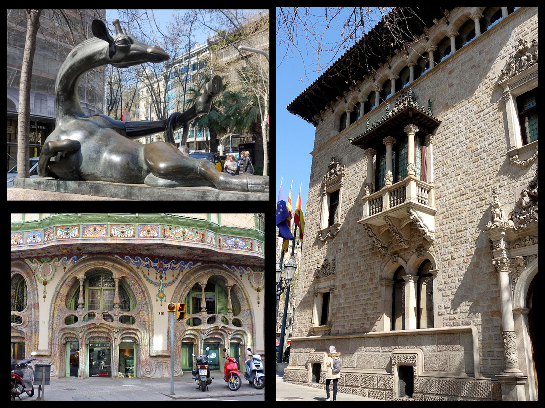
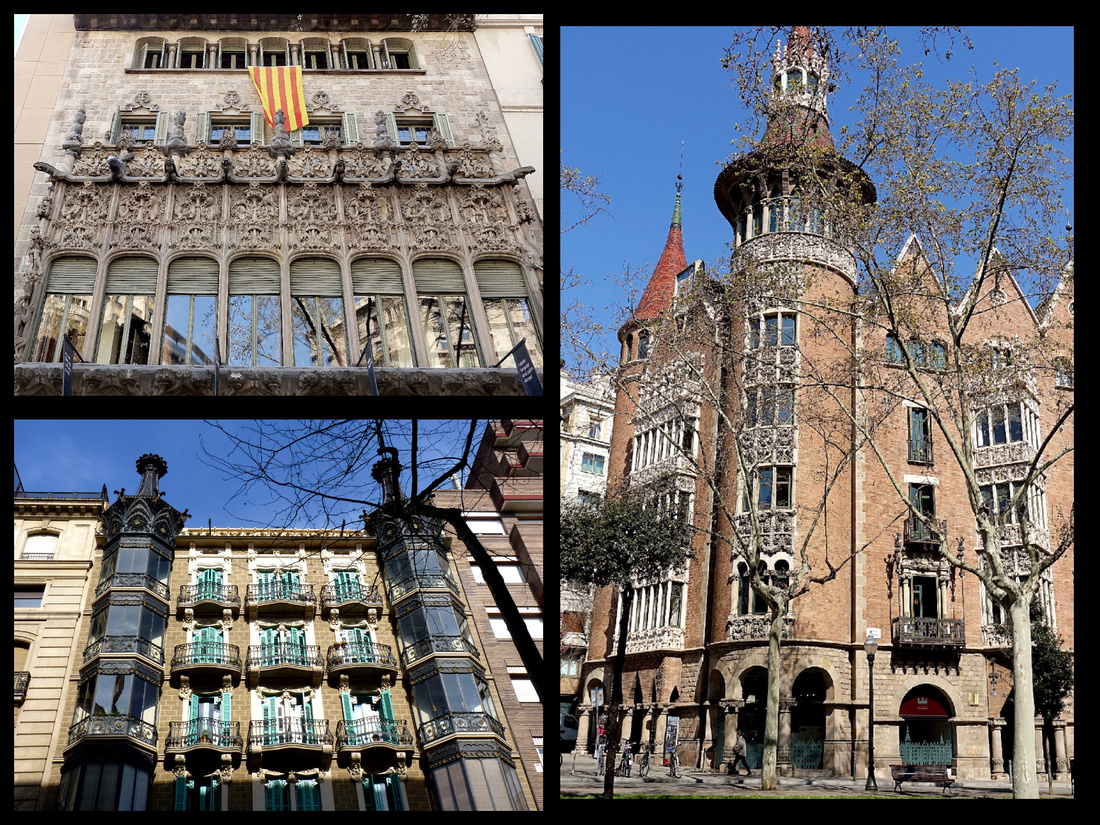
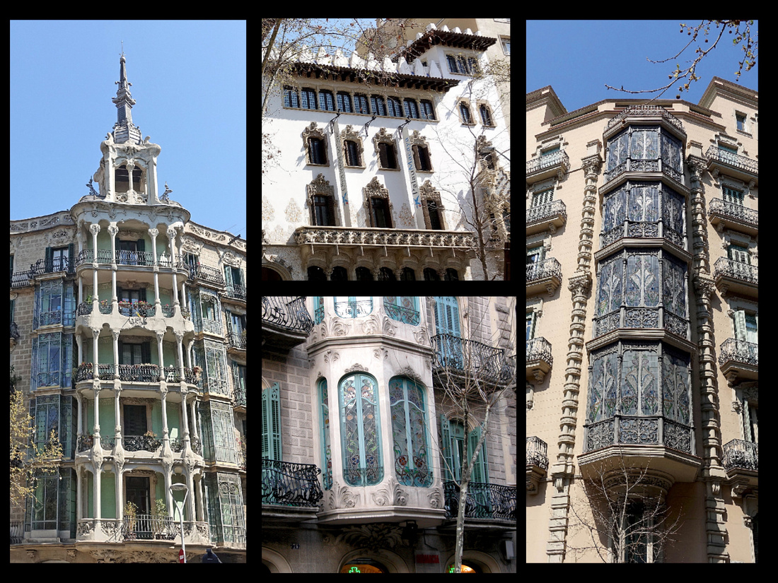
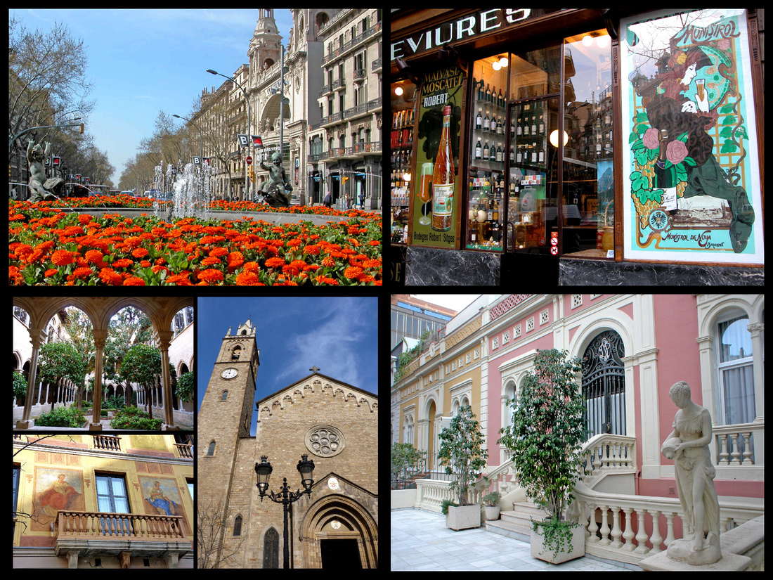
Parc Güell is where Gaudí turned his hand to landscaping, with spectacular results. Huge ceramic benches, giant decorative lizards, ceramic mosaics and pavilions of contorted stone all combine into a brilliant swirl of the imagination. Eusebi Guell bought two farms here in 1902 with plans to lay out an exclusive English garden suburb with 60 homes, a market, paths, gardens, etc. He gave Gaudi free rein to design the entrance, lodges, a central market and terraced walks. Although Guell left his fancy Gaudi designed home in El Raval to live here, none of the homes were ever built and when he died in 1918 his family donated the site to the city.
The Grand Stair – swoops around the most jovial salamander imaginable, clinging to the fountain and covered with brightly coloured trencadis that symbolize fire. Guell studied in Nimes, a city that was Catalan in the middle ages and which has a Place de la Salamandre. Trencadís is a type of mosaic created from broken tile shards. The technique is also called pique assiette. Gaudi used trencadís in many projects among which Park Guell is probably the most famous.
Sala Hipostila was planned as a covered market. The cavernous Sala is known as the Hall of a Hundred Columns (there are only 86), a thick forest of Doric columns which are hollow inside to allow rain water to run down into a vast cistern to store water for emergencies. Above it is a broad open space whose centrepiece is the Banc de Trenadis (Serpentine Bench), a tiled bench curving sinuously around its perimeter. To form the mold of the seats, Gaudi got a naked man to sit in wet plaster.
The spired house to the right of the main entrance is the Casa Museu Gaudí, where Gaudí lived for most of his last 20 years with his father and neice. The house was not designed by Gaudi, but by Francesc Berenguer as a house to show potential buyers but when there were none, Gaudi bought it. It is a pink, Alice-in-Wonderland house with green shutters and cream swirls around the windows and doors and a chimney covered with trencadis and a garden filled with sculpted flowers which Gaudi wrought from bits of cast off fencing.
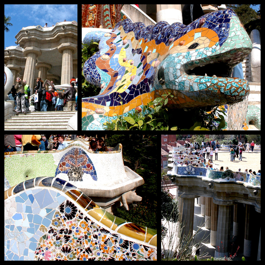
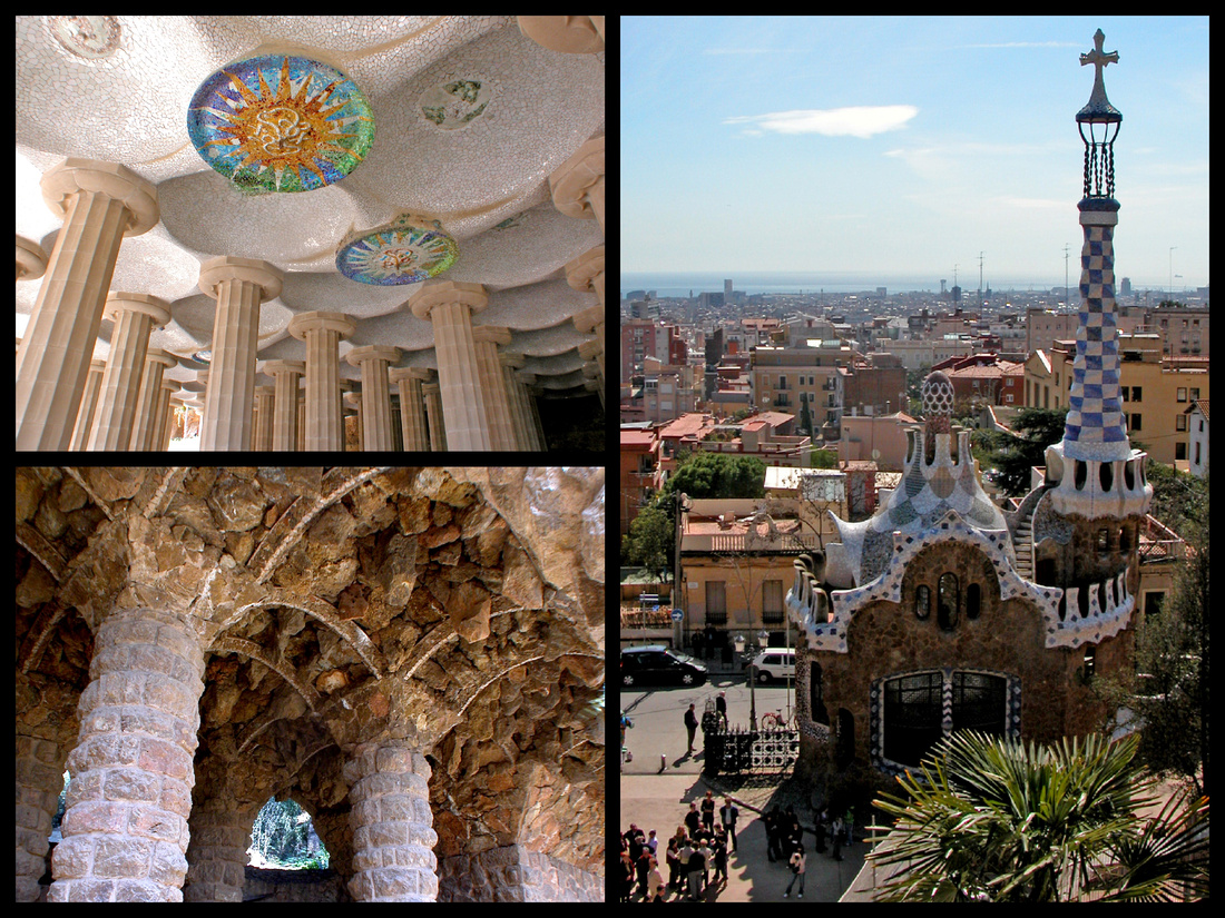
Monjuic - Placa d'Espanya is one of the busiest plazas in Barcelona, home to Barcelona's bullring, and flanked by striking 47-metre high towers. Avingunda de la Reina Maria Cristina heads up towards Monjuic. Stretching up the avenue are a series of terraces and several large fountains. At the top is Palau Nacional, which although looking old was actually designed for the 1929 exhibition, and now houses the Mluseu Nacional d'Art de Catalunya. On the other side of the Palau are the buildings and grounds from the 1992 Olympics.
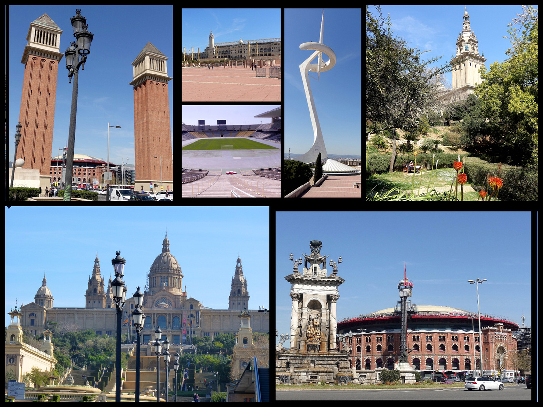
Poble Espanyol - A short walk to the western side of the Palau Nacional is the Poble Espanyol ("Spanish Village") A complete village consisting of streets and squares with reconstructions of famous or characteristic buildings from all over Spain. It was an inspired concept for the International Exhibition (and since then copied, world over at 'World's Fairs').
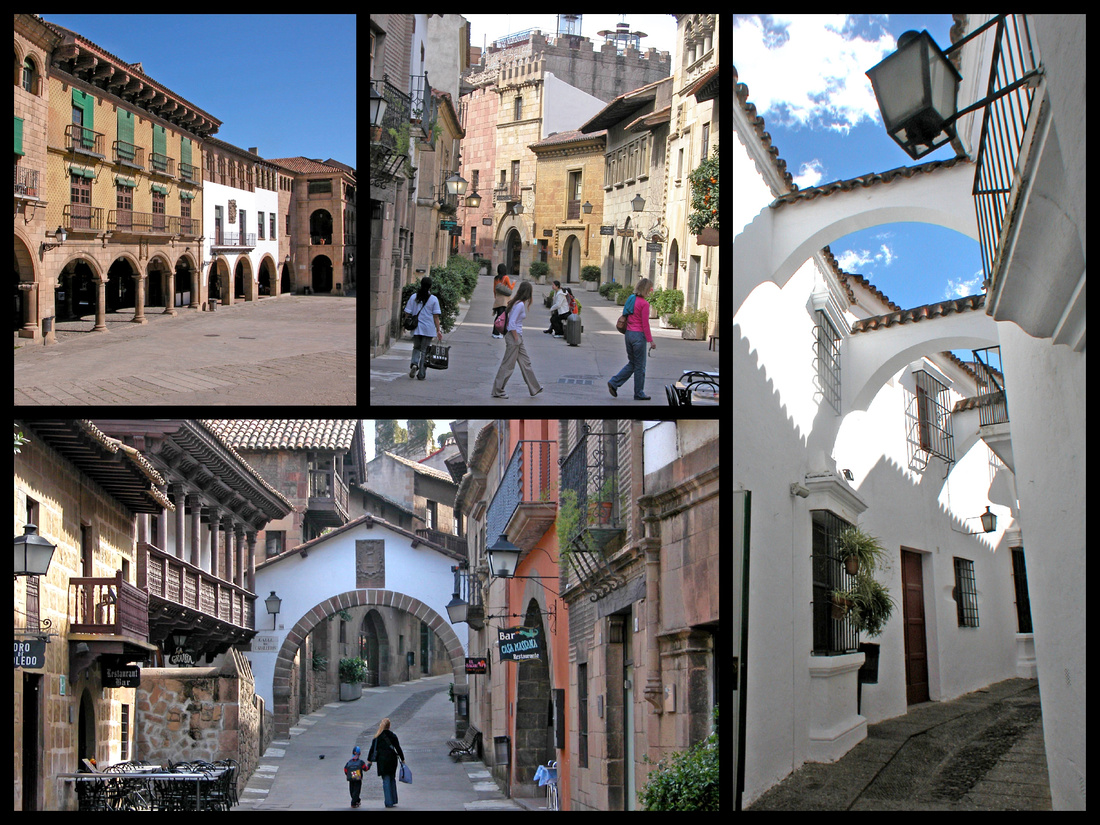
Monestir de Pedralbes With its triple-tiered cloister, gardens, convent kitchen and refectory, (and Rubens, Titians, etc. from the Thyssen-Bornemisza Collection), this is one of Barcelona's best secrets. Founded in 1326, the convent has an unusual, three-story Gothic cloister. You can also visit the medieval living quarters. There’s a large refectory, a fully equipped kitchen, an infirmary (complete with beds and water jugs), a separate infirmary kitchen and a well-tended kitchen garden.
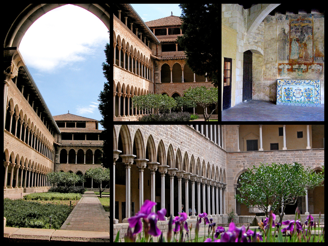
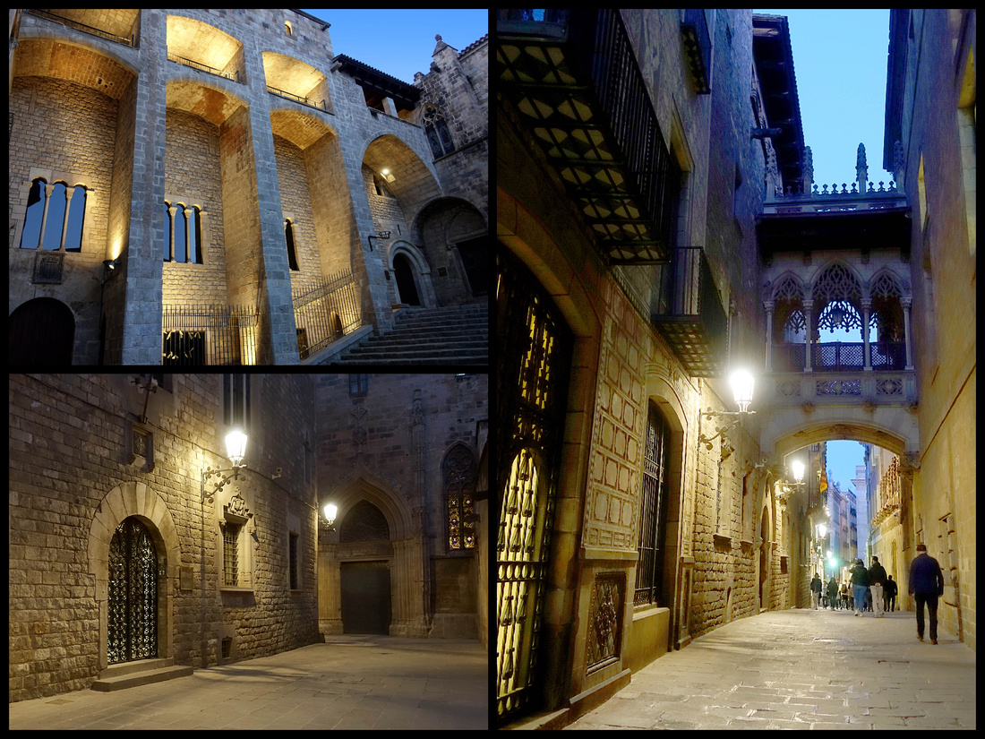

TARRAGONA
My main reason for visiting Tarragona was to do a side trip to the Poblet Monastery. I arrived at the train station on a beautiful sunny Sunday morning. It's a short walk to the main part of town but it is UP - which makes for great views but a steep climb to get there. I dropped my bag at the hotel (Hotel Placa de la Font) and went to the TI where a very nice lady informed me that the bus to monastery doesn't go on Sundays, and the monastery is closed on Mondays. Guess I didn't research this very well. But there was still a lot to see in Tarragona itself and two days was a good amount of time.
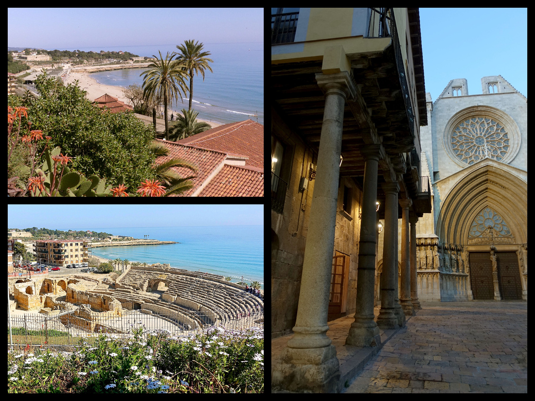
Tarragonna is today a provincial capital with a beautiful setting on the Mediterranean. It’s on the UNESCO world heritage list for the ensemble of Roman archaeological sites that date to when it was the most important city in Iberia. The most impressive is the amphitheater, set right on the water, built in the 1st C AD, could hold 15,000 spectators. There are also ruins of the forum, fairly extensive sections of the Roman wall and a museum. All of these can be ‘visited’ with a ticket, but you can see most of it pretty well without going ‘in’. There are also numerous other Roman bits scattered around town. The map from the TI identifies things pretty well.
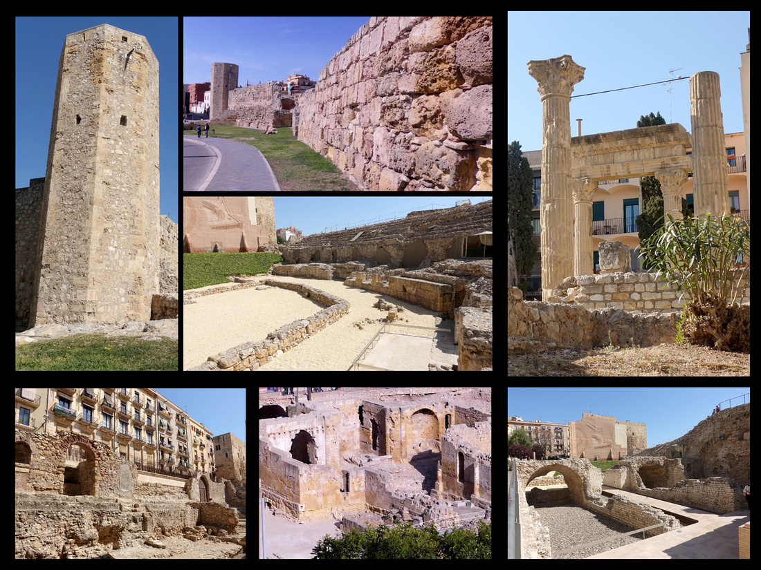
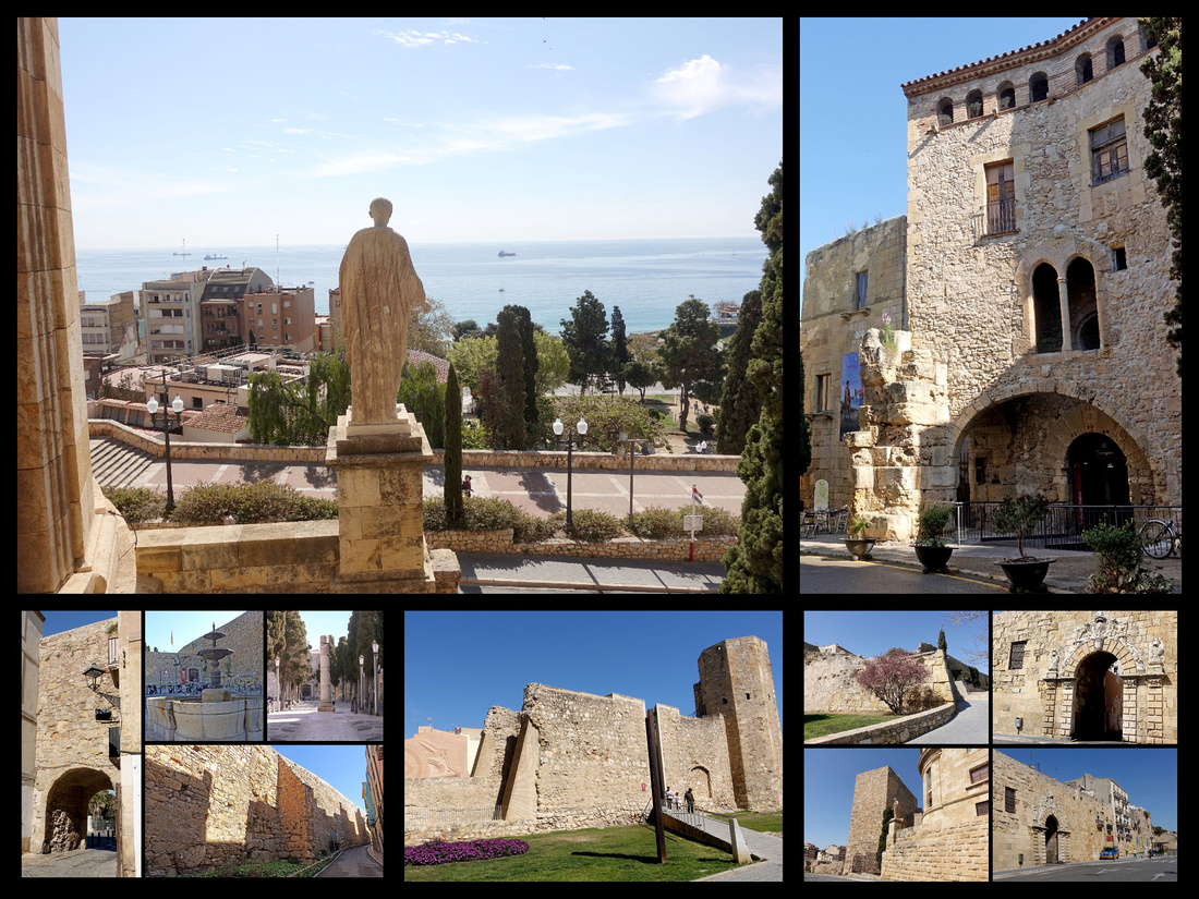
The main street in Tarragona, Rambla Nova, is a wide boulevard with car lanes on each side of a very wide pedestrian center – which is lined with trees and benches. At the top end is the Balcón del Mediterráneo, a terrace with stunning views of the Mediterranean. Steps from the Balcón del Mediterráneo lead down to the railroad station and the beach. Part way down La Rambla is an interesting statue – Monumento de los Castellers. This is a huge sculpture representing a human castle, which is a Catalan tradition in which a "colla" composed of many people create a compact base with their bodies clutching together and then the other members begin to climb up on the shoulders of these forming up to 10 floors easily measuring more than 10 meters high. This is a Catalan tradition, also done in Barcelona, but it’s native to Tarragona and has been around for over 300 years. There are posters and a tile plaque with pictures but the sculpture is the most impressive. Also in La Rambla Nova is a bronze of ‘grandfather’ statue and a nice fountain. Very pleasant avenue. Stores were pretty boring though.
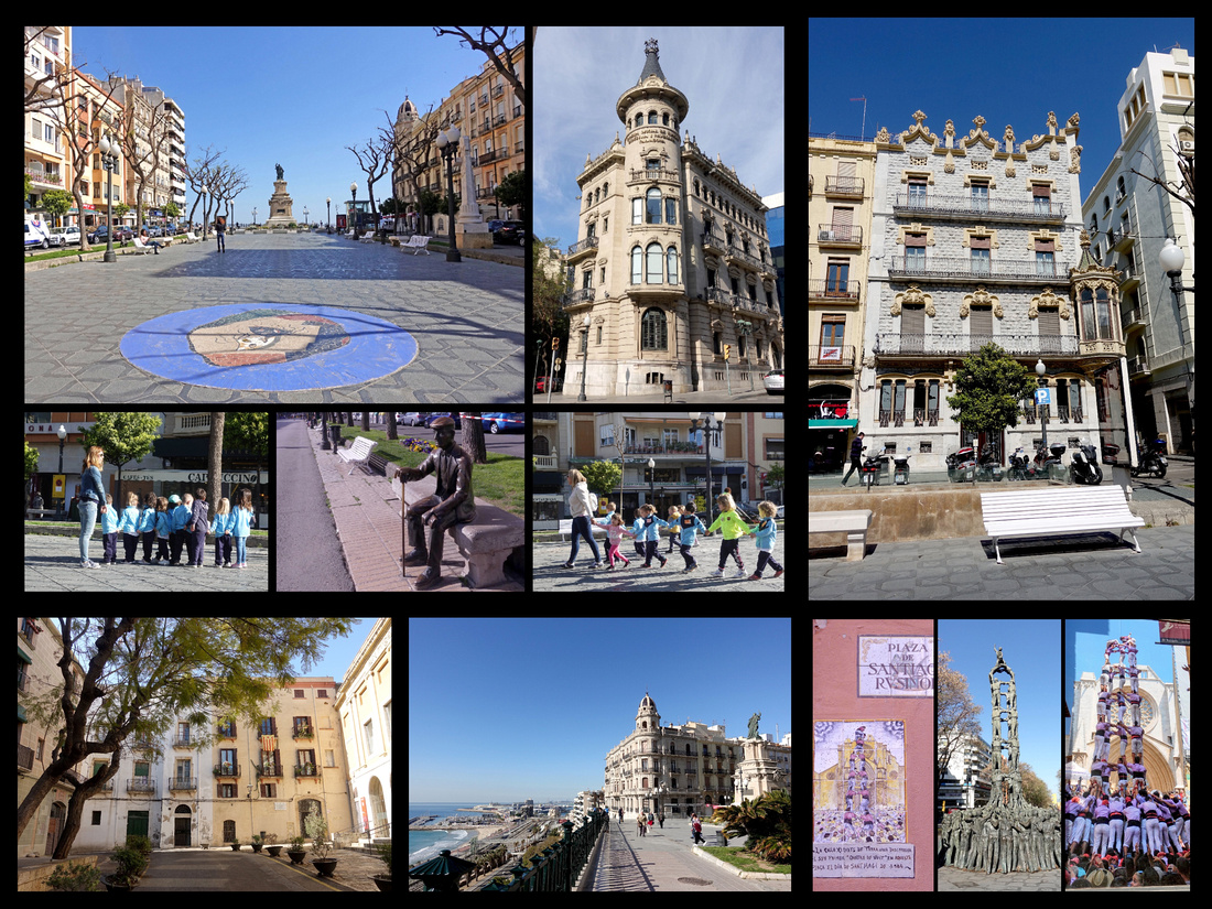
Placa de la Font is a large rectangular square, with the Ayuntamiento at one end.

Tarragona Cathedral (5€) Romanesque and Gothic, is large and really pretty from the outside, inside just average, one side chapel was cool, one side room looks more like a castle room than a church but overall nothing special. The cloister was very nice though, huge, very well kept with five fountains in the center, several of them with gold fish and one with 3 rather large turtles. I sat in the sun against the cloister wall for a while. Most of the time there were only a couple other people there, a few tour groups came through but didn’t stay long, very peaceful. The cathedral’s setting is interesting, at the top of a large flight of stairs on a small plaza, with some atmospheric medieval looking buildings on one side.
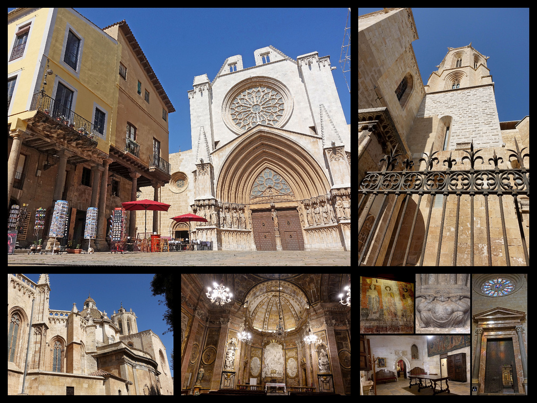
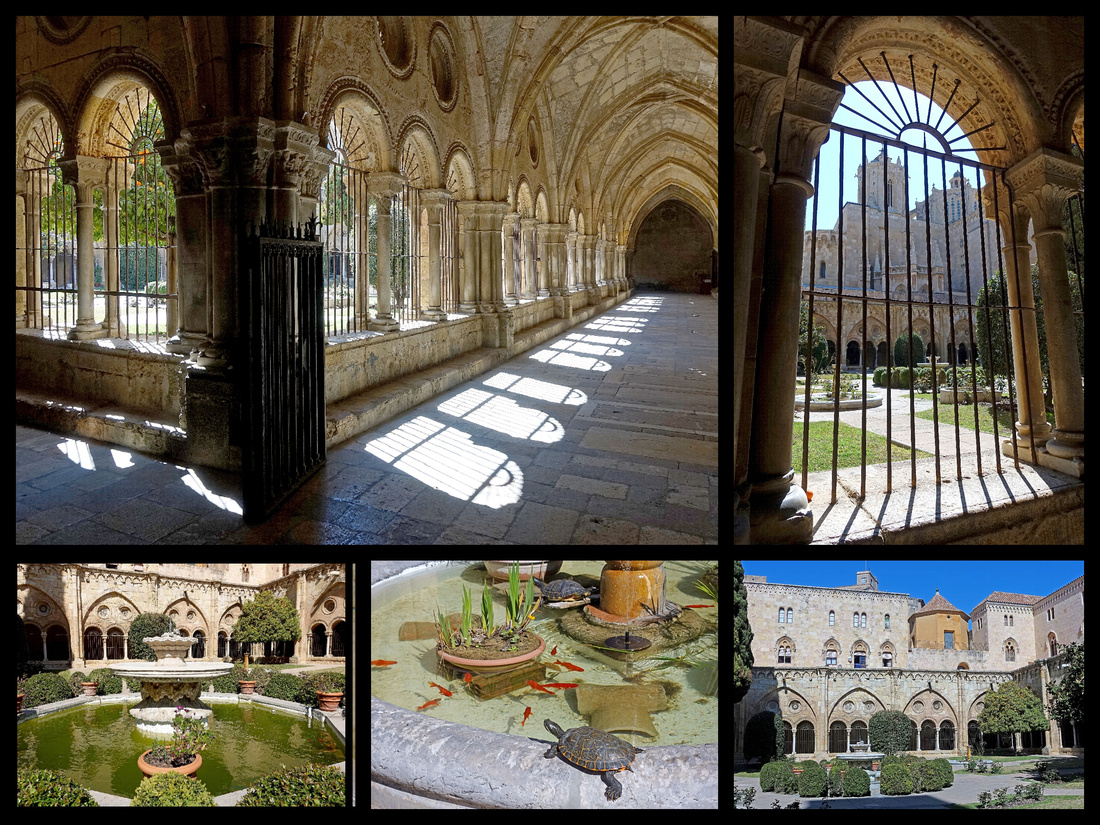
Surrounding the cathedral are medieval lanes and alleys, the section of town referred to as “Part Alta”, with houses from the 15th century onward but interspersed with bits of Roman ruins.
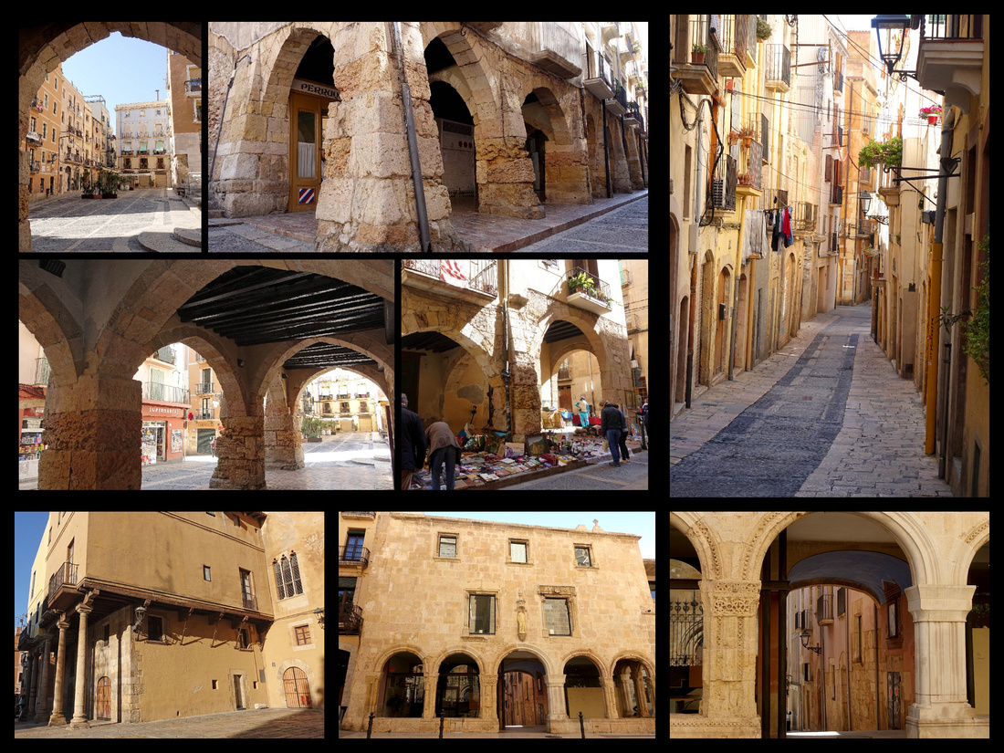
Besides the old town center, Tarragona has a lovely beach (Platja del Miracle) and about a half hour walk past the train station along the water is the old fishing village of El Serrallo. There are a few interesting old buildings, some of the city’s best seafood restaurants, and some boats – but mostly yachts, not much in the way of ‘fishing’ boats.
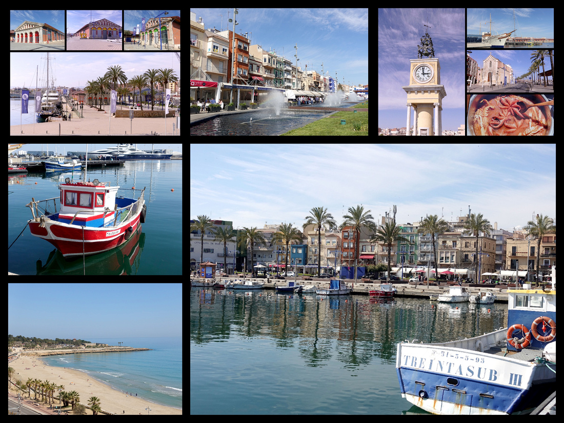
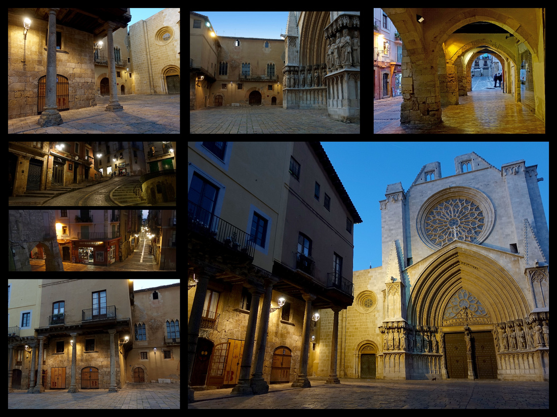
VALENCIA
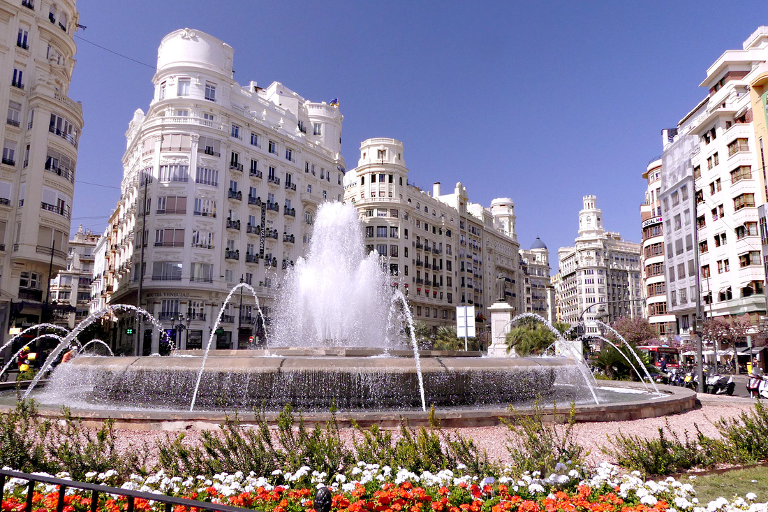
Valencia is gorgeous - I was way more impressed than I expected to be, don’t know why Valencia didn’t come up on my radar before now. The metro area has a population of over 750,000, the third largest city in Spain, but the ‘city center’ is quite manageable, just over a mile across (from Valencia Nord to the Torres de Serranos). About 1½ miles from Valencia Nord to the City of Arts and Science. The center could easily be seen in a full day, but I wandered around it several times, climbed both towers and visited several interiors. Visiting the 'City of Arts and Sciences' took another half day (but you could easily spend a full day there if you visited the museums). I also took a half day trip to Xativa Castle.
My entry point to the city was Valencia Nord train station (the other main station is Joaquin Sorolla, only a 10 minute walk past Valencia Nord, just follow the tracks, free bus between). The train station is beautiful, and then right across the street start blocks of gorgeous buildings. It’s about a 2-minute walk to the main square; I spent the afternoon exploring the city.
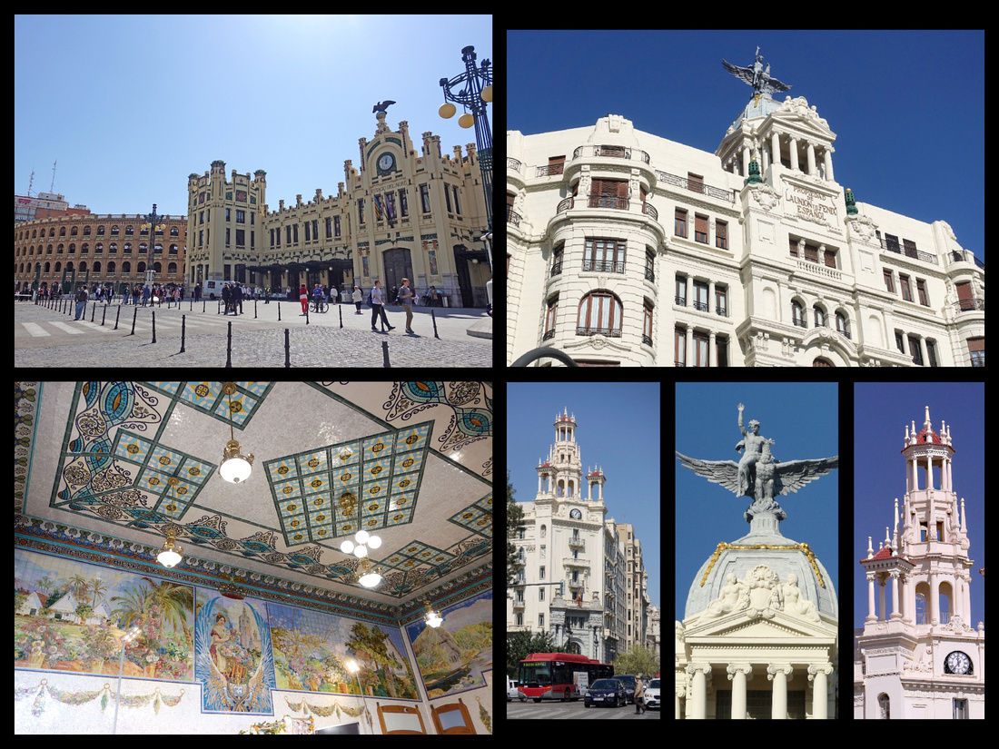
Estacion del Norte is Moderniste, 1917, has a main foyer decorated with ceramic mosaics. Next to it is Valencia’s bullring on Plaza de Toros. First sight you see coming out of the train station are gorgeous white buildings lining the block (¼ mile) to Plaza del Ayuntamiento, which is amazing, probably one of the most impressive squares in Europe – gorgeous buildings including the Ayuntamiento (neoclassical) and the Post Office (neo-baroque), probably the snazziest post office I’ve ever seen, the interior looks more like a theater lobby than a post office) plus many more beautiful buildings – certainly rivaling Madrid or Barcelona. The plaza is a huge open area with a huge beautiful large fountain and flower sellers. Just lovely. And Valencia has to be the best smelling city I've ever been to -orange trees are everywhere throughout the city and, at least in March, they were not only full of mature oranges, but also little white flowers.
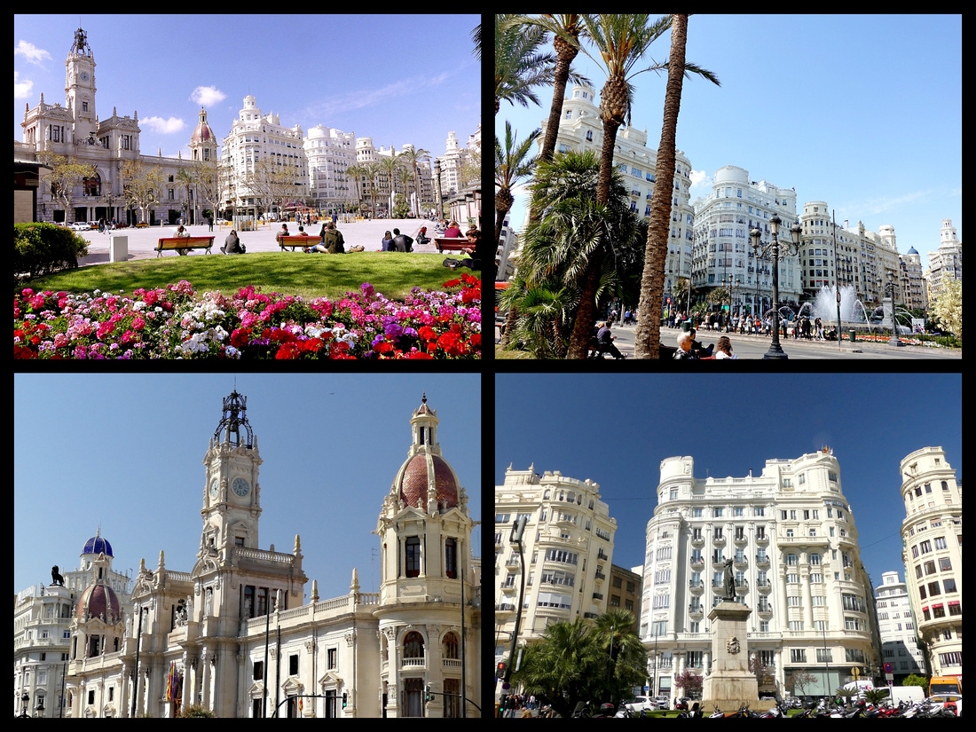 Plaza del Ayuntamiento
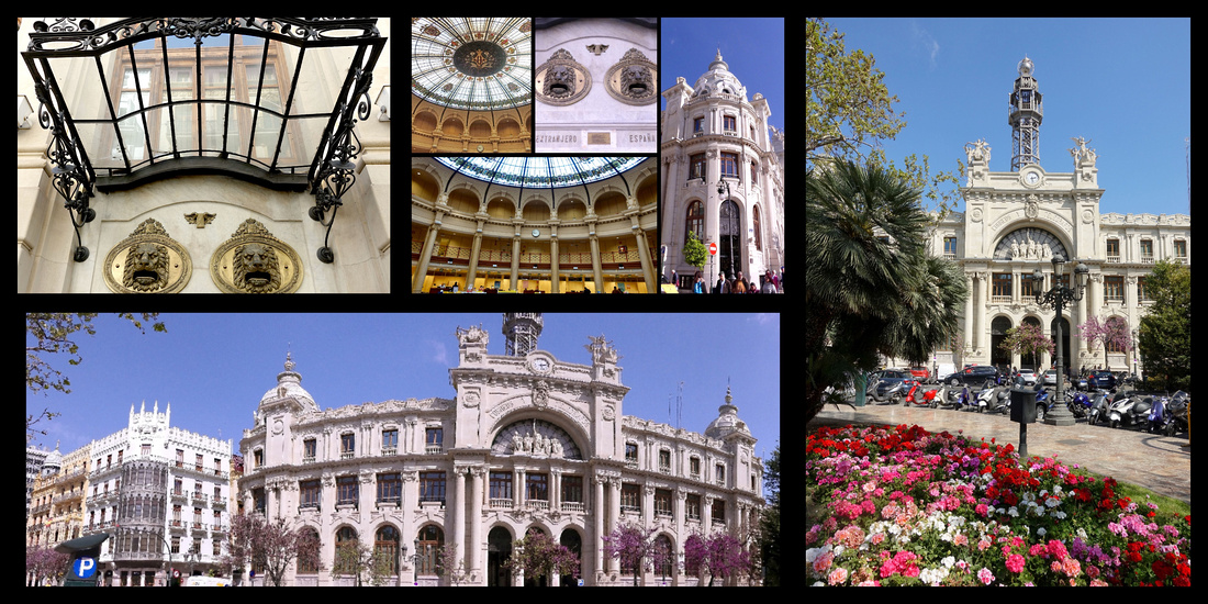 Valencia Post Office
The main part of the city is the oval area inside the Calles de Colon (ring road) where there are three major squares: besides the Plaza del Ayuntamiento there is the Plaza de la Reina and Plaza de la Virgen. The oldest quarter of the city, the Barrio del Carmen (aka El Carme) is delimited by Plaza de la Virgen, the Torres de Quart and Seranos and the Turia riverbed park.
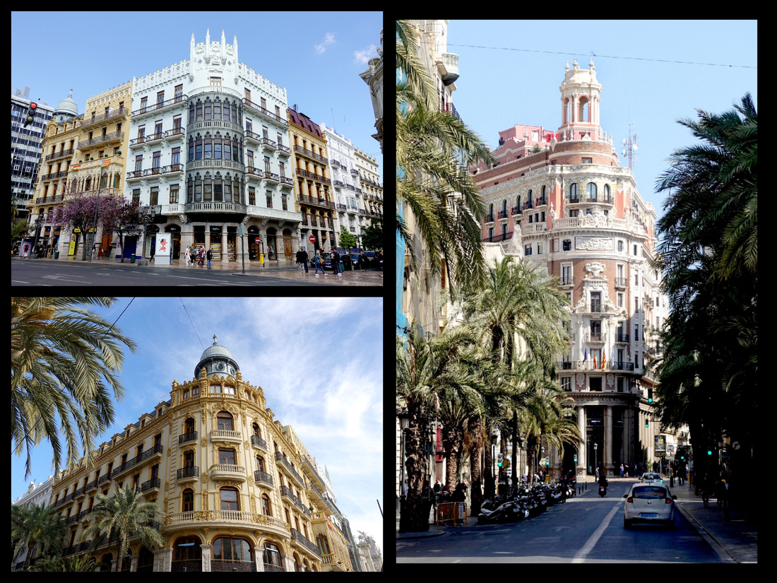 Typical Valencia buildings just off Plaza del Ayuntamiento
Plaza de la Reina –(aka Plaza de Zaragoza) is a busy square, lots of traffic, but lined with nice buildings with the main entrance of the cathedral at one end. It is the official ‘center’ of Valencia, many streets meeting here, it’s book ended by the old town’s two best towers, the Micalet and at the other end, Santa Catalina, an 18th Century baroque belfry, one of the city’s best known landmarks.
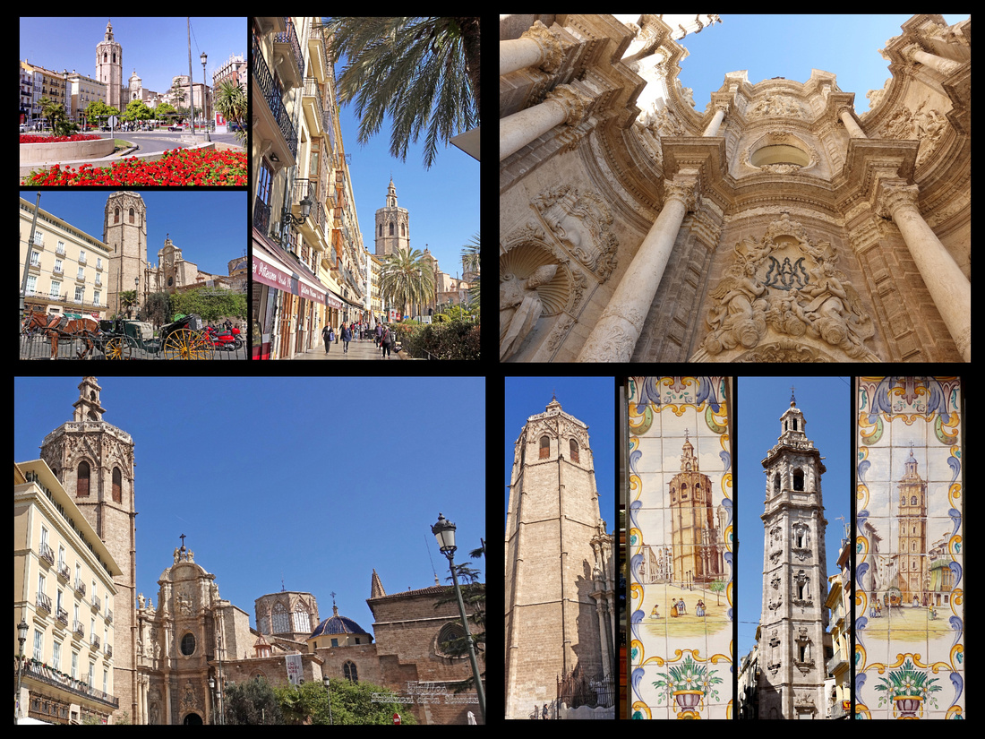
Plaza de la Reina - top right: main entrance to the cathedral, bottom right: Micalet on the left and Santa Catarina on the right was
Plaza de la Virgen was site of the Roman forum of Valencia and now a pedestrian square with the cathedral and the smaller church of Nuestra Senora de los Desamparados as well as the 15th century Gothic Palau de la Generalitat, seat of government for the Valencia region and a beautiful fountain. The Catedral (Seu) is one of the oldest buildings in Valencia, a medieval cathedral built in fortress-like style between 1252 and 1482 on the former site of the Grand Mosque, a former Visigoth Cathedral and a Roman temple of Diana. The cathedral embodies several design styles but good old Spanish Gothic predominates. The tower known as Miguelete (“Micalet” in Valenciano), right next to the cathedral is Gothic. The Puerta del Palau on Plaza de la Virgen is Romanesque; the dome, tower and Puerta de los Apostoles are Gothic; the presbytery and main entrance on Plaza de la Reina are baroque; and there are a couple of Renaissance chapels inside. It claims to house the Holy Grail, the chalice from which Christ sipped during the Last Supper.
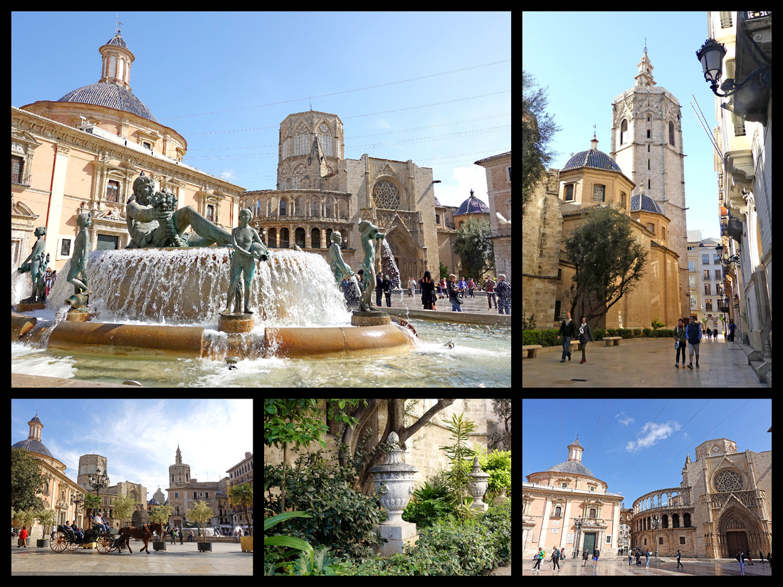
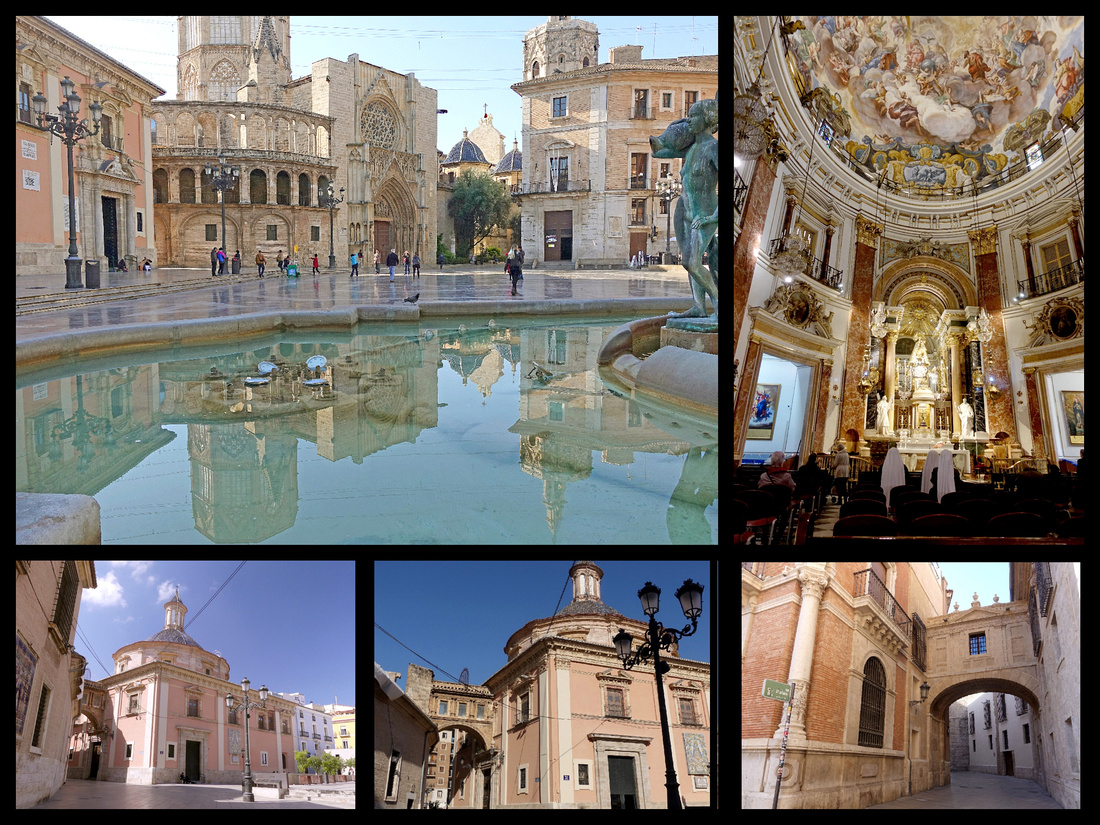
Top left: cathedral reflecting in fountain pool on Plaza de la Virgen, Top Right: interior of Neustra senora de los Desampanados
Bottom: rear side of Neustra senora de los Desampandos and archway connecting it with the cathedral.
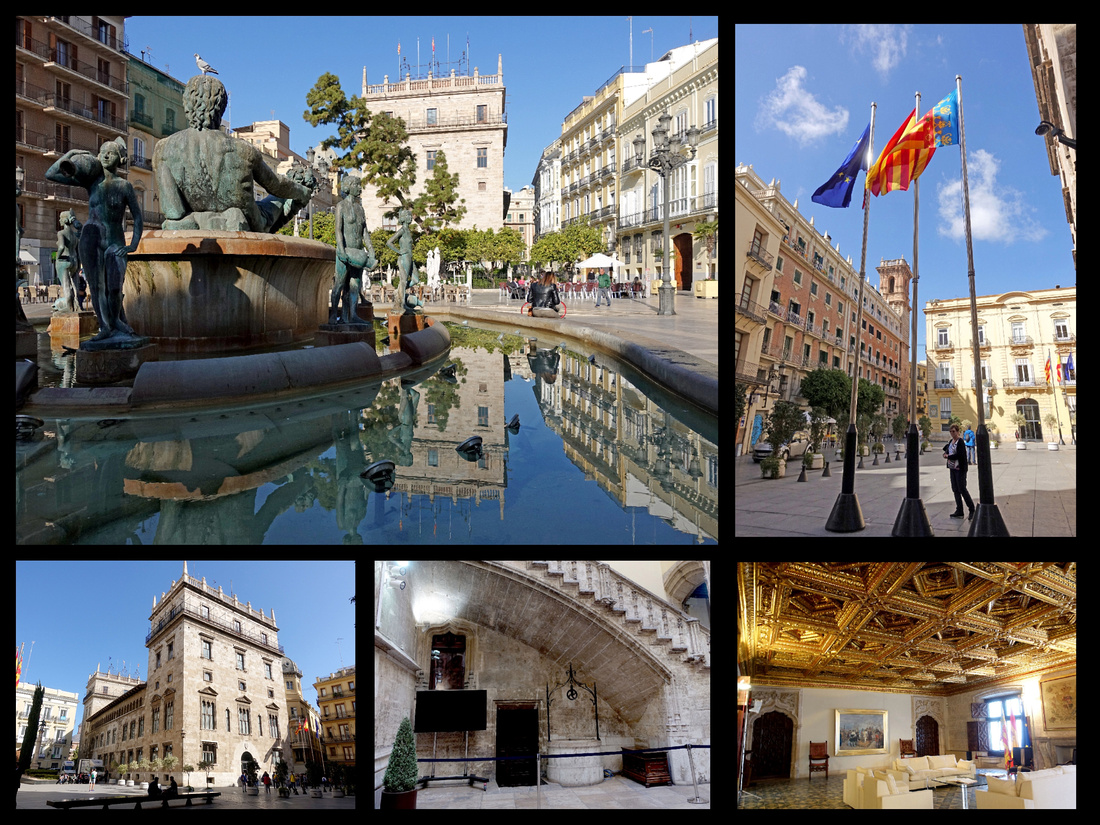
Palau de la Generalitat on Plaza de la Virgen
Torres de Serranos is the 14th century town gate which leads to Barcelona, and Torres de Quart is the 15th century gate which faces towards Madrid, the kingdom of Castile and the setting sun. Both towers are impressive whether approaching from the outside, or already “inside the walls”. Both can be climbed and are larger and more extensive than they appear from the outside. Torres de Serranos lies just inside the city from an especially nice section of Jardin de Turia, the riverbed park.
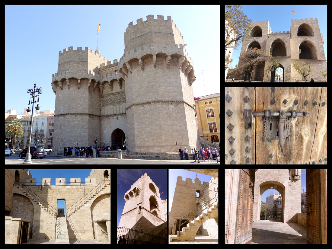

Above: Torres de Serranos
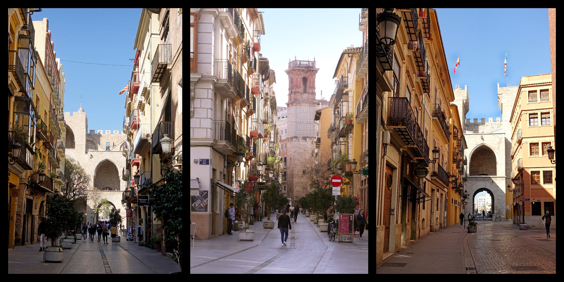
The walk between the Torres de Serranos (above left) and Torres de Quart (above right) leads through the old streets of Valencia (above center)
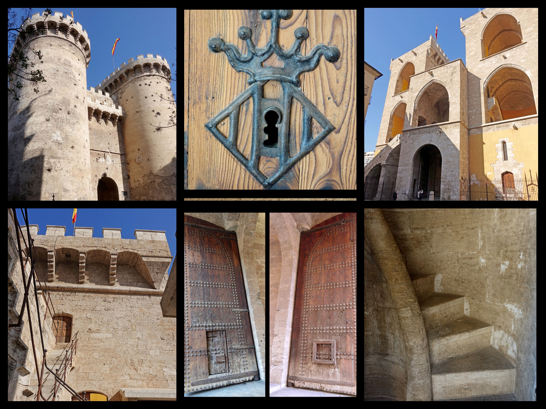
Above: Torres de Quart
Another main area of interest is around the main market. Mercado Central, Plaza Mercado, is Modernista in style (1928), one of the best food markets in Spain, not quite rivaling La Boqueria in Barcelona but impressive enough, if somewhat more sedate (and with a lot less tourists). Heavily featured are Valencia oranges, which were in season in March. Several places I saw signs for “Aqua de Valencia” (OJ).
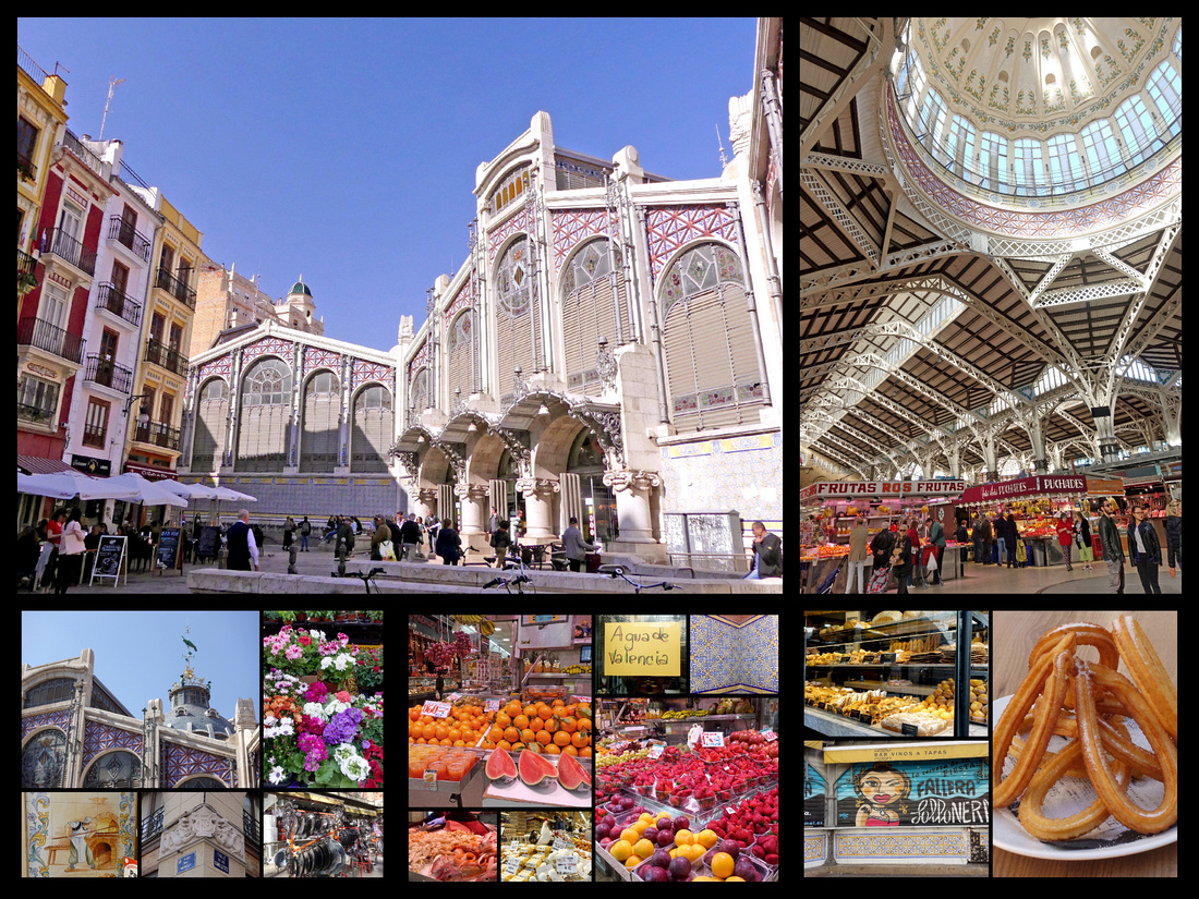
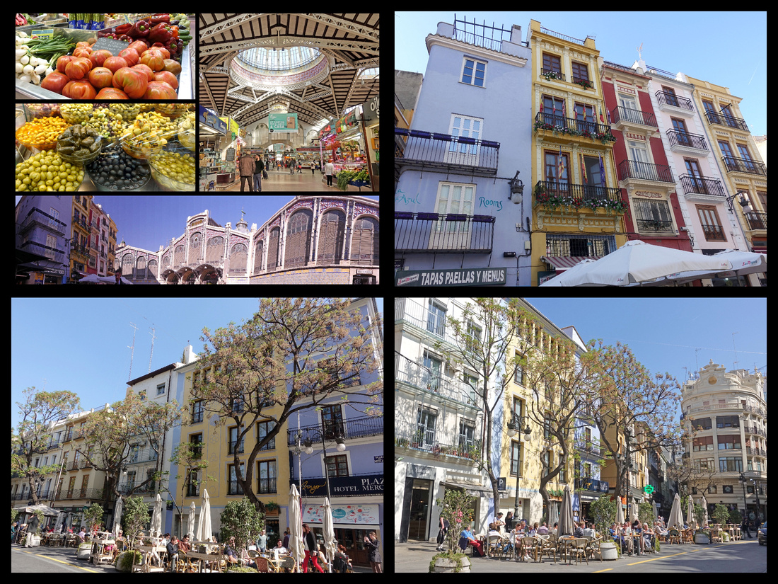 Above: the main market and the streets adjacent to Plaza Mercado
Just across the street is one of the prettiest, most interesting buildings, La Lonja de la Seda, built between 1482 and 1533, originally used for trading in silk (hence its name, the Silk Exchange) and it has always been a center for commerce. It is a masterpiece of late Gothic architecture. The grandiose Sala de Contratación (Contract or Trading Hall), illustrates the power and wealth of a major Mediterranean mercantile city in the 15th and 16th centuries. Listed as a UNESCO World Heritage Site, it is considered a top example of Gothic civic architecture. A forest of twisted columns supports the main trading hall, and the tranquil central courtyard is full of orange trees and a fountain. Besides being in a stunning state of preservation, the Lonja features some truly disgusting gargoyles. Walking around the building, both inside and outside on the facade, you can find all manner of perversion in the decorations: chimeras biting women’s breasts, a maiden fondling the genitals of a bent-over pauper, acts of bestiality, drunken men peeing into jars and more. These gargoyles are meant to represent the sins of humanity… and they don’t overlook many types of deviance.
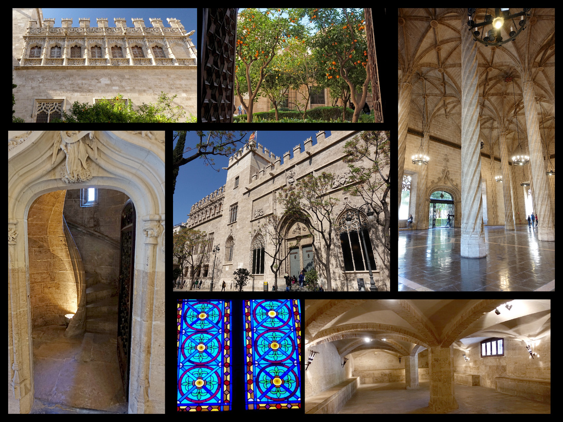
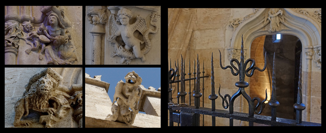
Between Plaza de la Reina and Mercado Central there is a perfectly round square. Redonda has been a part of Valencia’s layout since 1837, when it was a fish and meat market. Eventually, it became a place for sewing supplies; today there are still stalls dedicated to fabric and thread. A few years ago, the plaza was given a rather hideous makeover. The old stalls, which had been arranged in a circle around the perimeter of the plaza were moved into the center, and an ugly modern awning was added. Posters at the entrance show what it used to look like.
Just behind Lonja is Placa del Dr. Collado, a small square with a hardware shop which looks as though it’s been there for centuries. Café Lisboa, bohemian vibe, terrace tables arranged underneath the branches of a colossal, gnarled olive tree. For many years, this plaza had been the site of Valencia’s Lonja del Aceite, or Oil Market. The olive tree, as a symbol for oil, was planted in the corner to remind people of the plaza’s former purpose.
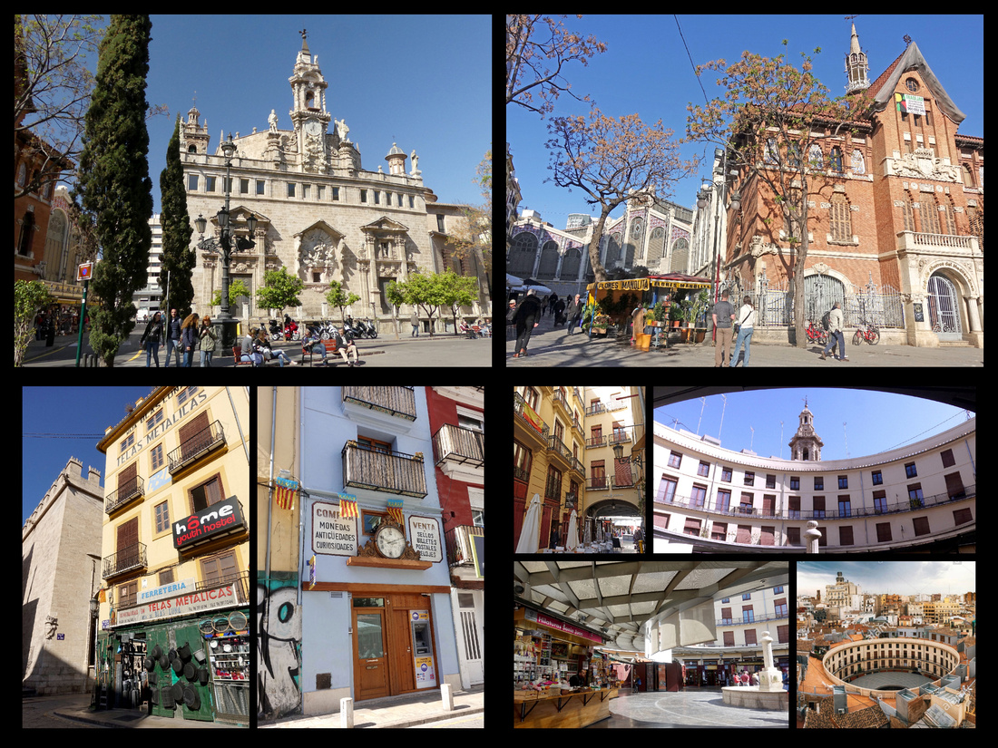
Top left: church across the street from the Lonja, top right: between that church and the market, bottom left: Placa del Dr. Collado, bottom right: Redonda
The other side of the old town has a few noteworthy buildings as well. Palacio del Marques de Dos Aguas, 15th C Gothic, radically reformed in 18th century Baroque. A lot of historic buildings in Valencia have beautiful doors, but the grand prize must go to the marble entryway of this building. It houses the González Martí National Museum of Ceramics and Sumptuary Arts and consists of four floors arranged around an interior courtyard. The entryway is magnificent but sides of the building feature some very nice decorations as well and there’s a tranquil fountain on one side.
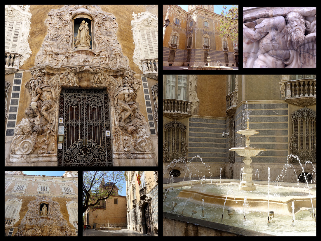
Plaza del Patriarca – a rectangular square with a symmetrical grid of orange trees, and home to a couple of Valencia’s oldest buildings: the Real Colegio Seminario del Corpus Christi and La Nau, both of which date from the 15th century. La Nau is the historic seat of the University of Valencia, 1498, centered around a spacious courtyard. The Colegio del Patriarca (or Seminario del Corpus Christi) has monks still living there, and every morning at 9:30, in the choir of the church, you can hear Gregorian chants. The church is covered in frescoes. In the foyer of the church, is the “Dragon of the Patriarch,” a stuffed crocodile mounted on the wall over the holy water basin. According to legend, this was a dragon who lived in the Turia River, terrorizing the people of Valencia. In exchange for a pardon, a Jewish prisoner agreed to kill the dragon. When the fateful day came, he approached carefully, and at the right moment, threw off his robe, revealing a dazzling suit of mirrors which dazzled the beast, and allowed the makeshift knight to deal out the killing blow. (In truth, the Dragon of the Patriarch is a crocodile brought back from one of the first Spanish ventures to South America).
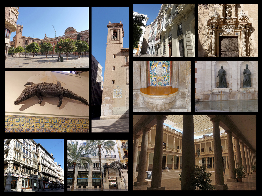
The rest of central Valencia is just as impressive. Throughout the old town there was a lot of interesting street art (mixed in with normal graffiti). Outside of the oldest part of town are some lovely avenues with pedestrian centers, lined with beautiful Valencia style buildings (several modernista style) and palm and orange tress. In this area is the other major market, the Mercado de Colon on Called de Cirilo Amoros, a modernista building, which now houses boutiques and cafes. Ave del Regne de Valencia leads out towards one of the ‘must sees’, the City of Arts and Sciences.
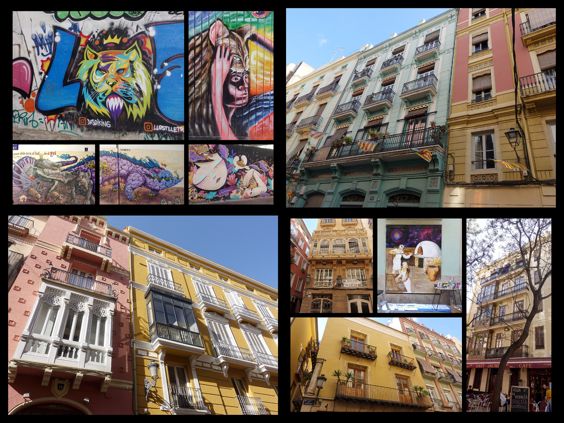
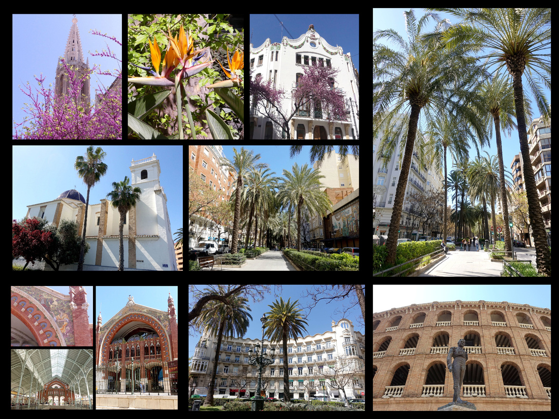 Above - Top photos and bottom center: Avenue Regne de Valencia Bottom left: Mercado Colon Bottom right: Valencia Bullring
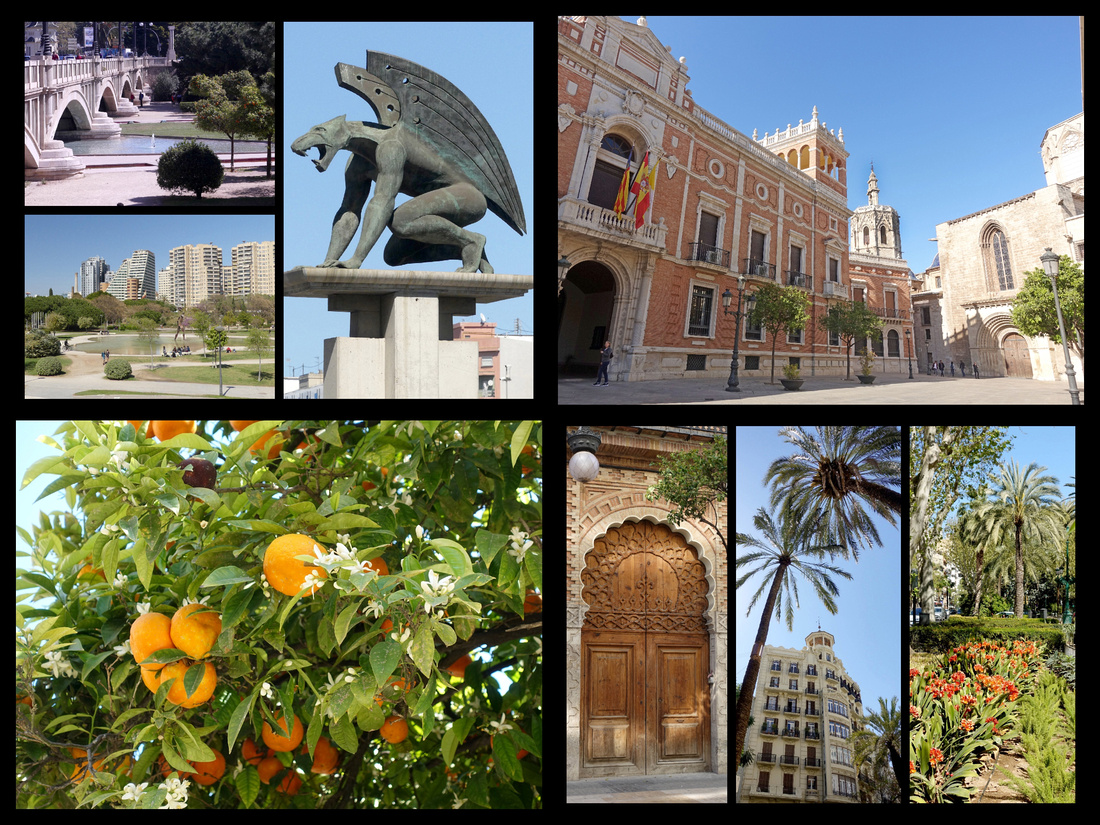
Above - Top left: Jardi del Turia Top right: building in center of Valencia behind the cathedral
Bottom photos - the walk from Valencia Nord to City of Arts and Sciences
The Jardi del Turia, is a park built along the former Turia River. After many floods the city of Valencia had the river diverted and in it’s place built a park, which now stretches all the way around the city center. In the center of the park sits The Ciutat de les Arts I les Ciencies (City of Arts and Sciences), blindingly white and futuristic buildings surrounded by blue reflecting pools - the whole thing is gorgeous. Largely designed by Santiago Calatrava, the engineer-architect previously known for visionary bridge designs and the World Trade Center Transportation Hub in NYC. The buildings house halls of science, art and performing arts but the space and the architecture are really the highlights. L’Hemisfèric, resembles a giant eye and eyelid and contains a massive IMAX theater, a planetarium, and a laser show. El Museu de les Ciències resembles the skeleton of a whale.
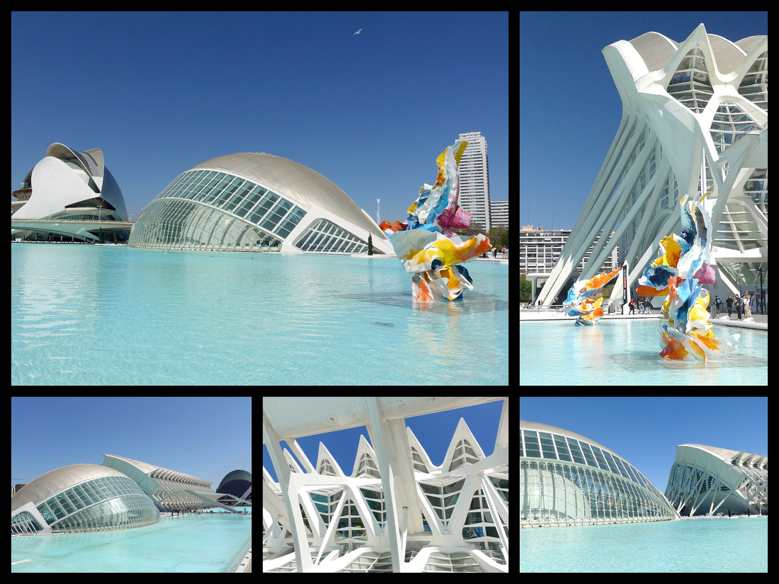
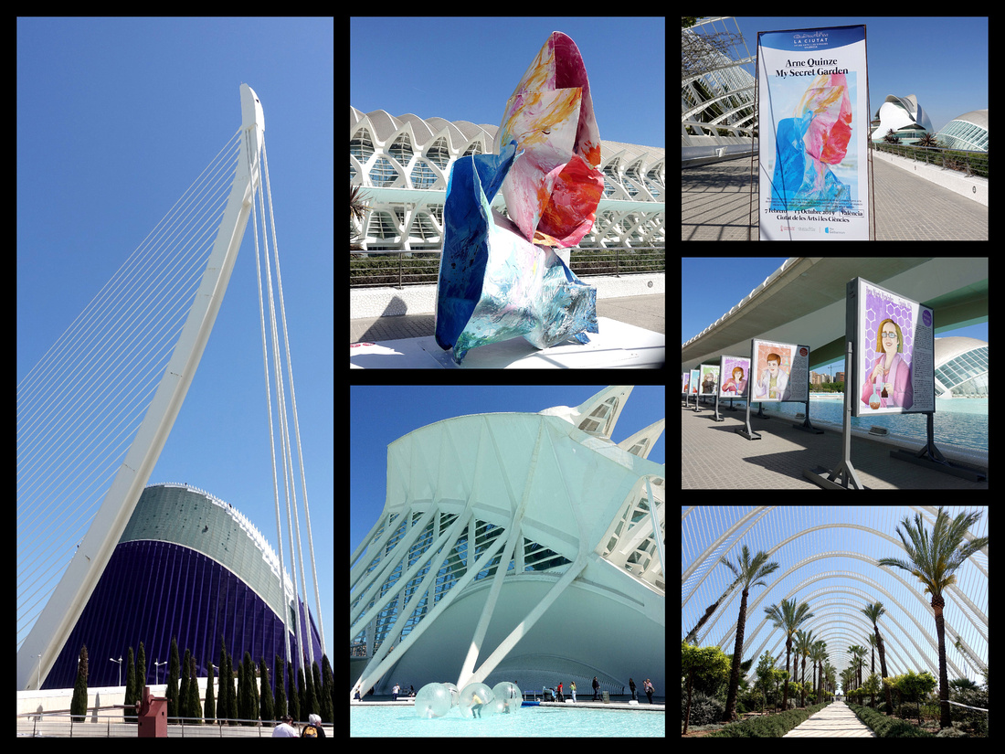
The City of Arts and Sciences features exhibits which change every six months or so. When I was there the exhibit was called "My Secret Garden" made up of numerous colorful 'flowers' which added to the otherwise all blue and white scene. There was also a poster exhibit of female scientists from around the world and throughout history.
Valencia is beautifully lit in the evening. The main fountain on Plaza Ayuntamiento has a light show, with the colors changing every few minutes.
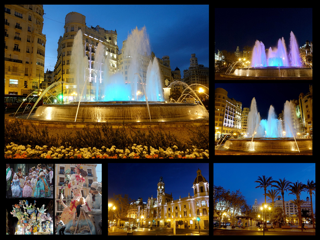
Plaza Ayuntamentio beautifully lit with colored fountain. Bottom left: some shots from the Fiesta which took place just a week before I got there. I missed it buy my friend Nikki supplied a few photos - looked like it was fantastic.
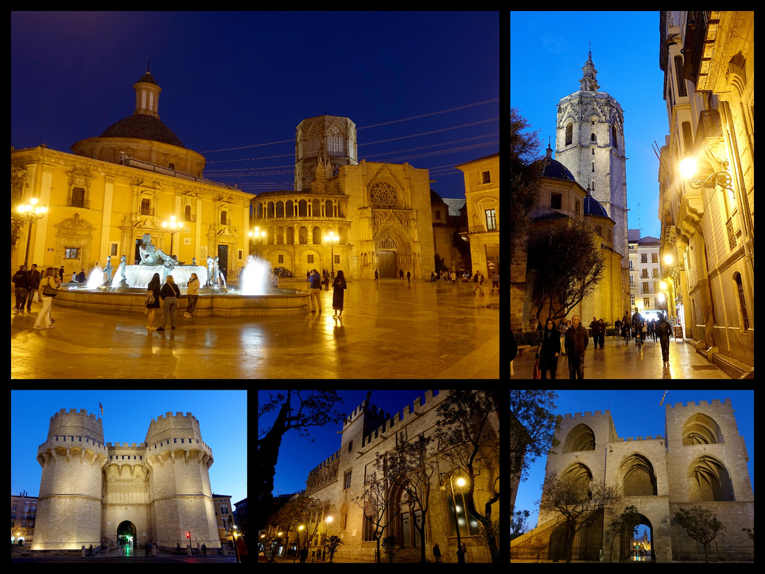
XATIVA
I took a half day trip to Xativa on another warm, completely cloudless day. I’d been checking Renfe website for a few months and it always showed only a 7 am and then a 13:00 train to Xativa. I figured that was weird but it was always that way, regardless of date. Anyway, I went to the train station a little after noon to find there were three trains within the hour. I got the 12:38 which arrived just under an hour later. The train station is reasonably large (the town is 28,000) with a manned ticket booth, small café, and WC. What it did not have was a TI or a sign to the castle. But you could see the castle up on the hill and I started walking towards town (with the castle on the other side of it), probably went a few blocks out of my way but eventually saw a sign for the TI where I got a map and was told is was 3km up hill, there was a ‘tourist train’ but that wasn’t going again until 16:30 (it was only 14:00 at this time) so I started walking. There were little signs, although a few places there were a choice of directions and no sign. One was actually a good mistake, it was only a block off course and there was a really cute little square (Market Square) – just a block past the cathedral. One other spot I had to ask a little old lady directions. I pointed up and said ‘castelo ?’ and she pointed to the correct street.
Part way up is a bar/restaurant/church and a map and signs showing two routes: the ‘old route’ (goat path) and the ‘wall route’ (car path). There were a couple Americans and a group of four Brits looking at the sign. The Americans (Shelly and Jeff from St George Utah) and I took the ‘wall route’ and the Brits took the goat path and we all got there at the same time. Took me just under an hour (45 minutes) going back. But I had Shelly and Jeff to keep me company, always nice to have someone to pal around with for a few hours when solo traveling. The castle is quite impressive – it’s mostly wall with a few inside bits but it’s quite large and strung along a hill with views to the city (which is unfortunately quite built up although the Cathedral and the church halfway up are scenic) and on the opposite side it‘s more rural. The smaller portion of the castle was closed for renovation which was unfortunate because, even though it’s the much smaller part it probably had great views of the larger part. The hike back down was almost as bad as the hike up, got a tad lost (couple blocks) looking for the train station, there was a train in 7 minutes and I arrived back at Valencia Nord exactly 5 hours after I left. From the Xativa train station to the castle and back was 13,700 steps, 75 flights.
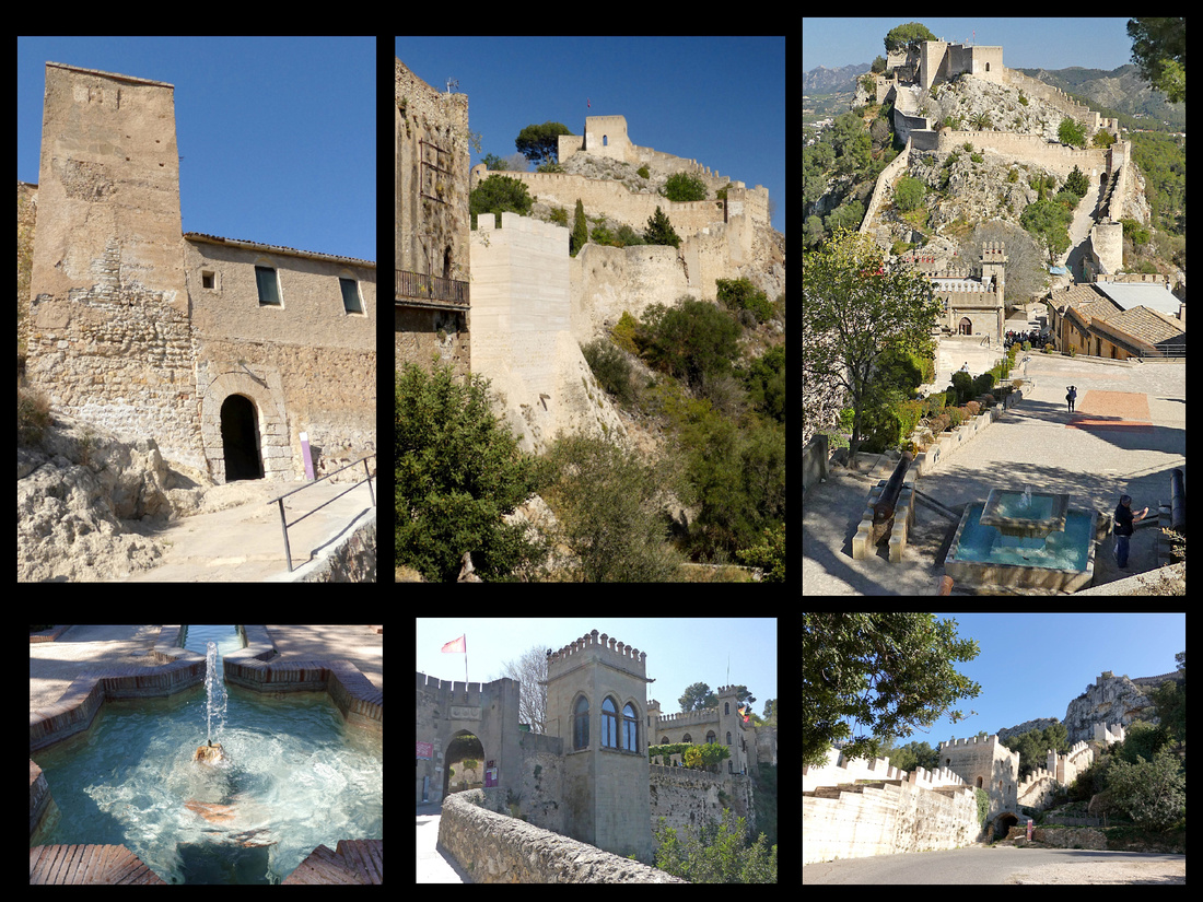
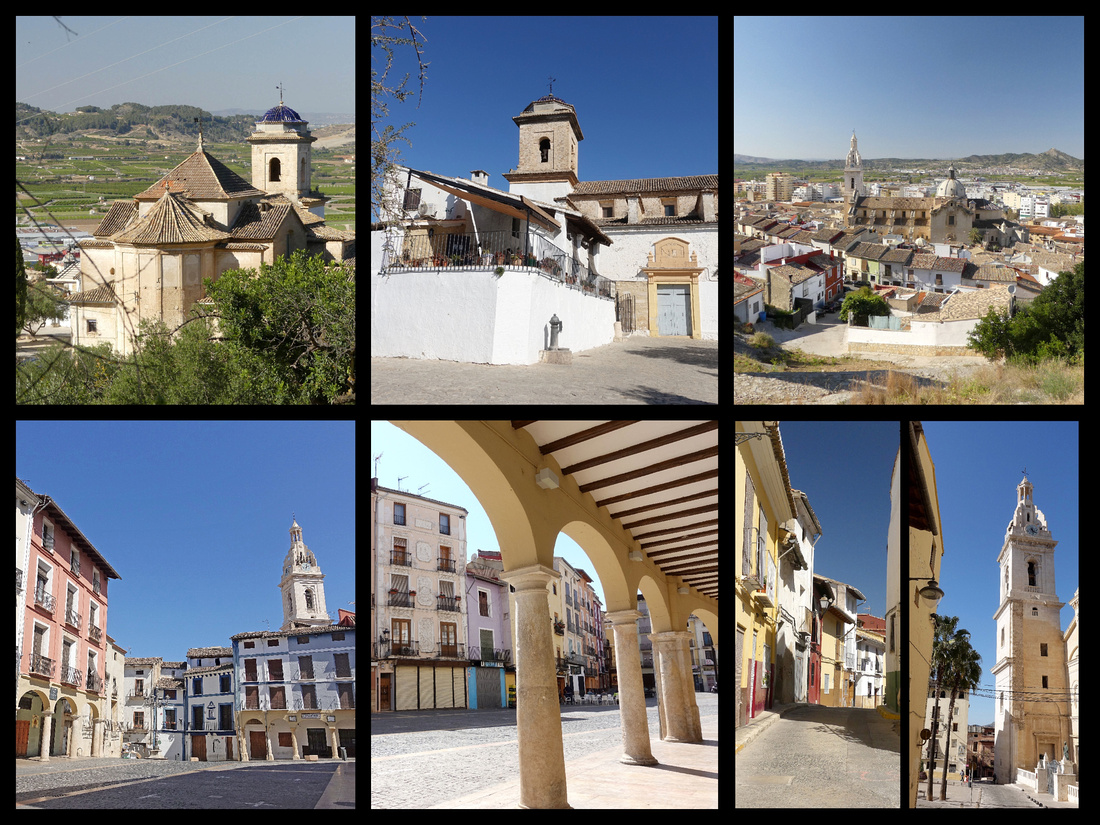
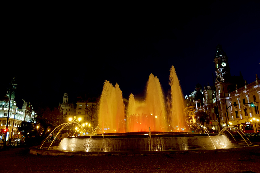
]]>
Mallorca - We had 4 nights so 3 full days on Mallorca which was the perfect amount of time for us. We did a half day trip to the village of Valldemossa and another half day trip to Soller and spent the rest of the time exploring Palma.
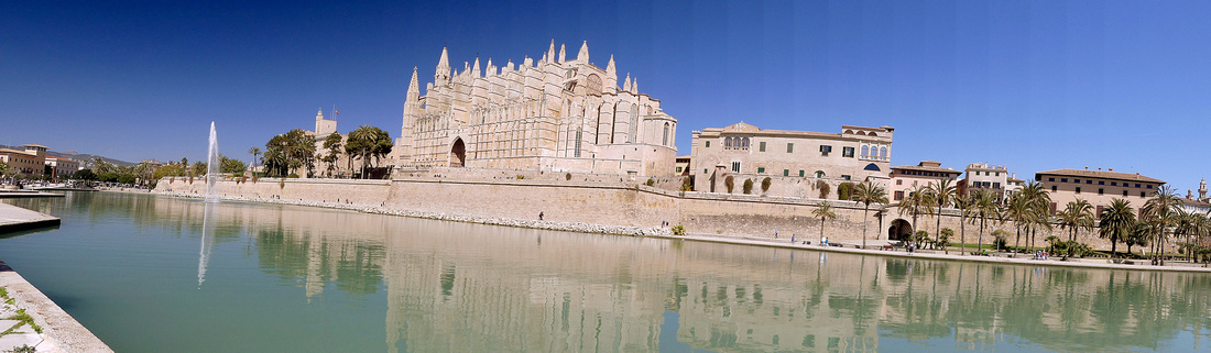
Palma de Mallorca
Day 1 - Our first full day was gorgeous sunny and 70s and we explored the whole town. Palma is a fairly large city (350,000) but the historic center is fairly small, probably less than 1 km in diameter. There are a number of avenues and ‘passeiges’ with 19th century architecture and central pedestrian promenades, and a good size area of narrower streets and alleys and several small plazas. There are a few stepped streets but overall the center is fairly flat.
By far the main attraction is the Cathedral and Palace, right next to each other (almost blending in as one large ensemble). Built up onto the old city walls, down below is the huge reflecting bay in the Parc de le Mer (with a giant water fountain in the center shooting a water jet high into the sky), just inland from the Paseo (Avenida Gabriel Roca), the main road along the Bay of Palma which stretches over 5 km of coastline, with paths for cyclists, pedestrians and vehicles. The promenade just opposite the cathedral and palace, sitting up above the ramparts, had views that, for me, made the trip to Palma worth it.
Cathedral of Santa Maria, is a Gothic masterpiece. Sunlight through the stained glass rose window (one of the largest in Europe) gives the interior an amazing colored glow. The cathedral is built of gold sandstone, begun in 1229 and took 600 years to build. Some of the 20th century renovations were undertaken by Modernist architect, Antoni Gaudí (only noticeable thing was one small chapel). Only the cloister was rather mediocre. €8
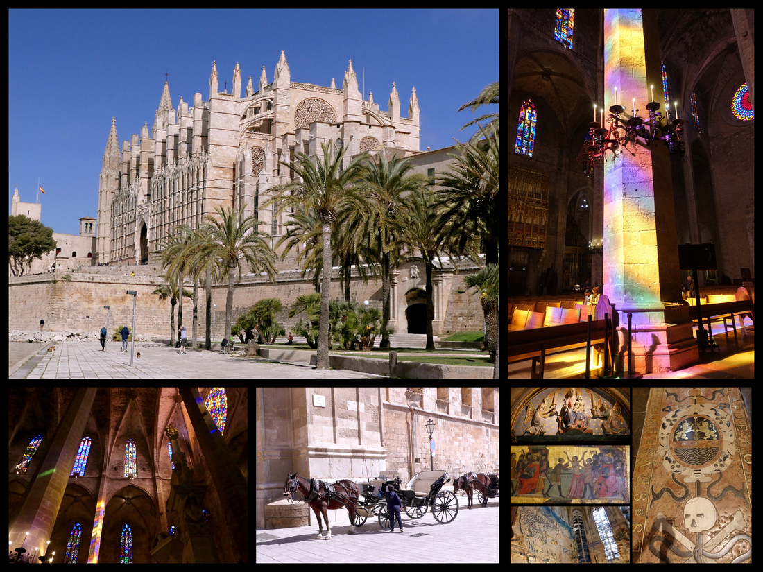
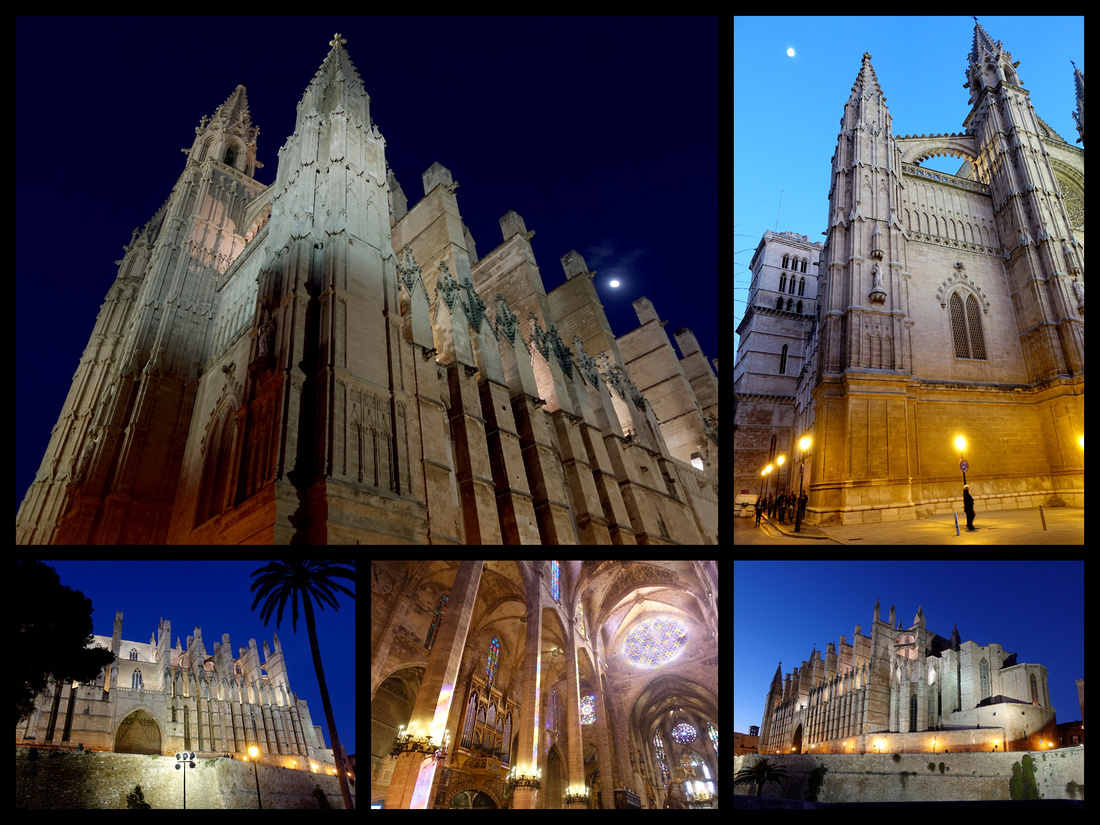
Across the narrow plaza is the Palau de l’Almudaina, (€7) The former Alcázar Real, built first by Muslim rulers in 1281, then significantly modified by the kings of Arágon over the next few centuries. There are a series of cavernous stone-walled rooms. The first narrow room you enter has a black-and-white ceiling, symbolizing the extremes of night and day, darkness and light. You then enter a series of three grand rooms. The rooms have period furniture, tapestries, etc. In the main courtyard, Patio de Armas, lion statues and fountain are rare Arab remnants. There are several terraces and courtyards and great views over the city and the harbor.
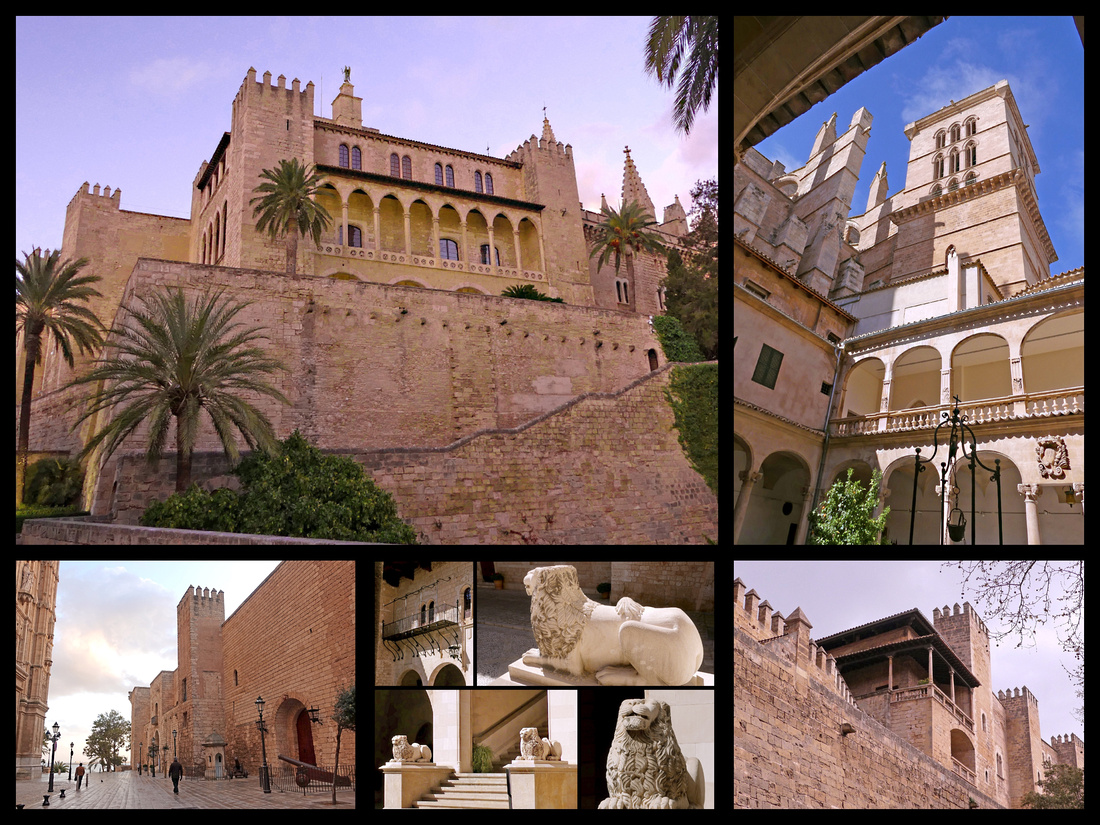
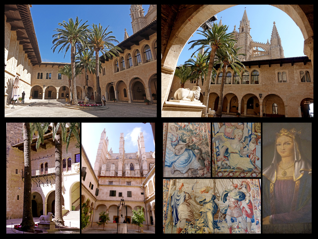
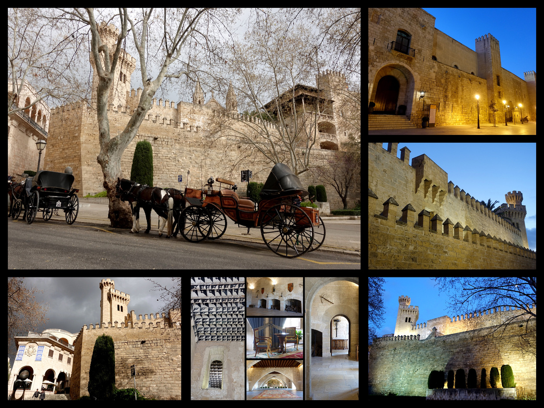
In front of the Palace, the Placa de la Reina with a large central fountain, is the beginning of Passeig del Born, the main shopping street, a tree lined pedestrian central promenade with cafes and street performers. Beautiful 19th century buildings line both sides of the passeig and house stores (designer plus the common international chains) and restaurants and tapas bars. One especially interesting building (between Zara and H&M) is Casal Sollereic, near the top end of the Passeig. The passeig is only a couple blocks long and not as wonderful as some (jaded traveler here, seen too many wonderful places).
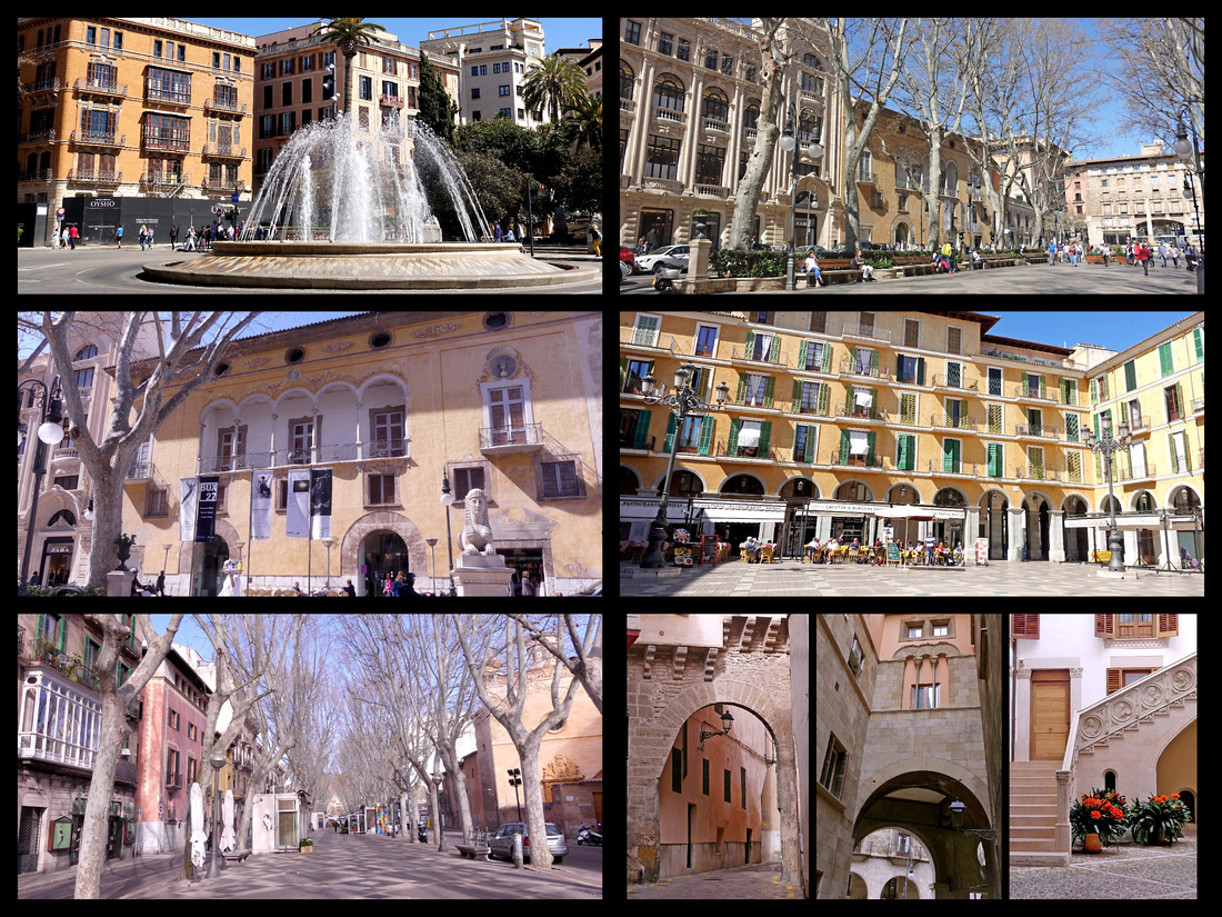
Top Left: Plaza de la Reina Top Right: Passeig del Born Middle Left: Casa Sollereic Middle Right: Plaza Mayor
Bottom Left: Las Ramblas Bottom Right: Streets of Palma old town
The ‘main part’ of the old town is behind the cathedral, a maze of small streets and plazas. Only a block or so up from the Cathedral is Placa de la Cort, a cute little square with one of the most interesting buildings in all of Palma, the Ayuntamiento. The front of it looks like a pretty typical Spanish town hall, but from the side it looks like a castle. Just around the corner from that is another cute plaza Placa Santa Eulalia with the church of the same name. Streets from here lead towards the main plaza, Plaza Mayor, a 19th century square reminiscent of Plaza Mayor in Madrid (and probably many other Plaza Mayors in Spain) only gold instead of Madrid’s red.
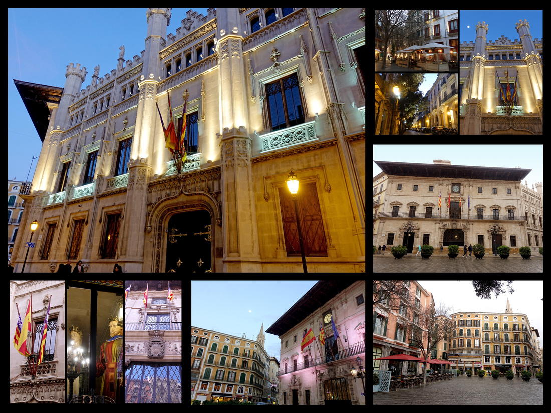
Above: Placa de la Cort and the Ayuntamiento
Just before you get to Plaza Mayor is one of the best modernista buildings in Palma, Can Forteza Ray - Gaudí spent ten years on the island, and the longevity and success of the Modernist movement in the Balearics is largely attributed to his presence. Can Forteza Rey is a wonderful example of the Modernist Art Nouveau movement. The highly stylized decoration of the façade is continued into the interior of the building (where there is a great pastry/coffee shop). The five-story building was originally intended as an apartment block and has sculptural decorations with superimposed fruit, flowers, and animals, using multicolored tiles, wood, iron and glass. There is a huge terrifying face flanked by winged dragons on the second floor. Plaça del Marquès del Palmer.
A few blocks in the other direction is Placa Mercat home to several other modernista buildings, Can Casasayas and Pensión Menorquina - These two buildings were designed in 1908 and are separated by a narrow street. There had been plans to build a bridge to connect the two, but planning permission was not granted. The buildings have matching façades and interior layouts strongly influenced by Modernist and Art Nouveau styles. Gaudí’s influence is strongly evident in the parabolic window and doorway arches, as well as the undulating style. Placa Weyler is technically a separate square but really runs into Placa Mercat, and features the most interesting of all the modernista buildings, the Gran Hotel. Palma is no Barcelona, but it has the best modernista buildings I’ve seen in Spain outside of Barcelona. Also on Placa del Mercat is Can Berga, built in 1677. The front is heavy with stone balconies framing the portal. Interesting to have such diverse architectural styles in one small area.
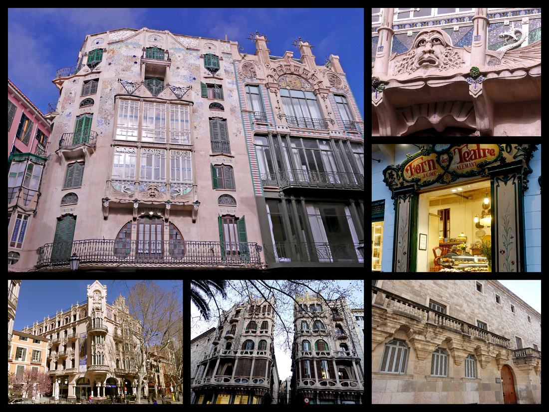
Above Top: Can Forteza Ray Bottom left: Hotel Gran Middle: Can Casasayas and Pensión Menorquina Right: Can Berga
Tucked down some narrow alleys just behind the cathedral are the Arab Baths. Smaller than some in Spain but quite well preserved (€2.50) There’s good signage (necessary cause you’d never find them without it). The only intact Moorish building in Palma, they were discovered only 100 years ago, but date to the 10th - 12th century, when Palma was an Arab city known as Medina Mayurqa. Thought to have been attached to a private home rather than a public hammam. The (mainly Roman) columns in the domed roof tepidarium (warm room) are all different and clearly salvaged from different places. The baths are set in a secluded garden of the Can Fontirroig manor house. The biggest room, has 12 columns supporting a dome with round openings which were meant to allow the steam to escape. There was a video playing on a loop in both Spanish and English explain the baths.
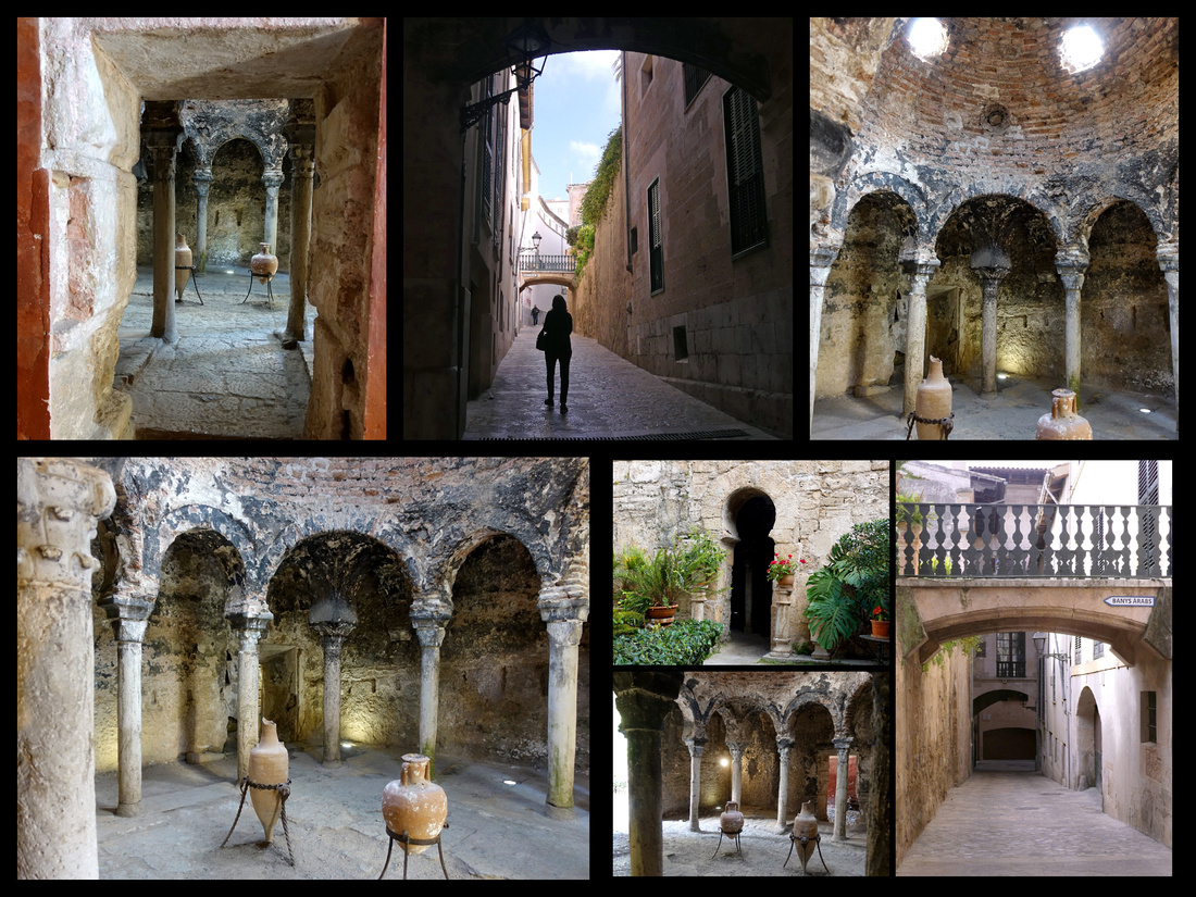
One block on the other side of the Placa de la Reina is the Llotja - beautiful building with crenelations, turrets and delicate stone masonry that was once a major mercantile exchange and meeting place. Built between 1420 and 1452, the ribbed vault ceiling is divided into twelve parts each with its own spiral pillar resembling the palm trees lining the outside pavements. The Angel Custodio visible above the main entrance holds a band reading ‘Defender of Merchandise’. The view from the Gothic-style arch windows into the courtyard behind it is pretty. Free.
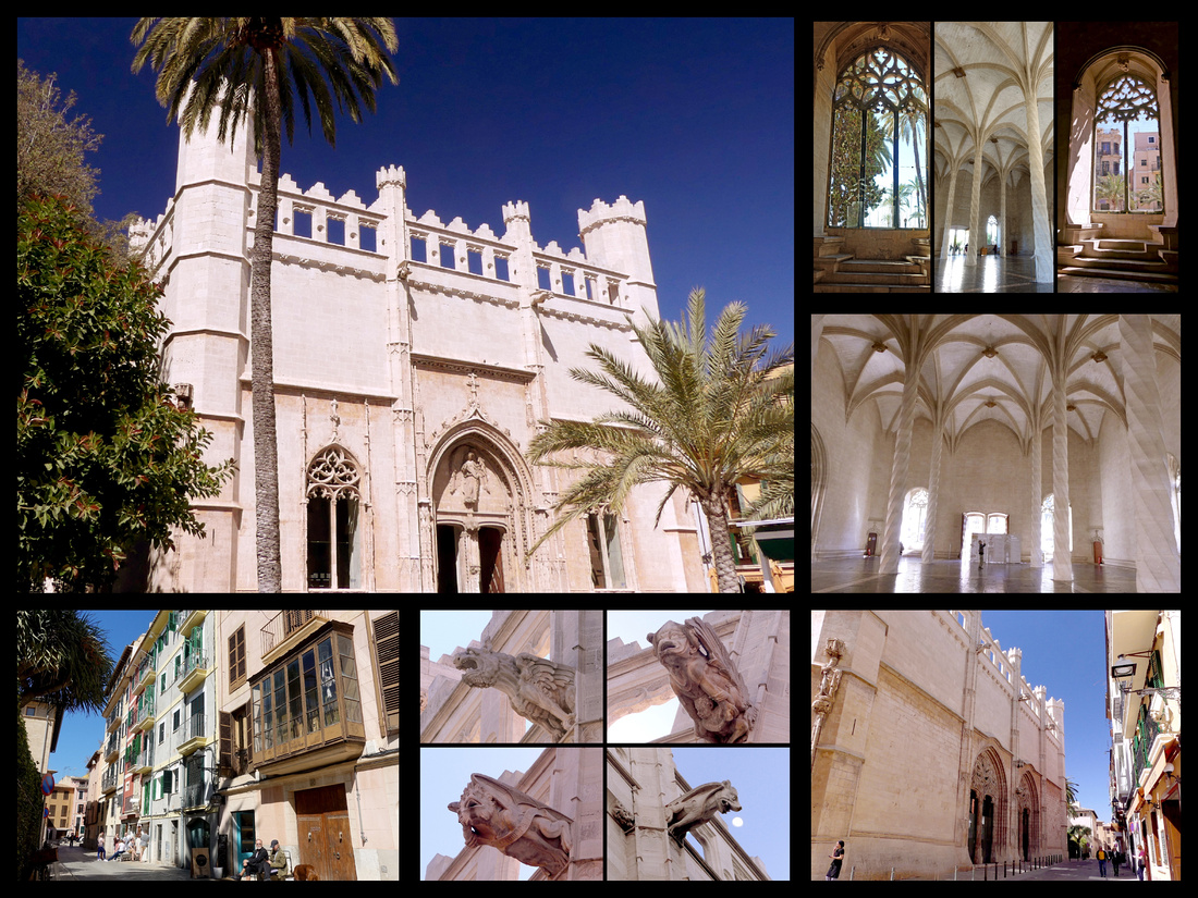
We explored all the above, including sitting for a while in the sun in the Parc de la Mer and then wanted to go up to the Castell de Bellver so inquired at the TI how to get there. Apparently the public bus, which didn’t seem to run all that frequently only went part way up, there’s another ½ hour up hill walk. But the Hop On Hop Off bus goes there so we figured it might be interesting, by this time sitting for a while sounded like a good idea anyway. The HOHO bus does get you up to the castle but a taxi probably would have been cheaper (HOHO was €18) and the rest of the 1¼ hour loop either went by stuff we had already walked by, or to very boring residential areas. So I don’t recommend it. But the castle is worth seeing.
Castell de Bellver, €4 Erected in 1309, was the summer palace of the kings of Mallorca—during the brief period when Mallorca had kings. The castle, which was a fortress with a double moat, is well preserved. The chief attraction here is the view—the name, Bellver, means “beautiful view.” It is perched on top of a wooded hill over the Bay of Palma, and is unusual in being one of only a few circular castles in Europe and the only one in Spain. It has three semi-circular towers, and a further large tower attached by a bridge over the (now dry) moat. The spectacular inner courtyard has a series of Gothic arches around it on the upper floor. Inside there are numerous rooms with archaeological findings. We had a light lunch at the very mediocre café.
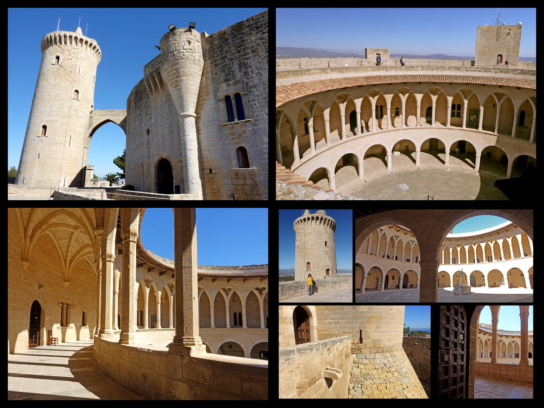
Day 2 - Another absolutely gorgeous day, high in the low 70s, not a cloud in the sky.
We went to the train station with the intent of taking the 10:10 train to Soller. We got there at 9:00 to find a huge long line. After waiting over an hour we discovered that all the trains that day were sold out. They were having a special (€13 instead of €32 normally, including tram). That combined with it being a beautiful Sunday must have caused a much larger than average crowd (who seemed to be mostly locals).
So we took the HOHO bus (tickets still good from yesterday) to the Spanish Village – similar to the one in Barcelona only smaller. But just as nicely done, almost deserted. Was worth the hour or so we spent. Poble Espanyol – (1.5 km from Passeig de Mallorca), €6 – An overview tour of Spanish architecture, showing its development through Muslim and then Christian influences. A total of 22 replicas in 1: 2 scale. There is a reproduction of the baths and patio from the Alhambra Palace, a “barrio andaluz” (a street from Andalucía), a ‘Plaza Mayor’, a copy of the Santa Catalina tower from Valencia and several other interesting streets, plazas and buildings. I think Crista was a little bored but I really enjoyed it.
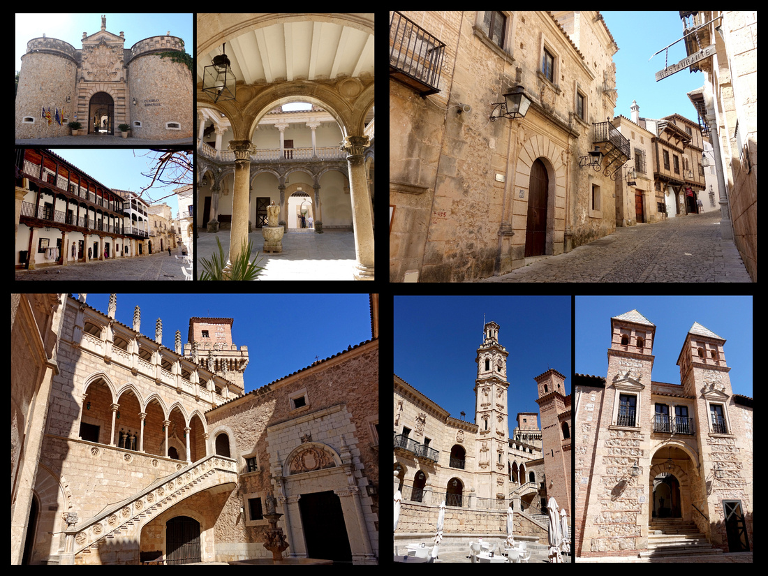
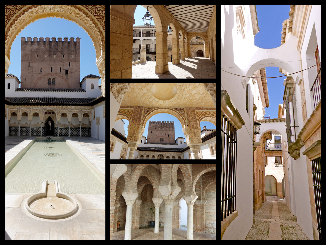
Rather than wait for the next bus we walked back through town along the town walls - which run right by the harbor and are quite extensive.
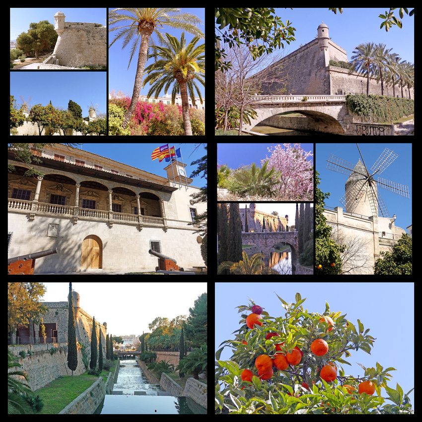
Back at Plaza Espagna we got the bus to Valldemosa (½ hour, €2 each way). Very cute little hill town, population about 2000, sprawls down a hillside in the Tramuntana mountains (which are a UNESCO World Heritage Site), bigger than it looks, you can get lost for a few hours exploring the tangle of cute cobbled alleys, tree lined streets, old stone houses. Valldemosa is famous for Cartoixa Reial, where George Sand and Frédéric Chopin wintered in 1838 and 1839. The monastery was founded in the 14th century. After monks abandoned the dwelling, the cells were rented to guests, which led to the appearance of Sand and Chopin, who managed to shock the conservative locals. Unfortunately it was closed Sundays. Also unfortunately since it was Sunday our choice of buses back to Palma were in one hour or 5 hours. We opted for five. We easily used up about 3 just walking around, shopping, and having gelato in the sun. Then stores started closing around 5 and sun was going down and not a lot of inside dinner options. But the one we did find was great – we got steak and fries that were cooked in garlic and peppers. Very good meal for €19. Then only about a 20-minute wait in the cold (and now dark) for the 19:30 bus back.
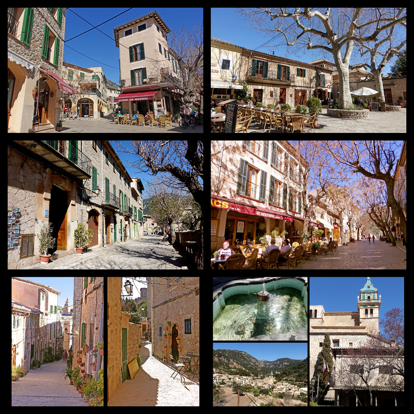
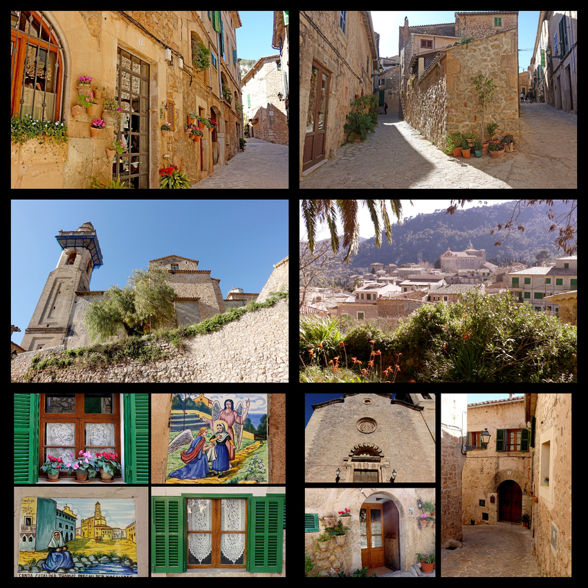
Day 3 - This started three days of cool and rainy, the only time in the whole two weeks that wasn't perfect weather. We discovered when buying our bus tickets to Valldemossa that the train is not the only way to Soller, there is also a bus (€3, 40 minutes each way). Through the nice mountains – but not really spectacular, not sure what makes it a UNESCO site. Lots of stone terraces, lemon and orange trees, olive groves, some other fruit trees just flowering. Some sheep, few goats, horses. Pretty enough but I’ve seen much better. The town of Soller itself didn’t look like much – fairly large, might have had a cute center but the area the bus could go in was unimpressive. We stayed on to Port de Soller. Of course all of this would have been better in the sun. Medium size bay with lots of boats (wintering over, sailboats, yachts, didn’t see much in the way of fishing boats). Tons of seafood restaurants, some post card shops. The cute little tram only runs once an hour. We walked the whole length of the bay, climbed up as far as we could – decent view of the harbor on one side and some cliffs into the water on the other side. But after two hours and starting to rain we just got the bus back to Palma.
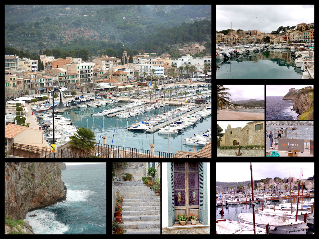
Days 4 and 5 - On to IBIZA - We took the ferry, reserved in advance, which was supposed to take 3 1/2 hours but only took 2 (fast ferry?). Large, comfortable inside seating which was fine given that it was pouring rain but wasn't the 'sitting in the sun on the open deck' trip I had pictured. But it was efficient, a bus was waiting at the port and then a ten minute walk to the Vera del Rey Rooms. It rained some, was cool, windy and cloudy most of the two days we had on Ibiza but the sun came out a few times and two days was more than enough to explore the town. Better weather and more time would have been necessary to rent a car and explore the rest of the island. I choose to visit Ibiza in the off season as I didn't want the crazy party scene of summer but did want to see it. However I didn't expect it to be as closed down and deserted as it was. The weather didn't help I'm sure.
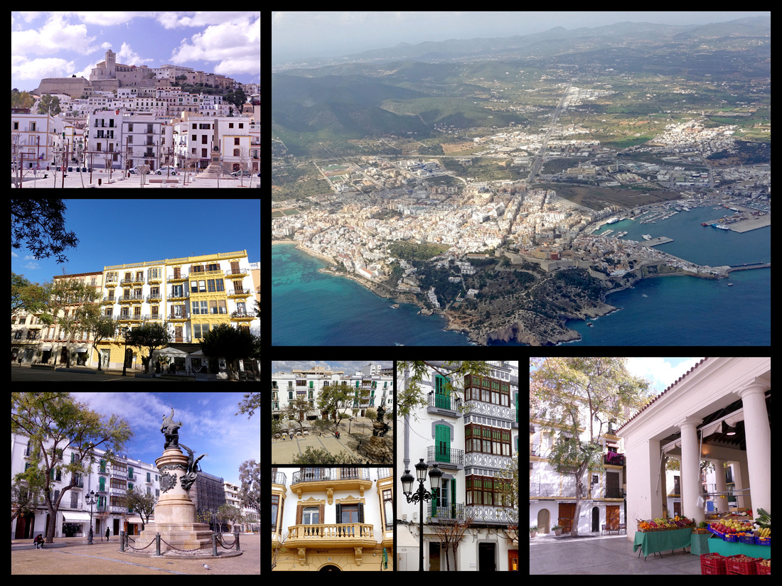
Ibiza is the other main Balearic island. It's well known for the very lively nightlife where major European nightclubs have summer outposts. Ibiza's art colony began to thrive in the 1950s, and in the 1960s it became the European resort most favored by the flower children. Today, Ibiza is overrun by middle-class package-tour visitors, mainly from England, France, Germany, and Scandinavia. It has become a major mecca for gay travelers as well. Birthplace of rave, Ibiza has some of Europe’s most famous clubs. But the rugged coastline is interspersed with dozens of sandy beaches, unfortunately most now consumed by intensive tourist developments. Still it’s a UNESCO mixed World Heritage site because of the old town/castle and the island's rich sea life. The Old Town is the area of the fortified citadel (D’alt Vila) and the old fishing area (Sa Penya) just below it. D’alt Vila was founded by the Phoenicians over 2500 years ago. There are traces of the Moors, and museums display artifacts from various periods of the island's history, including Phoenician, Carthaginian and Roman. A ramp leads from Placa de sa Font in Sa Penya up to the Portal de ses Tablas gateway, flanked by Roman statues, the main entrance to D’alt Vila. Steep streets and alleys lead up to the Cathedral, which overlooks everything. The original 14th century part is Catalan Gothic with additions later in the Baroque period.
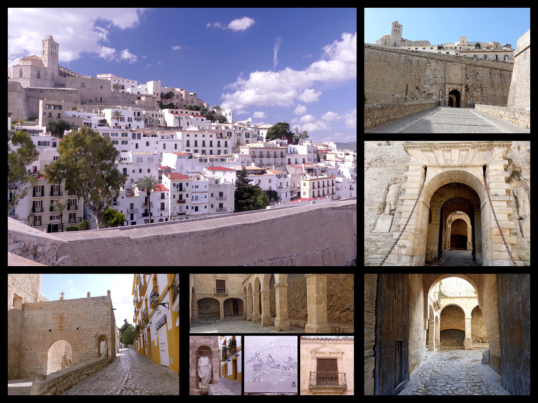
The castle is a lot larger than it looks from the water. You can walk all the way around the perimeter on ramparts, lots of outlooks. And in the center of the ramparts is the old town, very Greek (Cycladic island) looking with narrow lanes of white and stone buildings, great views out to the water.
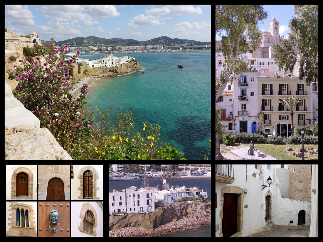
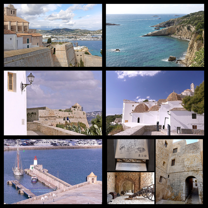
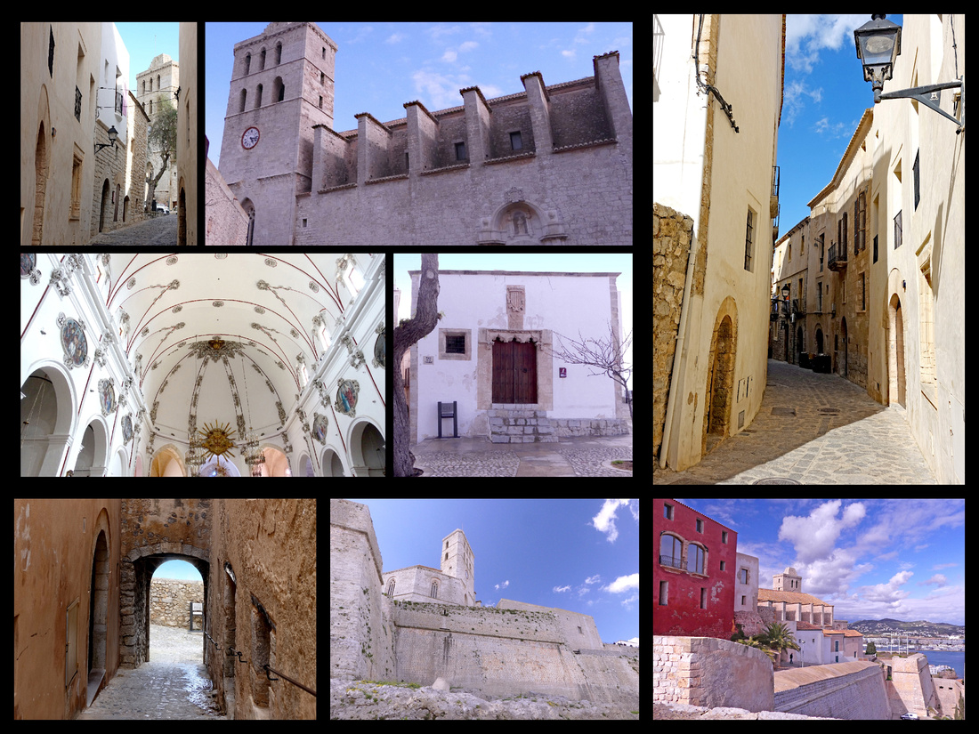
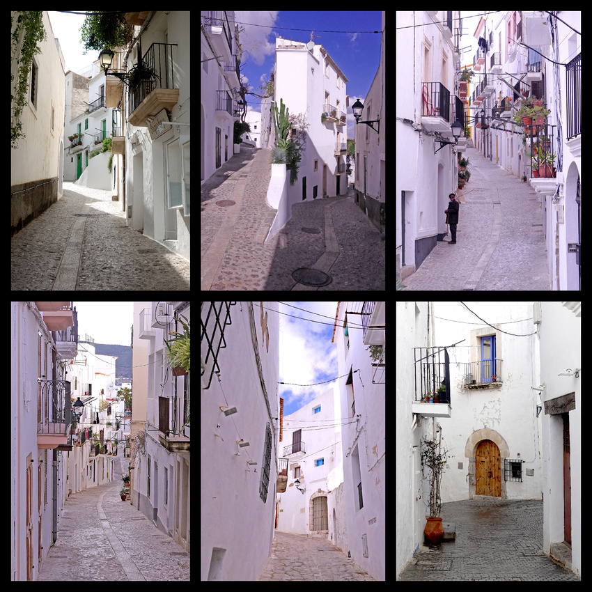
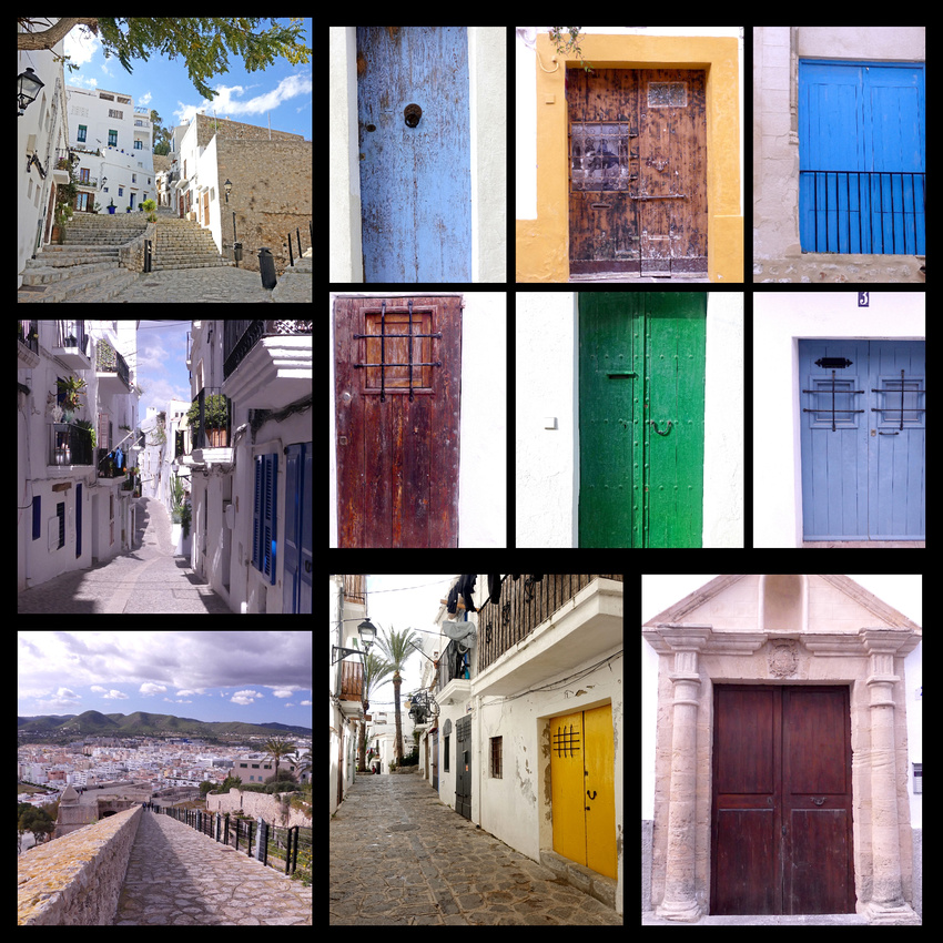
Between D’Alt Vila and the harbor is Sa Penya, a jumble of narrow streets and lanes lined with whitewashed shops, bars and restaurants. Most of these were closed for the season in March – very deserted. And the higher up you went the dodgier it got – lots of trash, broken bits of furniture and machinery, dog poop, graffiti.
The lower main part of the city is essentially very boring; mid 20th century pretty ugly buildings housing stores, businesses, and apartments. There is one large graceful plaza – Passeig de Vara de Rey with beautiful town houses from the beginning of the 20th century, tree lined with pavement cafes and a nice large statue in the center. Our 'rooms' - Vera de Rey' were on this plaza.
We did have some good eating experiences despite probably the better places being closed. There was a bakery right next to the hotel with amazing whole grain croissants (Quinoa and spelt). I don't normally associate 'whole grain' with 'croissants' but these were excellent. For dinner our first night we went to a tapas bar our hostess recommended Can Terra, and it was wonderful. There was a huge selection of tapas sitting out on the bar and everything was €1.70, just take what you want and keep the toothpicks so they can add up the total when you are done. Nice atmosphere - it was a bar, lively but not crazy, some patrons appeared to be tourists but most were clearly locals (did I mention there aren't many tourists on Ibiza in March). We had a great time but unfortunately about four hours later I was pretty violently sick - obviously food poisoning. But then I was able to sleep and was fine the next day.
In addition to exploring the town we visited two small museums and an historic house. Museu Puget features father and son artists we had never heard of but had some nice work and the building was very nice (and out of the cold and wind). Casa Erwin Broner is in the Sa Penya area. Broner was a German architect and designer who came to Ibiza, then went to America where he worked on Alice in Wonderland with Walt Disney, then back to Ibiza. He built the house to blend in with the other white cube type, similar to the Cyclades Island architecture, but with unique design features. The other museum was the Puig des Molins which is built on the site of a Phoenician necropolis that is considered the best preserved in the western Mediterranean. Early 7th century BC settlers, who gave the island it's name, buried their dead here and Phoenician, Punic and Romans followed. Some nice skeletons.
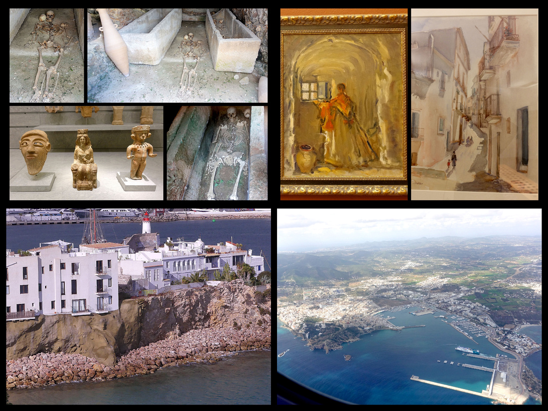
]]>
Day 13 - From Melk to Nurnberg via Passau -
The trip from Melk to our next stop, Nurnberg was the longest, over five hours and when I discovered that it was actually considerably cheaper to book a train from Melk to Passau, and another 4 hours later on to Nurnberg I decided it would make a nice stopover. This was my fist experience with ‘left luggage’ and it went great. There were lockers, in several sizes, one medium one fit both bags, €4 (for up to 24 hours). Not all stations have left luggage lockers, some have no option at all, others have a ‘room’. Left luggage in Bratislava was a room with a desk and no guy at it when we passed. Much more sketchy. But with the lockers you didn’t have to worry about schedules or guys taking breaks or anything.
Passau made a great 4 hour stopover. Had plenty of time to explore the old town, climb up to the castle, have a lunch at the Rathaus beer garden. Passau’s main feature is it’s setting at the confluence of the Danube and the Inn Rivers- it comes to a sharp point where the two rivers meet. On one side is a fortress/castle, the other an abbey. The alstadt is about a 15-minute pleasant walk on mostly pedestrian shopping streets from the train station. The Dom is huge and very pretty both inside and out. There’s a nice square behind it with cafes and a fountain. The rathaus is a gorgeous medieval building, right on the river across from the fortress, great huge clock tower. There are a few other churches, some medieval winding lanes, a promenade all along both sides of the peninsula along both the Danube and the Inn. On the Danube were multiple riverboat cruise ships. I think Passau probably saw a ten-fold increase in tourists once those cruises caught on, the place was crawling with silver haired tourists.
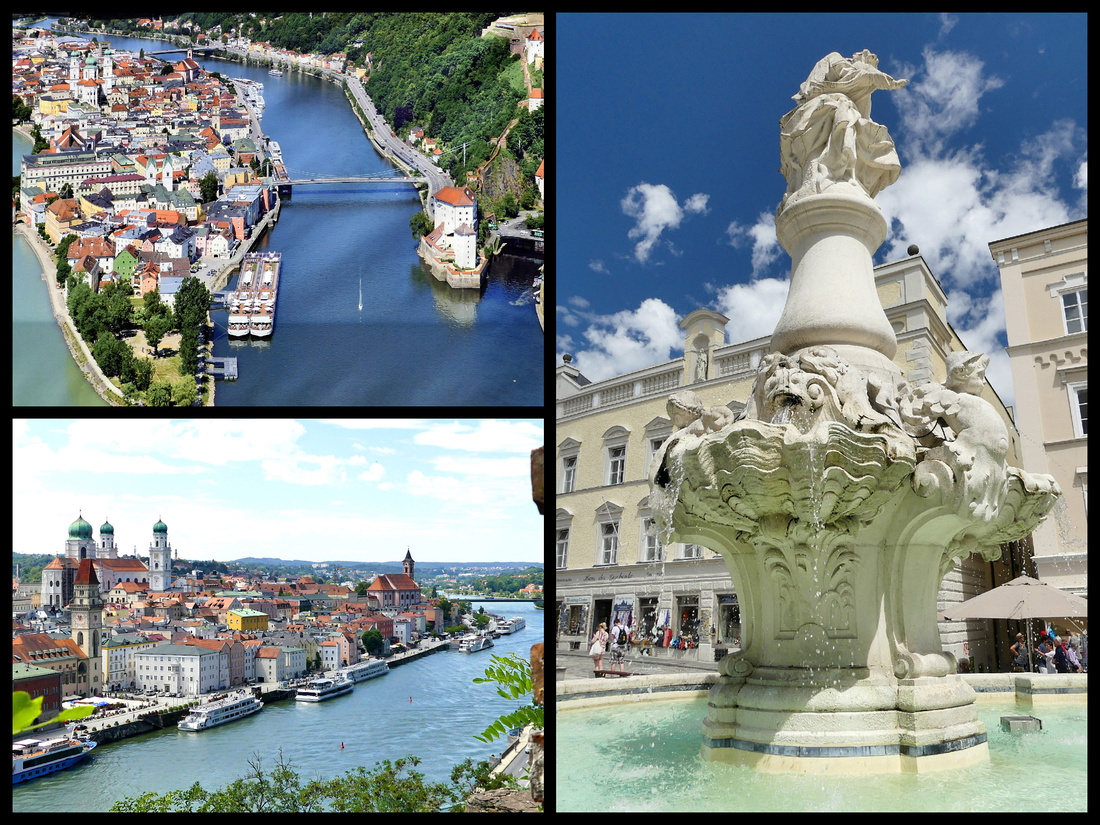 Top left: view of Passau (from a poster) Lower left: view from the castle Right: fountain in the square behind the cathedral
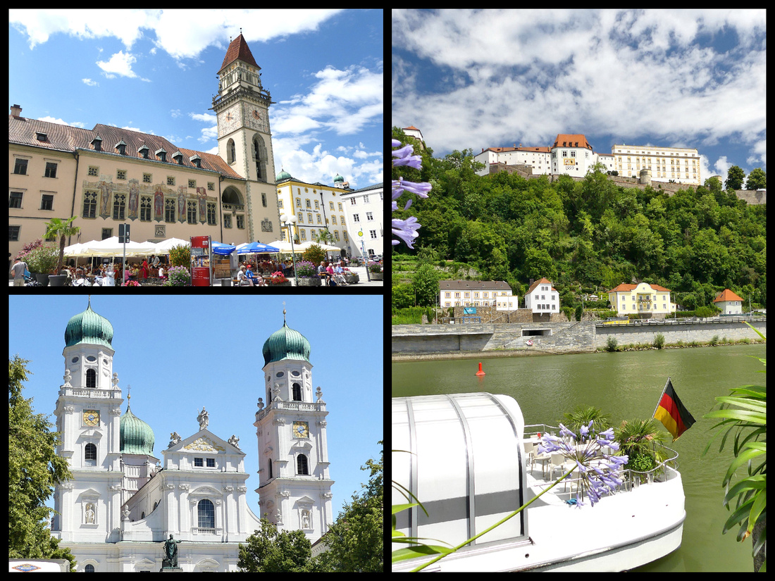
Passau was founded by the Celts over 2000 years ago, making it one of the oldest cities in Bavaria and is the last town on the Danube before the border with Austria. The city rests at the confluence of three rivers, Inn, Ilz and Danube, hence the nickname “City of Three Rivers.” The Schaibling Tower or Schaiblingturm has stood as a witness of the medieval fortifications of Passau since the 14th century.. Located on the banks of river Inn, the tower’s name is derived from the conical shape of its masonry: disc- Schaibling. It was part of the old salt boat harbor in Passau.
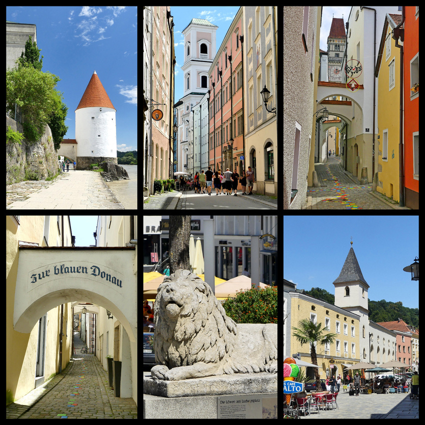
Days 14-16 We decided to base in Nurnberg for three nights as we had several one and two nights stays so far and though it might be more relaxing to have three nights in one place, and Nurnberg is centrally located between Bamberg and Regensberg. We wanted to see Nurnberg itself of course, but were surprised when it turned out to be our favorite of the three cities.
Hotel BB Nurnberg City is modern, 6 stories, 10 min walk from train station on main road, right next to opera house. Very clean and even a bit of a view of the church steeples. The Nurnberg train station is a classic northern European old style train station and is right across the street from the city walls and one of the main towers. Plus it had a great selection of decent food. Best train station food court I think I’ve ever seen (kind of like NY Grand Central’s). There is a fresh seafood restaurant (Nordsee, a chain); Japanese; ‘Dean & David’ which is fresh pressed juices, salads, wraps; Der Beck (German chain bakery with croissants, sandwiches, etc.; a pretzel sandwich place; decent looking pizza; and of course a place selling bratwurst, etc.
The first evening we were able to walk across the old town to the castle and back, across the river on some really pretty bridges, through nice squares and neighborhoods. Took about 1½ hours at a leisurely pace. We also had a couple of other mornings and two more evenings and felt we had a good amount of time to explore the city. We didn’t get to the WWII sites, which are a bit out of the center, but for us those were not a priority. We did have time to tour the castle and the Albrecht Durer House Museum.
During the 15th and 16th centuries, Nürnberg enjoyed a cultural flowering that made it the center of the German Renaissance, a northern Florence. So enamored was Adolf Hitler with the Nürnberg’s huge swaths of half-timbered houses, steeped and gabled rooftops, and cobbled lanes and squares that he chose to stage his massive Nazi rallies in what he considered to be the most German of German cities. Today probably the most picturesque part of the city is Weissgerber-grasse (Tanner’s Lane) – the largest ensemble of old artisan houses in Nurmberg.
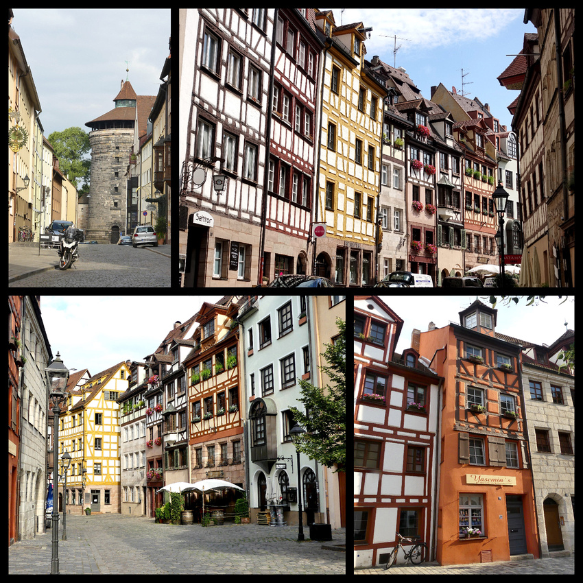
As the ideological center of the Third Reich, the city was a choice target for Allied bombers and much of the city was seriously damaged or destroyed and therefore today there are quite a lot of fairly ugly mid 20th century buildings. But a lot has been restored and the city is really very pretty. The Pegnitz River runs through the center and there are numerous lovely bridges.
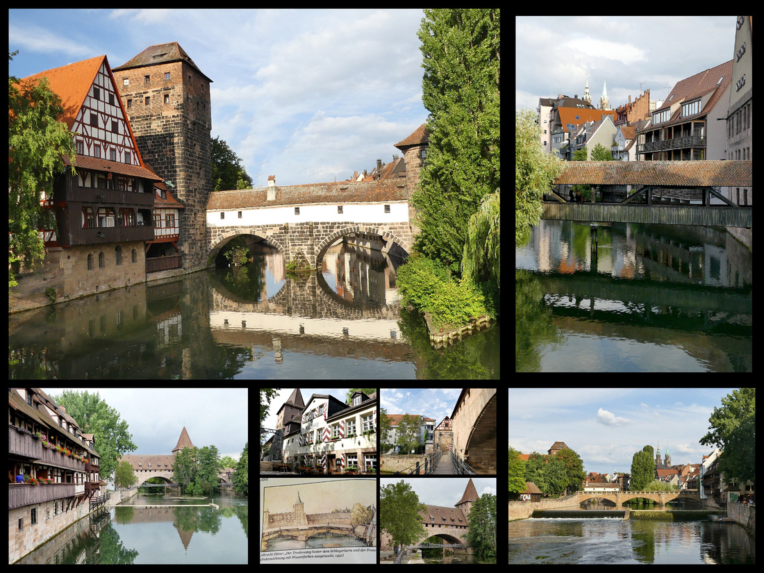
Lower left and center photos: Kettensteg is a ‘chain’ bridge, right up against the walls and one of the best preserved towers.
Handwerkerhof, just inside the walls across from the station (an underground passage leads from the station to the top of Königstrasse, the street that cuts through the old city) is an area of very touristy shops and restaurants but looks fairly medieval. It’s the start of an impressive stretch of old walls (interspersed with gates and towers) that stretches all along the west side of the city to the castle on the opposite side of the Alstatdt and site of the Königstorturm (tower) and Königstor Gate.
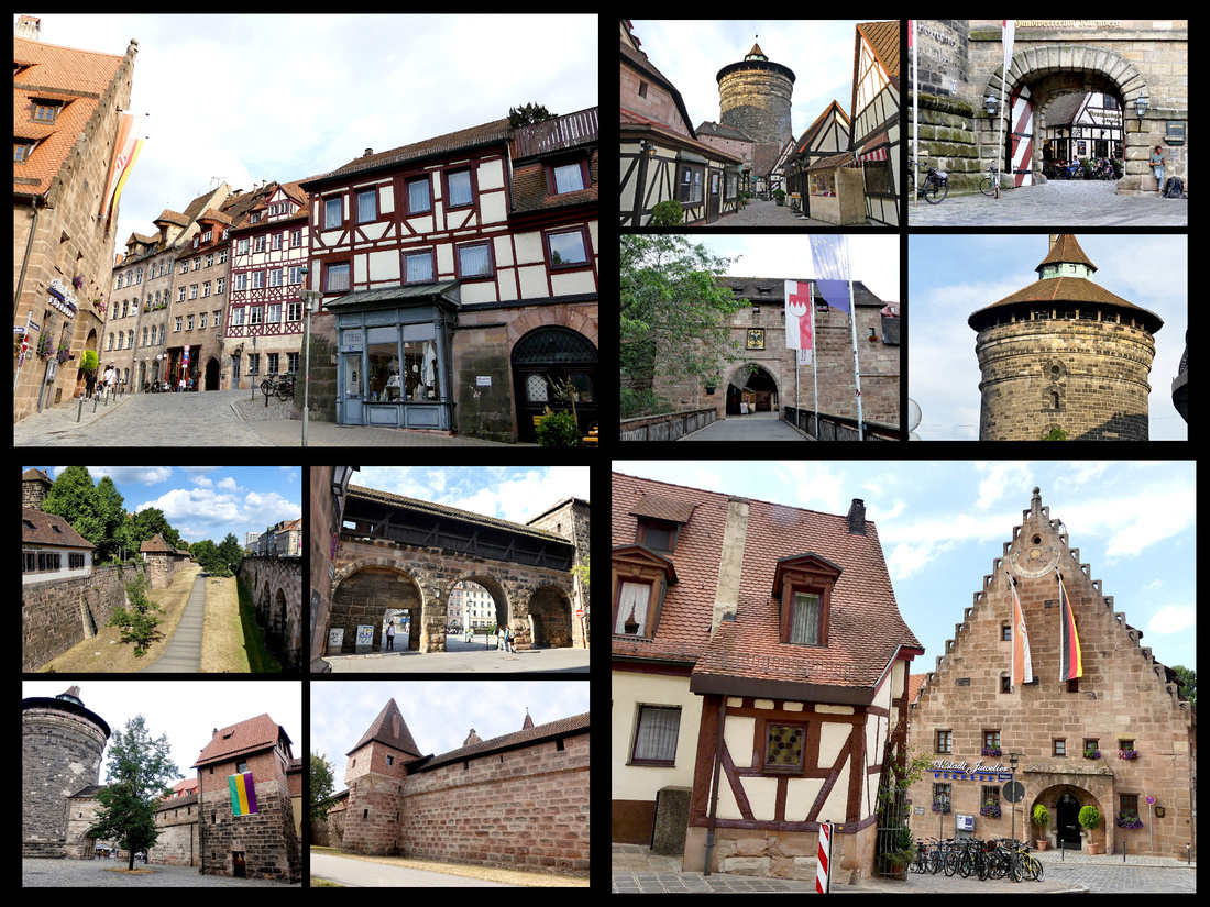
St Lorenz, the city’s largest church was heavily damaged but rebuilt impressively to its 14th century Gothic look. Across Lorenzer-platz is the 13th century Nassauer Hause – a great example of a medieval upper class house. In front of it is the 1589 Fountain of Virtue. And just a few steps past this is the Heilig-Geist Spital (Hospital of the Holy Spirit), 1332, beautifully reflected in the river. And just past this, completing the ‘heart’ of the old city, is the Hauptmarakt, the central market square with the Frauenkirche, 1352, and full of produce, food and flower stalls. At the opposite corner of this square is the Schoner Brunnen (Beautiful Fountain), 1396 adorned with 30 figures arranged in four tiers and a golden ring. Off this corner of the square if the Altes Rathaus, and across the street from this is St Sebaldus, a 14th century gothic church.
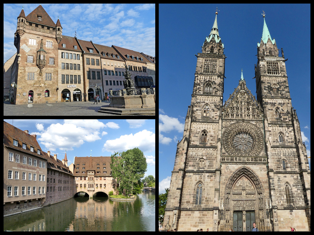 Top left: Nassauer Hause Lower left: Hellig-Geist Spital Right: St Lorenz
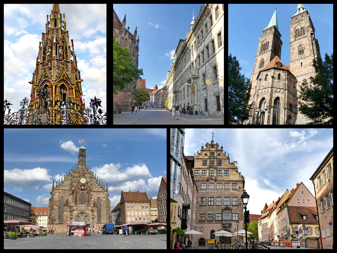
Lower left: Frauen-kirche Lower right: street leading past the rathaus toward the castle
There are atmospheric cobblestoned streets between the Hauptmarakt and the castle and the most picturesque square in the city, at the junction of Neutormauer and Albrecht-Durer-strasse, full of half timbered houses and lined with the best section of old city wall and the Tiergartnertor (tower). Also here is the Albrecht-Durer House/Museum where the artist/engraver lived between 1509 and 1528. It is the oldest house in Nurnberg.
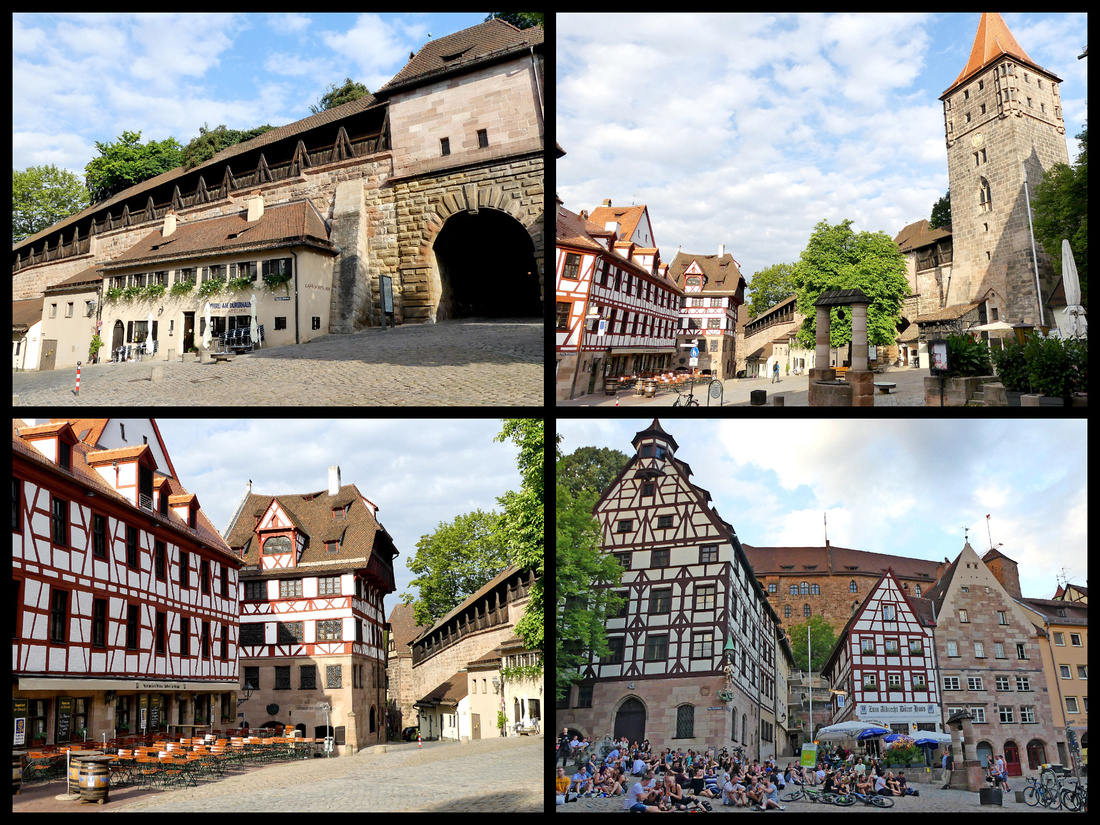
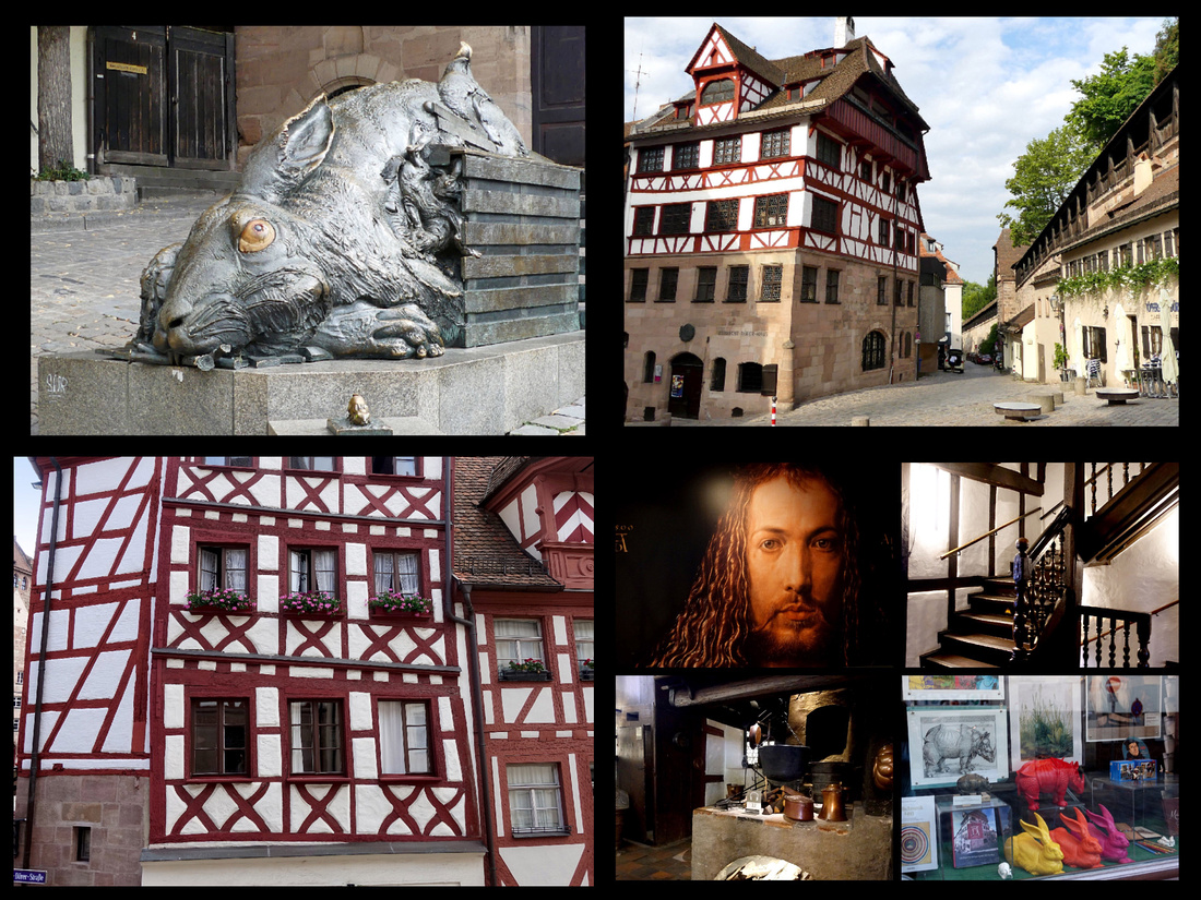
Nurnberg Kaiserburg – a large hilltop fortress at the northern edge of the Alstadt, begun in 1050 and added to over centuries. There are several buildings, one including an interesting 3 level Romanesque chapel open, but the highlights are the ‘deep’ well and the Sinwell Tower (a large round tower which can be climbed). Behind the castle are fairly extensive gardens with views over the town and the walls.
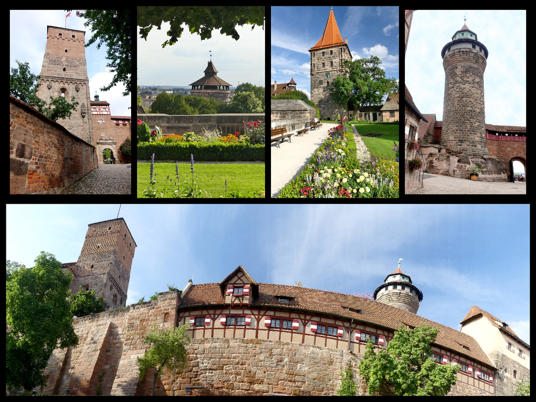
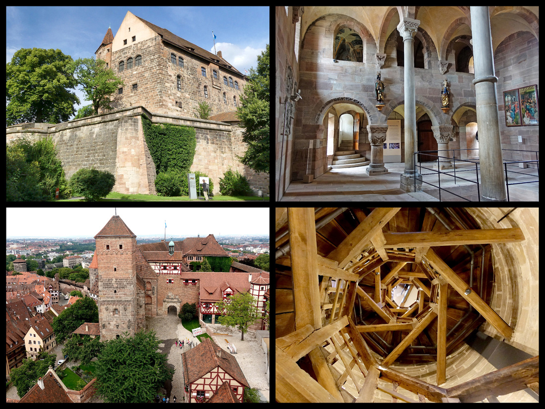
Another interesting area of town includes a corner of the walls and just inside the city from that, the Weisser turm (White tower – but it’s actually more pink), originally a tollgate from 1250. And right next to it a really interesting fountain called the Ehekarussell, or marriage fountain, it depicts the ups and downs of marriage (which apparently didn’t end well).
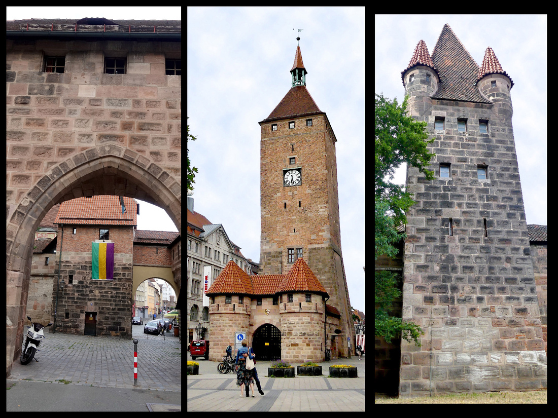 Above center: the Weisser Turn. Above right and left: sections of the extensive town walls with multiple towers.
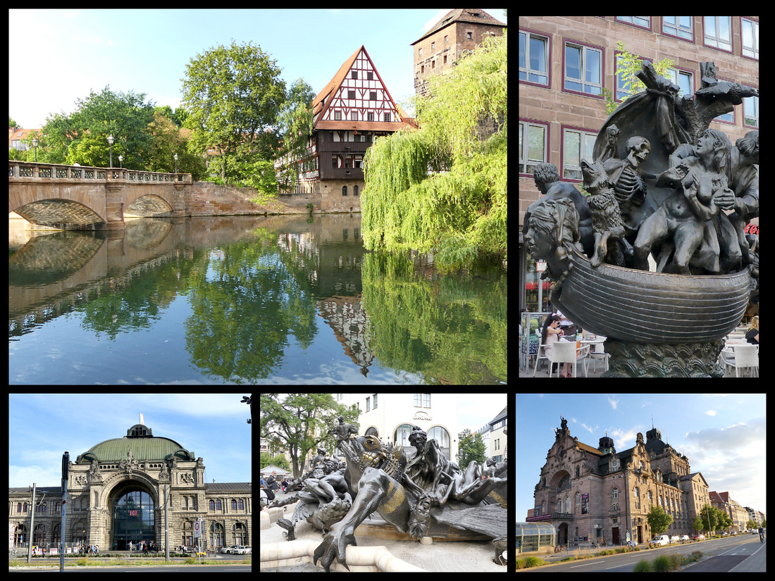
Above left: the Weinstadel reflected in the river Top right: fountain in front of St Lorenz
Lower left: Nurnberg train station Center: fountain in front of Weisser Turn Bottom right: Nurnberg Opera House (Nrunberg B&B Just past it)
One of our 3 days in Nurnberg we did a day trip to Bamberg
At a kiosk at the train station we got a VGN card for €19.70 which was considerably less than the Bayern card which is €31. Both are for two people, round trip, all day. We got the 9:38 train to Bamberg.
Bamberg is worth visiting for two reasons. One, it is a UNESCO town in it’s entirety with narrow cobblestone streets of ornate mansions, palaces, and churches, with styles ranging from Romanesque to Gothic, Renaissance to baroque, to the eclecticism of the 19th century. And two: it’s famous smoked beer. Bamberg has been called “a beer drinker’s Eden” (there are more breweries there than in Munich). The beverage of choice in Bamberg is Rauchbier, a smoked beer first brewed in 1536. My husband is a home brewer and self proclaimed beer snob and spent the whole trip trying different beers and this was his favorite.
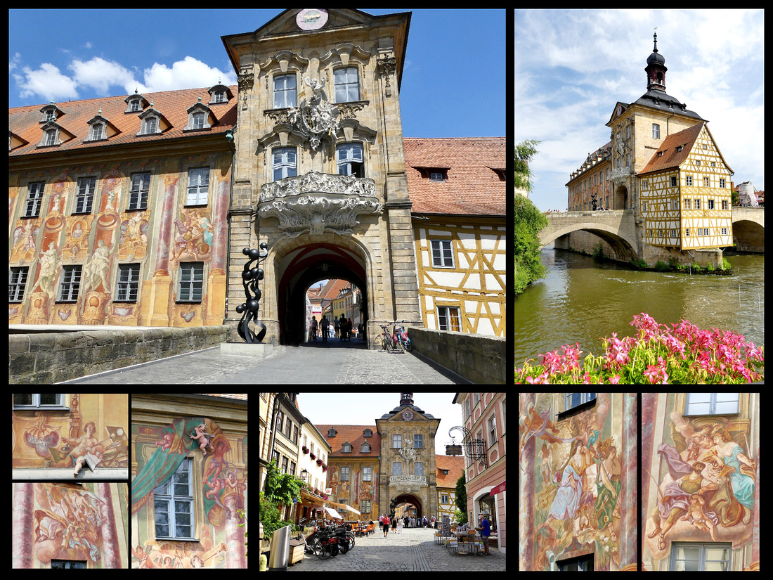
It’s a 30-minute walk from the train station to the Gruner Markt which is a long, pedestrianized square/street filled with market stalls of enticing looking fruits and vegetables. Just past that is the highlight of Bamberg, The Altes Rathaus, a gorgeous Gothic structure on its own little island in the Regnitz River. One part is half-timbered, the other covered on both sides with amazing frescoes. Determined not to play favorites between the ecclesiastical and secular sections of the city, the town authorities built this Gothic structure on its own little island in the middle of the Regnitz River, halfway between the two factions -- a true middle-of-the-road (or river) political stand. Right below it is ‘Little Venice’, a district of old fisherman houses along the river.
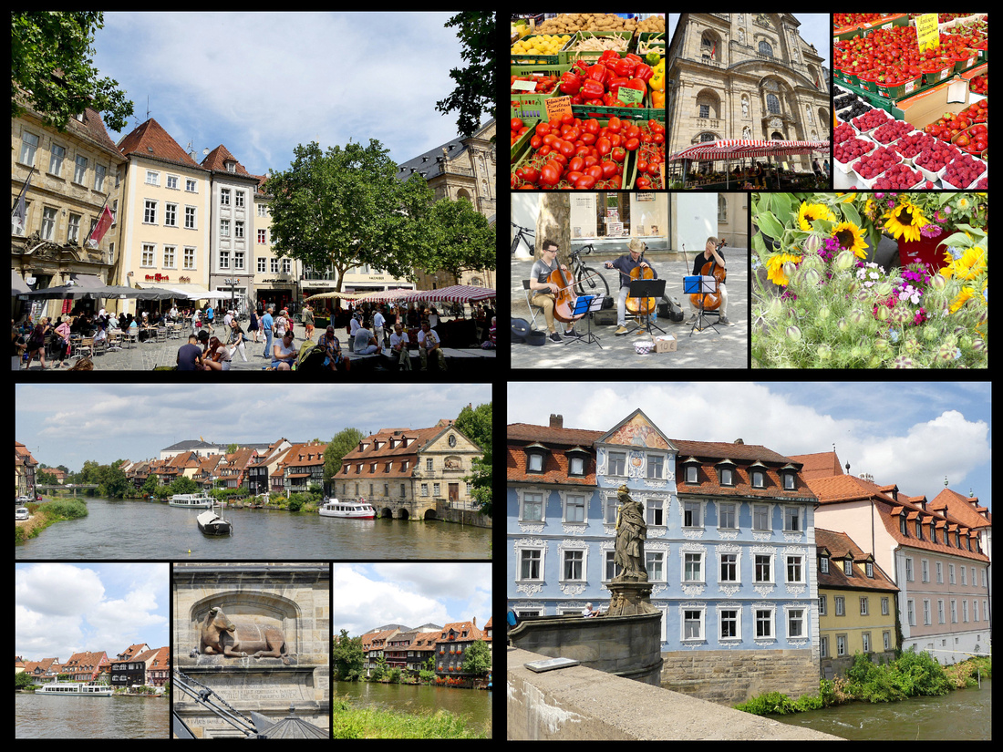
From the Altes Rathaus we headed to the Dom, passing The Schlenkerla Brewery, over 600 years old and its tavern is the only place in town serving the smoked beer from the barrels. Around the corner from the oldest brewery in town is the oldest pharmacy, the Hof Apotheke, in business since 1453.
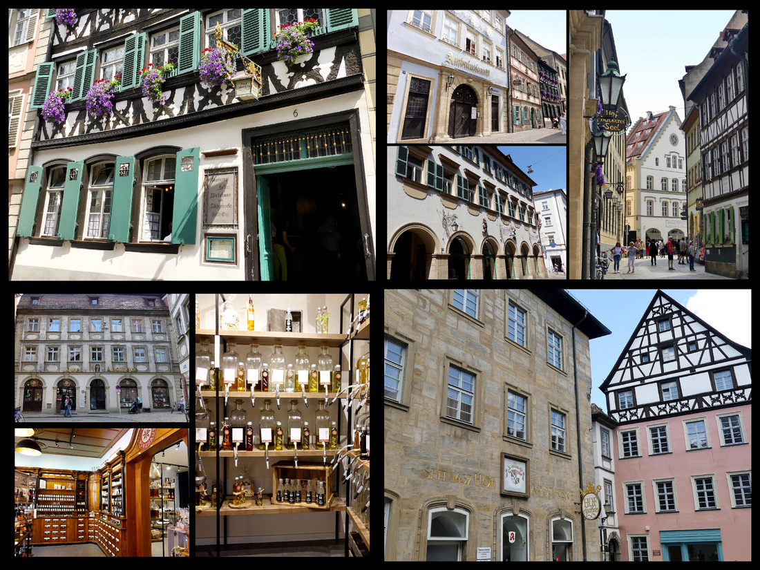
The Dom (St Peter’s and St George Imperial Cathedral, 11th century) shares it’s square (Domplatz) with the Alte Hofhaltung, a Renaissance palace with a courtyard surrounded with late Gothic half-timbered buildings. Across the square is the Neue Residenz, 1602 with a huge statue and fountain filled rose garden which supposedly has 4500 roses. Unfortunately all of these had a good deal of scaffolding around.
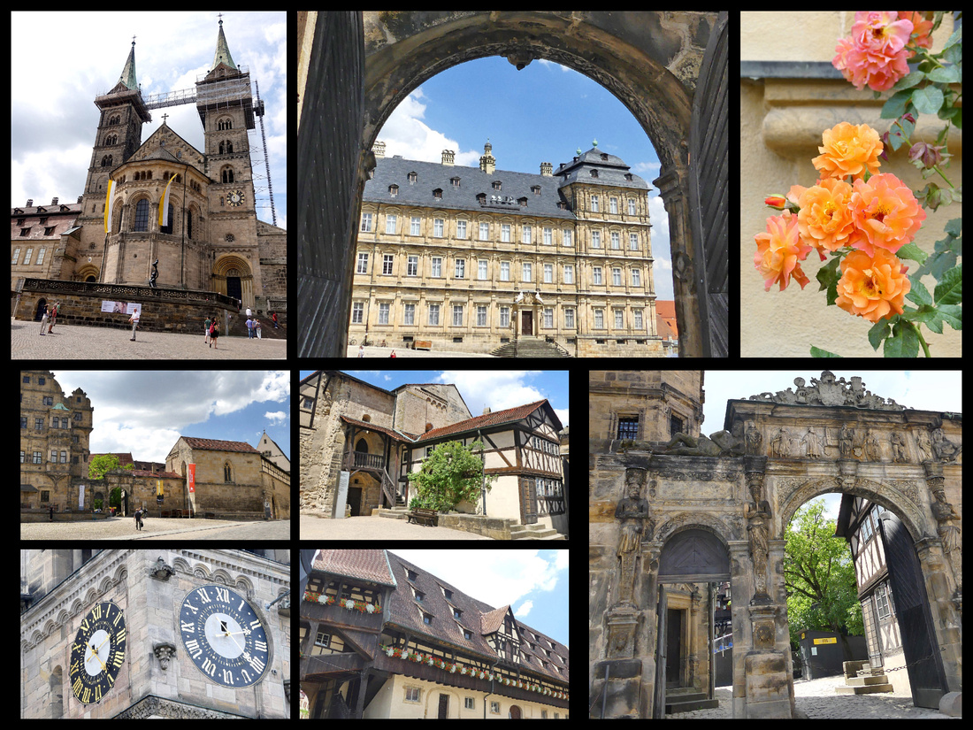
But one of the places we were most interested in visiting , Michaelsburg Abbey, a 15 minute walk up hill from Domplatz, was completely (and I mean completely) covered with scaffolding. And the Brewery Museum within it was closed. Bummer. However, this was all at least somewhat compensated for by the excellent lunch we had up there at the terrace restaurant, one of the two best meals we had on the trip, and of course they had the Bamberg smoked beer. The Michaelsburg torte we had for dessert wasn’t bad either. And there was a lovely view of the town below.
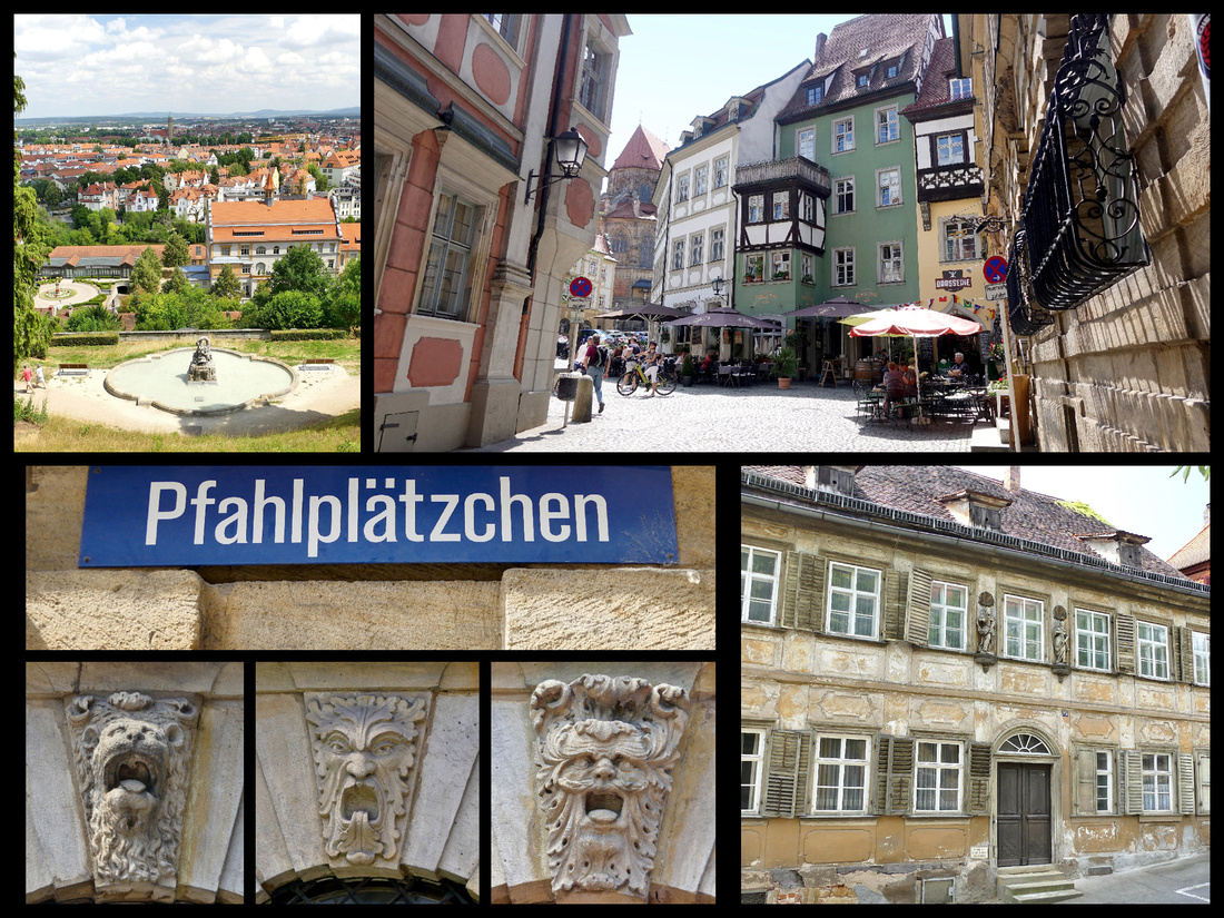
Regensberg Day Trip
We started the day with breakfast at the train station. Although Nurnberg Train station has several excellent places to get coffee, we just had to try the Dunkin Donuts. While Starbucks has been a common site in much of Europe for the past decade, I had no idea anyone in Europe had ever even heard of Dunkin Donuts but Nurnberg has at least two. The coffee was just like the Dunkin Donuts at home. Couldn’t bring myself to have donuts though when there were all those croissants only steps away though. Then we bought a Bayern ticket for €31 and got the 9:34 train to Regensburg (1 hour).
Regensberg train station is only about a 15-minute walk to the center. Although Regensberg is another UNESCO city, I was not as impressed with it as I thought I would be (this does not mean I didn’t think it was a beautiful city worth visiting, just that it didn’t live up to my very high expectations of it). There was even more construction than in the other cities (and they all have some) as well as lots of trash bags piled up awaiting pick up. There seemed to be a lot of vehicles, especially vans and trucks.
Regensberg is located on the Danube River and contains many medieval buildings of exceptional quality that testify to its history as a trading center. It has ancient Roman, Romanesque and Gothic buildings including patrician houses and towers, and a large number of churches as well as a 12th century Old Bridge. Regensburg is one of Germany’s best-preserved medieval cities and the only one to remain completely unscathed by World War II bombings. Strategically poised on the northernmost reaches of the Danube River, Regensburg was a Celtic settlement, then a Roman outpost, and the center from which, beginning in the 7th century, Christianity spread throughout Germany and into central Europe via the Danube. Regensburg was also a major hub for trade, and by the 12th century the town was pouring its wealth into churches, towers, and some genuinely lovely houses and public buildings. Two of Regensburg’s more famous contemporary residents have been Oskar Schindler and Pope Benedict.
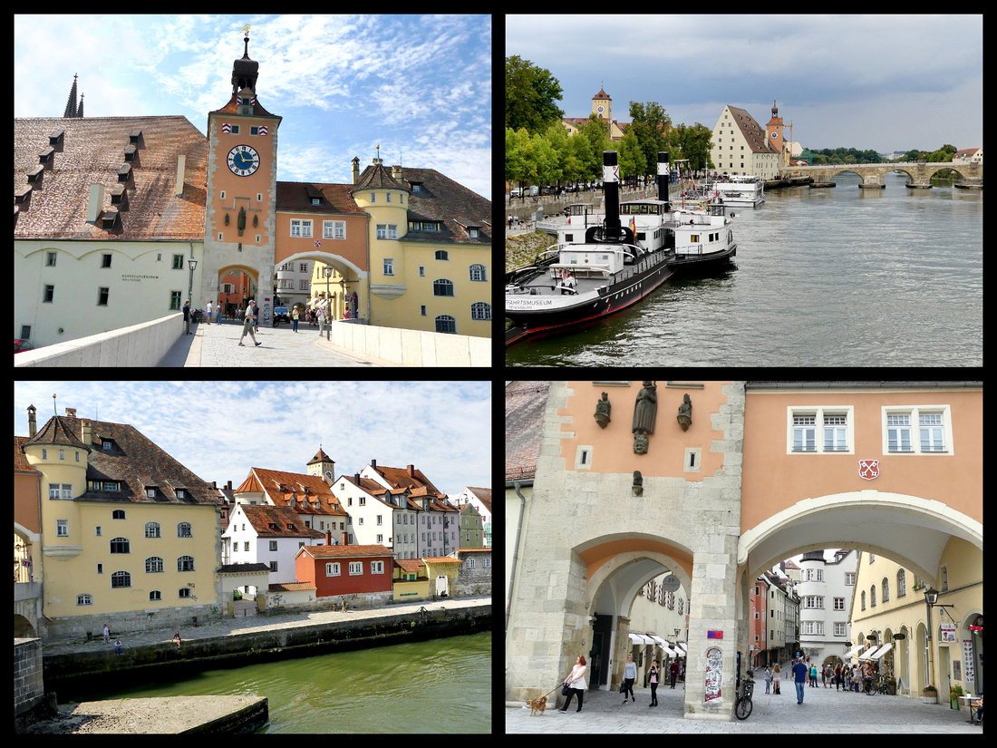
When we first got there it was quite sunny, lots of blue sky. There are some lovely old buildings but there was some modern stuff interspersed as well. The Dom looked a lot like the one in Nurnberg. Steinerne Brücke is the stone bridge over the Danube, built in 1135, with 16 arches, a beautiful bridge, unfortunately it was half in scaffolding. It was the only stone bridge crossing the Danube from Vienna to Ulm for over 800 years. The clock tower/arched entry to the bridge is gorgeous and there are nice views from it, especially of the Salzstadel (Salt Warehouse) right next to it, built in 1620, an interesting building that was important in the active salt trade in the region. The best views of both of these are from the next bridge down river. There are several boats docked between them including a museum boat, and boats leaving for day cruises.
The Porta Petoria from the 1st C AD. is just a small corner of a building really, but a well preserved Roman ruin nonetheless. The main square, the Haidiplatz is really pretty, lined with beautiful buildings. The Altes Rathaus in Rathaus Platz (houses the TI office) adjoining Haidiplatz is one of the prettiest buildings in the city. There are numerous towers scattered about the alstadt (old town). There were a few other squares but none terribly inviting. We had read about the view from the top floor restaurant of the department store in one of the squares so we checked that out but the view was not great. The Alter Kornmarkt sounded like it would be a pretty square but was essentially a parking lot. However, it is the site of the Alte Kapelle, a rather boring church from the outside but a definite “WOW” inside – very beautiful baroque. One of the more unusual sites is the Goliath House, built about 1260, the largest mansion in Regensburg but the best part is the 1573 painting of the flight between David and Goliath covering two stories of the outside of the building. We were just starting to check out some of the lesser sites when it got cloudy quickly and then there was a sudden massive thunderstorm – now that was impressive. Fortunately we found an enclosed alley and waited it out for about 15 minutes. Then it slowed to drizzle but by that time I was not interested in any more exploring – combo of weather and just the town itself.
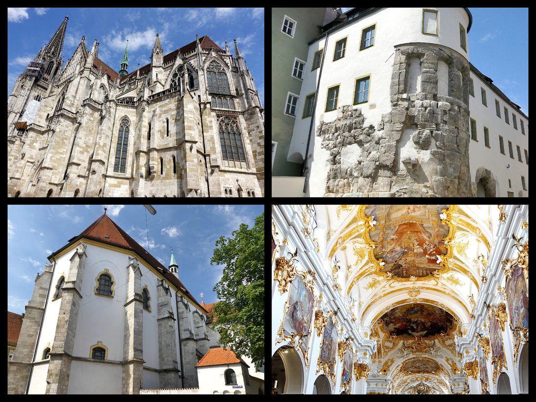
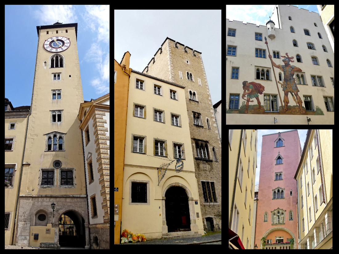
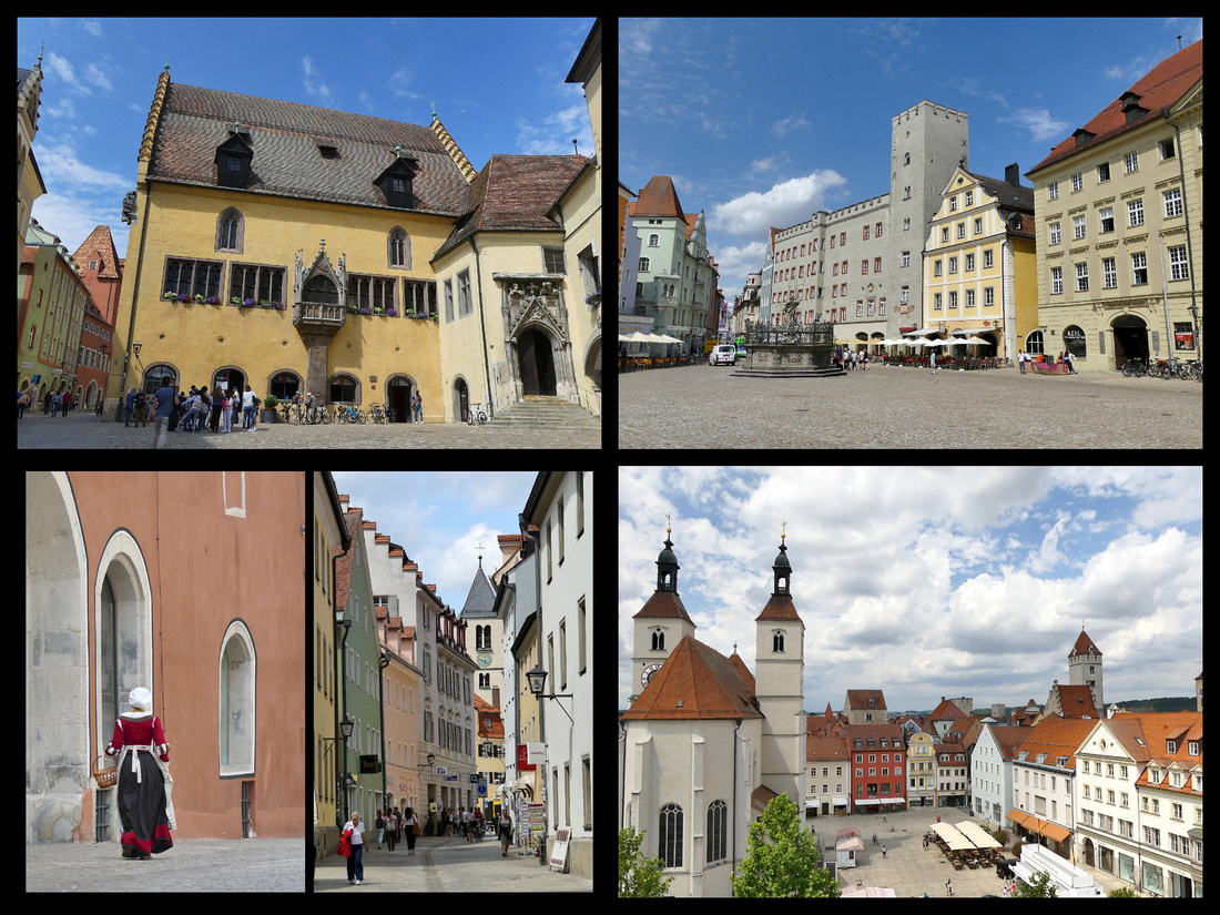
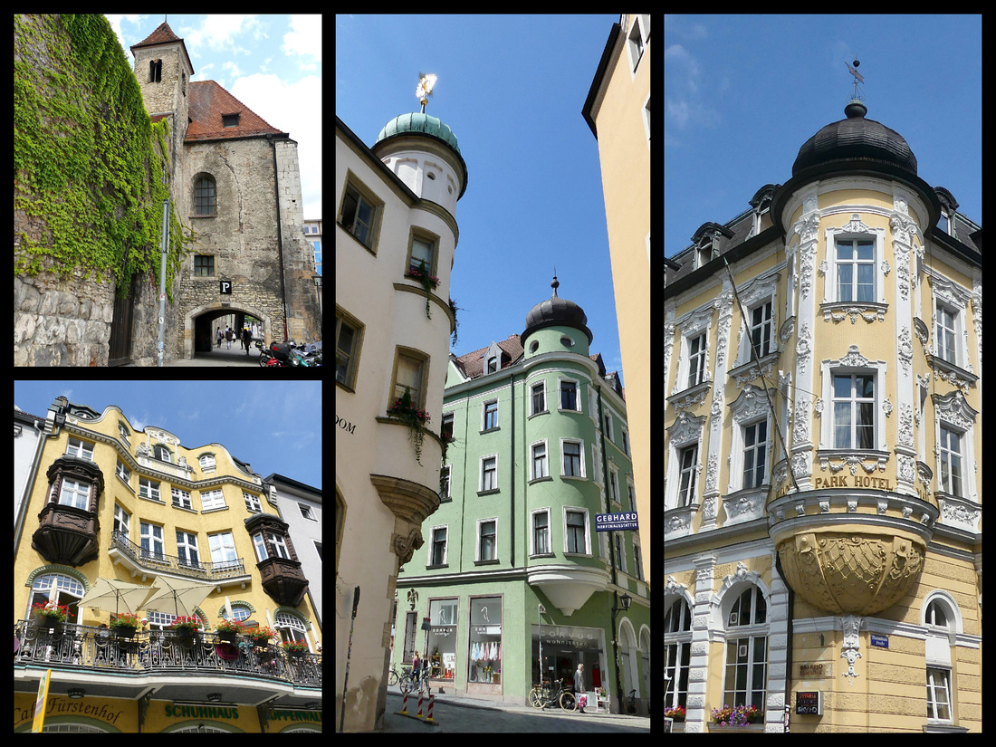
Day 17 - We spent the morning doing the few things in Nurnberg we hadn’t yet done (touring the castle and the Albrecht Druer House) and then took the 12:30 train to Rothenburg ob der Tauber ((VGN ticket). The whole trip was only about 1½ hour but required two changes, one 4 minute and one 5 minute but we made both easily, both trains were on time. We wanted a late afternoon and a morning in Rothenburg to try and avoid the crowds so booked just one night and this plan worked well. An afternoon/evening and a morning were just about right. Hotel Zum Breiterle is just inside the walls, a ten-minute walk from the train station. The hotel is a nice old picturesque house, inside not exactly modern, but clean and comfortable.
ROTHENBURG OB DER TAUBER – “Red fortress on the Tauber river” is every bit as gorgeous as everyone says it is. Surrounded by massive stone walls (most of which you can walk) with 42 towers and several gates and full of cobbled streets lined with gorgeous buildings and flower filled window boxes, a beautiful main square with amazing buildings, and a picture postcard perfect intersection of two streets with a gate and fountain. The walls were great fun, most of it free and the bastion at the south end of town also incredible and free. So Rick Steves is right, Rothenburg is the quintessential German medieval town. Looks like a movie set except for all the cars everywhere. Reminded me a bit of Brugge only with walls instead of canals. Rothenburg, like Brugge, was poor in the 17th and 18th centuries when richer towns were tearing down the old stuff and building Baroque and later, so it remains very medieval.
ButI was really surprised that they don't restrict at least the parking of cars in the old center. The tour groups everywhere mid-day I expected (that's why we spent the night), but the cars I didn't expect. We had just about 24 hours in Rothenburg which was perfect. We arrived around 2 pm and the town was jammed, by 7 pm we almost had the place to ourselves. The following morning the town was delightfully empty (except for the delivery vans) until about 10:00 when the tour groups arrived.
We entered the town through the Roder Gate - late 14th century and still has its toll both and gatekeepers cottage in front of it, the tower is the only lookout tower along the city walls.
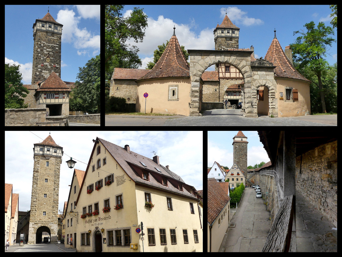
Inside, a few blocks towards the center is the Markus Tower which was part of the city’s first fortifications in 1200.
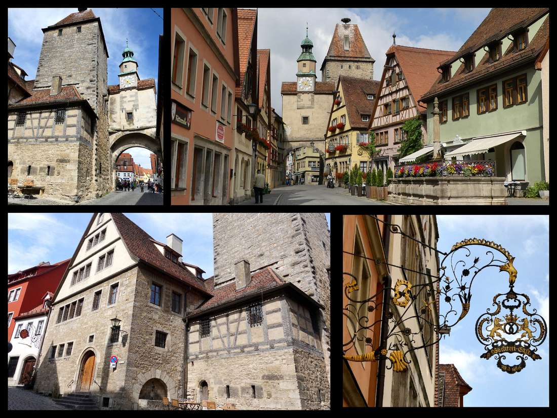 Above: Markus Tower, lower left: The Büttelhaus (Beadle House) which is now used to store the city archives has a very small door into the former prison.
The center of Rothenburg is Marktplatz (Main /Market) Square. The main building – Rathaus (Town Hall) is Gothic (1250-1400) at the rear and Renaissance (1572) in the front. Next to it is the Rathstrinkstube (City Councilor’s tavern), which features a beautiful front with astronomical clock. One corner of the square is George’s Spring, the largest in the city, 25 feet deep. The pillar above it is Renaissance (1608). We climbed two sections of wall and walked most of the circuit, some of it twice. We climbed to the top of the city hall tower which has great views of the square below and the entire town. The first hundred steps or so are stone spiral, very wide and easy. Then comes a series of wooden steps, getting more and more narrow and steeper as you go for another hundred or so steps. The final section is essentially a ladder. With (very small) backpacks we barely squeezed up there - certainly no one with mobility or weight issues could make it. That last part you climb, not walk. But it was fun. Interesing that the ticket desk ($2.50) is at the top. Due to the small space up there only 20 people are allowed at a time. About halfway up is a turnstile with a light - if green it lets you go, if red you have to wait till some people come down.
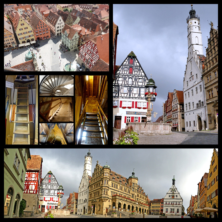
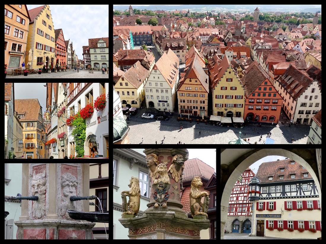 Above: Marktplatz from tower of Rathaus. Lower left and center: close ups of St George's Fountain.
The Schmiedgasse leads off from Marktplatz down to Plonlein/Siebers Tower, the most photographed place in town (where every selfie taking tourist insists on posing). Plonlein means ‘little square’. It dates from 1385. It actually is the most photogenic spot in a very photogenic town.
 Above - Top Left: The Plonlein and Siebers tower Top right: Kobolzeller Gate
Lower left and center: Schmiedgasse leads from Marktplatz to Plonlein Lower right: fountain in Plonlein
We also checked out St Jacobs-kirche, which is on one of the northern routes to the Camino de Santiago, (where we spent our trip last summer) and sure enough, there is a bronze statue of St James with the scallop shell in his hand right outside – and the bronze scallop shell markers on the ground pointing the way to Santiago.
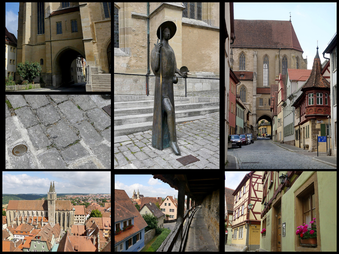
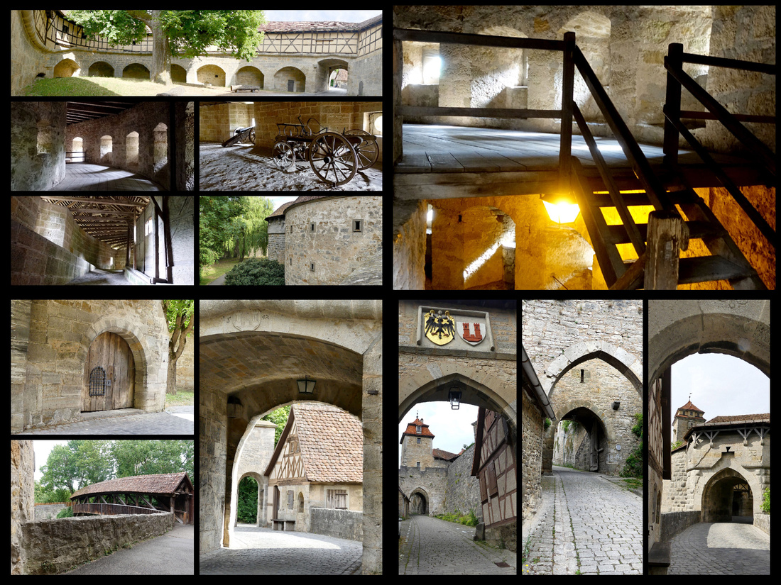
Castle (Burg) Gate & Tower was at the site of the castle which is no longer standing but the gardens remain. There is a mask with a ‘mouth’ through which the castle’s defenders poured hot tar onto attackers. The side doors were deliberately small so that only one person at a time could enter.
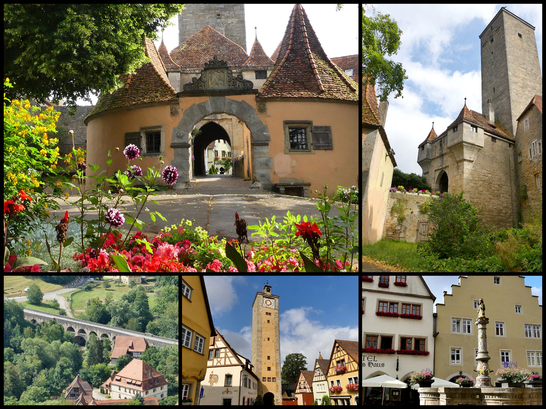 Above: Castle Gate and gardens Lower left: the 'Double Bridge as seen from Castle Gate Lower center & right: Castle Gate tower from town side
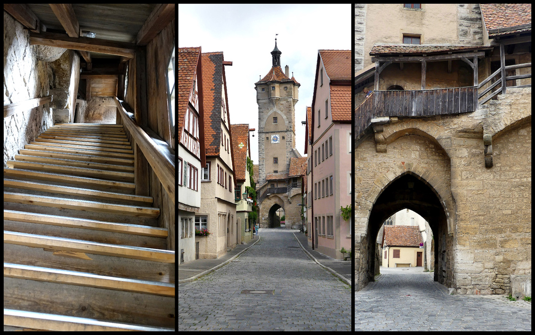
Above: Klingen Gate and one of the entrances to the town walls
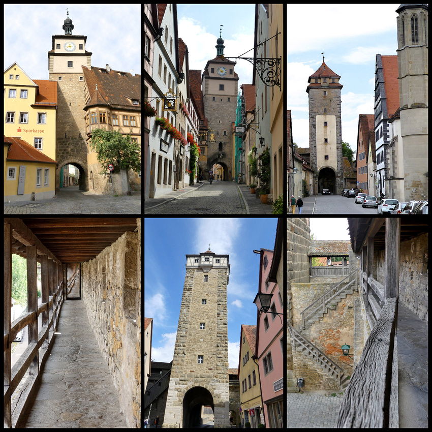
Above - top left: White Tower (from outside the walls) center: White Tower from inside top right: Gallows Gate/Tower
lower left and right the 12th-13th century walls lower center: Roder tower

Days 18-19 - Heidelberg
Heidelberg didn't exactly fit with the rest of the places we visited which were all in Bavaria but we needed to be close to Frankfurt to fly out and it turned out Heidelberg was perfect for the last couple days of the trip. We didn't arrive until early evening but had time to walk to the historic center (from our hotel which was across the square from the train station) for dinner. The pedestrian shopping street, Haupstrasse, was lively and pleasant, with some interesting historic buildings including the university, and leads to the main square - Markplatz - with great views of the highlight of Heidelberg - the 'half-ruined' castle on the hill.
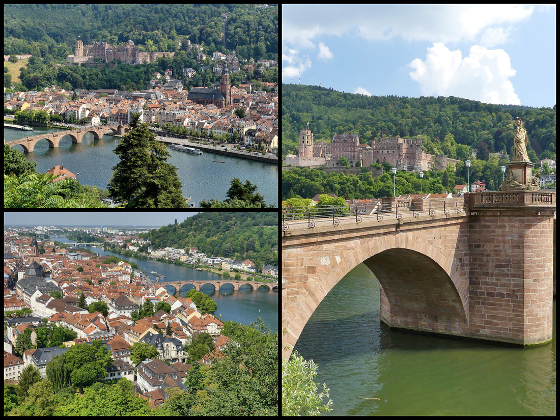
Marktplatz has the most impressive church in the city, Heliggeist-kirche as well as the Rathaus. The adjoining square is the Kornmarkat which was a grain market in the middle ages, nice fountain in the center. The entrance to the funicular is just off this square.
We took the funicular up to Heidelberg Scholss. It’s 7€ each for the funicular plus the castle grounds, the old apothecary and the giant casks. If you want to tour the rooms you have to buy a separate ticket for a guided tour. We took the funicular to the station above the castle and walked down thinking there might be nice views of the castle from above. It was an easy 15 minute walk but the view of the castle from the grounds (Schlossgarten) was even better. There are quite a lot of grounds outside the castle (with panoramic views of the town, the old bridge and the river) and the courtyard is quite large.
Perched on a hill overlooking the city, the ruins of Heidelberg Castle is the result of many centuries of building and destruction caused by war, fire and pillaging. The earliest fortifications were in the 13th century; most of the present structures date to the Renaissance. While much of the castle remains in a state of artful decay, some areas have been renovated to its Gothic glory. Even in ruin one of the great Renaissance landmarks of northern Europe suggests beauty, grandeur, and long vanquished empires—in this case a division of the Holy Roman Empire, whose prince electors lived here from the 13th century. Very interesting contrast with some of the castle in great shape – with lots of intricate carvings on the exterior walls, etc., yet the rest of it is a ruin.
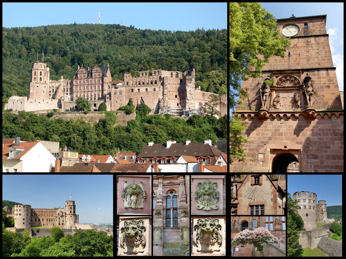
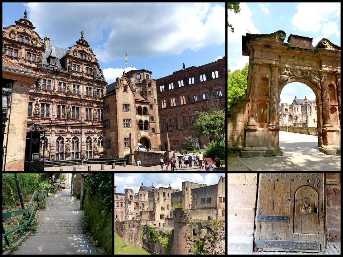
The Great Cask, aka the Heidelberg Turn, a symbol of the exuberant life the prince electors enjoyed, was built in 1751 to store more than 208,000 liters (55,000 gal.) of wine (the largest in the world) but failed to impress Mark Twain, who wrote, “An empty cask the size of a cathedral could excite but little emotion in me.” The cellars house the giant casks (there are three, besides the Great Cask). The biggest cask is in a room by itself with a beautiful wood spiral staircase going to the top of it. The others are in a large hall like space that is also a wine tasting bar and a food/beer/beverage bar. We got white sausage with sweet dark mustard, beer and ice tea. Same meal that was our first of the trip in Munich.
The Chemist’s Tower houses the Apothekenmuseum (Pharmaceutical Museum) and the old chambers spotlight the importance of German pharmaceutical research (much of it conducted at Heidelburg University) with utensils, laboratory equipment, and re-created chemist’s shop from the 18th and 19th centuries. The apothecary museum is extensive and one of the best I’ve seen (probably second only to Krakow). Many rooms, lots of apothecary chests (room size) and jars and jugs and miscellaneous other materials used in pharmacy. Lots of explanations on the history of pharmacy, all in both English and German. Nice little crocodile hanging from the ceiling.
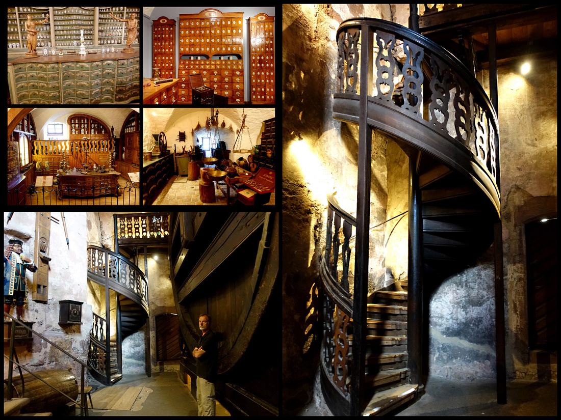
Although the funicular back down to town is included with the ticket we had, we choose to walk. It’s only 220 steps (and they had painted numbers on them).
On the other side of the bridge from the alstadt is the “Philosophers walk” (Philosophenweg )– up a rather steep hill, then along the river, through vineyards and woods. Fabulous views back to the old town with the castle above it and the old bridge over the river. The town is definitely better from a distance – but from a distance it is a stunner.
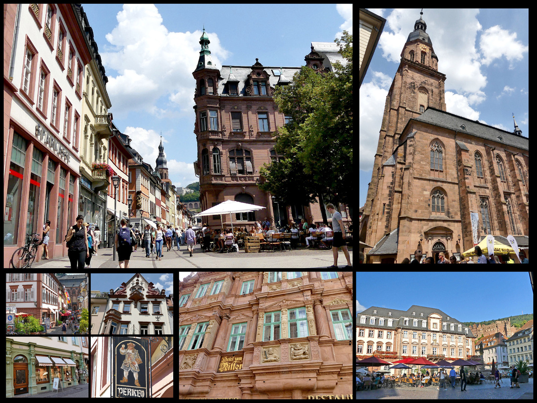
]]>
Munich 3 nights, Hallstatt 1, Graz 3, Bratislava 3, Wachu Valley 2, Nurnberg 3 (day trips to Bamberg & Regensberg), Rothenburg o.d. Taber 1, Heidelburg 2.
Turns out a lot of travel forum folks were right about three nights in Graz and Bratislava being too much (could have cut a day from each). But I was right about the one nighters. Hallstatt was hugely crowded with tour groups during the day, but was almost deserted evening and early morning. Pretty much the same with Rothenburg.
We did all our traveling by TRAIN The first one I booked on bahn.de, the official German train website. It was easy to use, but Capital One Visa did not like it at all and refused all subsequent attempts, so I ended up booking all the rest on “thetrainline.eu” which had the exact same schedules and prices as the German and Austrian sites. The only problems we had with regards to trains were some very short connection times. The main screen you get when searching (on any of the sites) showed departure and arrival times and how many connections there were, but to see details such as how long you had for the connection, you had to go to another screen, which I didn’t do as I ‘assumed’ if they were booking a journey from point A to point B, it would be a ‘doable’ connection. Sometimes they were only 3 or 4 minutes long meaning we had a few stressful moments. Although I don’t think any of the trains we took were totally full (so you could have purchased them on the day of travel) it did save considerably financially. In one case I checked the price of the €19.90 tickets we had and the price if we bought them that day would have been €49.90.
MUNICH
Days 1-3: We arrived in Munich around noon after our flight from Boston, via Dublin. Hotel Buddy – Uber modern. Check in on the ground floor kiosk or go up to the 2nd floor where there is another kiosk but also a nice lady to help you. The comfortable queen size bed is up against the wall but other wise fine. No closet or dresser but enough space for the two bags and surfaces to put stuff. Bathroom very modern, great rain shower, everything extremely new and clean. Could use a few hooks on the walls. AC, TV and fast wi-fi all worked great. The ‘free’ Buddy breakfast – I guess it was ‘worth the money’ - includes some cheap pastry and apples, vending machine has so-so cappuccino for €2. They set it out at 6:30 am, there may or may not be any left when you get up. €112 double (including the €10 extra for the ‘larger’ size room.)
Location is great, 5 minutes from the train station and one-minute from Karlz-platz, underneath which is a huge underground shopping center/food court. Escalators go down to it so it serves as a passage to go under the relatively busy Sonnen-strasse (one of which comes up almost directly in front of Hotel Buddy). Food options include Mexican, Indian, Thai, Kebab, Pasta, ‘traditional German (ham, schnitzel, etc.), sausage and fries, and numerous salad/sandwiches. One of the best-preserved city gates, (Karls-tor) is on Karlzplatz, through which is pedestrian street into town.
The Neuhauser-strasse / Kaufinger-strasse is lined with some interesting buildings interspersed with more modern (late 20th century) buildings – all of which house stores like Urban Outfitters, H&M, C&A, Zara, etc. The street was spruced up in 1972 for the Munich Olympics, becoming one of Europe’s first pedestrianized streets. St. Michael’s church is right on the street; set off by a half block is the Frauen-kirche, the tallest thing in central Munich with twin clock towers topped with green onion domes. Five minutes brings you to the Marien-platz.
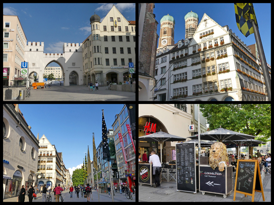
Marienplatz - with the New and Old Town Halls – is clearly the center of the action. The new town hall (Neues Rathaus ) built in the in the late 1800’s in the Flemish Gothic style, with a facade more than 90m (300 feet) long and featuring intricately carved stone. Inside are stained glass windows, vaulted ceilings, intricately carved wood working, and a labyrinth-patterned floor in the inner courtyard. Halfway up the center tower of the facade is a two-tier Glockenspiel, (Carillon) with 43 bells and 32 mechanical figures. The figures rotate accompanied by the music of the bells for about 15 minutes, several times a day. It is the largest in Germany and the 4th largest in Europe. The Old Town Hall (Altes Rathaus), at the end of Marienplatz, was built in 1470. The 55-meter-tall (180 foot) tower is visible from a number of spots in the city. The tower is actually older than the building proper as it was built in the 12th century as part of Munich's fortifications.
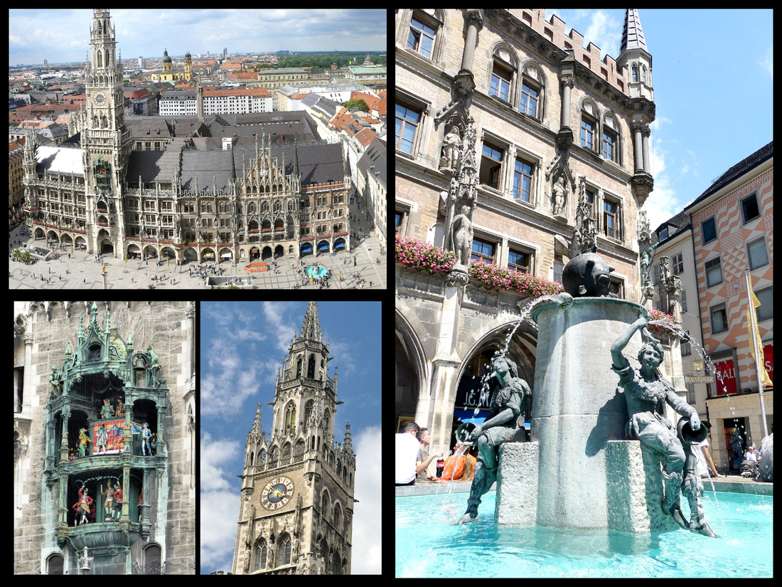
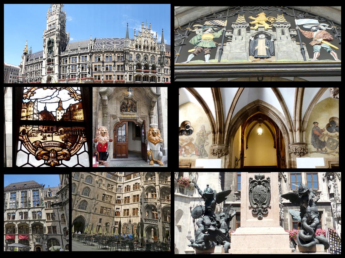
Above: Marienplatz and the Neues Rathaus The lower photos are of the courtyard.
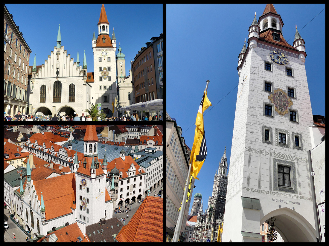 Above: the Altes Rathaus
Some towns in Germany (most of which were badly damaged in WWII) rebuilt in modern style (e.g. Frankfurt) but Munich chose to renovate and rebuild its old town center. There are many beautiful buildings, but they are interspersed with some more boring, mid 20th century stuff and this is evident in the buildings around Marienplatz.
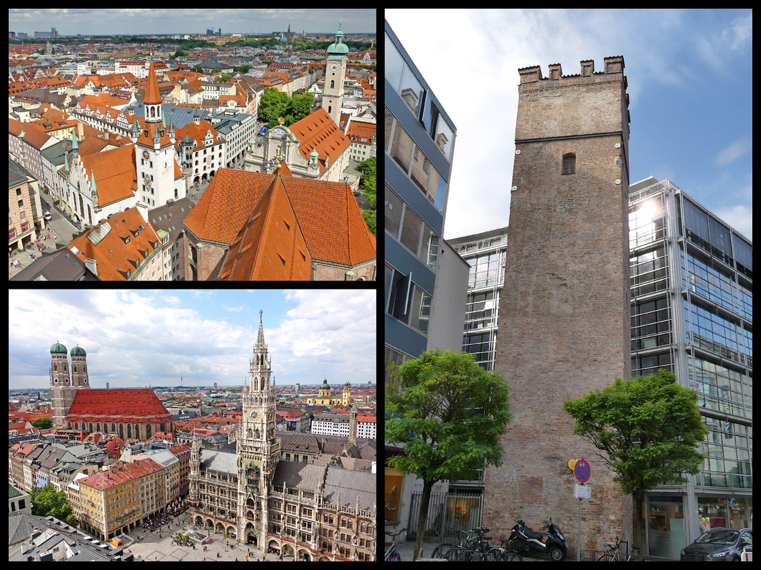
Upper left: Altes Rathaus at one end of Marienplatz from Peters-kirche tower Lower left: Neus Rathaus at the other end of Marienplatz and Frauen-kirche to the left of that. Right photo: the old and the new just off Marieplatz
We wandered around the Viktualien-markt but decided to go the Hofbrauhaus for lunch. The Hofbräuhaus – one of prettiest buildings and squares (Platzl) in Munich has been selling beer for over 400 years. It has four main areas. The Schwemme (taproom) is a huge room that was once used for beer production, but is now a beer-drinking hall seating 1,300 with beautifully decorated walls and ceilings. The Bräustüberl is a smaller room and the Festival Hall is a chandeliered room on the second floor which charges a cover but features live entertainment. Outside is the beer garden with shady chestnut trees.
We shared a table with a couple from Frankfurt, who spoke only marginal English (which was still way better than our German – but my husband did get to try out a few words). So we had a fun ‘conversation’ along with our bratwurst (grilled, pork sausage, served with mustard and sauerkraut) and some white sausage that is apparently the classic Munich sausage. It is veal and comes boiled which at first did not look that appetizing, but the mustard that came with it was really good (dark and sweet) so we actually liked that better. They pointed out the obvious that Germans are referred to as ‘krauts’ because of sauerkraut. My husband ordered a dark beer and I think it was the only one I saw, everyone else (hundreds of people) were drinking the light stuff.
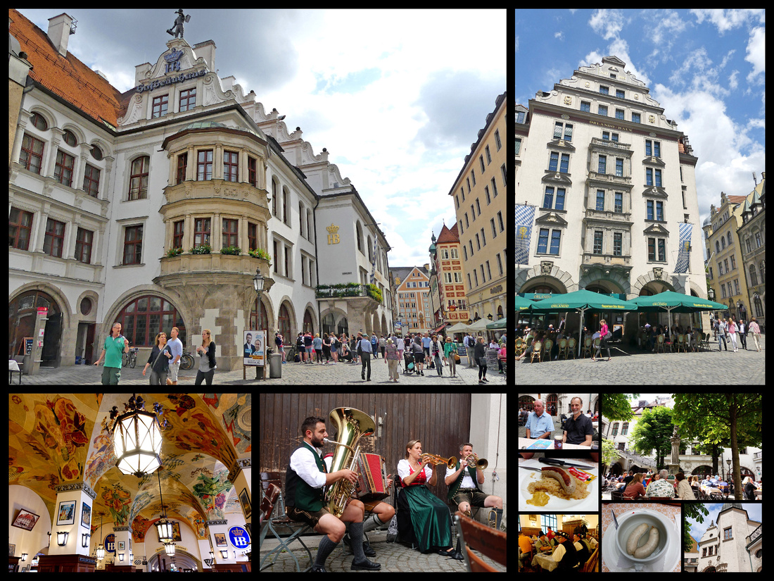
Viktuallienmarkt- a huge market with mostly permanent stalls selling all manner of food (bakeries, butchers, fruits and veggies, cheese, flowers, etc.) including prepared foods. In the center is a beer garden and you can get food at any of the stalls and bring it to the tables in the beer garden as long as you order a drink. The market has been there for 200 years and there is a large maypole in the center, which is painted in the Bavarian colors of blue and white. Maypoles were used in previous times to signify which crafts and industries are important to the local area. These emblems are still visible today on the Vikualienmarkt's maypole.
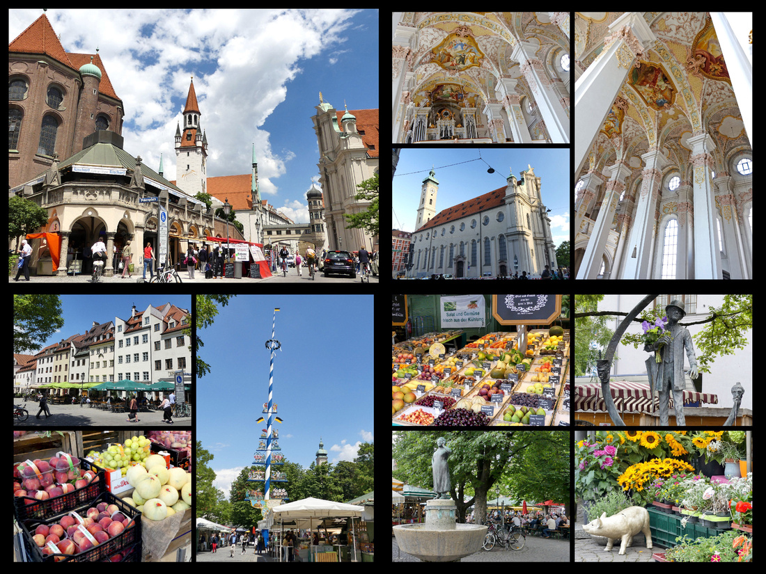
Upper left: Viktualienmark - one of the permanent market buildings with Peters-kirch to the left of it, Altes Rathaus directly behind it, and
Heiliggeist Church to the right of the photo. Upper right photos are of Heiliggeist Church including interior. Lower photos all of Viktualienmark.
Heiliggeist (Holy Ghost) Church sits between Marienplatz and Viktuallienmark. This Gothic "Hall Church" originally belonged to the 14th century Hospice of the Holy Ghost and while only ‘moderately’ pretty from the outside, has amazing baroque décor inside.
Just behind the market is Peters-kirche. It’s Munich’s oldest church, begun in 1181 but rebuilt numerous times in different architectural styles since then, today it is an elaborate Rococo / "Bavarian Baroque" style. The most interesting thing inside is the bizarre gem studded skeleton (of St Muundita). The view from the tower (307 steps, €3) is probably the best in the city. It is a pretty narrow stairway but there are numerous landings where you can ‘pull over’ to let people going in the other direction pass. I had read that it was ‘scary and unsafe’ and so crowded at the viewing platform that it was not worth doing, but I didn’t find it any more crowded than most towers (and I climb a lot of them). The views certainly made it worthwhile.
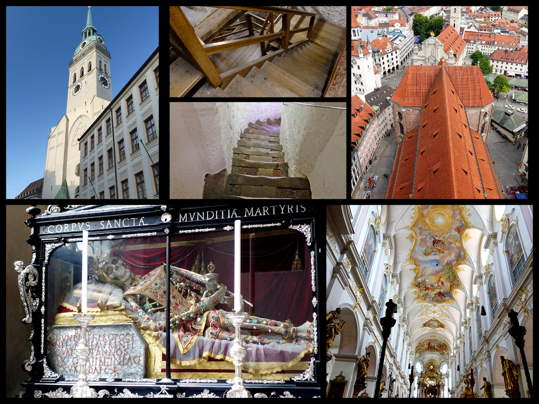
We wandered around the Allstadt as far as the Residenz (on Max-Joseph Platz) and National Theater – reasonably impressive but nowhere near the top of ‘impressive palaces and theaters in Europe’. Just down the street, the Theatiner-kirche and Odeonsplatz were much better. For one thing the church is bright yellow and the Odeon is an Italian style loggia with two nice big lions guarding the steps into it, and another nice lion inside. There were also lions all along the side of the Residenz which, takes up the entire block between the two squares. Then we checked out the Hofgarten – tiny but with a nice little rotunda (with two guys playing violin) and several fountains and manicured flowerbeds.
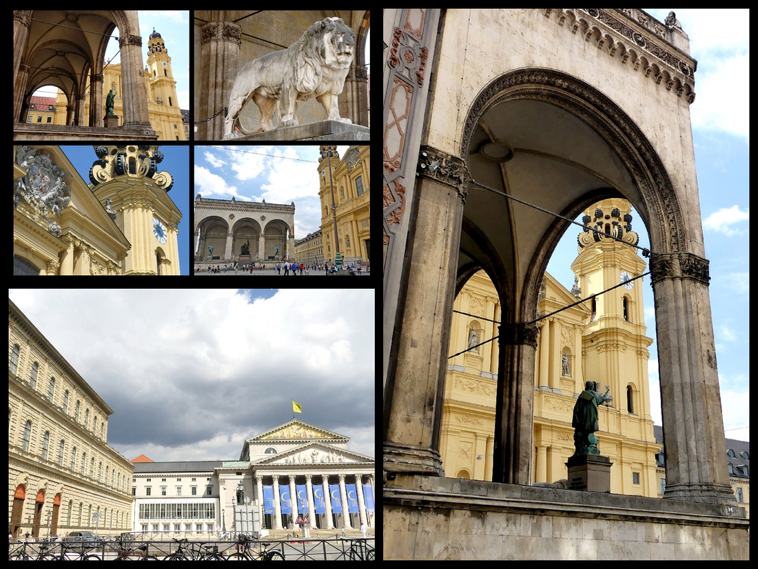 Above - Lower left: the Residenz and National Theater Other photos: the Odeon and Theatiner-kirche
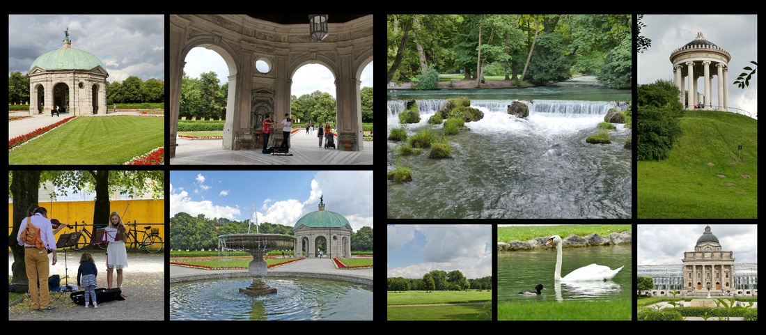
Above - Left photos: Hofgarten Right photos: Englischer Garten
The following morning we headed out to explore Munich in the sunshine (throughout the day it was sunny, cloudy, rained, repeat – quite cool, in jeans and a tee shirt I was alternately too warm and too cool). Central Munich is small enough to easily cover in a day (we felt a day and a half were just about right) – we explored churches, markets, gates and gardens.
Munich was originally protected by a city wall with nine gates, three of which still remain. Karlstor, originally had three towers, but the tallest, central tower was destroyed in 1857 when the gunpowder that was stored in the tower exploded. The two side towers were renovated in 1861 in a neo-gothic design. It’s through Karlstor that the main pedestrian shopping street leading to Marienplatz begins. Sendlinger Tor is the oldest remaining gate, built in 1318 as the entrance leading into the city from Italy. The tall central tower was demolished in 1808 and in 1906 the three arches that connected the two outer towers were replaced by a single, large arch, enabling cars to pass through the gate. At the same time two smaller gates were created in the hexagonal towers for the pedestrians. To the west of the city center is Isartor. The central tower was built in 1337 and gave entrance to the Isar, the river flowing through Munich. The smaller, octagonal towers were built in the 15th century. The facade of the Isartor is decorated with murals depicting a triumphal procession in 1322.
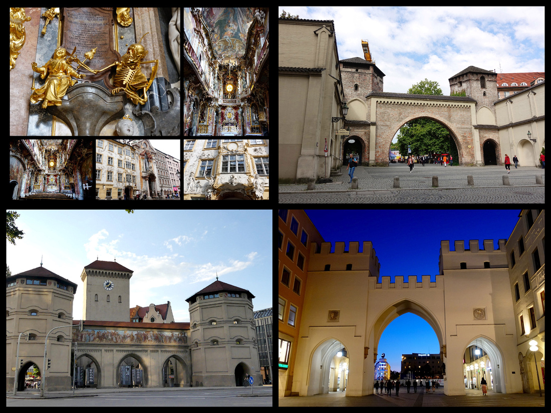
Above - Upper left: Asam Chlurch Upper Right: Sendlinger Tor Lower left: Isartor Lower right: Karlstor
Near the Sendlinger Tor is the Asam Church, very tiny and very rococo, but much darker inside than most rococo churches, it was built by two brothers as their private church without an official order. It ranks among the finest Rococo style churches in the world but it was too dark and too ‘busy’ for my taste.
Right on the main pedestrian street is Michaels-kirche, the largest Renaissance church north of the Alps. Built 1583-1597 for the Jesuits as a symbol to the Counter-Reformation's triumph over north German Lutheranism. The barrel vault inside spans 20 meters and is the second largest in the world after St. Peter's in Rome. The facade is graced with a large bronze sculpture of the Archangel Michael, 1588.
Just behind that is the Frauen-kirche. The twin onion domes were the inspiration for the characteristic domed church spires marking villages throughout Bavaria. Although much of the church was destroyed during World War II, the towers survived, the church was originally built in 1468-88, the domes added 1525. By law no other tower can be taller or obstruct the view of this symbolic Bavarian building.
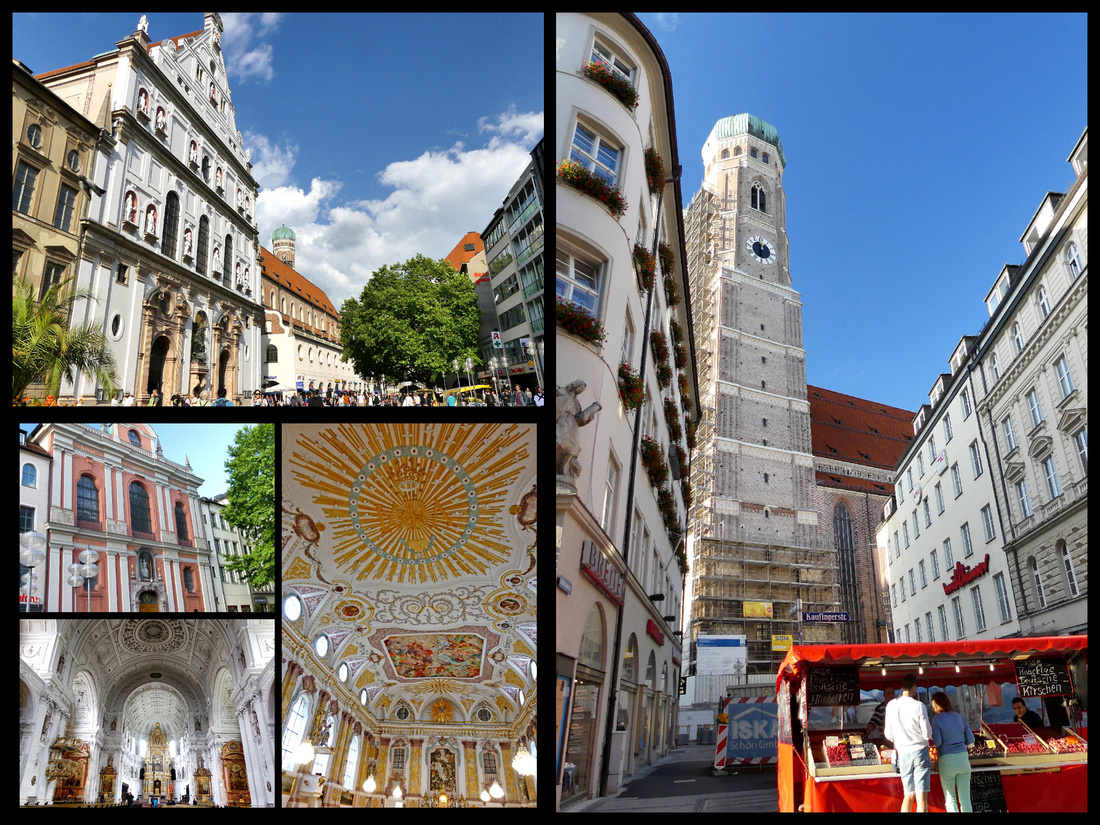
Throughout the center of Munich are several small squares, two of the prettiest are Alter Hof (1253) and Munzhof. Built between 1563 and 1567, this building has housed the imperial stables, the first museum north of the Alps, and a branch of the government mint. Today, it's headquarters for Munich's Landmark Preservation office. It’s connected to the Alter Hof by a covered arch.
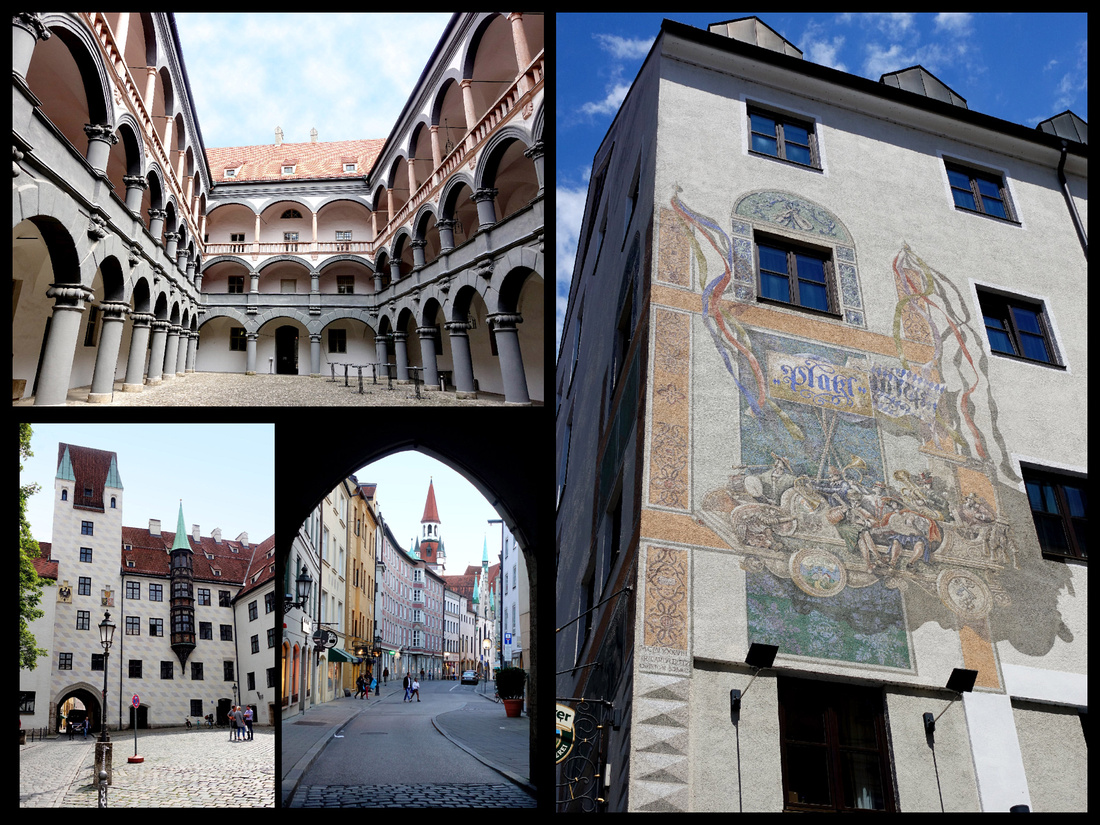
On the other side of town is the Englischer Garten – the largest city park in Europe (so they say), bigger than Central Park. Don’t know cause we only did the lower half, and it was a good mile or more but somehow didn’t feel like it was on a scope with Central Park. Lot’s less ‘stuff’. There is an interesting very fast flowing river – not sure how it flows that fast in such a flat city, but in parts it’s fast enough that there are actual waves and guys surfing. Also a nice little waterfall, some swans, lots of tree shaded paths and large lawns. About half way in is a Japanese pagoda (large size, but all wood, not painted) surrounded by a large beer garden (also numerous kiosks serving food, was too early for lunch but looked like it would be good).
Our last day in Munich was cold and rainy - so possible day trips we had considered were not going to be worth it. However the Deutches Museum and the July sales kept us busy.
HALLSTATT
Days 4-5 - We traveled from Munich to Hallstatt. The first leg was the 7:51train to Salzburg where we had about ten minutes to change trains and even though the Salzburg station is large (and modern and nicer than Munich’s) the train was on time and the platforms well marked so no problem. Then we had to change in a smaller town and 6 of our 11 minutes were taken up with the train being late. No time to dawdle but we made the connection with about 2 minute to spare. Arrived in Hallstatt on time and followed the crowd to the waiting ferry, “The Stephanie”, for the five minute crossing ($2.50 each way). Hallstatt is located on the west bank of the Hallstätter See (Lake Hallstatt), a UNESCO World Heritage site, while trains run on the east bank only. Hallstatt train station (Bahnhof) is thus on the “wrong” side of the lake. This boat ride would probably be gorgeous in nice weather, and was even pretty in the clouds and drizzle. (As was the scenery on the train). The maps of Hallstatt (on line and posted on signs) are not that great but there’s really only a few streets and we headed away from the ferry and through the central square, kept following the road which hugs the lake. By then it was really raining fairly hard but nothing to do but keep going. It was at least a 10-15 minute walk but when we saw signs for the funicular I knew it was close. From the funicular station it’s just about a block to the hotel, Gasthof Gruner Anger.
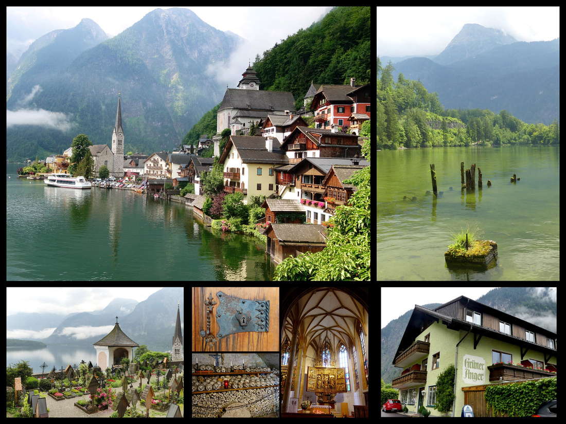
Gasthof Gruner Anger is pleasant enough – looks like every other house in town. It was about 1:45pm and the room wasn’t ready but we were not about to go out walking around in the pouring rain so we sat and had a beer till the room was ready around 2:30. Pretty large room, big bathroom, every thing relatively new, fast Wi-Fi. There isn’t a ‘restaurant’ but guests can have dinner if you tell the host by 4pm, choice of pork or fish. So we ordered dinner, which is served at 6pm. It was quite good, came with soup, salad and desert for €14 each, drinks extra.
Hallstatt is the oldest still-inhabited village in Europe, owing its longevity to the local deposits of salt. Between it’s history and setting it is on the UNESCO list. It is very scenic, even on a cloudy day. There were a lot of people, but I wouldn’t say it was mobbed, perhaps the rain kept the crowds down (I don’t know, where do tour buses go when it rains?). Asian’s outnumbering everyone else by about 10 to one. According to our hotel host, Hallstatt has become so popular with Chinese that someone in China built a complete replica of the town, which has served to make it even more popular.
We walked the length of town – if you just strolled and didn’t stop to take photos it would take maybe half hour tops. We looked in both churches and climbed a ways up the hill – to what turned out to be a parking lot with a view. Apparently there is a highway that goes through the mountains just above the town. There is also a pretty significant waterfall right in the middle of town, the best view of which is from said parking lot.
The following morning it was still drizzly. At 9 am the town was almost deserted, by 10 am there were a good number of people but still not oppressive, by 11 it was crowded. We wandered around to the various viewpoints at each end of town. Decided it was too cloudy to make it worth the money to take the funicular up.
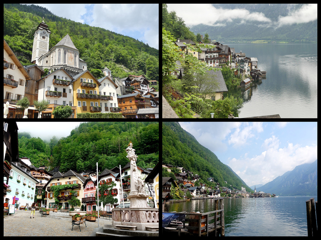
All in all Hallstatt is certainly a very pretty town in a beautiful setting. But you can walk from one end to the other in half an hour, the shops are all just touristy crap. Even the paths up the hill above town are not that great – the mountains coming down to the lake are very pretty but the town from above is not all that striking – best views are from one side or the other, from within and from above not so much. You could do the salt mine, or rent little boats and tool around the lake but neither of those really enticed us. Twenty-four hours was more than enough. But I think it was the right decision for us to do a one-nighter there, thus being there before and after the tour groups.
So onward to Graz. Our first train was 8 minutes late pulling into Hallstatt and we only had a 6 minute connection so we were sure we’d miss it but just as we were pulling in to the station where our connection was, so was our next train – we literally ran across the platform and hopped on.
Hotel Daniel in Graz is right on the train station square – a boring square with about 5 large hotels and nothing else. There is a Spar grocery store next to the train station. The hotel is 6 stories, modern and recently updated (says it’s been there since 1886 but must have been a different building as this one looks mid 20th century). Inside it’s pretty swanky, decent sized room, spotless, lift, AC, free fast internet. The only problem, and I think it’s pretty significant, is that the shower is literally 15 inches from the bed and there is just a glass wall. Seriously, who wants to watch someone else shower. It would be really creepy if it was two friends rather than a couple sharing the room. And at €112 a night it seems a bit steep for a ‘non-major’ city. Breakfast was €13 per person so we didn’t get that, but there were plenty of cafes next door in the train station.The hotel is about 3/4 mile (15 minute walk) from the river and the start of the old town. Boring but otherwise fine.
We wandered around, had dinner in a small restaurant in a courtyard just off one of the main streets. There were several musicians playing in different locations, a ‘summer vegan festival’ in one square. Nice enough vibe. Reminded me a little of Ljubljana but not quite as nice.
Days 6-7 We spent two days just exploring Graz. The main squares and buildings on the main streets of Graz are really nice – it’s a UNESCO site after all. “A harmonious blend of architectural styles and artistic movements that have succeeded each other from the Middle Ages until the 18th century, from the many neighboring regions of Central and Mediterranean Europe.” The main streets seem to be mostly car free – though the trams go through them.
Hauptplatz (Main Square), is the heart of the city, surrounded by ancient houses with characteristic red-tile roofs and narrow gables. The most notable house is the House of Luegg at the corner of Sporgasse, known for its arcades and facade dating from the 17th century. The town hall is the largest and most impressive building on the square. Herrengasse, is the main shopping street leading off from the square. The most interesting building in the city is the Landhaus, just off the main square. A 1557 Renaissance masterpiece, reminiscent of a Venetian palazzo. Supposedly the finest Renaissance building north of the Alps and I believe that. I had read that there are concerts there and sure enough, a free orchestra was performing the evening we arrived. Almost across the street on Herrengasse is the “Painted House” featuring Greek and Roman gods. It was first painted in 1600 but most of what is visible now is from 1742.
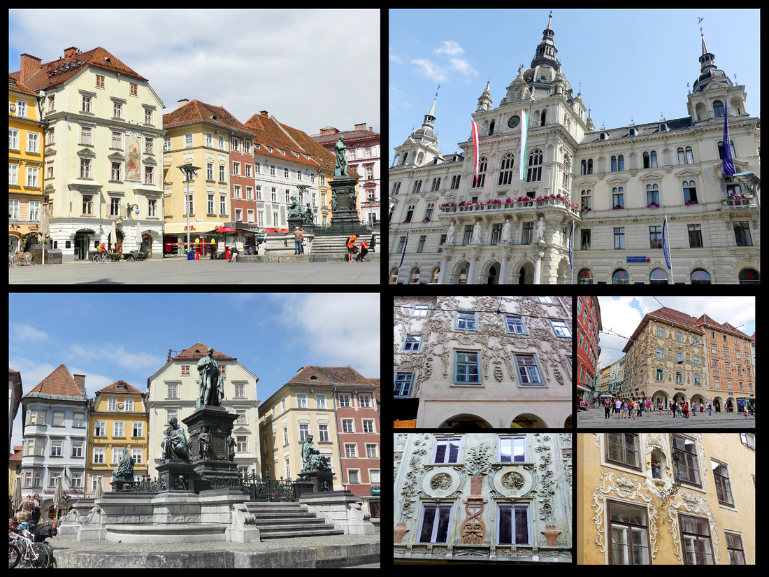
Above - Hauptplatz Top Right: town hall
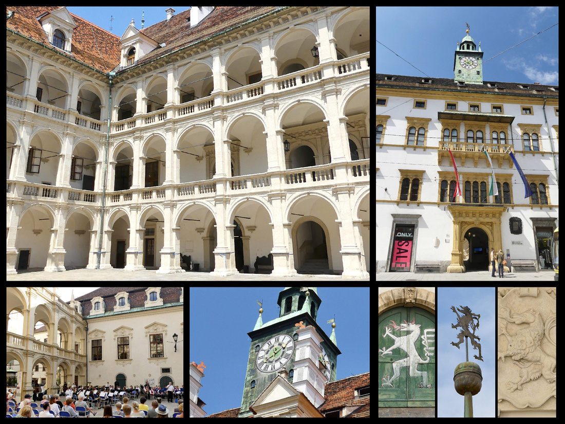
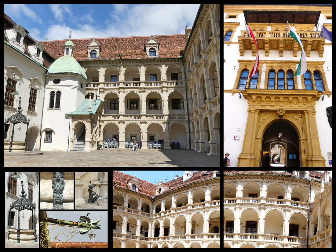
Above - Landhaus
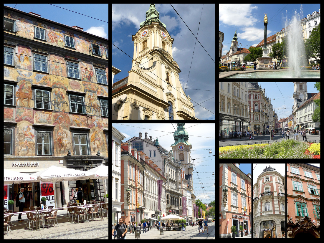
A few atmospheric side streets lead to Glockenspielplatz, one of the prettiest squares in the city and featuring an 1884 Glockenspeil.
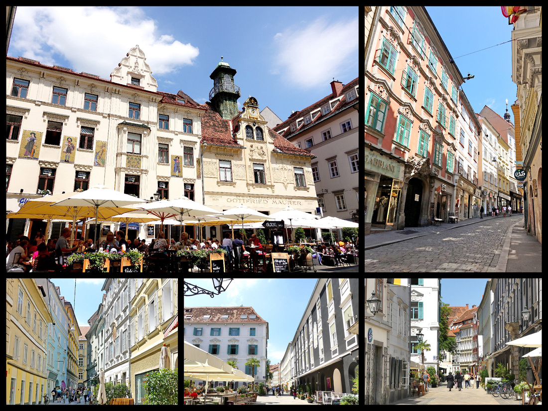
Graz’s cathedral/Dom, St Giles, I didn’t think was particularly impressive, but right next to it is the Mausoleum and the turquoise domes of the church and mausoleum together make a nice site.
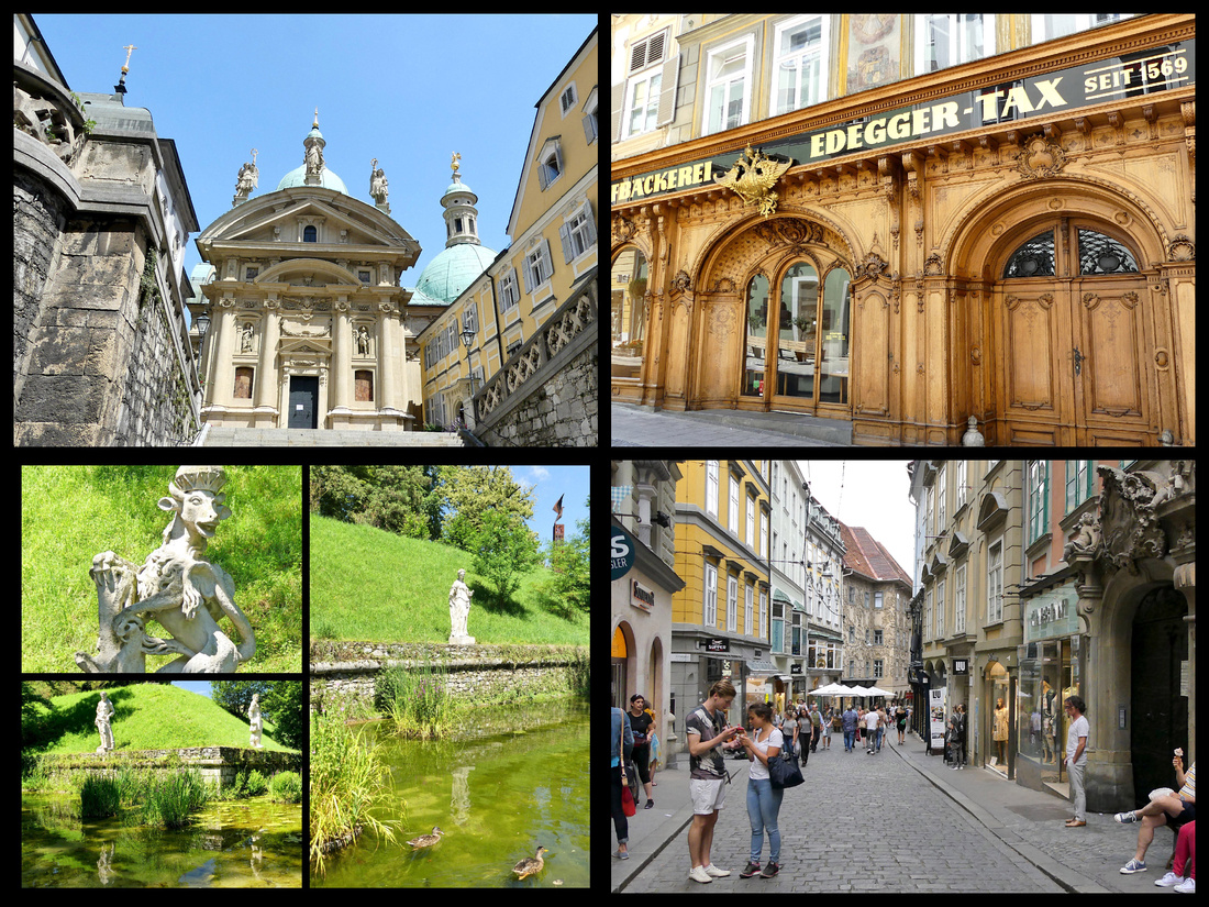
But even more interesting across the street is the Hofburg (all residences of the Habsburgs were called “Hofburg”. The burg itself is pretty plain (nothing ‘castle’ like about it) and if there was a way to tour the interior we didn’t find it. But it’s main feature, a double spiral staircase we did find. If you like stone spiral staircases this one is a stunner. Just behind it is a small but pleasant city park with duck pond and some statuary.
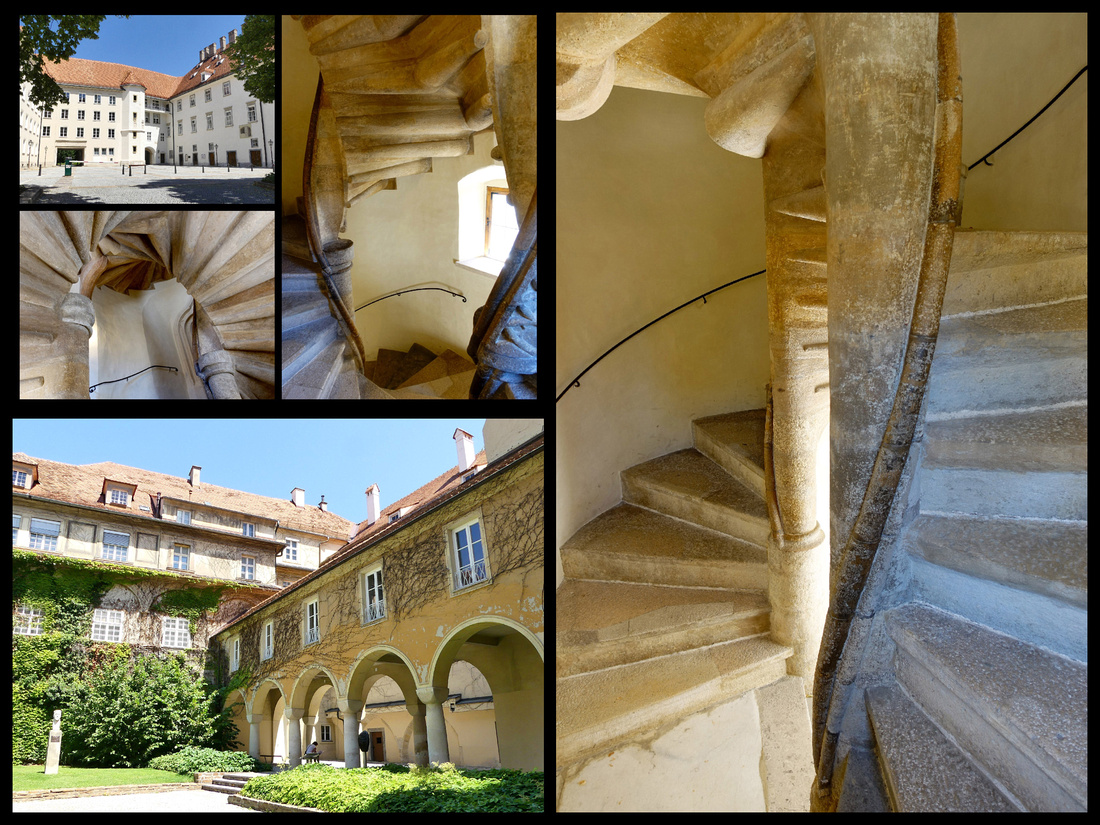
Probably the most noticeable feature of Graz is the Schlossburg, up on a hill in the center of town. There is only a small part of the original fortress, but the 16th century clock/bell tower remains and there is now a lovely park around it with a beer garden and the few remains of the fortress itself. The views are pretty good.
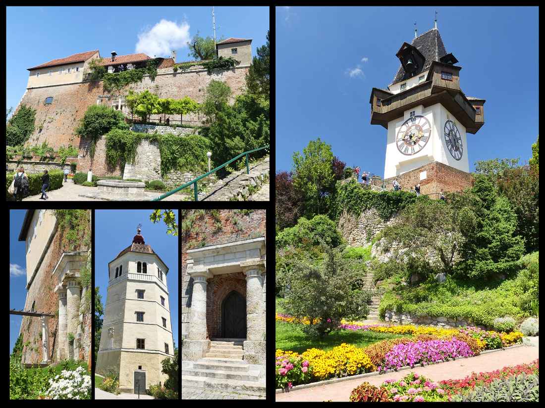
The Mur river runs through Graz, just outside the main part of the old town and there is an interesting ‘thing’ in the middle of it. I guess you could describe it as a footbridge with a man made glass island in the center with a café. Definitely unusual. And just past that on the other side of the river is the Kunsthaus, an art museum in a building, referred to as the ‘friendly alien’ which looks kind of like a blue glass balloon. Very interesting contrast to the surrounding neighborhood of old gabled buildings and square.
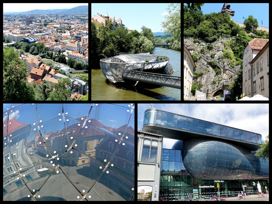
There were numerous other squares and neighborhoods and several nice churches.
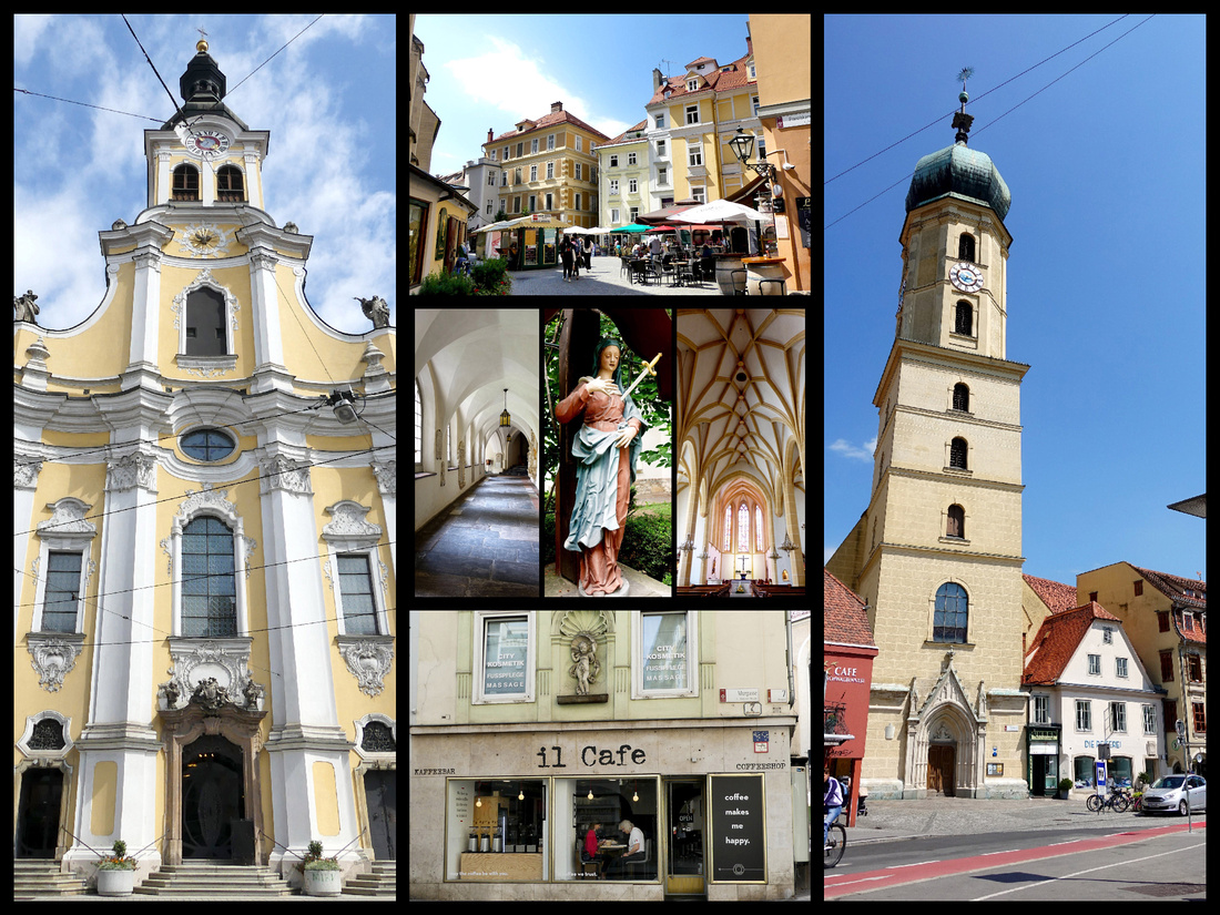
I would say Graz can definitely be ‘seen’ in a day or day and a half. If you wanted to do Eggenburg Palace and the armory museum that would take another half day – unfortunately both closed on Monday so we didn’t get to them. I wouldn’t say I was disappointed with Graz, I love most old European cities, but I certainly wouldn’t suggest someone go there instead of Saltzburg or Vienna. Since I had been to both of them previously, visiting Graz was a good decision for this trip.
BRATISLAVA
Days 8-10: Bratislava - Bratislava train station is about 20 minute walk to St Michael’s gate and APLEND CITY Hotel Michalsk , Bastova 4 is just around the corner from the gate. One of the nicest little lanes in town and we got upgraded to an apartment – huge, two big rooms, full kitchen, spotless, really comfortable. Right next door to the hotel itself. So don’t know how the rooms there are but the apartment is fabulous. And we got breakfast – not sure if it goes with the apt. or if we got it cause we had booked a regular room.
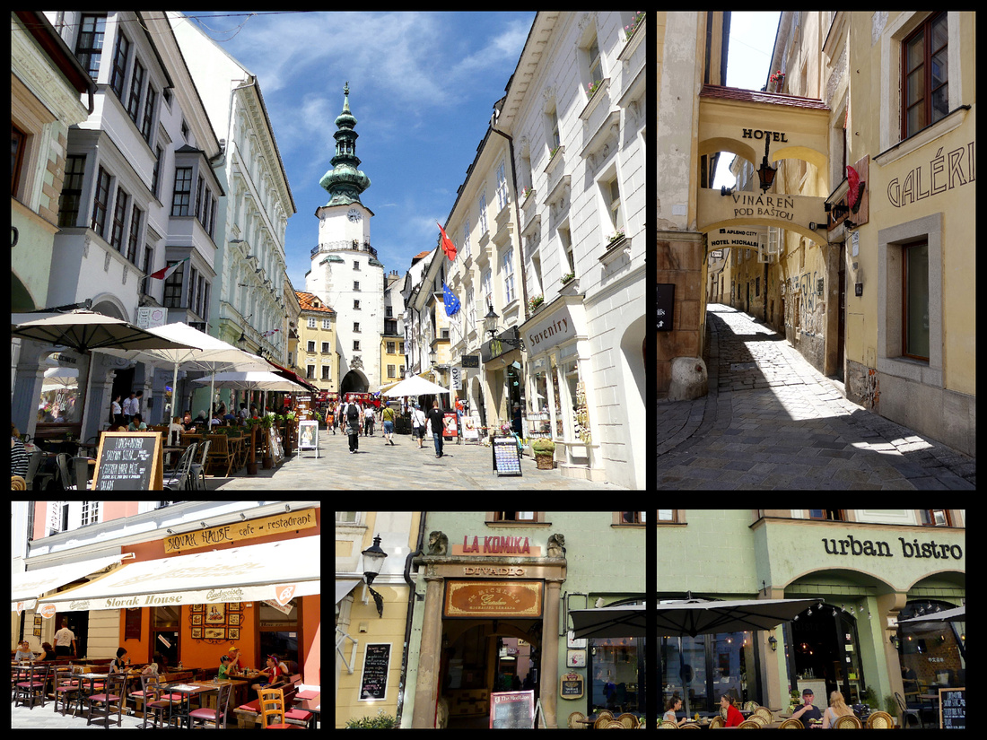 Above - Top Left: St Michael's Tower from Michalska (street leading to it from center of old town) Top Right: alley just to the left of the gate where hotel is located.
Bratislava’s compact old town has been completely and beautifully renovated and most of it is car free. It’s much smaller than I expected (the city’s population is close to half a million, and while most old European city’s old towns are pretty compact, this seemed much smaller than most). Similar to – but not as picturesque or interesting as – Prague, Krakow, Tallinn. But so small, without stopping you can literally walk across it in ten minutes. Easy to cover the entire area, including all the side streets, in a few hours. The castle on the hill is a nice touch but more scenic from a distance. Surrounding the old town is a massive area of Communist era concrete apartments but you really don’t notice them at all while in the old town. It’s a relaxing little city with a nice setting on the Danube, with plenty of picturesque squares and side streets to explore, and lots of reasonably priced restaurants with “Slovakian” food (as well as an assortment of Scottish, Irish and Mexican). The 'best' thing in town is St. Michael's Tower (Michalska veza). It serves as the entryway into the Old Town and is actually part of the city's medieval fortification system.

Above - top left: area just inside St Michael's gate, bottom left: entrance to St Michael's gate from outside
lower center: Church just outside St Michaels's gate, lower right: Bratislava's president's house a few blocks from St Michael's gate
The main square, Hlavné námestie, is small but in addition to a large fountain and the huge clock tower of the town hall, has a number of buildings from various eras; Gothic, Baroque, Renaissance, as well as art nouveau. The Old Town Hall/ Altes Rathaus is a beautiful yellow building with a pretty courtyard and a gorgeous clock tower (can climb it for €2.50) for nice view of the old town and the castle as well as the Danube.
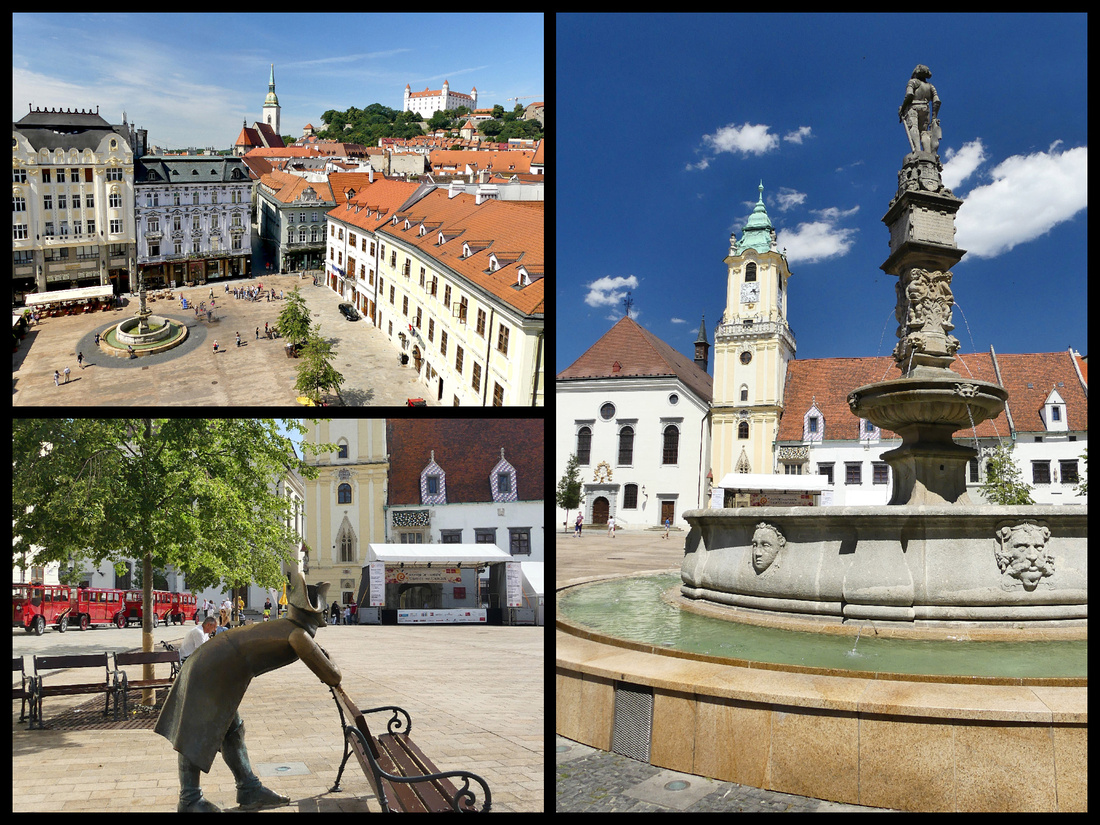
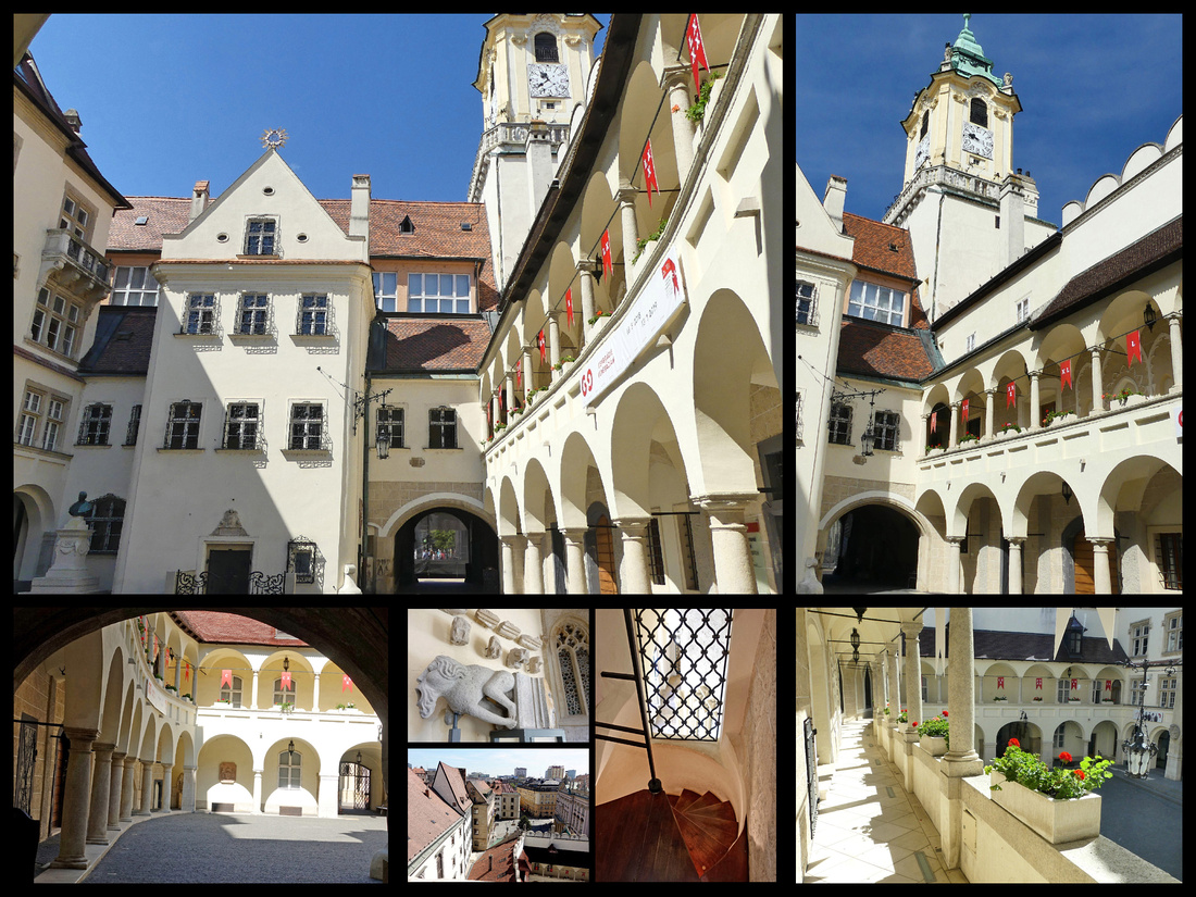 Above - The courtyard of the town hall
On the other side of the Town hall is the Primate's Palace (Primaciálny Palác), a very pretty pink building, that is now the home of the mayor.
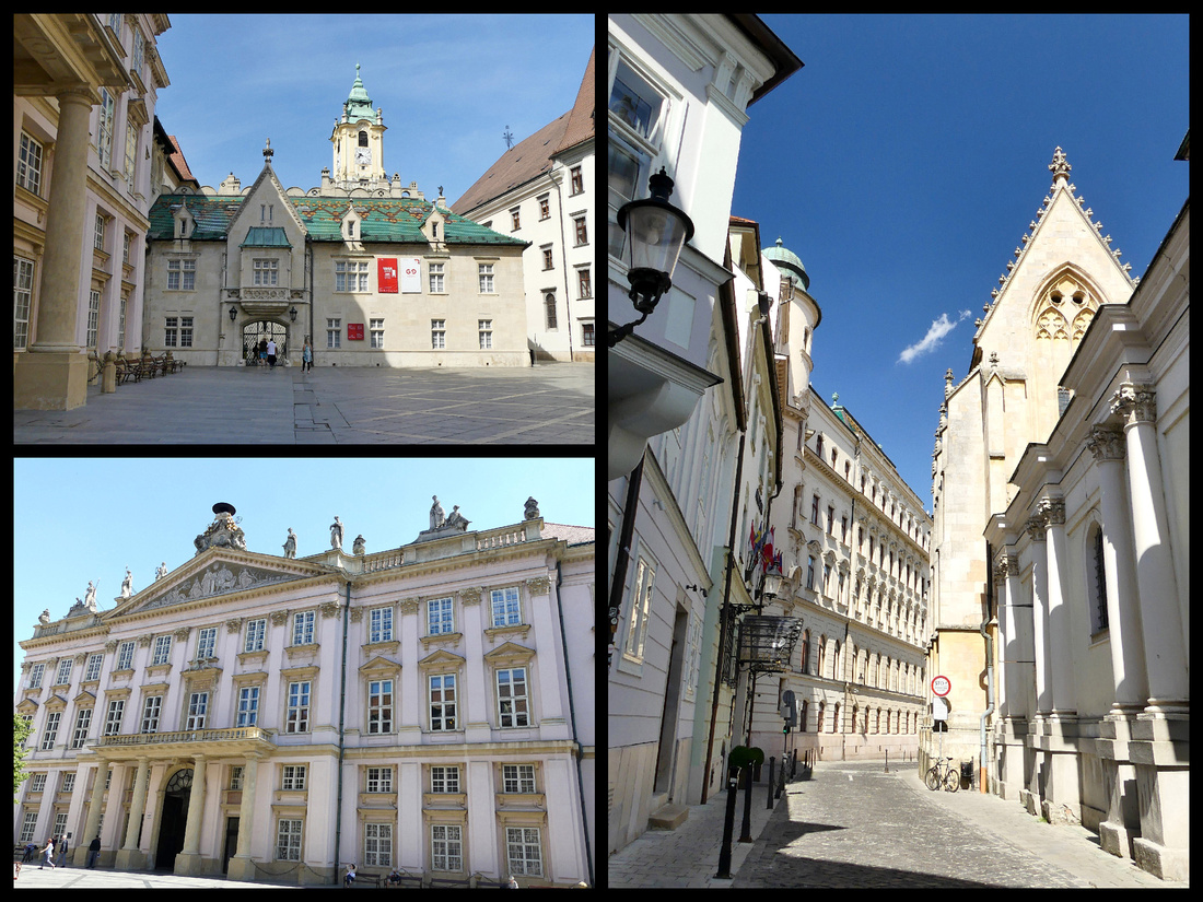
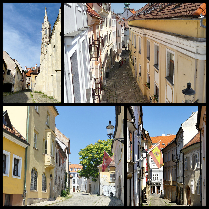
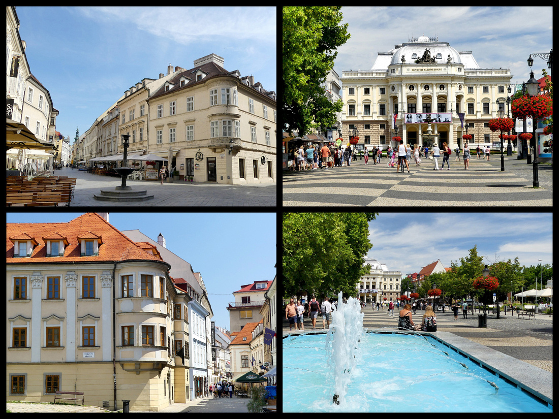
Above - upper left: main street leading to St. Michael's tower upper right: Opera House
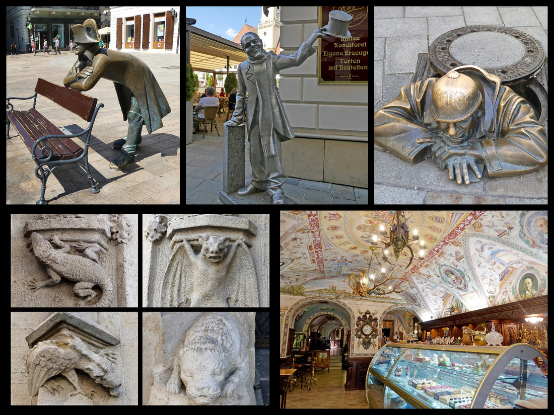
Upper photos: three of the most interesting bronze statues scattered throughout Bratislava Lower left: sculptures from the old Town Hall
Lower right: interior of cafe just off the main square
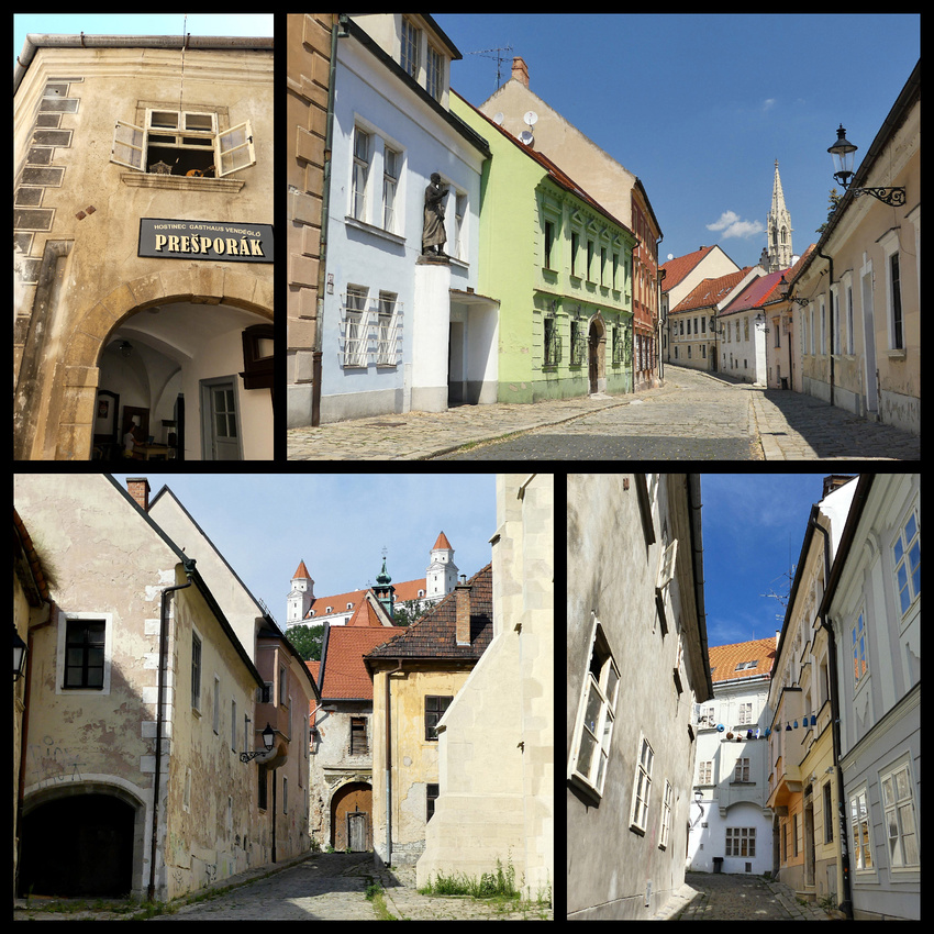
There is one small area of town walls remaining between there and the cathedral, opposite the castle. There was an interesting exhibit about WW II in one section. The castle itself is across the main highway (built in communist times, it goes right smack in front of the cathedral, done on purpose to diminish the importance of the 'church'). There are both under and over passes to get from the old town side to the castle side. One of the most interesting buildings in town is just below the steps up to the castle, opposite the cathedral. It's the House of the Good Shepherd, a very narrow Rococo style building, built in 1760.
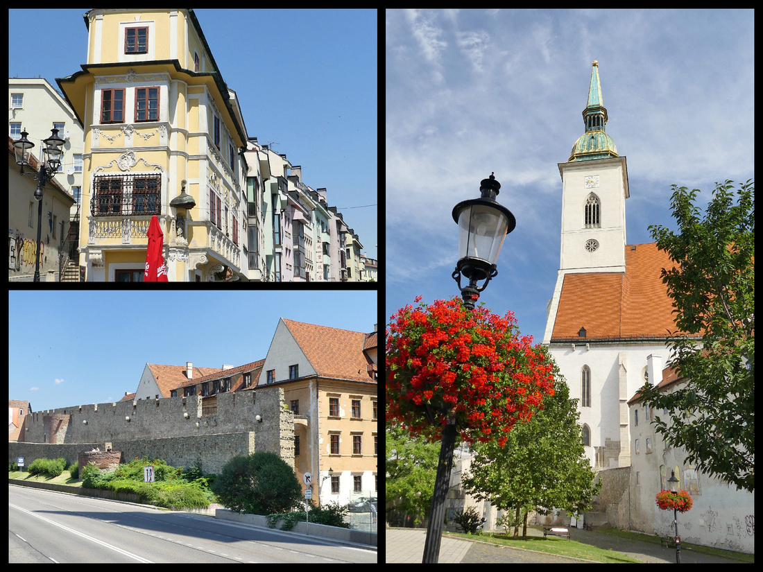
Bratislava castle – We also walked up to the castle – certainly a climb but took all of 15 minutes. You can see forever but the 20th century buildings are right up close to the old town so not that picturesque. But the Danube is pretty (though much more green than blue). Great view of the thousands of communist era apartment blocks that surround the city. Reviews of the interior of the castle were disappointing so we just walked through the grounds and gardens. More good views of the 1960s space age tower (UFO) just across the river is interesting.
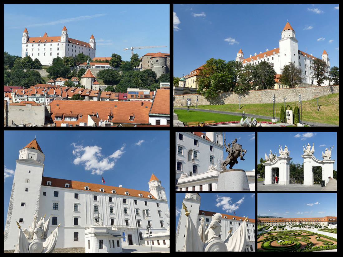
The “Blue Church” is Bratislava’s most appealing art nouveau building (1913). Its style, sometimes known as Hungarian Secession, is repeated in the nearby grammar school on Grösslingová Street. Both the interior and exterior of the church are painted in shades of pale blue and decorated with blue majolica; even the roof is tiled with blue-glazed ceramics.
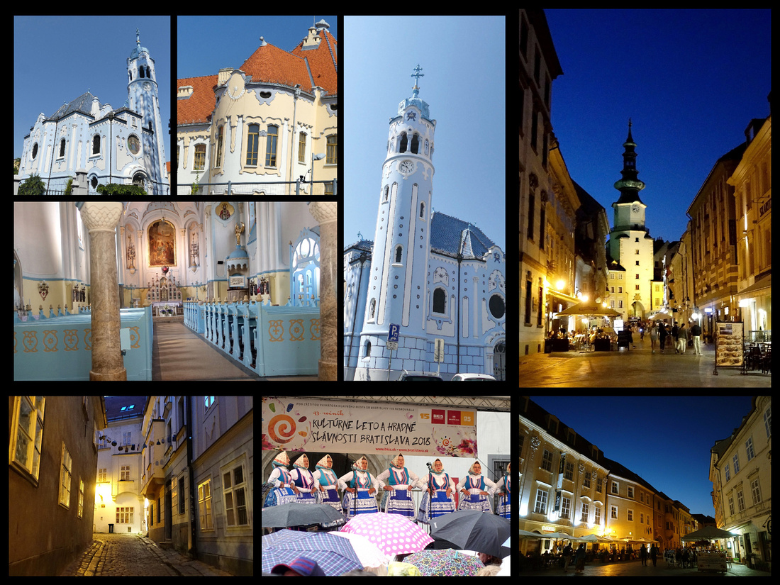
10 km west of the city center, Devín Castle is built on the top of a high crag, it towers over the small village of Devín and the confluence of the Danube and the Morava rivers, which form the border with Austria. Up till 1989 the Iron Curtain was drawn below the Castle, lined with barbed wire. Much of the literature (and the lady in the TI) said take bus 28, but when we went to buy tickets (from a kiosk, under the bridge just before the Bratislava castle ) the guy told us to get bus 29. So we did, comes every 20 minutes and takes about 20 minutes (.90€ pp each way, buy round trip as there is no where to get the return tickets in Devin). You could see the castle, and the stop was marked Devin Hrad. Ten minute walk to the entrance, another 10 after you buy your tickets (€5). Very nice ruins on top of a hill with a gorgeous view of the Danube – also the Morava as it joins the Danube. Also you can see 3 countries: Slovakia, Austria and Hungary. Spent about 1½ hours climbing various parts.
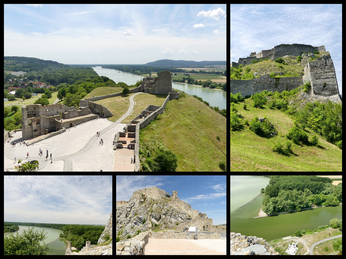
Tons of river cruises stop in Bratislava (one day I counted 12, they were even ‘double parked’). So there were plenty of tour groups wandering around, but overall it was not clogged with tourists and the whole center being car free was really nice. The one thing it lacked was interesting shops. Can’t remember any other city with so few stores selling anything at all I was interested in. The tourists shops sold nothing but junk and there were almost no other stores in the center. Although the major ‘attraction’ to Bratislava is it’s old town center, there is also a lovely riverside promenade (part of a 10 K walk that goes across the river to the other side and back) that leads to an area of modern glass buildings including one of the nicest malls I’ve seen (Eurovea Mall)– totally glass roof, interesting bronze statues scattered around, nice fountain out front and right on the river – with tons of cafes and bars along the riverfront. Across the Danube is a huge communist era apartment sprawl that apparently houses two hundred thousand people. Had no desire to explore it but interesting to think about what the city must have been like in those days.
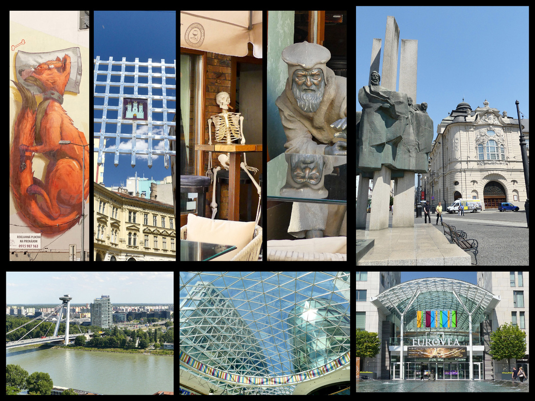
Above - upper photos: various scenes from Bratislava. Lower left: the retro-futuristic SNP Bridge which was built in the late 1960s at the height of Communist excess, inspired by optimistic futurism and looks like it sprang right out of an episode of Star Trek or The Jetsons. Lower center and right: the Eurovea Mall.
When trying to decide how many nights for Bratislava I asked the question on Fodors and got everything from ‘just do a day trip from Vienna’ to ‘you could be happy with three days’. Well my now ‘expert’ opinion is that a day trip would be ‘ok’ – you really can see the whole old town in a few hours, and while pleasant after dark it’s not that special that you need an overnight. However one night (with several hours each day) would be fine and two nights would allow for the visit to Devin – again, a nice enough fortress ruin but not a ‘must see’. Three nights was excessive and we were pretty bored by the second full day. Of course if your travel style is to just laze around cafes Bratislava is a pretty nice place to do that.
Days 11 & 12 - Back to Austria and the Wachu Valley
Bratislava Train Station is a real dump. As far as European train stations go, on scale of 1-10 it’s a 2, Communist era ugly building, no place to sit, crappy coffee shops, kebab places and tiny newsstands. Trains from Bratislava to Vienna are hourly and take about an hour. We then continued on to Melk (via St Polten) – so in total it was three separate trains, but easy enough – although each one was a few minutes late and connections were tight. But everything worked. We decided to base in Melk for two nights and do the Danube river cruise to Krems on our one full day which worked out great. We had time to tour the Melk Abbey the day we arrived, and spent most of the following day on the cruise and exploring Krems and then taking the bus to Durnstein for a few hours, and another bus back to Melk.
The Wachau is the 30-kilometer stretch of the Danube Valley between Melk and Krems, supposedly one of the most beautiful river landscapes in the world, where the river cuts a narrow, rocky valley and is noted for its many ancient little towns nestling below historic old castles and castle ruins. It preserves an intact form in terms of architecture, (monasteries, castles, ruins), urban design, (towns and villages), and agricultural use, (principally for the cultivation of vines) since prehistoric times and thus is a UNESCO World Heritage Site as a protected cultural landscape. It is very pretty and the towns of Melk, Krems and Durnstein picturesque, but we both felt we actually liked the Rhine River Valley better.
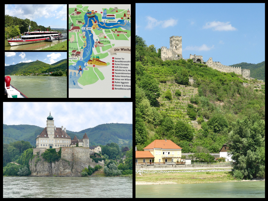
Melk (population 5000) is a cute little town, and the giant abbey on the hill over it dominates. Really only one main street but it has some really nice buildings, and the Abbey is gorgeous. The Rathauskeller Hotel is right in the middle of the main street, in one of the oldest buildings in town, great location, 10 minute walk from the train station. There are 11 rooms over a restaurant, one of the main ones in town. Dinner at the restaurant was one of the best meals of the trip.
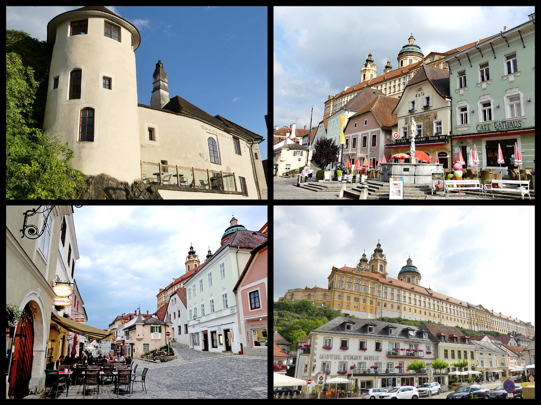
The Benedictine Melk Abbey is gigantic and very pretty in shades of light yellow and apricot sitting up on a hill overlooking the town and the river. The ‘museum’ part was pretty boring, but the actual church was amazing – considered the finest Baroque church north of the Alps. The view from the terrace was also lovey, the Baroque spiral staircase gorgeous and the library amazing. The Baroque Pavilion was built in the 18th century in the Abbey park, and it is filled with historical frescoes which show the then known continents and their inhabitants as well as their flora and fauna as imagined by the painter Johann Bergl. €11 per person.
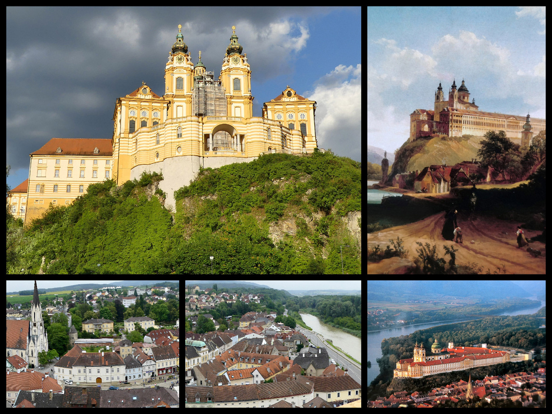 Above - Top Left: Melk Abbey today Top Right: historical painting of abbey in medieval times
Lower Left and center: view of Melk from the Abbey terrace Lower Right: a postcard view of the Abbey from above
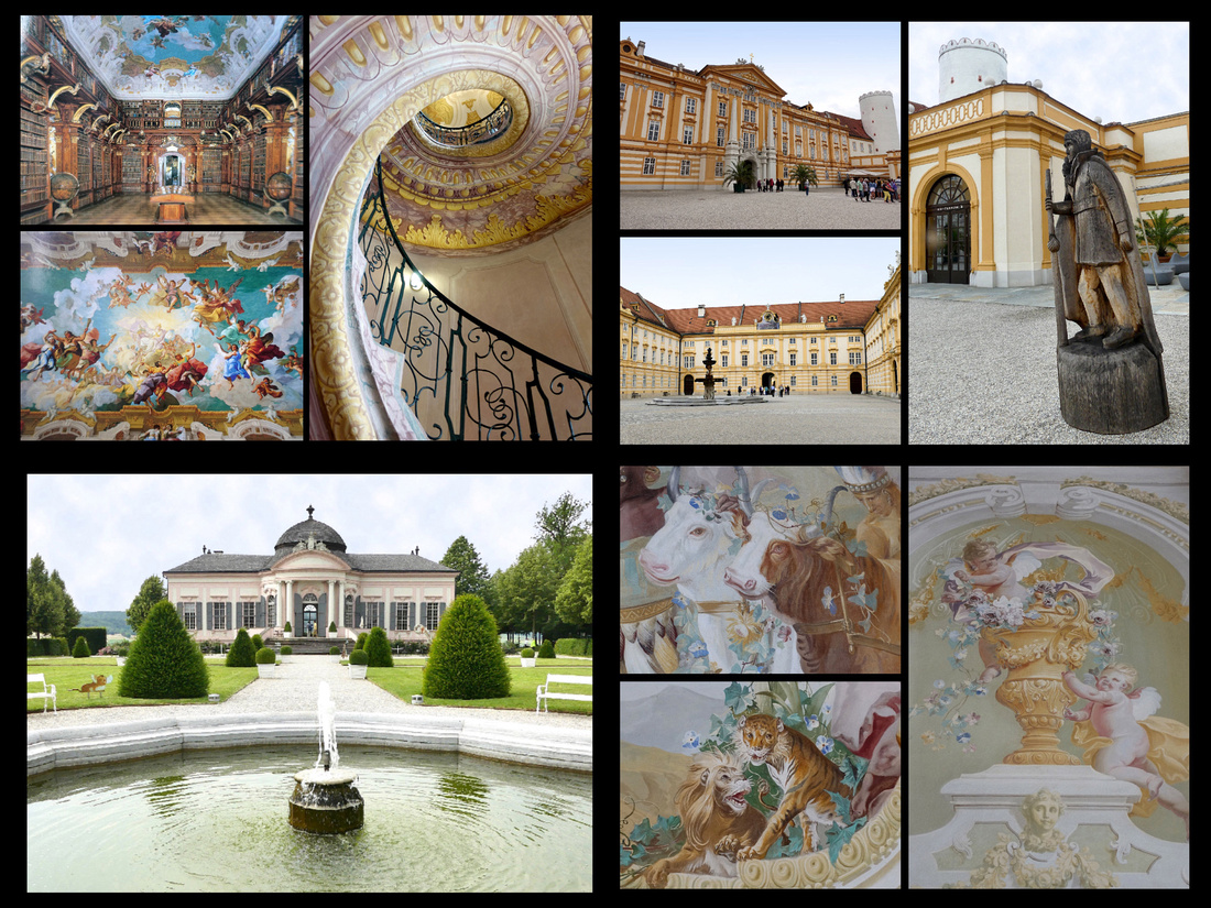 Above - Top photos: The Abbey Lower Left: The Baroque Pavilion in the Abbey Park Lower Right: some of the frescoes in side it
Danube River Cruise. Beautiful day, mostly sunny and warm but not hot. The trip between Melk and Krems (the most scenic stretch) takes 90 minutes going downstream and 3 hours back up so we opted for the quicker trip so we’d have more time to explore the towns and I’m glad we did. It’s pretty scenic but 90 minutes was plenty. There are about 3-4 cruises a day in each direction. We didn’t pre-book, got to the ticket office about an hour before the sailing and easily got tickets and then seats on the upper deck.
The Danube is almost blue when the sun is out – not ocean blue certainly. But the scenery is of course lovely, hills, many covered with vineyards, cute little villages and a few castle ruins. Nowhere near the castles of the Rhine though. Much less ‘traffic’ on the river too. Mostly the river cruise boats (Like Viking River Long Boats but many different companies).
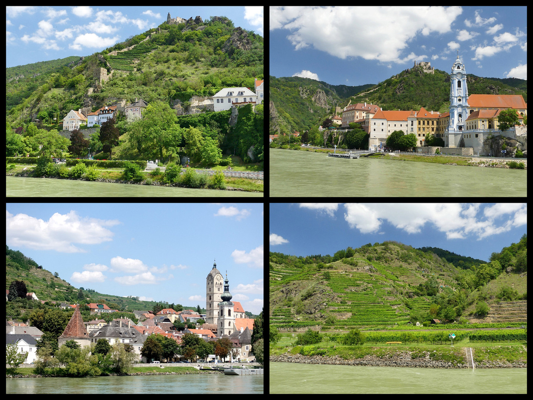
After debarking in Krems (population 24,000) we first walked in the opposite direction from the main part of town to Stein, which used to be a separate town but now blends in with the rest of Krems and I think was the prettiest part of the city. The main gate into Krems itself, Steiner Tor, is a ‘wow’ and the Alstadt past it, was nice enough, pretty lively, full of shops and people. We stopped for ice cream just inside the gate and got largest bowl of ice cream for €2.50 I’ve ever seen.
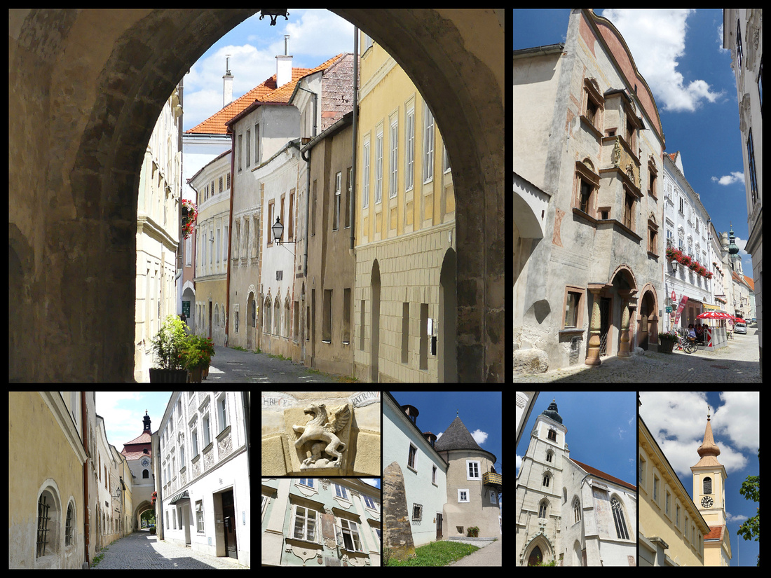
Above - The area of Krems known as "Stein"
Krems is the 5th largest city in Austria and is located 43 miles west of Vienna. It sits at the confluence of the Krems and Danube Rivers and was first mentioned back in 995 as an established town. Krems has an impressive claim to fame – it is the location of the oldest grave in Austria, a child’s grave that is over 27,000 years old. It was also one of the first places in Austria to produce coins, back in 1130. Steiner Tor is a 15th century (1480) preserved gate and is the symbol of the city. Until the end of the 19th century, Krems was completely surrounded by a medieval wall and four city gates until they were removed as the city expanded. In 2005, Krems celebrated the 1,000-year anniversary of the city and in celebration, they restored Steiner Tor to its former glory.
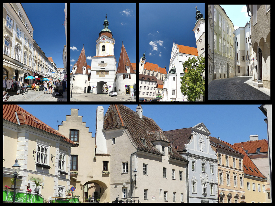
The bus station is right next to the Train Station. There are signs for the various buses, and schedules but no ticket office or kiosk. But the bus came right on time and we were able to buy the tickets from the driver. We got tickets only as far as Durnstein (€2.30 each).
Durnstein (population 870) is adorable – set on the river, amidst vineyards on both sides and behind the town, and high up on the hill an old castle ruin where Richard-the-Lion-Hearted was kidnapped and held for ransom when returning from or going to some Crusade. Old town walls on both sides of the village. Durnstein Abbey is the most striking church in the area, a beautiful large blue baroque church right on the river. The town is really only one main street, but lined with beautiful old houses. It was packed with people when we got there (3:30) but most of them disappeared within an hour (I think boats heading in both directions picked up a lot of them). There were lots of bikers and of course independent travelers who came in cars (parking lots on the outskirts) or like us on the public bus, but I didn’t see any tour bus groups.
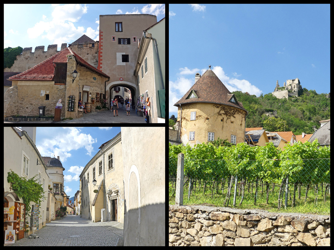
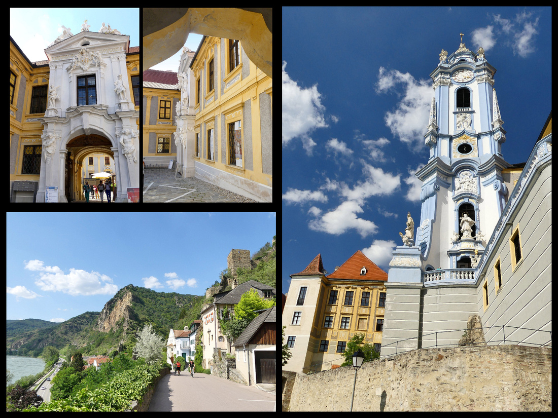
Next: Back to Bavaria - Passau, Nurnberg, Bamberg, Regensberg, Rothenburg, Heidelberg
]]>
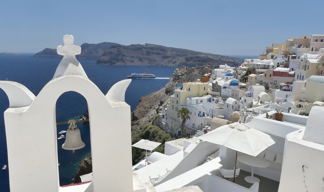
This was my third trip to Greece and my goal, other than just being on Greek islands, was to experience some slightly less popular islands. Previous trips included Santorini, Naxos, Paros and Crete - all of them among the most popular. Since I’d already been to Santorini on a previous trip, I really only scheduled time there because logistically it made the most sense to fly in and out of it to get to the other islands I wanted to see, but once there I realized I was really enjoying my time. It may not feel ‘authentic’ (whatever that means) but it sure is beautiful and I easily filled up the 2-3 days I had and would even have enjoyed more. I scheduled one full day between ferry and flight in each direction just to be safe, I actually wish I had added at least one more day.
I took SeaJets fast ferries between all the islands, booked on line well in advance. Then I started to worry as I read how awful they were. I had read things about how they throw your luggage in a huge heap and you can't get yours out from the bottom of the pile if you are one of the intermediate stops (and I was), and that the boats don't sail if it's very windy - and it seemed pretty windy, and that people get sea sick. On my first trip from Santorini to Folegandros none of that happened. It was like a gigantic, roomy airplane cabin. The trip from Folegandros to Milos was pretty bumpy and someone in the section in front of mine did get sick (although the crew had an efficient method of cleaning it up) and even I felt a bit queasy (and I rarely have a problem with motion). The last two trips were smoother but totally full with luggage blocking aisles, etc. All in all, it is an efficient way to get around the islands – most of my trips were under an hour, compared to over 2 hours on the slower ferries, but the slower ferries where you can sit out on the deck and watch the world go by are so much more enjoyable. (see photos at end)
Santorini – Σαντορίνη population 15,500, is in a class by itself – no other island comes close – which is both a good thing and a bad thing. The scenery – both the setting and the buildings, which have been built onto it – is unique and gorgeous. Curving around the caldera the towns of Fira – which almost blends into Imerovigli and Firostefani, and then further on Finikia, which blends into Oia – cling to the side of the hill, literally spilling down the sides. White cube houses, blue domed churches, white and grey stairs connecting buildings, the occasional earth tone pink or gold building all combine to form one of the most striking landscapes I’ve ever seen. Almost every structure is a hotel, restaurant or shop. All the ‘regular’ people live in one of the inland villages. But while it is so striking and gorgeous that it’s definitely worth visiting, it really doesn’t feel like actual towns.
The highlight of Santorini is the village of Oia, population 1500, at the far tip of the island. It is smaller and quieter than the main town of Fira, and while all of Santorini is picturesque, this is the ultimate.
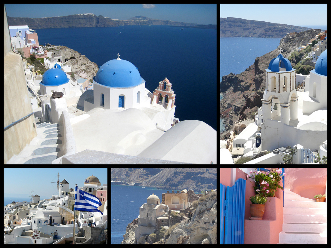
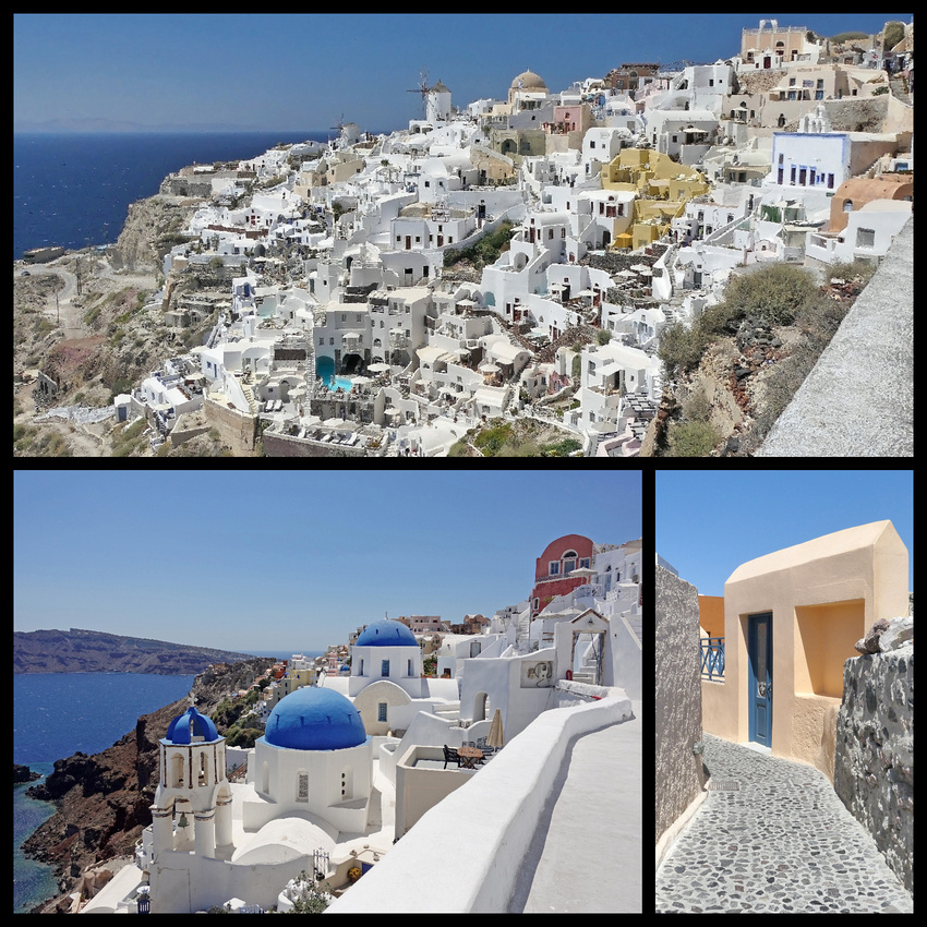
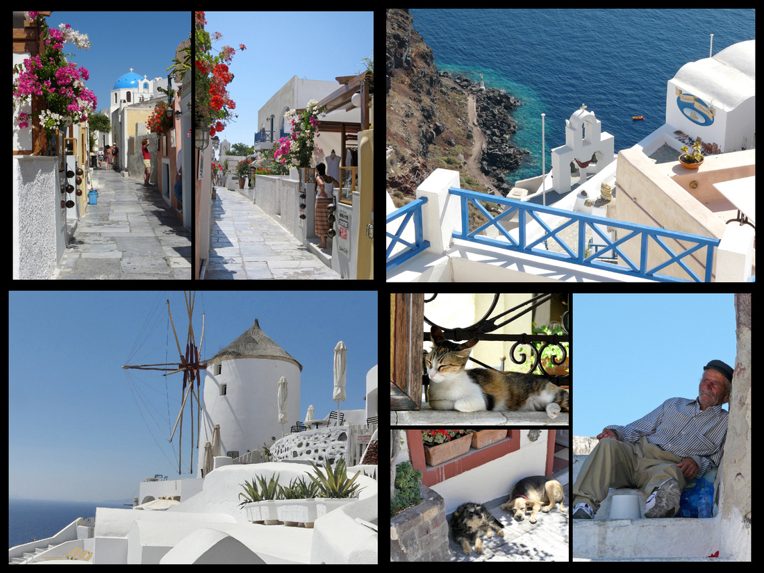
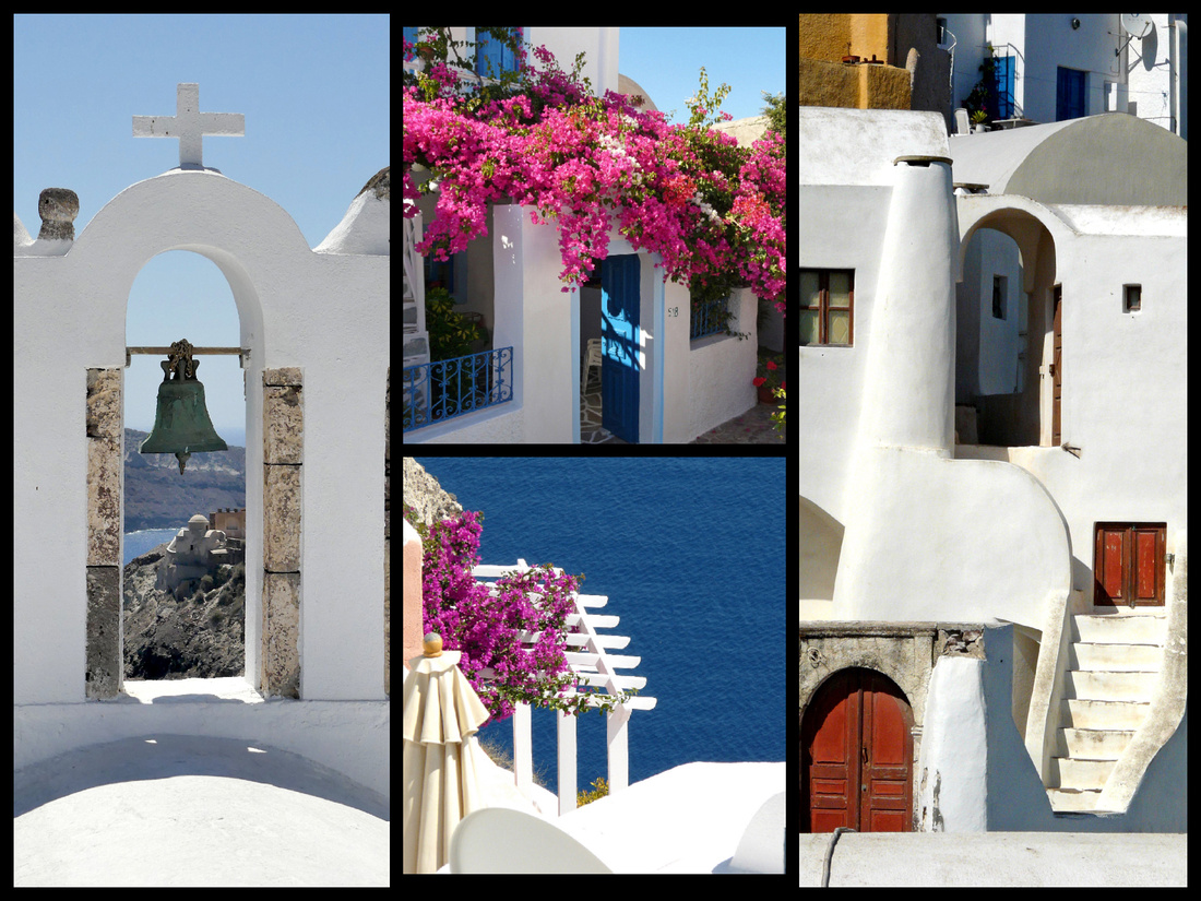
Finikia was once a distinct village but now blends in with Oia.
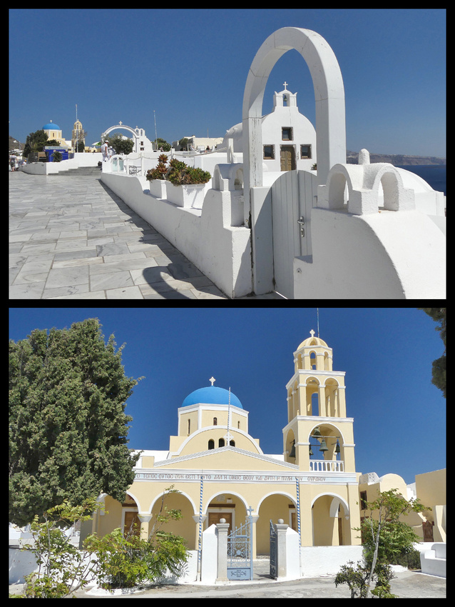
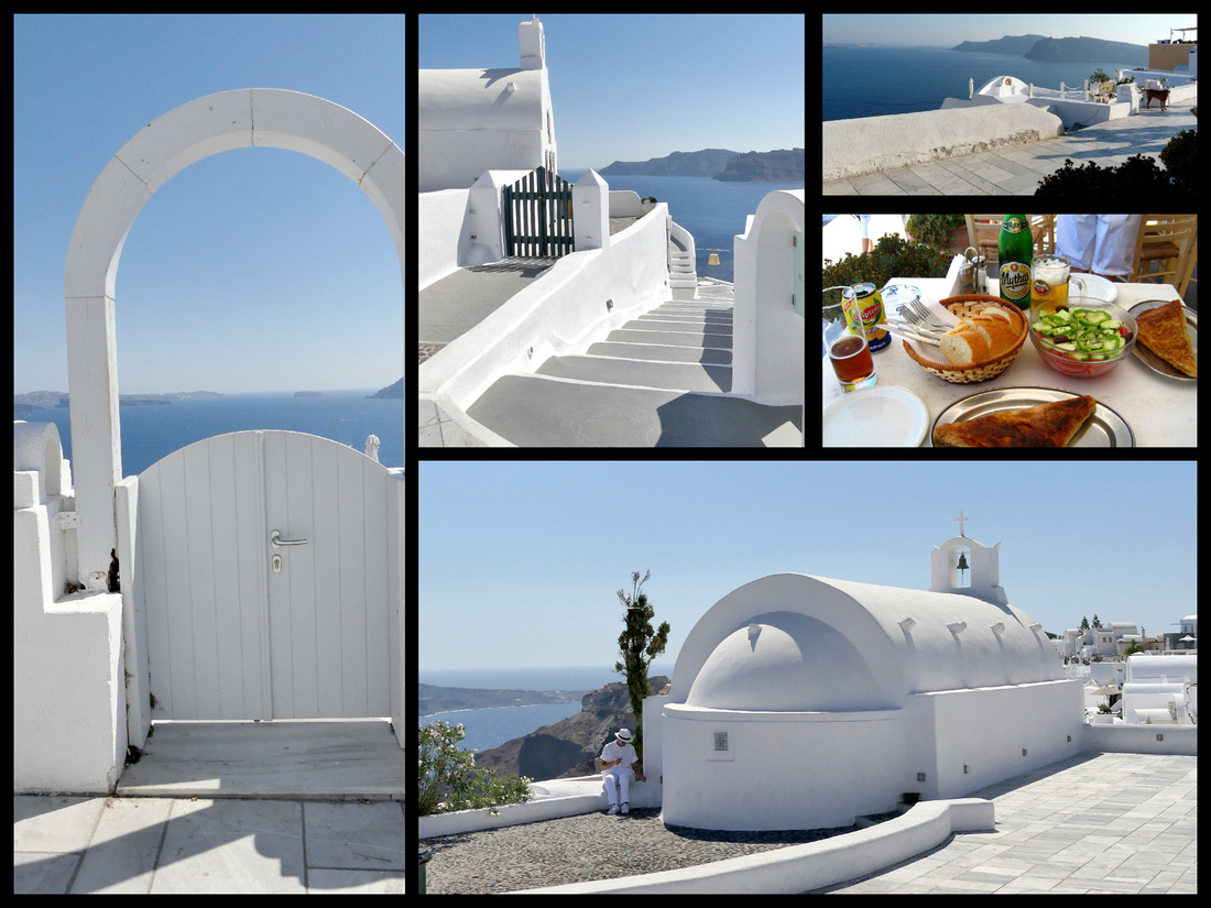
The main town, Fira, with a population of about 2000, is really just as gorgeous as Oia. And actually the view of the caldera itself is better than that from Oia. What were once the two distinct villages of Firostefani and Imerovigli now blend in with Fira and the walk from the center of Fira to the edge of Imerovigli is my favorite. Fira has, by far, the most restaurants, hotels, shops, etc. and is the transportation hub with the main bus station (which is essentially a large parking lot and a couple guys directing people as to which bus they need to get).
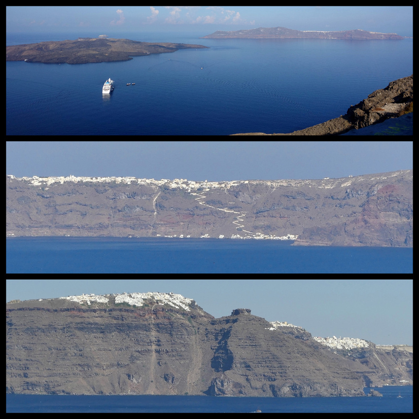
Top: view of the caldera from Fira Middle: view of Fira from the caldera Bottom: Fira (far right, Firostefani center & Imerovigli)
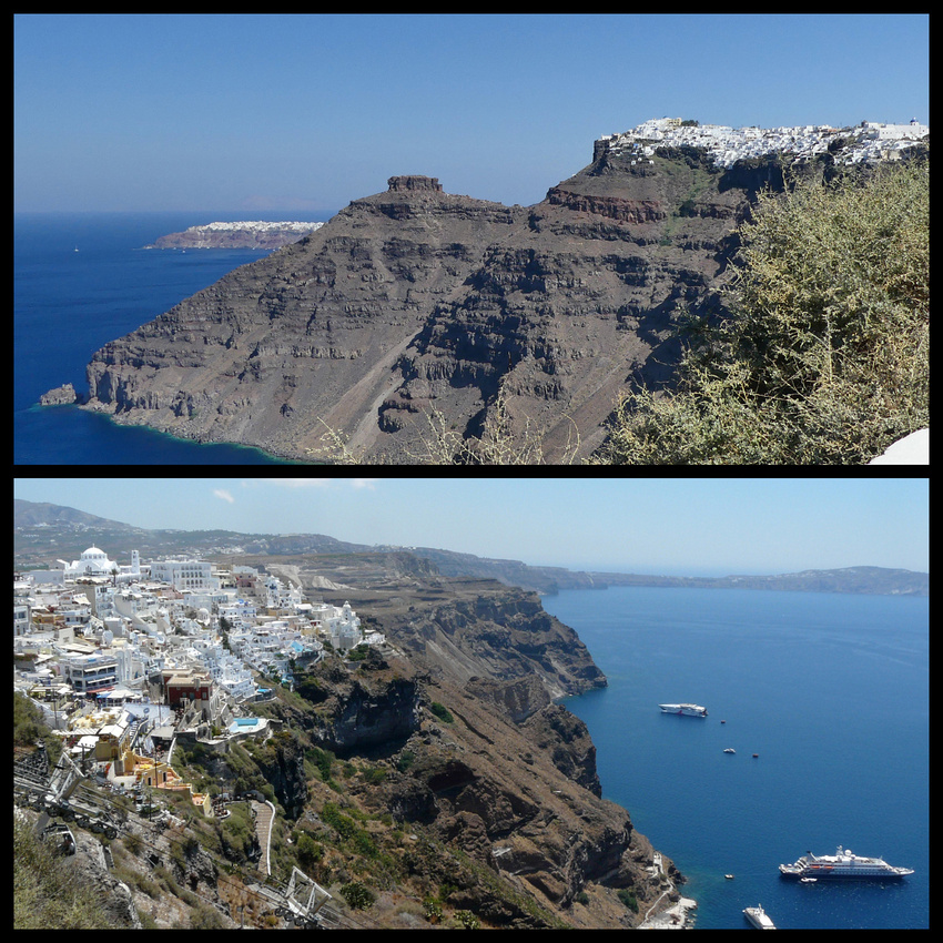
Top: Fira in the foreground with Oia in the far distance. Bottom: The main town of Fira, perched on the hill high above the caldera
Σαντορίνη, pronounced [sandoˈrini], officially Thira, Θήρα, is the remnant of the ancient (3,600 years ago) volcano, one of the largest eruptions (known as the Minoan eruption) in the history of the world, felt as far away as Scandinavia. The land that remained, the caldera, almost encircles the huge lagoon. This may have led indirectly to the collapse of the Minoan civilization on the island of Crete, 110 km (68 mi) to the south, through a gigantic tsunami. Another popular theory holds that the Thira eruption is the source of the legend of Atlantis.
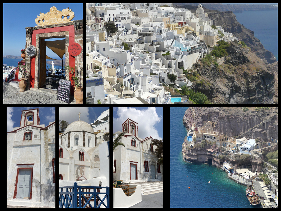
Fira
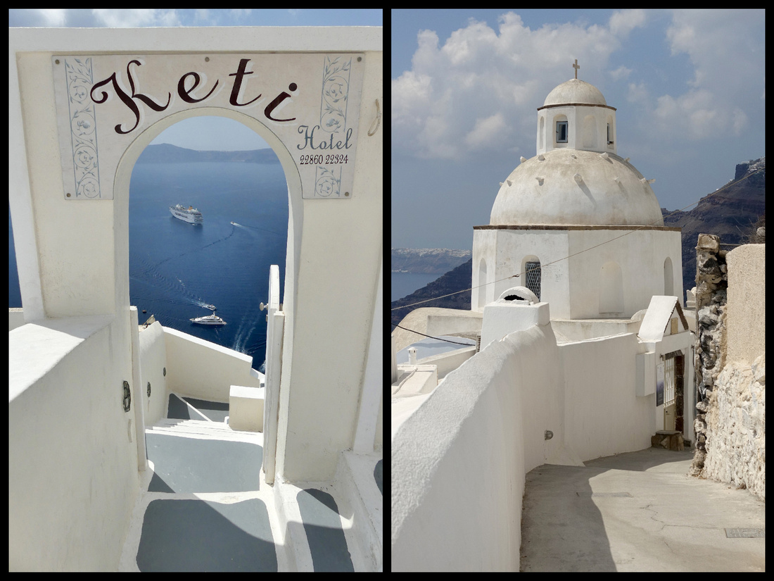
Fira
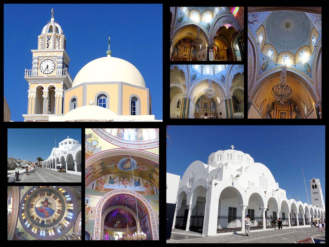 Top: Fira Catholic Church Bottom Fira Orthodox Church
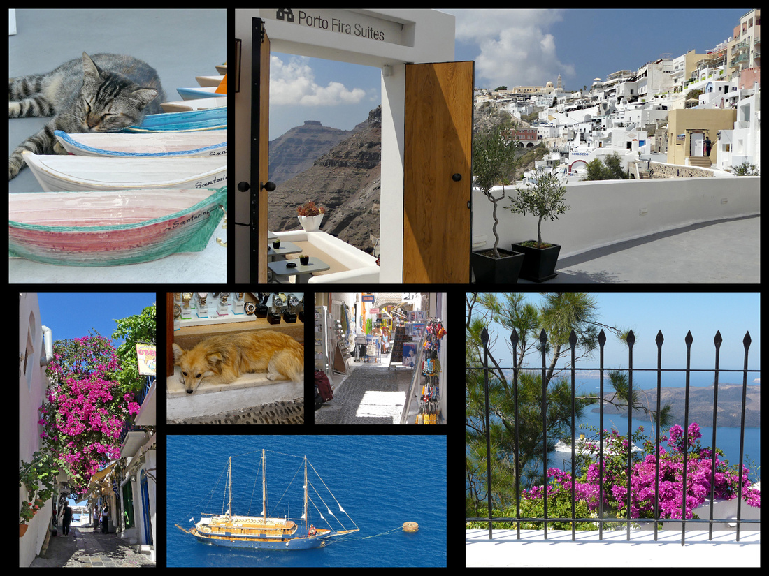 Fira
Fira
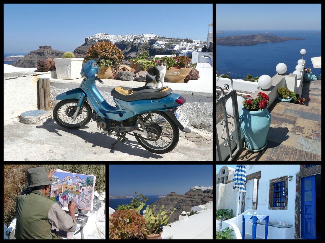 Firostefani
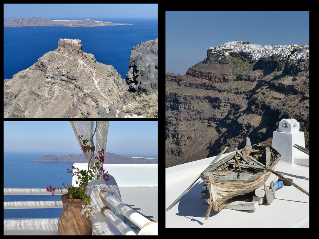 Between Firostefani and Imerovigli
 Imerovigli
Santorini gets 1.5 million visitors a year. There seem to be three types of tourist – the cruise shippers who arrive by little skiffs from their mother ships anchored in the center of the caldera, and then take the cable car (or a donkey) up. They shop, eat, look at the view, and then go back down without ever venturing more than a few feet from the cable car but when they are there (one day there were five cruise ships in the caldera) they definitely overwhelm the place. Then there are the people staying in the boutique hotels with a view, and many with tiny pools; they also shop and eat at the expensive restaurants with a view. Then there are the ‘other’ tourists, who are staying in the ‘low rent’ (although this is a relative term on Santorini) district in from the caldera – small hotels and ‘rooms’ as well a at least one campground and a few hostels. The main street and square are full of inexpensive eateries, people driving ATVs and mopeds zipping around. Very chaotic, but in a nice way.
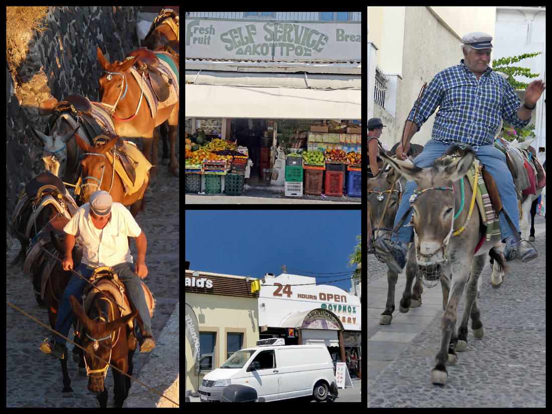
Left: Donkey's being led down to the cruise ships to haul people up the hill (photo from 2009) Far right: same guy in 2018
Center: Fira has several fruit/veggie/nut shops as well as a great bakery that is open 24 hours, a McDonalds, a grocery store and plenty of restaurants
Large buses (more like inter city coaches than city buses) go back and forth between Fira and Oia about every 20 minutes so you don’t even need to be aware of the schedule. They also go to the various inland villages, which are interesting and feel much more authentic, as well as to the few beaches on the other side of the island from the caldera and to the archaeological site, Aktrotiri. The inland towns (where the people who work in all the hotels, restaurants and shops live) are worth visiting.
Emporio is the largest inland village with over 3000 residents, in the south center of the island, about 12 km from Fira. The village was probably named Emporio (which means trade) because it was the center of the island's commercial affairs in the past. There is a 'newer' part of town, where the bus stops, which is where many of the people who work in all the shops and restaurants in Fira and Oia actually live.
Emporio also has a ‘castelo’ district that has no shops/restaurants at all, just ancient houses and very narrow twisting lanes. It was absolutely beautiful. I did go fairly early (before 10) and I was totally alone. The 'castle' sits at the highest point of the town and was originally built to guard the transactions and the residents from the pirate invasions which were common in the Cylades. There were once five fortified settlements on Santoroini. Emporio's castle was constructed in the mid 15th century and was very well fortified and structured: the houses were built side by side and connected by overpasses, arches and tunnels. The interior remains a labyrinth with very narrow streets only one person wide. There are steps, doors, small windows and arches everywhere. For safety reasons there was only one entrance, today there are a couple of ways in. Inside the fortified settlement are several small churches, the largest, the church of Panaqia Mesiani, dates to the 16th century.
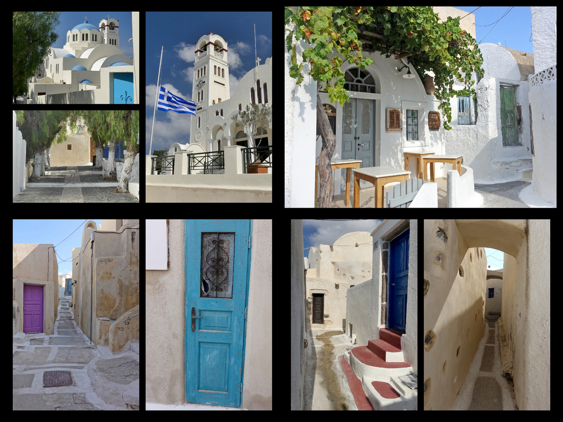 Emborio
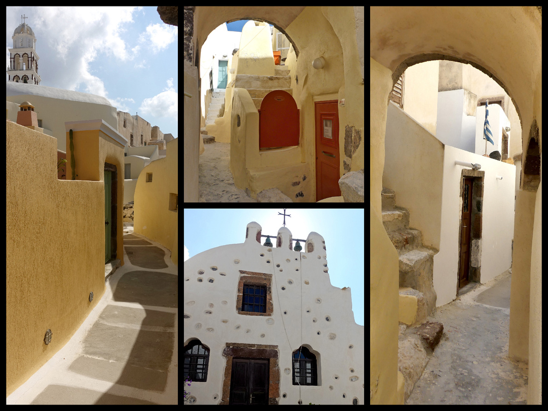
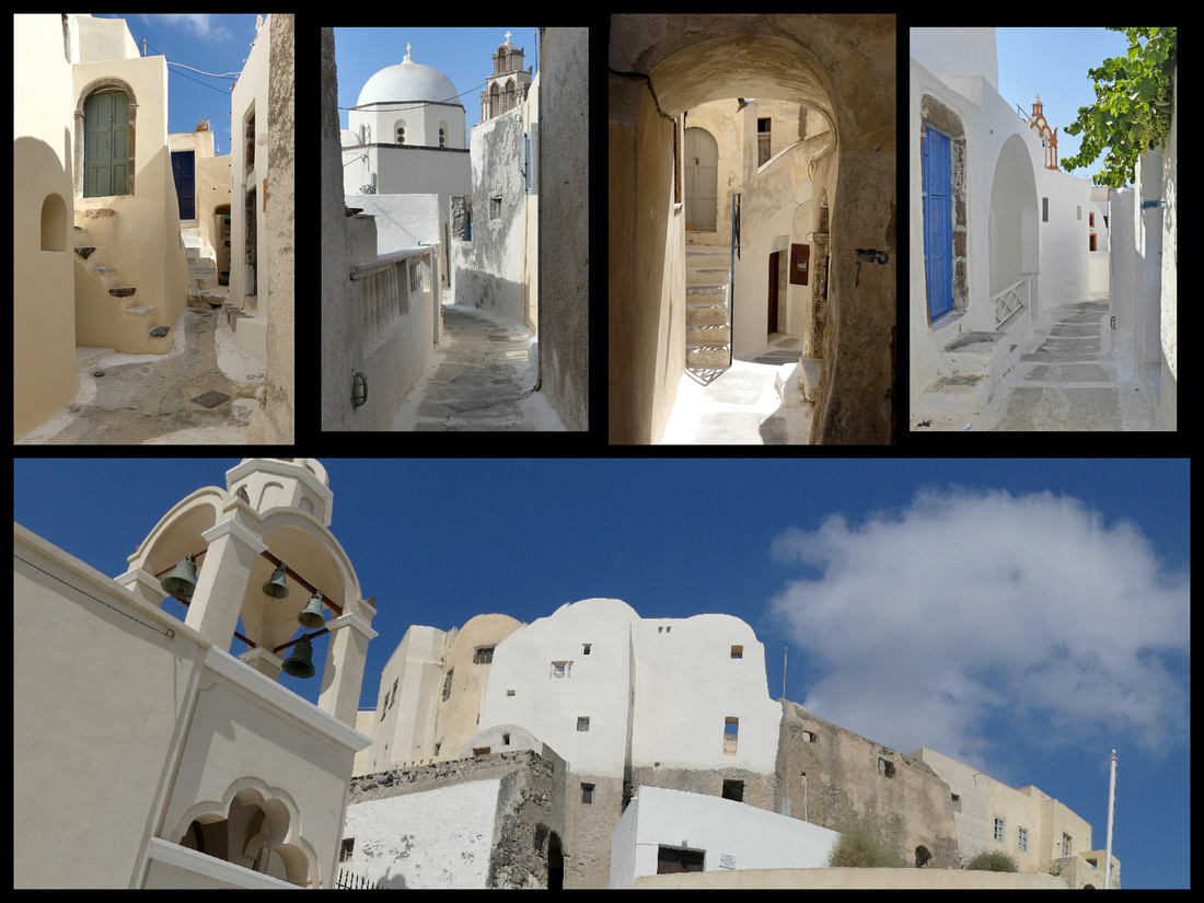
Emborio castelo district
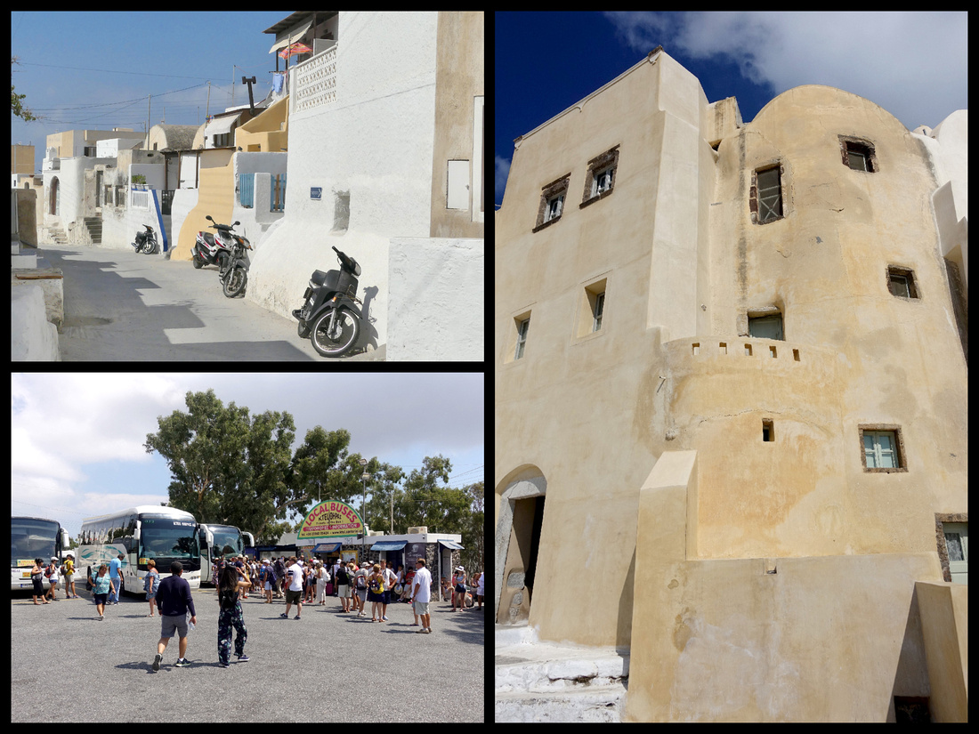 Emborio castle from the outside, Bus station back in Fira
Pyrgos - Less than 8 km from Fira, at one of the highest points on the island, Pyrgos (population 912) is a typical fortress settlement, another of the inland villages where the islanders actually live. It's topped by the ruins of the Kasteli and offers views of Fira and the sea on both sides of the island. From the bus stop in the main square, narrow, winding streets lead past white houses with blue doors, and small (and at least one not so small) churches to the ruins of the 13th century Venetian castle (Kasteli). Though the occasional tour bus hauls cruise ship passengers on an excursion to the village, other than one or two postcard or jewelry shops, for the most part it remains mostly untouched by the mass tourism of the caldera rim villages.
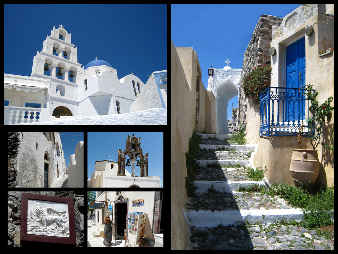
Pyrgos
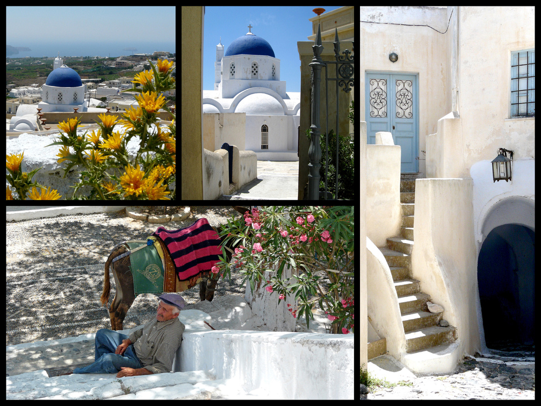
Pyrgos
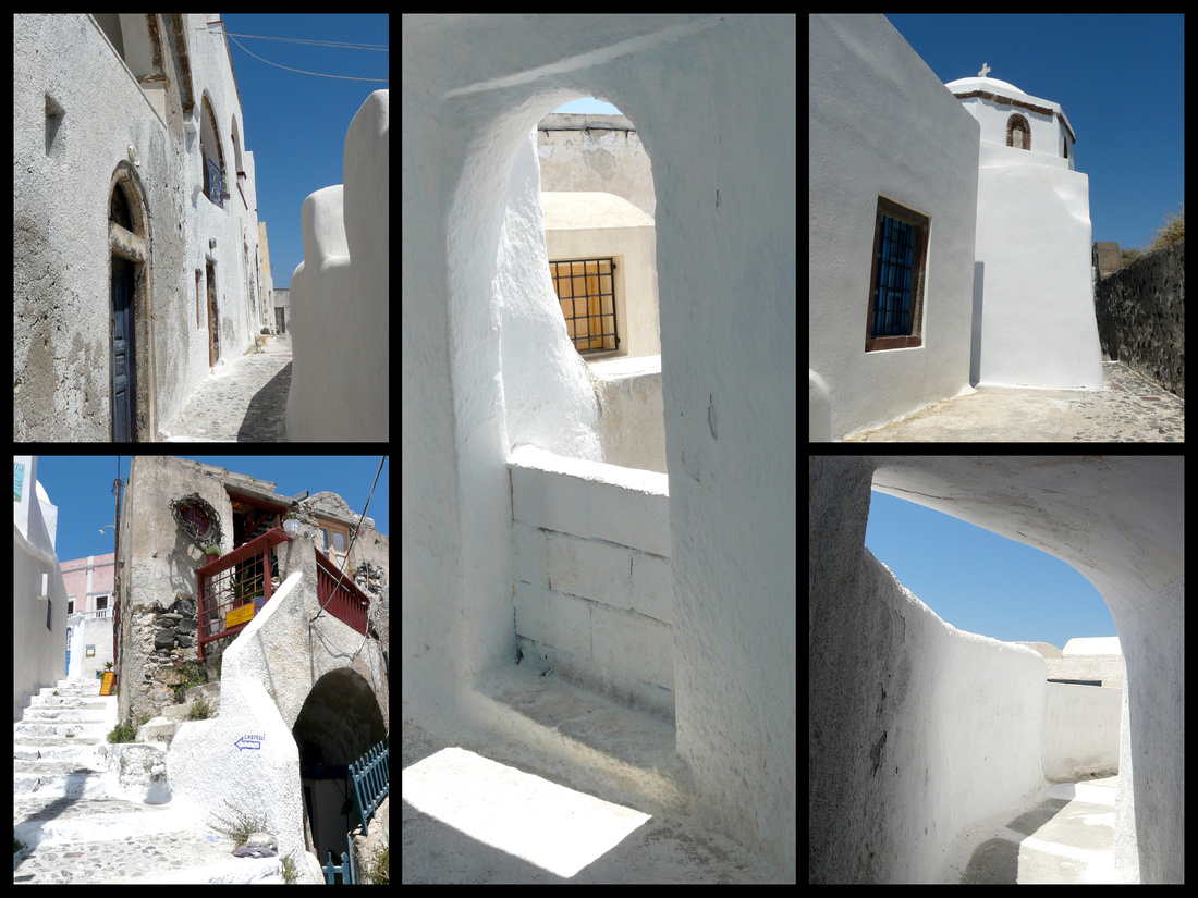
Santorini is famous for it's sunsets. They are equally impressive from Oia and Fira
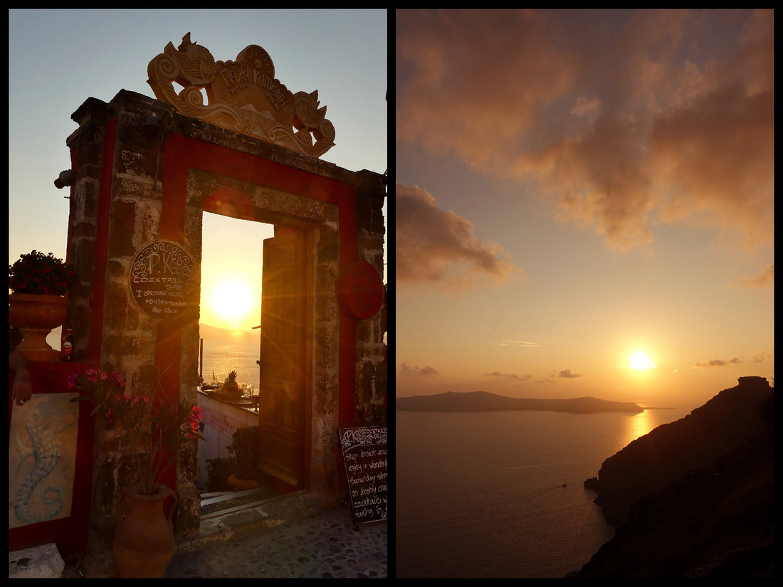
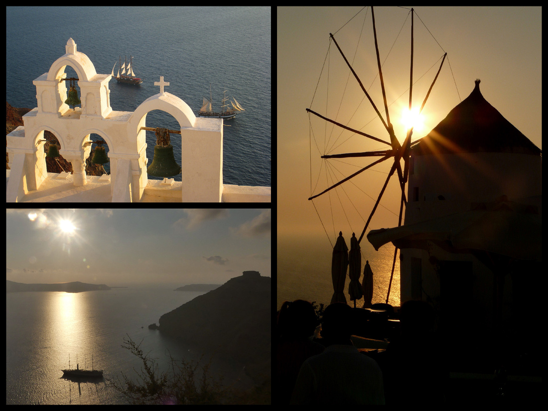
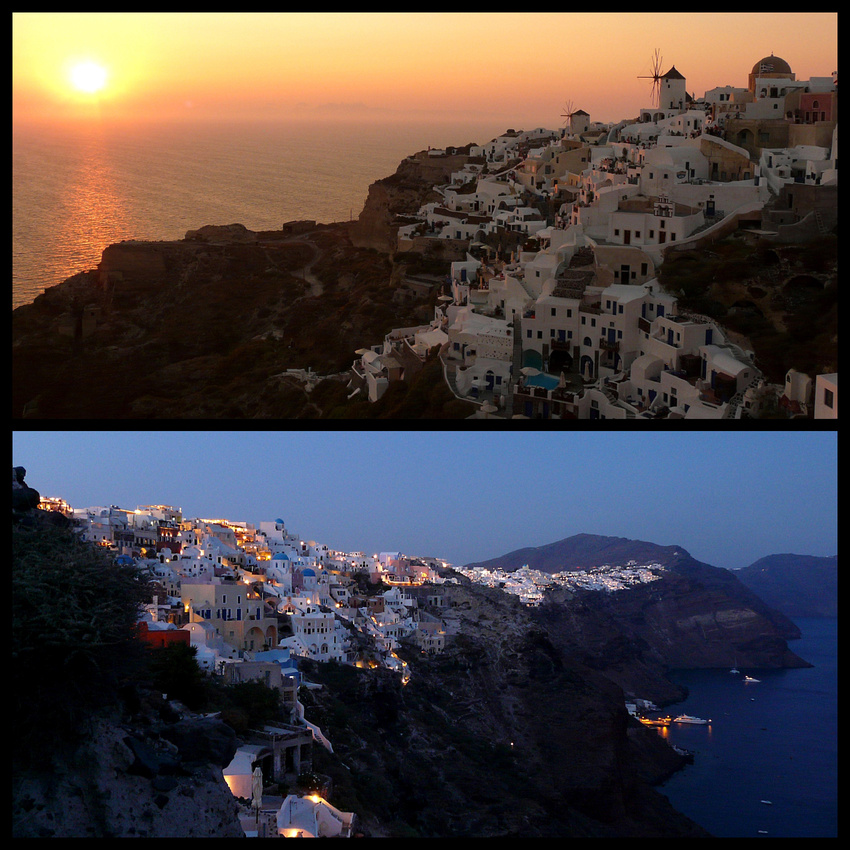
Go to Santorini to see it, but don’t plan to linger for a Greek island experience, because, as I said, it’s in a class by itself, which is bad as well as good.
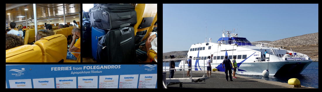
Above: Sea Jets ferries
]]>
Folegandros Φολέγανδρος population 650, is a small island, barren and arid with tall hills (300 m above sea level). I had read that if Santorini didn’t exist Folegandros would be famous. The main town, Chora, is one of the more aesthetically picturesque, traditional villages of all the Cyclades islands, and the view is wonderful. It is perched high on a hill, and there are dramatic cliffs down to gorgeous blue and turquoise water. But there is no ‘caldera’ type view, and no villages perched on the edge, spilling down the slopes as in Santorini. It's a very "quiet" island.
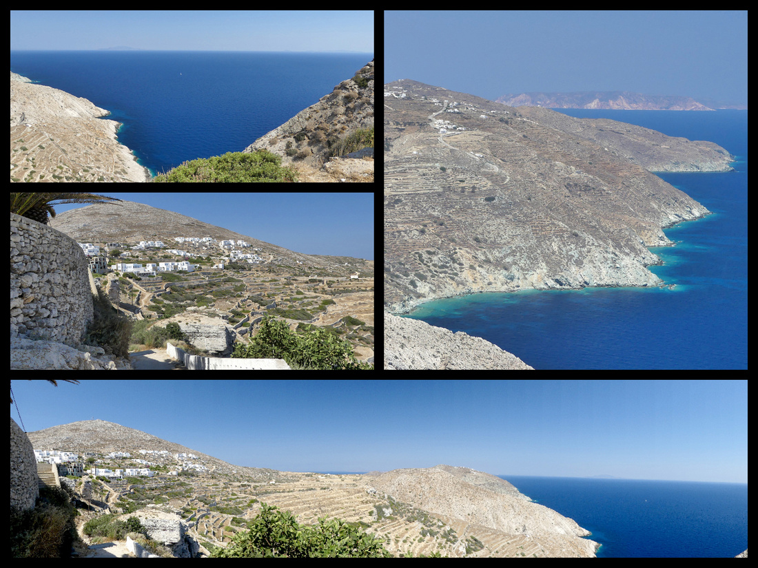
The only town of any size is Chora, small and totally pedestrianized, one ‘main’ square with numerous restaurants and several lanes going in all directions; narrow little alleyways, white stonewalls, courtyards, wooden balconies and Aegean-style churches.
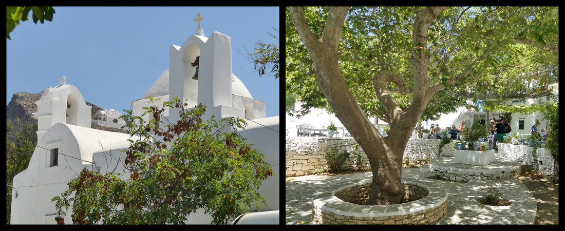
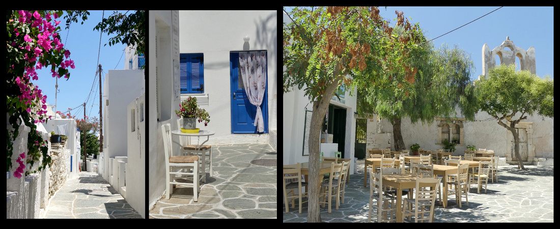
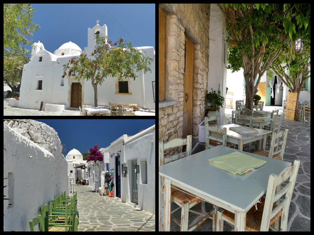
The most interesting part is the Kastro, a medieval-era district (former Venetian fort) that makes up part of the main town, essentially two really narrow alleys marked by ranks of 2 storey houses, repetitive, almost identical stairways and slightly recessed doors that are very appealing. The houses are all white with trim painted in shades of blue and green.
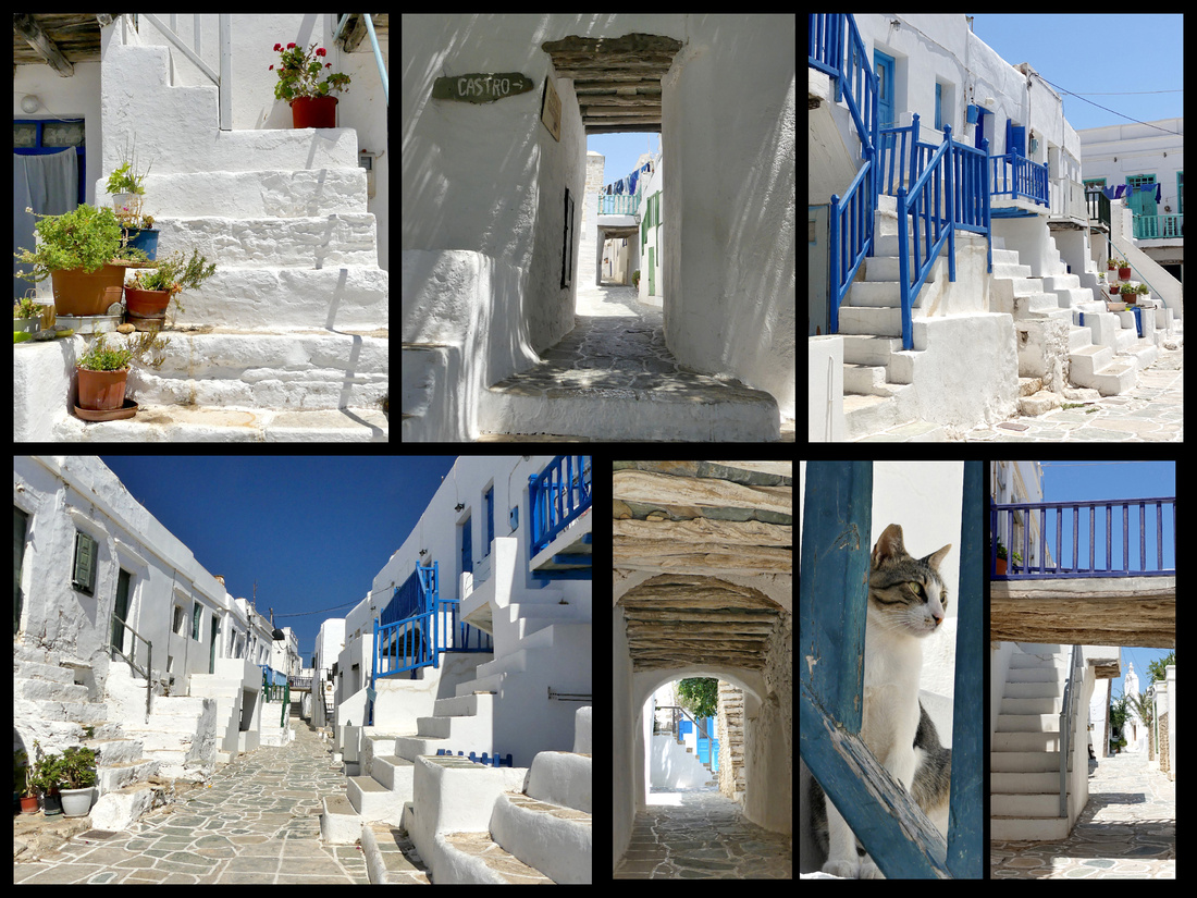
I had just about 48 hours on Folegandros. I stayed at Vardia Bay Studios, which is a 5-minute walk up the hill from the dock (although the hotel sent a mini van to the dock, mostly I think to take other guests to their sister hotel up in Chora, but they drove me right to the door of the hotel). I had a spacious studio with little kitchen and balcony. Around the back is the beautiful Vardia Bay beach. I arrived around 9:30 so of course my room wasn’t ready so I left my bag and took the bus up to Chora. The bus goes up to the 'Chora' from the port about hourly and only takes 5 minutes. It’s only about 4 km(2 miles) and I had read that it was ‘walkable’ in 45 minutes. Well that may technically be true but it would be a horrible walk, very barren, not interesting, no shade, uphill. I frequently walk when people say to take a bus or tram but no way I’d do this one, even down hill. Chora is 650 feet above the harbor.
After thoroughly exploring the town (which took about an hour, even photographing every doorway, alley, and cat) I went to the one bakery and got a cream pie and frappe and enjoyed it with a book and a cat at a little table in the small square. Then I ‘hiked’ up to the chapel above town.
Above Chora, a striking white path zigzags across the face of the mountain up to the church of the Panagia (St Mary). The walk is not as bad as it looks, took me about 45 minutes up and back including quite a while sitting inside. The church is a rare example of Aegean ecclesiastical architecture with three domes. Built on the ruins of the ancient sanctuary dedicated to the goddess Artemis. The sign (and my research) say it is open from 6pm-9pm but it was open at 13:00 in the afternoon the day I was there. They are doing some renovation on part of it and there were a couple workmen up there, perhaps that’s why it was open but it was very nice inside so I’m glad I got to see it. The inside of the main dome is blue. There was also a ‘box’ of water and cups – don’t know if that was for the workmen or the tourists but it was nice after the walk up in the blazing sun. I passed about 5 or 6 people in each direction – no tour groups, no crowds, so peaceful.
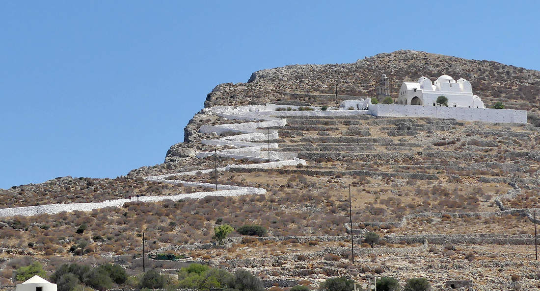
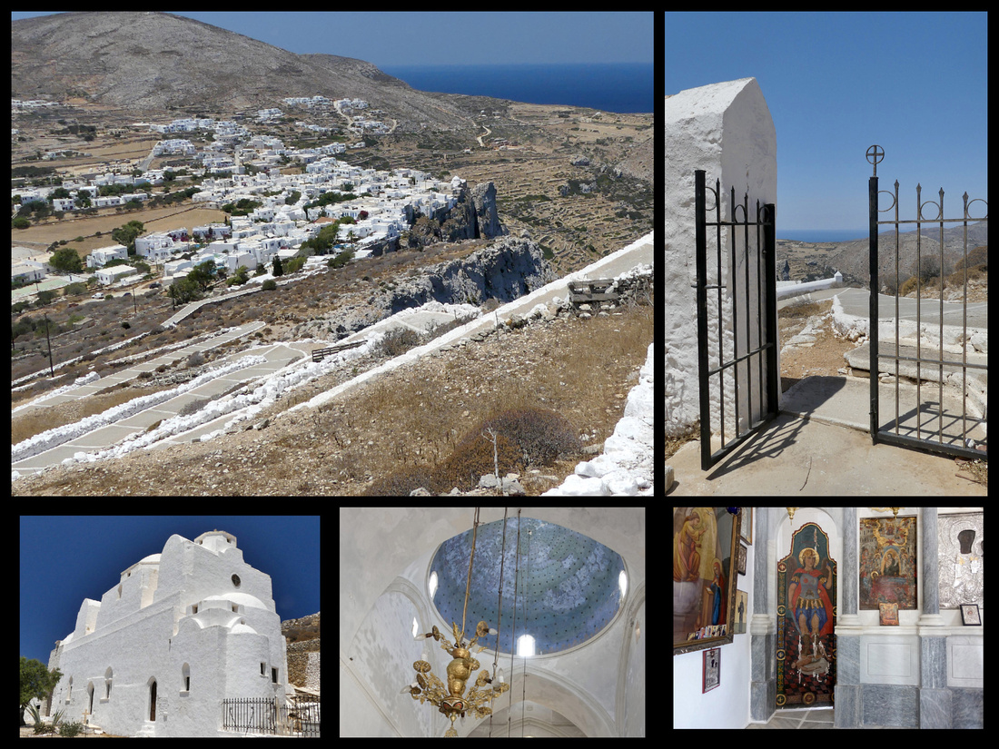
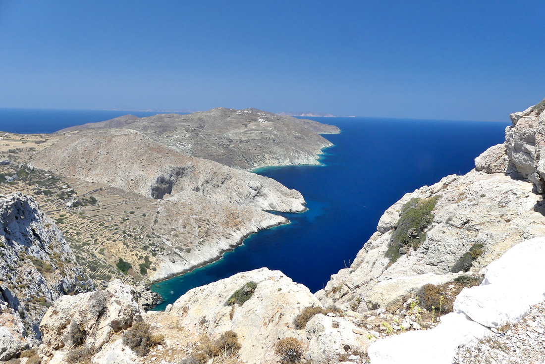
The port town (Karavostasis) is tiny, few restaurants/small market, tiny boat harbor (fishing, pleasure and ferry) and a couple beaches. One is the harbor beach, the other, around the backside of the tiny peninsula that Vardia Bay Studios is on, named, Vardia Bay, is small but secluded and quite lovely. Other than go to one of these beaches or have a meal, there is quite literally nothing to do in Karavostasi (the port town). There is one boat that does a cruise around the island a few times a week, and another smaller one that goes back and forth to Katergo beach, about a 20 minute sail, stopping for a minute at a little sea cave. That beach is very pretty, but small and really no better than Vardia Bay. The water at both beaches is crystal clear, light turquoise and warm.
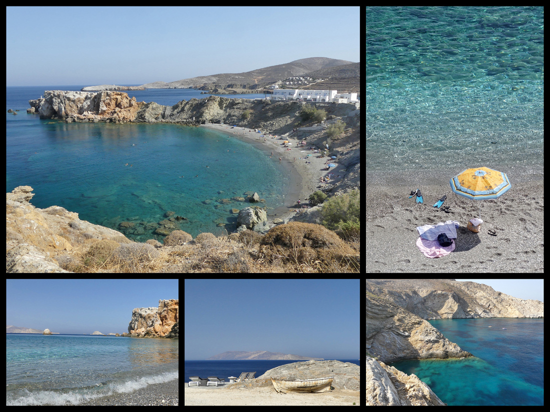 Above: Vardia Bay
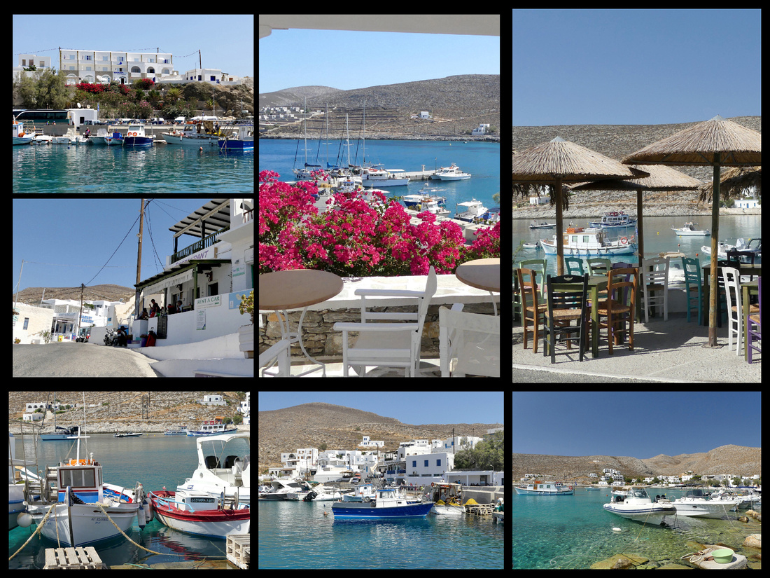
The tiny port town. Top left photo is Vardia Bay Studios, middle top photo is the view from terrace .
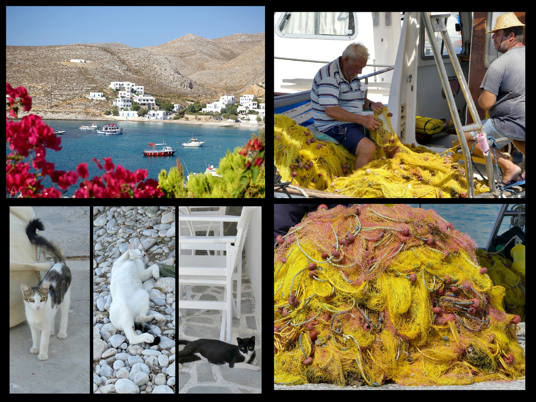
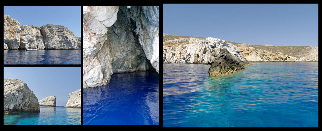
Above: images from the boat ride to Katergo Beach

Above: the smaller boat does the 'shuttle' back and for to Katergo Beach - which is the right photo. The larger boat does the circle around the island cruise, but only a few days a week.
This is definitely a 'laid back' island. There are some luxury resorts here and I think it's become popular with people who want a spa vacation on a beautiful island. But it is really quiet and peaceful and feels like what a Greek island must have been like before the tourist onslaught. Some of the guys in the main square were playing backgammon, others walking around with worry beads. There are a few shops in Chora selling clothing, jewelry and ‘souvenir’ type things. But certainly nothing on the shopping scale or with dining choices of any of the other 7 Greek islands I have visited.
Milos μήλος population 4500 Adamas Port in Milos is MUCH bigger than the port town in Folegandros, and to me much more inviting and interesting. Nowhere near as chaotic as Santorini though. I stayed at Hotel Delfini, to the left as you leave the ferry, about a 5 minute walk – just follow the harbor till it turns, past the small beach, and one block further.
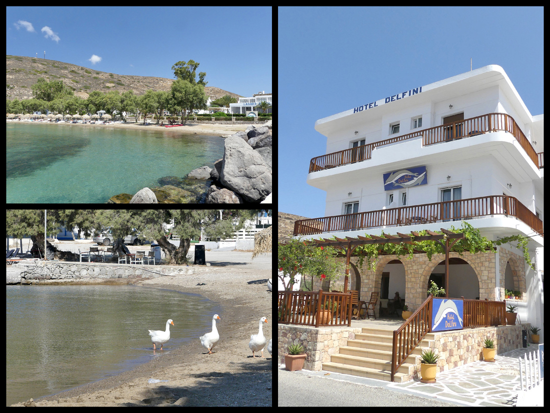 The beach in Adamas, the Hotel Deflini, one block inland from the beach.
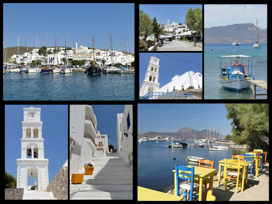
The port town of Admas is in a large bay that is considered the safest in the Aegean (was used by the Germans in WWII). Built on a small hill (topped with a white church) sloping down to the harbor filled with sailboats, yachts and day cruise boats. A few fishing boats off to the side. Large enough to have a selection of restaurants, tavernas, ice cream shops, bakeries and shops. There is a fairly large grocery store with pretty much anything you could need at prices way below mini-market prices. The bus stop is across from the bakery under the Portinia Hotel, just as the harbor road turns, a block from the ferry dock.
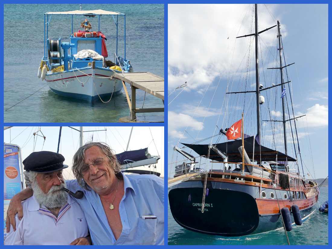
They say that besides Santorini, Milos has the most extraordinary terrain of any of the Cyclades due to its volcanic past. There are amazing rock formations, incredible views, and as many as seventy beaches. Lots of coves and sea caves. What they don’t say is that most of the beaches are tiny and only accessible by boat (or by climbing down long ladders from the cliffs above). Milos has vast mineral deposits and a fairly large (for a Greek island) mining industry (there is a mining museum). The varied mineral deposits make for an abundance of colors of rocks around the island. Milos emerged from the Aegean Sea during a period of intense volcanic activity. The contact of the emerging red-hot material with the seawater resulted in the creation of rocks and formations in an astonishing variety of colors and shapes. The flow of lava when the island was created also accounts for some amazing landscapes. It reminded me of Death Valley – only in the middle of the sea.
An excursion sail around the island and to the neighboring island of Kimolos is the best way to see Milos' amazing coast. There are full and half day cruises. Each evening around 7pm all the boats have come in from the day's sailing and line up along the promenade and sell cruises for the following day. The ‘best’ I though was the €40 Captain Yiangos – it’s a ten hour tour that stops for lunch at the island of Kimolos plus 3 or 4 stops to swim off the boat, including at Kleftliko. All the other cruises were more expensive, did not include Kimolos, some only went part way around the island, and included (what reviews say is pretty bad) food. The boat was big enough that you could move around, get out of the sun, etc. There’s a snack bar for cold drinks at prices less than mini-market prices.
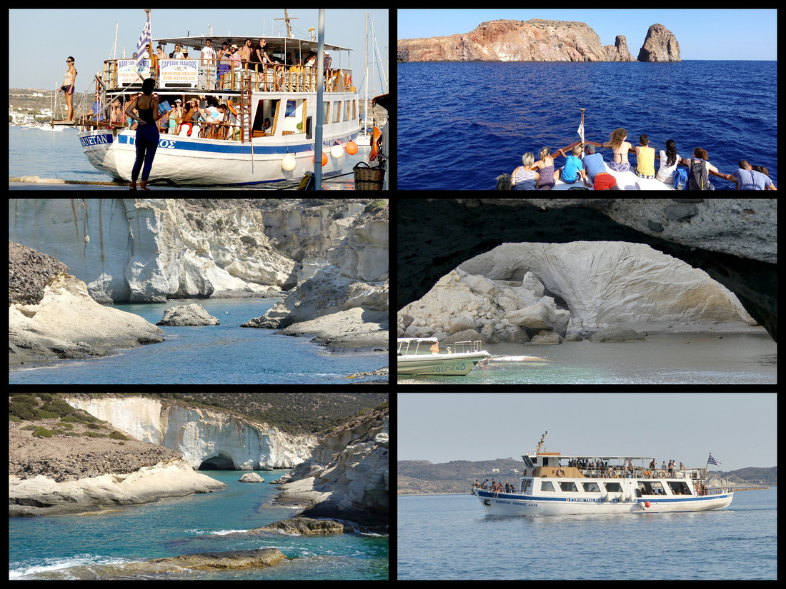
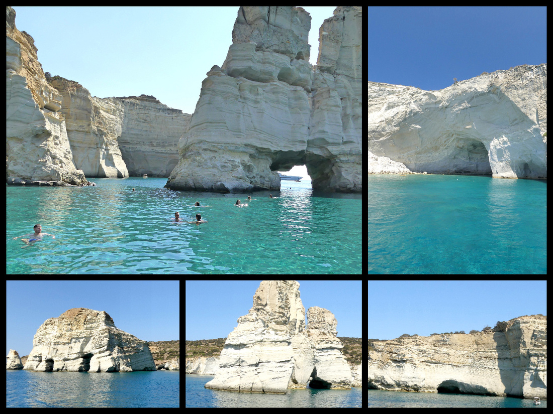
The cruise departs from the harbor in Adamas and sails half way around the island, stopping at the most outstanding feature of Milos, Kleftliko - huge white rock formations jutting out of turquoise water with caves and arches - for about 45 minutes so people can swim or snorkel.
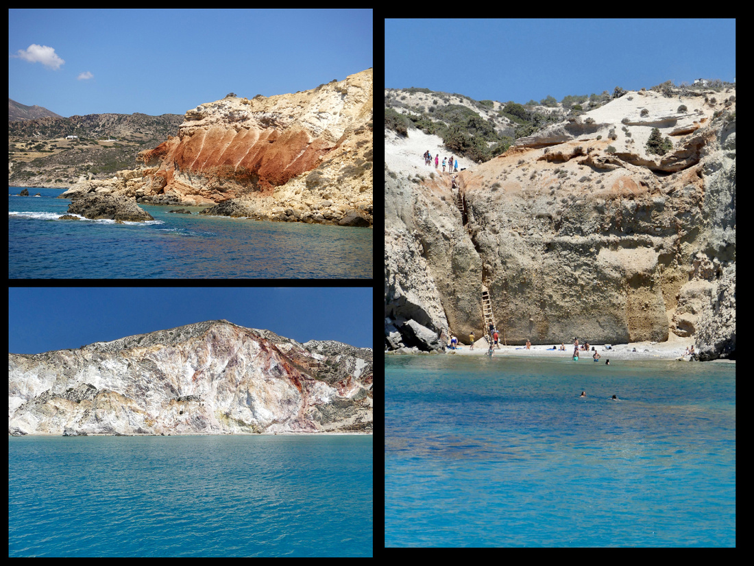
Above: Left - some of the amazing color combinations Right - one of the beaches accessible only by ladder from above
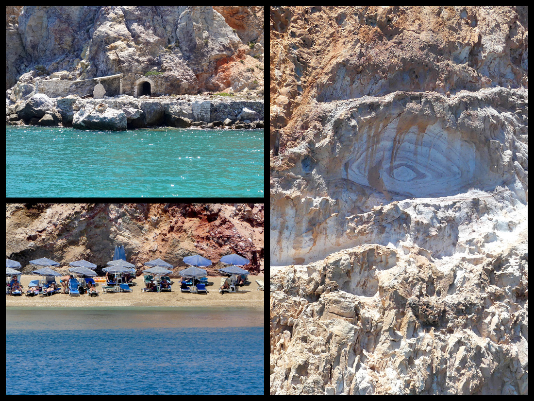
Above: Lower left - one of the few beaches accessible by car (and a walk) Right: the "eye" rock formation
The boat then stops for an hour or so for lunch at the neighboring island of Kimolos, a much smaller island just across a bay from Milos (from Pollonia). It has a small port (half dozen tavernas on the beach and one shop) and a larger (yet still tiny) town up on top of it’s hill. There is a ferry from Pollonia but very infrequent.
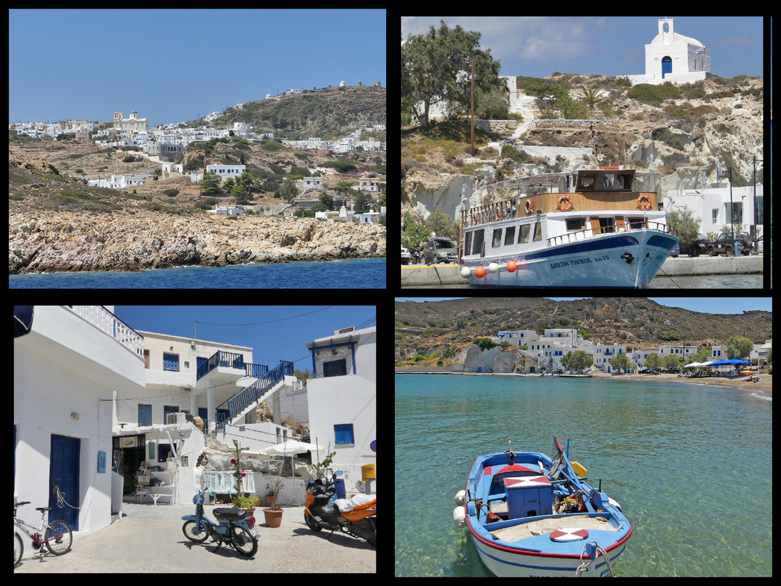
Above: Island of Kimolos Top right: the Captain Yiangos docked in Kimolos for lunch
Besides Kleftliko, the most outstanding feature on the coast is Sarakiniko, an area of bone white rock surrounding turquoise blue water that looks like a moonscape. The Adamos bay harbor is guarded by some unusual rock formations, the most distinct looks like a giant bunny rabbit.
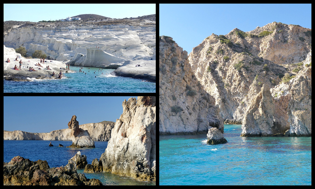
Just before you enter the harbor (and around the tip of that part of the island) are three fishing villages that are unusual in that the houses are built right into the rock walls. They are referred to as ‘syrmata” and were built in the mid 19th century after fear of Turks or pirates abated so people began living right on the water, rather than up in the Plaka. They have brightly painted doors to their boathouses on the ground (sea) level, with living quarters above. Kilma is the largest, the other two are Mandrakia and Firopotamos.
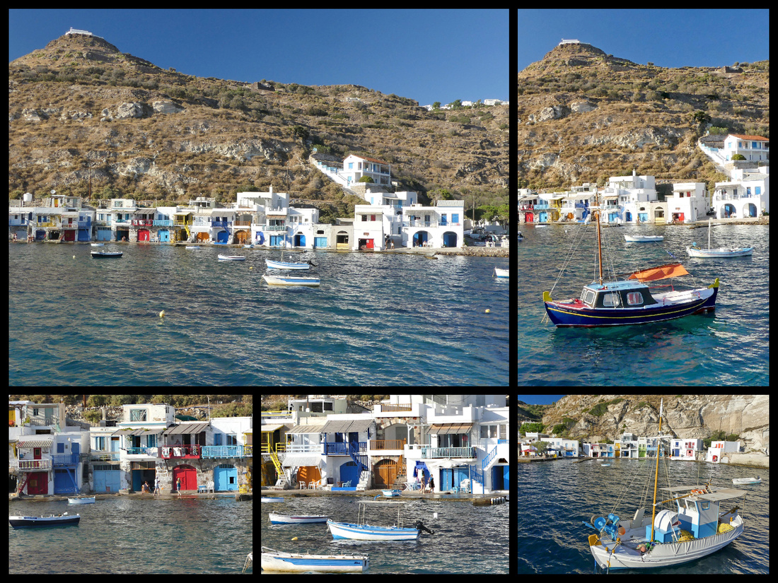
Milos' main village of Plaka is a typical Cycladic village with a warren of stepped and winding alleys lined with white buildings with lots of blue trim, plenty of bougenvalia and lots of small tavernas, with views out to the sea around every corner. There are three main churches, one in the center of the town, one half way up to the Kastro, and another at the top. Of course as in all the Greek islands, there are tons of tiny churches scattered all over. The island is rich with archeological sites including Christian catacombs, a roman amphitheater, and Venetian castle. The Venus de Milo was found here and a copy of the statue is in the small archaeology museum in Plaka. The Venus de Milo is actually Aphrodite, who rose from the foam of the Greek sea.
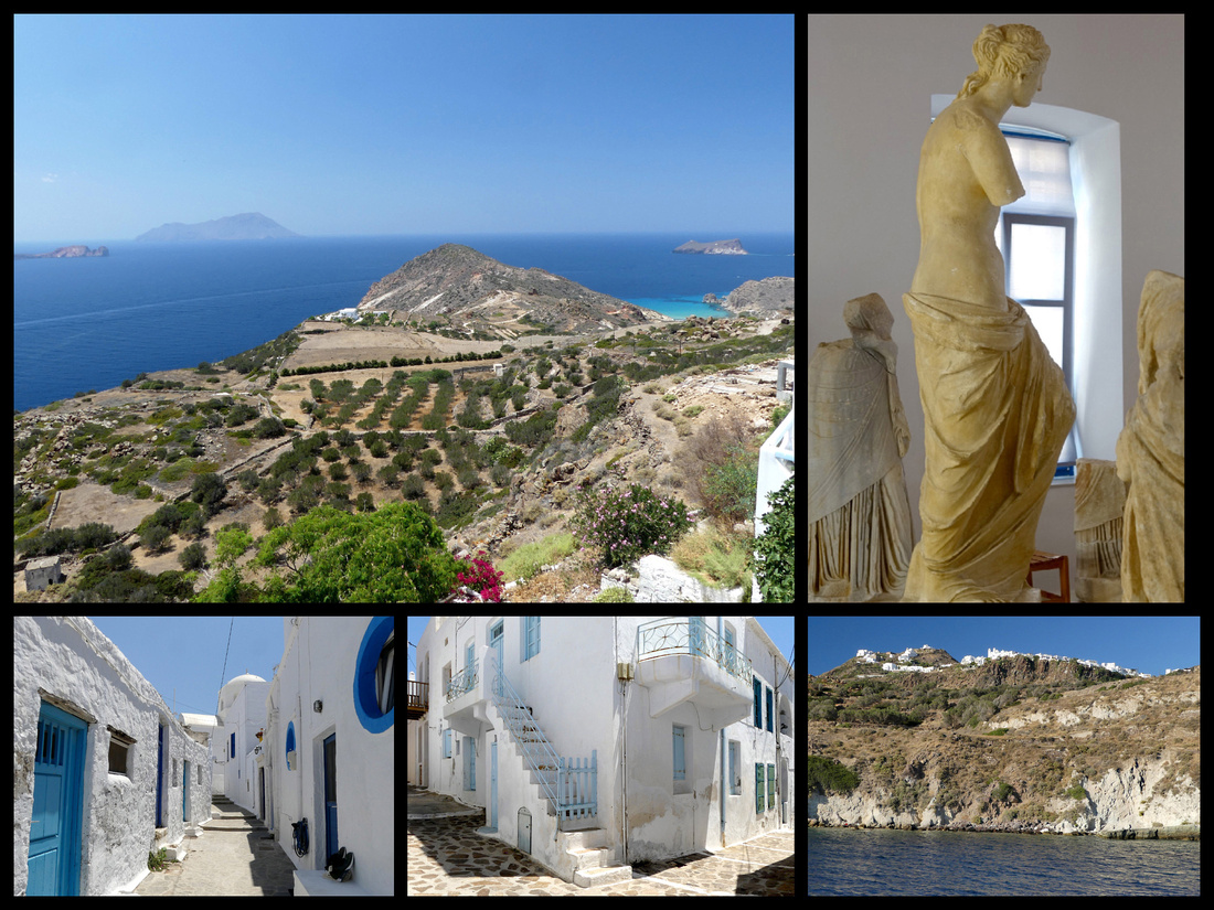
Above top left: view from Plaka, top right: copy of Venus de Milo in archaeology museum Bottom: Left & Center: Plaka streets, Right: view of Plaka from the water
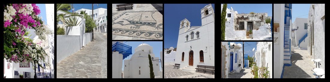
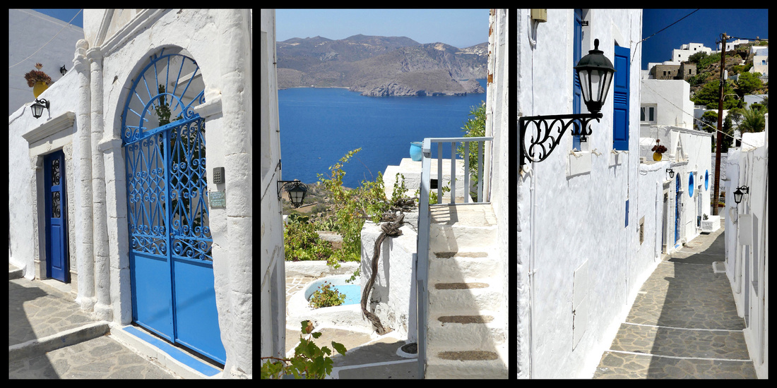
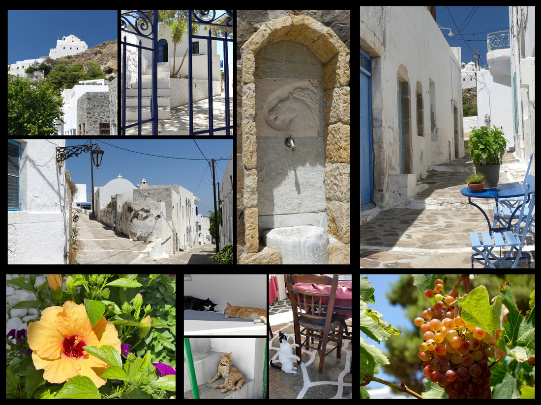
At the top of Plaka, on a steep hill 280 m above the town, is the old Venetian Kastro with two tiny churches. The Venetian family Sanoudoi, who since the 13th century had dominated the Cyclades and the Aegean, first inhabited it and used it as a stronghold against pirate attacks. The view from the very top, looking down on the slightly larger church half way up, the Plaka below, and the coast below that is incredible. Part way up the hill is the larger church, more steps lead to the very top where another smaller chapel crowns the hill and offers not only a 360 degree view of the entire island, but a beautiful view of the larger church below.
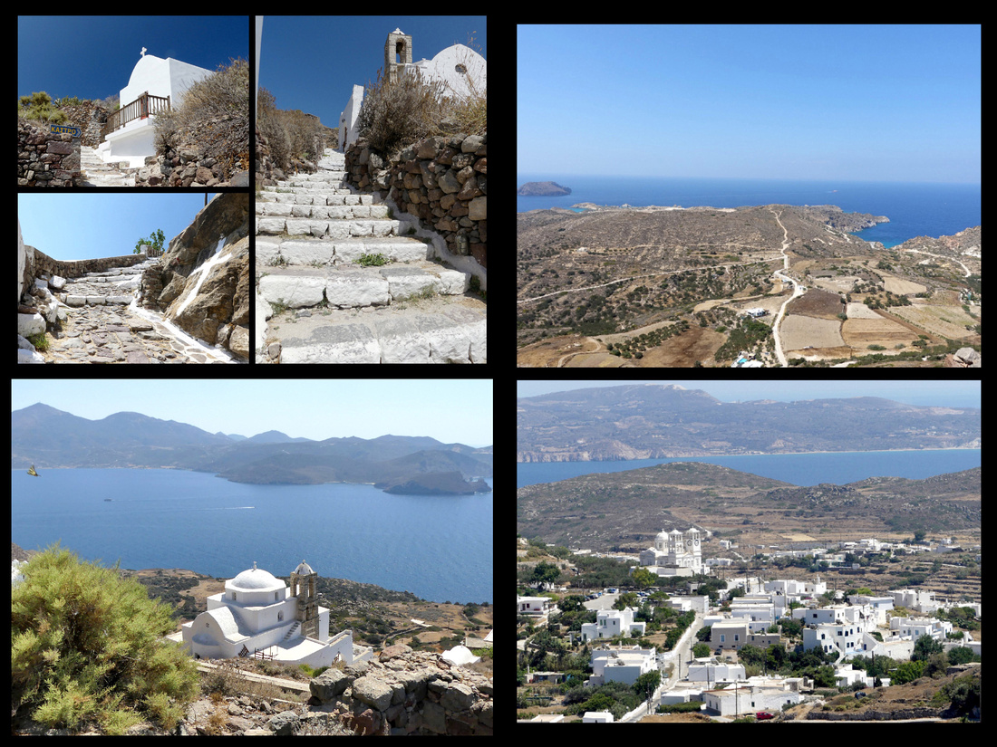 Top left: Steps leading up to the Kastro from Plaka Top Right: view from Kastro
Bottom Left: Church as viewed from very top Bottom Right: village of Tripiti below Plaka
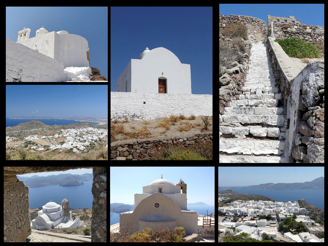
Top: Small chapel at the very top, and stairs leading up to it. Bottom: the larger church and view of Plaka from the top
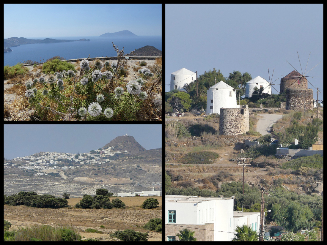
Top Left: view from kastro Bottom Left: view of Plaka, with kastro sticking up above from afar Right: windmill are found throughout Milos
Pollonia - is a small fishing village, built around a pretty bay, in the northeast of Milos. The church of the village, Agia Paraskevi, stands on a small peninsula, above Pollonia. A few hotels, mostly ‘rooms’ to let, a few tavernas and some pretty fishing boats, one or two shops. Beach is better than Adamas but not as amazing as some of the tiny secluded ones.
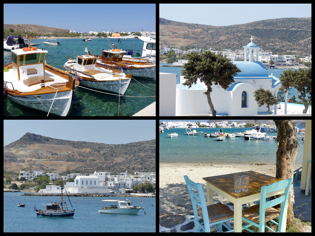
The buses go to most places with some regularity. They are about hourly to Plaka and Pollonia, every two hours to Sarakiniko. Of course most of the amazing coastline can only be seen by boat.
So between the buses and cruise you get to most of the island. To really see the tiny fishing villages and some of the beaches up close it wouldn’t be a bad idea to rent a car for one day (seemed to be plenty of places) – or if visiting in the spring or fall when the temperatures are more moderate, you can probably walk to a lot (e.g. the catacombs, Kilma). But you still need to do the boat ride.
What I did during 4 days on Milos: I arrived on the 10:30 ferry, was able to check into my hotel and explored a little of Adamas town. Then got the bus up to Plaka for lunch and the afternoon. I spent about 5 hours between lunch and exploring (photographing) the town and climbing up to the chapel on top of the castro. Words can’t describe the views, you have to look at the pictures. The climb up there is steep but only about 15 minutes. I saw a total of four other people. Back to Adamas for dinner.
The second day I went to Pollonia for half a day, spent the rest lazing around. That evening I went scouting for the best day cruise to take the following day. The boats all get back from their cruises around 7 pm and the crews stand out on the promenade trying to tell you why their cruise is better than the next guys, most also have pamphlets describing where they go, etc. The third day was the 10 hour cruise and the fourth day I went back up to the plaka – twice in fact. In the daytime to visit the archaeology museum where the replica of the Venus de Milo is (tiny museum, two rooms) and again in the evening for sunset. There were certainly other things I could have done, especially if willing to rent a car but by this time on my trip (I had been in Germany, Austria and Slovakia for almost 3 weeks before Greece) my energy level was sagging. I would say Milos is good for 3-4 days for the highlights, longer if you want to ‘see everything’ or spend extensive beach time.
Other than Santorini, I would say the sunsets from Milos are about as wonderful as they get - best view of course is from the top of Kastro above Plaka. But it's worth the hike.
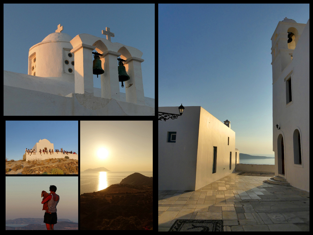
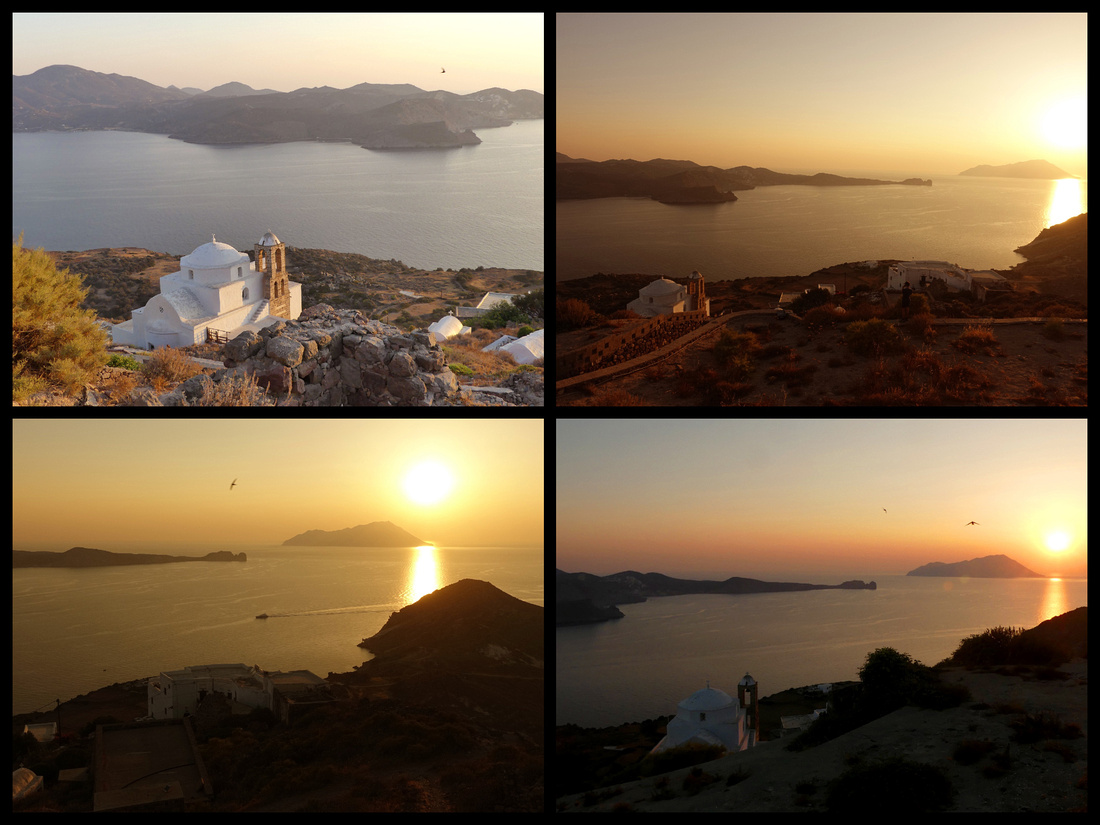
I arrived in Sifnos about 11:30 (the ferry leaves Santorini at 8:30, stops in Folegandros at 9:30, Milos at 10:30 and Sifnos at 11:30 – I hopped the same ferry every few days to the next island). Sifnos port town, Kamares, (population 250) is larger than Folegandros, but smaller than Milos. There is basically one ‘street’ (and the only cars allowed on it are those heading for the ferries, plus the bus). It is lined with tavernas – whose tables are across the street, right on the sand/water; ice cream shops; and jewelry/clothing/postcard shops. After the equivalent of about two blocks of that, is the beach and past that the bay curves around to a few more tavernas and a cute little chapel up a tiny hill. There are several streets of compact concrete houses climbing up the gentle hill. Between the ferry dock and the start of the tavernas is a tiny harbor with about 4 yachts and maybe a dozen small fishing boats. Numerous ferries come in and out of port several times a day, but don’t stay long enough to make it feel like a ‘port’. Once the ferries leave you are in a quiet (but not too quiet), fishing town that has a taste of tourism but not enough to make you feel like you are in Mykonos. There is a ‘supermarket’ on the main street (underneath the Stavros Hotel). There is so much interesting stuff crammed into this little store it is like going to a museum. Was able to get fruit/vegetables, yogurt, milk, water, juice, etc. There are supposedly two others but I didn’t see them.
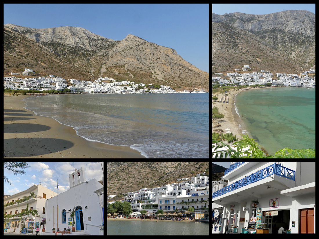
I was wondering how I was going to find my hotel, ‘To Steno’, given that google maps was really unclear, but I just started walking past the tavernas and saw a sign pointing down an alley, then another and there it was. There are three rooms and a reception, not sure if there are other rooms anywhere else. The proprietor checked me in and told me to come back at 2pm cause she hadn’t done the rooms yet.
So I went and checked out the town (that took about 20 minutes), then went to one of the tavernas on the water and had a leisurely lunch watching two kittens play with each other and the boats bobbing on the water. By then it was 2pm so I went back to ‘To Steno’ (1 minute walk) and the room was ready. Clean, spacious, bright, private little patio, decent AC and fridge. There is a lime tree surrounded by giant lavender on my patio.
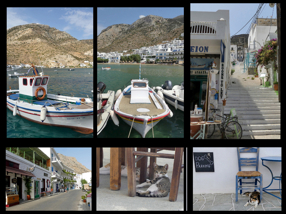
Sifnos Σίφνος population 2200. I had read that "Sifnos is full of beautiful Cycladic villages, the kind you see on postcards that made you want to go to Greece in the first place”. From a distance yes, Kamares and Apollina are quite scenic. ‘The villages of white cube houses crown it’s hill likes necklaces’ – that is true. Up close, they don’t hold a candle to Santorini, Naxos or Paros in the ‘picturesque’ department. However, Kastro is the epitome of a Greek Cycladic village.
Sifnos has long been a favorite of Greeks, especially Athenians, but now is popular with European tourists but I didn’t hear one American accent the whole time I was there. The mountains that frame Sifnos's deep harbor, Kamares, are barren and from the water the island looks as arid as the others, but inland there are terraced hillsides of mostly olive trees, some figs, occasional grape vineyards. There are still some of the beautiful slate and marble paths across the island, though most are now covered with asphalt to accommodate cars. Sifnos has been inhabited since 3000 BC. There are supposedly 365 churches and monasteries. Most of the churches are tiny one-room buildings, but they are scattered all over, not just in the villages. You can’t swing a cat on Sifnos without hitting a church. And there are cats wherever you look.
I’d read August can be hectic, rooms and cars booked, buses sardine-can full, but in July it was not at all crowded, buses maybe ¾ full, same with beach, restaurants at peak dining times, otherwise mostly empty. On numerous occasions I was totally alone on a path or street. Even in Kastro I almost never had to wait to shoot a picture without people.
Sifnos was the first island in Greece to hook up their plumbing to a purification and waste treatment plant, which makes Kamares one of the cleanest beaches in Greece and certainly the cleanest port. The beach is about a quarter mile stretch of sand that starts just past the ferry dock and circles around the harbor. There is an adorable church (Ag. Marina) part way up the hill side opposite the main part of town, only 100 steps, great sunset views from there.
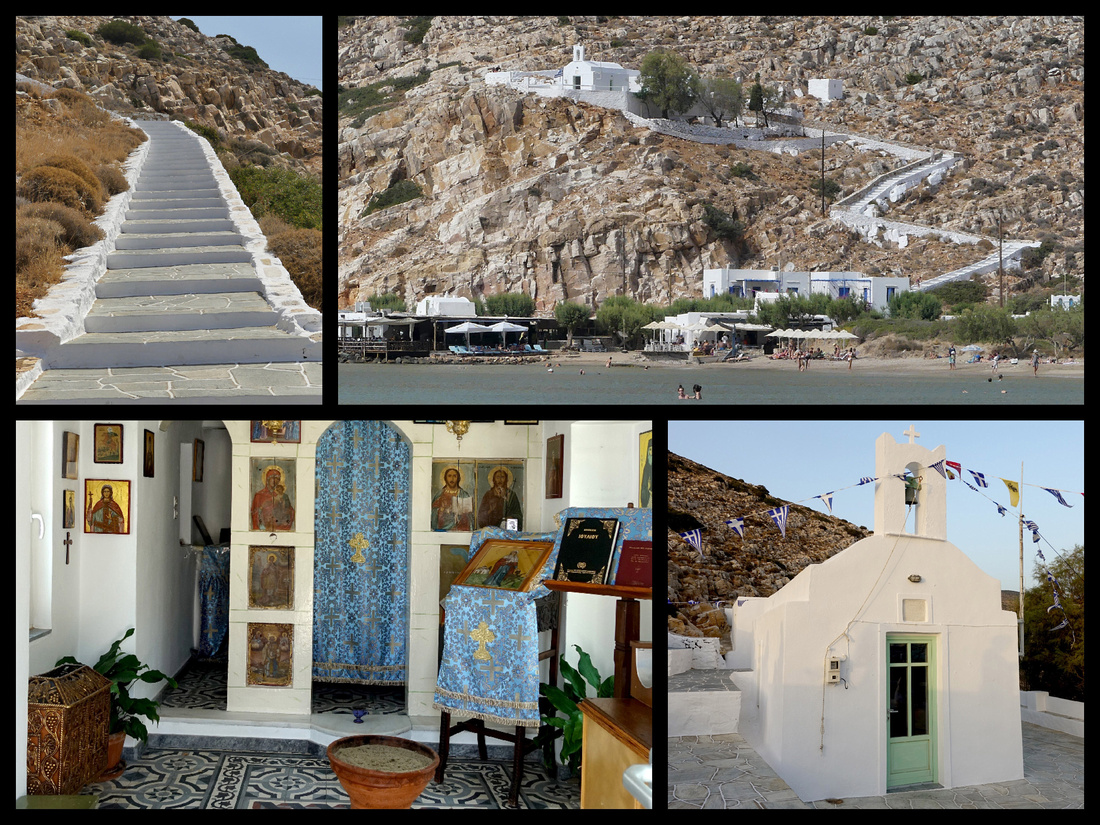
The centre of Hóra (buses go from Kamares up there hourly, takes about 20 minutes) is an amalgam of hilltop villages, which have merged over the years into one continuous community. The main town, near the center, is known as Apollonia (pop. 869). The town's name is thought to come from an ancient temple of Apollo on the site of the church of Panayia Yeraniofora. The second-largest town is Artemonas (800), ten-minute walk in the opposite direction from the bus stop, is thought to be named after an ancient temple of Apollo's sister-goddess Artemis. They kind of run into each other, plus three or four other once distinct villages that have now merged. Artemona is where the wealthy islanders built their mansions. So it has some Venetian and Neoclassical houses, that are unusual for a rural island like Sifnos.
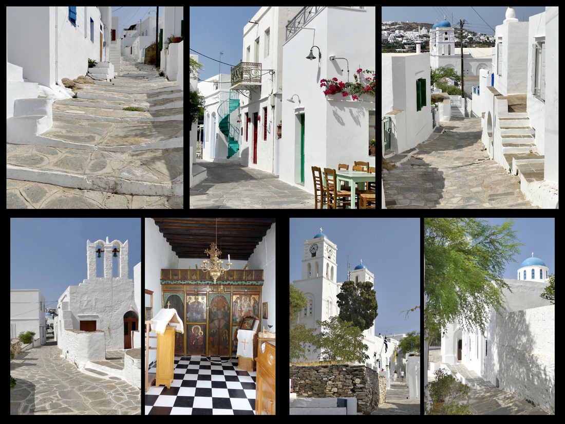
Center of the main village of Apollonia

Church and windmill at the far end of the village of Appolinia
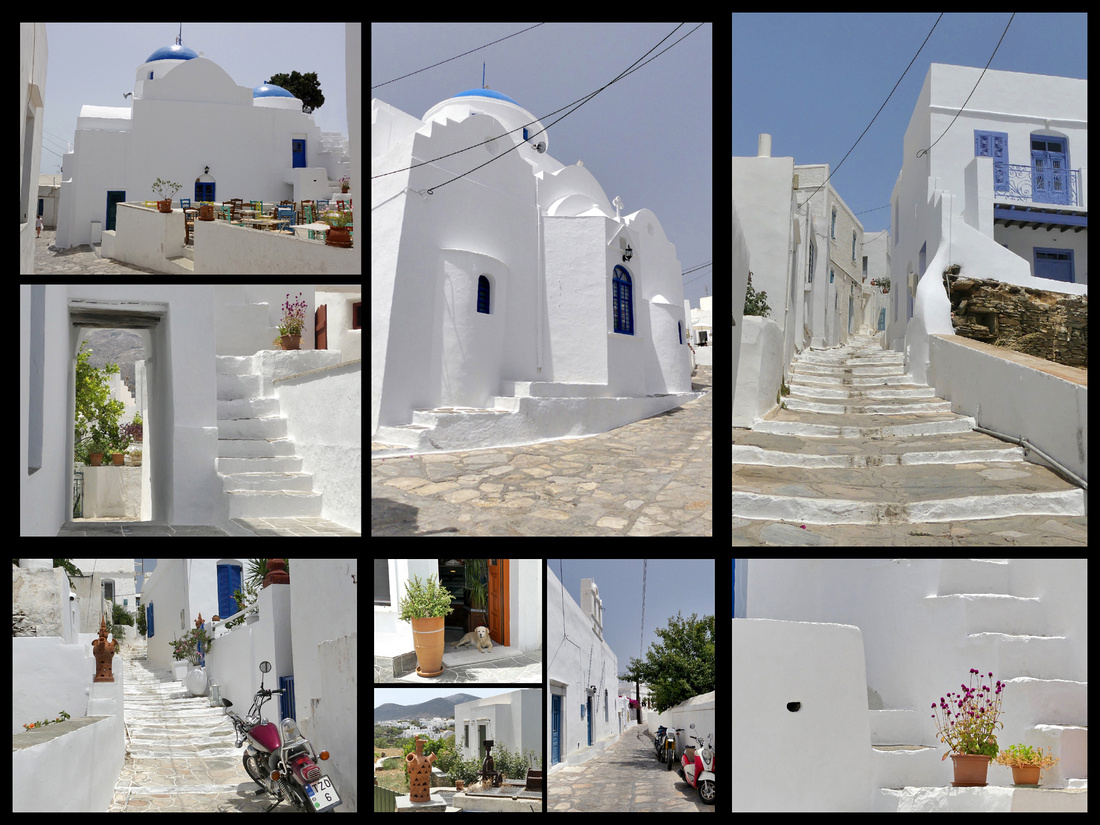
Center of the village of Artemonas
I really enjoyed the walk from Appolinia to Kastro. Where to start the walk was not immediately obvious. From the bus stop head up the main pedestrian ‘street’ a few feet till the ‘market’ and turn left on the flag-stoned path. It goes under the car road and then is pretty obvious. It goes for about 20 minutes or so through a terraced landscape of olive and fig trees, stonewalls, the occasional small plot of grapevines. Some dovecote buildings, a church all by itself in the middle of a field. Very scenic. Warm but not too hot and all downhill. Only one other woman on the path. The warm air intensifies the scents – almost smells like baking or cooking. Eucalyptus, wild thyme, rosemary, lavender. They say it’s a 45-minute walk, took me just over an hour but I stop to take a lot of photos.
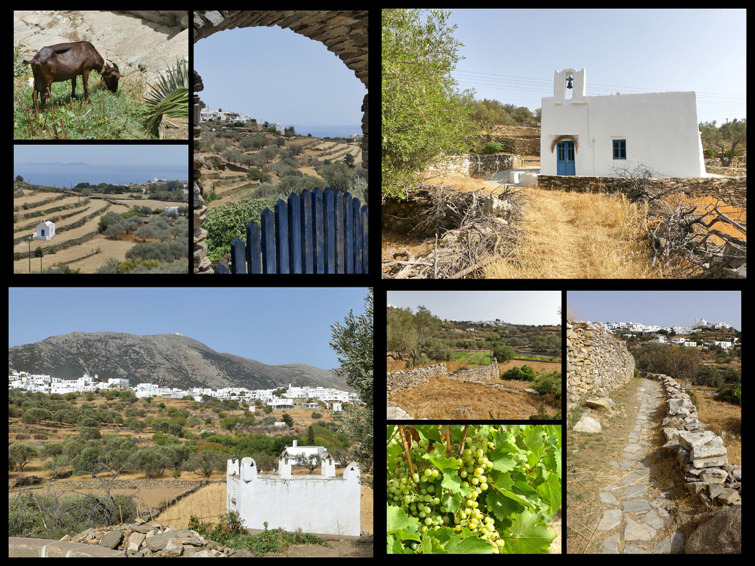
The walk from Apollonia to Kastro through fields with stone walls and flagstone pavement, past vineyards and olive groves.
Eventually you come out on a car road. The path continued on the other side but was signposted for walking trails and none of it said Kastro. There was a woman walking her dog and I asked her and she said (more or less) follow the car road. After a couple turns (was clearly in a little community at this point) I came to a T intersection with no sign. I asked someone in a passing car, and she pointed and said ‘down’. The car road wasn’t quite as bucolic as the flagstone path but hardly any traffic and views of the towns in the distance, churches, windmills. Then the road started seriously going down, switch backing on it self. And then Kastro came into view. Gorgeous, perfect little white hill town against the sea. As I walked down, down, down and it was getting hotter and hotter, I was thinking 'I sure hope there is a bus back'. And just as I got there a bus went by. Checking my schedule there would be another one in 2 hours. Turned out to be almost perfect amount of time. Just before town is one little chapel on one side of the road, three windmills, and the double church of Ag. Stefanos and Ag. Ioannis Kalivittis.
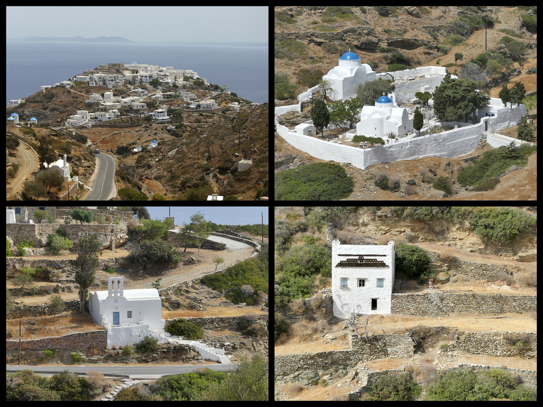
The village of Kastro on a hill overlooking the sea, as seen from the road from Appollina. Just before the village is a small church and some windmills on one side of the road and a 'double' church on the other.
Kastro (population 118), one of the best-preserved medieval towns in the Cyclades, built on the dramatic site of an ancient acropolis. It was the capital of the island during ancient times until 1836. It is downhill from Appolonia but it’s on top of a high cliff over the water on the island's east shore and today remains very medieval looking. This is the picture postcard town of Sifnos. Until several decades ago, it was almost entirely deserted; as tourists began to infiltrate the island, Kastro sprouted a few cafes. Whitewashed houses, some well-preserved and others eroding, adjoin one another in a defensive ring abutting a sheer cliff.
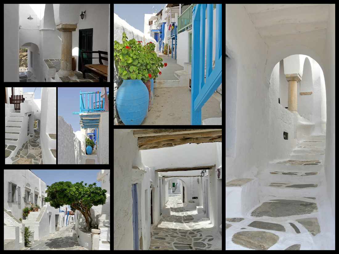
Kastros has been inhabited for over 3000 years. To protect the town from pirates there were only five entrances in the walls (formed by the houses), which enclosed it. These could be locked by iron gates. Today when you enter the town you go through tunnels and passageways into a labrynth of tiny streets wide enough for only two or three people to walk abreast. On the seaside of the village a small churche on a rocky promontory, hundreds of steps down from the village: the Church of the Seven Martyrs. It looks like the church from the wedding scene in Mamma Mia only down instead of up.
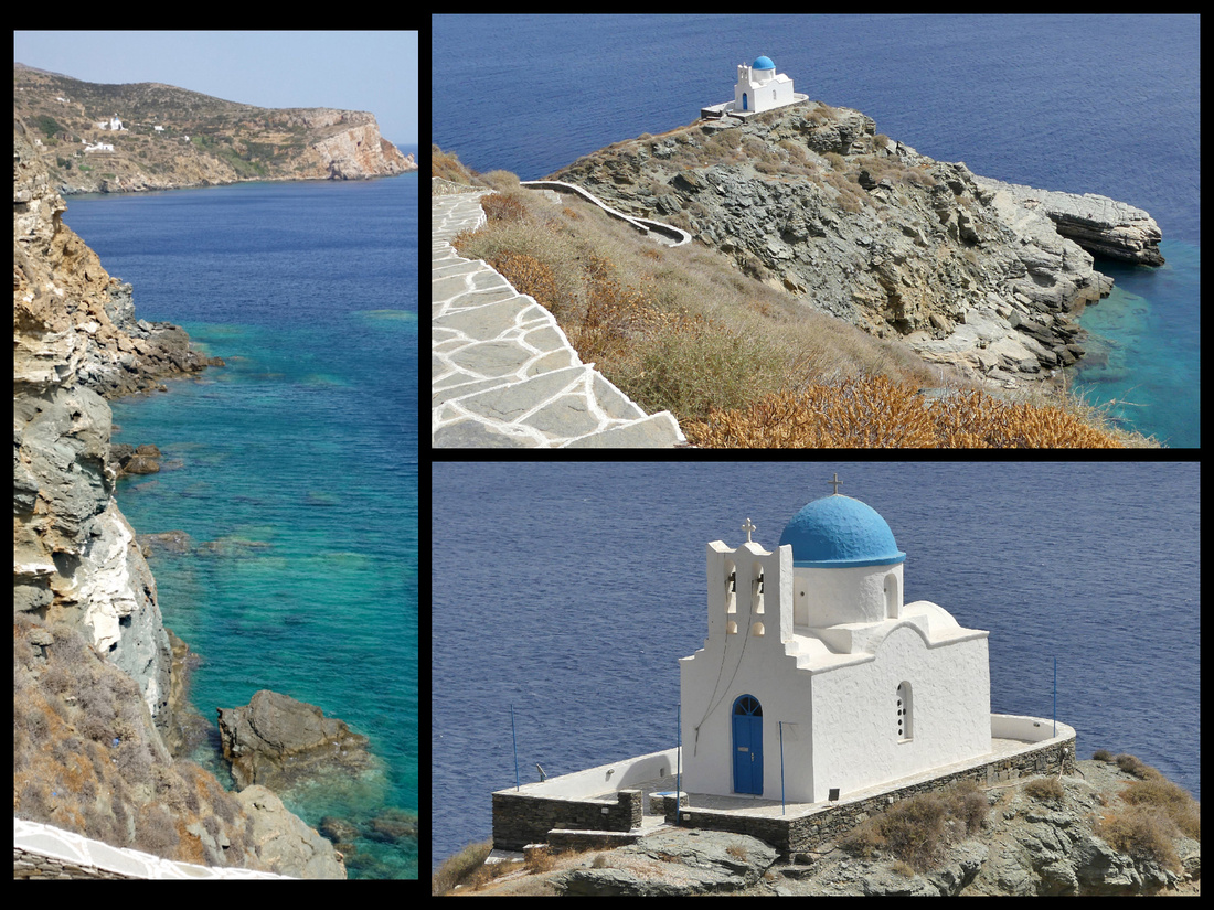
I noticed that the water around the promontory had striking differences in color from turquoise to light blue to dark blue – and this phenomenon occurs all over the Aegean and Mediterranean seas. So I looked it up. The reason the ocean is blue is due to the absorption and scattering of light. If there are any particles suspended in the water, like algae, that absorb certain wavelengths of light, it will alter its characteristics. When water is very deep there are no reflections off the sea floor, the water appears as a very dark navy blue. In tropical waters there is often very little suspended in the water so it is clear and takes the natural blue of pure water. Some types of algae and other microorganisms will make the water look green or turquoise, especially when it is not very deep. Also, the Mediterranean Sea does have tides, but they are of a very low amplitude, a few centimeters compared to the Atlantic where tides are a meter or more.
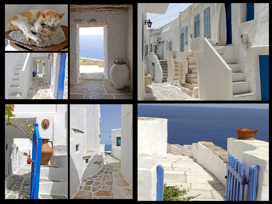
Center of medieval Kastro
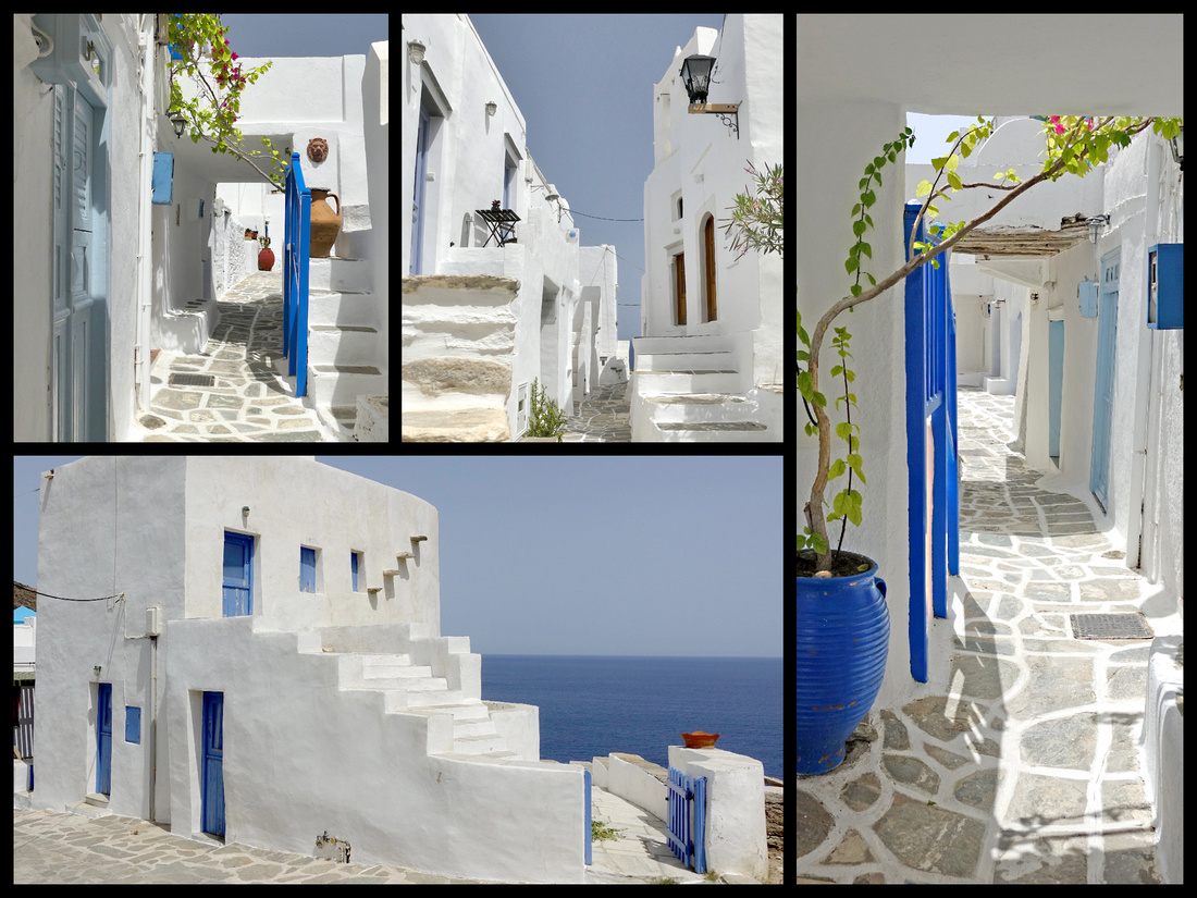
What I did with three days on Sifnos. The first afternoon I took the bus up to Apollonia but my timing was terrible – it was the middle of the afternoon and very hot and of course nothing was open and the streets deserted. OK for shooting photos but the atmosphere and the heat were less than perfect. Fortunately the beach in Kamares is wonderful so cooled down back there. On my second day I went back up to Apollonia in the morning, much nicer, and then began the highlight of my time on Sifnos, the walk to Kastro. The walk was idyllic and Kasro one of the most picturesque villages I’ve seen in Greece. The third day I had planned a day trip to the next island over, Serifos, but a lazy day on the beach seemed like a better idea at the time (of course now I wonder what Serifos is like, oh well, will have to return). All three evenings, after dinner at various tavernas on the water I walked up to the little chapel on the hill for sunset.
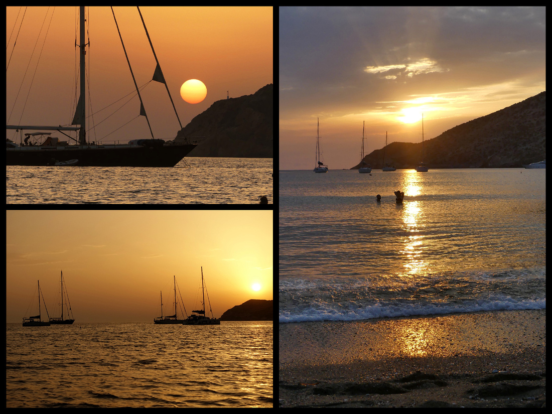
My last two days in Greece were back to Santorini (it is a three hour ferry from Sifnos) where in addition to just wandering and gazing at the view in Fira and Oia, I visited the inland village of Emporio. I then flew to London for five days before returning home. And while after a 37 day trip I was glad to be home, within about two days I wished I were back in Greece.
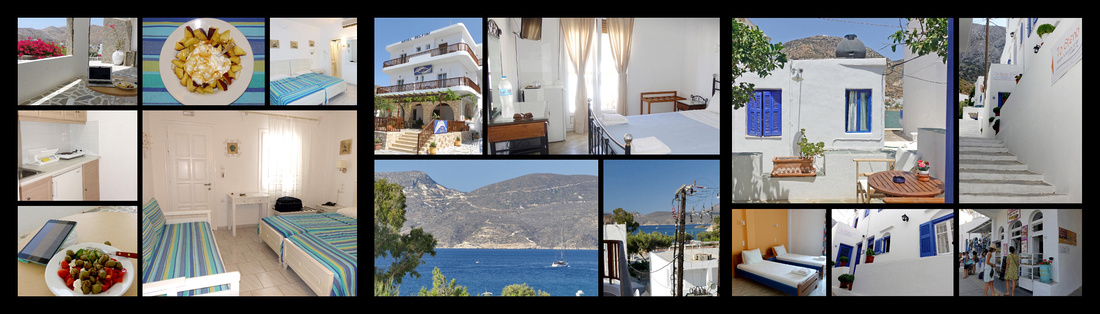
The hotels: Left: Vardia Bay Studios, Folegandros Center: Hotel Delfini, Milos Right: To Steno, Sifnos
]]>Five Weeks in Northern Spain (and Basque France) - Part 1
When I set out to put together an itinerary of Northern Spain including Basque France I knew of the Camino de Santiago but certainly it was not a focus of the trip. It was just coincidence that my trip was to be five weeks and that’s exactly how long most people take to walk it, if they do the entire route. But as the trip took shape I realized I would essentially cover most of the two most well known/well traveled Caminos, the Camino del Norte and the Camino Frances. And while I didn’t ‘walk’ either of them (technically) I did walk a total of 315 miles over the five weeks (the Caminos are ‘about 500 miles’, though you can get your certification for having walked it with as little as 112km/70 miles), and much of that was on one Camino or another. (My best day was 13.3 miles, worst was only 5, averaged 9.3 miles/day). But I traveled from place to place by bus and car and did my walking on day trips, and most of that exploring the cities, towns and villages rather than walking between them. As it turned out though, virtually every place I went was on a Camino – mostly those two main ones, but there are many more “Caminos” and I certainly found myself following the yellow arrows/ yellow scallop shells on blue background signs everywhere I went. Surrounded by pilgrims. It really became a focus of the trip much more so once I was there (as opposed to the planning stage) and I think made the whole trip more fun and interesting. They say the Camino ‘calls you’ and I certainly heard it, almost daily, saying ‘here I am’.
While I did a big loop that covered most of the Camino del Norte and Camino Frances, I did not do it in what most people would consider a logical sequence - but there was a logical reason for this. I can take a 5-week vacation but my husband can only manage about 2½ weeks. In previous years I’ve gone one or two places, then he’d fly over and we’d go another place (last year I went to the Baltics, met him in Italy and then we went to Greece, the year before I went to Malta, then we met and went to Italy, year before that I went to Norway, Poland and we met in Italy – you get the idea). But since this trip was to be just Northern Spain (with a few days in the Basque corner of France) I decided to do the larger cities on my solo portion (he prefers more rural areas, plus the cities are easily connected by bus) and then we rented a car for the second half. Thus I ended up crisscrossing the Caminos and doing more of a figure eight than a loop.
So – the itinerary ended up – Solo Part:
London (2 nights)
Bayonne (4 nights) (day trips to Biarritz, St Jean Pied du Port [Camino Frances] , St Jean de Luz)
San Sebastian (4 nights) [Camino del Norte] (day trip to Hondarribia/Hendaye) [Camino del Norte]
Bilbao (3 nights) [Camino del Norte] (day trip to Portugalete/Gexto) [Camino del Norte]
Santander (3 nights) [Camino del Norte]
Burgos (3 nights) [Camino Frances]
Leon (2 nights) [Camino Frances]
leaving Leon we rented a car and did: Astorga [Camino Frances] and Ponferrada [Camino Frances]
en route to Lugo (1 night) [Camino Primitivo]
Santiago de Compostella (2 nights) all the Caminos
Ribadeo (1 night) [Camino del Norte] Cathedral Beach and Cudillero [Camino del Norte] en route to
Oviedo (1 night) [Camino Primitivo] Ribadesella [Camino del Norte] en route to
Potes (1 night) [Camino Lebaniego] (Picos de Europa)
Santillana del Mar (3 nights) [Camino del Norte] (day trips to Comillas, San Vicente de Barquera,
Altima caves) [Camino del Norte]
Laguardia (1 night) Peunte La Reina [Camino Frances] en route to
Olite (2 nights/day trip to Ojue/Monastery Leyre, Castillo Javier) [Jacobean route of the Camino Frances]
and last night at Madrid airport (Barderas Real Desert Park en route)
The total trip was 34 nights, including the first two in London (last few years I’ve found excellent fares to London and then flew Easy Jet (or Ryan Air) to my ‘actual’ destination). This year I flew Norwegian (for $279), non-stop and it was great. Had almost no jet lag. There was no way I could get from the US to Biarritz without long layover/convoluted routes costing far more. (And had the same experience last year when my destination was Estonia). Anyway, I love London, know my way around, stay in the same hotel so it’s a pleasure to have a day or two there to start my trips. My husband flew Aer Lingus to Madrid and we flew that together on the way home.
Camino de Santiago de Compostela
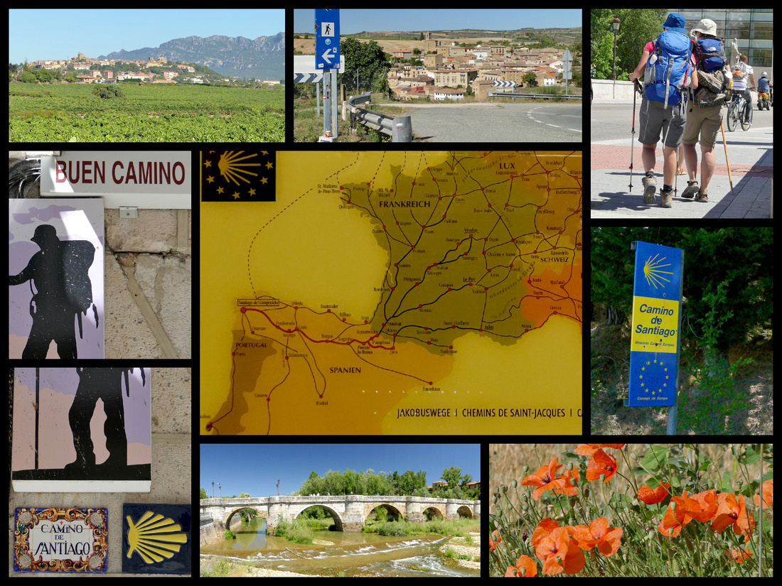
Since we got home and began telling people about our trip we discovered that few had ever even heard of the Camino. Now I know I’m a travel nerd and spend an inordinate amount of time on Fodors and other travel sites, but that still surprised me that so few knew of it. If you search ‘Camino’ on Fodors you get lots of threads, and I know there are numerous Fodorites who have walked at least portions of it. And I know a couple of ‘actual’ people who have walked it. So here’s the basic info on it.
The Camino de Santiago, (the “Way” of Santigo), is the longest-established “tourist” route in Europe, a thousand year old medieval pilgrimage route to the city of Santiago de Compostela where the tomb of St James is located. There are actually many routes, back in day you began the pilgrimage from where ever you lived, but today there are more than a half dozen well-known routes. Collectively the Caminos are a UNESCO World Heritage site.
The most well known is the Camino Francés, a 500 mile (798 km) route which begins in the French Pyrenees town of St Jean Pied du Port (63% of people doing a “Camino” do this one). The Camino del Norte, also about 500 miles, which begins at the border of France and Spain and follows the coast (16%) is the oldest, sometimes referred to as the “Original”. The Portuguese Camino starts in Lisbon (18%) and the Camino Ingles (3%) is the route English pilgrims who arrived in Spain by boat would follow. There are several others.
CAMINO FRANCES
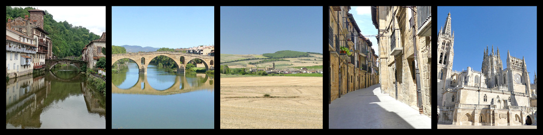 St Jean Pied du Port, France Puente La Reina Sansol LaGuardia Burgos
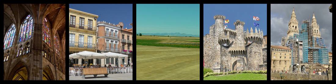 Leon Astorga Ponferrada Santiago de Compostela
CAMINO DEL NORTE
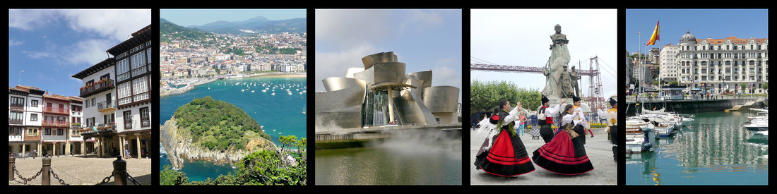 Hondarribia San Sebastian Bilbao Portugalate Santander
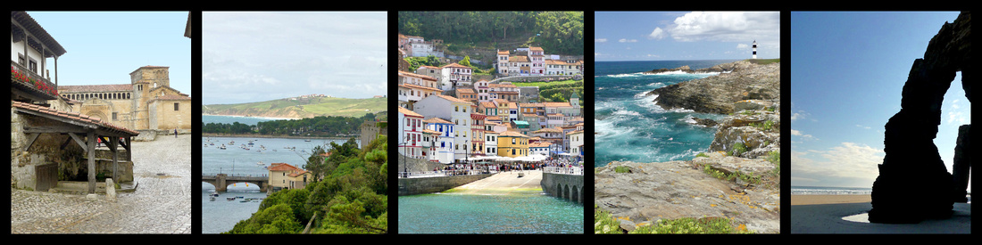 Santillana del Mar San Vicente de la Barquera Cudillero Ribadeo Cathedral Beach
The history of the pilgrimage to Santiago de Compostela stretches back more than 1000 years to the discovery of the body of St. James during the reign of King Alfonso II (792-842). St. James, one of the apostles closest to Christ, was already revered, but with the discovery of his relics it became a focal point for pilgrims. A hermit named Pelalyo saw in the sky what looked like masses of stars falling on the fields – a ‘campus stellae’ and in that place the remains of St James had been buried. By the early 12th century, Santiago came to rank with Rome and Jerusalem as one of the great destinations of medieval pilgrimage. Although the shrine was visited by the great – Fernando and Isabel, Carlos V, Francis of Assisi – you didn’t have to be rich to do it. The various roads through France and northern Spain that led there, collectively known as El Camino de Santiago were lined with monasteries and charitable hospices. Villages sprang up along the route, and an order of knights was founded for the pilgrims’ protection. There was even a guidebook – the world’s first – written by a French monk called Aymery Picaud, which recorded, along with water sources and places to stay, such facts as the bizarre sexual habits of the Navarrese Basques (said to protect their mules from their neighbors with chastity belts). It was an extraordinary phenomenon in an age when most people never ventured beyond their own town or village.
Today the Spanish government has made a huge effort to promote the camino, maintaining an extensive network of inexpensive pilgrim hostels along the separate routes that converge on Santiago. Private companies have gotten into the act as well and there are many ‘tour’ groups, as well as companies that will transport your pack from inn to inn, etc. While many pilgrims stay in the ‘official’ albergues (aka hostels) which feature dorm room type accommodation with bunk beds, shared bathrooms, etc. there are also other options in most of the villages, towns and cities such as pensiones (aka hostals) which are family run small hotels, posadas (same only in historic buildings that have been refurbished), casas rurales (essentially a B&B), and Paradors (luxury hotels that are state run usually in historic buildings such as castles or monasteries). Oh and regular old hotels.
As Galicia is on the coast, there is a lot of shellfish. In the Middle Ages, whenever pilgrims finished the Camino, they would pick up a scallop shell off the beach and carry it back with them as proof of having walked the Camino. Today, most pilgrims begin the walk with a shell attached to their backpack, and virtually all of the way markers and guideposts feature a yellow shell on a blue background. Most cities and towns have bronze scallop shells imbedded in the streets marking the route through town. And of courses every shop along the way sells scallop shell trinkets and jewelry, as well as the actual shells. I actually cannot understand why anyone would need an organized tour, the Camino is so well marked I can’t see how you could get lost.
While back in medieval times most pilgrims walked the Camino for religious reasons (the journey guaranteed a remission of half the time in Purgatory) some did it for adventure, social fashion, or opportunities for marriage or even for crime. In the 12th century it is estimated that half a million pilgrims a year made the pilgrimage. Today most Peregrinos (pilgrims) are not religious, even if you include ‘spiritual’ reasons along with ‘religious’ reasons it accounts for less than half. Other reasons given are adventure/challenge, sport, Spanish culture/history, and actually for the majority it is ‘time out’, a chance to take a break from life. Whatever the motivation, the camino’s popularity has exploded in recent decades; by the early part of the 20th century almost no one registered to walk the Camino, in 1986 there were 2,491 recorded pilgrims, by 2016 there were 277,913 and 2017 so far is seeing about a 20% increase over 2016 (statistics mostly from the official Pilgrim office in Santiago). A huge amount of the increase in recent years has been in English speaking pilgrims. In total about 45% are Spanish, followed by Italian (15%), German (13%), American (9%), Portuguese (8%), French (5%), Irish (3%) and English (3%). 18% of Pilgrims are over 60 years old, 27% are under age 30. The male/female split is just about 50/50.
To do the ‘entire’ Camino, either the Camino Frances or the Camino del Norte, takes about 5 weeks (about 500 miles each) but actually only about 12% of those doing the most popular Camino Frances actually start in St Jean Pied du Port, more than half start in Sarría, 115km (71 miles) from Santiago, which is the last major town where you can start walking and still earn a compostela. And of those who do start in St Jean or elsewhere, many ‘hop-scotch or leap-frog’ taking buses or even taxis to cut out long stretches. The bus from Burgos to Leon was about ¾ full of pilgrims, and, as the bus followed the Camino, more got on at various stops along the way. Also, a lot of people walk stretches of the Camino at a time, a week or two, or even just a few days at a time.
One reason many people do not walk the entire routes at once (other than time) is that a good deal of the Camino is not all that pleasant. About 60% of the Camino Frances is on paths/tracks, the rest is on roads, sometimes highways. And even the paths/tracks often are within sight of, or even right next to, roads. According to one website, 95% of the time you are within earshot of car traffic. Another site explains: “This is an ancient pilgrimage trail that dates back thousands of years, way before there were highways, cars, or bikes. The trail was created since it was the most accessible, and easiest way across Spain to Santiago for trade and religious reasons. As the years have gone by the infrastructure ‘Gods’ have also recognized that this is the easiest and best way across Northern Spain, therefore roads sprouted up along the trail. So about 30% of the Camino is not pretty and some of it can be down right ugly and unpleasant includingwalking on the busy roads where there isn’t even a shoulder and sometimes walking through major industrial zones between factories. The entrances and exits to big towns such as Burgos and Leon can be mind numbing as you walk along and under/over major highways as well as past industrial parks”. www.ottsworld.com/blogs/camino-de-santiago-ugly-photography/ www.ottsworld.com/blogs/camino-de-santiago-faq%e2%80%99s/
Some people compare the Camino to major hiking routes in the US such as the Appalachian Trail or the Pacific Crest Trail but there is a huge difference. Those are wilderness trails and the Camino is not. Also especially in summer the Camino can get rather crowded so people seeking solitude may not find it. On the other hand, for many people that is exactly what they find so special about the Camino – the people they meet. But several websites talk about the ‘bed race’ and strategies to assure you get a place to sleep each night. I know many of the hostels I passed had ‘complete’ (no vacancy) signs on the doors. On the other hand, you don’t need to carry days or weeks worth of food as it is readily available every few hours, and you don’t need to carry a tent/sleeping bag.
I did some research on the Camino while planning my trip, but once there the Camino became a much more important part of the trip than I expected it would, and so when I returned home I did more research (see above statistics). I now realize that while I didn’t carry all my stuff on my back every day (many pilgrims do not, ‘tours’ carry the stuff for you and even many individuals have their packs transported for them), and I didn’t stay in albergues (many pilgrims do not, they stay in all manor of lodgings, especially those on tours but individuals too) and I didn’t cover the whole 798 km (only 12% do that) I DID ‘do’ the Camino.
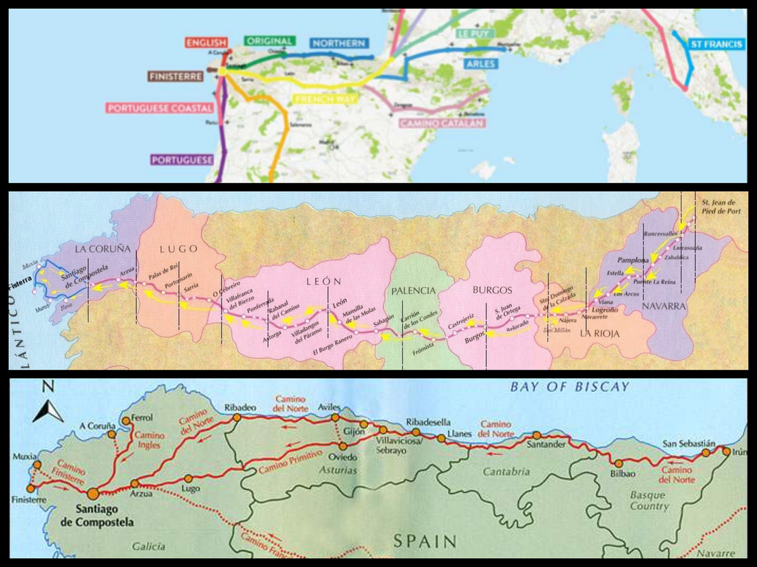 Top: All the Caminos Middle: Camino Frances Bottom: Camino del Norte
OVERALL IMPRESSIONS
Overall I enjoyed the trip immensely, saw some wonderful and amazing places, am glad I did it, probably would do the same itinerary again knowing what I know. In general I think 5 week trips are more enjoyable split between two or more distinct cultures/areas, and while this was a whole five weeks in just one third of one country (plus few days in Basque France which was pretty similar) there was quite a variety of landscape, weather and architecture which ranged from cool, green Galicia to the hot plains of Castile y Leon to Europe’s only desert.
Of course there is even more to see than I did, places I wish I’d had time to get to. And even in this small patch of northern Spain, the scenery and weather was different north of the mountains than south. But the food, the general ambiance, etc. – despite part of it being in Basque ‘country’ it was all pretty culturally similar. In fact, to me anyway, Basque France was clearly France and Basque Spain clearly Spain rather than feeling “Basque”. Only main difference I felt was the language. In Basque Spain everything was in Basque and Spanish. Elsewhere in Spain and in France it was Spanish (or French) but with English ‘subtitles’.
Language – I am terrible with languages, always have been (the only course I every flunked was French). But I type out ‘cheat sheets’ of common words and phrases and try to use local language to at least ask if they speak English or state that I don’t speak Spanish. Since I’ve been to Italy so many times I’ve found I can at least read at bit of Italian though I can’t say/understand much. Same with French. But in most of my travels I’ve found people in Europe do tend to speak at least a bit of English. This trip I found the least English spoken than just about anywhere else I’ve been including other parts of Spain. Still, I got along fine, everyone was willing to help. My best experience was the woman in Hondarribia who did the ‘chicken dance’ to tell me there was chicken in the sandwich I was buying. A few people essentially implied ‘if you don’t speak Spanish it’s your problem’ but most were more than willing to pantomime what they were trying to say and to try to understand me.
Weather – I’ll admit I am more weather – especially sun – dependent than most people. Maybe it’s just me, maybe it’s because photography is such a central focus of my trips (and with photography “it’s all about the light”). I can take it cool or hot and don’t much care, but I need sun most of the time. I guess that’s why I love Italy and Greece and Provence and southern Spain so much. Well I knew there was more of a possibility of rain in the north, after all it’s the ‘green’ part of Spain and places don’t get green without some rain. But I had quite a bit of rain/clouds. Of my 34 days only 14 were all or mostly sunny (and those mostly in Castilla y Leon, La Rioja and Navarra – only a handful of totally sunny days in the far north of Galicia, Asturias, Cantabria and Basque country). Not all the rest were complete washouts, but ‘partly sunny’ often meant only an hour or two.
Food – OK, to start off, I am not a foodie. I like to eat as much as the next person, but that has never been a priority of my trips. And while I do like to sample different and local cuisines, I actually prefer ‘street food’ types of things (and desserts) to elaborate, expensive meals. And especially in the summer both my husband and I like to eat light. And on top of that, my husband is on a low salt diet. We both love traveling in Italy because you can pretty much always get a great pizza or just have the pasta course in a restaurant. And gelato is everywhere. But generally food in Spain was way less satisfying than Italy – but also less satisfying than most other countries I’ve been to. Probably my least favorite trip in terms of food.
It’s hard to eat light in Spain - other than tapas/pinxtos – most places have a ‘menu de dia’ which was way more than we wanted. You could certainly order just one course – but then you get just one thing – for example once I ordered shrimp in garlic oil and got a huge dish of just that – good shrimp (swimming in oil with bits of garlic). But no salad, vegetable or potato. Had I wanted I could have ordered those but then it’s too much food and gets expensive pretty fast. Most of the salads all came with tuna, egg and/or ham. We hardly ever found just a side salad. Very few places had English translations, and the guidebook menu translators don’t have the regional names of things. And when we did figure out what was on the menus, most of them featured ham, squid, octopus, sardines and anchovies as well as tripe, pig trotters and blood sausage. None of which are on my list of favorite foods and all of which are very salty. The Iberian ham was wonderful, as were lots of the cheeses, but after a few weeks I got pretty tired of ham and cheese. Some of the tapas/pintxos, especially in the Basque region were wonderful, but ham and bits of salty fish featured heavily.
On any trip of five weeks I eat some meals from markets/grocery stores and did so much more on this trip. There were some excellent fruits and veggies available – peaches, strawberries, cherries, raspberries, cherry tomatoes, red peppers, and olives. Most of the stores also had packaged salads (came with meat, cheese, croutons, dressing). I bought a jar of wonderful honey early in the trip and it lasted till just the last day. Oikos natural Greek yogurt was in all the stores (at half the price it is at home), I ate a ton of that with the honey and fruit. I also frequently found whole grain croissants – don’t know if they are actually better for you than the regular ones, but sounds like they should be, right. And for dessert there were some wonderful pastries, éclairs, etc. And there is a Spanish chain of frozen yogurt shops called Smöoy that I found in every city and was delicious (and healthy if you got the fresh fruit toppings, not so much if you went for the chocolate.)
Coffee (café con leche) was excellent just about everywhere, every day. Panadaria, hotel, café, bar, restaurant – anywhere.
Driving – Roads were excellent and well marked (though the route numbers didn’t always match up with the maps, and they tended to change – and then often change back again). Drivers were mostly rather courteous – not as fast as in Italy, no imaginary third lane like we found in Greece, less tailgating than in France. We lucked out and got a Fiat 500, which we’ve had on several trips in recent years (and which we like so much we are seriously thinking of buying one at home).
We didn’t have GPS and didn’t get lost (at least not seriously) or for very long (or in ways that GPS would have helped). We actually intended to get a local SIM card so we could use google maps but the store we planned to get it in the day we picked up the car was closed and then we found we really didn’t need it. Before the trip I had google-mapped directions to all the hotels, and picked the hotels largely with the criteria that they be pretty easy to find (and have parking) and printed all that out and I had a couple of paper maps that I had purchased on Amazon.
We found every hotel with no problem although in Santiago we missed turning down the street and then had an awful time getting back to it. In Oviedo we found the hotel easily but then drove to the churches and got lost finding the hotel on the way back. And getting to the car return at the Madrid airport was a horror but that was due to construction and lack of signage and GPS would not have helped in that case. Everything else was a piece of cake.
The first half of the trip I went from city to city by bus. Alsa buses go everywhere in Spain, are cheap, comfortable and while it takes a bit longer than driving yourself it is way less expensive (especially when it’s just one person) than having the car, parking, etc. I booked all the reservations on busbud.com and some of the buses were full so I’m glad I had a reservation, but this was summer, I think other times you could have just bought your ticket when you wanted to leave.
I found it interesting that about 99% of the cars I saw on the whole trip were Spanish (E), and of the other 1%, almost all were “NL”. So I guess they don’t get a lot of visitors driving down from the rest of Europe.
General impressions: lots of street music in every city. Benches! – now that’s one thing that Spain does better than most countires. Every city had lots of benches. Water – I think a seaside is the best, but a nice river (as in Bilbao) is good too. Makes such a difference to have that focus. On the other hand, there’s something to be said for hot, dry, and sunny.
Siesta seemed longer (12:30 or 13:00 till about 17:00 in many cases) and more ‘complete’ than in most parts of Italy or France where it seems to be more like 14:00-16:00).
Beware of DCC everywhere in Spain – usually they asked (and plenty of the time it’s just done in Euros) but several times they snuck in the conversion without asking).
Storks and Swallows/swifts – Found throughout Europe in the summer, storks and swallows/swifts seem especially Spanish. I don’t recall any storks in the north, but all over the plains I spotted them, generally on top of church steeples, towers, even just tall poles, usually on the outskirts of cities. They build stick nests, often several on each church or tower. Swifts and swallows (they are two different types of bird from the same family and I’m never sure which it is I’m seeing) are seen all over Europe, especially on a balmy summer evening flitting through the sky as it turns deep blue, then purple, then black. They race around church steeples, castle towers, and ancient bell towers, usually screeching. They build their nests under the eaves or on old stone ledges much more commonly than on any modern structures. Remarkably, they eat, sleep - half their brain remains awake - and even mate on the wing. Swifts eat insects and windborne spiders and when the weather is hot and their food has been carried high on thermals, they follow it into heavens, appearing as tiny specks in the summer sky. I spent a good deal of time just watching them do their thing. Storks, swifts and swallows all spend summers (March to November) in Europe and migrate in winter to Africa.
]]>Less than 20 miles from the Spanish frontier to the mouth of the Adour is the French Basque Coast. Lots of half-timbered houses, brightly colored trim, mostly red. Coastline with crashing waves, the interior hilly and very green (they get a LOT of rain there). French is the main language, I didn’t hear (or see signs) in Basque for the most part (which is different from the Spanish Basque region where everything was in both languages and people were speaking Basque, here they were mostly speaking French). Virtually no one spoke English, just minimally in the hotel, not at all in lots of the shops and restaurants. Heard English spoken by a few tourists, but for the most part I think the tourists are from France, or at least Europe.
The airport, named Biarritz, is between Biarritz and Bayonne. There is a local bus system that goes all around Biarritz, Bayonne and other towns and line 14 runs from the airport to Bayonne (and Biarritz). It takes about half an hour and costs 1€. Several per hour. To travel between Biarritz and Bayonne line 1A takes about half an hour and costs 1€. Modern, attractive (bright pastel stripped buses – pastel stripes are the ‘thing’ around here) buses. The train works best for getting to either St Jean (de Luz or Pied du Port).
I spent 4 nights in Bayonne and did day trips to St Jean Pied du Port, St Jean de Luz and Biarritz. While I had a few sunny hours in Biarritz and Bayonne, most of the time it was cool (60s), dreary, rainy and very windy which most likely explains the fact that this was not my favorite part of this trip (or any trip). Also, this was the only hotel I didn’t really like.
Bayonne –population 45,000, divided by the Nive and Adour rivers. It’s set back about 5km from the coast, but has two rivers and five bridges. A cathedral city and the capital of the Pays Basque, it's characterized by narrow streets full of half-timbered tall buildings (about 5 or 6 stories). The smaller river, Nive runs through the center and the quaysides are full of eateries, which on nice days, have outside seating and street music. In the rain it’s pretty dreary though. The riverside quays are the city’s most picturesque focus, with 16th century arcaded houses. There are several shopping streets, it’s larger than it feels at first. Good selection of places to eat, the only international chain I saw was one ‘Subway’. The cathedral sits on a small square (which was really the only square in town) and is somewhat hemmed in by buildings. Still, it’s an impressive building and its steeples can be seen from a distance. There are some old ramparts (walls) around the edges of the old town, not particularly scenic though. There are two ‘castle’ like structures, one on each side of the river. While I was there four nights I was only in Bayonne itself a few rather early mornings or afternoon/evenings as I did day trips each of my three full days. But that was more than enough to explore the small city. If in the general vicinity Bayonne is certainly worth a visit, it’s just that compared with so many amazing places in Europe it doesn’t quite claw it’s way to become a ‘must see’.
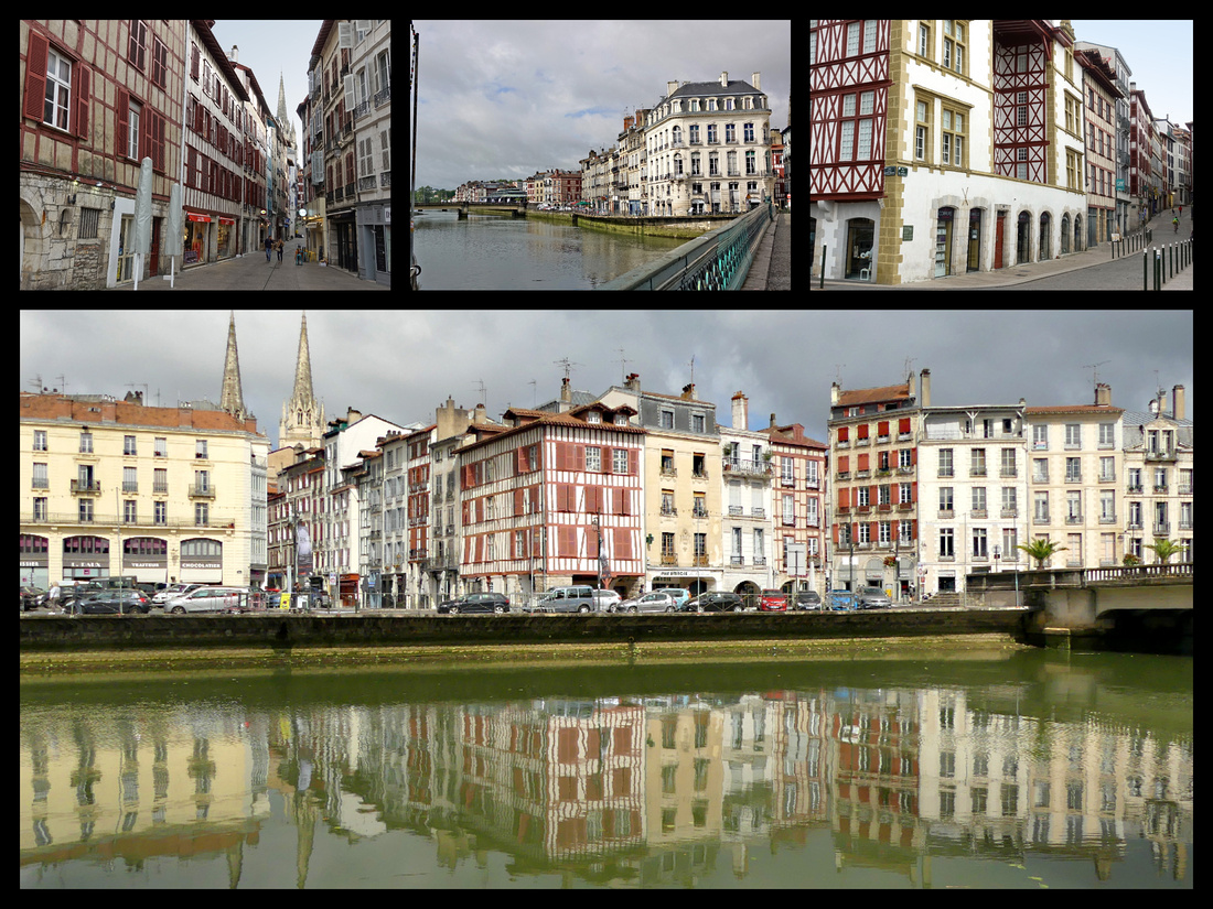
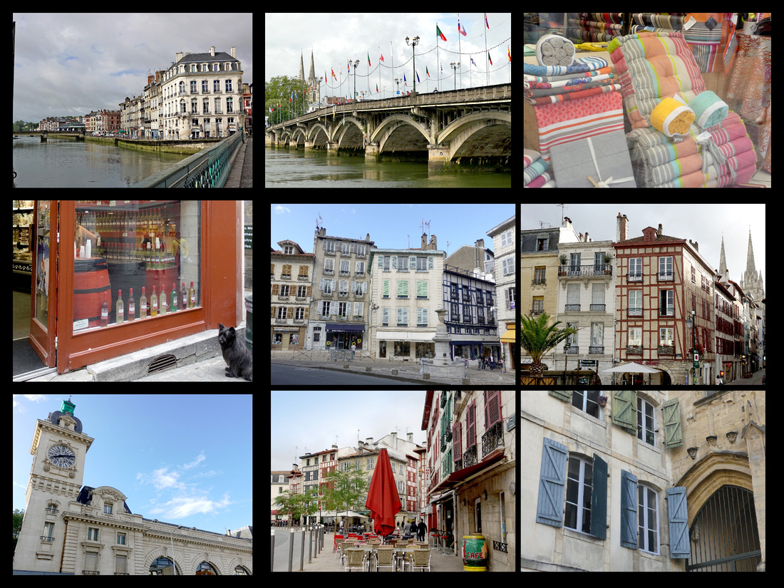
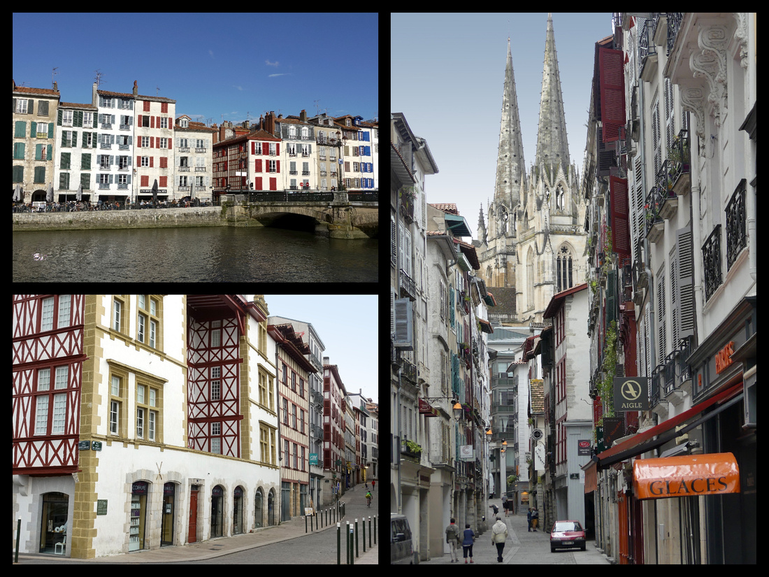
“St Mary's Cathedral is gothic in style and built using locally-sourced white and red stone on the site of a Romanesque cathedral which was destroyed by fire in 1258. Situated in the heart of the historic centre of Bayonne on a mound overlooking the Nive and Adour rivers, the cathedral contains relics of St Léon, a 9th century Bishop of Bayonne and was listed as a World Heritage Site in 1998 as part of the French Pilgrim Routes of Santiago de Compostela. The adjoining cloister dates back to 1240. Constructed in stages between the 13th and 16th centuries, it was not until the19th century that the spires were built giving the cathedral the elegant outline it has today. The chapels are decorated with 14th century style paintings by Steinhel and the stained glass windows are done in the style of Chartres Cathedral.”
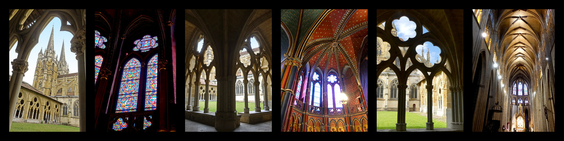
While I don’t find Bayonne listed on any of the current routes of the Camino, logistically this is where you need to come to start either the Camino del Norte or the Camino Frances (unless you had someone drive you to St Jean Pied du Port or Hondarribia) as it’s the only place with public transportation there. There is a pilgrim office in the cathedral so it seems to be ‘on the Camino’ but very few people today start walking from Bayonne, most take a train to St Jean Pied du Port or a bus to Hondarribia/Irun on the Spanish boarder.
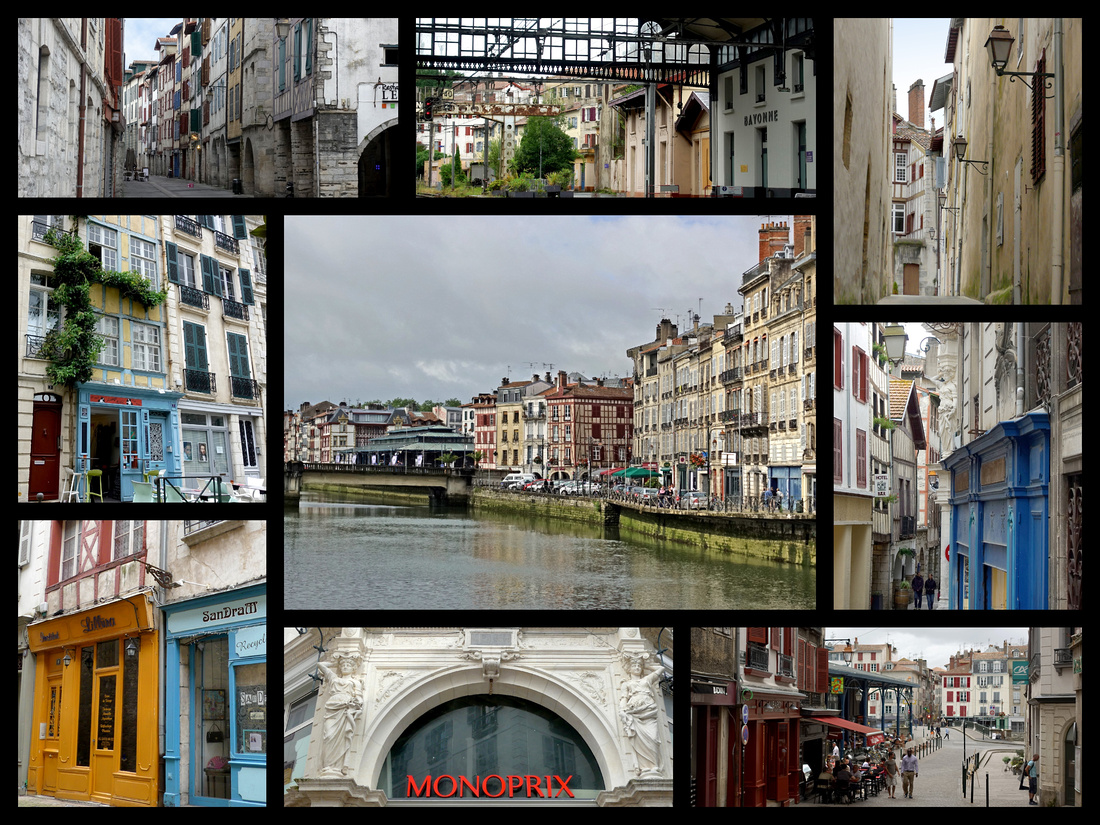
Biarritz – Population 30,000 Up until the 1950s, Biarritz was the Monte-Carlo of the Atlantic coast, transformed by Napoléon III during the mid-19th century into a playground for monarchs, aristos and glitterati. With the 1960s rise of the Côte d’Azur, however, the place went into seemingly terminal decline, despite having been discovered by surfers in 1957. But from the early 90s, Biarritz was rediscovered by Parisian yuppies, a new generation of the international surfing fraternity and a slightly alternative family clientele, who together have put the place back on the map. Eleven miles from the Spanish border.
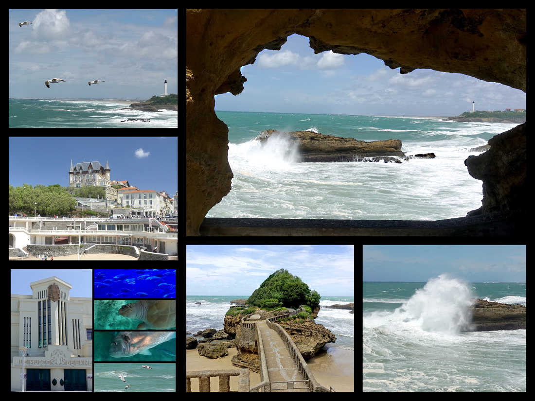
The main feature of Biarritz is the large curved beach, the Grand Plage, with a peninsular arm at one end with the lighthouse, and rocky outcroppings at the other. Alongside the beach is the Quai de la Plage promenade. This wide pedestrian walkway offers stunning views of the breaking waves and the Biarritz lighthouse in the distance. The large Casino, built in the 1930s, is a major feature of the beach. Biarritz is the surfing capital of Europe, heavy winds bring strong surf – this is normally a good thing for surfers. But when I was there the wind – and the surf – was SO strong that surfing (and swimming) were prohibited. It was cloudy and dreary all morning, I ended up going to the Aquarium during a downpour cause what else was I going to do. It’s pretty mediocre and no English signs. But a turtle and a fish are the same in any language. The heavy surf did make for some impressive waves which were fun to watch when it wasn’t raining. And then miraculously the sun came out for two or three hours and Biarritz was much nicer. Still, I wish I had seen it with the brightly stripped beach cabanas that are on all the post cards.
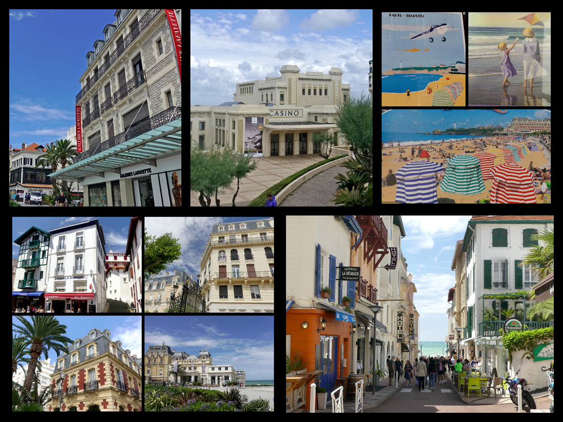
Along the beach is a large casino and the Hôtel du Palais, built by the Emperor Napoleon III for his wife Eugénie, ( Second Empire style). Since 1893, the building has been used as a hotel. The Fishermen Port, originally built in 1870 for local fishermen now mainly houses leisure boats.
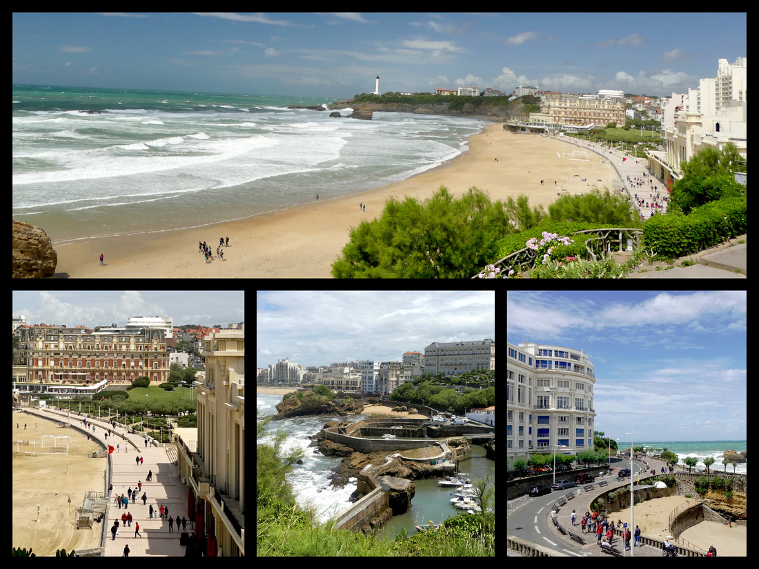
Rocher de la Vierge (Virgin of the Rock) is set on a steep, narrow rock jutting into the ocean. The site is accessible by an iron bridge built by the Gustave Eiffel workshops. As the focal point, a statue of the Virgin Mary stands on top of the rock, looking out towards the sea. There is a great panorama of the coastline from here, extending from the mouth of the Adour River to the Spanish frontier. Vieux Port lies on the other side of the headland. The most atmospheric part of the town of Biarritz is centered on Rue du Port Vieux, which leads inland from the Vieux Port. There are several more modern, and pleasant, shopping streets.
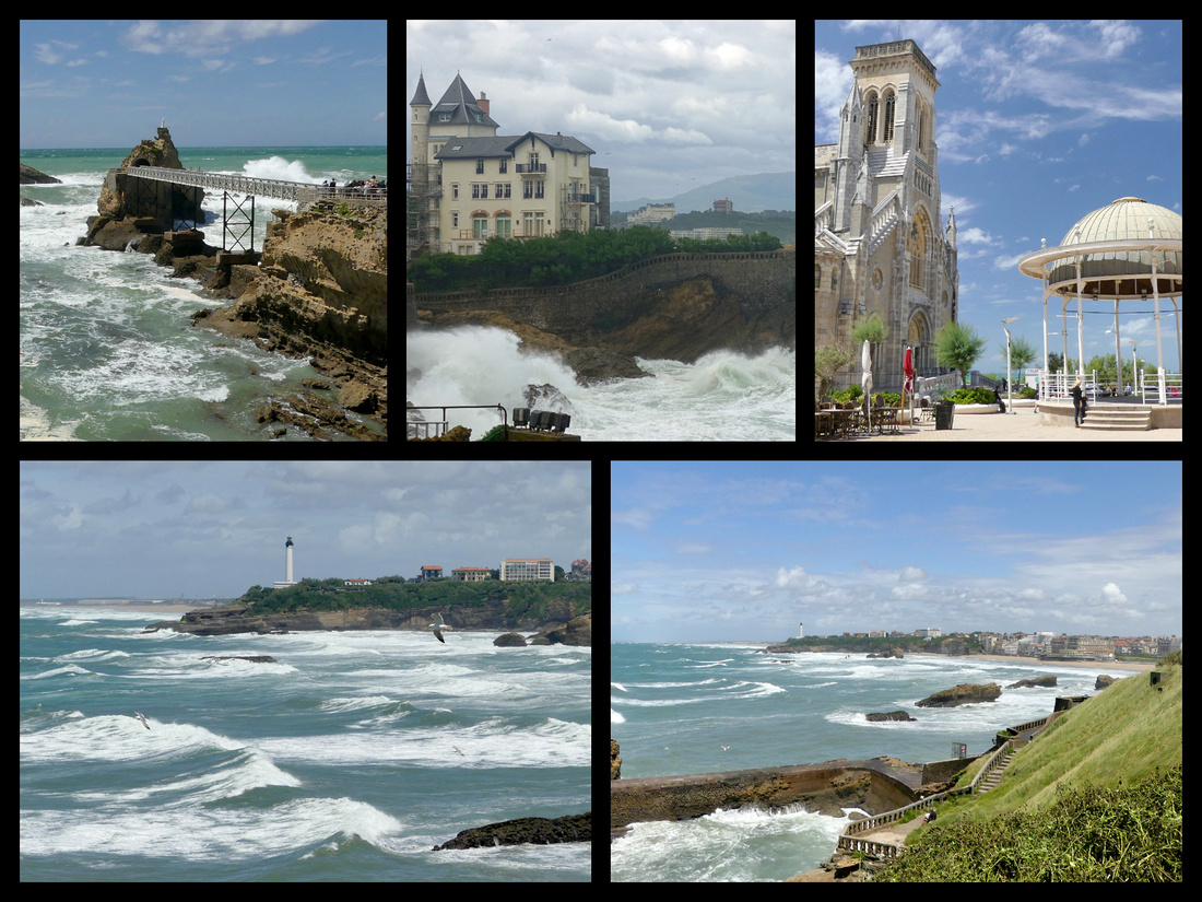
Saint-Jean-de-Luz (16 miles/ ¾ hour train from Bayonne, pop 14,000) A quaint fishing village with traditional Basque character, the old quarter is full of half-timbered buildings, it’s the most attractive town in the area and still one of the busiest fishing ports in the area. Looks like it would be absolutely charming except it was very dark and cloudy and rained most of the day I was there. While there were frequent trains all morning, the options for return trains in the afternoon left me with a choice of one hour or almost six hours! I did opt for the longer time figuring I’d have a nice long lunch somewhere. But it stopped raining for an hour or two and so I walked around the town/beach and harbor and thus delayed lunch till around 2:30 and the restaurant kind of rushed me through my meal as they wanted to close up. So much for a leisurely lunch reading my book; after less than an hour I was back exploring the town in the rain.
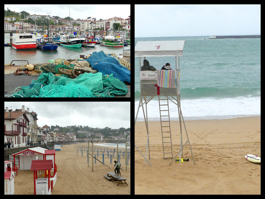
The wealth of St-Jean’s seafaring past is evident in the town’s 17th and 18th century merchant and ship-owner’s houses. Adjacent to the Hotel de Ville on the plane tree studded Place Louis XI is the turreted Maison Louis XIV. The Maison de l’Infante is a pink Italiante villa overlooking the harbor. The church of St-Jean-Baptjiste is on pedestrianized rue Gambetta, the main shopping and tourism street. The churches’ main claim to fame is that it is where Louis XIV and Marie Antoinette were married. There is also an attractive and lively food market (Les Halles) and plenty of shops selling clothing, local food and many featuring the Basque fabric, which is brightly striped.
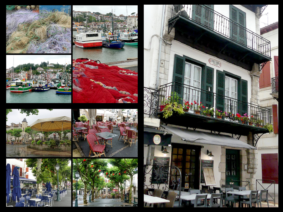
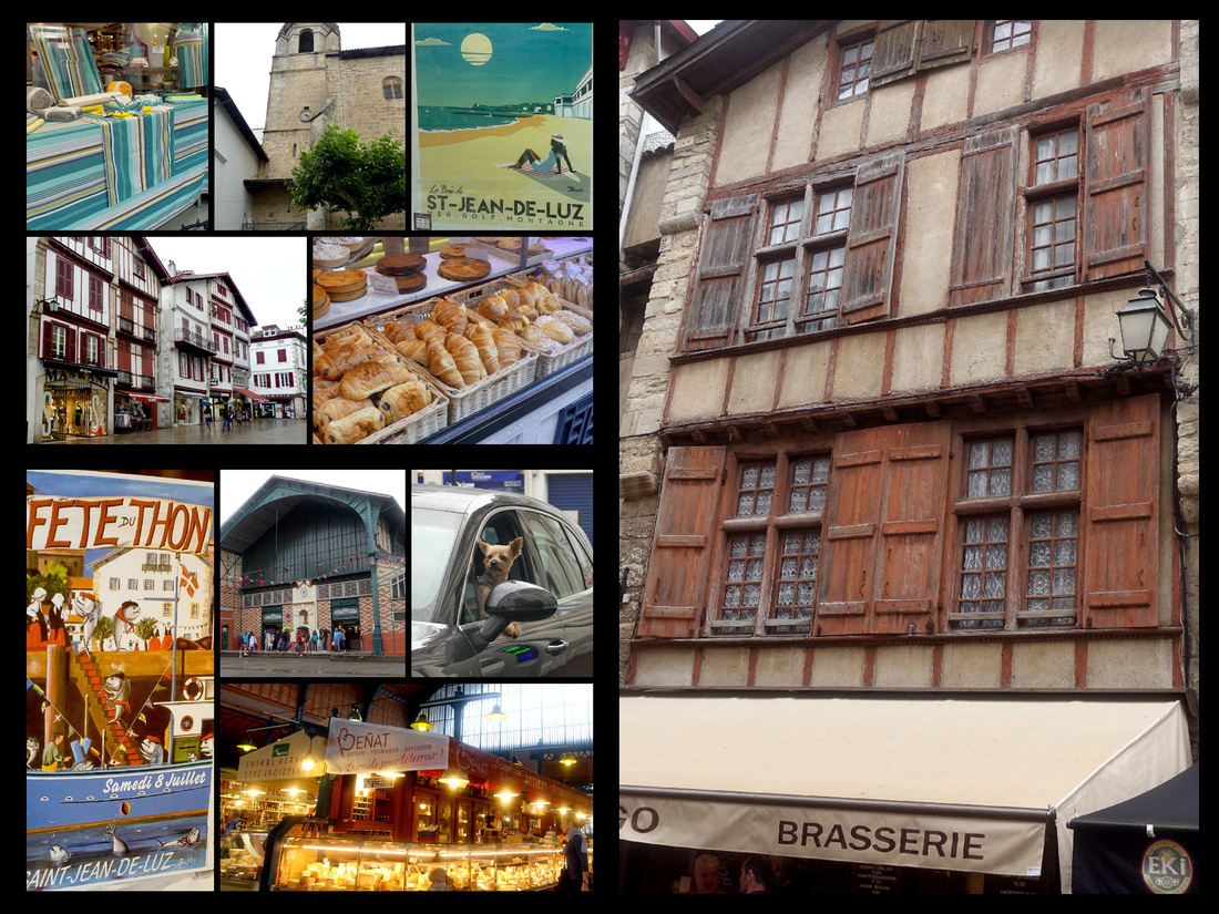
Saint Jean Pied de Port Camino Frances
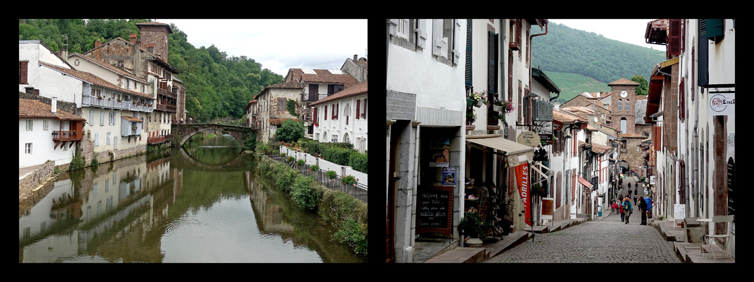
(1 hour train from Bayonne, population 1527) Located at an elevation of 1,300 meters, this medieval town was an important stop on the Camino to Santiago de Compostela and was considered one of the most difficult stages of the pilgrims' journey. Dating back to Roman times this area has been an important passage through the Pyrenees and dating back to the 10th century it has been the meeting point of the Caminos de Santiago that come through from various points in France. Listed as a UNESCO World Heritage Site, the historic old quarter has steep, winding cobblestone streets and stone bridges and a church - the Eglise Notre Dame du Bout du Pont. Literally "Saint John [at the] Foot of [the] Pass", it is now the start of the Camino Frances, the most popular of the Caminos. It is 5 miles from the Spanish border on the River Nive.
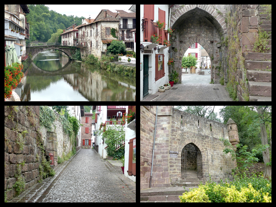
Saint-Jean-Pied-de-Port is the terminus on the railway line from Bayonne through the French Basque Country, along the valley of the river Nive, with two or three services each day. The train station is 1 km from the center of the town.
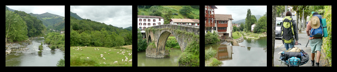
The main street is the cobbled rue de la Citadelle, which runs down hill and over the river from the 15th century Porte St-Jacques to the Porte d'Espagne by the bridge. From the bridge, there are views of the old houses with balconies overlooking the Nive. Many of the buildings are very old, of pink and grey schist, and retain distinctive features, including inscriptions over their doors. One, a bakery, lists the price of wheat in 1789.
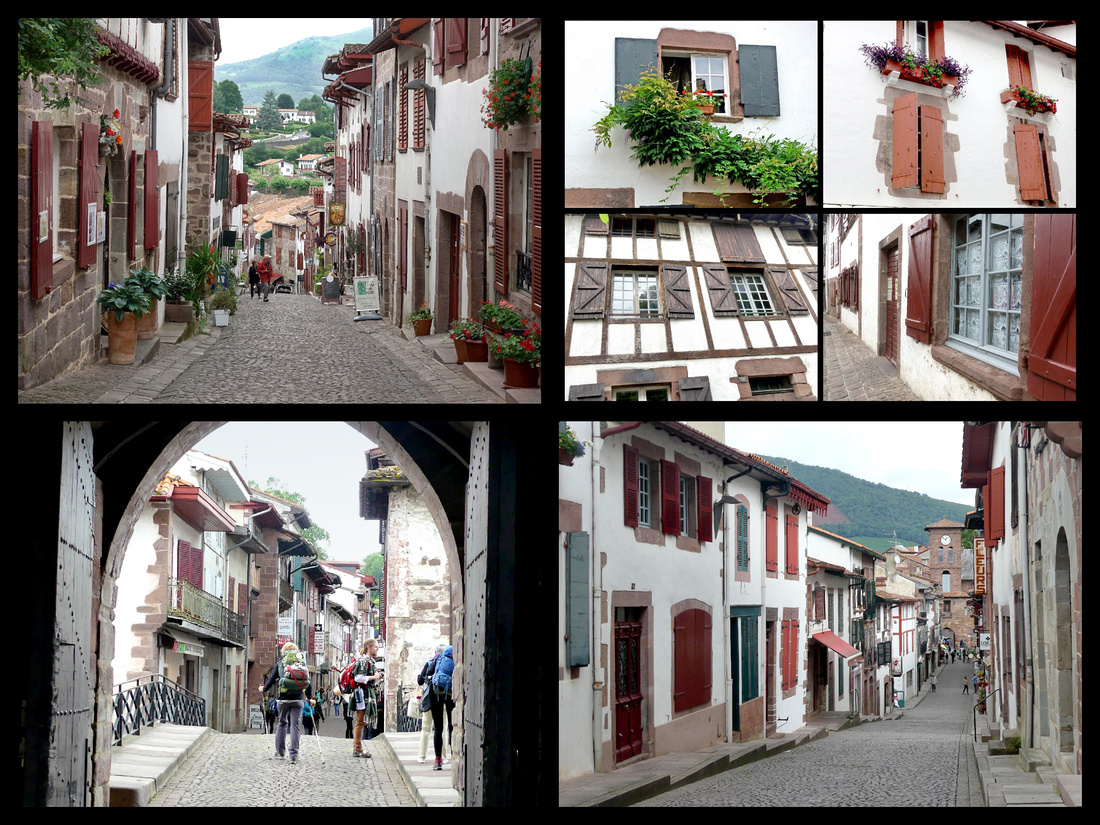
The Camino is pretty much the main thing in town. There actually were a number of ‘regular’ tourists around but the pilgrims, and the pilgrim office, the numerous hostels, and shops catering to hiking were the main feature. I had intended to start the Camino and walk an hour or so, even though I knew I would have to backtrack but I wanted to see what the beginning of the Camino is like. Unfortunately it was raining pretty heavily by the time I had explored the town itself so I just took the train back to Bayonne.
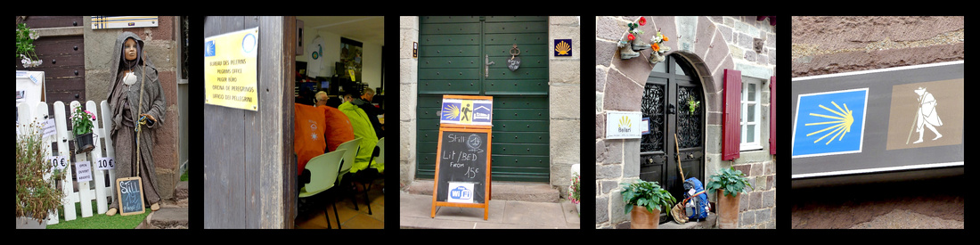 Sign for a pilgrim hostel The official Camino office, people getting their 'passports' More Camino lodging
]]>
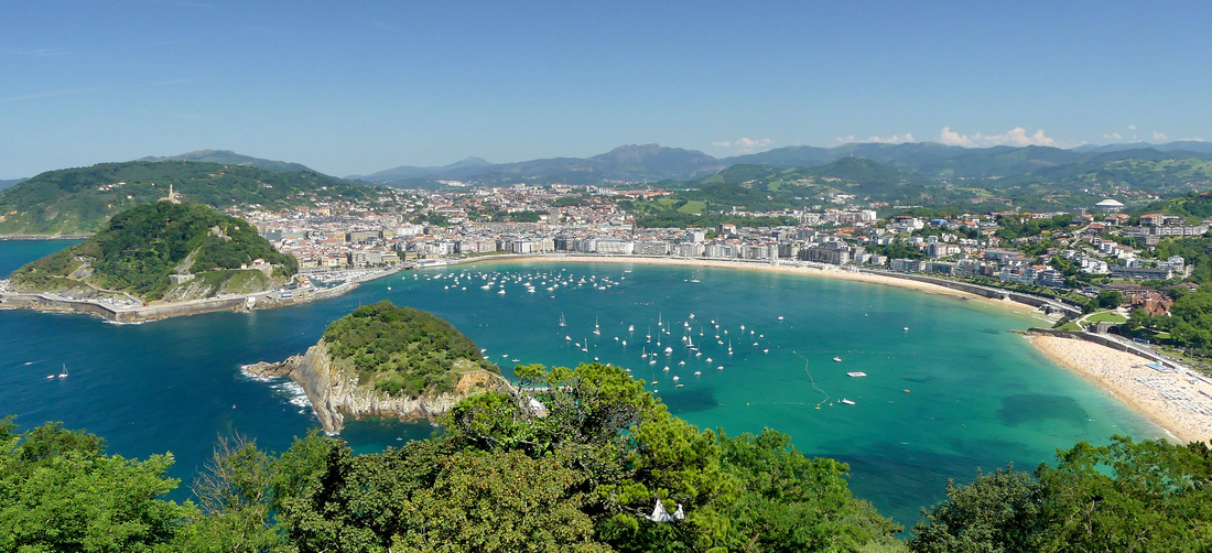
On the Bay of Biscay, 12 miles from the French border, definitely in Basque Country, the city of San Sebastian (Donostia in Basque) was one of the highlights of my five-week trip. The fact that I had great weather and a hotel right in the middle of the Paseo de la Concha may have contributed to my feelings but I think I would have loved San Sebastian regardless. Appropriately, San Sebastian and it’s scallop shaped bay is on the Camino del Norte.
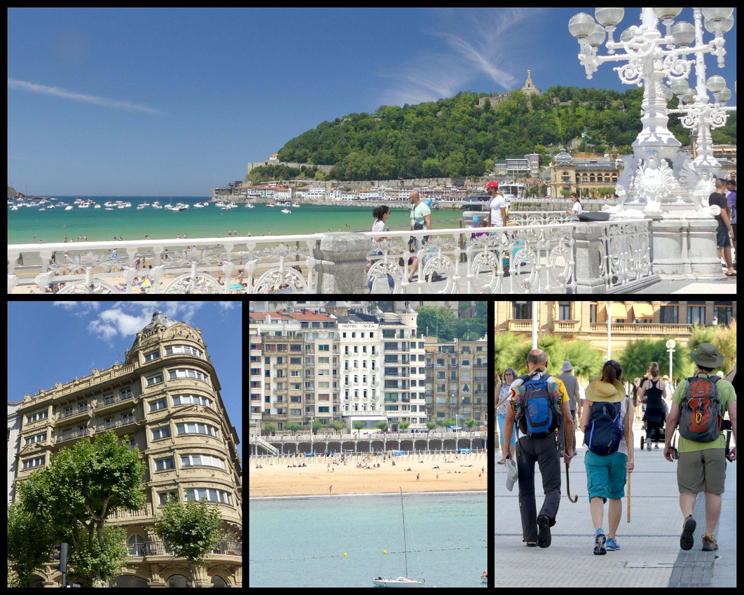
top: Paseo de la Concha bottom left: Área Romántica bottom center: Hotel Niza white building in center bottom right: Camino del Norte
A mixture of Paris and Barcelona, elegant and stately yet with a relaxed beach resort ambiance, centered on the Bay of La Concha capped by twin peaks at each end and a cute little island in the center. The incredibly delightful beachfront promenade, Paseo de la Concha, (2 km) runs the length of the bay, with the old town at one end and a ‘Belle Époque’ shopping district behind. For a century the characteristic and lovingly painted wrought iron balustrade that stretches the length of the promenade has been a symbol of the city, it shows up on everything from jewelry to headboards. The promenade leads at one end to a funicular up to the Mounte Igueldo viewpoint, and at the other end to ’El Muelle’, the little fishing/yacht port, behind which paths wind up to Monte Urguell, topped by the soaring statue of Christ gazing over the city (a kind of Rio de Janeiro aura).
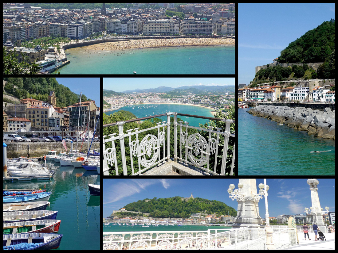
top left: view from Mt Urguell right: Mt Urguell above El Muelle bottom right: Paseo de la Concha with Mt Urguell topped by Christ Statue in the distance bottom left: El Muelle center: view from Mt Igueldo
San Sebastian is a city with about 200,000 population but it feels much smaller. No towering skyscrapers. The Basque culture and language are very apparent there, signs are always in both Basque and Spanish (and sometimes also French, rarely saw any signs in English). People in the tourist trade speak minimal English, but most people were friendly and helpful. I heard a LOT of American English spoken as I walked around the city so clearly it’s on the American tourist map, much more so than other towns in Northern Spain.
I was in San Sebastian four nights/three and half days. One day I took the bus to the Spanish/French boarder towns of Hondarribia and Hendaye and the rest of the time I just wandered around San Sebastian, back and forth all three beaches and their promenades, explored the old town, climbed Monte Urguell and took the funicular up Monte Igueldo. Could have done that for weeks.
San Sebastian has five main areas. The Parte Vieje, ‘old town’, lies across the neck of Monte Urgull, the bays eastern headland. It is neatly underlined to the south by the Alameda del Boulevard whose broad promenade leads into the pedestrianized Parque de Alderdi Eder, which in turn merges with the Paseo de la Concha. South of the Alameda del Boulevard is the sleeker commercial and shopping district, the Centro Romantic [Área Romántica], laid out on a grid pattern with late 19th century buildings.
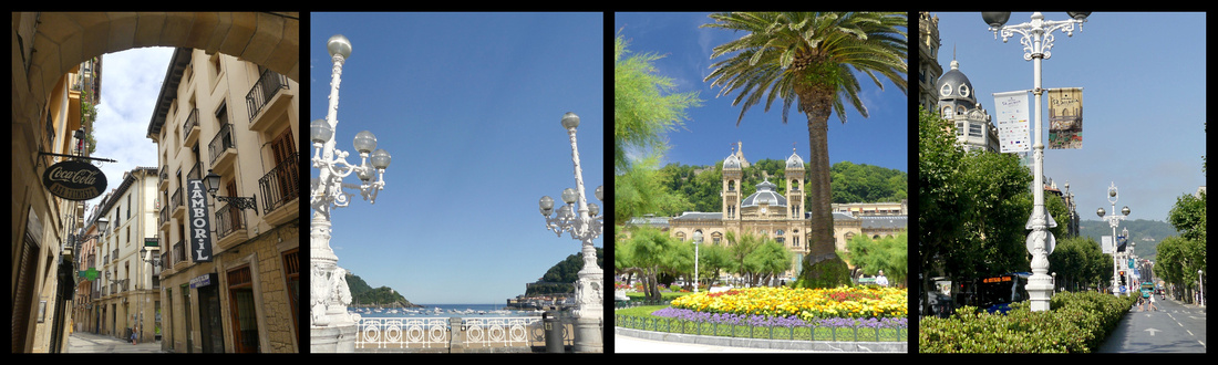 narrow streets of Parte Vieje Paseo de la Concha Parque de Alderdi Eder Avenida de La Libertad
On the east side of the Rio Urumea is the district of Gros, with a relaxed ambience and surfing beach of Zurriola. and at the opposite, western end, of the city is Playa de Ondarreta (essentially a continuation of Playa de la Concha), a very upmarket district known as a millionaires' belt on account of its lavish homes.
Paseo de la Concha runs along the beach and is full of benches and little trees, most of the time people, and much of the time street performers. There are a few kiosks selling soda and ice cream bars but only a couple restaurants so it all open for strolling and people watching. It’s a nice difference from a lot of touristy places where in the summer it’s wall-to-wall tables and umbrellas. In addition to the gorgeous white wrought iron balustrade there are a pair of huge clock towers and at another point, a pair of huge white iron Belle Époque lampposts. In the center is the Perla Spa Thalassotherapy Centre occupying a couple interesting stone buildings jutting out from the paseo (also the only actual restaurants on the Paseo). (Thalassotherapy is the use of seawater, algae, mud, and other marine items as therapeutic treatment.)
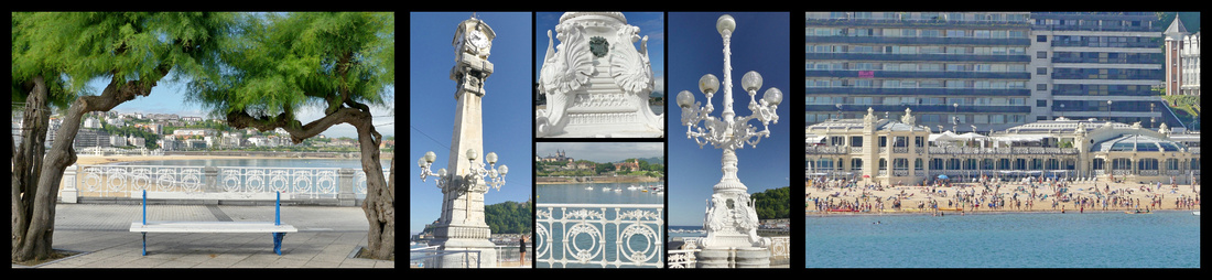
Paseso de la Concha Perla Spa
The Bay of La Concha has very calm waters and the main beach, La Concha Plage has a very wide swath of fine white sand and is frequently awarded ‘most beautiful urban beach’ awards. At low tide the beach is almost 40 meters side. The extension – past the Mirimar Palace, is Ondarreta Plage. The third beach, Zurriola Plage is on the far side of the Urumea River and has larger waves (well, at least they qualify as ‘waves’) so is the surfing beach.
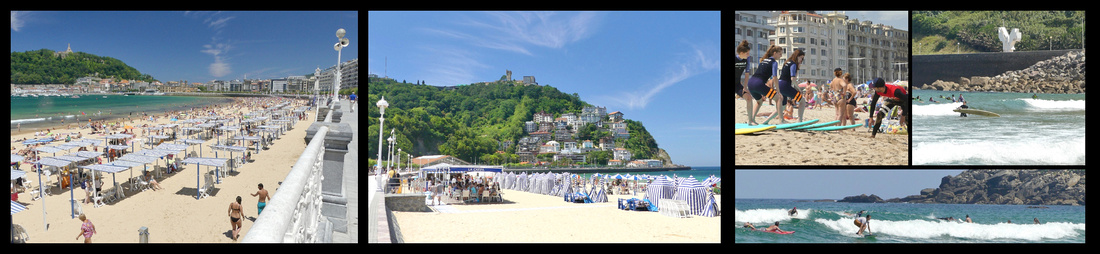
la Concha Plage Ondarreta Plage Zurriola Plage
Palacio de Miramar (Miramar Palace) and park, which divides the crescent in the middle, was where Queen María Cristina resided in 1893, when she made San Sebastian the summer court. She was advised to come here to bath in the sea for health reasons. The Palace is in the Queen Anne Cottage Style.
Antiguo Tunnel passes by the Miramar Palace, joining the two beaches. It is decorated with maritime motifs (supposed to look like the aquarium), one of the legacies of being the European Capital of Culture in 2016.
Isla de Santa Clara is a tiny 30-meter-wide island just off the coast. The island has restaurants and picnic areas. During summertime a ferry runs from the San Sebastian harbor to the island.
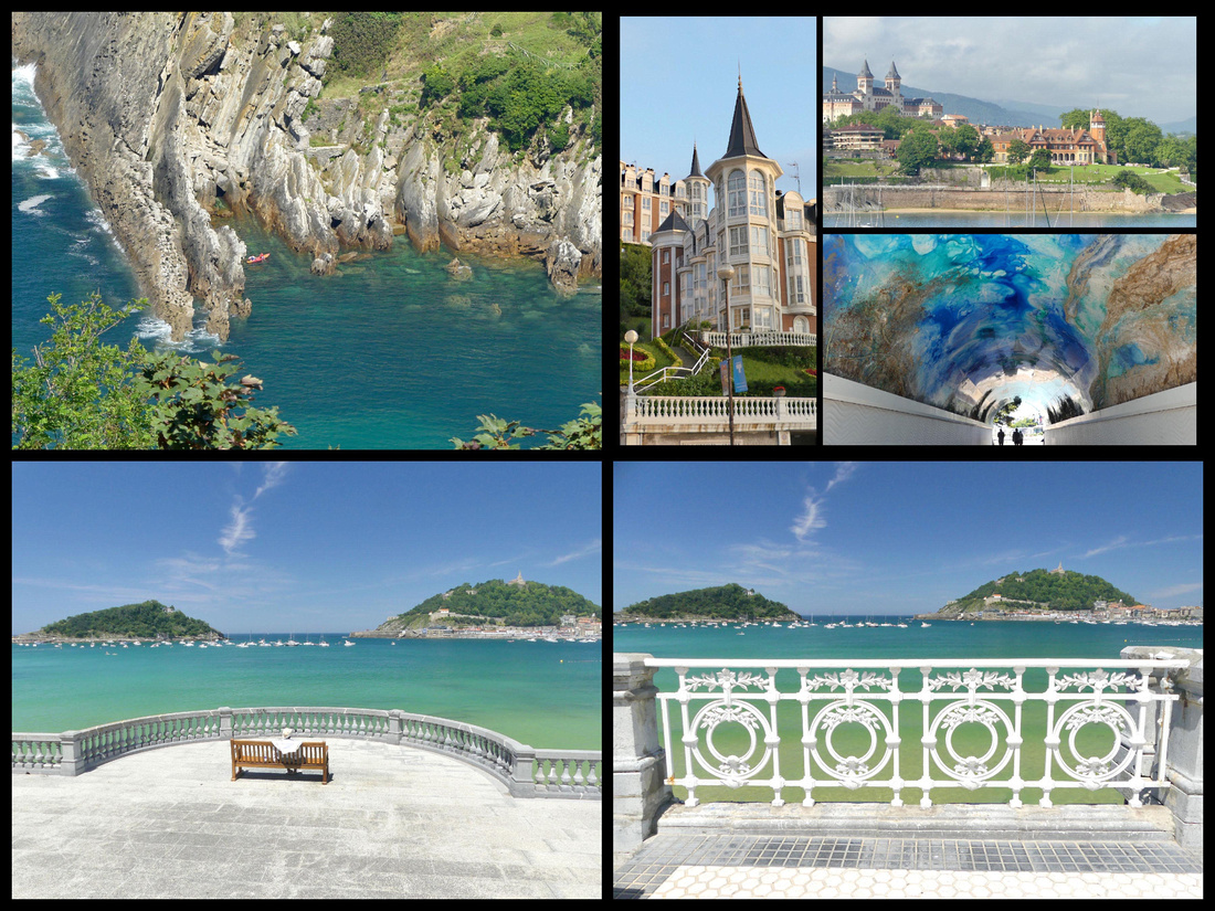
Top left: Isla de Santa Clara top right: Mirimar Palace bottom right & left: Isla de Santa Clara left and Mt Urguell right from Paseo Ondarreta
Monte Igeldo is the higher of the two ‘mini-mountains’ and has absolutely awesome views. There is a turn of the century (Belle Époque Style) funicular which runs up and down every half hour (€3.15 RT). There’s a very old, kind of tacky, little amusement park up there which doesn’t seem to get much action. Virtually everyone just takes the funicular up, gazes at the view and goes back down. The funicular station is just behind the tennis courts where the shore turns.
El Peine del Viento (Eduardo Chillida sculpture), the “Wind Comb” – about 5 minutes past the funicular, at the very end of the promenade are three huge iron sculptures jutting out of the rocks. It’s become one of the symbols of the city. In contrast to the beach area, which has barely lapping waves, the waves crash with some force on the rocks here and can be mesmerizing to watch. I spent at least an hour doing just that (but then I’m easily amused).
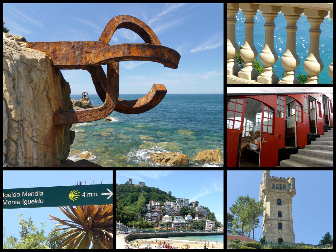
El Peine del Viento Monte Igeldo funicular castello Mt Igeldo
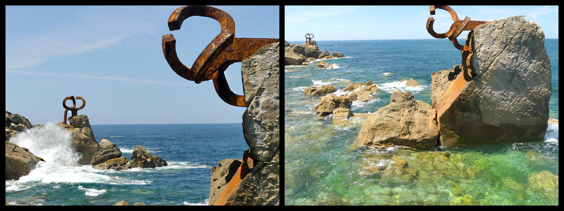 El Peine de Viento Sculpute
At the other end of La Concha Plage is The City Hall on a small plaza, which opens into a tiny park with flowers and a carousel, Parque de Alderdi-Eder. The city hall was originally a casino when it was built in 1897 until 1924.
El Muelle - Beyond the town hall, the Paseo ends at San Sebastian’s small fishing and recreational harbor, El Muelle. There is a passage through the wall at the appropriately named Calle Puerto into the old town. The other side of the harbor, a wide promenade, Paseo Nuevo, encircles Monte Urgull, with panoramic vistas of the Bay of Biscay and goes all the way around to the Urumea River. There is another rusty metal sculpture here, the Construction Vide, not quite as interesting as El Peine del Viento,.
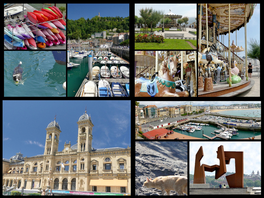
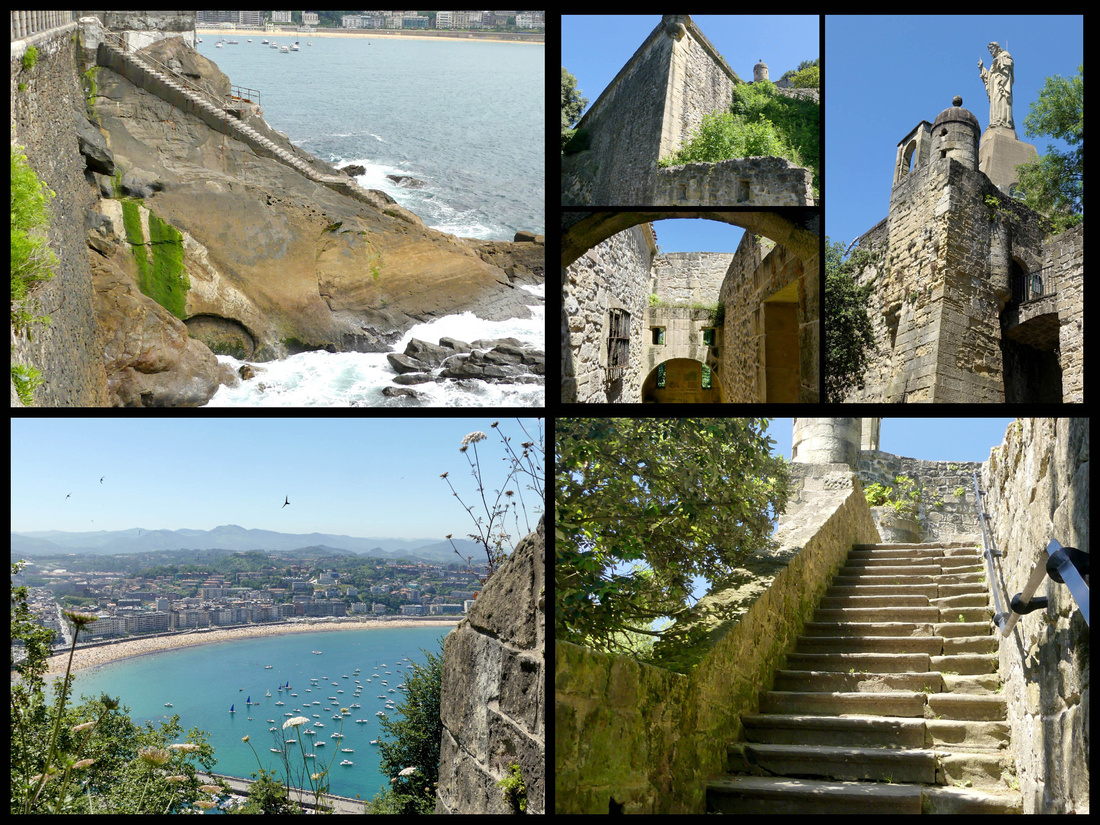
Monte Urgull - A once mighty castle (Castillo de la Mota), 12th century, is atop Monte Urgull, as are views. The best are not from the statue of Christ, at the very top, but from the ramparts of the left side as you face the hill, just above the port’s aquarium. You can walk up there via several paths from behind the aquarium, or from just above the old town. There are paths, steps and combinations of the two, and you can’t get lost, they all end up at the same place. On my way up I saw what I think was a bobcat.
The Parte Vieje, ‘old town’, fills the neck of Monte Urgull, the bay’s eastern headland. There are shops and residences but mostly what there is are pintxos bars, seems like hundreds of them. The old town is mostly deserted in the morning, but it’s like party central in the evening. The main (pedestrianized) street, Calle Mayor, starts at the city hall and ends at Eglise Santa Maria, an 18th century Baroque church. It was built on the site of an ancient Roman temple. The church has a splendid Churrigueresco facade with a statue of Saint Sebastian in a niche and two towers. Looking in the opposite direction down Calle Mayor you can see the spire of the cathedral.
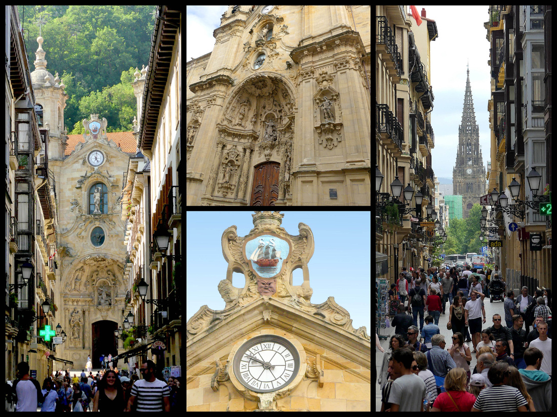
Down Calle 31 de Agosto, the only street that survived the fire in 1813, is Eglise San Vicente - thought to be the oldest building in San Sebastián. Its origins date to the 12th century, but it was rebuilt in its current Gothic form in the early 1500s. Buried in the center of the old town is it’s only real square, Plaza de la Constitucion - bullfights used to be held there and the seat numbering on the balconies remains. Lots of cafes.
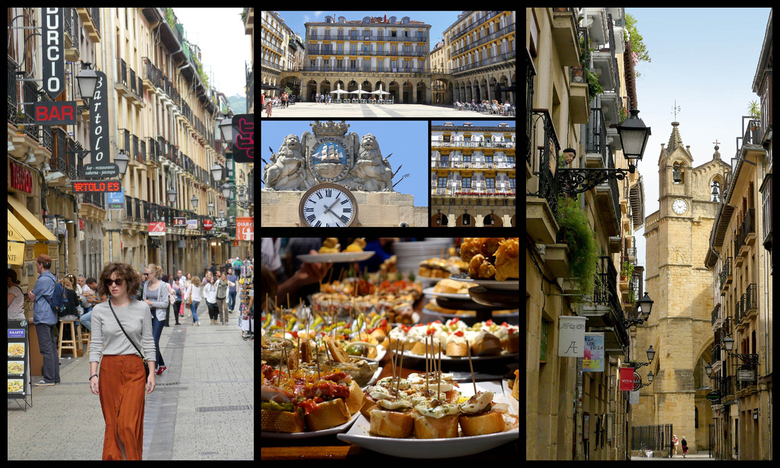
Left: side street in the old town, top center: Plaza de la Constitucion Right: Eglise San Vicente
The old town is neatly underlined to the south by the Alameda del Boulevard a broad avenue with cars on one side and a grassy area with plane trees, grass and flowers in the center, and a wide pedestrian walk on the other. There is a band-shell in the center and it ends at City Hall sitting in the Parque de Alderdi-Eder at the top of the promenade, which in turn merges with the Paseo de la Concha. Mercado de la Bretxa , a sandstone market building facing the Alameda del boulevard is now mostly a modern shopping complex, with a McDonalds (with a very good McCafe). The produce market still takes place mornings along side the building.
Just below Alameda del Boulevard is the “Romantic Area” – the Belle Époque area that reminds you of Paris and Barcelona. The Plaza de Gipuzkoa is in the middle and in the center of it is a miniature park, complete with a pond with two swans and a tiny waterfall. That’s where the bus to Hondarribia leaves from. Classy place for a bus stop. Many of the streets are pedestrianized, full of stores including some of the international chains such as H&M and Sephora, etc. The Avenida de La Libertad runs parallel to the Alameda a few blocks south, lined with elegant buildings and a row of white iron Art Noveau lamp posts in the center.
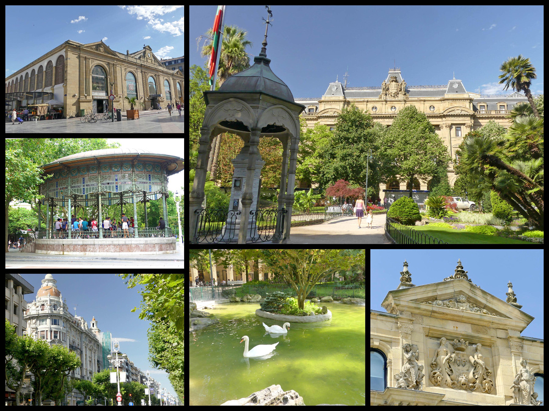 top left: Mercado top and bottom right: Plaza de Gipuzkoa bottom left: Avenida de La Libertad
The area continues several more blocks to the Catedral del Buen Pastor - The largest church in San Sebastian, the Cathedral of the Good Shepherd, is in the New Town. This Neo-Gothic cathedral was designed by a Basque architect in 1880 and completed in 1897. With its 75-meter-high tower, it is an important city landmark. The cathedral was built out of sandstone from the Monte Igueldo.
Between the Cathedral and the river is a tiny plaza, Plaza de Bilbao, with a fountain in the center and some nice Art Noveau shop fronts.
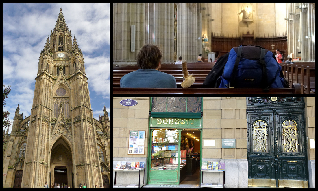
A block from there is the Rio Urumea and the most impressive of the bridges, Puente de Maria Christina (1905). Between Puente de Maria Christina and the next bridge, Puente de Sta. Catarina, both sides of the river are lined with elegant buildings and fronted with park like tree shaded promenades. The next stretch, to the last bridge, Puente de Zurriola (with modernist, art-deco lampposts built in 1921) features two Belle Époque buildings, the Hotel Maria Christina and the Theatre Vicyoria Eugenia. In most cities this riverfront would be a main attraction, but given San Sebastian’s gorgeous sea front it sort of takes second place.
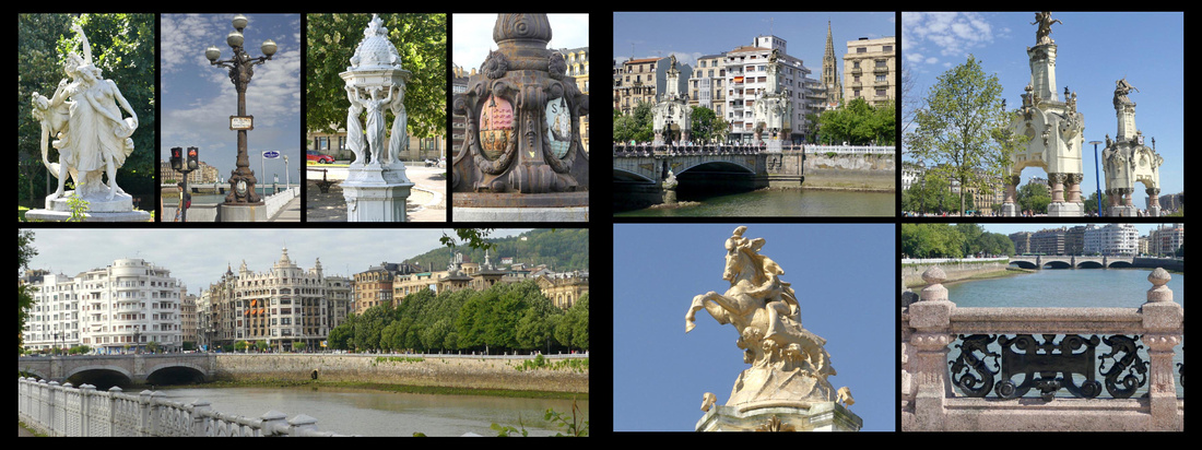
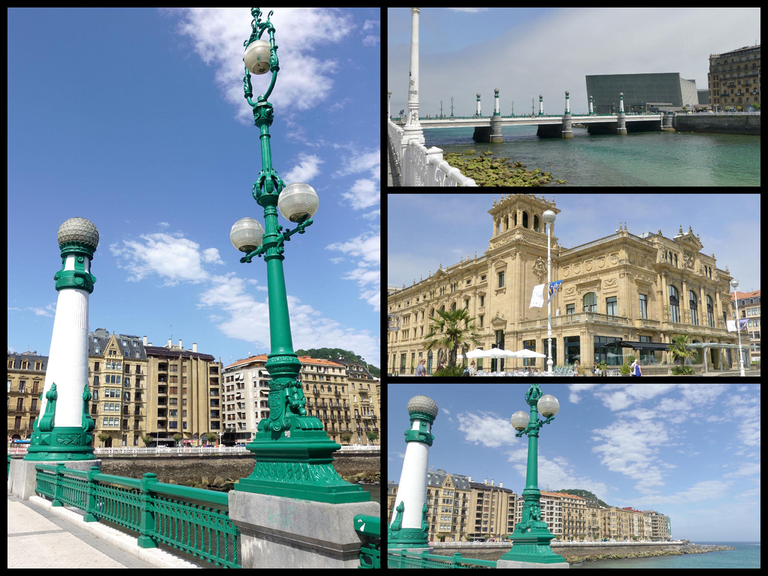
The river opens up to the ocean with Monte Urgull on one side and the Zurriola Plage on the other. A large modern building, the Kursaal Congress Center, was designed to look like two rocks stranded on the seashore.
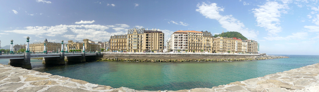
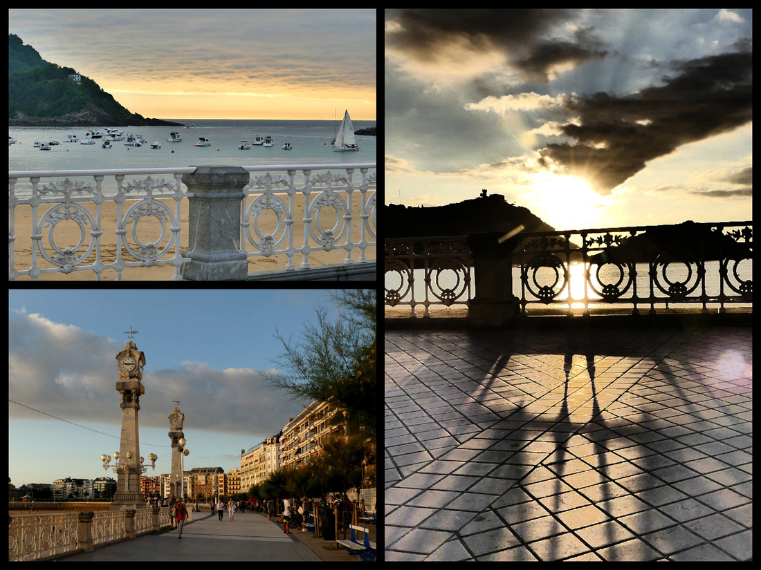
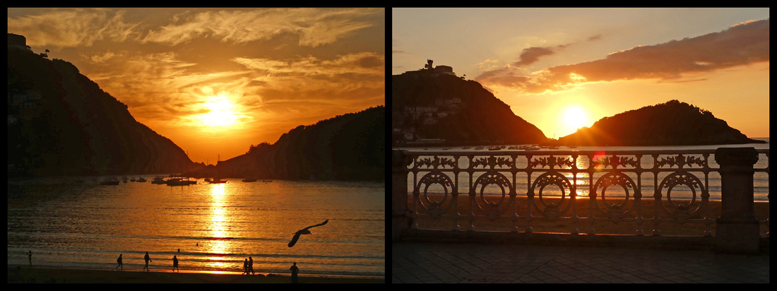
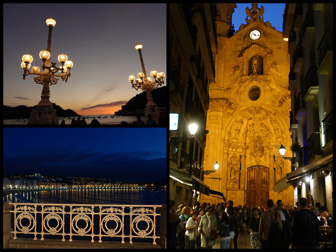
HONDARRIBIA Camino del Norte
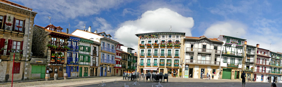
Gipuzkoa Plaza in San Sebastian is where the buses leave from for Hondarribia. There are several bus stops (a bench with plexi glass enclosure and signs listing the routes) along one side of the plaza, at least three of which go to Hondarribia, the E 20, 21 and 27. www.lurraldesbus.eus). They are pretty frequent, each line goes once or twice an hour. I took the E20 there and it does go through a lot of suburban sprawl and takes close to 45 minutes. The E21 is the express and goes via the highway taking about ½ hour. I got that one coming back. But either will do. There are two stops in Hondarribia between the old walled town on the hill and the harbor – really just the one main street. The first one is just below the Santa Maria Gate and the other is at the other end of the walled town, just before the “fisherman’s village”. Literally about a minute apart so doesn’t matter which one you get on/off at.
The border town of Hondarribia is one of the most historic and pleasant towns in the region. Almost completely free of tourists, it’s a well-preserved town surrounded by 15th century fortified walls, the only one in Guipuzcoa province. There’s a fishing port, a marina, and a beach, but the most charming area of Hondarribia is the walled part, a hilly grid of cobbled streets entered through arched gates. But the whole town is tiny, could be crossed on foot in less than half an hour.
The main square, at the top of the town is Plaza de Armas, with colorful houses on two sides, the Castle of Charles V, built around 1190, and today the Parador, on the third side and views across the bay to France on the fourth . The Castle’s location on the hill overlooking the Bidasoa River, Hendaye and Txingudi Bay, made it the perfect position for defensive purposes. Just off the plaza is the Church of Santa Maria de La Asuncion y Del Manzano, built in the 15th and 16th centuries on the remains of the town’s original fortified walls, mostly Gothic with some Renaissance features. The belfry is 18th century Baroque.
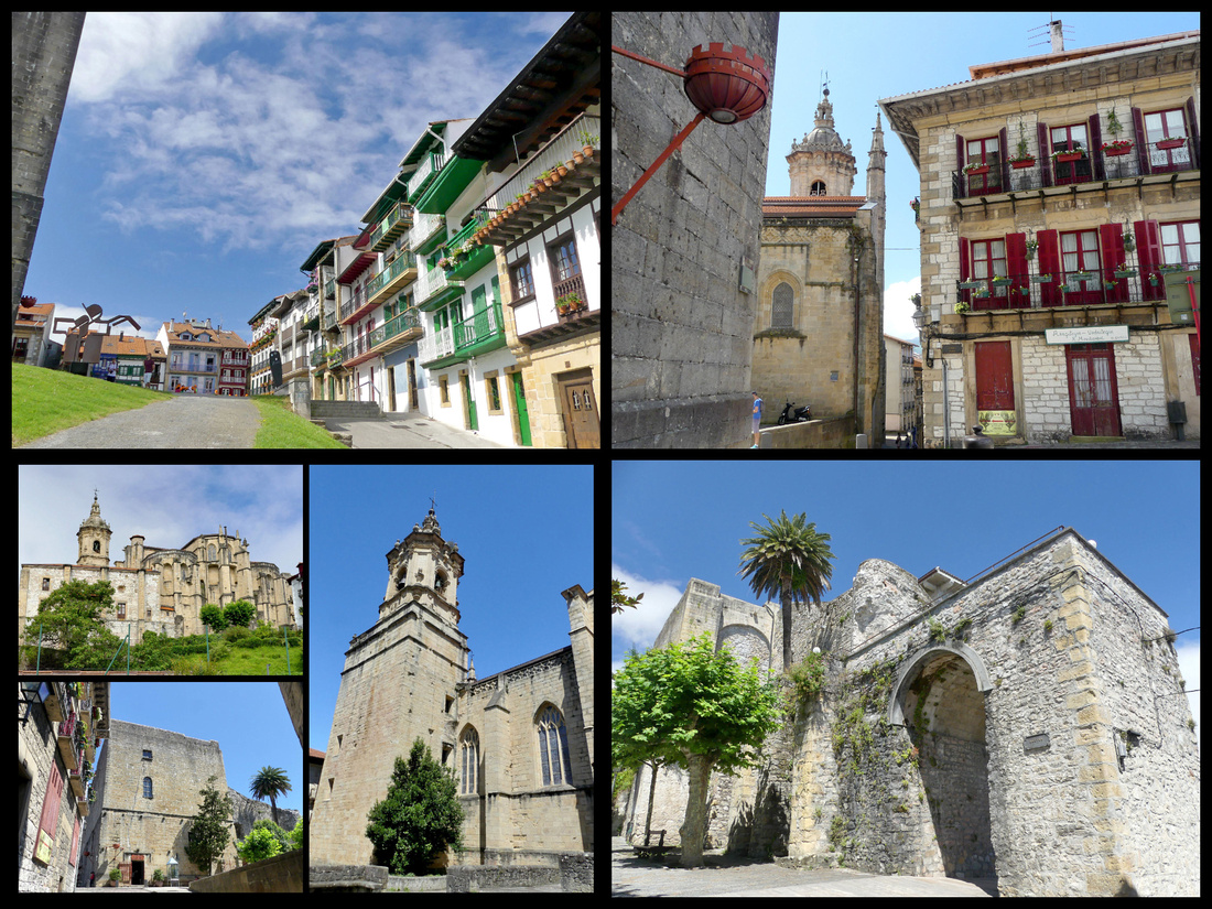
The main street, leading down hill from Plaza de Armas to the Santa Maria Gate is Calle Mayor (Kale Nagusia in Basque) The cobbled street, is lined with 17th and 18th century buildings featuring carved beams under the eaves, wrought iron balconies and family crests. Santa Maria Gate is one of two original entrances to the town, there used to be a draw bridge, guard house and moat here. Over the gate is the town’s coat of arms and over that a sun dial.
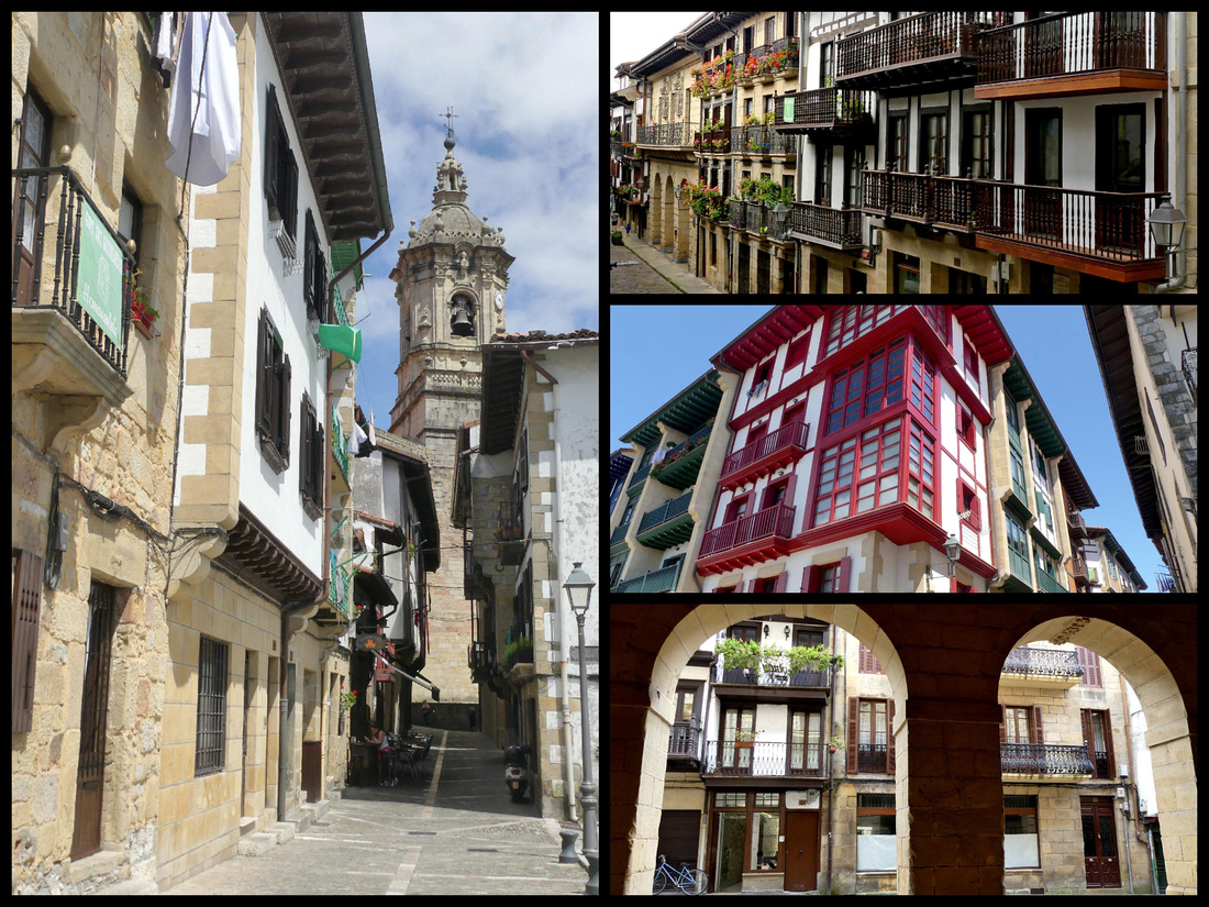
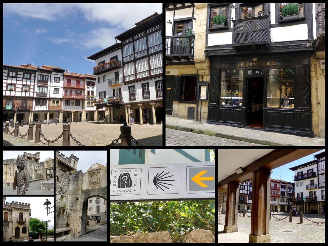
The Queen’s Bastion, built in the 16th century where the two main sections of the wall come together.
The other main plaza is Gipuzkoa Plaza , cobbled and small but with ornate buildings overhanging a wooden colonnade. This area was originally entered through San Nicolás Gate. In the 15-16th centuries this door was the village's main entrance. Originally a chapel, a tower, two doors and two bridges (one that could be raised and lowered and the other fixed) to cross over the moat formed the compound.
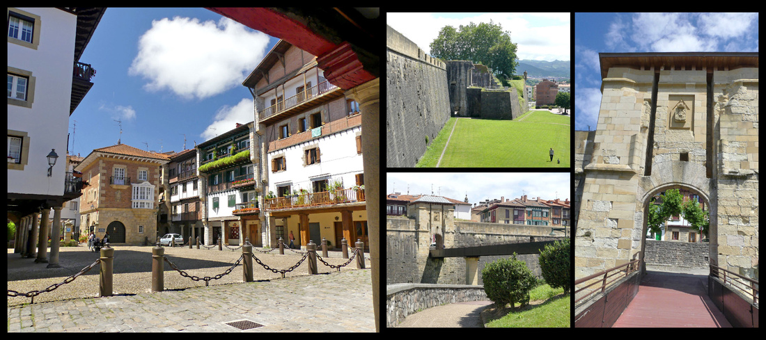
Santiago Street leads from Gipuzkoa Plaza down to the old fishing quarter. It was the first street in town and was used by pilgrims en route to Santiago. In modern times the first stage of the coastal Way of St James takes pilgrims through this town. Many maps list the town of Irun as the start of the Camino del Norte but Hondarribia was the original town at the start of this Camino and still truly is (Irun has more public transportation so many pilgrims start there, but it would be a big mistake to skip Hondarribia).
Down hill and outside the walls San Pedro Street is the main street of the old fishing village, known as the Marina District. The colors of the houses reflected those of the local fishing boats. The oldest building on the street dates to 1575. Today it is filled with restaurants and shops, lined with plane trees and benches. I got a chicken pastry thing for lunch, along with an ice tea and ate on a bench while people watching. The shop I got it in had mostly sweets and though the sign said ‘poullet’ I wasn’t entirely sure. The woman spoke no English but did the chicken dance to let me know what it was. Love sign language to overcome the language barrier.
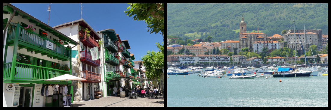
From the marina a tiny boat shuttles between Hondarribia and Hendaye, France (1.90€, summer only). The ride takes about 10 minutes and it runs every half hour.
Hendaye, France
Just on the other side of the river from Hondarribia, Hendaye’s location on the border has made it an important point for commerce between Spain and France. Historically speaking, the location has also proven to be problematic for the town since it has been involved in every conflict between the two countries. There’s a long beach (with surf) and streets of Basque style houses, a castle, the Chateau Abbadia, and good views of the flysch rock formations that are accessible on coastal walking paths.
Ondarraitz Beach has a long promenade next to it which is known as the “Boulevard de la Mer.” About halfway down the promenade there is the “Old Croisière Casino,” a building that stands out, not just because it is the only building located on the beach itself but also because it has its own particular style. Built in 1884, this is the only building in Hendaye that has an Arabic architectural style. For over 70 years, until 1980, the Old Croisière Casino was used as a casino. Today, it is a luxury residence and also a shopping mall.
At the end of the beach, are two rocks just off the coast called the twin rocks (“les deux jumeaux” in French). The legend around these rocks says that one day a Basajaun (a bigfoot like creature from Basque mythology) was in the Basque mountains and he tried to throw a rock to destroy the town of Bayonne. However, in doing so, he tripped and the rock fell out of his hand, broke in two and landed in the water of Hendaye beach.
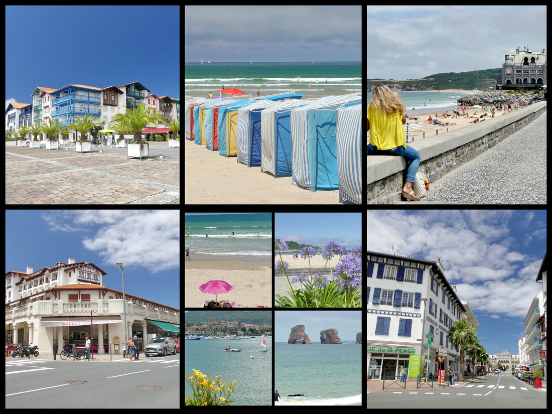
BILBAO Camino del Norte
Bilbao, Spain's sixth-largest city and biggest port, has been described as an ugly, gray, decaying, city. The metropolitan area has the highest population in the Basque region; including the suburbs and surrounding towns, Bilbao has over a million inhabitants. After the museum opened, 20 years ago, whole sections of the city were cleaned up and rebuilt. The river has wide pedestrian walks on both sides, with trees and benches. Some nice buildings but most seem to be mid-late 20th century boring. Some are nicely colored. But not quite the charm of Italy or some other Spanish towns. Still, the old town and the river are very pleasant. The ‘new’ part of Bilbao has some very nice buildings scattered around, but they are overshadowed by boring mid 20th century cement and steel buildings so the overall ambiance is nothing special. There are a few impressive modern glass skyscrapers. It’s not a bad city, but nothing you would really go out of the way for – if it weren’t for the Guggenheim.
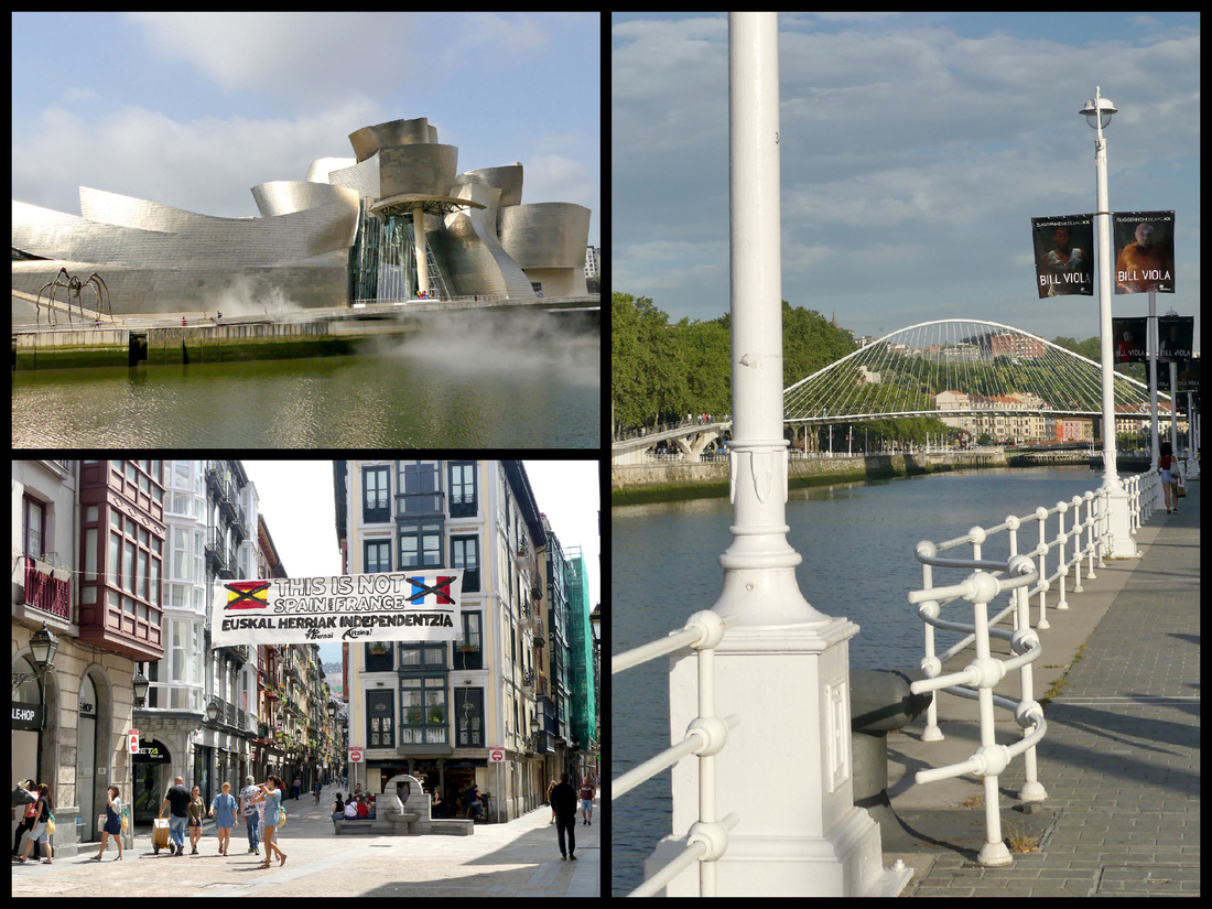
The bus ride from San Sebastian to Bilbao passed the ocean a couple times, and a few pleasant vistas of hills and farms but mostly it went through two medium sized ugly towns that I never heard of and took forever to drive through (to pick up or drop off one passenger each) or else highway. Driving through the suburbs of Bilbao was mostly ugly sprawl. As we were turning into the bus station I did see the tram so knew where to walk to get to it, (area around the bus station is confusing at first but there are two tram stops and a metro stop within 5 minutes walk).
The Guggenheim Museum is without a doubt the main attraction of Bilbao. Designed by architect Frank Gehry, the museum opened to the public in 1997 and has since been hailed by both the public and critics as one of the most important structures of contemporary architecture in the world. The building is wrapped in titanium panels that create what appears to be random organic curves. These panels were designed to capture light. For this reason, the building takes on a different appearance at night as the city lights reflect off it. Also, when viewed from the river, it resembles a ship (albeit abstract) and the panels are reminiscent of fish scales. Both of these attributes pay homage to the fact that the river was historically the economic hub of Bilbao. In the Atrium, the central interior hall that is a signature feature of Gehry's architecture, paintings are displayed along the walls of the curved walkway in a three-level staircase. Gehry’s masterstroke was to use titanium, an expensive soft metal used in airplanes. He was intrigued by its futuristic sheen and malleable qualities; the panels are literally paper-thin. The titanium makes the building shimmer: it seems to capture motion. Giant windows allow in natural light. The building also interacts fluidly with the river itself; the pool at the museum’s feet almost seems part of the Rio Nervión, a few feet away, and the mist sculpture, when turned on, further blurs things. It’s entitled FOG, which also happen to be the architect’s initials. The same pool also has Fire Fountain pyrotechnics at night.
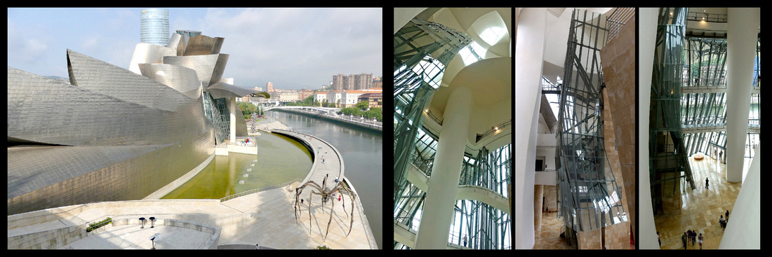
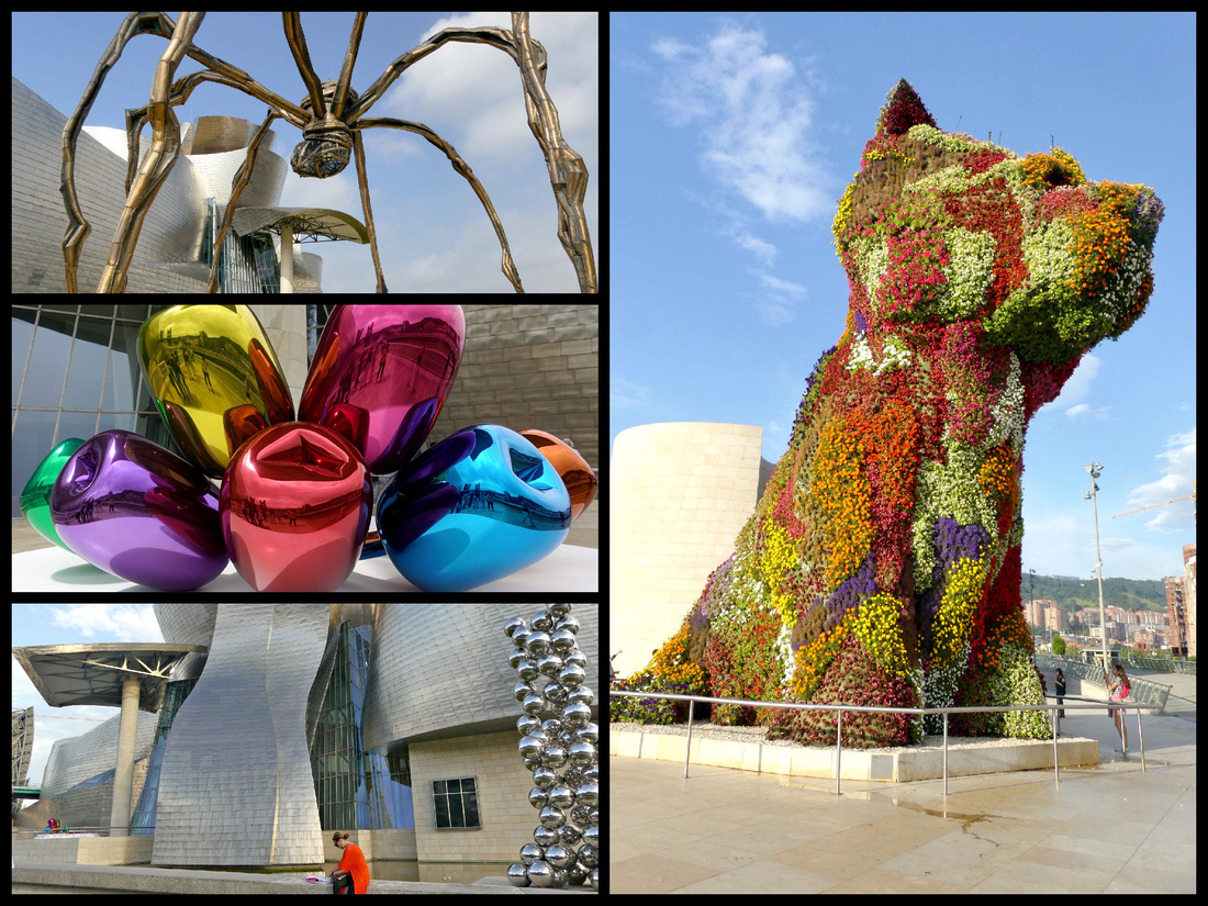
Outside the museum itself, Jeff Koons’s giant floral sculpture, “Puppy”, sits eagerly greeting visitors. Initially a touring attraction visiting the city for the opening of the museum in 1997, Bilbaínos demanded that he stayed put. On the other side of the building, a sinister spider-like creature guards the waterside approach. It’s a striking piece of work, and makes a bizarre sight if approached when the mist is on. More comforting are Koons’s colorful bunch of Tulips by the pool under the gallery’s eaves.
Inside, massive Gallery 104, built with the realization that many modern artworks are too big for traditional museums, has been dedicated to Richard Serra’s “The Matter of Time”, an installation consisting of eight monumental structures of curved oxidized steel. A hundred feet long, and weighing 180 tons, it’s meant to be interactive – walk through it, talk through it, touch it. Other galleries feature ‘traditional’ modern art. The entire second floor is dedicated to temporary exhibits and while I was there it was Bill Viola a video artist whose work heavily features water. The third floor is their permanent exhibit which includes one Monet and a number of post-impressionists that were nice, plus some more modern stuff like Warhol (150 Marilyn Monroe faces), etc. I like that there were only a few rooms of each kind of art from late 1900s through 20th century. There was also some sculpture by Eduardo Chillida who did the Wind Sculpture in San Sebastian and an exhibit about turn of the (last) century Paris.
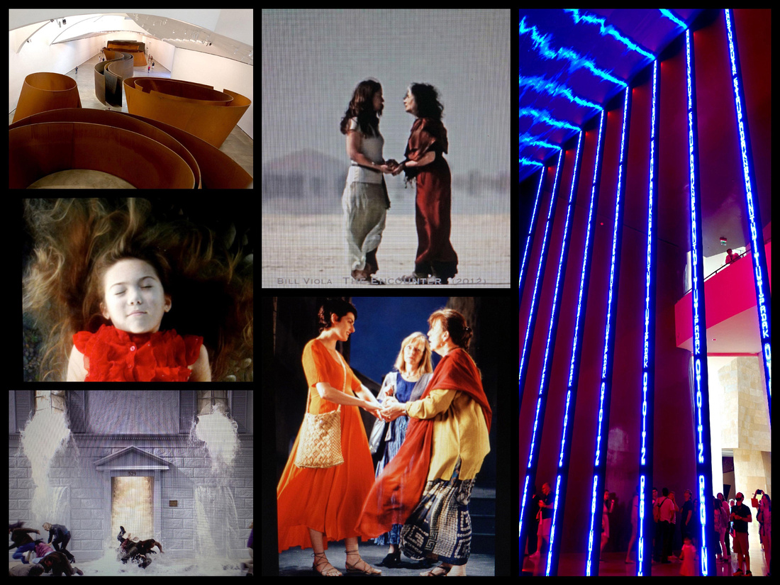
Top left "Matter of Time" steel installation, remaining photos are all Bill Viola works
The Nervión River meanders through Bilbao, whose historic core was built inside one of its loops, with water protecting it on three sides. Now there are promenades on both sides with parks, benches, playgrounds, etc. and crossed by several bridges, the most striking being the Zubizuri (which is Basque for ‘white bridge’, also called Puente del Campo Volantin) footbridge. Opened in 1997, the bridge's unusual design consists of a curved walkway which is supported by steel suspension cables from an overhead arch. The structure of the bridge is painted white and the bridge deck consists of translucent glass bricks. Hotel Conde Duque is right at the foot of the bridge, ten minute walk from the Guggenheim in one direction and the old town in the other.
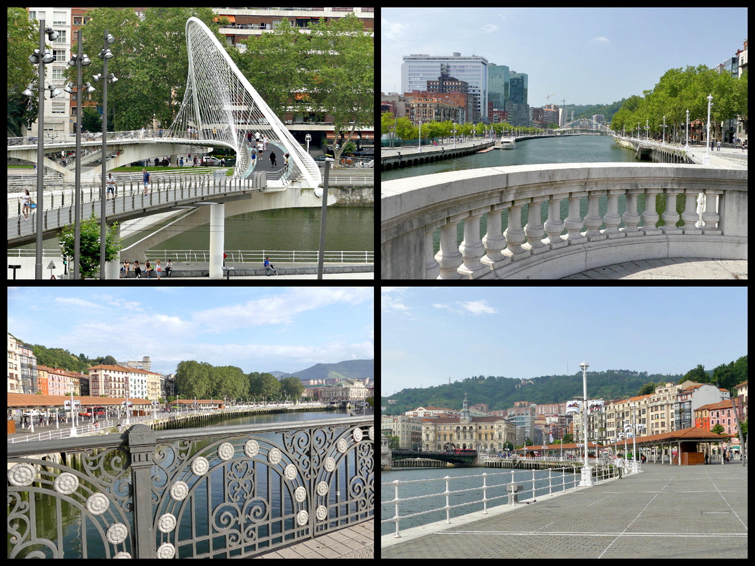
The Casco Viejo of Bilbao is also known as “las 7 calles” (Siete Calles) or “Zazpi Kaleak” in Basque (the seven streets), since these were the seven streets that formed the original medieval town. Full of Old World charm, the Casco Viejo is on the right bank of the river extending between the San Antón Bridge and the Church of San Nicolás. The beautiful narrow streets are mostly pedestrian-only. More ‘up-scale’ than many European Old Towns, the buildings are several stories high, colorful, and with iron balconies featuring flower boxes. Numerous ones feature glassed in balconies. Plenty of pintxos bars but also lots of shops – produce, meat, fish, bakeries, clothing (including some international chains).
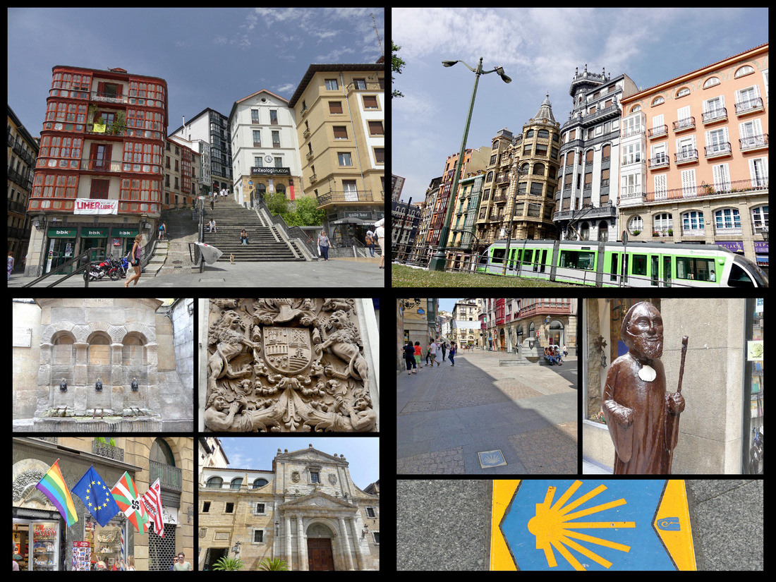
Bilbao's old town. The cute little green tram is the best way to get around Bilbao. The Camino goes right through the center o the old town.
Formerly an area of marshy sand, the Arenal was drained in the 18th century. It is now a busy nexus point for strollers, and dog walkers, and has a bandstand. The beginning of the Old Town it is joined to the other side of town by Puente del Arenal and the Paseo del Arenal.
Iglesia de San Nicolás de Bari. has a Baroque facade and an octagonally shaped interior; the church dates from the 14th century but was completely rebuilt in 1756.
Plaza de Arriaga / Teatro Arriaga, across the street from the Arenal, is an elegant Neo-Baroque theater that was inspired by the Palais Garnier Opera House in Paris. Built in 1890 and later renovated, the Arriaga Theater is the cultural hub of the city where classical music concerts, opera, and theater performances are staged. Was only reopened in 1986 after decades of neglect. It’s very much in plush fin de siècle theatre style, with chandeliers, soft carpet and sweeping staircases.
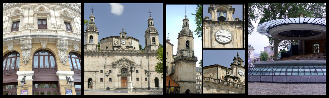
Abando train station – Across the river from the Theater. Both the side facing the river, and the giant stained glass window upstairs where the trains depart are beautiful, especially for a train station.
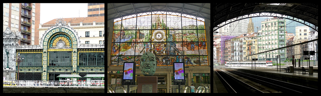
Plaza Nueva (Plaza de los Martires)- finished in 1849 and enclosed by elegant arcaded buildings featuring cafés and bars with outdoor terraces, also used for town festivals and farmers markets. More formal and symmetrical than most of the old town with courtly neoclassical arches.
Catedral de Santiago, built in the 14th century and then restored in the 16th century after a fire. Gothic. The cathedral's facade was rebuilt in the 19th century. Slender spire rises high above the tight streets. A graceful Gothic affair, two of its best features are later additions: an arched southern porch and a small but harmonious cloister.
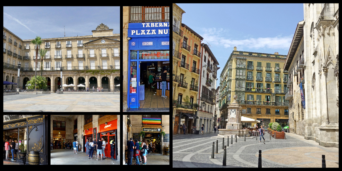
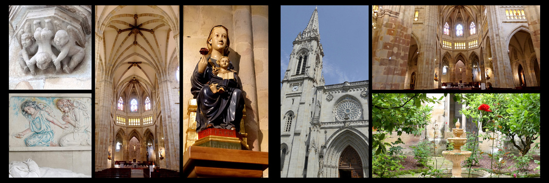
Mercado de la Ribera, art deco building from 1930 sits on the riverbank. The 10,000-square-meter space is one of Europe's largest indoor marketplaces. A bright and cheerful space, the market hall has skylights above and a floor made of clear, translucent material that allows light to flood into the building. The exterior features whimsical Art Deco designs, floral decorations, and lattice windows. This is the main place in the city to find high-quality Basque culinary products, fresh fruits and vegetables, seafood, and other gourmet food products plus there is a great assortment of pintxos bars.
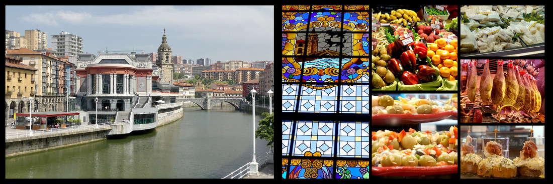
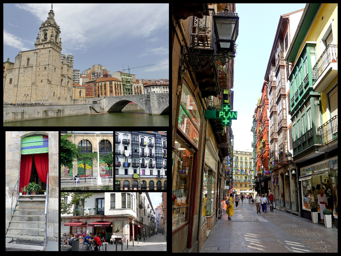
San Antón top left, on the edge of the old town.
El Ensanche, the new town, while a little grey and with a bit too high a percentage of boring late 20th century buildings, does manage to have an elegant European feel to it. There are stately banks and international shops lining the avenues. When the small Casco Viejo area became too small for the population in 1876 the Plan de Ensanche (expansion) was approved, and the area across the river was designed governed by the curve of the Nervión. The Ensanche quickly became Bilbao’s business district, and it remains so today.
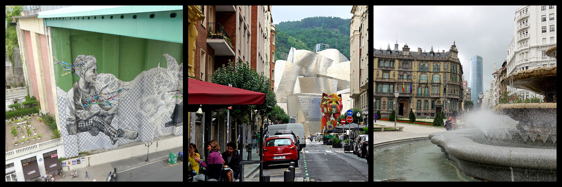
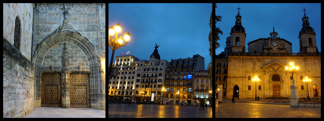
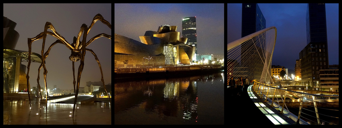
BIZKAIA BRIDGE - Portugalete/Getxo Camino del Norte
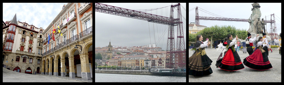
A twenty minute ride on the metro to either town (3.60€ RT) and a ride across the river on the Bizkaia Bridge('vis-KAI-ya') Gondola (.40 – or €8 to walk across the top). Located on the final stretch of the Bilbao’s Ría, where it flows out into the Bay of Biscay, the bridge links Portugalete ('por-Tu-a-lay-te')and Getxo ('gets-co'), two towns, the former with winding mediaeval streets and the latter more of a grid pattern with larger, newer, town houses. UNESCO World Heritage Site. It was the first metal transporter bridge in the world and is considered a masterpiece of engineering of its time. It was opened in 1893 and has been in operation ever since. A bizarre cross between a bridge and a ferry, it was opened at a time when large steel structures were à la mode in Europe. Wanting to connect the estuary towns of Getxo and Portugalete by road, but not wanting a bridge that would block the ría to shipping, the solution taken was to use a ‘gondola’ suspended by cables from a high steel span. The modern gondola goes back and forth with six cars plus foot passengers aboard. You also see the bridge referred to as the Puente Colgante (hanging bridge). It’s very tall, and the mechanics of it very interesting, but otherwise not especially beautiful to look at.
Very much separate towns rather than suburbs of Bilbao, Getxo is a wealthy, sprawling district encompassing the eastern side of the river mouth, a couple of beaches and a modern marina. Portugalete is a hill town on the other side of the river with several old buildings, some winding streets and nice plazas. Both have riverfront promenades. In both directions there is evidence of the shipping industry but that is a ways from these towns. Portugalete is by far the more interesting one to wander around. There was a group in folk costumes playing bagpipes, drums, etc. and dancing so that certainly added to the ambiance.
I took the metro (‘average’, very functional but boring cars, boring stations) to Portugalete. About 25 minutes. Between the one sign (TI and bridge) and common sense (go down the hill not up) I found the main part of the old town and the bridge.
SANTANDER [Camino del Norte]
Santander, population 200,000 is a coastal city with an extensive south facing bay (the only one on the north coast of Spain), the narrow Bahía de Santander. From the heart of the city, you can see across the bay to rolling green hills and (on clear days) the high mountains of the Picos de Europa (I only saw these on my last of three days, and only in the evening). Originally it was a fisherman’s town but today it’s main activities are industry, commercial port and tourism. In the 18th and 19th century it was a major port for maritime routes between Castile and America. A huge fire in 1941 destroyed most of the historic district. In 1983 the Autonomous Community of Cantabria was created and Santander became it’s capital. It is on the Camino del Norte.
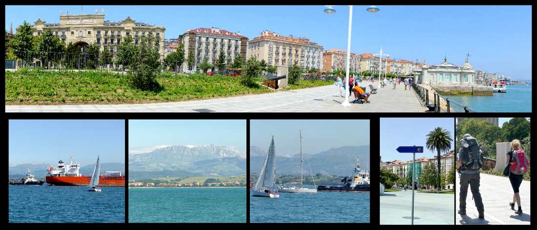
Paseo de Pereda – a long waterfront area on the Bahia (the narrow bay, not the ocean) stretches between the industrial/commercial area and the Magdalena Peninsula. Beginning at the Jardines de Pereda, the promenade continues to Puertochino, the leisure boat marina. Half the city strolls or jogs here on summer evenings. Both Paseo de Pereda and Calle Castelar, opposite the Puerto Chico, are lined with grand buildings flaunting typical glassed-in balconies. Puertochico was Santander's fishermen's port over 100 years ago, and before that commercial vessels docked there. It's home to a gigantic Spanish flag.
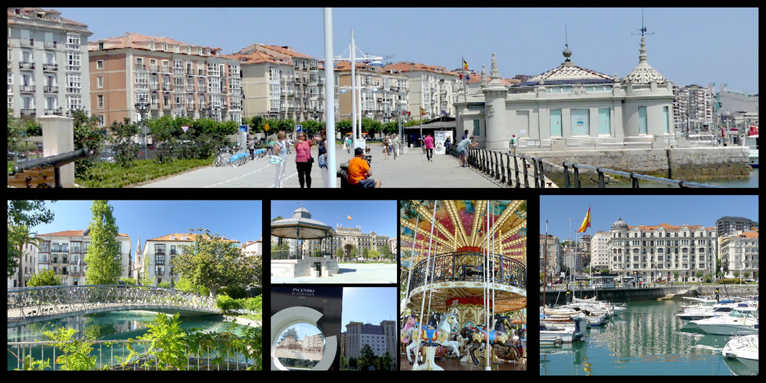
Just before the Jardines de Pereda is the Estacion Martima (ferry terminal) built in the 1970s, it’s roof designed to simulate the strong swell of the Cantabrian coast. Brittany Ferries from the UK docks there. Hotel Bahia overlooks it. Pereda Gardens are lovely with several sculptures, a small pond with a curved footbridge over it, a carousel. Post Office Building and the Bank of Spain building sit at one end of the garden. The area right behind here is where the huge fire began which burned much of the old city. There are interesting plaques all around showing what the area looked like before the fire.
The first building on the waterfront promenade is the Futuro Centro Botin, a futuristic building, in two parts, opened in June 2017, designed by the Italian architect Renzo Piano. The building is levitated from the promenade on slender pillars and clad with 360,000 ceramic discs finished with a mother of pearl glaze. It houses an exhibition center (Picasso and Goya, etc.) and cultural education programs, lectures and performances. Santander is hoping it becomes a major art-world destination, and that it will bring the kind of revenue and benefits known as the “Bilbao Effect”.
Next to that is Grua de Piedra, an old Stone Crane that served in the Port of Santander from 1900 until the end of the 20th century. It was used in the loading and unloading of the merchant ships that docked there. Palacete del Embarcadero, built in 1920, the former passenger station, is now an exhibition center.
Just past there is Escultura de los Raqueros - statues of boys on waterfront, in honor of poor or orphaned boys who used to wait for coins to be thrown at the sea and then dove for them.
After the Puertochico is the Palacio de Festivales Cultural Center, 1985, a gigantic theater and performance space. The promenade ends here and become woods and beaches. Steps lead up to Avenida de la Reina Victoria, which connects the Peninsula de la Magdalena with the center of the city and is lined with very upmarket houses (some of Northern Spain’s most expensive residences).
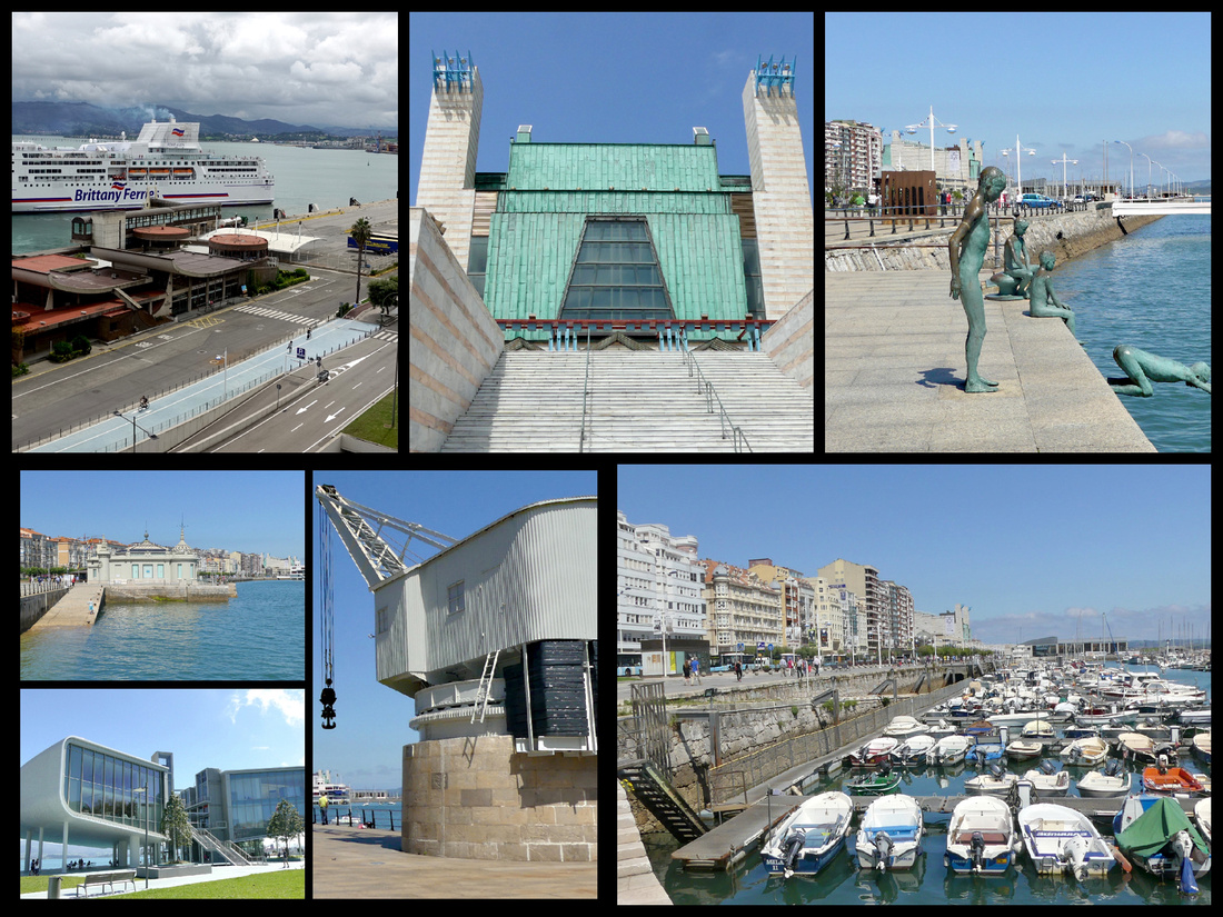
The Península de la Magdalena protects the bay of Santander from the Atlantic, at the tip is the Magdelana Palacio, a gift from the city to the king that now houses a summer university that draws people from around the globe. The building, 1908, is ‘like a child’s idea of a palace, surrounded on three sides by the sea.’ On the bay side of the peninsula are a couple of pretty beaches, Playa de la Magdalena and Playa de los Bikinis. On the sea side is the artificial Playa del Camello, named for the humped rock that sticks out of the water opposite it. The whole peninsula is a park and there are seals (2), sea lions (3) and penguins (several), and three replica Spanish galleons. The views of nearby beaches across the crashing sea are beautiful and both lighthouses are visible from here. And a bronze mermaid.
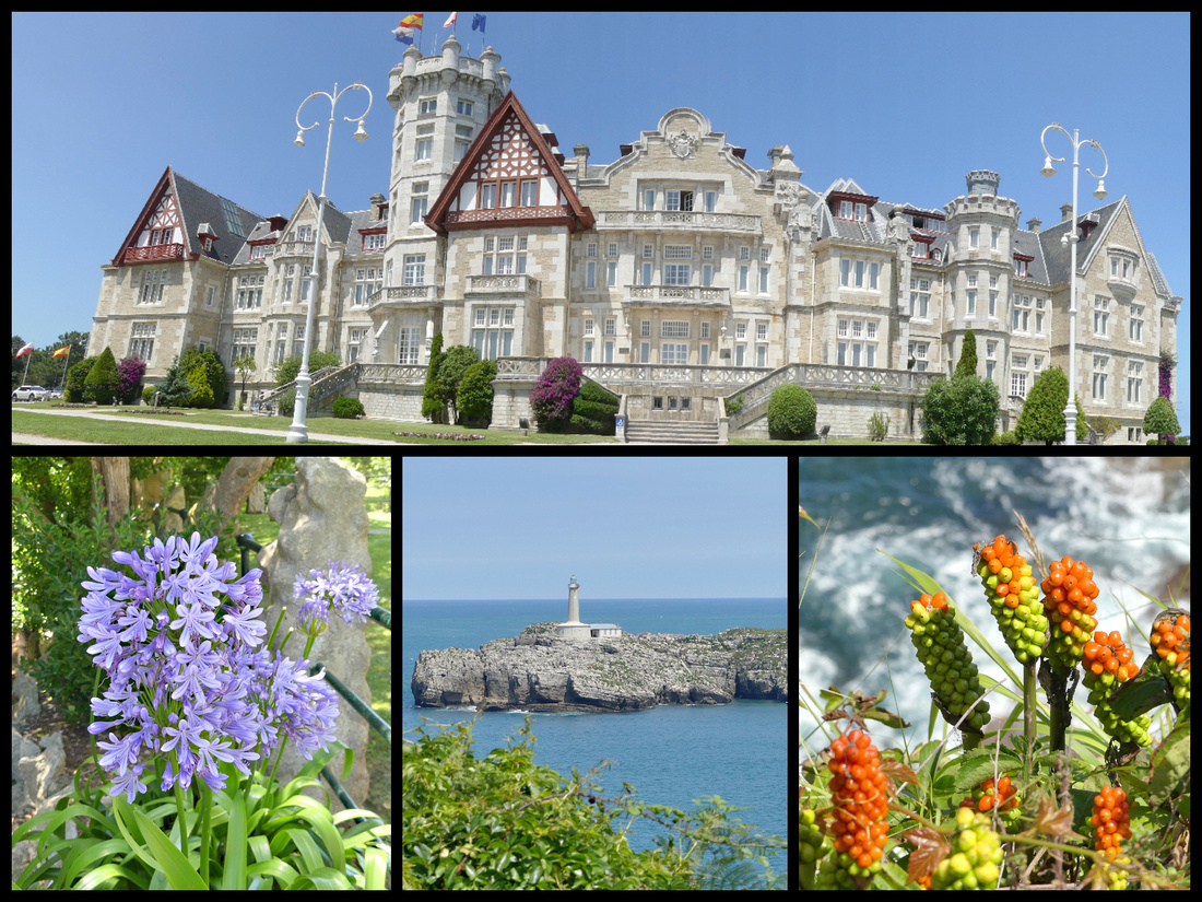
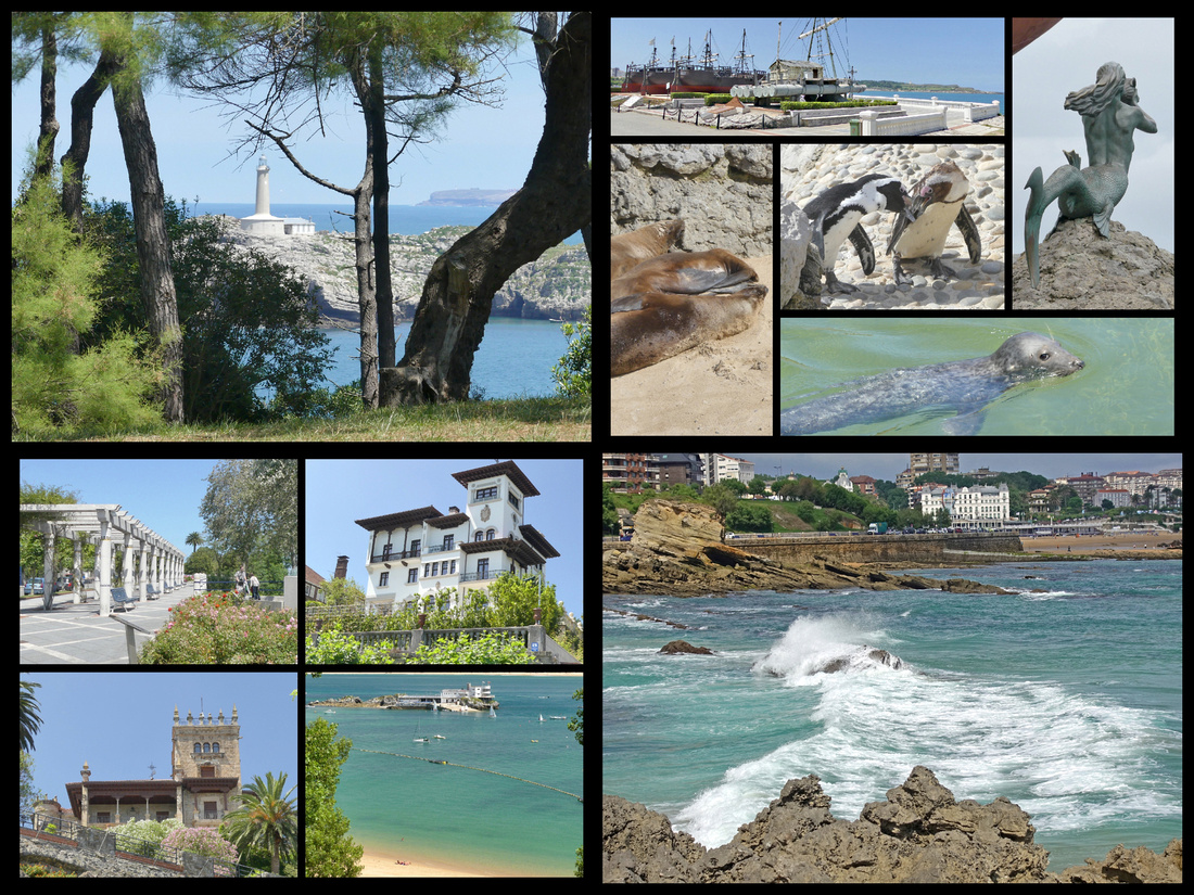
Plalya del Sardinero – a long beach between the Magdalena Peninsula and the Faro de Cabo Mayor headland has preserved the atmosphere of the Belle Époque era with elegant hotels, an elegantly restored casino and a scenic promenade perfect for coastal strolls. El Sardinero Beach is north of the Peninsula of La Magdalena, facing the Atlantic Ocean where the breaking surf can be dramatic.
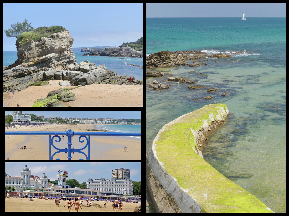
From the end of the beach, a coastal path begins that skirts a golf course around the Cabo Menor headland before reaching the Mataleñas (another beach) then up through a high meadow area overlooking the cliffs and the waves below and eventually comes to Faro de Cabo Mayor and the Puente Forado, an interesting formation shaped like a bridge that was carved by nature from the limestone rocks. ~3km
I walked along a path atop a headland with waves crashing on the rocks far below, through a large meadow, wild heather, the ocean, the lighthouse, a golf course off to one side, a stiff breeze – and bagpipes. I could have been in Scotland. And the sun came out and the clouds disappeared and the sky turned blue. Made up for the last couple weeks of mostly cloudy weather. Absolutely gorgeous.
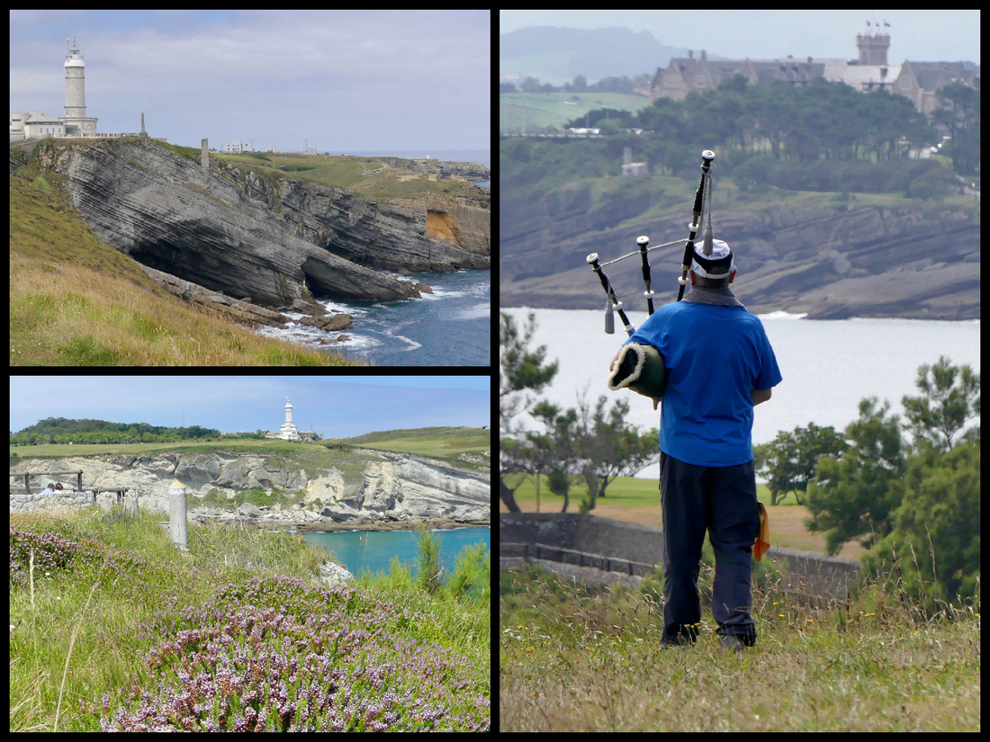
There is not much left of the ‘old town’ due to the fire of 1941. Most of the buildings are mid 20th century but a lot were rebuilt in the traditional Santander style with glassed in balconies.
Santander Cathedral is composed of two Gothic Churches, one built over the other. The lower church, Iglesia del Santisimo Cristo was built during the 8th century, the upper church was begun later in the 8th century but had to be largely rebuilt after the fire of 1941. There is a 14th century cloister. The interior of the church is rather boring but the exterior is unusual, with large square towers rather than the usual steeples, and it’s built of white stone, also unusual among European cathedrals. The cloister is the more traditional golden stone and is lovely.
Banco de Santander building dominates the waterfront area. Going through its grand archway you enter the old quarter. An extraordinary and distinctive fin-de-siecle building - actually two, joined by a huge arch - that was the original head office of what has gone on to become one of the most important banks in the world. I’ve seen ‘Banco de Santanders’ all over Europe, used their cash machines many times so it was kind of cool to see the real thing.
Palazo Pombo – A medium sized open square with a round band shell in the center. The Church of Santa Lucía, 1864, has a beautiful Renaissance portico with large columns.
Mercado del Este, 1839, now houses several tapas bars, a florist and the main office of the TI
Plaza Porticada (64 porticos) one of the largest squares in the city was built with the idea of making it the central hub of the city, after it was devastated by fire in 1941.
Ayuntamiento - The building was built in 1907 in the same place where formerly stood the old convent of San Francisco. In the mid sixties it was enlarged to its present size.
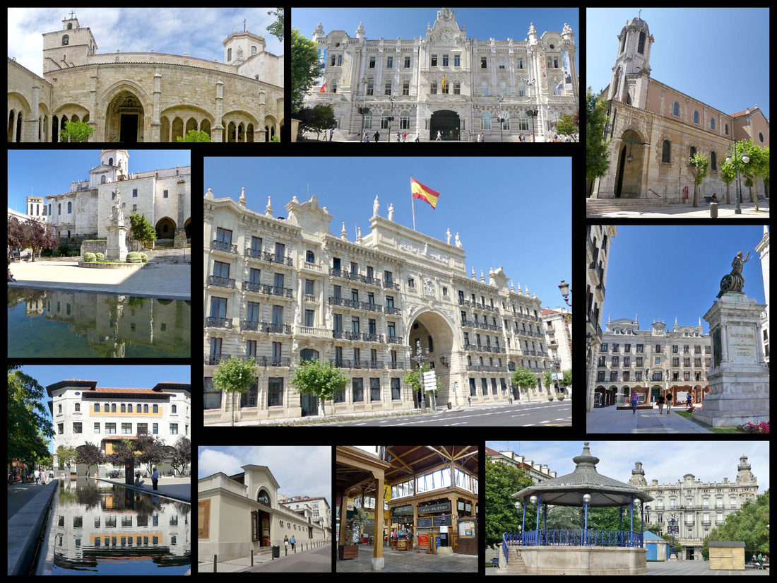
]]>
After Santander I "crisscrossed" the Camino and took a bus from the Camino del Norte to the Camino Frances, to Burgos. Burgos felt very much like a “Spanish” city, not that the others weren’t, (well Bilbao and San Sebastian/Donista are Basque). The blindingly bright sunshine and hot weather helped.
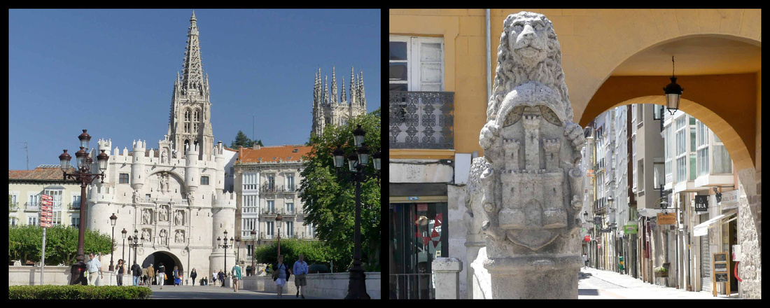
Founded in 884 as a fortification against Islamic invaders, the city, which was the capital of the unified kingdom of Castilla-Leon for five centuries, sits in the middle of Spain’s high plains, a cross-roads for a thousand years. Several centuries of decline culminated with the Napoleonic Wars destroying the castle and much of the city. Today, Burgos, population, 175,000, feels small and friendly, you can walk across the historic center in less than an hour. A candidate in 2016 for ‘European City of Culture’ (lost out to San Sebastian) it was spruced up and now the entire center is sparkling. While the kingdom of Castilla-Leon is now part of Spain, Burgos is the provincial capital and symbols of ‘castles and lions’ are everywhere. The main Camino de Santiago goes right through the center.
Rio Arlanzon delineates the historic center from the newer city. The river is quite small but there is an expanse of greenery on both banks that makes it a rather pastoral setting for the center of a city. The Paseo del Espolon is a wide, plane tree shaded promenade along the banks that feels much more like a park than a promenade. There are benches and fountains and in July there were little white tents housing an arts and crafts market in the evenings. Lining one side are cafes and restaurants.
The main pedestrian bridge, Puente de Santa Maria, leads to the Arco de Santa Maria – the first thing you see as you approach the center of Burgos is this grand arch – from a distance it blends in with the cathedral. Originally built in the 14th century as a triumphal arch in honor of Emperor Carlos V, it formed part of the 11th century city walls. It was turreted and decorated in the 16th century. In 1552, the gate was renovated in Renaissance style. The interior is not especially interesting though there is one large fresco. It houses temporary art exhibits.
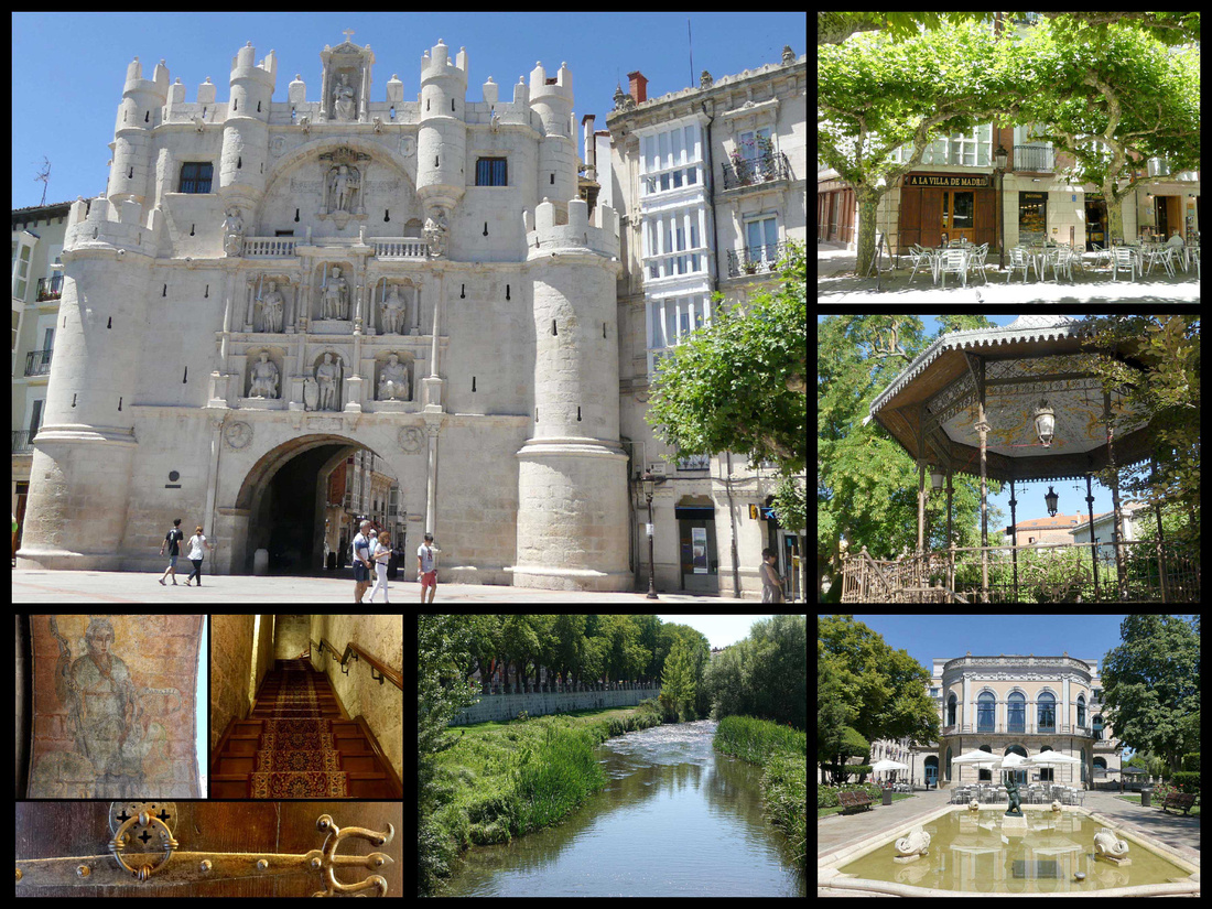
Through the arch is the large Plaza del Rey San Fernando and the cathedral. You can see the spires of the Cathedral from pretty much everywhere within the town. It’s just gorgeous and massive in both bulk and height. It’s setting is also impressive with a small square, Plaza de Santa Maria, in front of it, with a fountain and steps going up along the side of the square so you are looking straight at the cathedral, rather than just up at it.
At the top of the steps of Plaza de Santa Maria, just behind the cathedral is the Iglesia de San Nicolas, a smaller church that also blends with the overall appearance of the cathedral though it is clearly a separate church. The street in front of San Nicolas, along the north side of the cathedral is the Camino. Burgos was historically one of the most important cities on the Camino and at one time had over 30 ‘hospitals’ dedicated to the pilgrims. (‘Hospitals housed pilgrims, some of which are still albergues, or hostels).
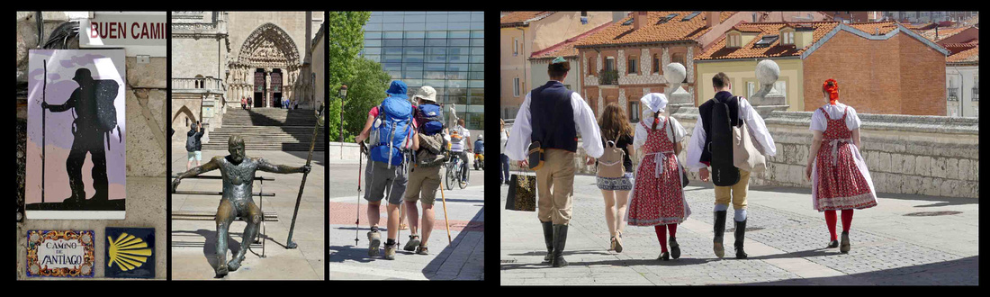
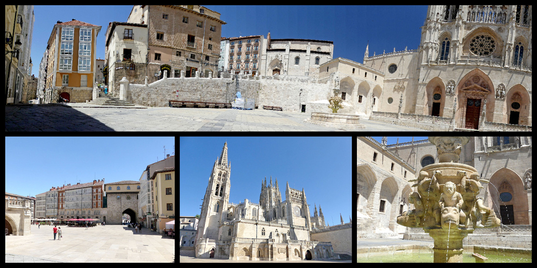
top: Plaza de Santa Maria bottom left: Plaza del Rey San Feranando center: Cathedral right: fountain in Plaza de Santa Maria
UNESCO-listed Cathedral of Burgos, a masterpiece of Gothic architecture, was begun in 1221 and is the third largest in Spain (after Seville and Toledo). The profusion of sculptural decoration and grandiose proportions make it one of the most impressive in Europe and one of the best examples of French Gothic. WOW – that really is a spectacular building. The size of the building is even more impressive from the inside than the outside. Built from white limestone, and predominantly Gothic, the building reveals other artistic styles that represent later additions (constructed from 1221 to 1795). The spires were only completed in the 19th century. The cathedral's main façade features the Puerta del Perdón doorway above which is a beautiful star-patterned rose window called an estrellón. Every side is just as beautiful as the last. And the cloisters, always my favorite part of any church, did not disappoint. There are two levels, and the upper level is glassed in with stained glass. A lot of the stone is painted which is unusual for most cloisters, which are just natural stone. The lower level is equally nice and the views of the towers and spires from the cloister are beautiful.
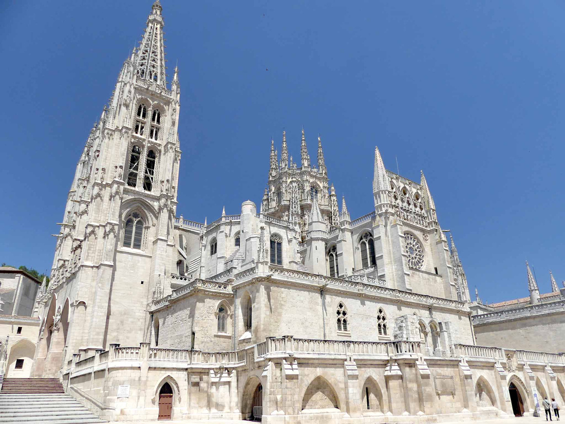
Just as amazing inside as out, extremely light and delicate and intricate. You can get a stiff neck looking up. It embodies Flamboyant Gothic style and is richly decorated with sculptured filigree everywhere. There are nineteen side chapels, each more highly decorated than the other, but most with a very light, airy feel unlike a lot of Catholic cathedrals which are dark and foreboding. This church is a riot of spiky spires and towers, pointy arches, four-leaf clovers, and flowery vaulted ceilings.
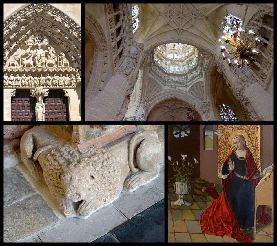
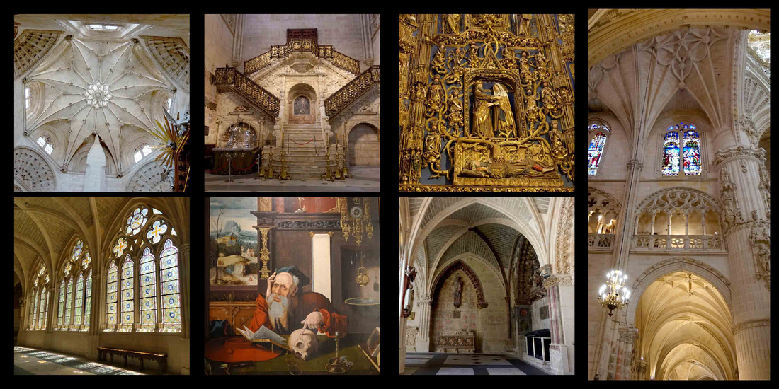
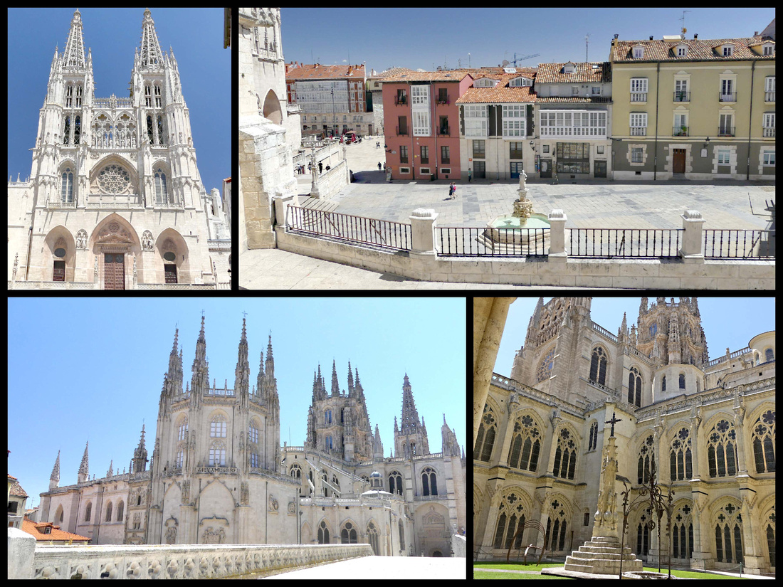
Top from steps in Plaza Santa Maria Bottom left: cathedral back from the Camino Bottom right: from the cloister
At the other end of the Paseo del Espolon is the Plaza de Mio Cid just over the river from the modern city. Puente de San Pablo is lined with sculptures of characters related to El Cid. The Plaza features a statue of El Cid, Estatua del Cid, the city’s hero (and pronounced El Thid, in pure Castilian Spanish) (he pursued a campaign against the Muslims in the 11th century). The Teatro Principal and Provincial Palace line the plaza and it is the starting point for Calle Vitoria and Calle Santander, two of the city’s main streets. Just down Calle Santander is Casa de los Condestables/Casa del Cordon, with a massive corded façade and two towers, 15th century. It was here that the Catholic Monarchs received Columbus after he returned from his second voyage. Across Puente de San Pablo in the modern citiy is Museo de la Evolucion Humana.
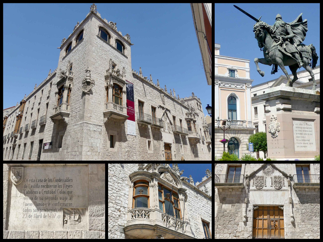
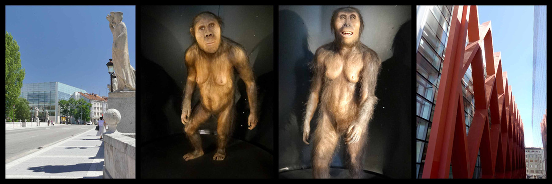
Plaza Mayor is in the historic center, home to the Ayuntamiento, in neoclassical style from the 18th century. The center of the square is full of modern benches, but it is lined with shops and eateries and colorful buildings in the Burgos style with glass fronted balconies. The Casa Consistorial (Ayuntamiento) has marks and dates from two of Burgos’s biggest floods; it’s hard to believe that the friendly little river could ever make it that high.
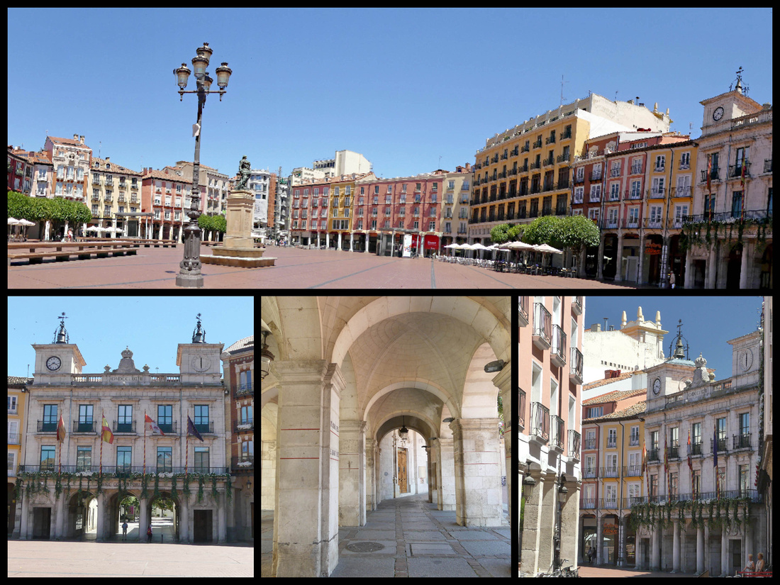
The old town feels much lighter and more airy than many old towns. The streets are wider and many of the buildings feature glassed balconies. One of the most beautiful buildings is Palacio de Capitania, early 20th century. Iglesia de San Lorenzo, buried deep in the medieval streets of the old town, is 17th century. Another feature of Burgos is bronze statues, featuring everyday people and found throughout the city.
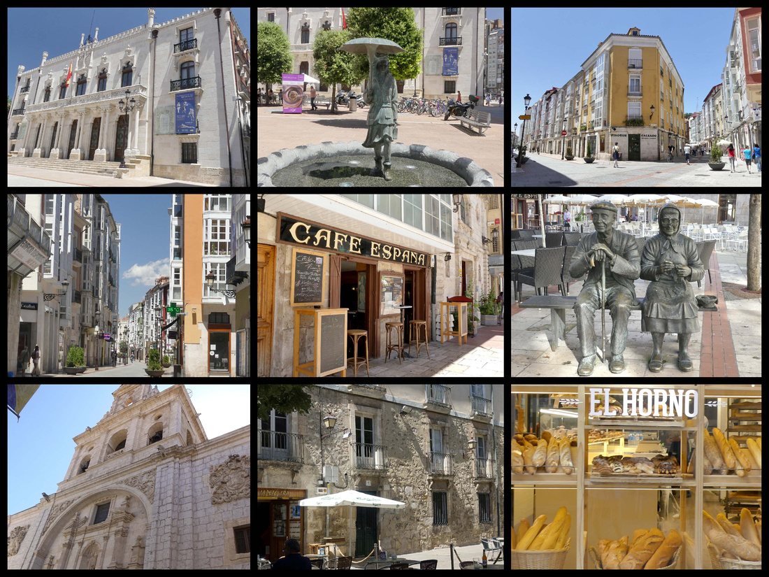
top left: Palacio de Capitania bottom left: San Lorenzo
The Camino enters Burgos center through the Arco de San Juan, follows Calle de San Juan to the church of San Gil, passes between the Church of San Nicholas and the Cathedral, then leaves the city through the Gate of San Martin. The Camino has played a significant role in the life of the city and was its cultural and economic communication road with Europe, influencing the urban layout of the city.
Iglesia de San Lesmes, 15th century, sits on the banks of the small River Vena just outside the Arco de San Juan.
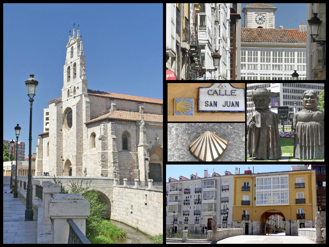
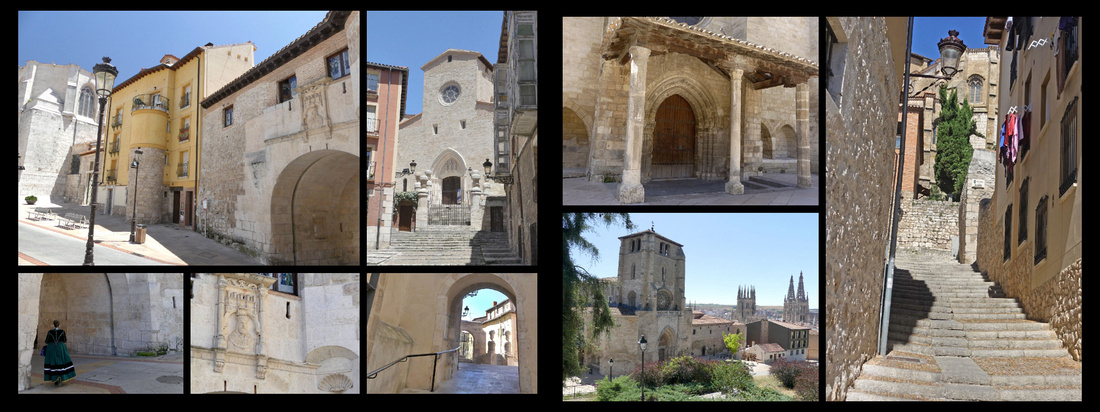
left: Iglesia and Arco de San Gil, 14th to 16th century, the church built right into the walls right: Iglesia de San Estaban, 13-14th century
Several sections of the town walls remain including those between Arco San Gil and the Castillo, and along side Arco de San Martin. The Castillo is where the original city was founded, today it is mostly a leafy park. Houses once covered the slopes of the hill down to the location of the Cathedral. Interesting displays in the cathedral show what the city looked like when the cathedral was being built. The Castle was destroyed by Napoleon in 1813 but some of the ramparts remain and there are displays showing what it used to look like. Views extend beyond the modern city of Burgos to the plains (and windmills) beyond.
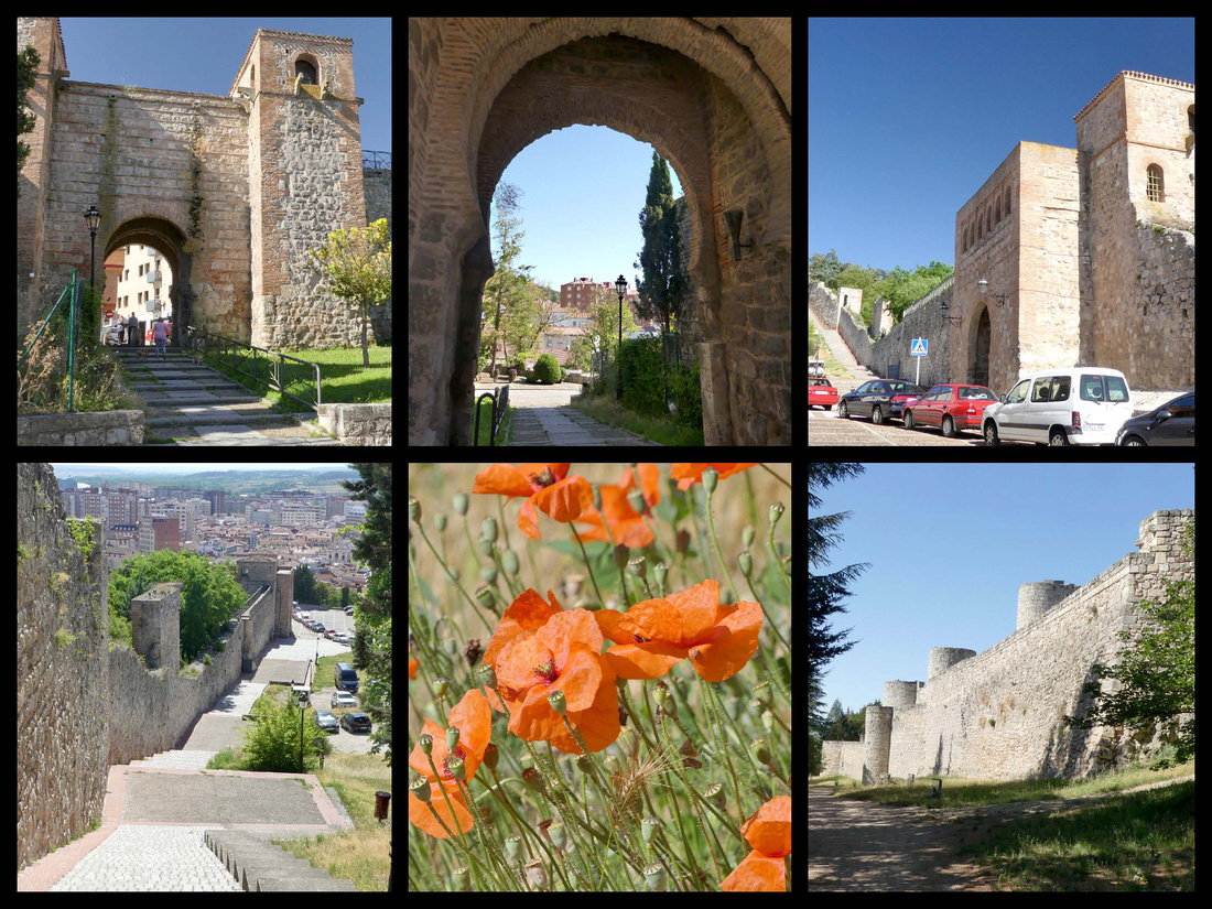
Arco de San Martin, a Muddejar style gate from the 14th century through which pilgrims leave the city, and which historically monarchs entered once the city’s privileges had been sworn. Several churches nearby had storks nests atop them.
Parque de la Isla, a park along the river laid out in the 19th century with a wide variety of trees and plants and various artistic elements such as the classical arches of the Palace of the Count of Castilfale, the Renaissance fountains from the Monastery of San Pedro de Arlanza and the Romanesque front of the church of Cerezo de Rio Tiron.
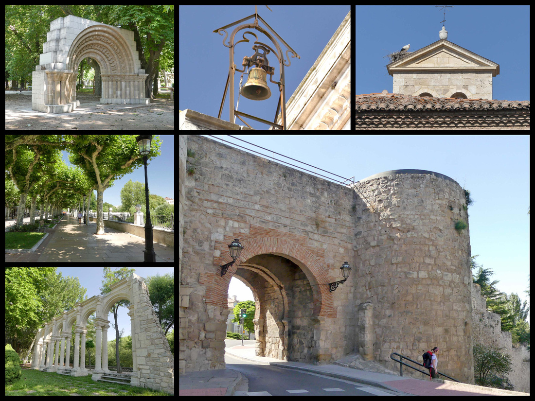
Monastererio de las Huelgas - a medieval Cistercian monastery which was originally a country residence of the kings of Castile is about a half hour walk from the center, through Parque de la Isla. The Spanish word huelga means "repose/relaxation." King Alfonso VIII converted the building into a convent for noble women in 1187. The monastery exemplifies the austere architecture of the Cistercian order, and includes the church, cloister, and chapter house. The original 12th century church was built with a Mudéjar Almohad style, resembling the architecture of Andalusia. It still houses about 40 cloistered nuns so can only be visited by guided tour (long, in Spanish only). To keep the nuns separate from the public, the church was partitioned in the 16th century, and the naves separated by walls. There's a moving pulpit that enabled the priest to address both the congregation and the separated nuns. There is a large cloister and a very pretty smaller cloister with amazing carved plasterwork, no doubt Moorish-influenced.
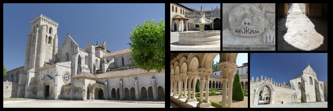
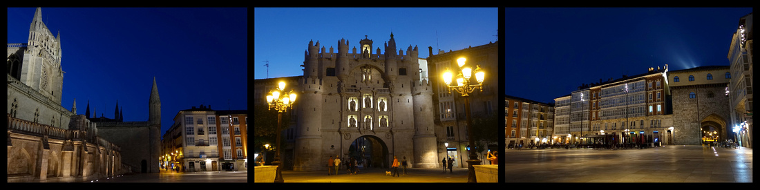
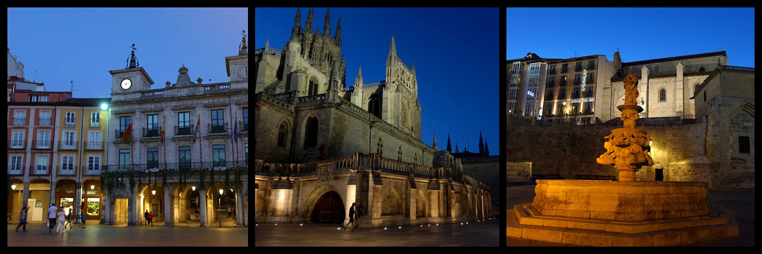
We took the bus from Burgos to Leon, a trip which is less than two hours via the highway but which most of the time followed the “N” road so took over three hours. Much of the time we were on the Camino and could see pilgrims walking alongside the road, sometimes right on it, usually in a dirt track just to the side. About half the people who got on the bus in Burgos were pilgrims and as the bus stopped numerous times more got on at each stop (only once did a few get off). Once the bus stopped and picked up a few pilgrims and then, as it was pulling away we saw several more waiting (in the shade) on the other side of the road, waving madly at the bus, which did not stop. Bummer, as there wasn’t another bus scheduled to do that route for several hours. So essentially you can cut out over a quarter of the total Camino by taking that bus ride. (183 km of the total 780 km) – or about 7-9 days of walking). The land is mostly flat and almost entirely golden wheat fields, with a few scattered fields of sunflowers, and a few decrepit little towns. Way off in the distance you can see the mountains of the Picos de Europa . It was kind of pretty to look at – for a few hours, no way would I want to walk for over a week of that same scenery. The bus station is in the newer part of Leon, just down the street from the train station (and car rental pick up location).
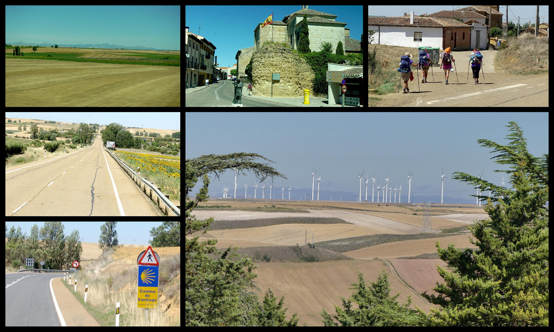
León Camino Frances
A concentration of beautiful architecture from varying periods, one of the premier stops on the Camino, a lively student population, a spectacular cathedral, a picturesque old quarter – the Barrio Humedo. Immediately loved Leon. From the bus and train stations just across the river (which has extensive riverside gardens) to the cathedral is about 1km. The old town lies immediately south of the cathedral.
Located at the base of the Cantabrian Mountains, and starting life as a provincial Roman settlement, Leon lived through Muslim invasions, entering it’s zenith in the Middle Ages. It was the capital of one of the major regions in the Christian re-conquest of Spain. In the 10th century Leon was a model of reasonable, civilized medieval government. León today is the gateway from Old Castile to the northwestern region. There were signs celebrating that 2017 was the 1000th anniversary of León, which was really interesting to us as our town in Massachusetts just had a huge celebration for it’s “250th” old in North American terms but Leon is four times that old.
It’s a little-known fact that the Spanish city of León’s name only coincidentally means “lion” in modern Spanish. It was founded as an encampment for Roman legions, the Latin name for this legionary town (Legio) converged with the word for lion (leo) over the centuries as Latin grew into Spanish. Apparently this distinction was also lost on the locals and a lion is now the city’s symbol. All over Leon are lions - freestanding sculptures, imbedded on facades, on the manhole covers, on flags, etc. In Burgos, which is in ‘Castile y Leon’ there are lions along with castles featured everywhere.
Puente de los Leones – From the newer part of town where the bus and train stations are located cross this bridge with large Lion sculptures at all four corners, over the Bernesga River to the first main plaza, Plaza Guzman Bueno, a busy traffic circle but it has a beautiful huge fountain in the center and is surrounded by nice buildings. The main street leading into the old town is Ave Ordono II which leads to
Plaza de Santo Domingo – the next main plaza, a somewhat smaller traffic circle but also with nice fountain in the middle and surrounded by attractive buildings. This is the start of the old town, the street name changes to Calle Ancha and it becomes pedestrianized. You immediately see two of the most gorgeous buildings in Leon, Palacio delos Guzmanes and Casa de Botines.
Plaza San Marcelo - Plaza San Marcelo is adjacent to the larger Plaza de Santo Domingo. Iglesia de San Marcelo. Built between 1588 and 1627. Home to the Ayuntamiento which occupies a Renaissance era palace.
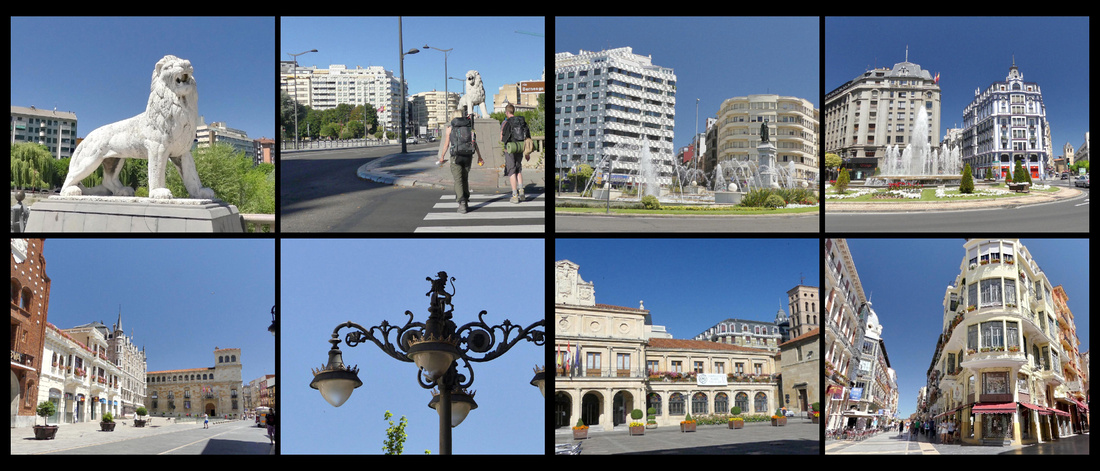
Palacio de los Guzmanes is an impressive 16th century Renaissance palace designed in the style of an Italian palazzo. It has an imposing facade with rounded arches, large corner towers, and wrought-iron balconies. Once a private residence, the palace is designed around a courtyard featuring classical columns. The palace currently houses the Leon Regional Government.
Next door is Gaudi’s castle like neo-gothic Casa de Botines (1893), with stained-glass windows and sharply pointed turreted towers. Gaudí started the project in 1891 when it was commissioned by textile merchants of León. Business was conducted on the ground floors, and the upper floors were designed as private apartments. The building’s façade features St George sticking it to a dragon; a bronze sculpture of Gaudí observes his creation from a park bench outside.
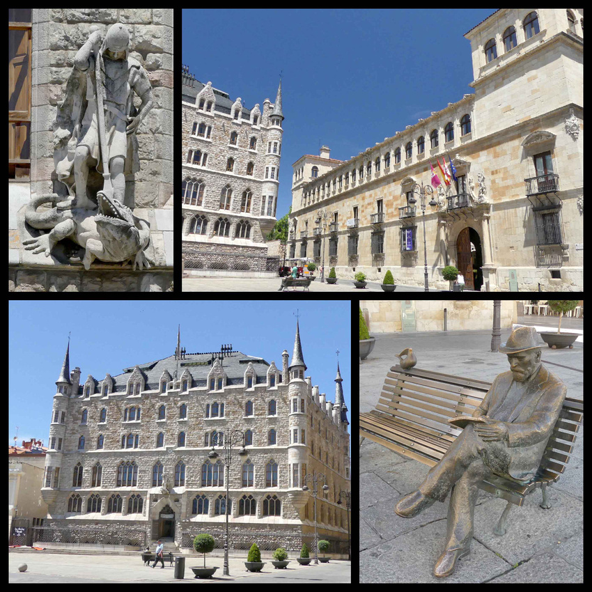
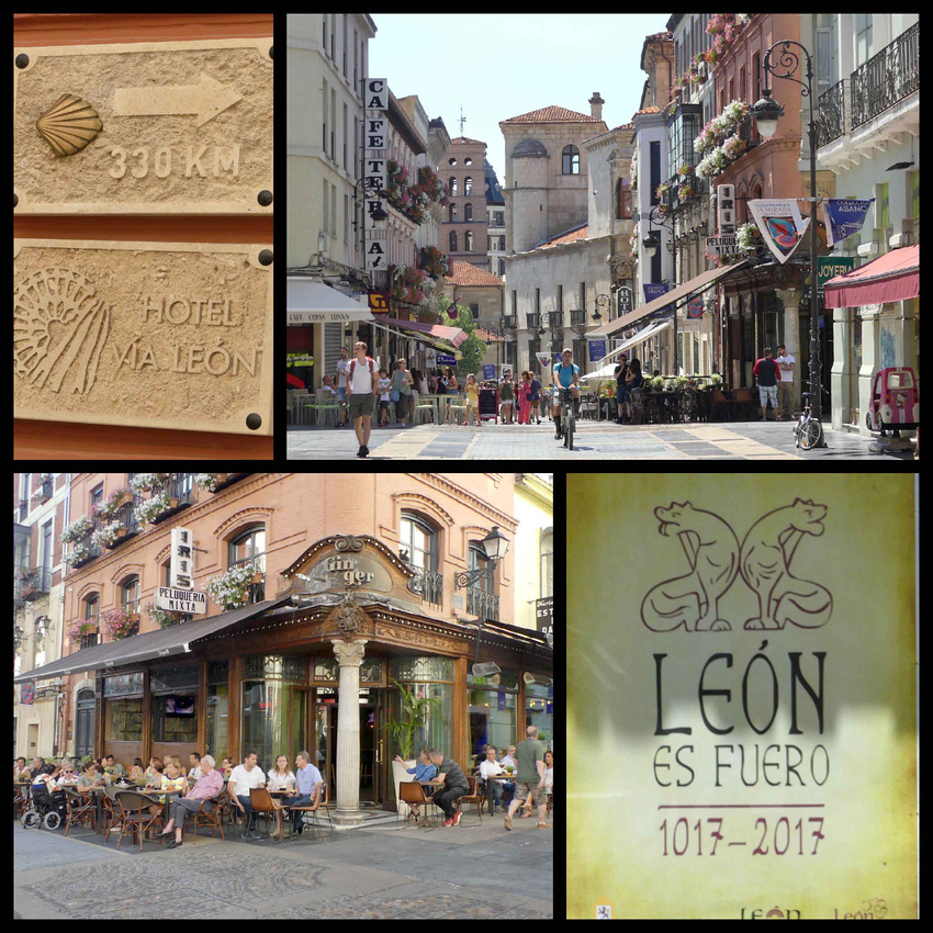
León Cathedral, a UNESCO site, is surprisingly French in style. A huge rose window dominates the west façade, and there is literally wall-to-wall stained glass that covers the entire upper half of the church. Massive panes span from the pointed arches up to the ceiling, giving the impression that the walls simply vanish into glorious light. The whole atmosphere is truly dazzling. The windows transform the usual gloomy gray stone interior into a reddish-purplish wonderland, though it is still quite dark inside. This only enhanced the beauty of the stained glass. There is a €6 fee to visit the church (includes an audio guide) and a separate €2 to visit the cloisters which are entered from the side.
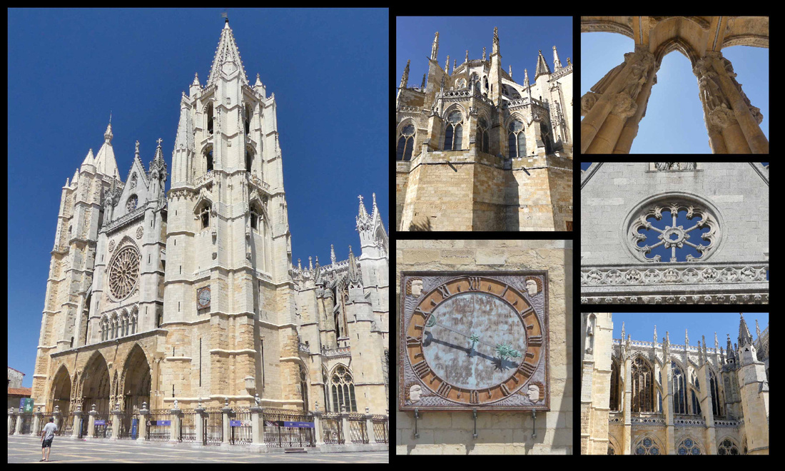
It was begun in 1258 in the Romanesque style, but the soaring upper portions are Gothic at its best. It took 200 years to build, though the upper portion only about 50 years, in the 1300s. The exterior is covered in towers and flying buttresses which range in size and shape. Symmetry was certainly not the goal of this cathedral. In the church-building frenzy of the Middle Ages, every Gothic cathedral vied to distinguish itself with some superlative trait. Milan Cathedral was the biggest, Chartres had the most inspiring stained-glass windows, Palma de Majorca had the largest rose window, and so on. Structurally, though, the boldest cathedral was León. It set the record for the highest proportion of window space, with stained-glass windows soaring 34m to the vaulted ceiling, framed by the slenderest of columns. The windows occupy almost all the space where you'd expect the walls to be. The peaceful, light filled claustro (cloister) has 15th century frescoes. The main door has a triple-arched façade, expressively carved. The central portal features a jovial Christ above a graphic Hell, with demons cheerfully stuffing sinners into cooking pots.
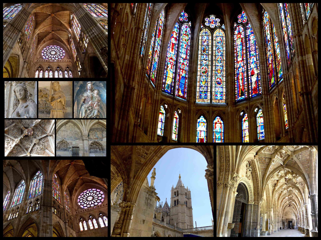
Plaza Regina - The medium size plaza in front of the cathedral has a nice building to the right, the Museo Diocesano de Arte Sacro, and a few souvenir shops and cafes/ice cream parlors opposite but is otherwise rather plain.
Plaza San Martin - At the heart of the Casco Antiguo (Old Town). This quaint public square is lined with bars and restaurants. This is ‘tapas and dinner’ central. From the Plaza de San Martín, many little streets wind their way around the medieval maze of the Old Town, most also filled with tapas bars.
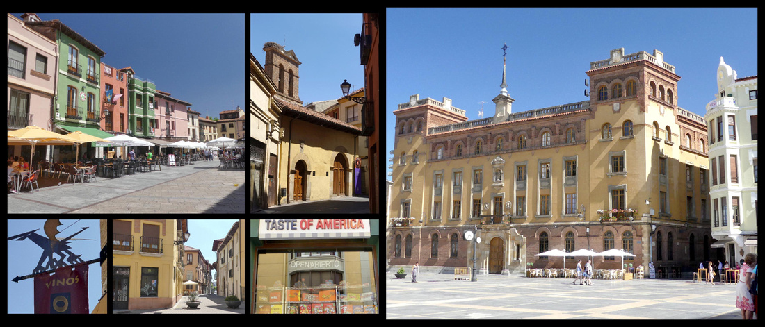
Plaza Mayor, beautiful and time worn, 17th century, sealed off on three sides by porticoes, this is a sleepy plaza by day, more lively in the evening with numerous tapas bars and restaurants. The old city centers around here, winding cobbled streets full of houses with wrought-iron balconies. Ayuntamiento antigo is the old town hall.
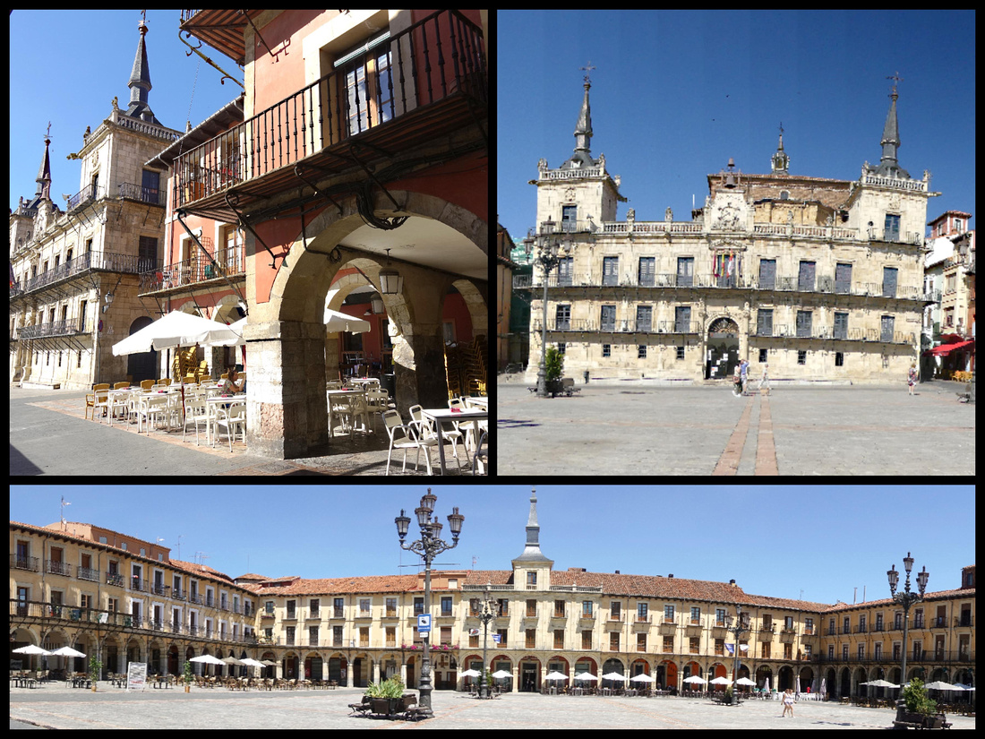
Plaza de Santa Maria del Camino (aka Plaza del Grano, for its one-time wheat exchange) feels like a cobblestone Castilian village square and is overlooked by Romanesque Iglesia de Santa Maria del Mercado. It’s a lovely time-worn space with rough cobbles, wooden arcades and a pretty Romanesque church. In the morning it’s largely shaded and had several locals and their dogs hanging out. Later in the day it’s hot and sunny and the families and dogs are replaced with people having drinks at the café under umbrella shade.
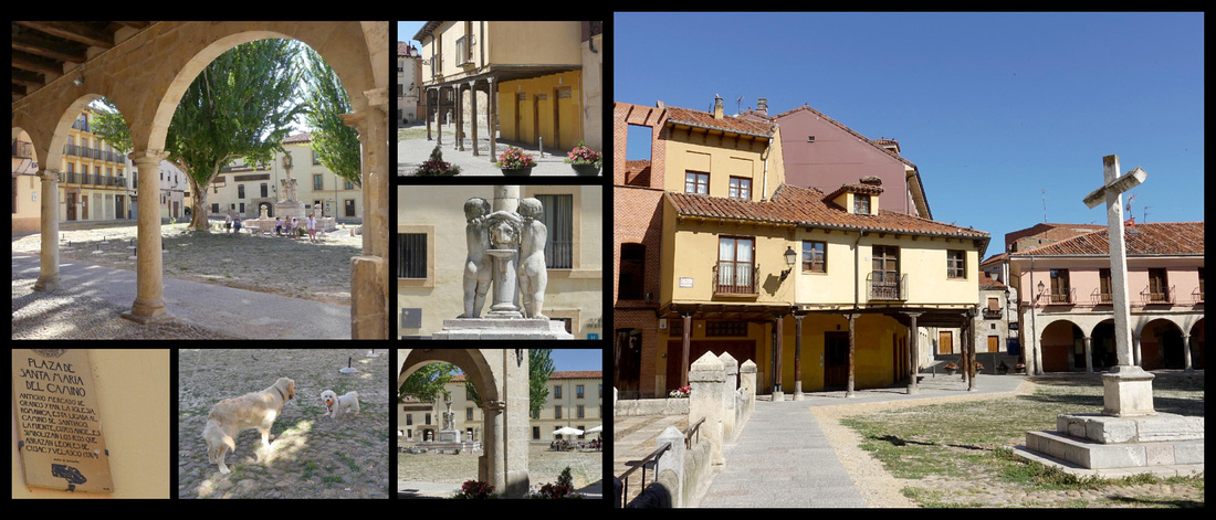
San Isidoro - one of the oldest Romanesque churches in Spain. Although it’s been spruced up over the centuries—the east section was rebuilt in Late Gothic style—the church looks generally as it would have a thousand years ago. On the south façade, are two Romanesque tympanums (the sculptures in the round semicircle above the doors), and within are some unique arches that look like they belong more in Moorish Andalucía than in northern Spain. The Puerta del Cordero (Doorway of the Lamb); the main doorway with sculptured figures of Saint Isidore, and the Lamb of God; and the Puerta del Perdón (door of forgiveness); pilgrims could gain absolution by passing through here if they were too infirm to continue their journey to Santiago.
The original 10th century church was built in the pre-Romanesque style of Asturias, similar to the ancient buildings in Oviedo. This early church was destroyed in 988 by Al-Mansur and later renovated by Christians in the 11th and 12th centuries in classic Romanesque style although the apses were converted to Gothic style.
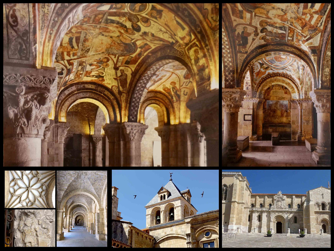
The highlight of visiting San Isidoro is the Panteón de los Reyes, the royal burial place for dozens of kings and queens who ruled the medieval Kingdom of León. Covering the entire ceiling are bright, thousand-year-old frescoes that represent biblical scenes, hunting scenes and an illustrated agricultural calendar interwoven with animal and plant designs. These vibrant, masterful paintings have earned the Pantheon the distinction of being compared to the "Sistine Chapel". They are in a superb state of preservation (never restoration, only ‘cleaned’ twice). You have to go on a tour to see it, and no photos are allowed – two things which are usually total turn offs for me but this tour was in English (cute Spanish guy who kept apologizing for his poor English but it was really quite fine and he was very interesting). Had to make do with postcards for pictures. The tour also included the cloisters (where photos were allowed) which was pretty good, and several rooms of artifacts. The top of the tower of the building has a ‘Cock’/rooster weather-vane, the original is in the museum and he explained that roosters were a symbol of the Muslims and this one was made in the 6th century and brought over from Persia by them when they occupied Spain. All in all worth the 5€ admission.
The complex is built into the medieval city walls, much of which is preserved.
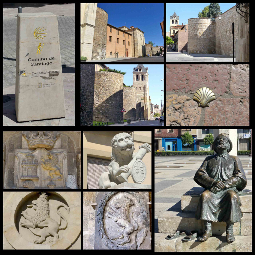
San Marcos / Parador – At the edge of town on the Rio Bernesga, now a five star Parador, built in 1168 as a hospital for pilgrims on the road to Santiago. The ornate Plateresque façade was added in 1513 and is more than 100 m long. The exterior is Plateresque style, which means the intricate stonework, shells, and sculptures on the façade look like they were forged by silversmiths, or plateros in Spanish. This architectural movement was unique to Spain and was kind of a transition style between Gothic and Renaissance. A perhaps morbid factoid about this building: during the Spanish Civil War, it served as a concentration camp for Franco’s Nationalists. The church, museum and cloisters are quite extensive and are open for free.
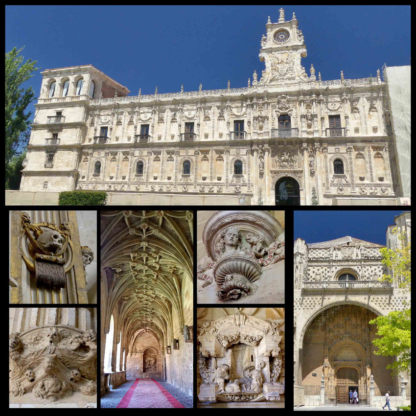
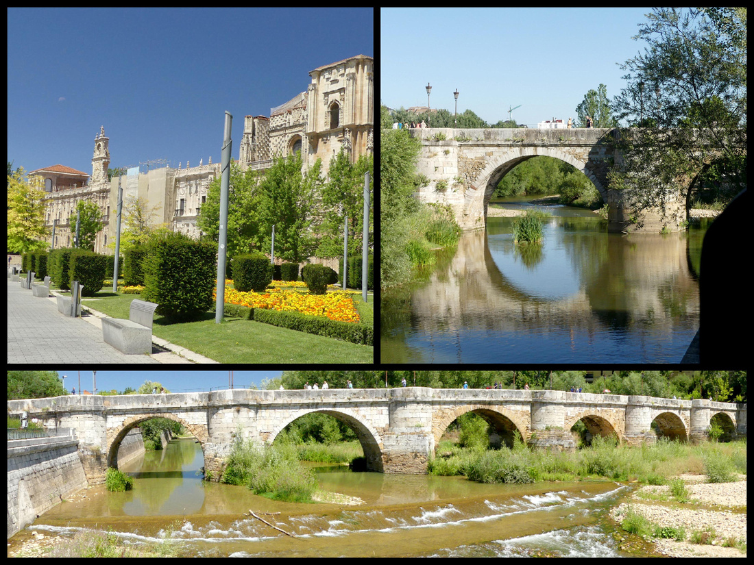
Right next to the parador/San Marcos is the Roman Bridge / Puente de San Marcos, a six arched stone bridge over the Rio Bernesga. The river itself is not very wide (at least in July) but it’s banks are, and they merge into a nice park which runs from the Roman Bridge to the Puente de los Leones.
We had considered staying at the Parador, I kind of wanted to do at least one Parador stay this trip, but in the case of Leon (and it turned out, several other locations as well including Ribadeo, Santillana and Olite) I found what I think were just as nice hotels for less money. Hotel Via Leon is right in the center of Leon, one block off Calle Ancha, less than a five minute walk from the cathedral and Plaza San Martin.
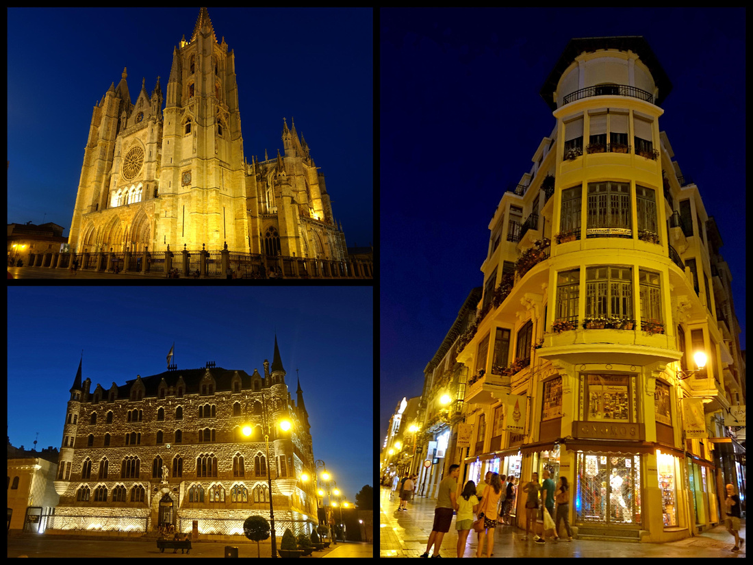
After two nights (one and a half days) – which was just about a perfect amount of time to explore Leon – we picked up our Fiat 500 and found our way out of Leon by following signs for Astorga. Numerous turns and round-a-bouts (all well marked) later we were on the highway for the 45 minute drive to Astorga. We had intended to get a SIM card for the iPhone so we could use google maps but the Vodaphone store was closed and we didn’t want to wait around an hour so we figured we’d get one later. Turned out driving that day was so easy we didn’t bother.
Astorga Camino Frances
On the frontier between the tan plains of northern Castilla and the green mountains of Galicia, Astorga, population 12,000) is a little town with attractions out of proportion to its size. In addition to its cathedral there is a Gaudi designed palace, and a smattering of Roman ruins and a couple nice sections of city wall. Astorgas’s old center is small and easily navigated (both in car and on foot). The cathedral and Palacio Episcopal are side by side in the northwestern corner of the old town.
We missed the turn into the first parking lot you come to off the main road and thus ended up driving through the center, which turned out to be a piece of cake (at this point I was thankful we weren’t in Italy cause it would probably have been a ZTL). We parked right in front of the Cathedral and I walked the half block to the parking ticket dispenser machine – and not only knew how to use it (we have the exact same machine at home) but showed a Spanish woman how it worked. I bought two hours worth of time, which was more than enough since it was too early in the day to be having lunch.
While Astorga has an interesting history, nothing much goes on there now. However, it’s a very pleasant, relaxed place with some attractive buildings and a peaceful small-town atmosphere. As a major Roman center for administering the gold-mining region further to the west, Astorga was known as Asturica Augusta, having been founded by Augustus during his campaigns against the never-say-die tribes of the northwest of the peninsula. The city is a key point in the Camino de Santiago, as two mains routes to Santiago, the French Way and the Vía de la Plata, meet there and there was an abundance of blue and yellow scallop shell signs and yellow arrows.
The Catedral has a Plateresque southern façade, made from caramel colored sandstone and ripping in sculptural detail began in 1471 on the site of its Romanesque predecessor and took 3 centuries to complete resulting in a mix of styles. Most of it is in late Gothic style, but the font façade and towers are later baroque constructions and don’t seem to really go with the side and back. There are some really interesting sculptures including a lot of babies, some bare breasted women and what appear to be mermaids. I didn’t go inside since after Burgos and Leon (not to mention the half dozen on the coast before that) I needed a break from cathedrals and figured no way this one was going to compete.
Gaudi Palace. In 1887 a Catalan bishop was appointed to Astorga. Not prepared to settle for a modest bungalow on the edge of town, he decided that his residence was to be built by his mate, a man called Gaudi. The townsfolk were horrified, but the result is a fairytale-style castle with pointy turrets. Inside is the Museo de los Caminos, a collection of art and artifacts relating to the pilgrimage to Santiago, but it was closed since we were there on a Monday. The garden is guarded by some scary angels.
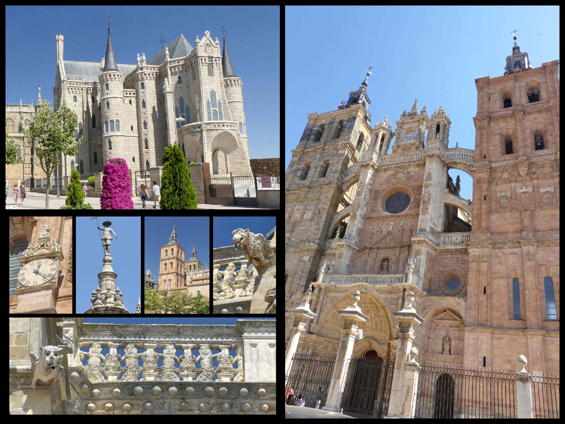
Plaza Mayor is the most attractive square, and the town hall is typical of the region, most towns in the area had a very similar one. However this one has figures of a man and woman that strike the hour on the clock. Built in 1683, it is Baroque with three towers in its façade, the middle one including the bells. The square is (of course) lined with cafes.
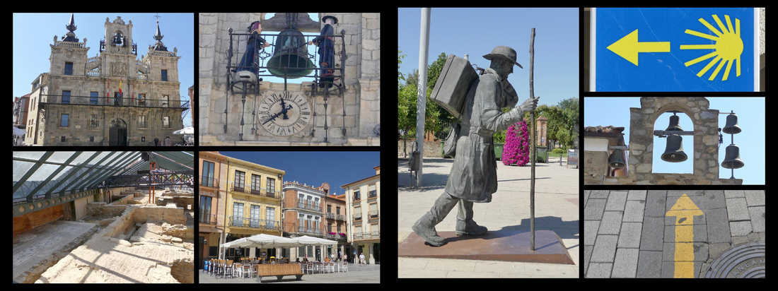
Ponferrada Camino Frances
Easy 45 minute drive out of Astorga, continuing along with the Camino, and into the next town, Ponferrada. Slightly larger (60,000) but signage was still good and directed us to the center where we ran right into an underground parking garage under the town hall plaza. The google maps I had printed out weren’t very good at this point and we weren’t really sure where the castle was but we knew it was close so we parked and started walking around. Geo got to practice his Spanish asking directions. They essentially pointed off to one corner of the Plaza, which fortunately coincided with the signs to the TI, always a good place to start. We walked under a charming old clock tower and then saw the walls of the castle (right next to the TI).
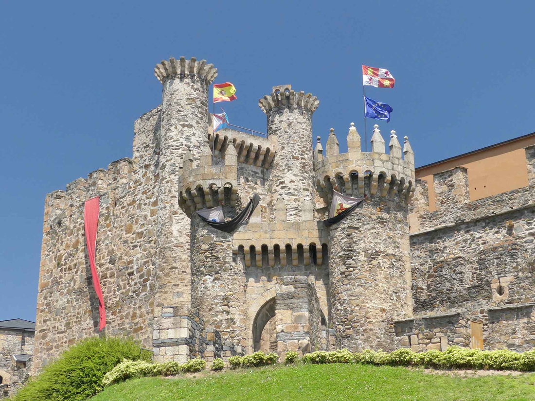
Castillo de los Templarios - has 12th century turrets and battlements that look like gingerbread but were built to protect pilgrims from the very real threat of the Moors by the Knights of Templar, and the arcaded streets and overhanging houses of the old quarter grew up in their protective shadow. The front entrance to the castle is drop-dead gorgeous, exactly what you think a castle is supposed to look like (think fairy tail picture books or Lego castle designs). There are a couple of buildings/towers that have been recently renovated and house a pretty interesting exhibit of medieval life (with English translations) and there are several towers you can climb, but the majority of the grounds are just open areas and there is the ‘old’ castle building, in a slightly crumbling state. Despite it being close to 100 degrees we spent a good hour or so exploring it.
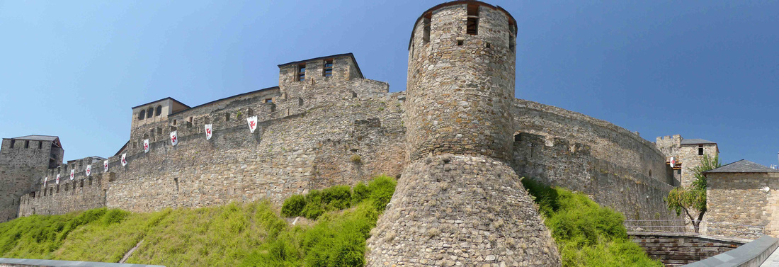
By then it was siesta so the rest of the town had pretty much closed down. Plaza Ayuntamiento is an attractive space in itself (with that similar city hall design). The clock tower, Puerta del Reloj, arches across the street that we walked through to get to the castle is the most interesting building we saw (other than the castle). We got lunch in Plaza Ayuntamiento, retrieved the car and headed on.
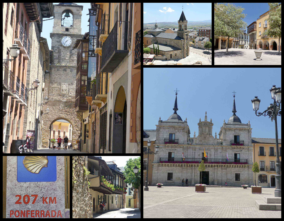
The main road between Ponferrada and Lugo is the A6 highway. And at this point we detoured off the Camino to Lugo (which is on the Camino Primitivo). Leaving the plains behind we entered hilly, green Galicia. Over a period of less than 15 minutes the landscape completely changed.
Lugo [Camino Primitivo] (Roman Walls UNESCO)
Lugo was founded about 14 BC by the Romans, who constructed the Roman wall in the mid 3rd century. After that, the Visigoths were in Lugo until 714 when the town was invaded by the Muslims. Today it’s a small and very pleasant inland provincial capital with a prosperous feel. We wanted to see the Roman Walls, which are a UNESCO world heritage site, and it made perfect one night stop before Santiago.
Driving into the town off the A6 was a breeze and we easily found the Gran Hotel Lugo (which I had chosen because it was a five-minute walk to the walls and town center, yet on a main road and with a parking garage). The hotel is not really our style – it’s large, old and somewhat elegant with a huge shiny lobby – but it turned out to be perfect for our needs. There is a large grocery store across the street where we got ourselves a picnic dinner, and only five minutes to the walls so we were able to go back and forth to the hotel frequently (it was close to 100 degrees and we needed air conditioning breaks).
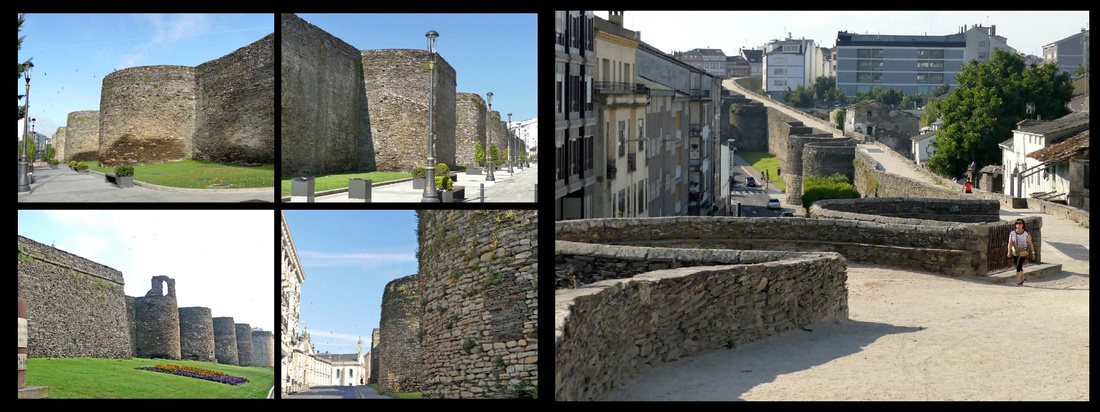
As per UNESCO, the Roman walls of Lugo are, “the finest example of late Roman fortifications in Western Europe.” The circular walls are 10-15 metres high, with 85 circular towers along a circuit of almost 3 km and are broad enough to provide a pleasant thoroughfare for walks around the city. There are 10 gateways to enter the walled area and 6 staircases and a ramp to reach the pedestrian path on top of the walls. Sadly, insensitive building has blocked out most of the views of the surrounding countryside and a busy loop road makes it impossible to appreciate the walls from any distance outside. Walking along the base of the walls is the best way to appreciate their construction and walking along the top of them is the best way to see the town. In the morning much of the walkway on top of the walls is shaded and there are some great views out to the countryside. In the afternoon it’s hot and sunny and in the evening you can see the old town lit up. We walked parts of the walls at all three times and were glad we did.
Within the walls is a beautifully preserved, lively and mainly traffic free historic center. Lugo doesn’t have any ‘great’ sites but it’s a nice place to wander filled with late medieval and 18th century buildings and numerous plazas. The main square, Plaza Mayor, is home to the Ayuntamiento/Town Hall, mid 18th century (clock tower added in the late 19th) which is large and attractive, in Galician baroque, a style that is similar to much Portuguese architecture. The square has nice gardens, shade trees and a bandstand pavilion in the center and is lined with cafes and restaurants.
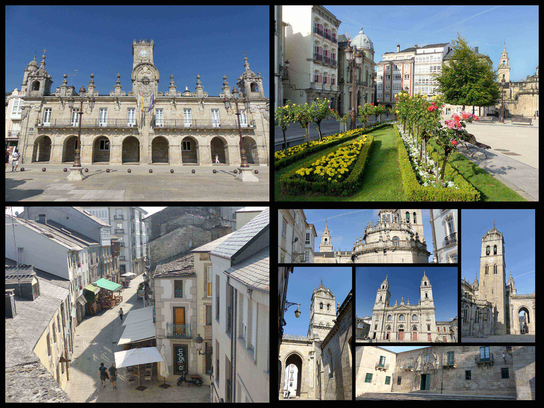 top left: Town Hall, right: Plaza Mayor Bottom left: view of the town from the walls Bottom right: Cathedral and around
There are numerous shopping streets and plazas within the walls but the most interesting place is Plaza do Campo, a triangle-shaped square. During the Middle Ages, it was the city’s main marketplace. Rúa Nova and Rúa do Miño are the two main streets leading out of Praza do Campo. Just steps from Praza do Campo are the Cathedral and Bishop’s Palace. The cathedral was built over centuries beginning in the 12th and so is of several styles including Romanesque, Gothic, and Baroque; the back and side are more interesting than the front. Across a small plaza is another beautiful building, the Episcopal Palace, 18th century.
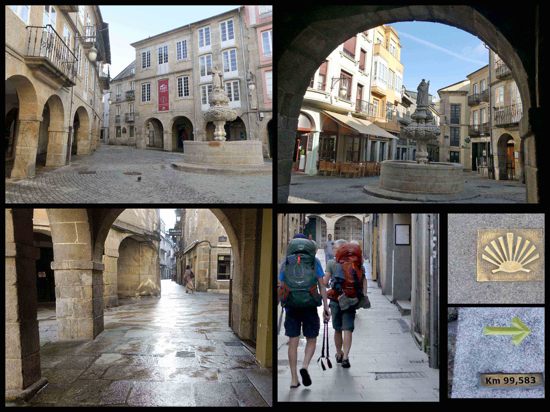
Plaza do Campo
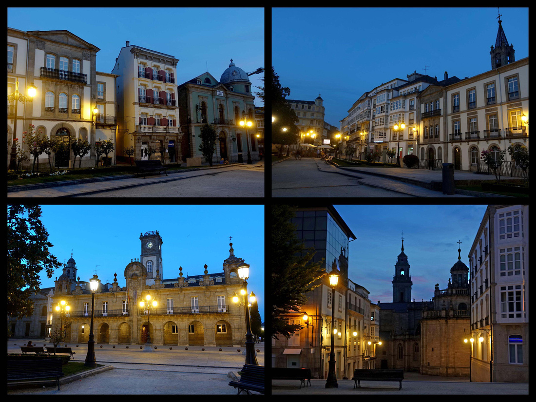
Santiago de Compostela Camino de Santiago
All roads in Spain, at least in northern Spain, lead to Santiago.
Being the end point of the Camino de Santiago makes it the third-most-holy city of the Christian world (after Rome and Jerusalem). But it’s also a university town and a marketplace for Galician farmers. It has cobblestone arcaded streets, beautiful gold/grey churches and buildings and numerous plazas. It is one of the most interesting and historic of Spain's great cities. The medieval city center has been declared in its entirety to be a UNESCO site. The Camino de Santiago (combined routes) is also on the UNESCO World Heritage list.
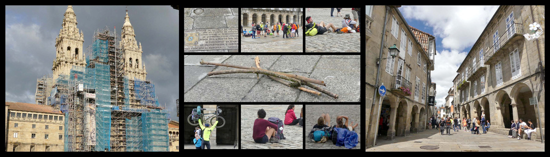
Although a relatively small size, population 95,000 - 15 minutes walk from one side of the pedestrianized center to the other, it is quite confusing until you figure out your way around and you can walk in circles trying to find your way out. Immediately surrounding the pedestrianized center is a more modern shopping district and a lot of one-way streets. Neither logic nor signage are strong points of Santiago.
Santiago also has the dubious distinction of being the rainiest city in Spain, though the showers are frequent but brief and often consist of just a lot of mist. Water glistens on the facades and vegetation sprouts everywhere with the cathedral coated in orange and yellow mosses and grass poking up from the walls and cobbles.
Rúa do Vilar and Rúa Nova are the two main streets in the old town and they are bounded on either side by soportales or arched, covered walkways. Most of the other streets wind in and around the many tiny plazas.
Just down the street from the cathedral along Rúa do Vilar is the Casa do Deán, the modern-day Pilgrims’ Office where people go to get their compostela or certificate that says they have completed the Camino de Santiago.
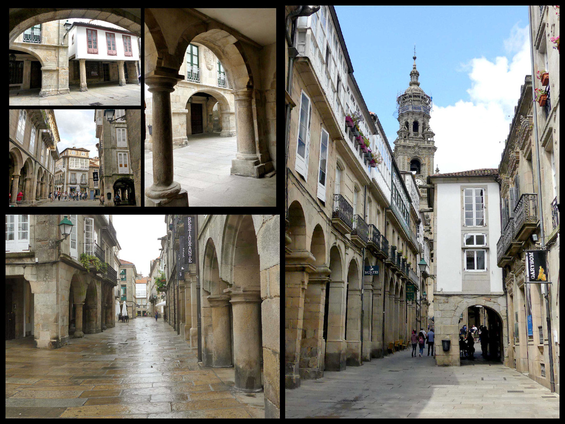
The main thing in town is of course the cathedral, which is sprawling rather than just massive (inside it actually felt quite small compared to Burgos or Leon cathedrals) and has four distinct sides each with a plaza that is lined on its non-cathedral sides with other beautiful buildings.
Plaza do Obradoiro is the ‘main’ plaza facing the ‘front’ of the cathedral – the west side. It has a tile with a scallop shell in the middle of the square that is the official end of the Camino. When it’s not raining the square is full of pilgrims who traditionally sit or lie down here to mark the end of their journey. This square has four different architectural styles: the Cathedral front is 18th century Baroque, the Hostal (now the Parador) is 16th century Plateresque, The city hall is 18th century neoclassical and the university is 15th century Romanesque. This front of the cathedral is featured on Spain’s one-, two-, and five-cent Euro coins. This exuberant façade would be unrecognizable to Pilgrims from the Middle Ages, however, as it completely replaced the earlier one that was designed when the cathedral was built. In the 1700s, a Baroque façade was created, not only to get with the times (the Baroque style was “in” then), but also to finish the work begun a century earlier that had raised the height of the towers; to enclose the Pórtico da Gloria, a medieval sculpture ensemble that had been left to deteriorate in the humid air. As the cathedral (and the city) were built on a bluff between two rivers, a double staircase takes you from the plaza up to “ground level” where the main doors are. Unfortunately it’s been covered in scaffolding for years and still was when we were there.
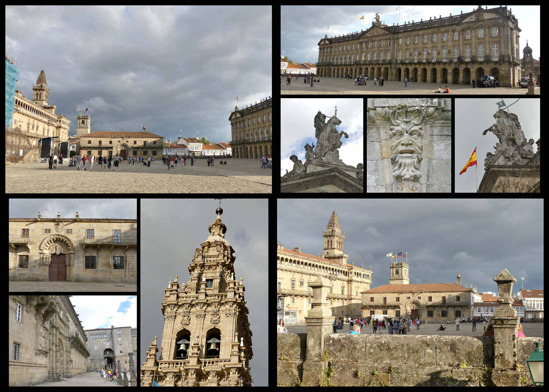 To the left as you face the cathedral is the massive Hostal de los Reyes Catolicos (Hospital of the catholic kings/ Pilgrims Hospital) an example of Gothic Plateresque architecture. Isabel and Ferdinand came here in 1501 to give thanks for successfully forcing the Moors out of Granada. When they got here they found many sick pilgrims and built the hospital to give them a place to recover. It was free, and remained open until 1952 (when it was still Santiago’s main hospital) when it was converted into a Parador. The hospital later doubled in size in the Baroque era.
Pazo de Xelmírez/ Colexio de Fonseca, the archbishop’s palace, one of the few remaining examples of civil Romanesque architecture, is where Santiago’s university originated in the 1500s. The front of the building on the square is the original University building, today the library. This is Spain’s 3rd largest university with 30,000 students.
Ayuntamiento /City Hall (Pazo de Raxoi), built in 1766 in Neoclassical style, so pointy Ionic-order columns abound. An arcaded covered walkway spans the entire width of the building—a useful feature in rainy Galicia—and at the top there’s a statue that depicts the legendary Battle in which Santiago rides in from heaven to help the Christians as they fought against the Moors.
Praza das Praterias is the south façade, the church’s oldest and the only Romanesque façade that appears as it did eight centuries ago. A double portal supports carved marble columns, sculpted tympanums, and an upper frieze. The clock tower’s base was built in the 1400s but the upper section was remodeled in the Baroque style in 1680.
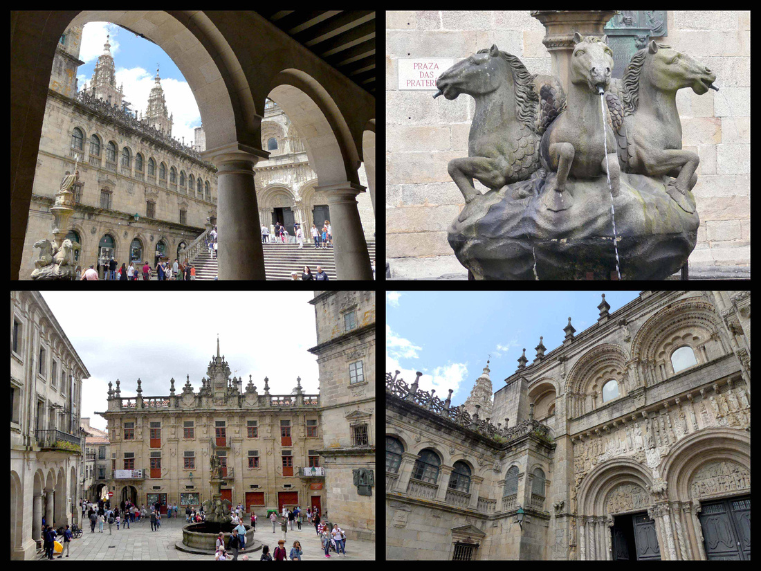
Casa do Cabido, the cathedral’s chapter house that was built in 1759 for the sole purpose of beautifying the plaza. This building with pretty red doors and windows is only three meters deep—pure façade. Gotta love the Baroque era!
On the square’s east edge is the Museo das Peregrinacións e de Santiago, a museum with a scale model of the cathedral plus a model of what the walled city of Santiago would have looked like in the Middle Ages.
Praza da Quintana is the square to the east of the cathedral. It is a curious space, with an upper and lower half; these are known as the halves of the living (the top) Praza de Quintana de Vivos, and the dead (below) Praza de Quintana de Mortos; the area used to be a cemetery. The portal on this side is known as the Puerta Santa, or holy door. The façade is 17th century, but contains figures salvaged from the Romanesque stone choir. The 18th -century clock tower soars over both Praza das Praterias and Praza da Quintana. The three walls that zig-zag across the cathedral’s east façade were put together to give a uniform look and feel to this side of the church, since it had become a helter-skelter collection of side-chapels bubbling out from the transept and apse.
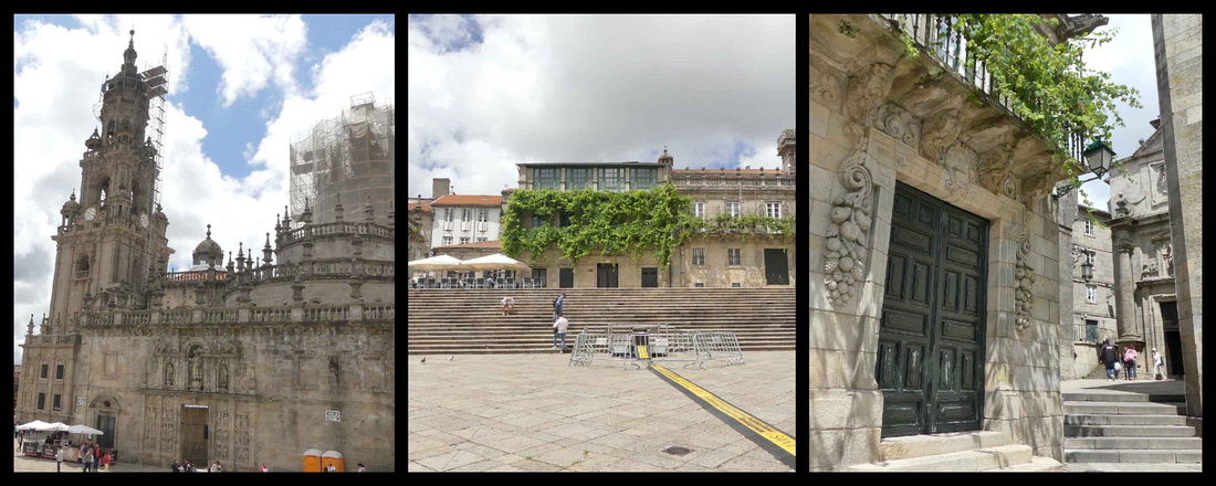 On one side of this square is Casa de la Canónica, the former residence of the canon. Across the square from the cathedral is the Saint Pelayo Monastery (Mosteiro San Paio). Founded a thousand years ago as a monastery to look after St. James’ tomb. Benedictine nuns moved in after their Benedictine brothers moved out in 1499.
Praza da Inmaculada (north facade) was the final stop along the Camino for pilgrims hiking the Camino Frances - the "French Way" - and the Camino Ingles - the "English Way" (which starts on the north coast). All medieval pilgrims would have entered the church here at the north door, the Porta do Paraiso (Paradise Portal). The north entrance is also called the Azibecheria facade because shops nearaby sold jewlery made from azibeche, or jet, a black gemstone. Today the Caminos all technically end in the Plaza do Obradoiro.
Facing the Azibechería entrance looms the huge former monastery of San Martiño Pinario, once the second-largest monastery in all of Spain. Today it houses the Seminario Mayor (seminary for Catholic priests) and an hospedería for pilgrims.
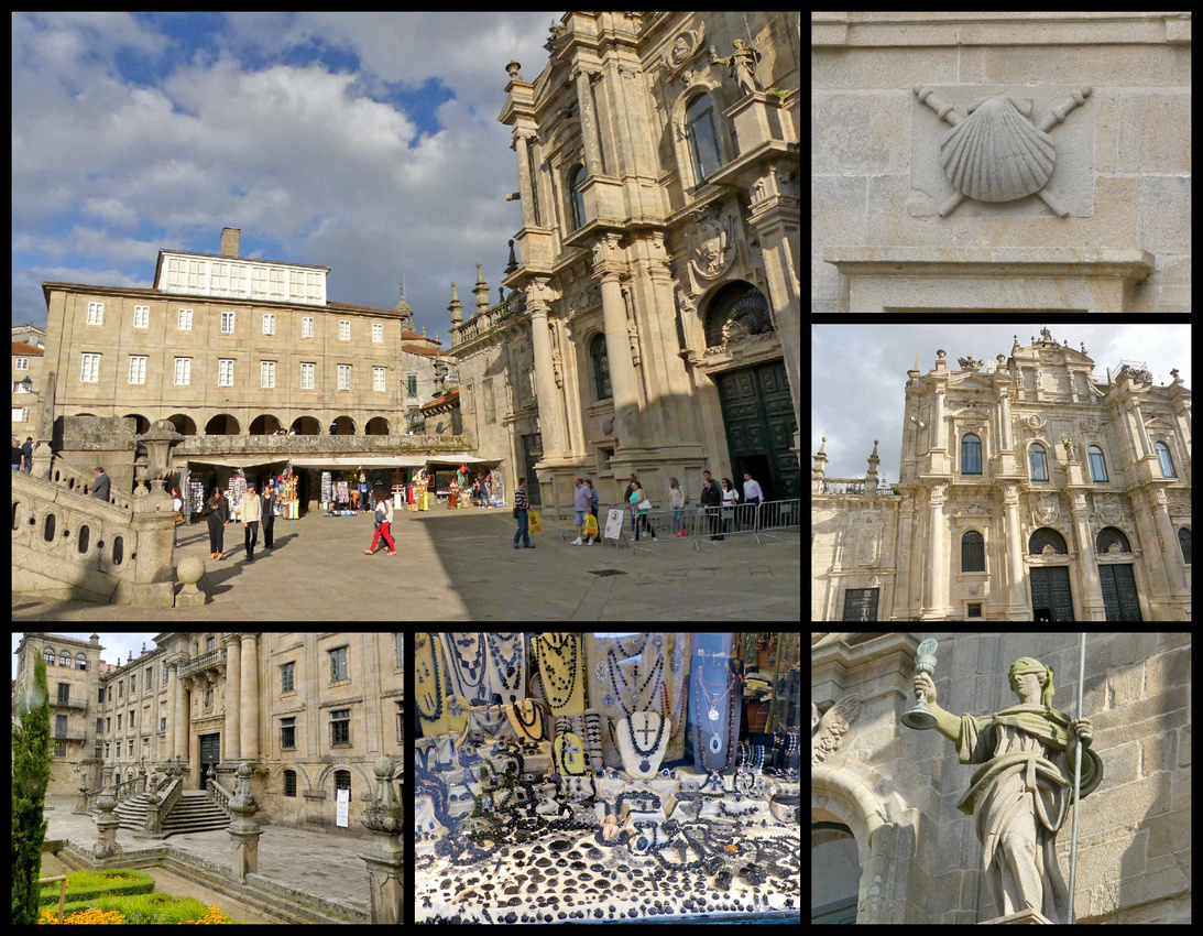
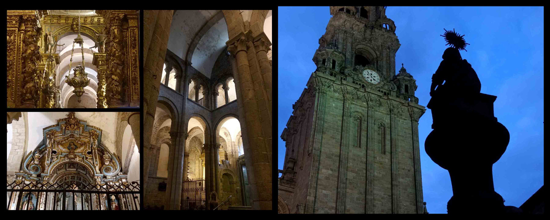
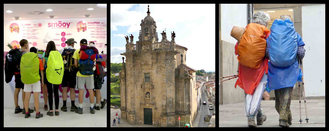
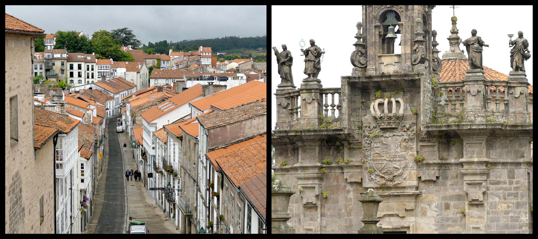
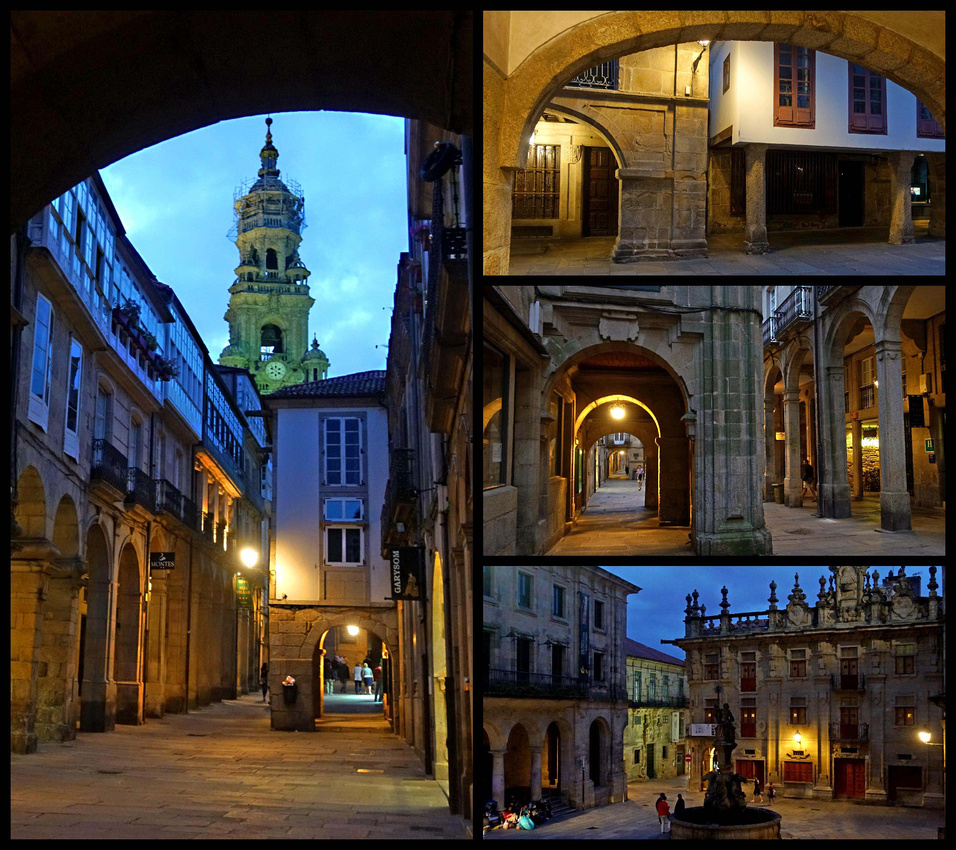
]]>
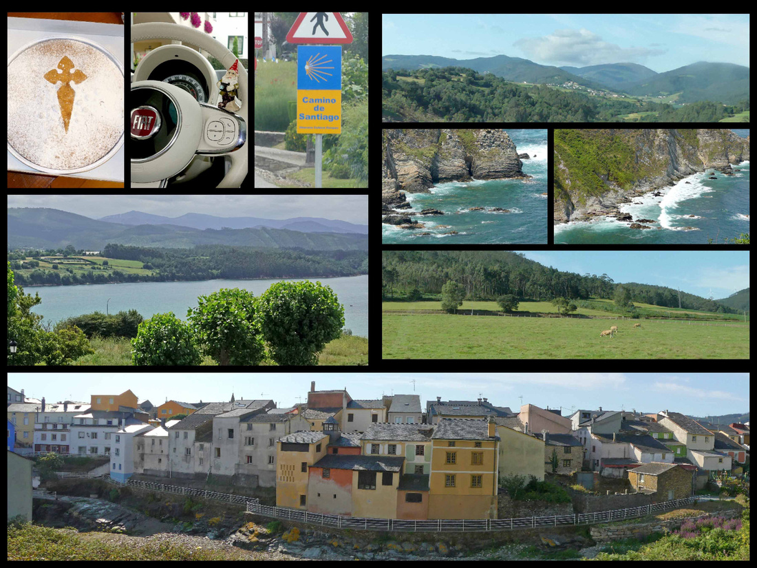
Coastal Galicia - top left: Santiago cake; center left: view from our room at Hotel O Cabazo in Ribadeo, bottom: Rinlo
Praia das Catedrais - About 7 km west of Ribadeo (along either the N634 or the local beach road) is the tiny village of Rinlo. I have no idea what the population there is but we didn’t even see any shops, just a collection of houses. And from there it’s just another km to Cathedral Beach/ Praia das Catedrais (large signs on the N634, can’t miss it). There are a couple of medium sized parking lots, a small café/bar, and some WCs. It’s apparently the second most visited place in Galicia after Santiago de Compostela itself.
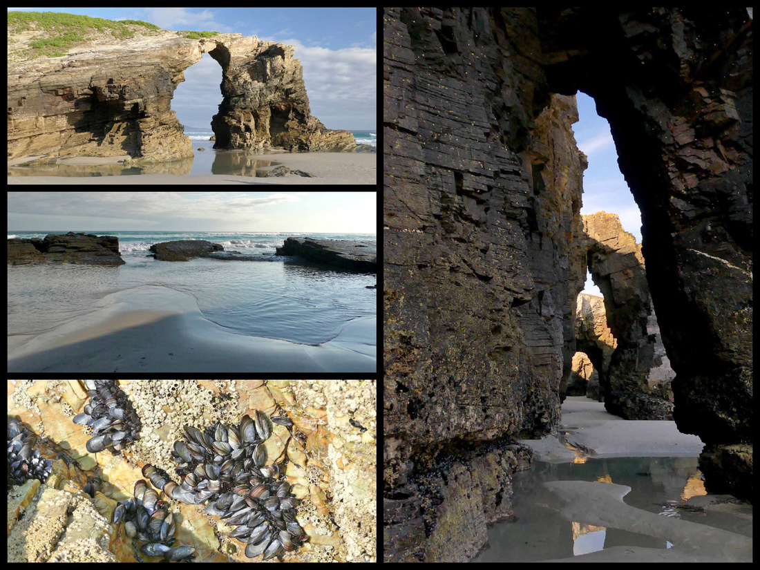
Constant pounding from the Atlantic Ocean has sculpted this astounding work of natural art into contours resembling cathedrals. Small vaulted caves, resembling medieval Gothic architecture, are strewn all along this particular section of shore, giving Cathedral Beach its iconic name. The entire beach is under water except at low tide so it can only be visited for a few hours twice a day. Not only are the cliffs, caves and rock formations unusual and beautiful, but the rocks themselves are a gorgeous array of colors, and numerous tidal pools are interesting shades of turquoise and pink. The place is just beautiful (usually comes up near the top of the list of most beautiful beaches in Europe) and that, combined with the limited amount of time people can visit result in some pretty awful crowds. Because of this the local authorities have restricted access and require reservations during the summer. Registration online is free and easy.
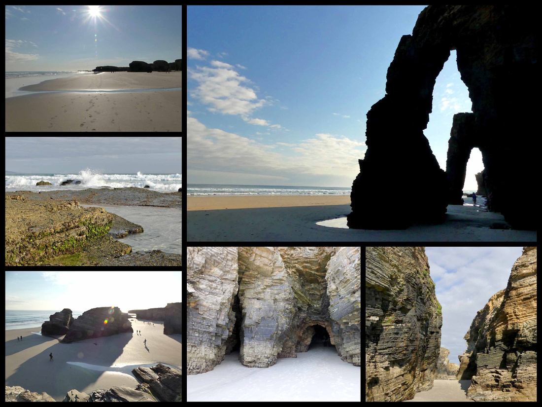
A combination of luck and good planning resulted in our having a great experience. I checked the tide charts (available on line, months in advance) and was able to organize our visit on a day when low tide was at 9:00 – meaning the best time to visit would be between 7 and 11:00. We got there shortly after 8:00 and there was no one checking reservations, and although there were some people already on the beach it was largely empty. By the time we left around 9:30 there was a line to check reservations, two tour buses in the parking lot and loads of people. But we had a wonderful visit.
Ribadeo - [Camino del Norte]
Perched on the broad ría of the same name, Ribadeo, population 8000, is the last coastal town in Galicia before Asturias. There is a nice main square, Praza de Espana, with attractive buildings, some with glass balconies, plus the “Tower of Moreno” a 1915 building that looks like it belongs in Barcelona. There are a few pedestrianized shopping streets and an‘old town’ consisting of a few streets with somewhat older houses. The main part of town is considerably higher elevation than the harbor/marina. It’s not a bad walk but apparently it bothered enough residents that they built a transportation tower with elevator to help people up the 40 meter elevation change. The building housing it is of stone, designed to look like sea rocks. The marina itself is a mix of active fishing boats and leisure boats. A major feature is a tall bridge which carries the A8 highway across the ria.
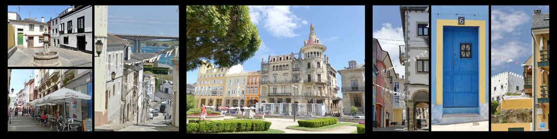 Old town streets, center: Tower of Moreno
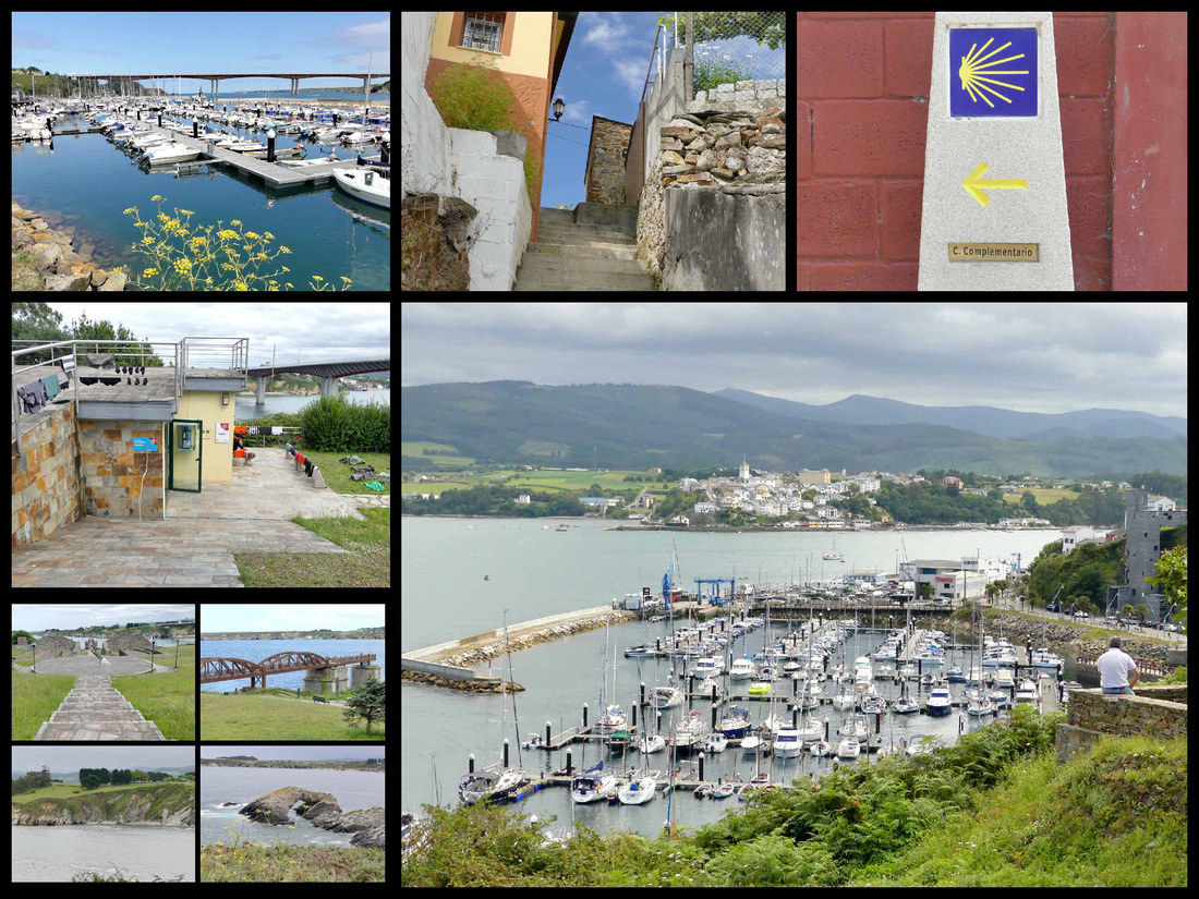
There is a great lighthouse about 2 miles from the center of town, easily walked via a paved path along the ria. The lighthouse sits on a tiny island just offshore, Isle Pancha. All along the walk out there, and then past the lighthouse, the water changes from grey to dark blue to turquoise and there are some impressive rock formations. The Camino del Norte goes through Ribadeo, the concentration of Camino signs seemed especially high here, seemed to be one every few feet. On the path to the lighthouse was a tiny albergue (looked more like a hut) with a bunch of pilgrims hanging out their laundry.
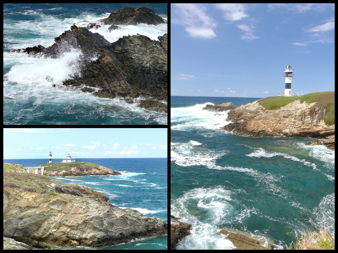
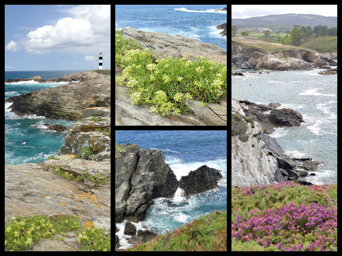
Cudillero - [Camino del Norte]
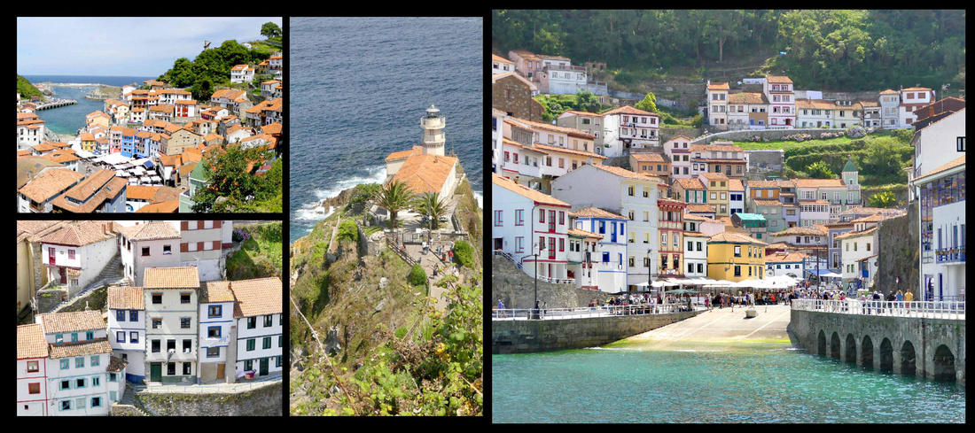
This tiny village (population 5300) is so cute and colorful it could almost be on the Amalfi Coast. By far the most picturesque village we saw anywhere on the north coast of Spain. For centuries it’s been a fishing village and there is still an active fishing fleet. The houses cascade down the hillside to a tiny port on a narrow inlet. Despite its touristy feel, Cudillero is reasonably relaxed, even in mid-July. The surrounding coastline is a dramatic sequence of sheer cliffs and fine beaches. It had everything: seaside setting with lovely harbor with pretty little boats and a nice lighthouse, and a town wrapped around the harbor and climbing up the steep hills. There are walks with steps going up all around the town, with bright blue painted railings (could be on a Greek island) up to several miradors with great 360-degree views of the water and the town. All along the walks are nicely kept flowers. The paths were fairly well marked, although that wasn’t really necessary as you could pretty much see the entire town from wherever you were. There’s a 16th century church, a lighthouse, an open-air fruit/veggie/ miscellaneous market down by the water and a small main square (actually more of a rectangle) full of seafood restaurants and cafes. Mostly its houses (some, but by no means all, of which are now B&Bs), some painted bright colors, others white with colorful trim (the colors supposedly correspond to each family’s fishing boats, which are the same color. I read about this in other villages on the Northern Spain coast). We hiked as far up as you could go, all around the town, down by the water and had a drink and snack at a café on the main square and were still ‘done’ in about three hours. You can smell the sea and hear the violin player down by the harbor; the music carries all the way up to the top of the town. Sea gulls swooping below you. Sound of waves, scent of sea air. Lots of restaurants down by the harbor, in that way it’s like any ‘tourist’ summer town. But no big hotels, no tour groups, no one spoke English, not one English menu anywhere.

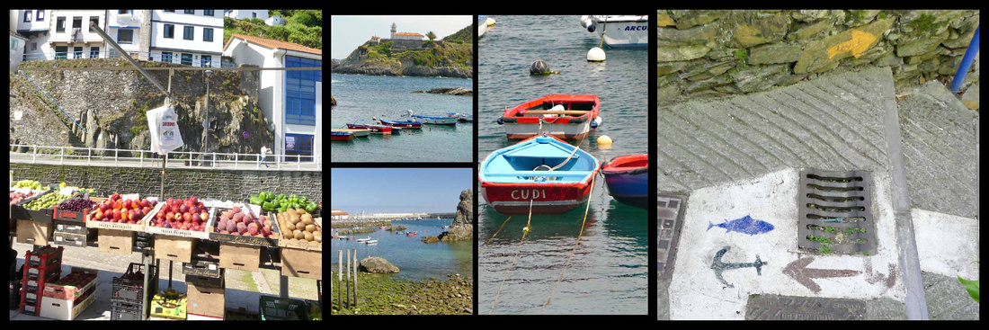
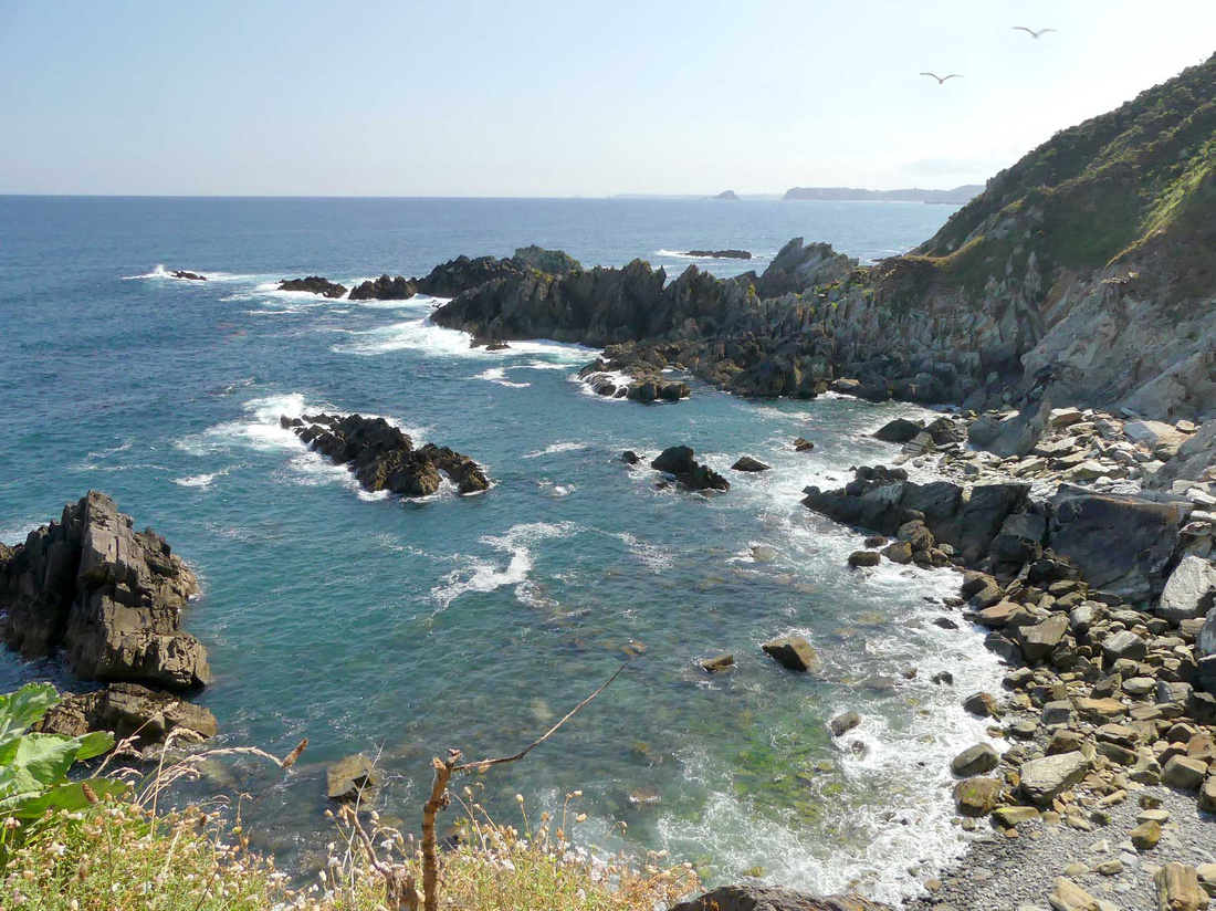
Oviedo [Camino Primitivo] (Monuments of Oviedo and the Kingdom of Asturias UNESCO)
Mostly cut off from the rest of Christian Europe by the Muslim invasion, the tiny kingdom that emerged in the 8th century Asturias gave rise to a unique style of art and architecture. It was a precursor to the Romanesque, the first architectural style to be used across Europe since the fall of the Roman Empire. Abandoning the distinctive horseshoe arches from Visigothic times, Asturian architects reached further back and drew on the simple, semicircular Roman arch and threw it in everywhere it could fit: vaulted ceilings, windows, doors, and halls. The fact that these buildings have lasted 1,200 years more or less intact, despite wars and bad weather, is just as fascinating as their unique architectural style. The 14 buildings, mostly churches (and collectively a UNESCO World Heritage site) that survive from the two centuries of the Asturian kingdom all have straight lines and floor plans – no apses or cylinders – although their semicircular arches are obvious forerunners of the style that would later be known as Romanesque. Another precursor of the Romanesque style is the complete vaulting of the nave. Roman and Visigoth elements are visible. In many cases the bases and capitals of columns with their Corinthian or floral motifs were simply cannibalized from earlier structures. Another adaptation, which owes something to developments in Muslim Spain, was the use of lattice windows. They appear purely as a design effect, since their Eastern progenitors were inspired by the desire to maintain privacy from the outside world – hardly an issue in a church. There are three main examples of this ‘Pre-Romanesque’ style building in Oviedo.
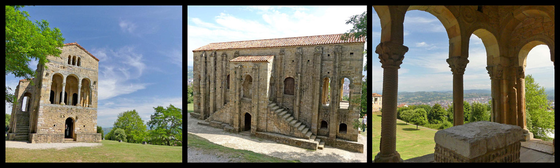 Santa Maria de Naranco
Santa María de Naranco and San Miguel de Lillo, collectively known as Los Monumentos, overlook the city on Naranco hill to the northwest. There’s a good view over Oviedo, which, unfortunately, isn’t super-attractive from up here, but is backed by beautiful mountains and the immediate area is lovely and peaceful. Santa Maria (842-850) was designed not as a church but as a hunting lodge. Architecturally, the open porticos at both ends are most interesting – an innovation developed much later in Byzantine churches. The columns in the upper hall could almost be carved from bone or ivory, such is the skill of the stonework. Balconies at either end add to the lightness of the design. A range of sculptural motifs, many of them depicting alarming animals, decorate the hall, and have been attributed to Visigothic and Byzantine influences. Underneath the hall is another chamber variously identified as a crypt, bathhouse, and servants’ quarters. San Miguel de Lillo is a couple hundred metres beyond Santa Maria, built of soft golden sandstone and red tiles. It is half of a 9th century structure, the other half collapsed. There are window grills carved from single slabs of limestone and superb Byzantine style carved doorframes.
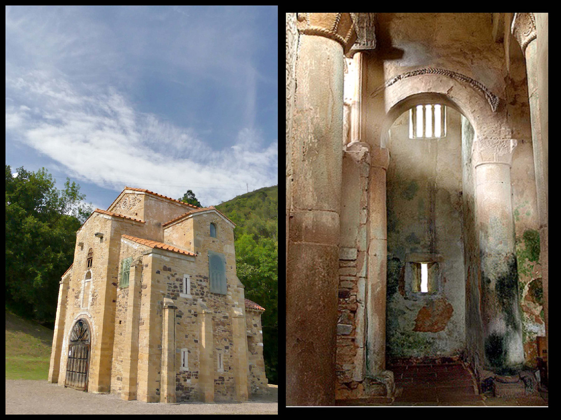
San Miguel de Lillo
The buildings can only be entered with a guide, there are tours (Spanish only) every half hour (3€). It’s a short, well marked drive from the center of Oviedo (not so easy going back down as the center of Oviedo is rather large and confusing). It looks like it would take at least an hour to walk up there, I think there is a public bus that stops up there, but not terribly frequent).
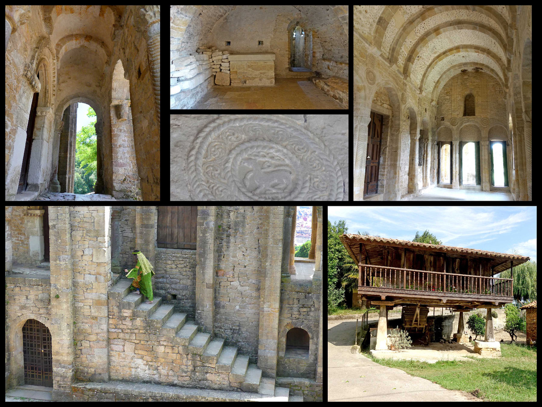 Top and left: Santa Maria de Naranco Bottom right: An 'hórreo', a typical granary for drying grain, this one located down the path from Santa Maria
The ‘modern’ town of Oviedo, population 275,000, looked pleasant enough though not anything very special, but the old town was nicer than I expected with a very nice cathedral on the large pleasant Plaza Alfonso II El Casto. Next to the cathedral are the remains of the pre-Romanesque Iglesia de San Tirso. Plaza de la Constitucion features the old city hall (ayuntamiento) and next to that the market building is turquoise metal and glass. The Cimadevilla, the oldest part of the historic quarter has an unusual Plaza de Trascorrales. Bronze sculptures were scattered around town – a lady sitting on a bench, a couple old women with pots and jugs, a fashionable lady in 19th century attire near the cathedral.
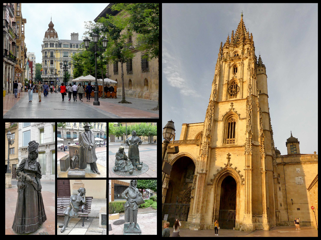
The old town had a lively atmosphere with numerous restaurants and siderias – which is a form of hard cider (often from crabapples) which seems to be as popular as wine in Asturias, Galicia and Basques regions. All over the region we saw waiters pouring the sidra by holding the bottle high in one hand and the glass low in the other. The reason for this is that cider becomes flat quickly so pouring it from a height of about 3 feet aerates it (natural carbonation). You only pour one gulp at a time. There are also devices that sit on tables that accomplish this, but the dramatic flare of the waiter pouring the cider is more impressive.
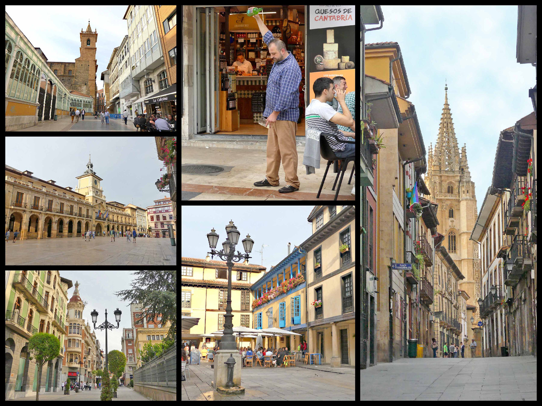
Ribadesella [Camino del Norte]
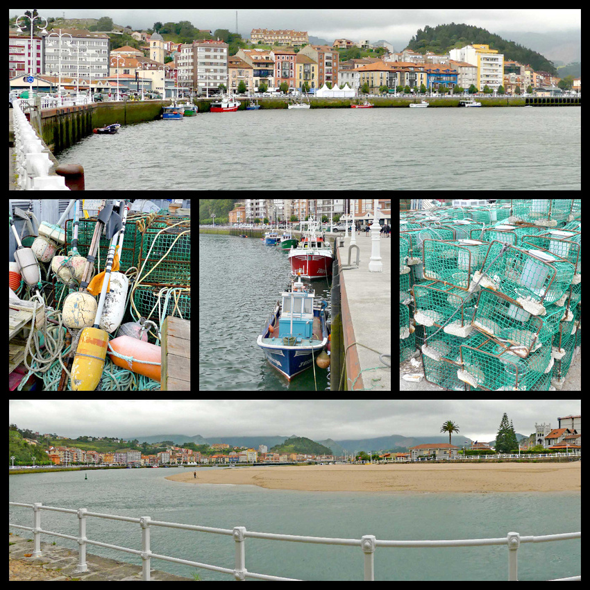
Ribadesella, population 6000, is an unaffected old port town, split into two by the Sella river, and bridged by a long causeway. The reasonably attractive old town, is crammed between the hills to the east and the river, and consists of several stone streets, running parallel to the fishing harbor. Across the river from the main part of town is a small peninsula of land between the river and ocean, which is lined with the 19th -century mansions of the fanciful type called Indianos—multi-story places with towers, etc. built by locals who made their fortunes in the new world and brought the money back to build their dream houses in their native land. There is a paved waterfront promenade going from the town center out to a point overlooking the beach, Playa Santa Marina. The ocean side beach had pretty good surf and there were quite a lot of surfers in the water, despite the cool cloudy weather, but the beach was mostly deserted. The inner harbor has a few working fishing boats (lobster/crab catching baskets stacked along the waterfront). I think the most impressive thing about Ribaesella is the setting, wedged as it is in such a narrow space between the mountains and the sea. Unfortunately I’m not sure that can be appreciated from within the town itself (the photos I’ve seen of it were probably taken by plane), but definitely not on a cloudy day. There were several bars and restaurants including one tiny coffee/pastry shop right out of the 1950s where we got amazing café con leche and croissants. There was also a cheese market going on in the main plaza with about two dozen vendors selling all kinds of local cheeses.
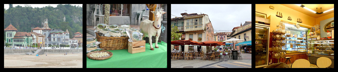
Picos de Europa
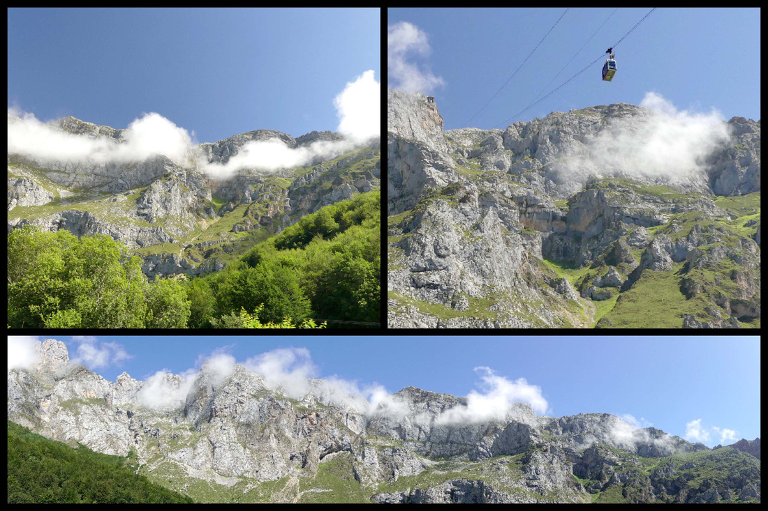
A relatively small stretch of cut-glass high mountain peaks (the steepest in Spain) just 15 miles inland from the ocean. The ‘best’ part is the Cantabrian part which contains the region’s most accessible and enjoyable bits: the scenic drive through La Hermida Gorge, the charming mountain town of Potes, and the views from Fuente De, home to the longest single span cable car in Europe. Rising more than 2,590m (8,500 ft.), they are not high by alpine standards, but their proximity to the sea makes their height especially awesome. During the Middle Ages, they were passable only with great difficulty. (The ancient Romans constructed a north-south road whose stones are still visible in some places.)
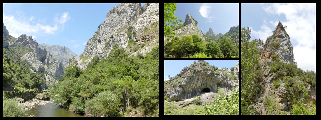
La Hermida Gorge
Leaving the coastal A8 at Unquera you drive along the N-621 through a pleasant river valley and the suddenly enter La Hermida Gorge with surprisingly high and close mountains on all sides, a now much narrower river still running along the road. It’s about a 45 minute, beautiful drive to the town of Potes, the only town of any size in the Picos. At Potes you can turn onto the CA-185 to Fuente De, where the road dead-ends about a half hour later at the foot of the highest peaks in the Picos, or you can continue south on the N-621 (which would eventually bring you down near Leon). All the roads in the area are small, winding and gorgeous – even in cloudy weather, and in the sunshine they rival the Alps – actually look a lot like the Dolomites.
We were there less than two full days, had some serious clouds the first day but absolutely gorgeous sunshine the second. After checking out Potes (and checking in to the hotel) we drove south on the narrow winding N-621, turning off at LaVega onto the really narrow winding road, past the village of Dobres, that ends at a cute little village of Cucayo. There are two tunnels through the edge of mountain peaks that you go through just before the village. I have no idea how people got there before those tunnels. We noticed some hiking and mountain bike trails, a few farms with chickens and sheep, and some houses. You turn around and go back down to Potes the way you went up, no other way. It was a pleasant drive in the clouds, I bet it would be spectacular with blue sky.
Our second day was gorgeous blue sky with puffy white clouds playing hide and seek with the peaks. We drove to Fuente De. The road stops at Fuente Dé, and it’s not hard to see why; there’s a massive semicircle of rock ahead; a spectacular natural wall that rises 800 m and is almost sheer. It is named Fuente Dé because this is where the Deva springs from the ground; there’s little here apart from two hotels, a campsite and a cable-car station. Fuente De is not a real town, just the end of the road and the station for the cable car (cafeteria, souvenir shop and ticket office). The large grassy parking lot was only half full, there were lots of people sitting in the sun on the grass by the cafeteria building and a short line waiting to go up the cable car. We got on the considerably longer (20 minutes) line to buy the tickets only to discover the wait for the cable car was two and a half hours! Having seen photos from the top we decided it wasn’t any better than what we were looking at right there and we wanted to see some more of the area and get to Santillana while the sun was still out so we skipped it.
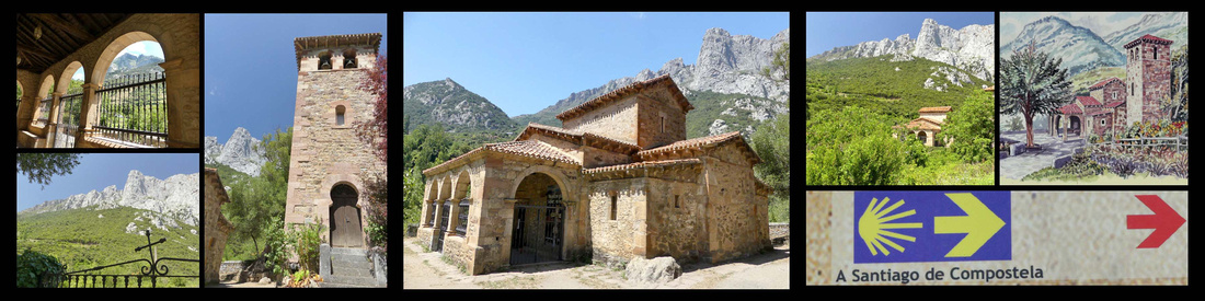
Santa Maria Lebena
After another stop in Potes we drove back up La Hermida Gorge stopping (8km north of Potes) at the church of Santa Maria Lebeña, a 10th century chapel in a little valley surrounded by high peaks, full of vineyards. It is the main pre-Romanesque monument of Cantabria and one of the most important of the style denominated Mozárabe. Some people consider it the best example of Arabized Christian architecture in Europe, with Islamic-inspired geometric motifs. Continued the drive north on the N621 through La Hermida Gorge – just incredible tall mountains rising right from the road, in some places part of the mountain kind of arches over the road, just barely high enough for a car. At some places the river is right next to the road, several stone bridges crisscrossing it. In a lot of ways it reminded me of Yosemite, in others of the desert southwest only the mountains are greyish white. But the sky was blue and the trees green and overall very pretty.
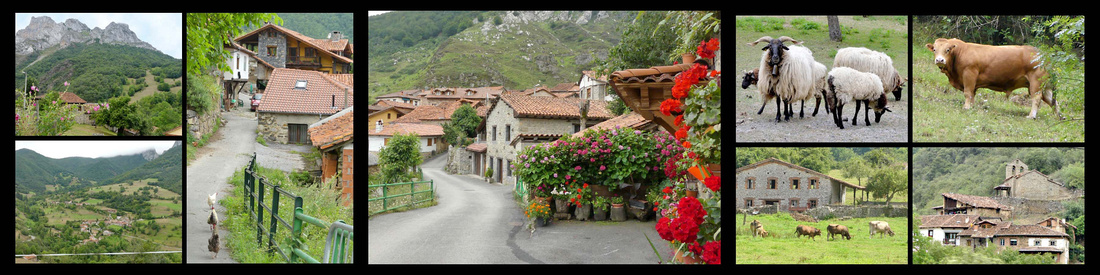
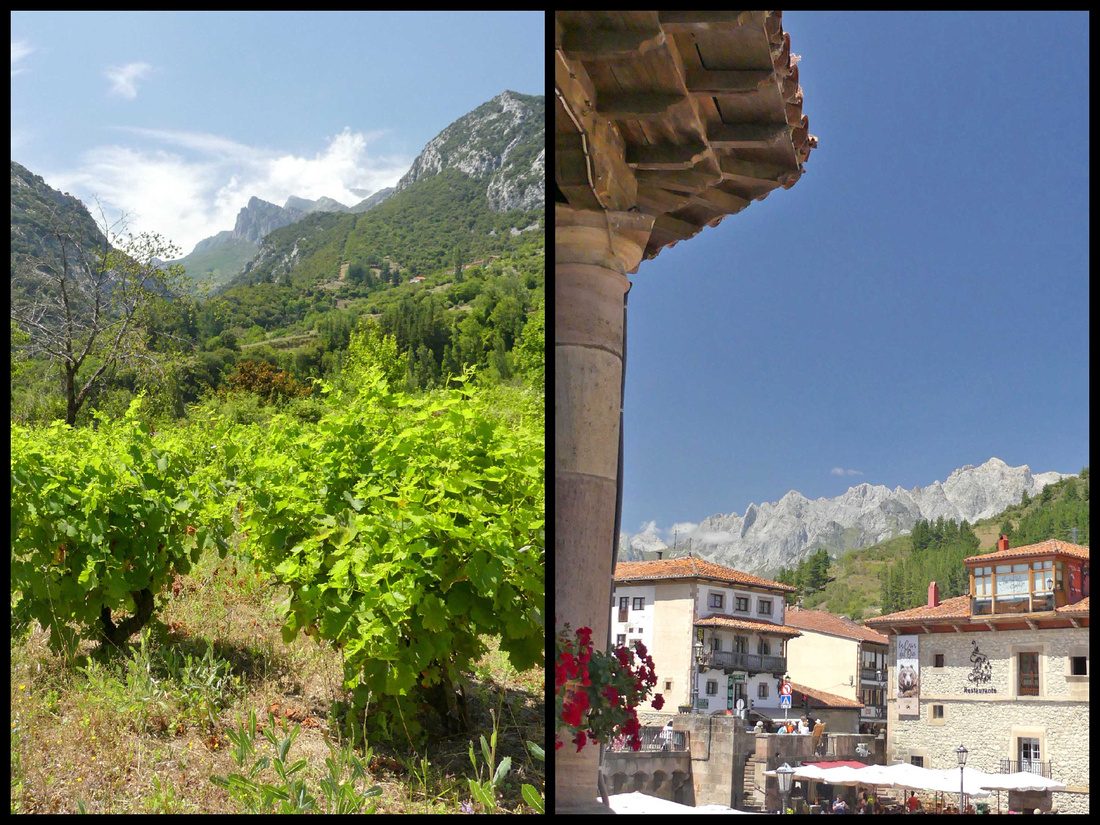
Potes [Camino Lebaniego]
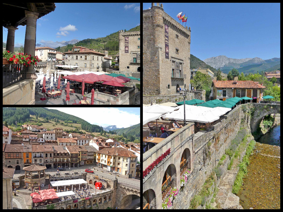
A picturesque town that felt larger than a population of 1500, although there really is just one main street. It sits at the intersection of four valleys surrounded by mountains, with a river running through the center, spanned by three stone bridges. In the center of town is the Torre del Infantado, a 14th century castle like tower, overlooking the main plaza, which is full of restaurant tables/umbrellas. There are walkways along the river through out the town, both down at river level and up at town level. Though mostly restaurants and souvenir shops, there is a fairly large supermarket (good for picnic supplies) and a couple of bakeries. We were passing one and the smell of bread was overwhelming so we stepped in. She had just taken out an oven full of baguettes and we bought one (for 30 cents!), still warm, and had it for our picnic lunch an hour or so later, the best bread I ever ate. Although most of the restaurants were ‘local’ fare, there was one Mexican Restaurant, we had dinner there and it was one of the best meals of the trip.
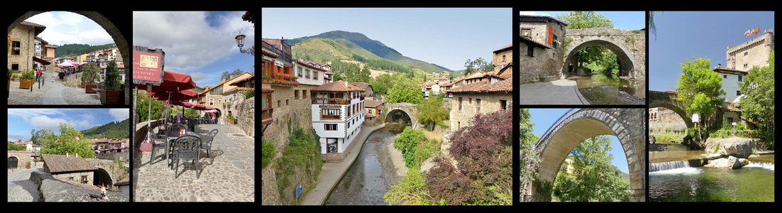
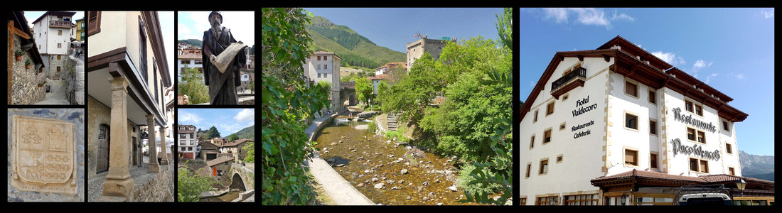
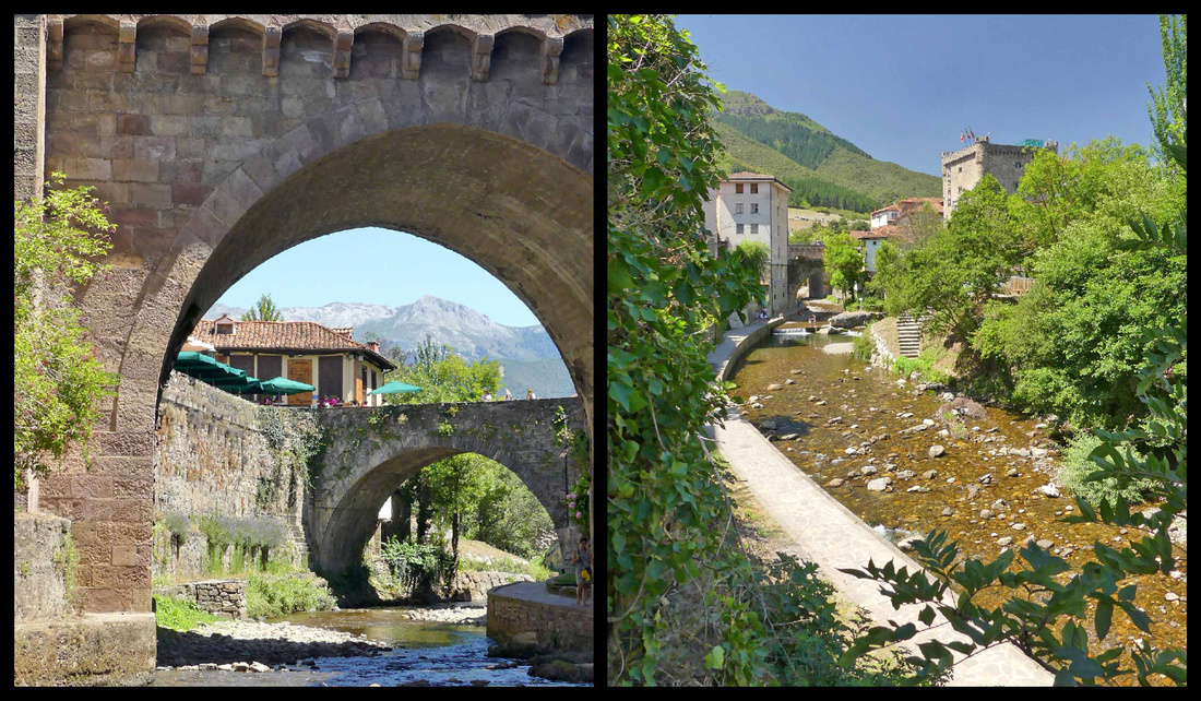
Ribadesella in Asturias, and Comillas and San Vicente in Cantabria, are three small towns wedged in the narrow strip of land between the Picos and the sea, photographs of all of them are interesting but were mostly taken from boats offshore or from the air, and the setting of the towns is hard to appreciate from within them. Not quite as 'charming' or picturesque as Cudillero or Santilanna, they were all worth short visits.
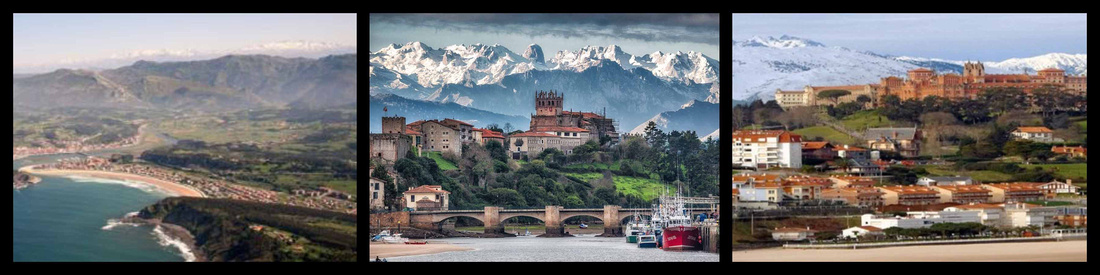
Postcard views of: left Ribadesella center: San Vicente de Barquera right: Comillas
San Vicente de Barquera [Camino del Norte]
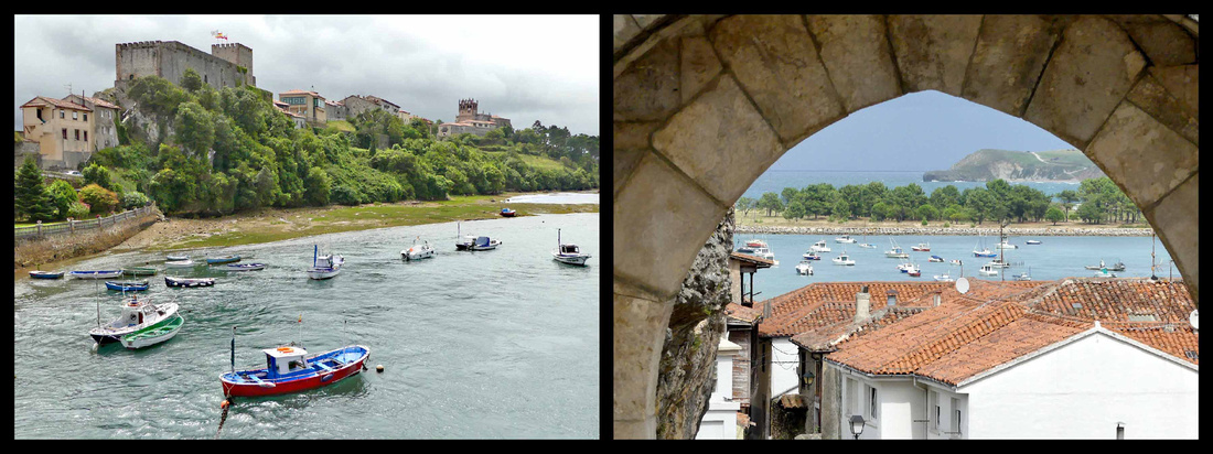
A long, dramatic (Roman) bridge over a bay leads to San Vicente de la Barquerea. The seaside town overlooks a boat filled harbor. Marooned on both sides by the sea, inland, dark green, forested hills rise towards the Picos de Europa. The town itself, a thriving fishing port with a string of locally famed seafood restaurants, is functional rather than pretty, with not all that much left of its historic core. But a short climb up from the modern town brings you to the remnants of the hilltop medieval town. At one end of the ridge, is a Renaissance ducal palace and a Romanesque-Gothic church, Santa María de los Ángeles. The church was built in the 13th century, when Romanesque was going pointy, and it’s an interesting example of this phase. There are good views from here over the river estuary and the long bridge crossing it and in the other direction of the green hills – looks a lot more like Wales than Spain in that direction. A five-minute walk to the other end of the ridge is the castle, in reasonably good shape but not especially compelling, nice views of ocean though.
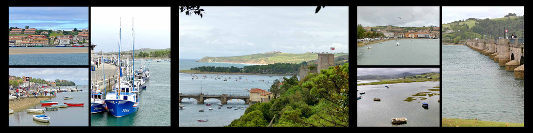
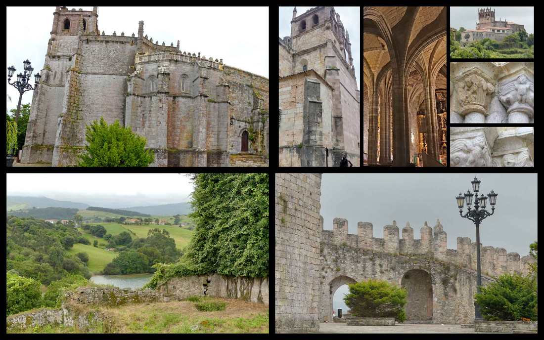
Comillas [Camino del Norte]
Another twenty minutes east, Comillas feels a bit like a large hill town, with twisty lanes clambering down to the sea. Definitely not as undeniably charming as Santillana (has not grasped the idea of ‘pedestrianized’), the beach-side road is lined with tacky tourist hotels. It does have cobbled streets and squares with ancestral houses, towers and Modernist style buildings, but the cars everywhere certainly detract from the overall ambience. It’s also feels considerably larger (despite websites giving it a smaller population than Santillana). It does have several impressive buildings.
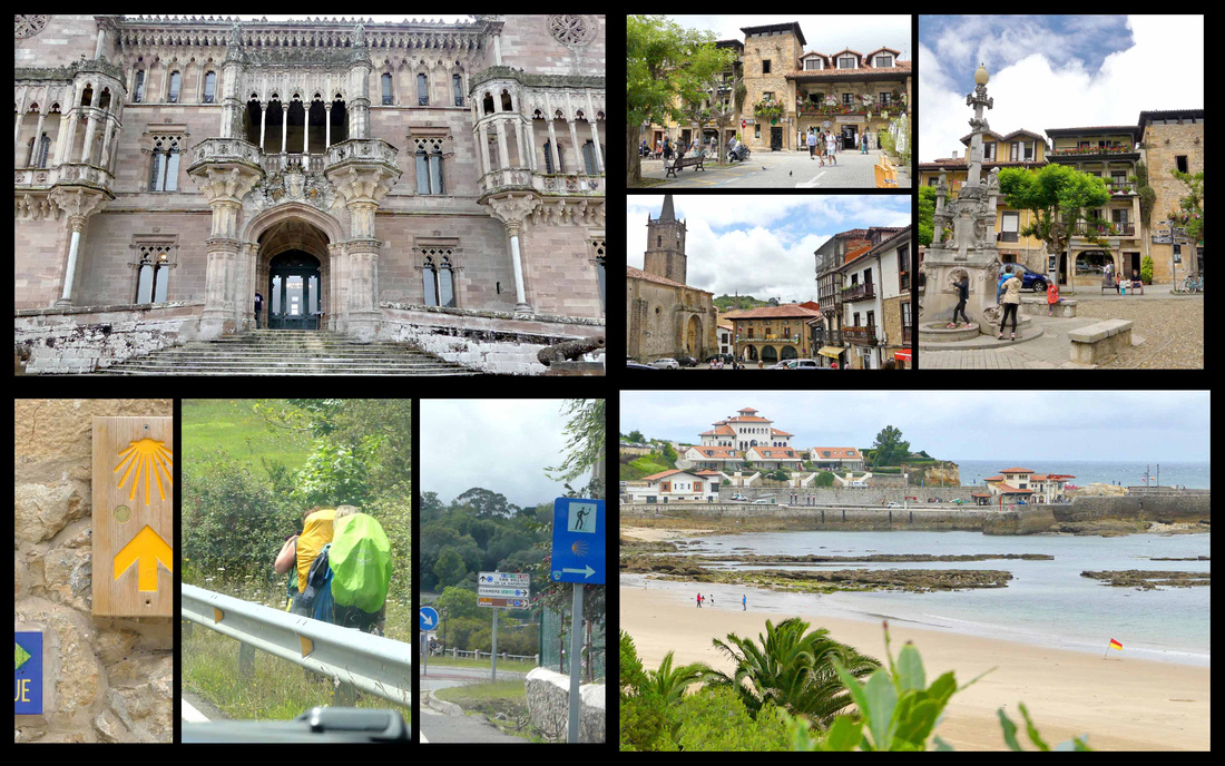
Top left: Sobrellano Palace Top right: town center Bottom left: pilgrims on the Camino Bottom right: Comillas Beach
At the end of the 19th century, Comillas was chosen by the royal family as their holiday destination, and the city was decked out accordingly. The main royal court building, Sobrellano Palace is in neo-Gothic style and stunning from the outside. Close by is an impressive Gaudi building, El Capricho, clad in green and gold sunflower tiles, with turrets and iron balconies and a bronze of Gaudi sitting on a bench outside admiring his work. The huge Pontifical University building, the location of the International Centre for Higher Education in Spanish, (aims to become the international center for the study of Spanish and Spanish-language teaching) was built as a theological college in avant-garde style. It sits up on a hill and can be seen from all over town, and is guarded by a nice gate entrance. Heading down towards the beach from the university is a cemetery with art nouveau Guardian Angel (1895) built on the ruins of an ancient burial ground and 15th century church. The beach and small marina are nice enough, though nothing special compared to the rest of the region.
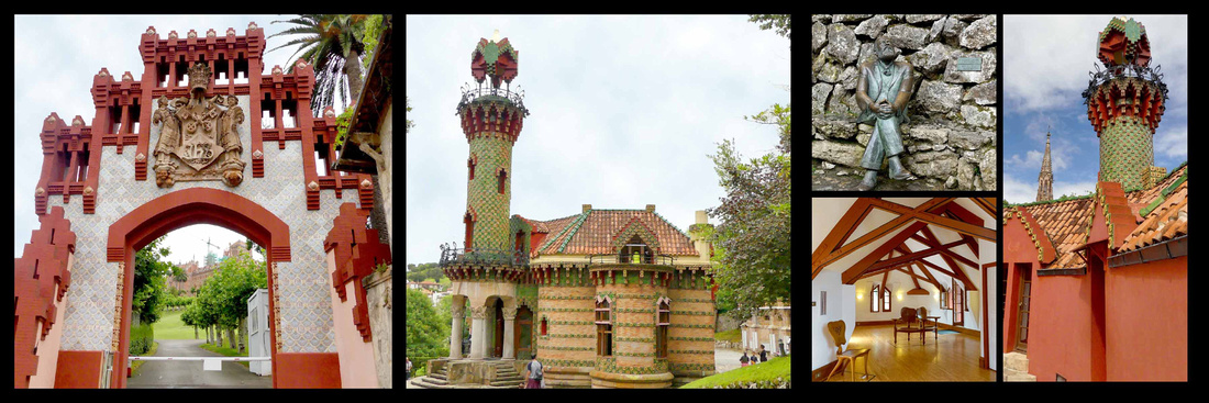
Left: University Center and right: El Capricho
Santillana del Mar [Camino del Norte]
Santillana, population 4000, is a little stone village with charming time-warp qualities that have (barely) survived the stampede of multinational tour groups here to see the village and visit the nearby Altamira Caves. Jean-Paul Sartre called Santillana "the prettiest village in Spain”. In spite of all the tour buses, Santillana retains its medieval atmosphere. It is three cobbled streets and a couple of squares, climbing up and over mild hills from where the village meets the main road. Referring to its literal translation, the locals call it the “town of the three lies” – as it isn’t very holy (santi) nor particularly flat (llana), and despite the del Mar actually stands a few kilometres back from the sea. A monastery houses the relics of St. Juliana. Some say the name Santillana is a contraction of "Santa Juliana."
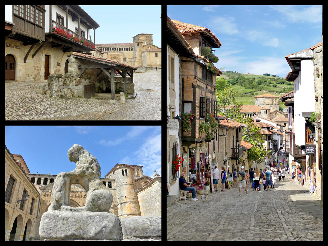
Outrageously picturesque but the crowds in summer have unquestionably diminished its appeal. Its cobbled lanes abound in gorgeous sandstone buildings with flowery overhanging balconies, while the farms and fields on the adjacent hillsides give it a lovely rural atmosphere. Strolling is a delight, even if most of its ochre-colored buildings now hold restaurants, hotels or souvenir shops. It’s definitely worth staying overnight, as the bulk of the visitors are on day trips, and the emptier the town, the more atmospheric it is. At dusk, and for a few hours in the morning it was delightfully un-crowded (although delivery trucks kind of mar the ‘picturesque’ quality). And while it was certainly full of people mid day, there really weren’t many tour groups, it was mostly individuals. One morning I went out quite early – I think it was between 7 and 8 – and it was just me, a couple of dog walkers, and some Camino pilgrims.
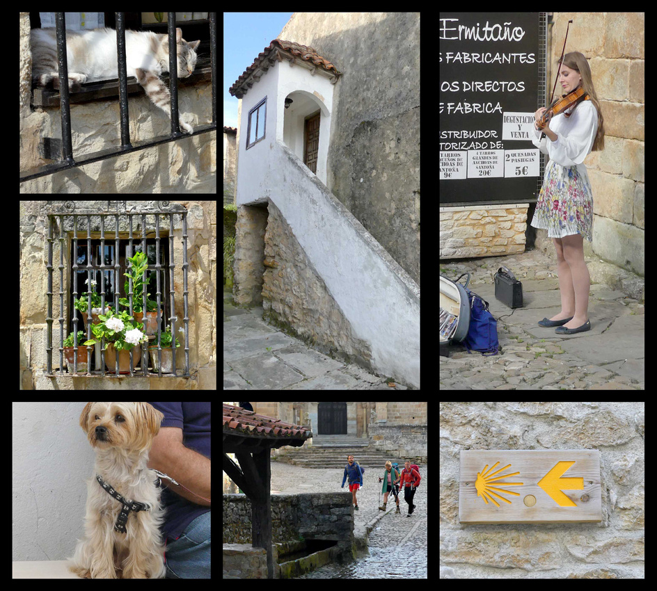
Top Right: Klara Gomboc, violinist (we bought several of her CDs, beautiful arrangements of classical and modern compositions) www.laviolinista.es/en/index.php
The main street (which seems to have three names, Calle Carrera, Calle Canton, and Calle Rio) runs down hill to the 800-year-old cathedral, Colegiata de Santa Juliana. The current Romanesque building replaced a former Benedictine monastery in the 12th century. An arcaded gallery runs high above the portal, and a round bell tower is to the right, two towers behind that, and an arcaded porch to one side. Wonderfully asymmetric. The entrance to the church interior and the cloister is around to the side. It’s a beautiful building, on a ‘human’ scale, and takes on different shades of gold or honey color depending on the light. It has a slightly neglected appearance, which I think adds to its charm. The cloister, while small, has some really impressive carvings on the capitals.
On the street just before the church is an interesting old well with a tile roof. This part of the street is called Calle del Río, which gets its name from a stream running through town to the fountain here.
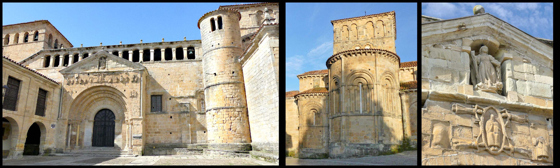
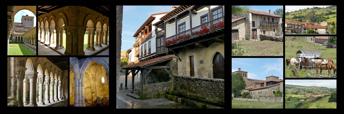
The houses in town (14th-18th Century) are mostly stone and timber, many with wooden balconies, some with iron balconies, and there are several grandiose palacios emblazoned with coats-of-arms (in some cases hugely oversized). The main square, which is at the end of the other main street, Calle Juan Infante, is Plaza Mayor, home to the Ayuntamiento, the Parador (in Casa de los Barreda-Bracho), the Torre de Don Borja, and the Torre del Merino. Around behind the church is the Palacio de los Velarde, a grey stone 16th century Renaissance style building that looks somewhat castle like.
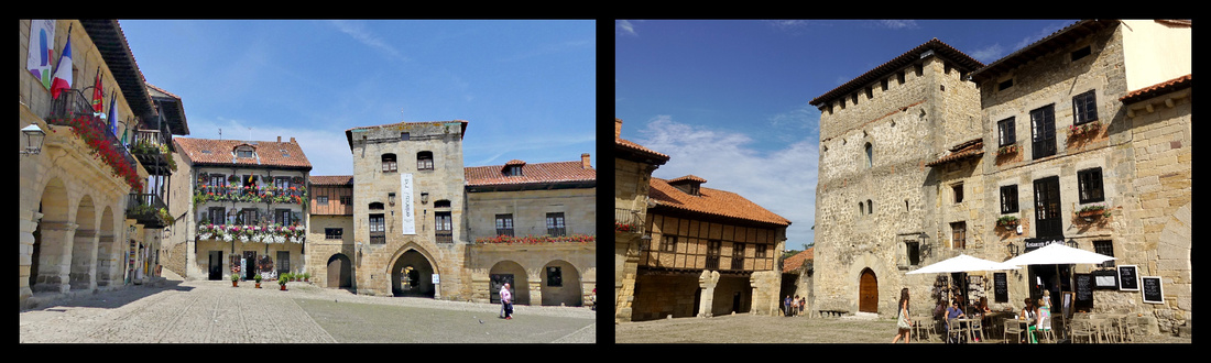
Plaza Mayor
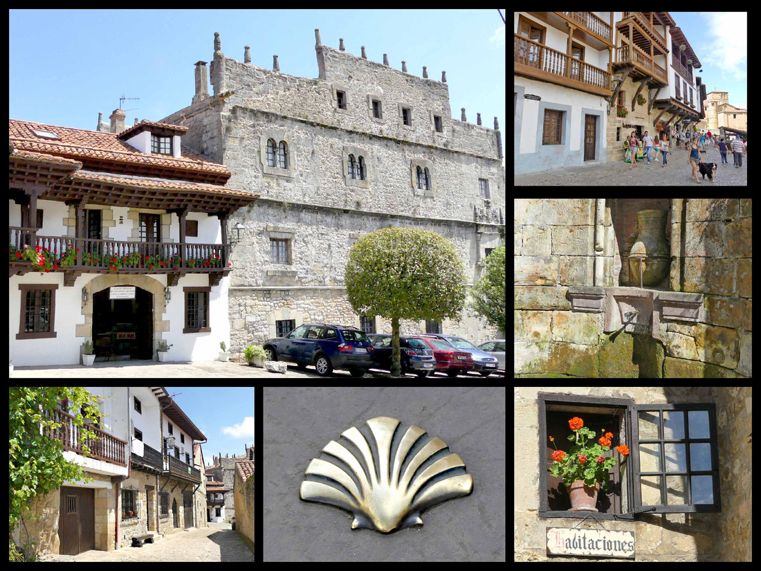
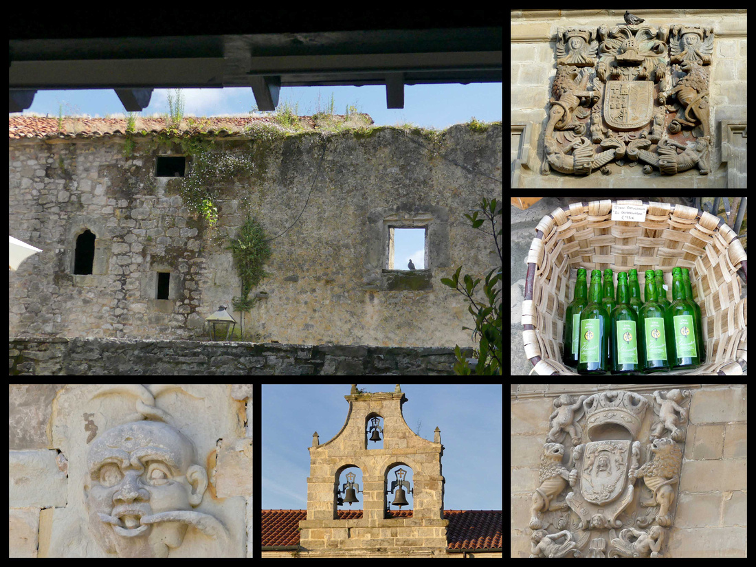
Cuevas de Altamira –a UNESCO World Heritage Site . The bison, wild boar, horses and other animals on the ceiling at Altamira are the largest known group of “polychromes” (figures painted using several colors of pigment – ochers, manganese oxides, charcoal, iron carbonate). The two most important sites in the world are Altamira and Lascaux in France. About 2.5km from the center of Santillana is the cave, famous for prehistoric paintings dating from the end of the Ice Age, (14,000 years ago) that have caused these caves to be called the "Sistine Chapel of prehistoric art." These ancient depictions of bison and horses, painted vividly in reds and blacks on the caves' ceilings, were not discovered until the late 19th century. Once their authenticity was established, scholars and laypersons flocked to see these works of art. Severe damage was caused by the bacteria brought in by so many visitors, so now the Research Center and Museum of Altamira no longer allows visitors but has created a replica, which along with the museum can be visited. http://museodealtamira.mcu.es closed Mondays, 3€,
Museo de Altamira and the Neocueva are located a few hundred feet from the original caves. On exhibit is a perfect replica of the cave, complete with precisely realistic copies of the original murals. The replica was created by computerized digital-transfer technology; the so-called "neocave" contains every crack and indentation of the original. The highlight is the array of 21 red bison in the Polychrome Chamber. The exhibition begins with an excellent overview of prehistoric hominids so you can get your Neanderthals sorted from your Cro-Magnons before moving on to more specific displays about the Altamira epoch and ways of life at the time.
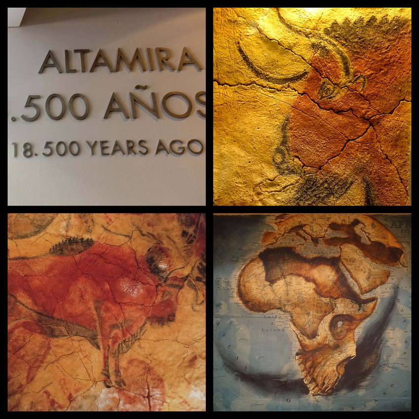
The ticket booth is outside the main entrance and when we were there (10am in July) the wait to buy tickets was exactly one hour and then our timed ticket was for one hour later. You get a timed ticket for viewing the neocueva, the museum you can see anytime. So you could choose any time later in the day, and leave and return if you didn’t want to wait. But we found one hour to be just about the right amount of time to see the displays in the museum. The museum is small – really only three medium sized rooms, but full of displays, videos, and plaques with information (all in English as well as Spanish). Most of the videos were self-explanatory so there was no talking in any language. Then you queue up and are ushered into a small room (20 people at a time, staggered about every 10 minutes) to watch a 5-minute video and then you walk through the cave. Pretty amazing, the whole ceiling is covered. As you enter the cave you see where the people spent most of their time (the large entrance area, with exterior light) and then down a few steps into the darker part of the cave where the paintings were. You only get about 5 minutes in there but there’s just the one space so it doesn’t take long, but it sure was pretty amazing.
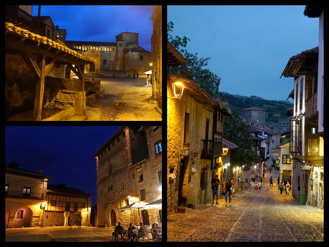
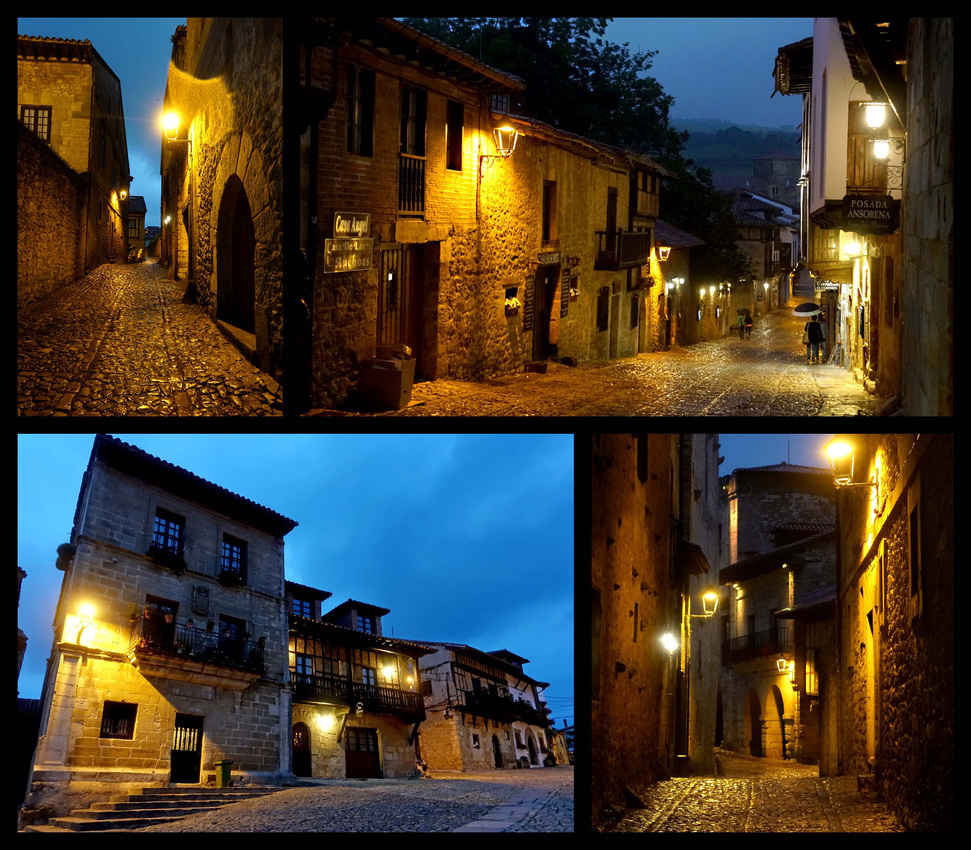
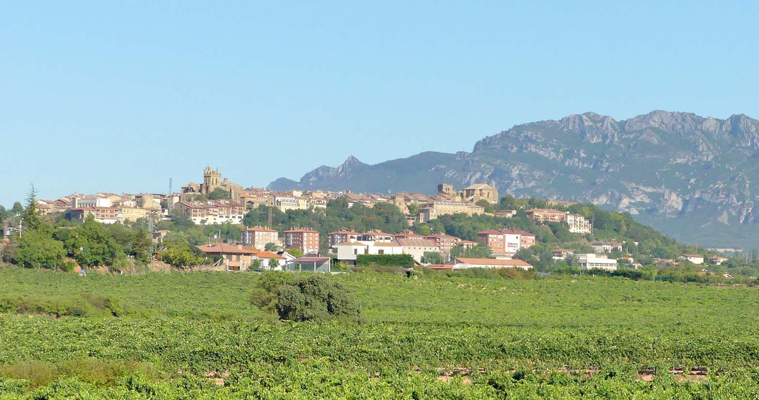
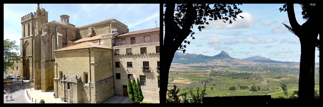
Laguardia, population 1500, sits at the top of a hill, its tightly packed stone buildings enclosed by massive stone walls. From the walls are views of the valley below and the Sierra de Cantabria mountain range behind it. The town is surrounded by vineyards on all sides, there are bodegas everywhere. The core of the economy in Laguardia focuses on the world of viticulture, Laguardia is the capital of one of the most famous wine regions of Spain, Rioja Alavesa. Basque speakers call the town 'Guardia'.
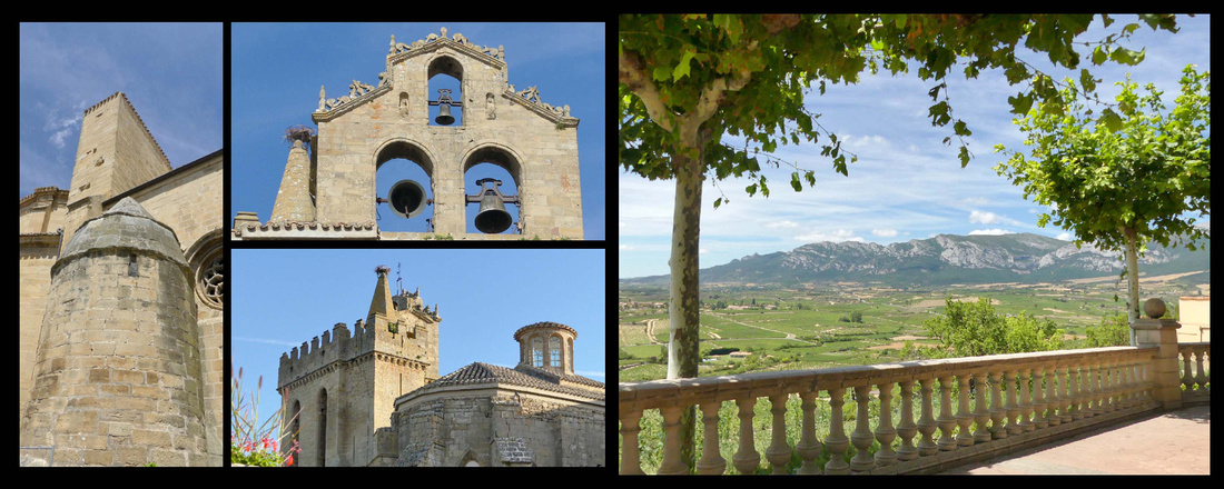 Iglesia San Juan Mirador on west side of town
The town itself is totally pedestrianized, very narrow streets (about 3 streets run the length of the town, a few more short cross streets; the town is very narrow). You can walk up and down every street in less than an hour.
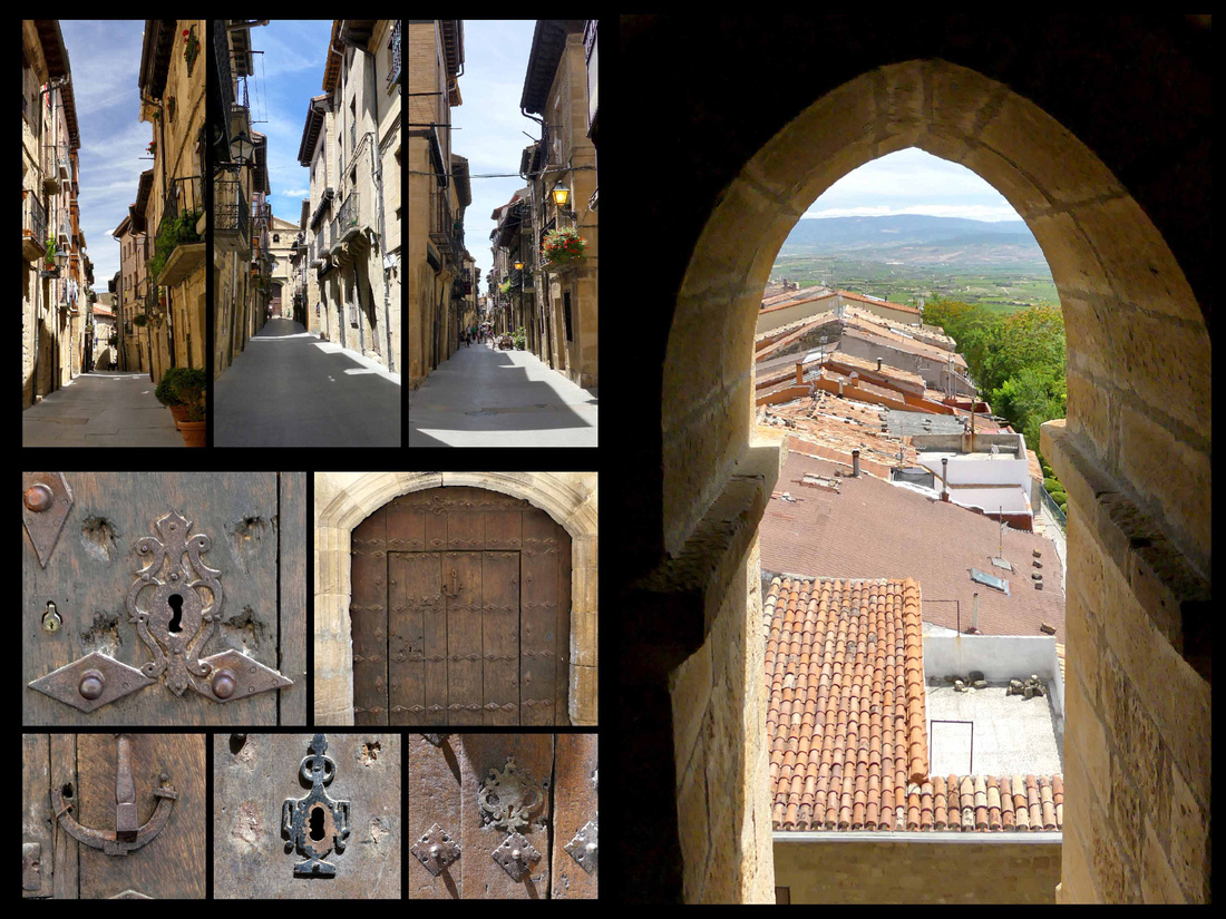
During its tumultuous medieval past, the rock beneath the streets was carved into a maze of tunnels for shelter and escape routes when the town was under attack. Today some of these house wine cellars. There is the Romanesque church of San Juan Bautista at the one end of the village and the church of Santa María de los Reyes at the other, originally probably a Templar monastery. Next to it is the Tower of Santa Maria, which has a Gothic façade with a portico finished in the fourteenth century. It is one of the few preserved polychrome portals in Spain. The tower can be climbed for great views (€2). In the center of town is Plaza Mayor, a tiny square with arcaded buildings on both sides, both the old and new town halls. The old town hall has a clock, which opens up and automated figures perform a regional dance.
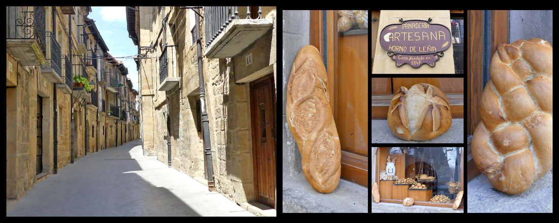
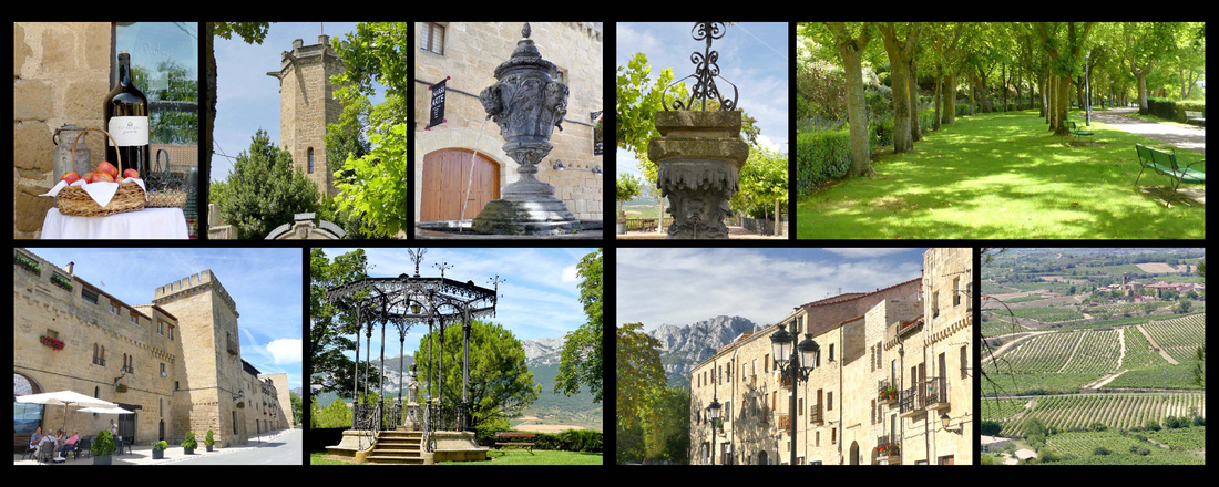
Walls on eastern side of town Promenade and view from it on western side of town
There’s a nice promenade around the tip of the town, benches, tree shaded, great views. A little square near the church of Santa Maria had an interesting sculpture – two bronze tables, one filled with bronze shoes and the other with bronze bags/suitcases/backpacks. It’s by Koco Rico titled 'Viajeros/Bidaiariak Izenekoa' (“Travelers”) “The basic idea of this sculpture is the journey and the evocation of it (of the land that leaves us and of which we leave) reflect on how an object related to traveling, such as shoes or a suitcase, can make us relive different situations and moments.” It was lovely.
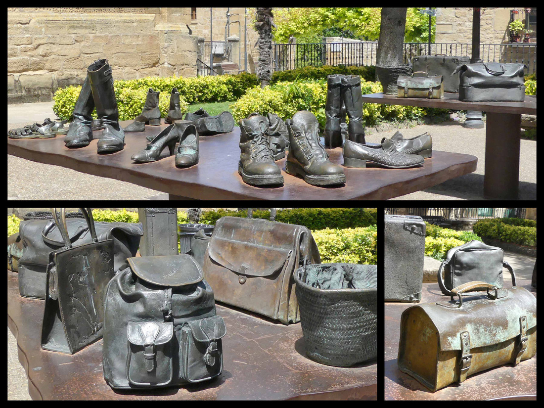
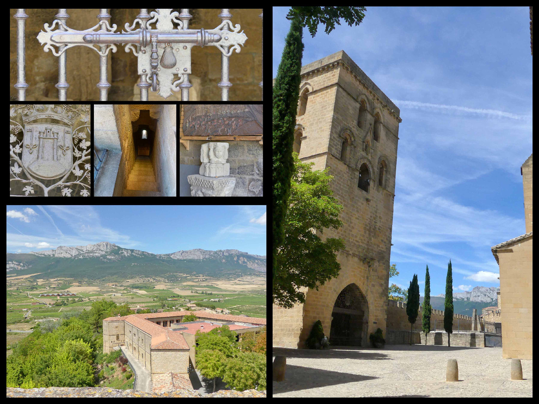 Tower next to Santa Maria and view from it
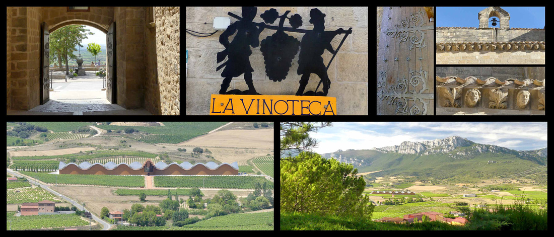
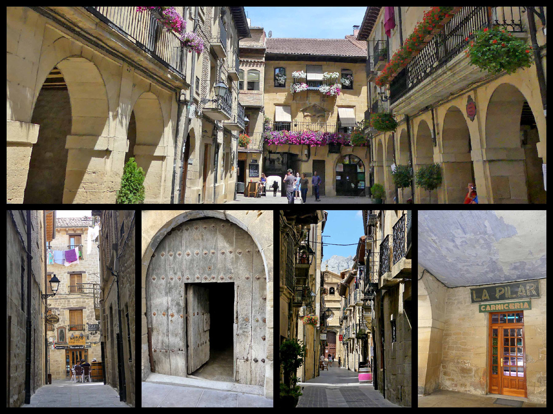
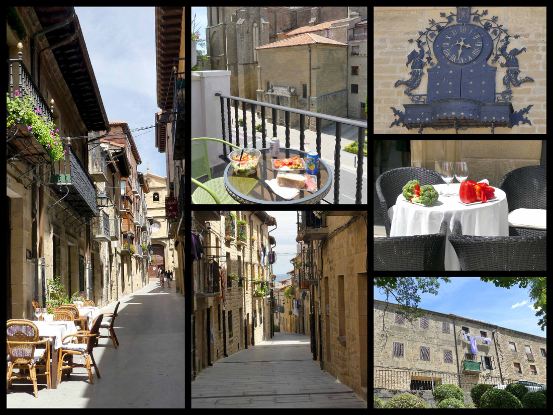
There were two or three touristy shops, a few wine stores, a couple of butchers and bakeries and one small grocery store where, in addition to groceries and produce, you could purchase all types of wine, including some unlabeled Rosé for €1.49 a bottle. We couldn’t resist, although the corkscrew we had to buy to get into the wine cost three times as much as the wine did. It was at least as good as your average Rosé. While we were there we put together a picnic dinner an ate on our balcony, just meters from the church and town walls and watched the stone change color as the sun went lower. Then we walked over to the mirador on the western edge of town for sunset.
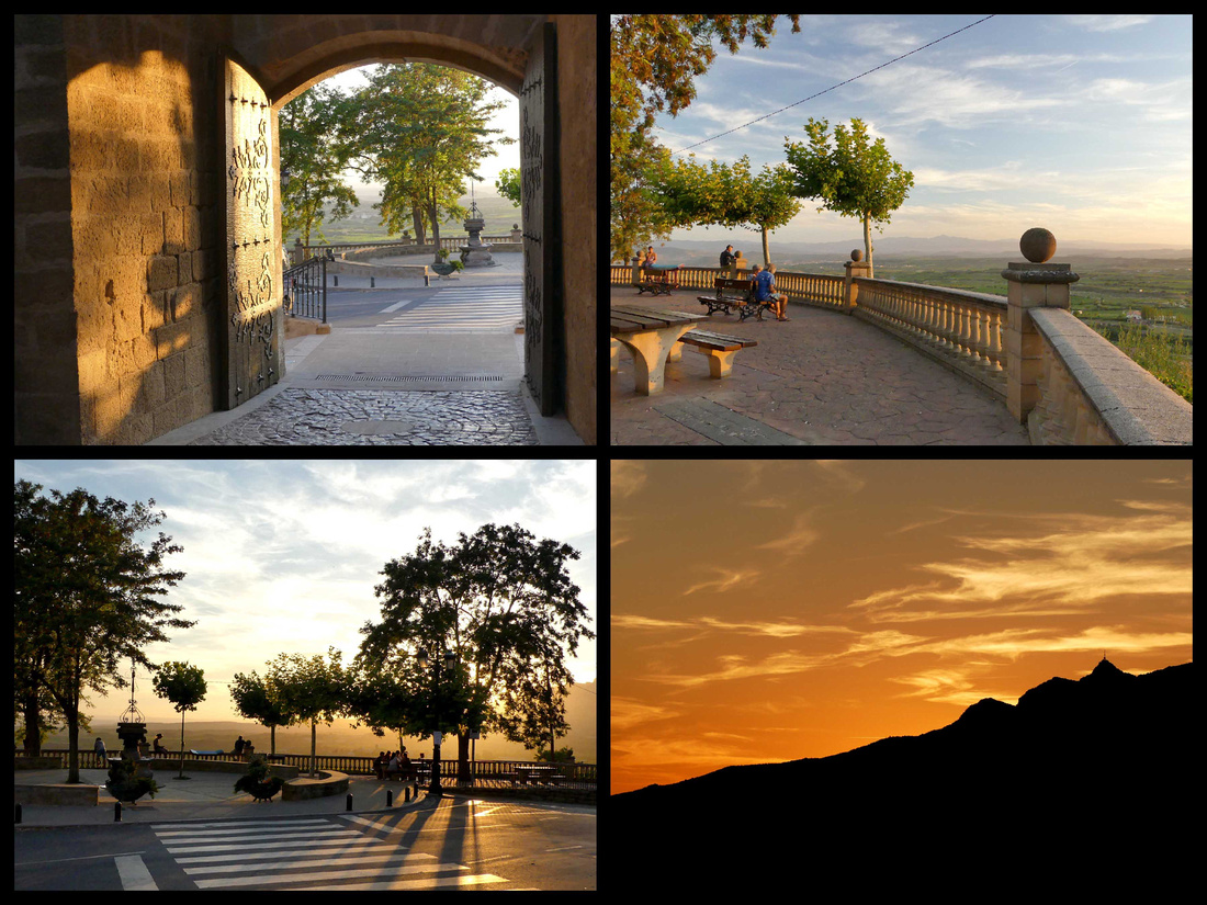
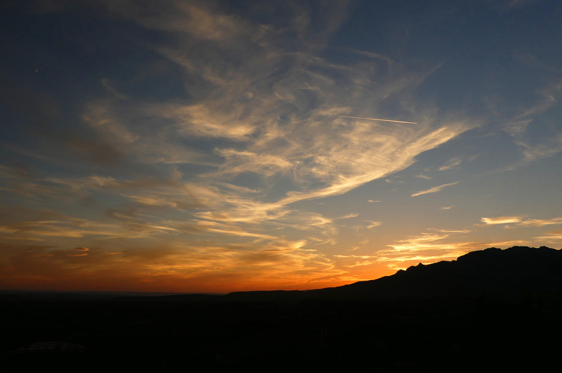
The view of the sun setting over the mountains from the promenade was spectacular and in the warm evening the town came alive with people of all ages, children playing games and riding tricycles, parents and grandparents enjoying wine or dinner at one of the restaurants lining the streets, or just sitting in the main plaza.
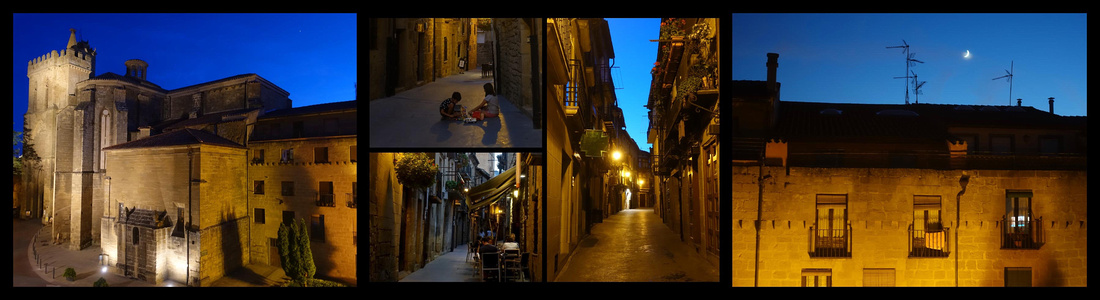
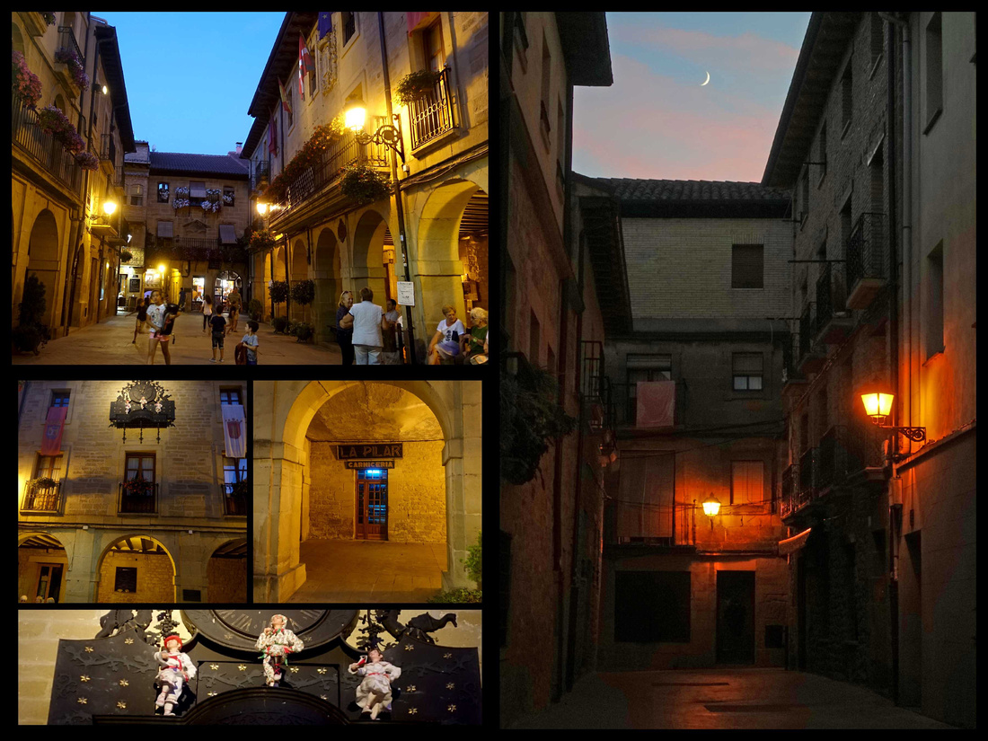
The drive from Laguardia to Puente La Reina is pretty straightforward. Mostly stayed on the N roads, which followed the Camino. Saw a good number of walkers. Passed a few cute stone villages. Watched as the Camino went along the road and then would cut through fields for a while and reappear on the road. Slightly hilly, mostly wheat fields and vineyards. Not un-pretty landscape, but would get bored after a few hours of what takes more like a few days to walk. The route goes through Logorno and a few other sizeable towns, which are easily passed in a car but walking through them didn’t look like fun.
One very picturesque stone village, Sansol sits just where the Camino leaves the road and goes off into hayfields
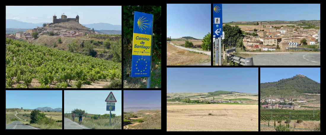
Puente La Reina [Camino Frances]
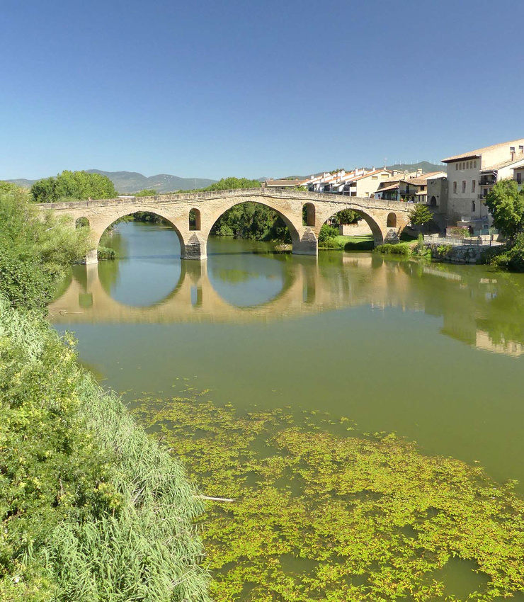
The six arched medieval bridge has carried multitudes of pilgrims over the river. Over the centuries they approached from Roncesvalles to the north and Aragon to the east and then united to take the one main route, Camino Francé, west to Santiago de Compostela. Their first stop here was at the late Romanesque Iglesia del Crucifijo, erected by the Knights Templar. In Spanish literally the "bridge of the Queen”. Queen Muniadona, wife of King Sancho III built the six-arched bridge over the Río Arga for the use of pilgrims on their way to Santiago. The bridge, Puente de los Peregrinos, is Romanesque and reflects beautifully in the river.
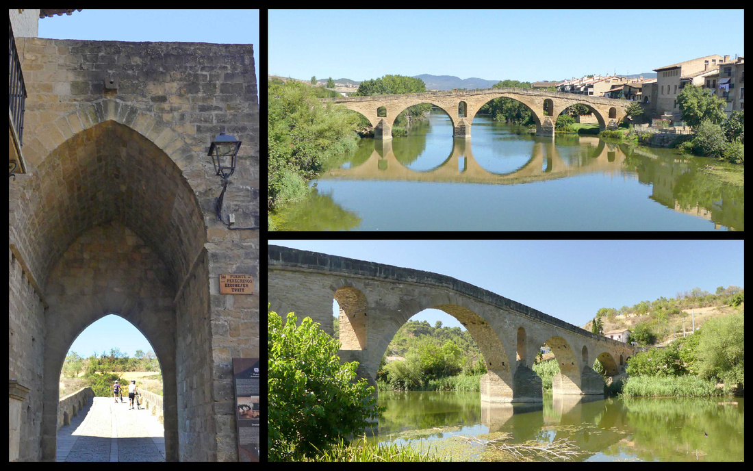
There are several architectural gems such as the churches of the Crucifix, St. James and St. Peter and beautiful buildings peppered with details of the influence of the Pilgrim's Way. The town isn’t built around a castle as is the case in many medieval towns, instead it’s more of a medieval mall concept: the main street, Rúa Mayor, is the Camino, leading you past churches and shops before putting you on the bridge. Alfonso I, king of Navarre, designed it this way to attract Camino traffic and commerce in the 11th century. The goal was for Navarre to get settlers to beef up a sleepy Basque wheat-farming settlement and push back the northern expansion of Moorish rule. This is one of those places where you realize the story of the Camino is not just a spiritual one, but also one of political interests, immigration issues, developer power plays, and tourism opportunists. Still, what they left behind is beautiful.
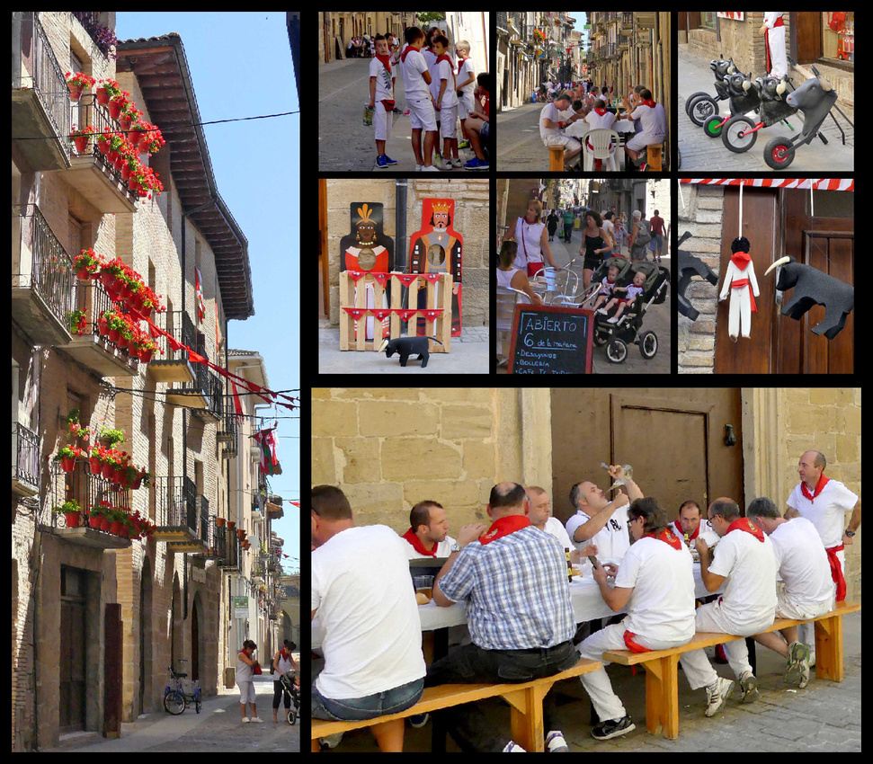 We found parking in Puente La Reina with no problem and walked through the town. First thing we noticed was that 90% of the people were dressed in white with red trim. At first I thought they were going to Pamplona but then we realized there were so many of them it had to be local (plus Pamlona’s festival/running of the bulls had been over for more than a week). We finally found signs saying Puente La Reina’s festival is July 25-29th. They appear to have a tiny bull ring right in the main square –there was sand and pretty substantial walls and bleachers. Then we noticed there were large gates closing off the side streets (so the bulls must run through the main street to the main square). But the main street was currently full of restaurant tables and people eating and drinking (despite it being 11am). Everyone in white and red, even babies and grandpas. As we were leaving town there was the beginning of a parade.
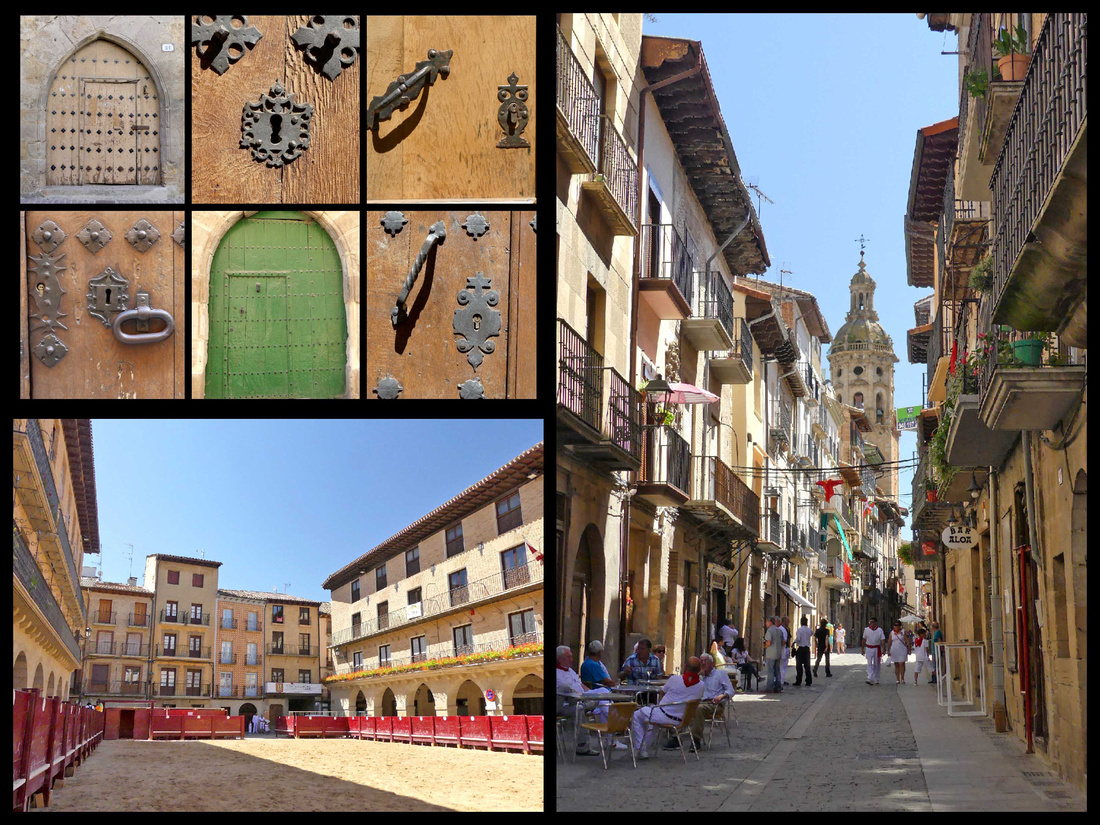
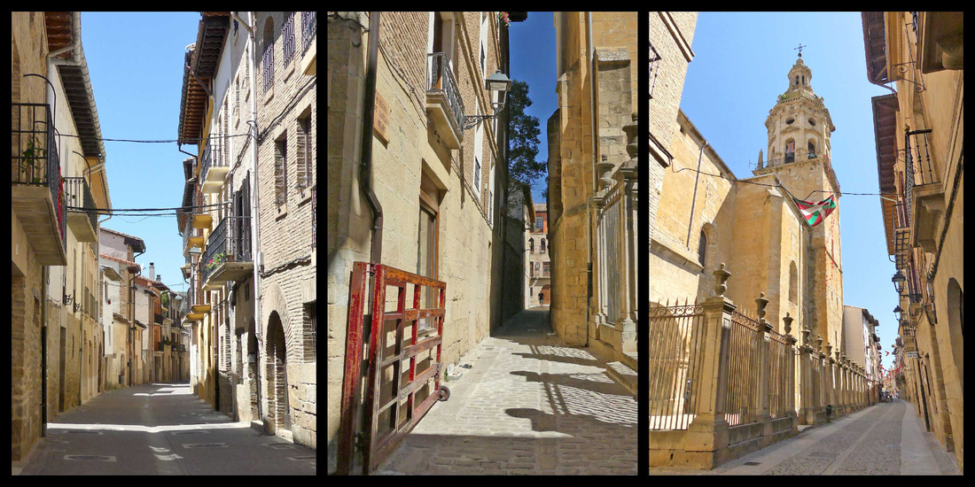
The Church of the Crucifixion at the far end of town, is next to the Pilgrim Hostal and the Pilgrim monument (which is apparently the base of an old crucifix). The church has a backpack and walking staff right under the crucifix near the altar.
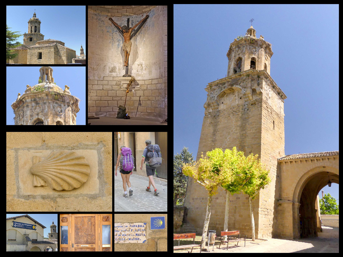
Heading south from Puente LaReina, a couple km past town I spotted a round stone church in the middle of a cornfield and we pulled off – there was a parking lot and a few people. It was just lovely, was actually hexagonal with a kind of round cloister all around it. Unfortunately it was closed but it was great to just walk around it. It’s the Church of Saint Mary of Eunate, a 12th century Romanesque church with links to the Knights Templar. Its octagonal plan and the fact that it is not located in a present-day village but in the countryside contribute to its enigmatic nature. I was just saying ‘why is this not in a guidebook’ and then as we were leaving a tour bus pulled in. Guess it’s in Spanish guidebooks. While there were lots of great things I saw on this trip, my extensive research meant that there were few surprises, so the fact that I just ‘spotted’ this one added to the experience.
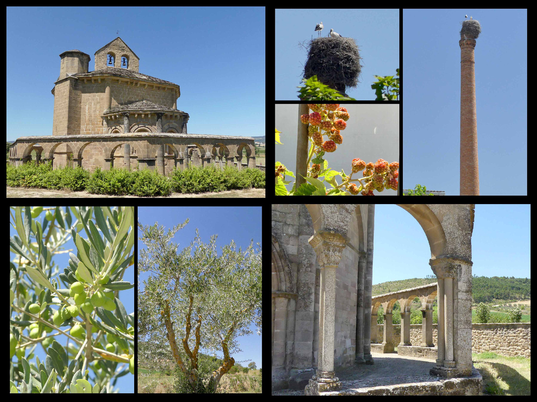
Olite [Jacobean route of the Camino Frances]
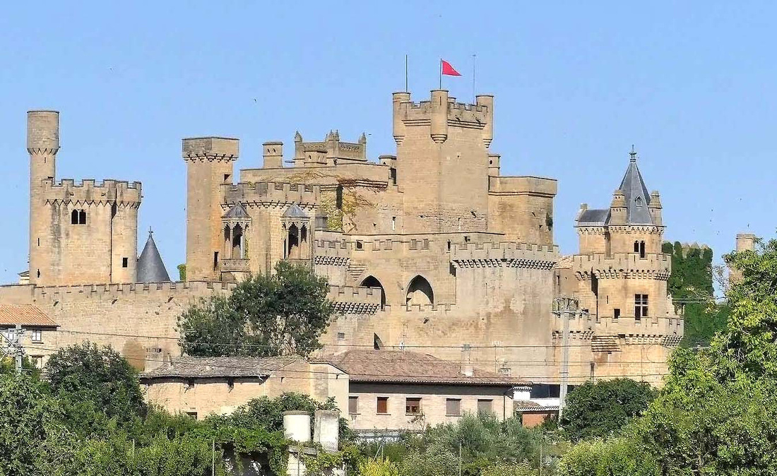
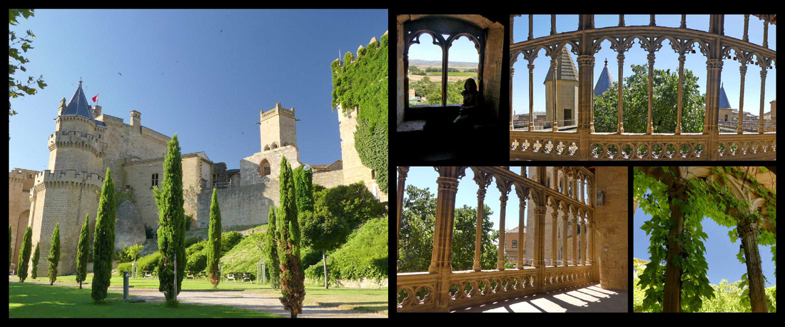
Olite, population 3500, is a pleasant little town in the center of Navarre that was the seat of the Royal Court of the kingdom in the Middle Ages with an exceptional medieval castle complex known as the Palacio Real. There are crenelated towers and square towers and round towers and turrets and annexes, it just keeps rambling.
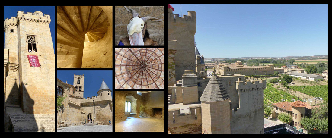
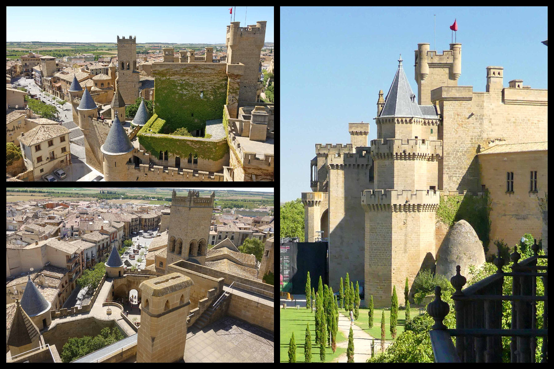
Left: views from the Castle towers Right: view of the castle from the balcony of our room at Hotel Merindad
Declared a national monument in 1925, the castle is the best example of civil Gothic architecture in Navarre and one of the most notable in Europe. There are lots of towers to climb (I think there were 12), each offering spectacular views of the rest of the castle, the town & the surrounding vineyards. There are interior rooms, courtyards (one completely covered in ivy), and balconies. The original part of the castle is now a Parador, the rest of it, the main parts, are open for visits. It’s been highly renovated (but very faithful to it’s original appearance), sometimes castles less recently renovated have more charm, but the renovations were well done and it really does look like a fairy tale castle. There are photos of it from before renovations. If you like to fantasize being a medieval knight or princess this is the place to go.
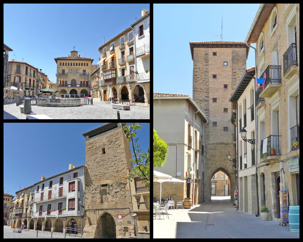
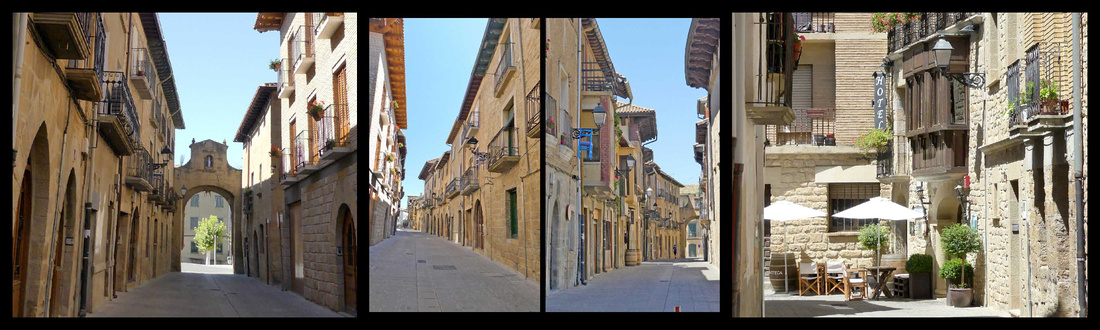
The old town of Olite itself is enclosed by it’s medieval gates, with one main plaza and a couple of smaller ones, a nice watch tower in the center, a pretty town hall, several streets of stone buildings. Hardly any tourists and of the few that were there, most were Spanish (although we met an American family, which felt strange since we had hardly heard any English at all in days). There is a more modern town surrounding the old town, but it’s small and unobtrusive. And the old town itself has plenty of cafes and restaurants, a small grocery store and a couple of coffee shops right out of the 1950s with amazing croissants and pastries (and of course great coffee). There are bodegas all around the town.
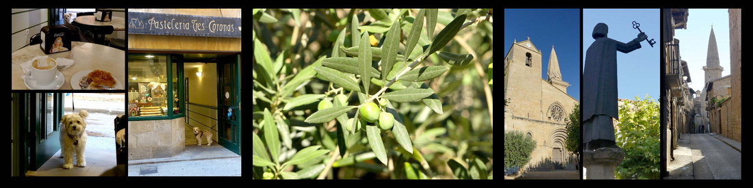
Sort of attached to/ integrated into the castle is the Iglesia de Santa Maria la Real, which has a superbly detailed Gothic (12th century) portal, set in a sort of cloister like ruin. The carving over the door is amazing and still has remnants of paint. In addition to the usual collection of saints there is a 3-D sculpture of the Virgin and baby and a lot of other things – animals, people, castles, flowers, scrolls, gargoyles. Really beautiful and interesting.
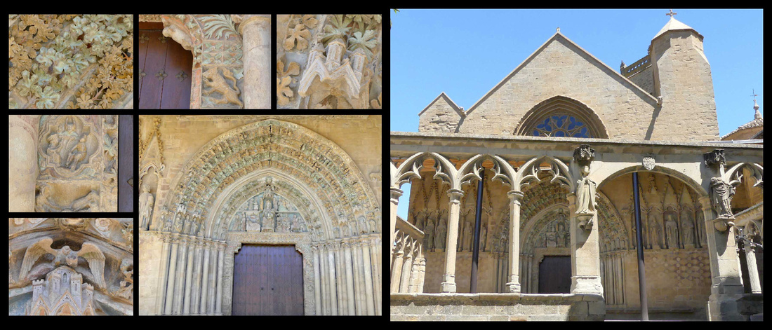
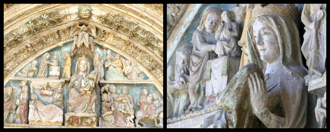
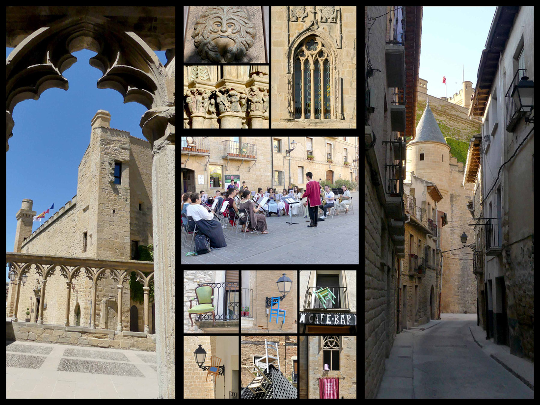
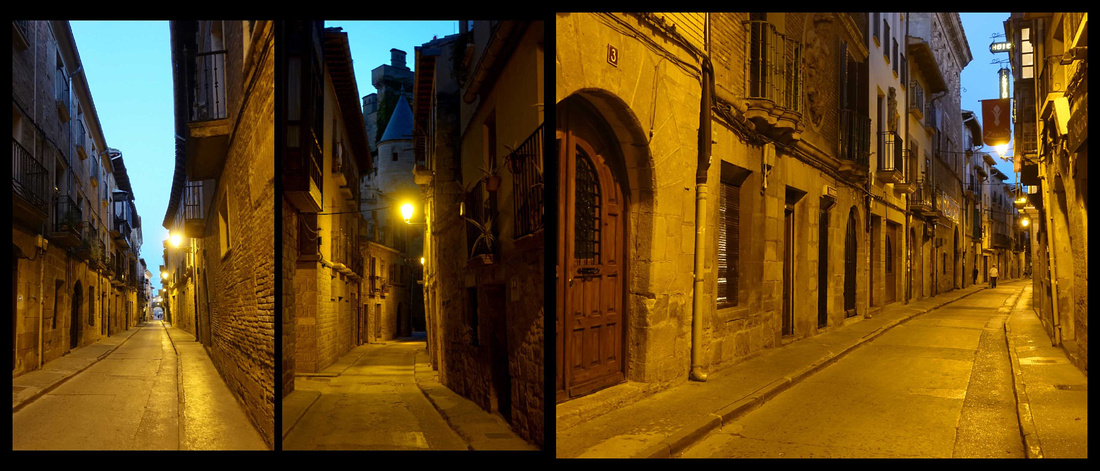
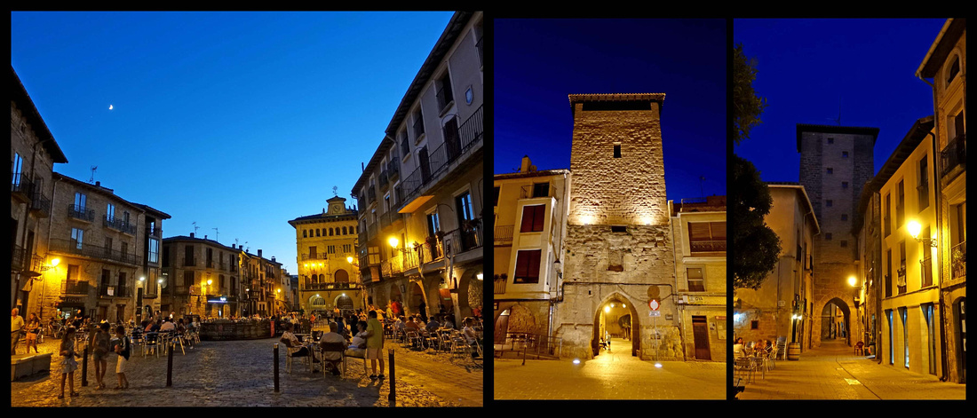
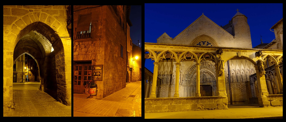
Ujue
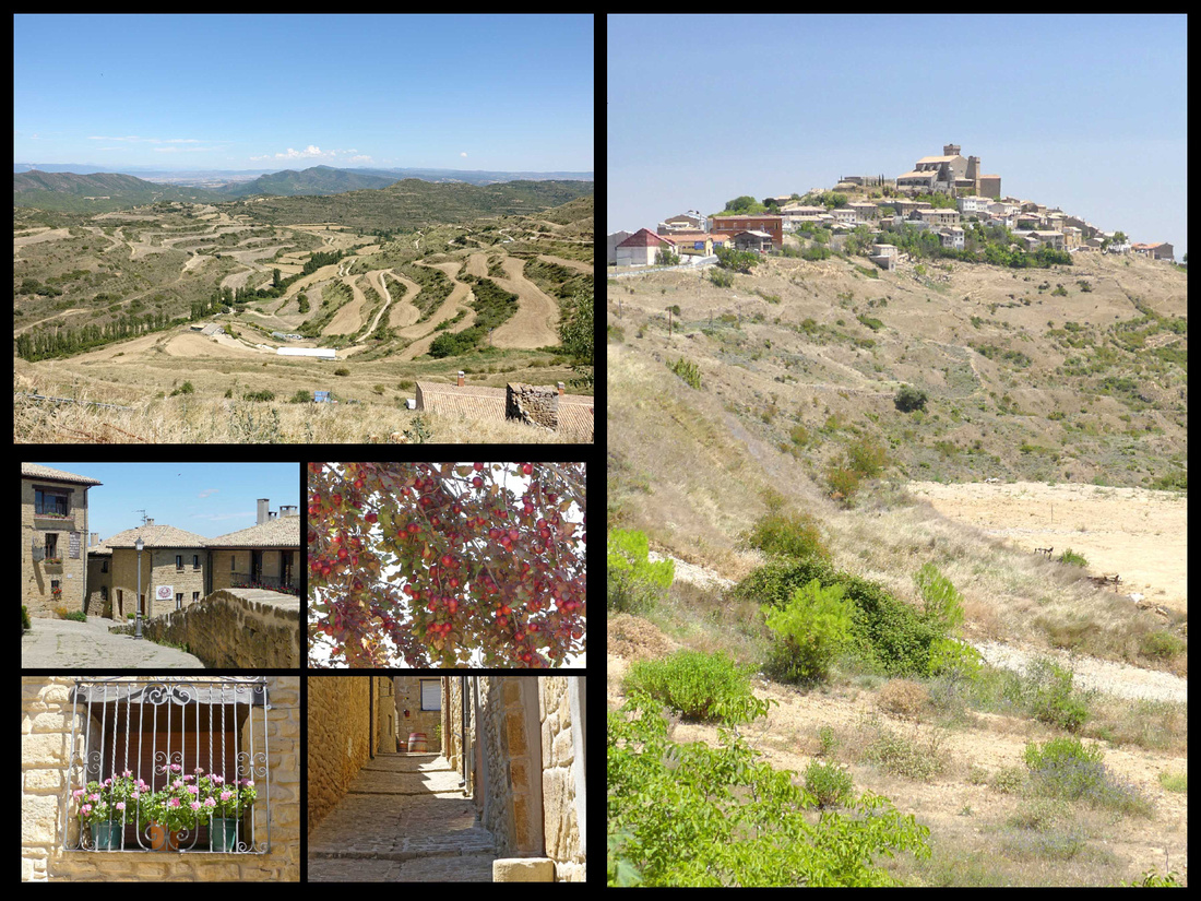 Perched above concentric terraces harboring apple and almond trees, Ujué, population 198, was founded in the early days of the Navarran monarchy in the ninth century AD. The beautiful walled settlement was ennobled by Carlos I, who built much of the sanctuary complex that perches atop the hill. The Santuario de Santa María seems part castle and part church – the church is sort of surrounded by a castle like enclosure, so from the outside it looks like a castle, but inside it’s really just a church. There are some great sculptings and fabulous views of the countryside, extending to Olite in the west and the Pyrenees in the east. It’s free to visit; there were two people just leaving and other than that we saw no one else in the hour or so we were there.
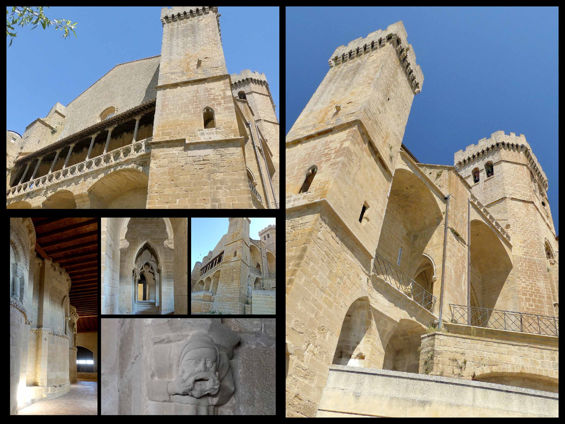
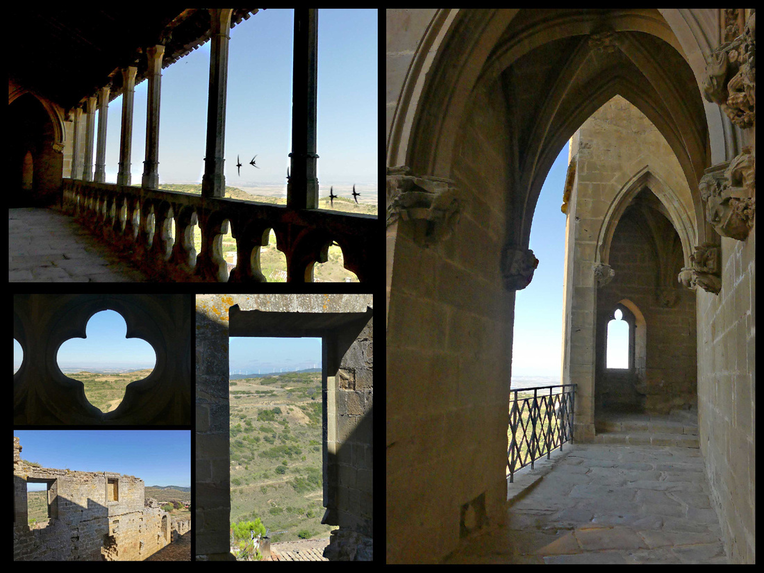
In fact, we hardly saw any people in the village itself, totally built of honey colored stone, really does looks like it was frozen in time from the middle ages. One shop had some local produce (honey, wine, etc.) and we saw one bakery and a couple of restaurants. That was it. Just a few cobbled streets full of stone houses. The occasional satellite dish implies there may be some 21st century people hiding in the houses, but it really does feel very medieval.
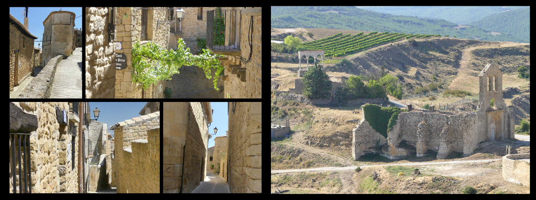
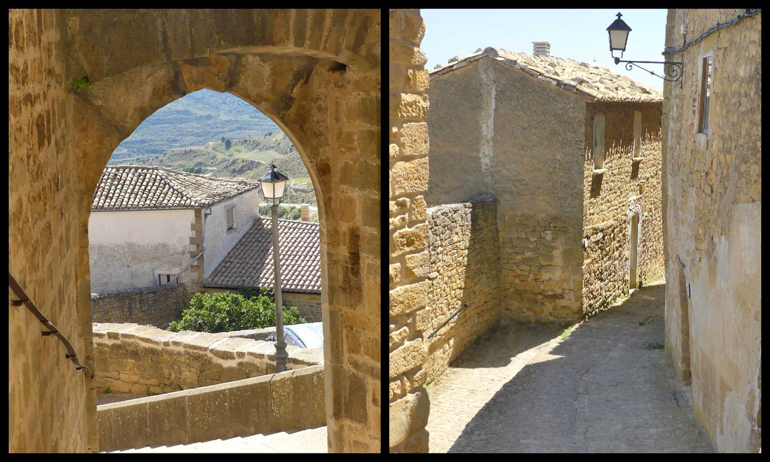
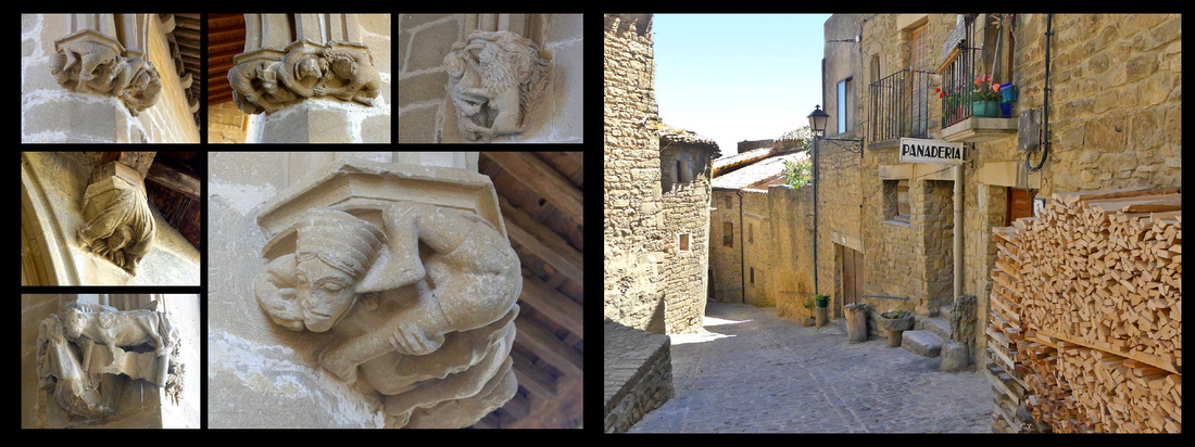
The road up to Ujué starts from the attractive little village of San Martín de Unx, and offers great views of the town from a distance.
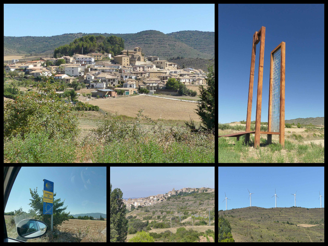
Top left: a hilltown on the N132 between St Martin de Unx and Yesa (interesting modern tower/sculpture on the side of the road). Lower cener: St Martin de Unx
Castillo Javillero
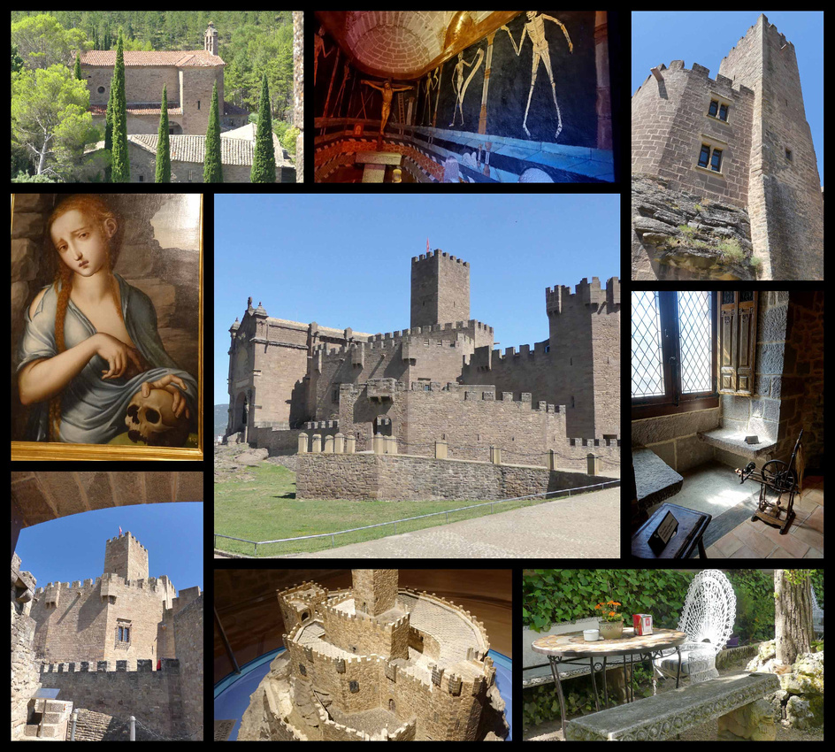 Continuing past St Martin de Unx, we next visited Castillo Javillero. The castle dates from the 11th century, but owes its present look to restoration work carried out in 1952. Francisco Javier (Xavier), patron of Navarre, was born here in 1506. Along with Ignatius Loyola, he founded the order of the Society of Jesus (the Jesuits) in the mid-16th century and thus he is a ‘big deal’ among Catholics (there was one tour bus full of people when we were there, and parking for several more). So most of the castle is dedicated to exhibits about his life. A silhouette of crenelated towers, the Castle of Javier, is more impressive from the outside. It’s very highly renovated and feels much more like a museum about Saint Javier than a ‘castle’. Even if you are not interested in religious history the mural depicting the ‘dance of death’ was kind of interesting. However there is a drawbridge, towers, dungeons, machicolations, embrasures and arrow slits. The castle well signposted off the N-240 (near Yesa).
Leyre Monastery
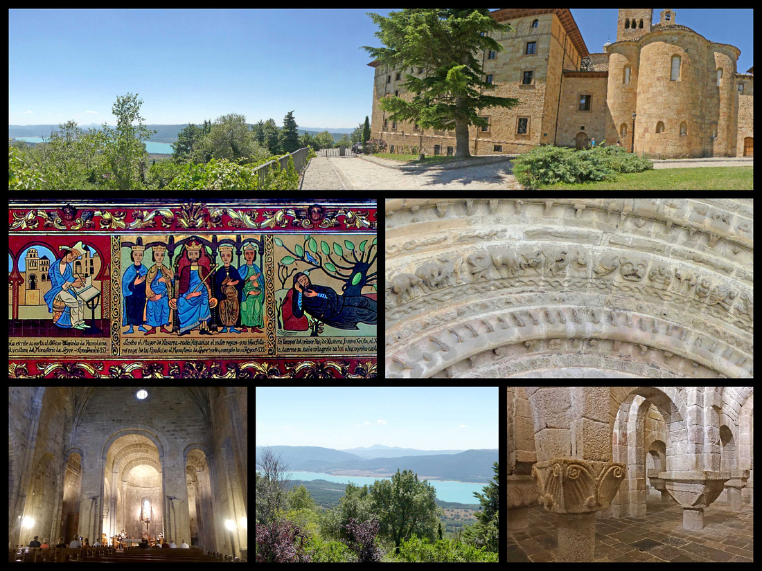 Slightly disappointed by Castillo Javillero, we almost skipped the Monasterio de San Salvador of Leyre figuring it too might not live up to what we had read about it, but since we spent less than an hour at the castle we continued on to the Monastery and were very glad we did. It’s 16km (10 miles) east of Sangüesa, perched on the side of a mountain of the same name, overlooking the Yesa Dam. The monastery is 4km (2½ miles) from Yesa, which itself is on N-240. Take N-240 into Yesa, then follow an uphill road marked LEYRE 2½ miles to the monastery. From the outside the monastery is not all that exceptional but it’s setting above the turquoise lake (actually a reservoir) is stunning.
It consists of a monastery building where monks still live so that part is not able to be visited, a section which is now a hotel, the church itself, and the crypt. There were very few people around when we were there, but apparently it can get swamped at times (large parking lot). There is a small (modern) building that serves as a gift shop and ticket office. We were given a key and told to unlock the door to both the church and the crypt, being sure to lock ourselves IN while we visited. "And oh, by the way in 15 minutes in the church the monks will be singing, you can still go in just don’t walk around too much”.
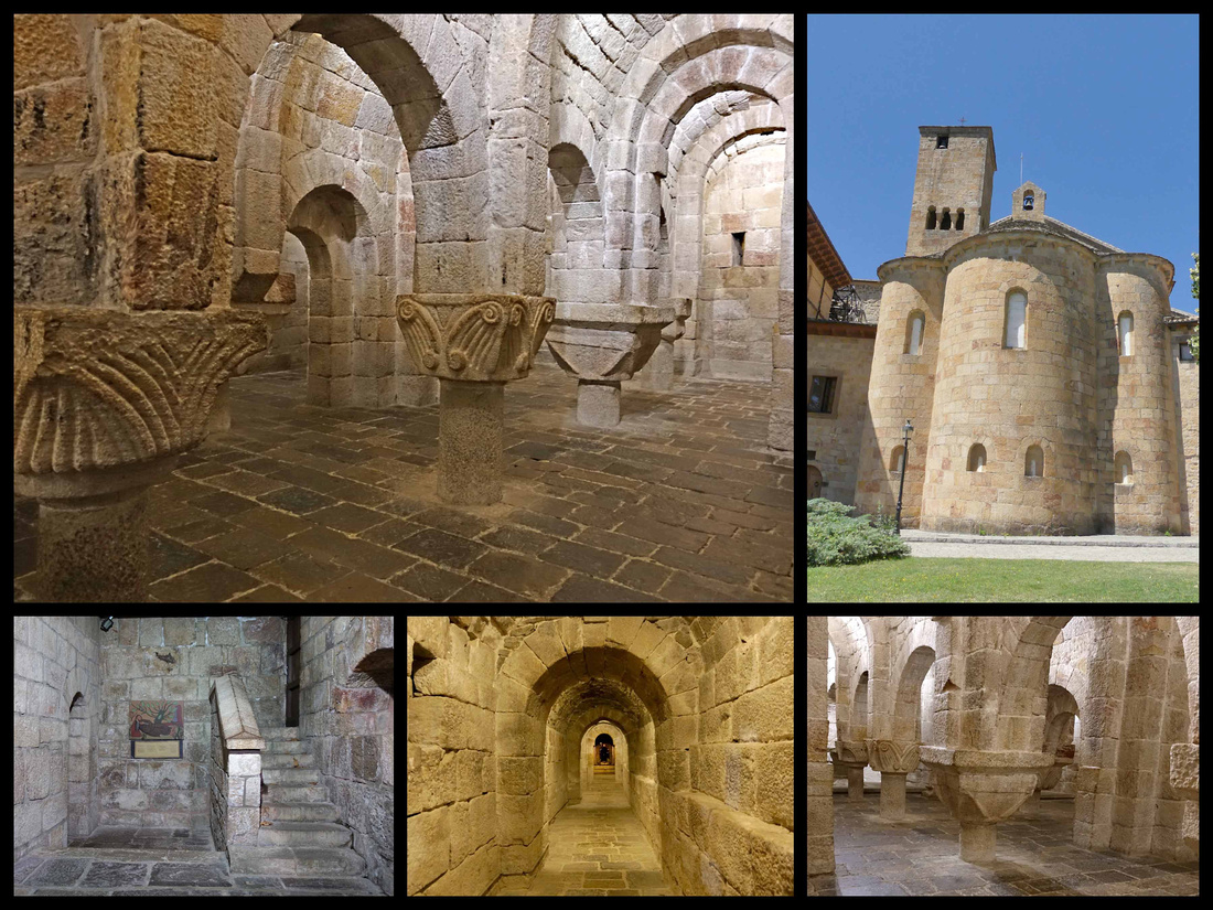
Kind of scary to lock ourselves into a crypt but it was beautiful and very atmospheric in there and we were the only ones there. Nicely lit and the lock is modern so not really afraid we’d get locked inside, (still after my experience in Barcelona that time when I got locked in a cloister....) The crypt is part of the original 11th century pre-Romanesque church, consecrated in 1057 and is considered a major work of Romanesque art. The stone altar and ram-horned columns suggest darker ritual purposes. The columns all different and are very short – it’s strange to have the capitals at waist height. Next to the crypt is a tunnel leading to an image of San Virila – a former abbot. Then we went around to the church, same deal with the key. But in addition to the monks, who were indeed chanting, there were ten or fifteen tourists sitting and watching. Pretty cool. And the setting with the Pyrenees foothills on one side and a beautiful turquoise lake down below was very nice.
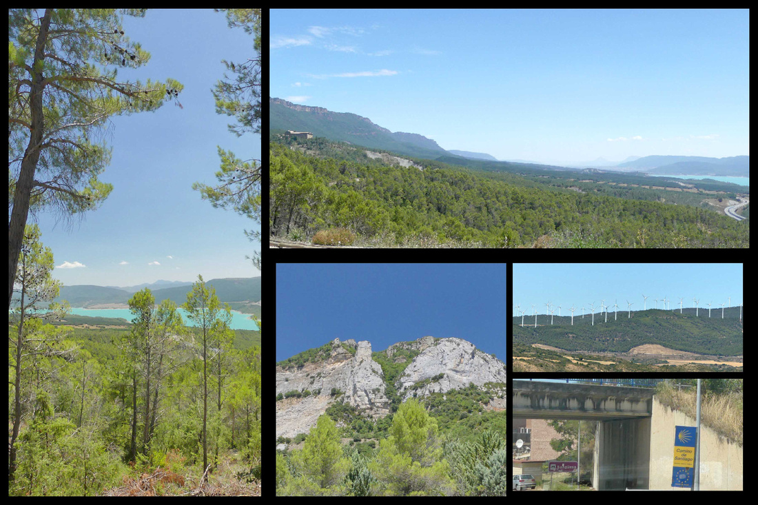
Barderas Reales Desert Park
The Bardenas Reales is one of only a few deserts in Europe and is definitely the most impressive. When researching the trip I came across pictures of it, and since it was on our way and I love deserts (I'm a huge fan of Death Valley National Park) we decided to stop. We visited it on our last day, between Olite and Madrid and it was definitely worth a couple hours. However, compared to the U.S. southwest it was a bit of a let down.
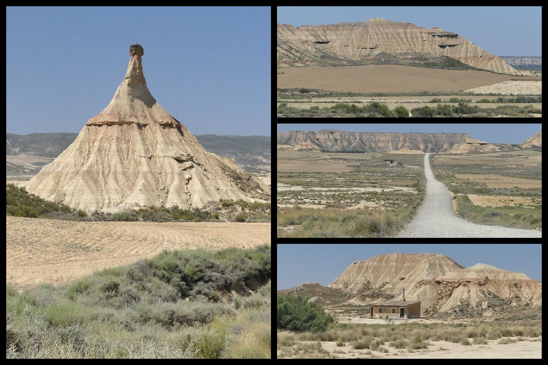
Technically semi-desert; a violently rugged expanse of white gypsum flats and scrawny sheep grazing on what little spiky foliage survives. It’s a popular location for filmmaking: eg the Bond film The World is not Enough was made here. The information center and main entrance to the park can be accessed from the road N- 134 just south (approximately 3km) from the town of Arguedas. This is the best entrance since the road is paved, pavement ends after the Info Center. At the information center (WCs and vending machine with cold drinks) we were given a map and told the road is fine for all cars, just go slow, it should take about 1 ½ hours to do the circuit, plus stops. The road is certainly very dusty, but totally fine to drive in our Fiat 500.
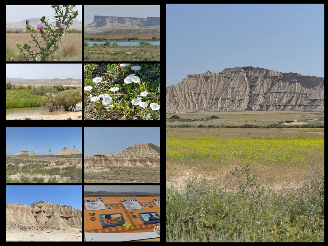
There are several unique geological formations and some lovely landscapes. These landscapes are the result of a very special climate made up of hot summers, cold winters and long dry periods interrupted by heavy rain. There is also a particular wind current that runs through the area, called “cierzo.” The difference of pressure between the Cantabrian and the Mediterranean Seas generates a current of strong wind that flows along with the Ebro River. The “cierzo” wind is responsible for the unique, abrupt landscapes, canyons and plateaus, produced by its erosion on the soil, which mainly consists of clay, chalk and sandstone.
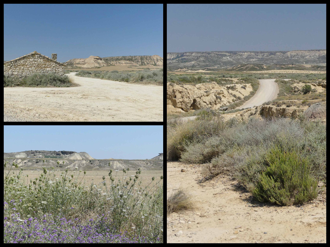
It was certainly beautiful in that ‘desert’ way, but if you’ve been to the desert southwest of the US it was pretty underwhelming. The mesas and other geologic features are tiny, probably a tenth the height of most of the stuff in the US deserts, kind of like desert miniature. The most impressive is Cabezo Castildetierra which is featured on all the posters and postcards and does look very otherworldly. There were the ruins of some old buildings (can’t imagine anyone living here) and plenty of places to pull off the road to take pictures and walk around, but I didn’t see any actual paths or places where you could do hikes, not that we would have, given it was 99 degrees and sunny. There were some nice wild flowers, a lake a distance off the road, and something which we think might have been rice growing (which would be weird).
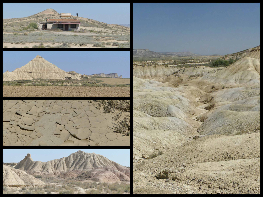
The entrance road in from the main highway (before the visitor center) features some ranches with nice cows and bulls.
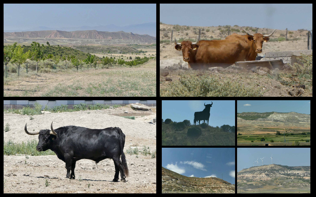 Top left and right and lower left: Barderas Real Lower right: the highway back to Madrid
It was definitely worth a few hours (from the main highway and back the detour took us about 3 hours) if you are anywhere around there.
]]>
I've been on a quest the last few years to 'research' places to go where it's 'nice' when it's not 'nice' where I live (northeastern US). So this was part of my research mission to see how northern Italy is is the early spring.
Although the first week we were looking at cool rainy weather in Milan and areas around it – especially the lakes – and thus made a last minute switch to Rome (where we had 70 and sunny), by the second week Milan had great weather. After one morning of drizzle the sun came out and stayed out for five days, temps climbing from the low 60s to over 80.
All over Lombardy and the Veneto – green grass, tons of pink and white flowering fruit trees, other trees just starting to bud out, dandelions, little white wild flowers, jasmine, forsythia, daffodils, tulips, wisteria.
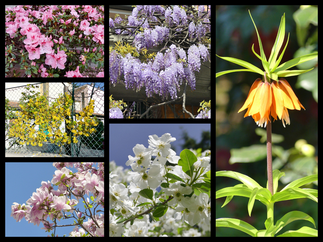
This was my third visit to Milan, a city I didn’t even deem worthy of seeing until my 6th trip to Italy. And I still don’t think it’s on a par – from a tourist standpoint – with Rome with it’s ancient ruins and Baroque piazzas, or Renaissance Florence, or ‘like-no-where-else-Venice’. But it’s a nice city. The Duomo and Galleria and surrounding piazza is incredible and most certainly ‘worth’ seeing. And it’s got some nice shopping/strolling streets, a pretty decent center city castle whose courtyards you can wander around for free, and a pretty park. And Milano Centrale is one of the ‘best’ train stations in Europe. A huge Fascist era building that itself is worth seeing if you like train stations. But I think the best reason to plan a few days in Milan is that it’s transportation connections are so good. It’s got two airports and if you’re traveling from anywhere south to the rest of Europe, or going from one coast to the other in Italy, you most likely will go through Milan. And it’s so central there are numerous really worthwhile day trips possible. On this trip I did Pavia ( ½ hour by frequent train), Lake Como and Lake Lugano (both less than an hour), and Genoa, which at 1 ½ hours is close to my limit for a day trip, and now that I’ve been there I know next time I will plan to stay a few days, but it was a totally enjoyable day trip from Milan. Other day-trips easily done from Milan include Bergamo, Cremona, Brescia and Parma.
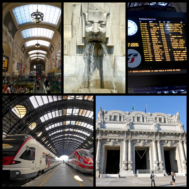
Sunday, March 26, 2017 Rain in am, sunny and 63 rest of day. Spent a lovely six hours exploring Pavia. Loved it.
Pavia is a university city with Romanesque and medieval buildings and an interesting historic center set on a river. Founded by the Romans, Pavia reached its greatness over 1300 years ago when it became the capital of much of the Italian peninsula. A comfortable provincial town founded on an easily defendable stretch of land alongside the confluence of the Po and Ticino rivers. Pavia barely gets mentioned in guidebooks and travel forums, and when it does it’s because it’s only 8 km from the Certosa di Pavia, a huge monastery complex, which I ended up not getting to as I so enjoyed the city itself I spent all my time there.
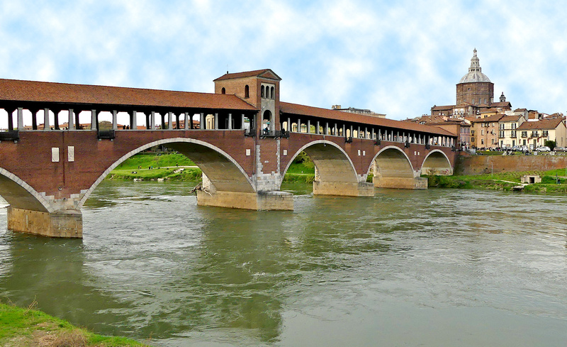
At first Pavia seemed to me a bit like Vicenza – quiet, prosperous, pretty - but not very interesting. The Duomo was impressive but not particularly pretty from the outside and looked closed. Most of the stores were closed (it was Sunday). I found the covered bridge – Ponte Coperto - and that was quite nice. It’s a reproduction of a 14th century bridge destroyed during the war, which itself was built near the site of a Roman bridge over the Ticino river. I sat on a bench in the sun for half an hour and watched locals walk their dogs and kids. Then explored the center – I found a TI Office which looked closed but there was a guy in there who let me in and gave me maps and was extremely helpful telling me where to go. Having the map really helped (I left my relatively lousy guidebook map in the hotel). There are posted maps all over town but without having one in my hand I kept forgetting where to turn. With the map and his instructions I easily found the main square, Piazza della Vittoria (really nice, lots of outdoor cafes and pretty buildings).
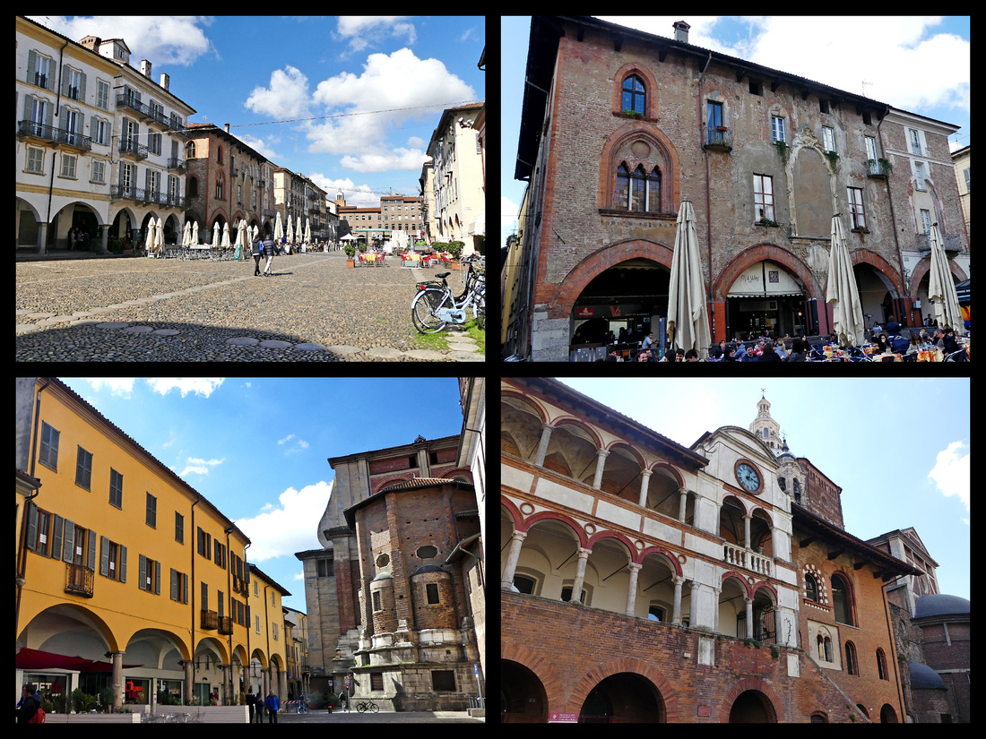
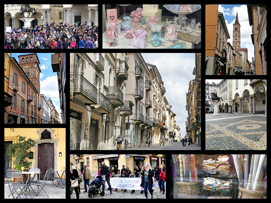
The University, one of the oldest in Europe (founded 1361 but possibly based on a school here from 825). There are at least 12 different courtyards and gardens, all arcaded, beautiful. The architecture is a mix of baroque and neo-classic. Three of the medieval towers (there were once 100, now only about 5 left, but they are quite striking) are in a park like setting behind the University.
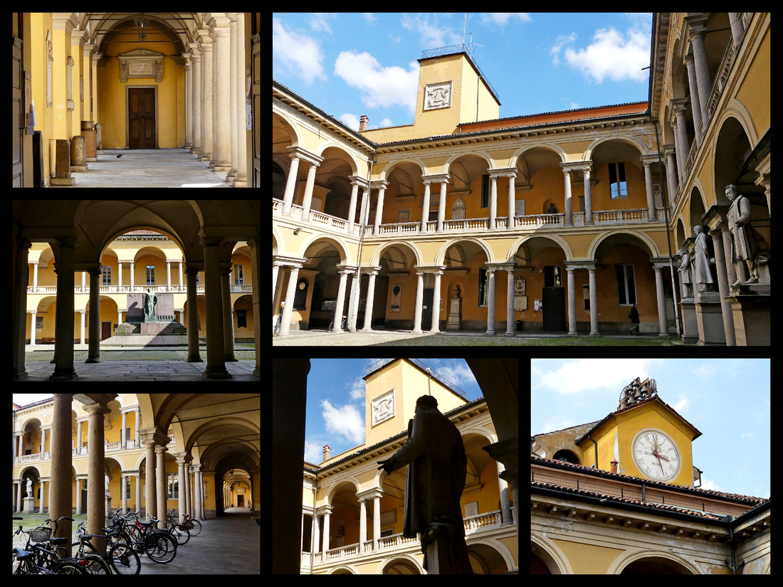
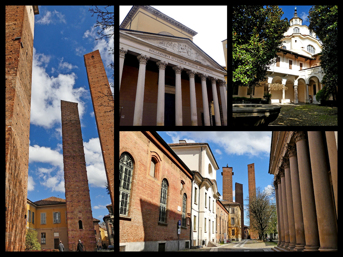
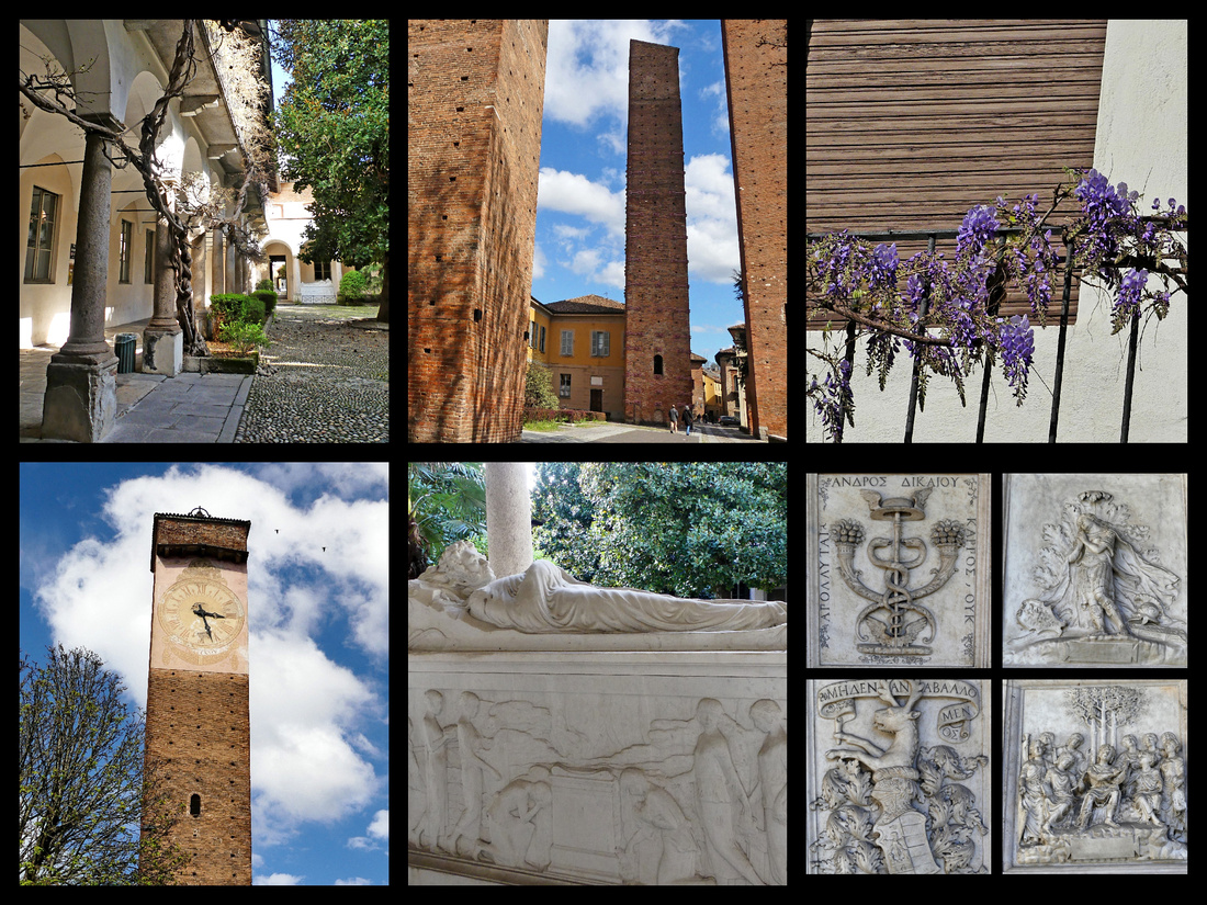
The Castello Visconteo, (1360s) looks like a small fortified castle but was actually used as a private residence, set in a lovely park with people, kids, and dogs and everything green and with wildflowers blooming.
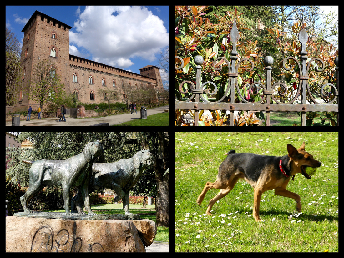
There are plenty of churches – none terribly beautiful on the outside, but all were huge and gorgeous on the inside. San Michele (between the bridge and main part of town) had extensive carvings on the sandstone façade including griffins, dragons and other beasts locked in a struggle with people representing the fight between good and evil. Inside was huge and impressive but my favorite was the lower level crypt/chapel – very Romanesque.
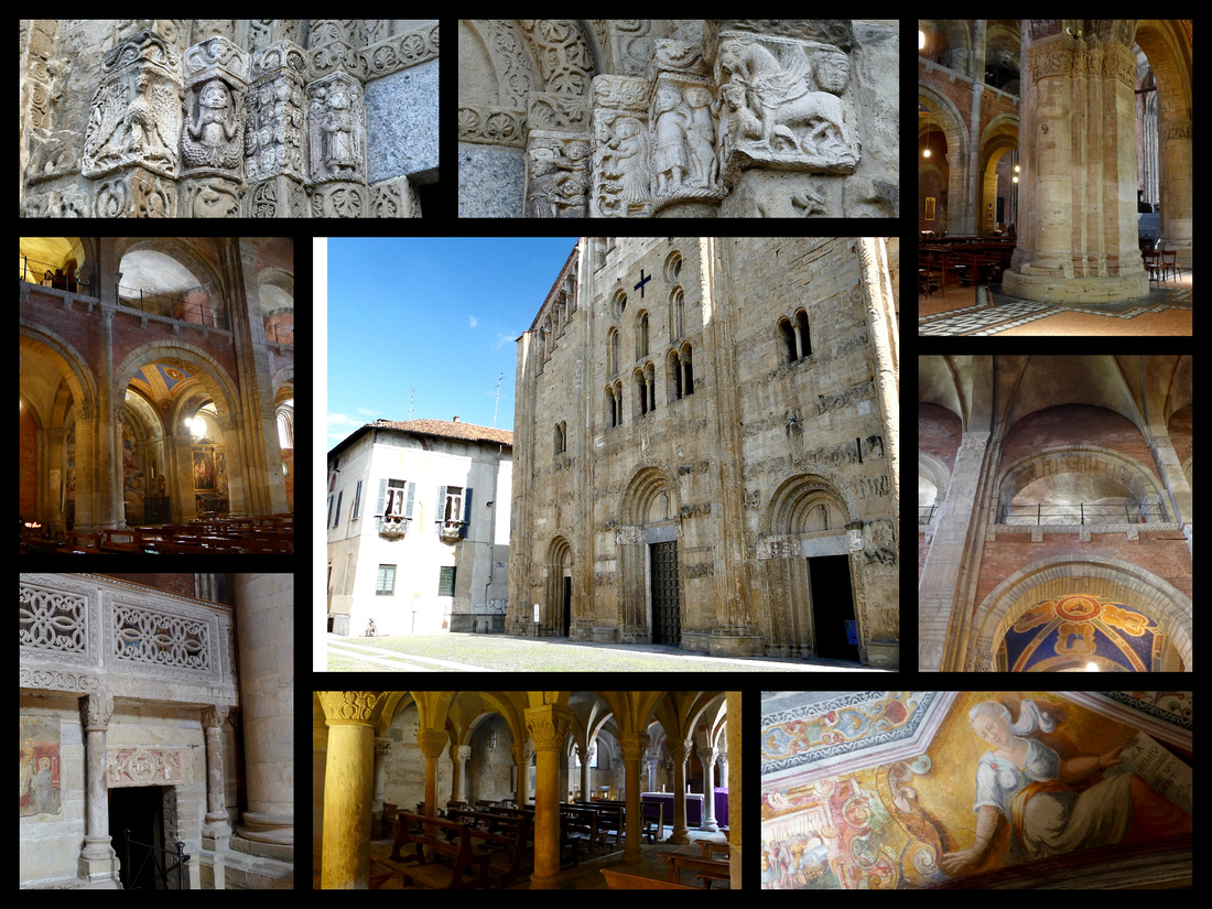
Another, Basilica of San Pietro in Ciel d’Oro, (close to the castle) 1132 is similar but of brick instead of sandstone but also has a lower level chapel that feels very old (and that strange feeling I get in some very old churches that is a combination of spooky and religious). In both churches there was singing/chanting coming from unseen voices.
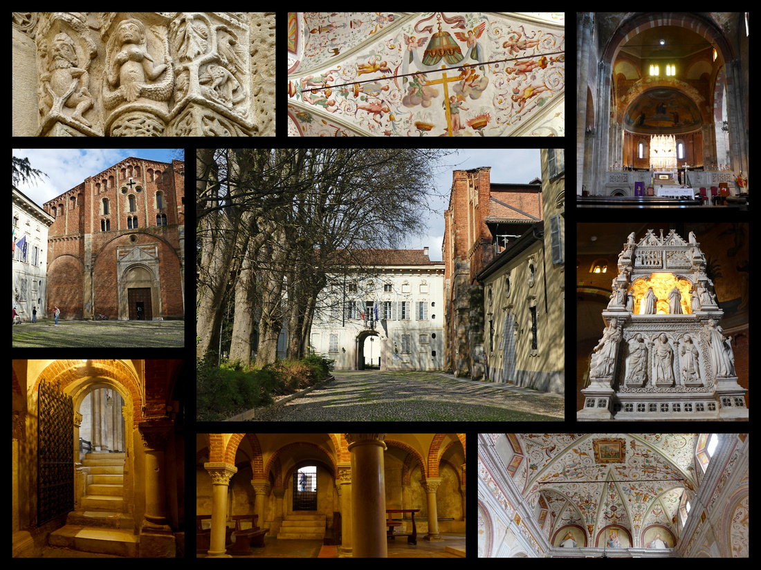
A third church, Santa Maria del Carmine (towards the main piazza), also of brick was less interesting but it did have frescoes featuring the town’s bridge and other sites and some secular scenes. All were free to enter, and none had more than a handful of tourists.
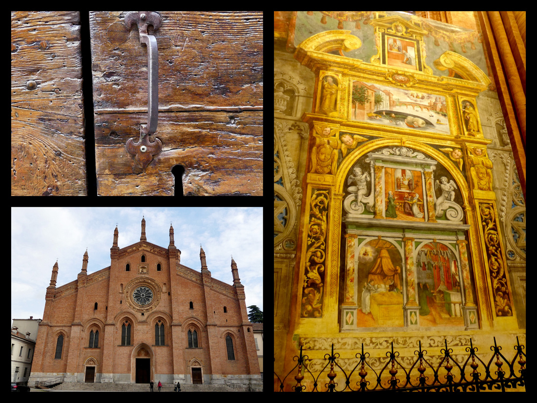
I went past the Duomo a second and this time it was open and gigantic –and very white inside (different from the others which were all much darker). There was a mass just starting which actually added to the effect. Outside was a band performance and little festival. Earlier I’d passed the band leading a parade of people (many of them children) holding signs. Not sure what they were celebrating but everyone seemed very happy. Outside the Duomo the band was playing “YMCA” – then to walk into this incredible church with a mass (in Italian obviously but to me it sounded like Latin) – quite the contrast.
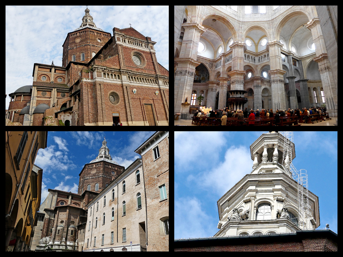
Back to the bridge as I saw a photo of it from the opposite side (didn’t walk across it the first time) and the view is better from that side. Finally headed back towards the train. The whole town was out shopping/walking/eating gelato. Huge difference from the sedate feeling in the early afternoon (it was now after 5pm). Tons of dogs of all kinds, lively atmosphere, birds singing in back streets/along the river, some street performers, the band (parade), the singing in the churches, wisteria, forsythia, trees just budding out, warm sun, cool breeze. Lovely day.
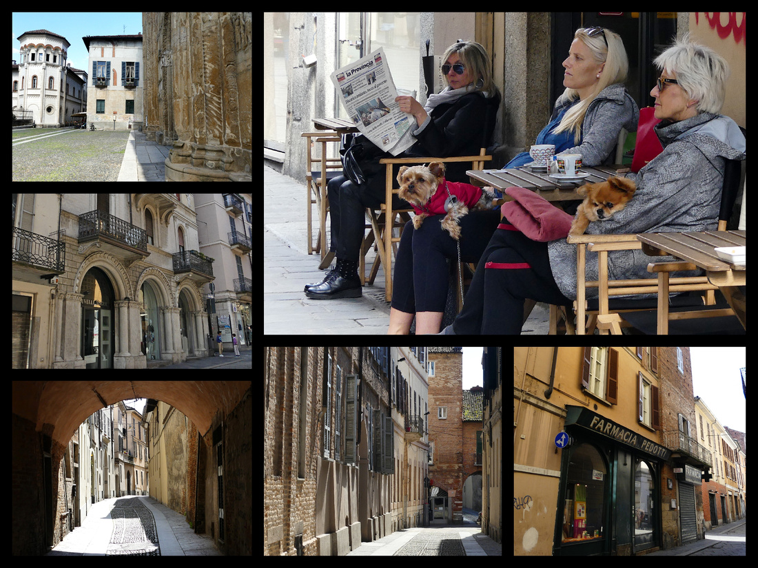
Monday, March 27, 2017 - Sunny and 65 – Took 8:10 train to Genoa, arrived just before 10. Walked all over. Took 4:09 train back.
I liked Genoa a lot more than I thought I would. I had figured it would be sort of like Palermo, maybe not even as nice, kind of gritty, rather dark. But it was lovely. Sprawled behind the port area (Italy's biggest) is a dense and fascinating warren of medieval caruggi (tiny alleyways) – and these are kind of dark. But the rest of the city is bright and clean and there are some incredible buildings, including several 16th and 17th century palazzos along Via Garibaldi which are a UNESCO site, and the 19th Century city along arcaded Via XX September which is the main shopping street – with all the usual international chains.
The main Piazza – Piazza Ferrari – separates the old town from the more modern 19th century city, and has a huge fountain which was incredible. 19th century neo Baroque buildings surround it including the ‘Borsa’ and the Teatro Carlo Fellice.
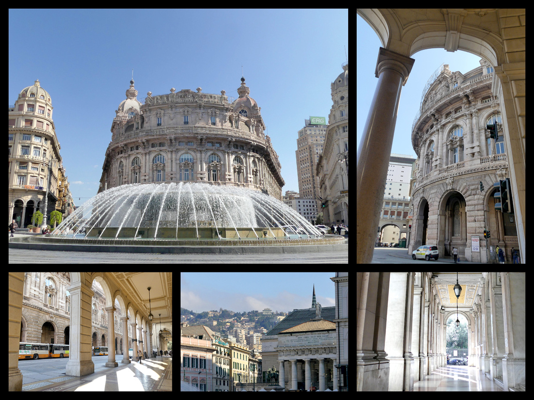
A couple blocks south from Piazza Ferrari brings you to Piazza Dante off which is the ancient main gate to the city, Porta Soprano, still very imposing with two huge towers. Right next to that is the tiniest cloister – no church, just a perfect square little arcaded stone cloister from the 12th century. It is the Cloister of sant’Andrea. Christopher Columbus’s house is supposedly right around here but I didn’t see it.
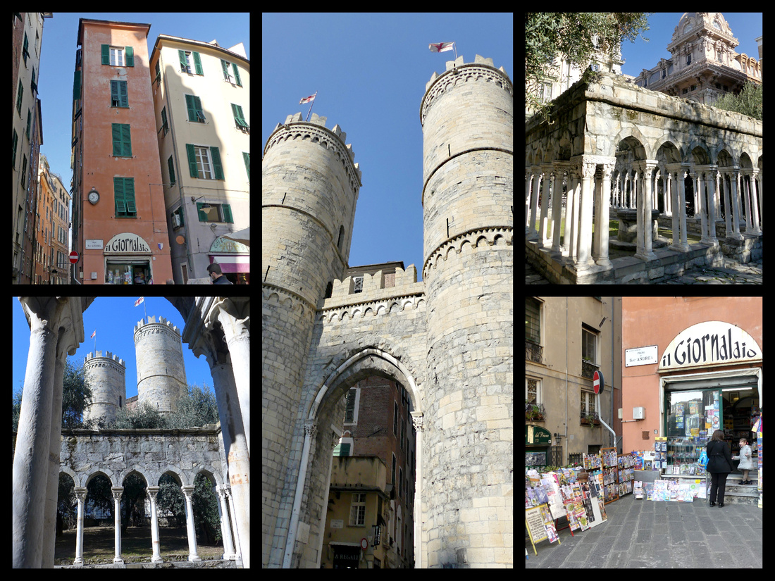
Southwest of Piazza Ferrari is the Chiesa dei Sant Ambrogio e Andrea (big, pretty and yellow, late 1500s) and Piazza Matteotti, home to Palazzo Ducale, the historic location of the Genova Republic' s Government and today is the center of all Genova' s cultural activities.
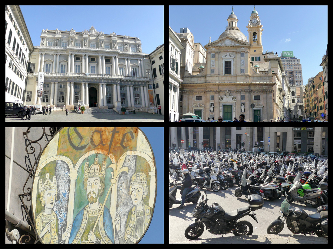
In the other direction from Piazza Ferrari is tiny Piazza Matteo with a cute little black and white striped church. This beautiful little square is the domain of the city’s most acclaimed family, the seagoing Dorias, who ruled Genoa until the end of the 18th century. The church is 12th century and contains the crypt of the Dorias’ most illustrious son, Andrea. Several of the buildings surround the piazza are also black and white striped (like many others in the city) which denotes homes of the most honored citizens.
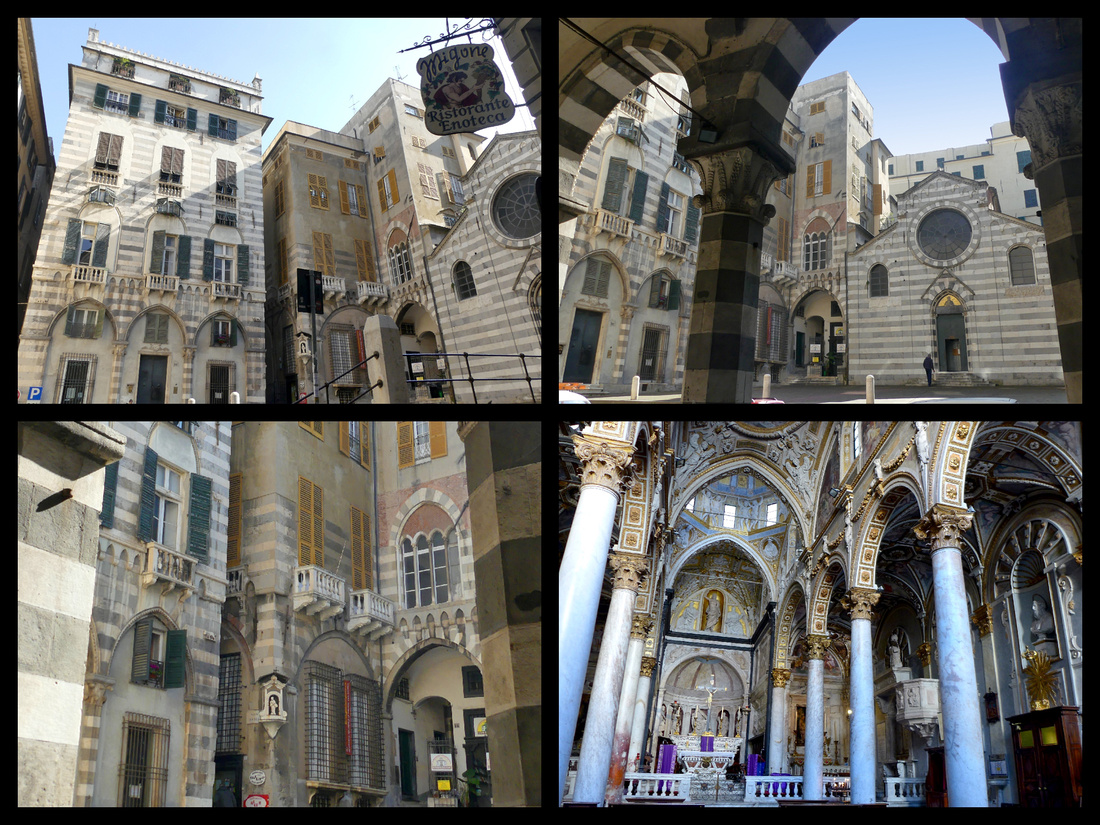
Just around the corner from Piazza Matteo is the larger San Lorenzo Cathedral – also black and white stripes with a pair of nice lions guarding the stairs leading to it. It’s Romanesque-Gothic, begun in 1160, remodeled in 1307 with a Renaissance dome added in 1557. From here Via San Lorenzo is the ‘main’ street leading down to the port. On the map it looks like a big busy street but in reality it’s narrow and pedestrianized, not all that much wider than the narrow, atmospheric alleys all around it.
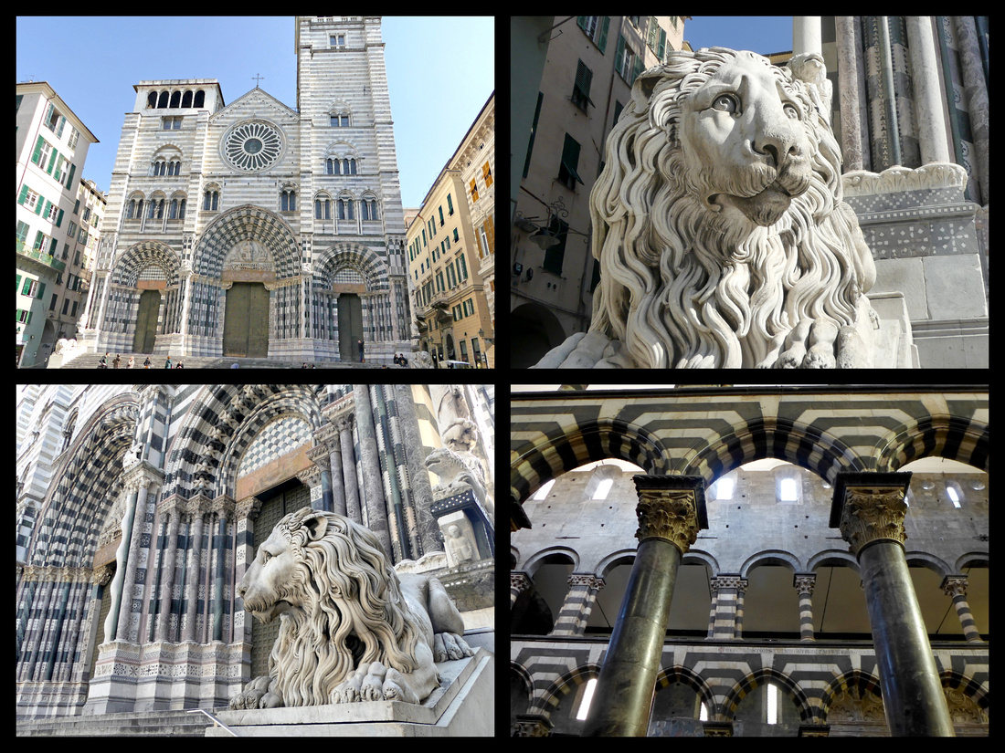
It opens out onto the area just behind the Harbor. Via di Sottoripa is a covered street with lots of eateries. The back of Palazzo San Giorgio is here. The back of the building looks like a medieval castle, but the front (and side) is bright, beautifully painted with pastel colors including a huge depiction of Saint George slaying the dragon. The place is absolutely gorgeous, only slightly diminished by being right across from the large highway overpass.
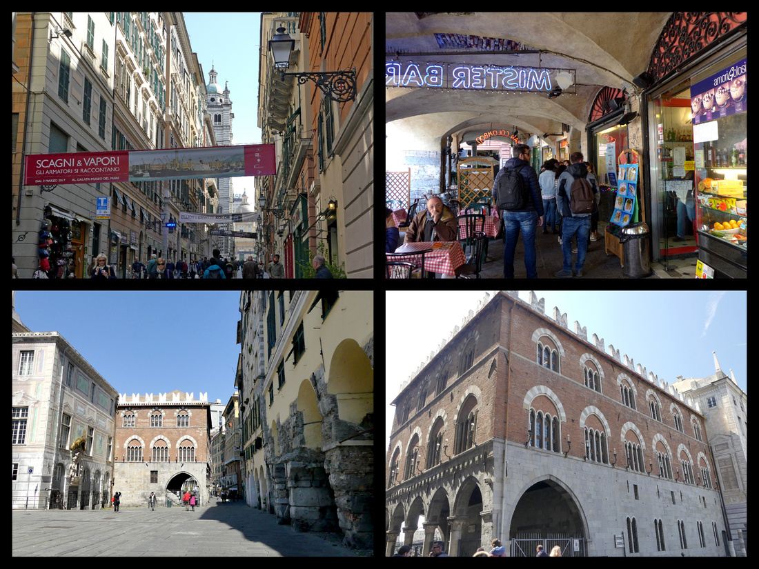
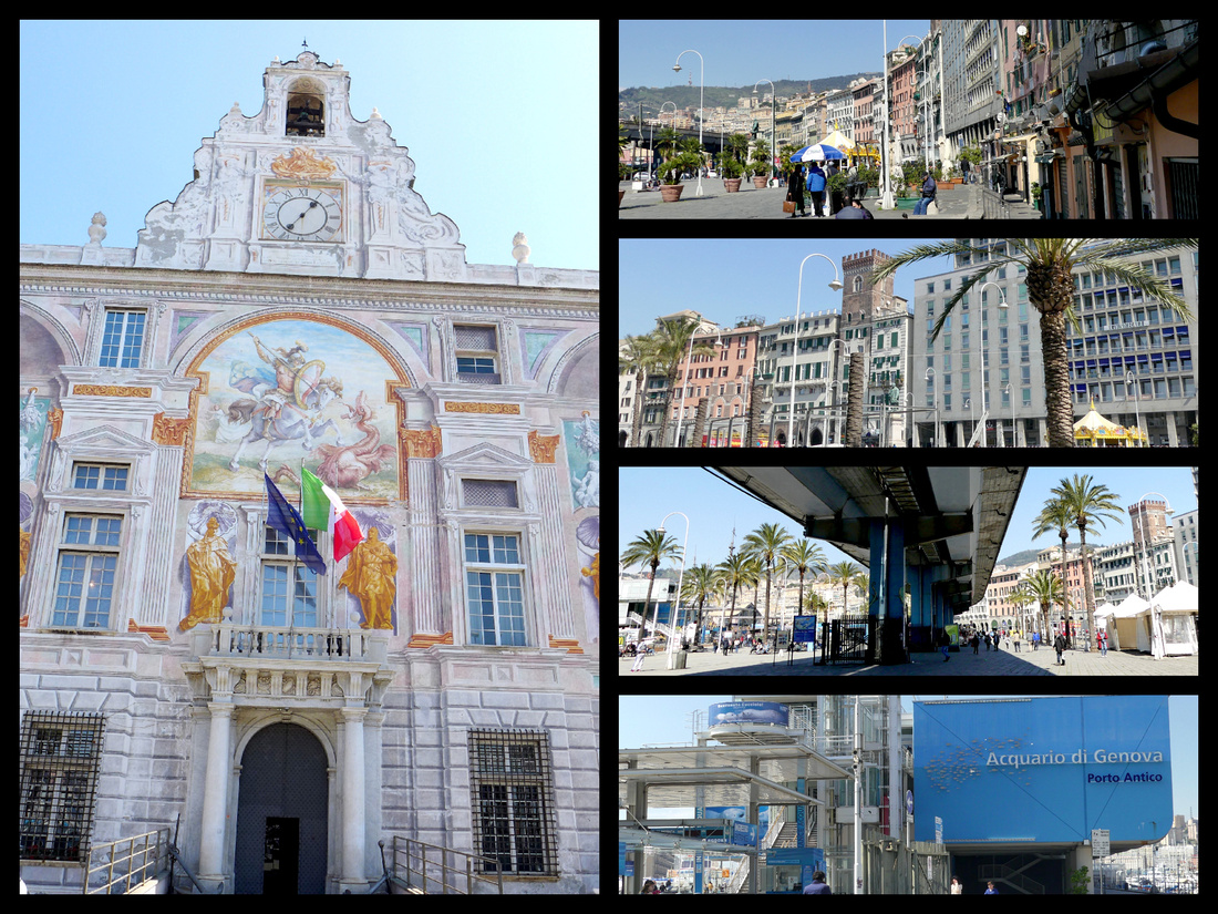
There is a relatively busy street even under the highway, but there are lights and crosswalks and it’s easy to see the harbor from the main side of the road. Porto Antico, totally revitalized over the past two decades, it’s old warehouses converted into exhibition spaces, concert halls, museums and waterfront cafes. It’s Italy’s biggest port, but the industrial shipping and cruise ship areas are way off to one side so the area directly in front of the city area I just described is all open and inviting. There is what is supposedly the ‘best’ aquarium in Europe (I was really sorry not to have time for it) which includes a huge round Biosphere which stretched out into the harbor. The Galeone Neptune is certainly an eye catching addition to the harbor. It’s a replica of a 17th century Spanish galleon. It was built in 1985 for Roman Polanski’s film Pirates. But it sure is pretty.
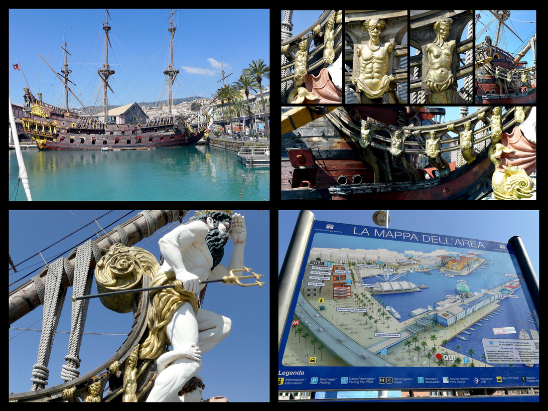
Another eye catching thing on the other side of the aquarium is Il Bigo – a ride in a capsule strung from what is supposed to look like a ships crane, that gets lifted high over the port. Next to this is an old warehouse renovated to house a huge ‘Eataly’ and numerous other shops and restaurants. There are sailboats, yachts, sightseeing boats. Modern art sculptures, renovated old cranes. The whole area is delightful (especially on a blindingly bright day with temperatures in the high 60s) and I walked quite a ways just taking it all in.
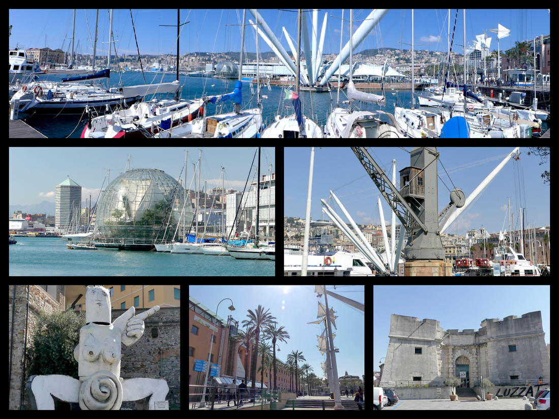
I could have stayed down by the waterfront for the rest of the day but I wanted to see the street which is a UNESCO World Heritage Site so I made my way back inland and up through the narrow caruggi. The streets here are indeed dark and narrow and the few piazzas are so tiny you can hardly call them piazzas. But Piazza San Luca has a pretty little church and Piazzi Banchi is a tiny but busy little square with an interesting kind of elevated church.
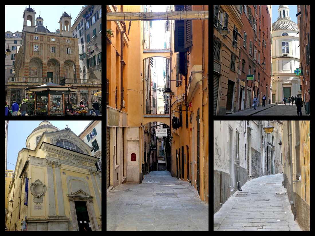
There are over a hundred Renaissance and Baroque palaces on the Strade Nuove (‘New Streets’), built between the 16th and 17th centuries and 46 of them are collectively listed as a UNESCO world heritage site, the main ones on Via Garibaldi, a few blocks inland from Piazza Ferrari. Descriptions of Via Garibaldi make it sound like a grand boulevard but it is actually a narrow pedestrianized street which feels even more hemmed in by the large palazzos on both sides. Palazzo Rosso, Palazzo Bianco and Palazzo Tursi are the most well known.
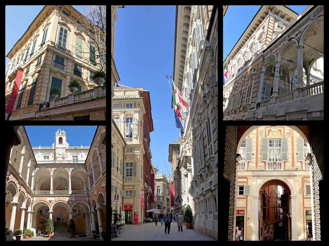
Just a block past Via Garibaldi is Piazza del Portello, a busy traffic square, which has the entrance to the Art Noveau lift up to a belvedere with great views of the lower city, the water and the hillsides which are the ‘suburbs’ of Genoa, with pastel colored buildings as far as the eye can see.
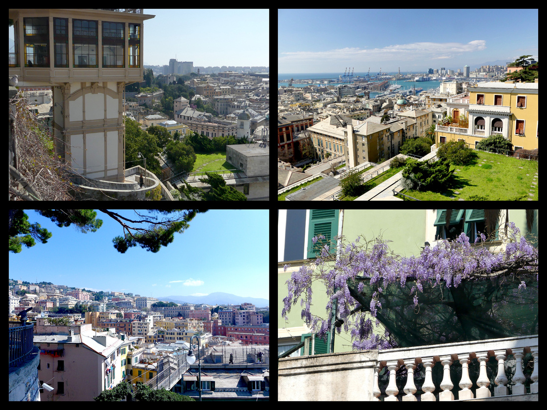
Everything was a lot closer together than I expected it would be. From the maps and what I read I figured the hills would be worse and the distances much farther. Genoa is a large city (Italy’s 6th largest I think) but the historic core and the waterfront are close together and it’s very walkable. There is a lot I didn’t get to and I definitely plan to come back. Still, I walked a ton (though never considered taking the metro which I though I would have to). The route I took is only about 5 miles, though of course I double around a lot so did at least twice that.
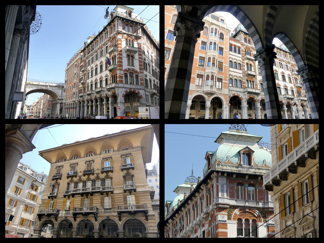
Via XX Septembre arcaded shopping street
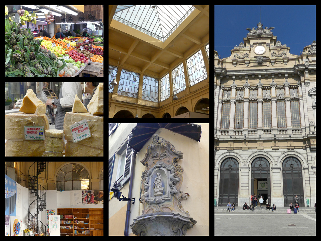
Mercato Orientale (left and center) on Via XX Septembre and one of Genoa's two main train stations, Stazione di Genova Brignole
Tuesday, March 28, 2017 - Sunny and 65
It’s just about exactly an hour from Milano Centrale to Varenna. I bought my return ticket before I left Milano as I had heard the Varenna station is unmanned – which it is, but there is a café at the station and they do sell train tickets there, plus there is a ticket machine. I bought a ‘mid-lake’ ferry pass and took the ferry first to Menaggio for an hour or so, then to Bellagio for another hour or so, and spent the rest of my day in Varenna.
Lake Como in March
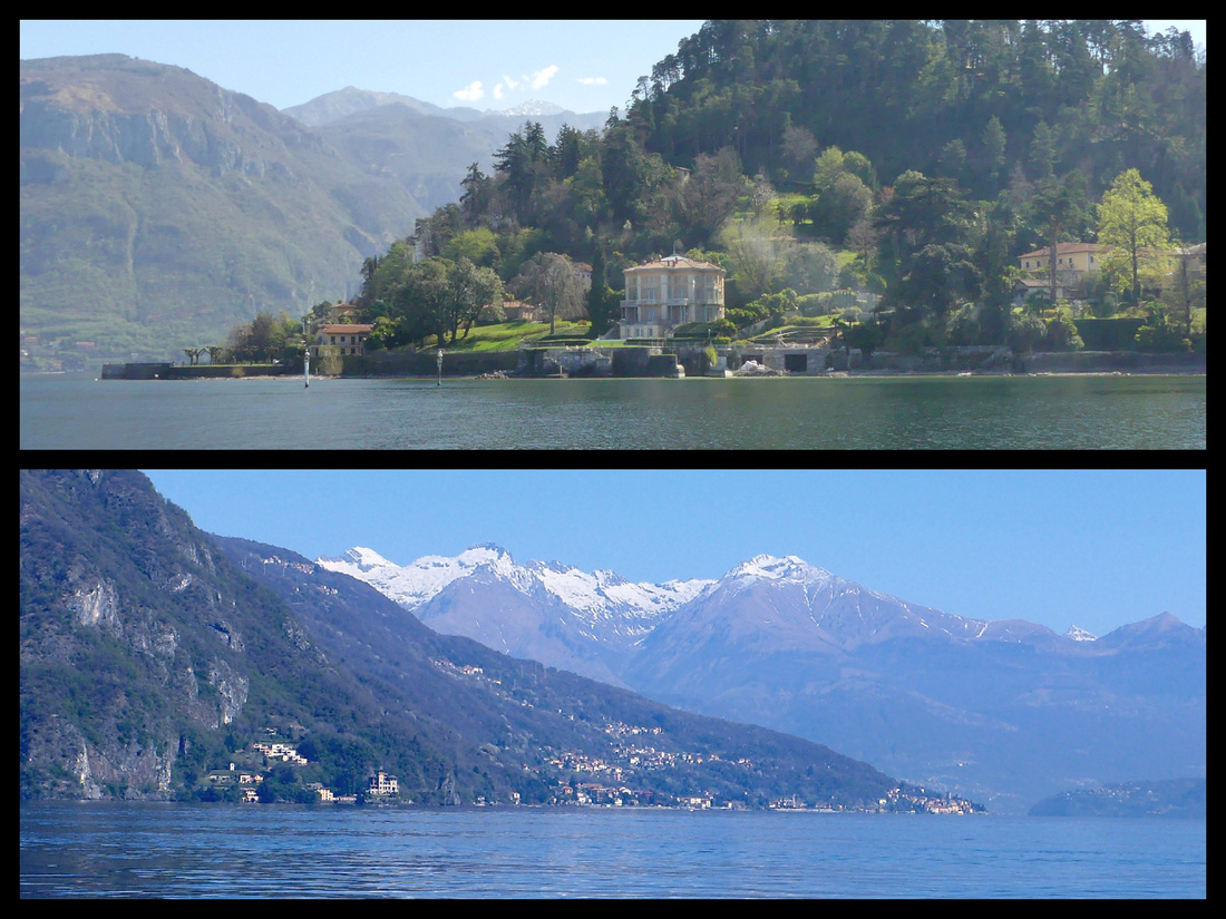
Snow on the higher peaks in the distance. Wisteria, forsythia, dogwood, tulips, daffodils, pansies. Empty boats. A few tour groups in Bellagio but Varenna and Mennagio were empty except for the locals and a handful of independent tourists. Less than half the stores were open but that was enough – not much to buy except overpriced clothes. Plenty of places to get lunch, a drink, gelato.
Bellagio had lots of ‘pre-season’ construction going on, reminded me of Positano in March. In fact, just in general it reminds me of Positano. Almost every shop is a tourist store or eatery, nothing I want to buy. Bellagio is supposed to be the ‘prettiest’ town on Lake Como (a designation which is deserved in the case of Positano) but isn’t. Varenna is far more attractive and interesting with a long lakeside walk with breathtaking views, tons of little steeply stepped stone lanes (most of which are not lined with stores) going up to an attractive little town center with cute church and some real stores scattered in among the tourist ones. I liked it best 13 years ago, and still feel that way. I have no idea why people prefer Bellagio, and probably it’s fame has made it even worse as there appears to be virtually no ‘real’ houses or stores. Menaggio is even less touristy than Varenna. Long wide lakeside promenade and a tiny town center with two attractive churches but overall somewhat less pretty than Varenna.
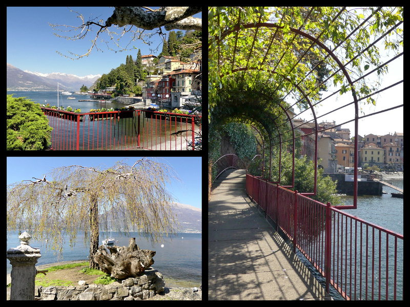 Lakeside Promenade in Varenna
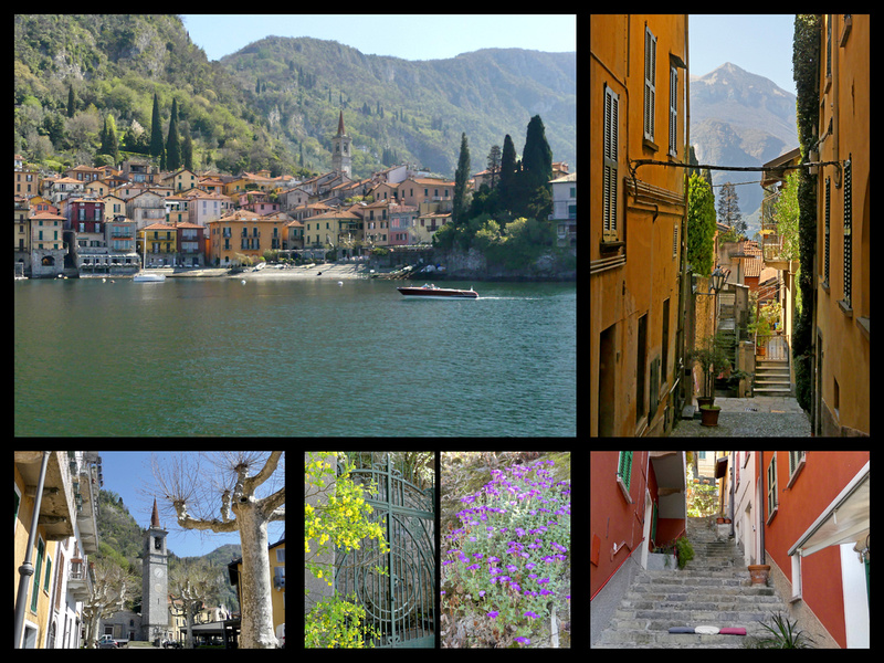 Varenna
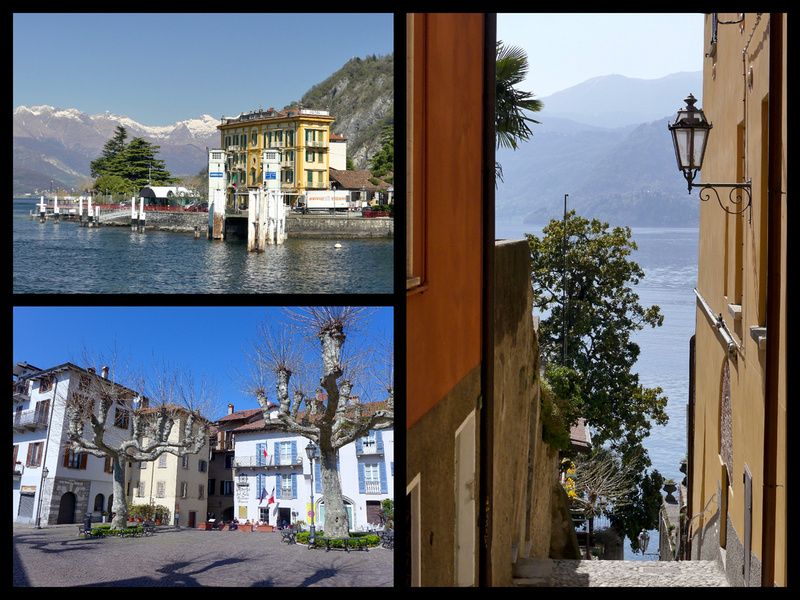 Varenna
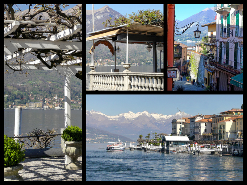 Bellagio
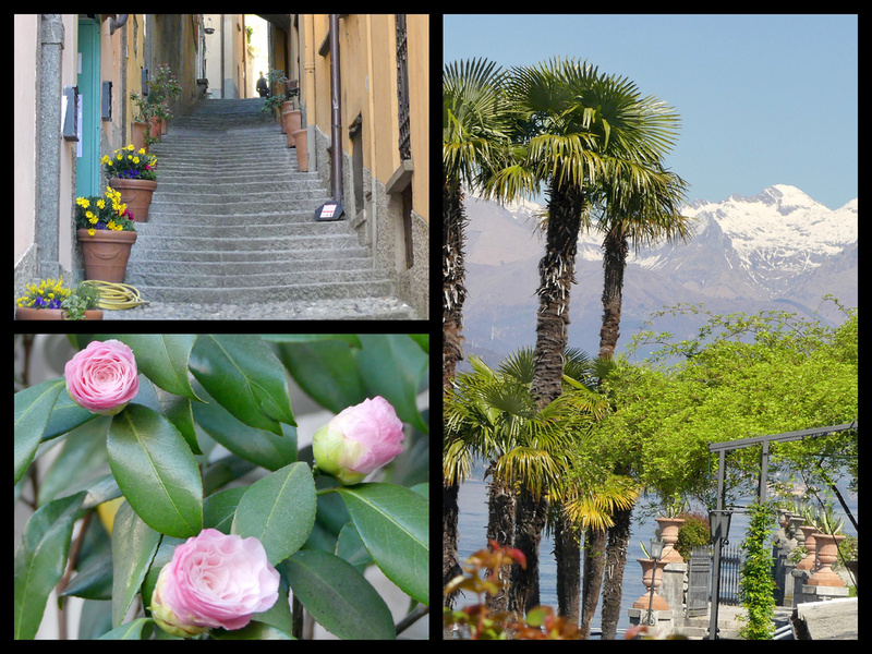 Bellagio
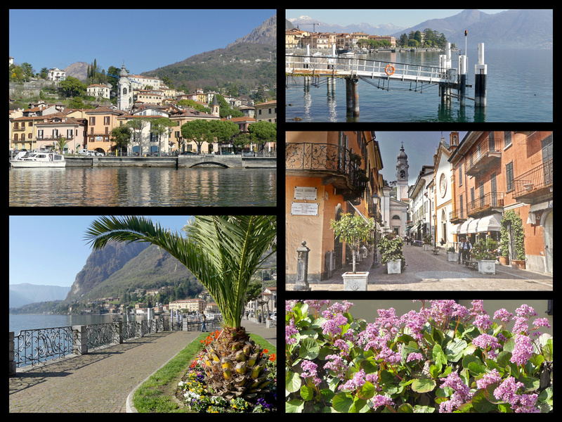 Menaggio
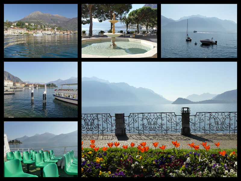
However, overall, as beautiful as Lake Como is, I really prefer Lake Garda. The mountains are higher and closer (which might be the case with the top half of Lake Como, I have not been there) and the three northern towns on Lake Garda are more interesting and scenic than the Lake Como towns, the lower towns are larger and prettier and then there is Sirmironie.
But the birds were singing, the sun shinning, cool breeze, warm temps. It was lovely. In another month there would be more flowers blooming, more things open – so a more lively atmosphere – but there would be more people too. Other than the chance of clouds/rain being higher in March I think planning a trip to the lakes in early spring is a great idea. As long as you can choose a sunny day (eg plan to stay in Milan and do other things if the weather is bad).
Wednesday, March 29, 2017 - Sunny and 70 - Lugano, Switzerland – OMG what a gorgeous day – 75 and sunny, not a cloud in the sky. Lugano has a magnificent setting, much better even than Lakes Como or Garda. Lugano itself is a medium size city (71,000/140,00 urban area), mostly pretty modern. There’s been a town there for thousands of years but most of the buildings are from the late 1800s and later. The ‘center’ seems to be 1880-1920, some nice arcaded buildings and streets but nothing that feels especially old. And lots of 20th century building – that’s the majority. So not quaint, not especially atmospheric, but what a setting. There is a long promenade (at least 2 miles) part of which is a very nice park. Lots of things in bloom – pink and white flowering trees, dogwood, tulips, daffodils, willows just budding out, palm trees! I love that there you can see palm trees and snow covered Alps at the same time (which is also true of Lake Como). Delightful to walk along the water through the park. Lots of swans (and very tame). Hardly any boats in the water (most still have their winter covers on and pulled up on the shore) so that looks different than summer but otherwise it could have been June (probably more in bloom even than in than in June).
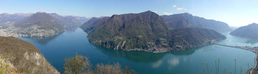
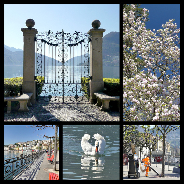
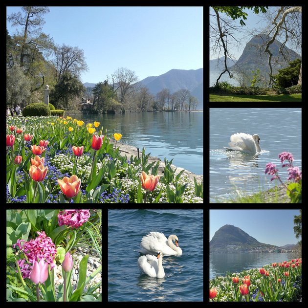
I walked all over – the ‘center’ is tiny, one main square and a few minor ones – lots of chain and designer stores, but nothing terribly interesting (and virtually nothing touristy). Italian is the main language though some signs are in French and German as well (not much in English).
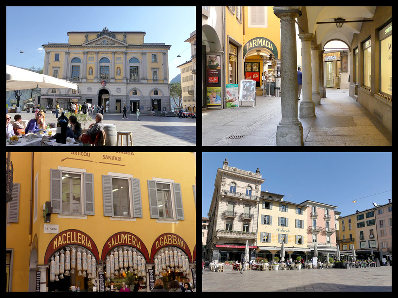
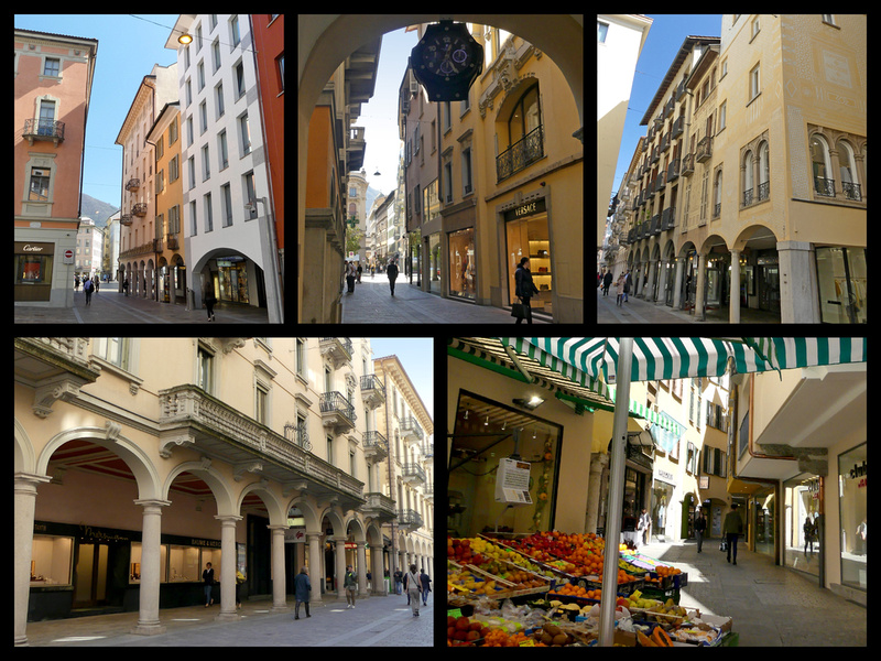
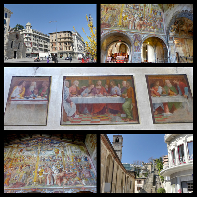
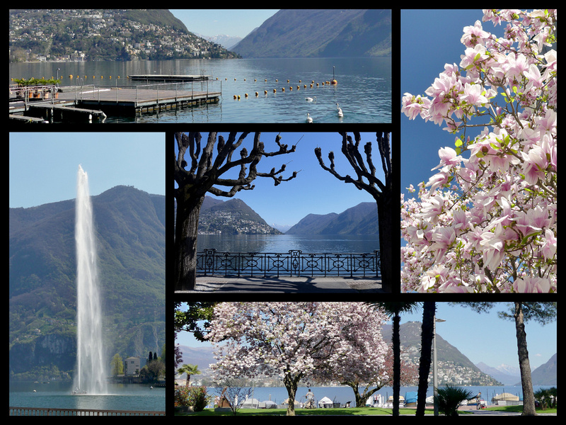
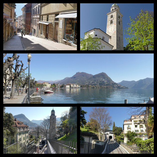
I took the funicular up to Monte San Salvatore (26 Swiss francs, took credit cards). Fabulous views. The view is definitely better if you walk the five minutes from the top of the funicular station to the top of the church (there’s a viewpoint up there). The views from the ‘terrace’ at the restaurant at the funicular station are nothing compared to those five minutes further up. They had an interesting display of Swiss Tourist Posters from the last hundred years all along the walk up to the viewpoint.
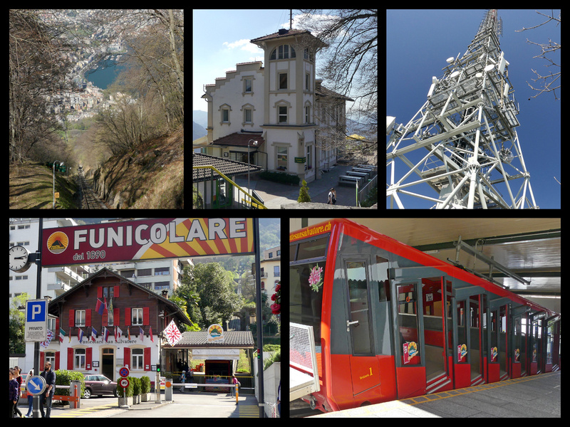
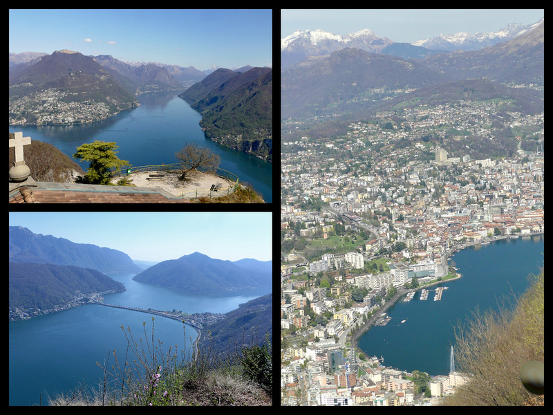
I was unable to get anything to eat as I had no Swiss francs. I could have gone to an actual restaurant which took credit cards but I had my ham and swiss croissants and water so all I really wanted was a smoothie or something but that was not worth taking money out of an ATM for since I was there just for the day.
The train situation was interesting. On the way there I had to buy a ticket with seat assignment and it was just like all the other train trips I’d been taking in Italy. Very orderly. At the border some immigration and border control guards got on the train and walked through checking random passports (a nice looking blond –e.g. they were not profiling potential immigrants - across the aisle was checked but no one else in our row). On the way back it was just a ‘ticket’ (no seat assignment). Much more crowded and kind of chaotic – the exact opposite from previous train trips in which Swiss trains were super orderly and on time and the Italian trains not so much. They announced they would be checking identity cards but I didn’t every see anyone.
Thursday, March 30, 2017 Sunny and 80 – Spent the day in Milan.
I had not expected it to be so hot so of course was over dressed. But it was an absolutely gorgeous day. I walked from the hotel to the Duomo, through the Public Garden (which was OK, nothing great except it was the perfect trees just leafing out so everything is that luscious green color and the sky was intense blue), then checked out the Venetian Gate – two mid 19th century buildings, again, OK but not something to go out of your way for. Normally when I stay at Hotel Berna I take the metro the two stops to the center, but it is totally walkable if you aren’t in a hurry.
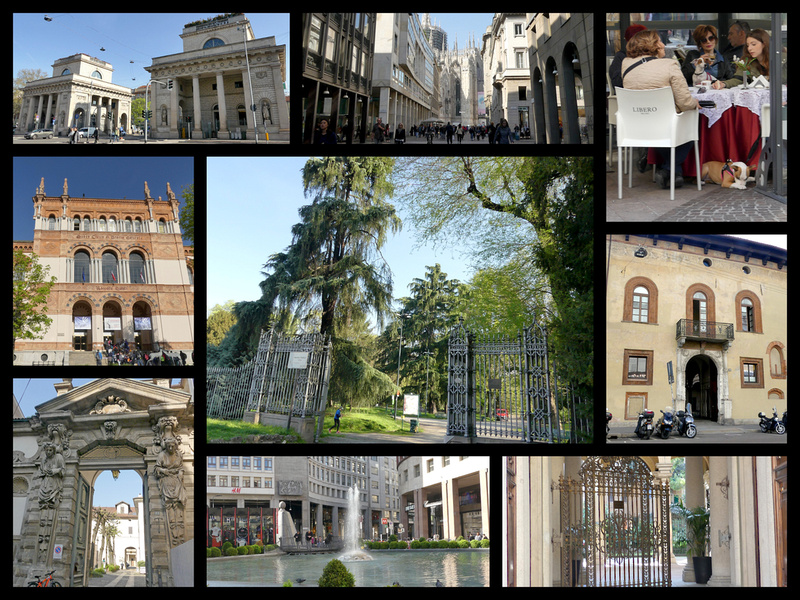
The Corso Venezia is one of Milan's most prestigious streets, bordered by stately buildings in a multitude of architectural styles, from Renaissance to Art Nouveau. It's about 1 km long and runs north from Piazza San Babila to Porta Venezia, and iis bordered by the Giardini Pubblici, one of the few public parks in the center of Milan.Just inside the park is the Museum of Natural History. From Piazza San Bablia to the Duomo is a short pedestrianized street filled with shopping options.
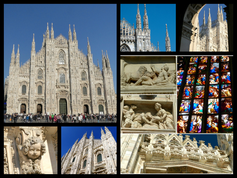
The last of Italy's great Gothic structures, Milan's Duomo took over 500 years to complete. Begun by the ruling Visconti family in 1386 – it is one of the ten largest cathedrals in the world, with 135 marble spires, a stunning triangular facade, and over 3,400 statues flanking the massive but airy, almost fanciful exterior. From the roof are stunning views of the flying buttresses up close as well as views over Italy’s most frenetic city.
Every time I've been to Milan I've gone to the Piazza del Duomo. For one thing it's an amazing sight, but it's also very much in the center of the city. Walking around the Duomo and through the Galleria is a 'must-see' whenever you are there. I'd been inside the Duomo on a previous visit but had never gone up to the roof.
There was at least a 15-minute line to buy tickets for the Duomo, I just got the roof access as they are now charging for the Duomo interior as well and since I’ve already been in there and it was such a gorgeous day I wanted to be outside. Then another 15-minute line for the lift plus some serious security. There’s a bit of construction going on up there so a good deal was under scaffolding – not terribly noticeable from the ground but it was from up there. Still, interesting to see the flying buttresses up close and the views of the piazza in front, etc.
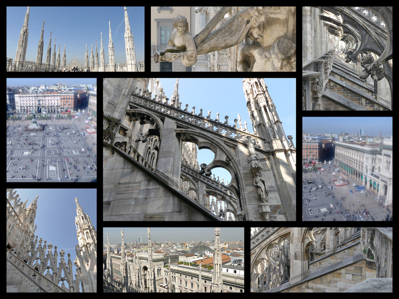
Galleria Vittorio Emanuele is a spectacular, late-19th century glass-topped, belle époque, barrel-vaulted tunnel. It is essentially one of the planet's earliest and most select shopping malls, the prototype of the enclosed shopping malls that were to become the hallmark of 20th century consumerism, and of course none of those have come close to matching the Galleria for style and flair. This is the city's heart, midway between the Duomo and La Scala, an important meeting and dinning place. Like the cathedral, the Galleria is cruciform in shape. The great glass dome above the octagonal center is a splendid sight. The paintings at the base of the dome represent Europe, Asia, Africa, and America. The Galleria has always been home to luxury retailers like Prada but until 2013 there was also a McDonald’s in there. It was prevented from renewing it’s lease (after 20 years) and sued the city. McDonald’s is now located just outside the Galleria and it’s former space is occupied by a second Prada store. The entrance from the Piazza del Duomo is framed by a monumental triumphal arch, drawing people in from the square in front of the cathedral in.
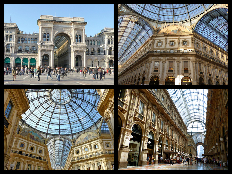
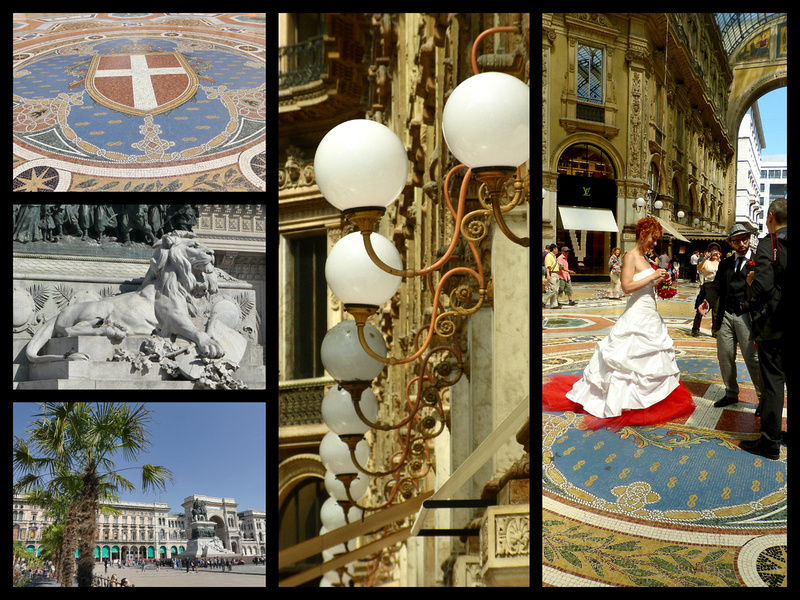
The Galleria was constructed during the era of Italian unification and symbolized Italian unity, so it was decorated with patriotic symbols. Mosaics on the floor below the dome depict the coat of arms of Savoy and Italian cities are allegorically represented: a wolf for Rome, a lily for Florence, a bull for Turin and a white flag with red cross for Milan. Stepping with the heel of your foot on the genitals of the bull is supposed to bring good luck.
Just off the Piazza del Duomo is what is left of medieval Milano, now just a small Piazza (Mercanti) with a couple of buildings including the Palazzo della Ragione (1228) and the Loggia degli Osli (1316), and Palazzo dei Giureconsultli (with the clock tower) . From there, Via Dante is a pedestrianized shopping street full of restaurants and cafes that runs to the castle.
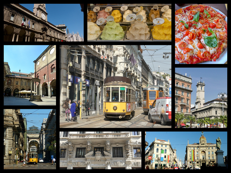
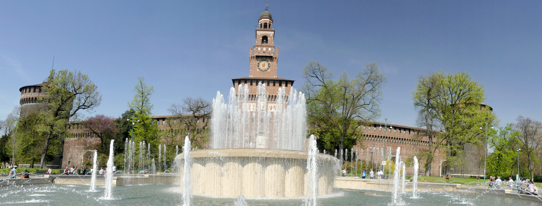
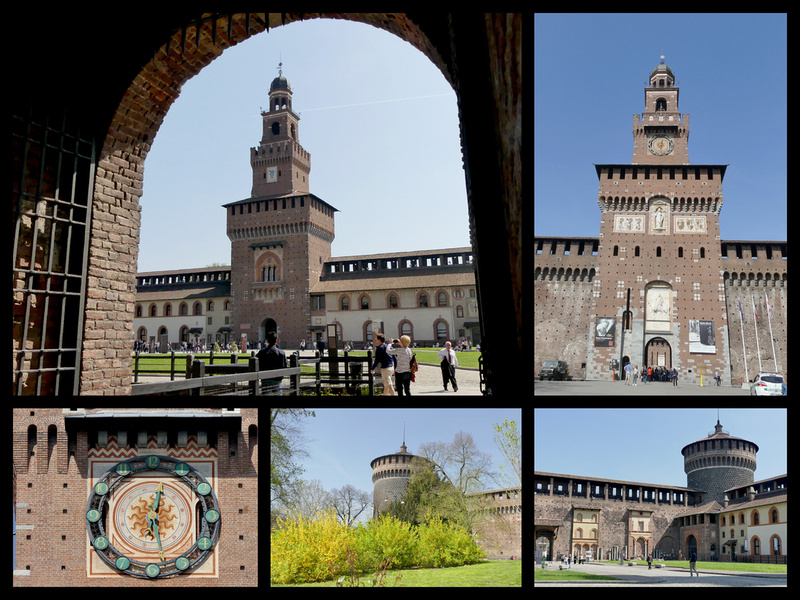
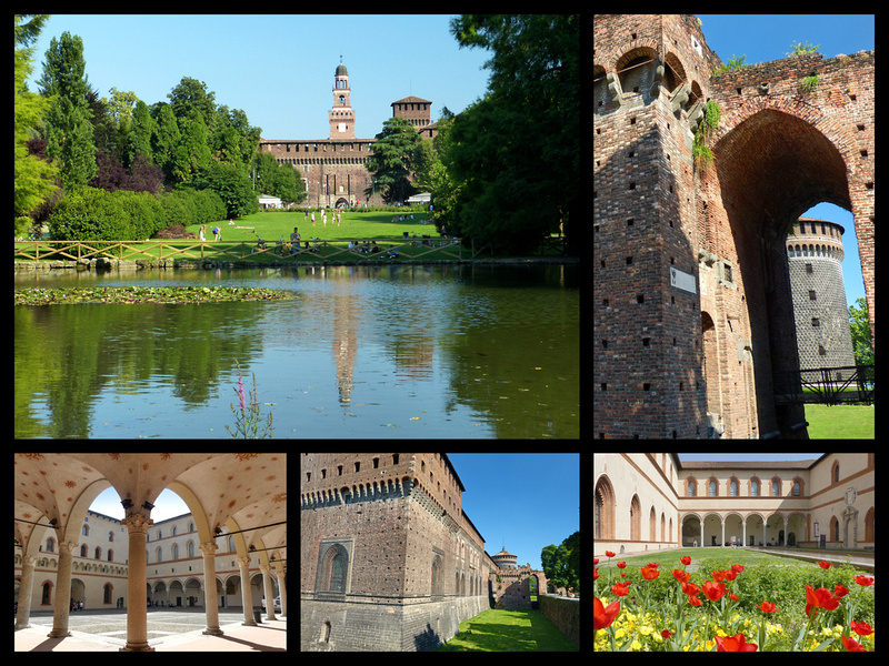
Castello Sforzesco, begun in 1358 and expanded several times through the 1400s. The present castle, with a square plan laid out around three inner courtyards , is dominated by its many towers. The main entrance leads through the castle's tallest tower - the Torre del Fiarete - to the Piazza d'Armi, an expansive inner courtyard. Behind this tower is the heart of the castle with the palatial residences of the Sforza dukes enclosing two smaller courtyards. Castello Sforzesco is home to a number of museums, but the grounds are free to wander through.
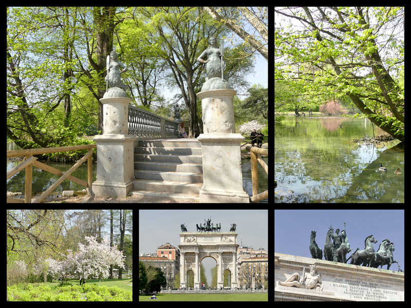
The sun was shining beautifully on the front of the castle and the fountain in front was going. I ate my croissant with ham and cheese and cherry tomatoes along with a limone granite sitting on the bench around the fountain. After wandering around the castle grounds for a while I made my way into the park, sat for a while in the sun (too hot to linger). Parco Sempione is a nicely laid out 116 acre park in a landscape style with winding paths, open grassy areas, tall trees and a picturesque bridge across a central pond which usually nicely reflects the castle. Everything was in bloom and it was just lovely.
I then checked out the Arco della Pace, which was originally a triumphal arch and looks very similar to the Arc de Triomphe du Carrousel in Paris, the smaller cousin to the more famous Arc de Triomphe which sits at the far end of the Champs-Elysees. Arco della Pace sits at the site of one of Milan's town gates, which was originally the entrance to the city from the road which led to Paris.
From there I managed to walk to the Cemetery without getting lost (the map I had printed out was actually very detailed). The Cemetery, billed as Italy’s Pere LaChase, does have a lot of very fancy statues and little buildings/tombs but as far as I know no one famous is buried there. The huge main building was pretty impressive as well.
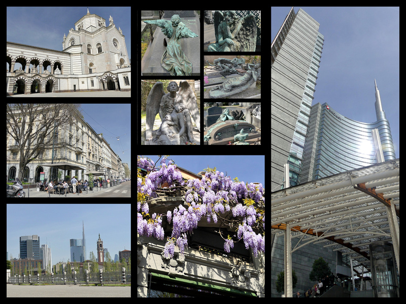
Then I debated walking or taking the metro back to the hotel. By the time I got to the metro stop I wanted it looked like I wasn’t all that far but it turned out to be a bit of a slog. Passed some of the new shinny glass office complexes, something I don’t usually see in European cities as they, fortunately, tend to be segregated in the outskirts.
The last evening in Milan I enjoyed the beautiful way major monuments in European cities are lit and the way they glow golden against the dark blue sky.
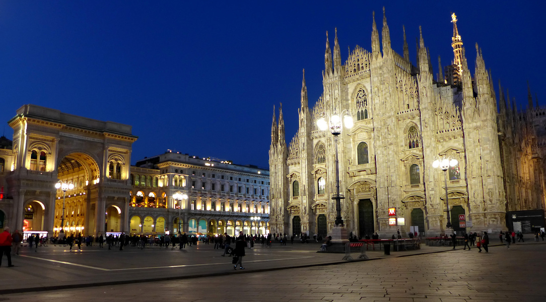
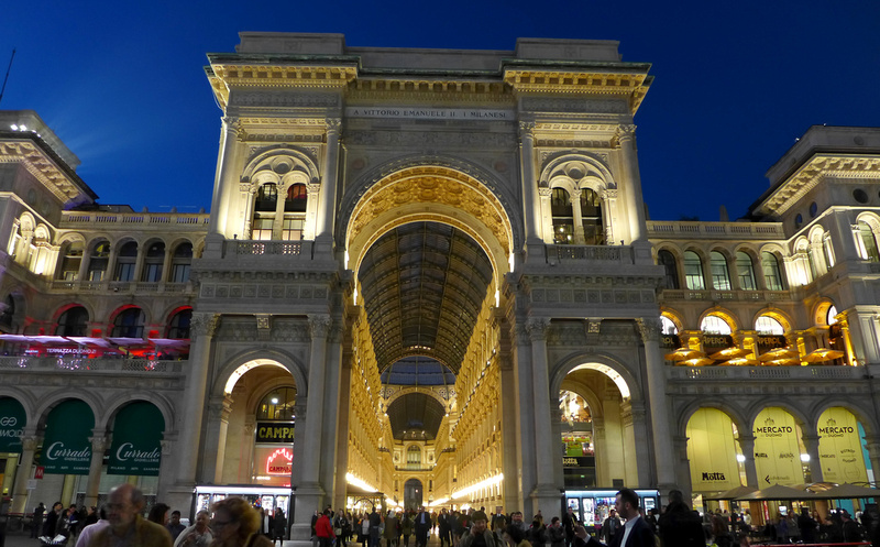
For the Venice, Florence, and Rome portions of my trip see "Italy through Fresh Eyes: Chasing the Sun in Italy in March" Parts 1, 2, and 3
For more photos click on "All Photographs in the upper right corner and navigate to the Italy gallery.
]]>We ended up getting to the train station almost an hour before our train to Rome so we sat and had cappuccinos at a train station café listening to people play the piano. I love that many train stations in Europe have pianos just sitting there waiting for passersby to stop and play a few tunes. In the hour we were there several people did just that.
Train was high speed (up to 255km/hr) and took just 1.5 hours. Went through a lot of tunnels – ear popping. Somehow I booked us in Business Class – seats are a bit wider, and leather instead of cloth. Otherwise no difference and certainly not worth any extra money.
Checked into the Hotel Julia. It’s almost a half hour walk from Termini. It’s twice as far as the Floris, the other hotel I’ve stayed at recently in Rome, but they were full with only two days notice. So it was a pain to drag the bags, but once at the Julia it is closer to everything. A ten minute walk to the Trevi Fountain, less than five minutes to Piazza Barberini (where there is a metro stop), and on a quiet (for Rome) street. It's a perfectly fine hotel, not luxury but clean and comfortable. There is an annex next to the main building, where the rooms are a bit nicer, but the wi-fi not as good (at least it wasn't a few years ago, it was great in the main building this trip).
As we had not planned on going to Rome on this trip I had none of my information with me, no map (although the hotel has good free maps they give out). Fortunately I’ve been there enough recently that I know my way around pretty well. I took Crista on my favorite “Introductory Rome Tour” (the center of Rome is a UNESCO World Heritage Site)
Trevi Fountain (nice and clean after it’s recent renovation, the scaffolding that’s been in place the last few years all gone), The Trevi Fountain, 1762, is an incredible Baroque Masterpiece, huge and beautiful. But it's beauty and fame (featured in "Three Coins in a Fountain", the 1954 film that was the first color film to be produced on location, it made half of America decide to go visit Italy) have caused it to be difficult to visit. An aquatic marvel in a city filled with them, the fountain's unique drama is largely due to the site: its vast basin is squeezed into the tight meeting of three little streets (the "tre via", which gives the fountain its name) with cascades emerging as if from the back wall of Palazzo Poli behind it. The tiny piazza in front of it is literally jam-packed most of day, full of tourists trying to throw a coin over their shoulder into the fountain to assure they will return to Rome. There are some railings to lean on - if you can get anywhere close to them - but no benches. Early in the morning before the tour groups arrive it is still enjoyable, after that forget it.
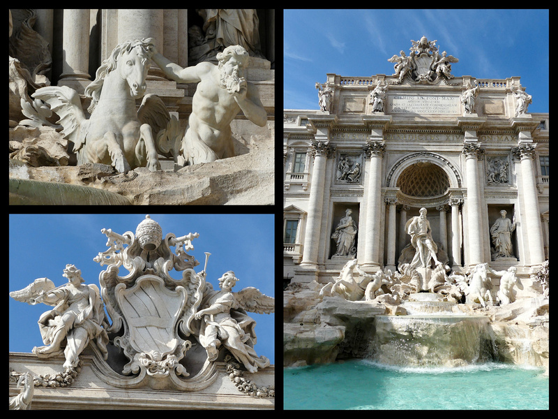
Piazza Colona (site of one of the most dramatic obelisks in Rome, the Column of Marcus Aurelius built in AD180 but changed in 1589 when a pope replaced the Roman warrior on top with a statue of St Paul. Behind the obelisk is the Palazzo Chigi, residence of the prime minister.) Then on to Piazza di Montecitorio – a Bernini designed piazza containing a 6th century BC Egyptian obelisk. About a block further is La Maddalena, Rome’s only truly Rococo church, 1669. Slight detour back a block or so to Piazza di Pietra home to 11 huge Corinthian columns that are the remains of the 2nd Century Tempio di Adriano.
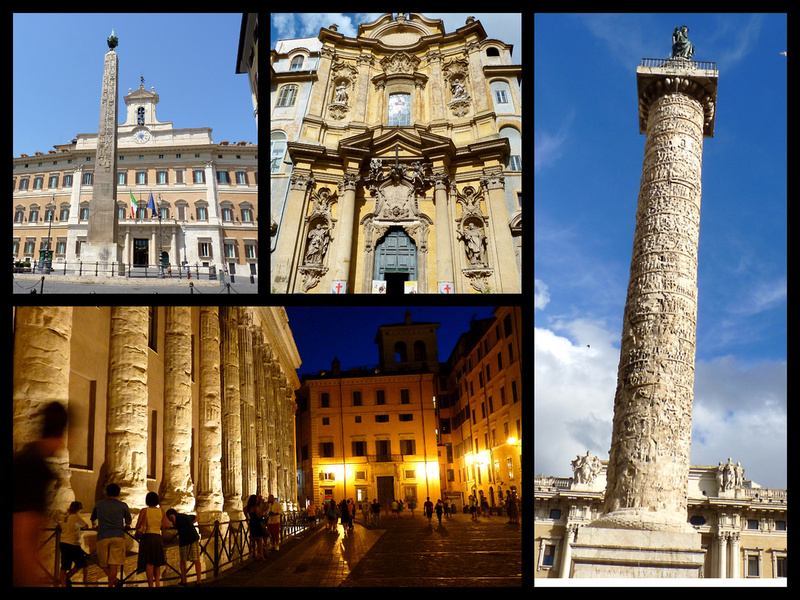 Clockwise from upper Left: Piazza di Montecitorio, La Maddalena, Column of Marcus Aurelius, Piazza di Pietra
Another block or two to Piazza Rotunda.
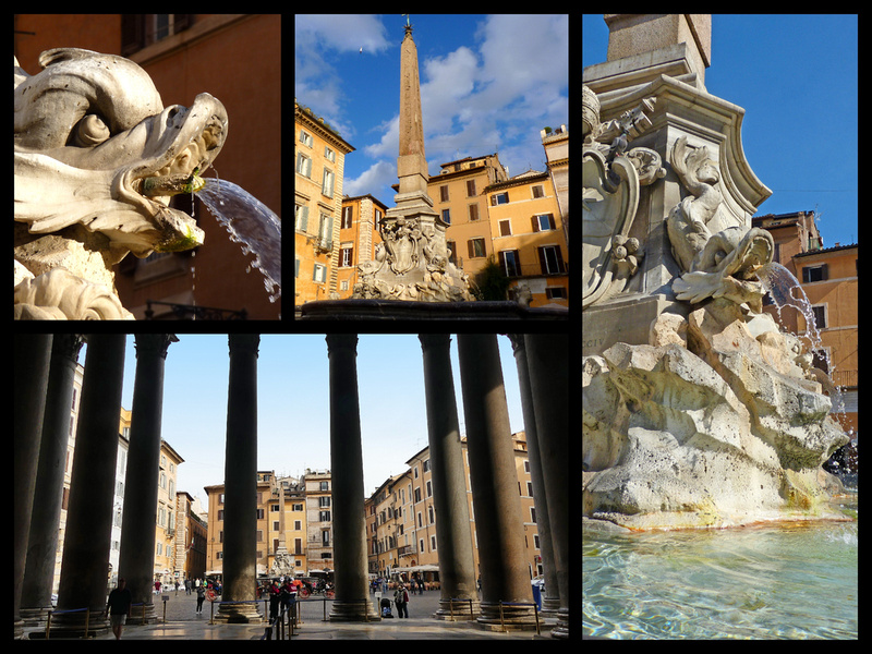
Piazza Rotunda is one of my favorite piazzas in Rome but it was soooo crowded and a line to get into the Pantheon! (it’s free, the line was just too many people trying to get in). Six previous trips to Rome, many of which were in high season and I never saw it like this. So we skipped going in for the time being. At 9:00 the next morning there was no line and virtually empty inside. In the center of the piazza is my favorite fountain, the Fontana del Pantheon, 1575, surmounted by an Egyptian obelisk.
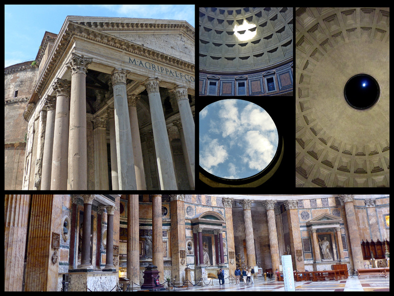
The Pantheon is the best preserved ancient monument in Rome. A pagan temple originally dedicated to 'all the gods' it was transformed into a church in AD 609. Originally erected by Agrippa in 27BC, (you can still see letters engraved on it spelling Agrippa) it was rebuilt by emperor Hadrian in AD120. It's size is immense but more impressive is the harmony - the diameter of the dome is exactly equal to its height - some people call it the world's most architecturally perfect building. The opening in the center of the dome is 30 feet in diameter, the temple's only source of light, intended to symbolize the 'all-seeing eye of heaven'. It houses the tombs of the artist Raphael and the first king of Italy, Vittorio Emanuele II.
Just behind the Pantheon is the Chiesa di Santa Maria Sopra Minerva, a church built over (sopra) an ancient temple (of Minerva). The church has been ‘renovated’ numerous times so it’s not terribly authentic despite technically being Rome’s only Gothic church. But inside is a Michelangelo sculpture and outside is an adorable elephant sculpture atop a short obelisk, by Bernini. Free
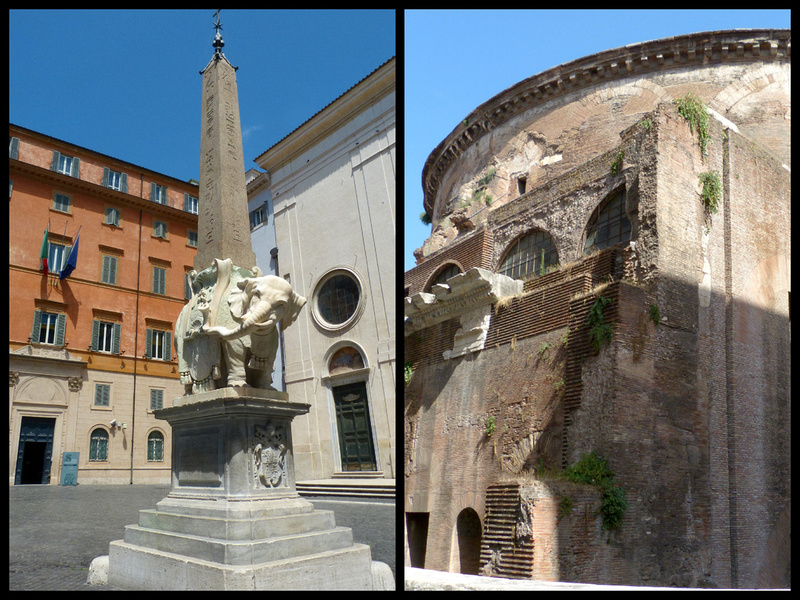
Elephant statue in Front of Santa Maria Sopra Minerva, Back of the Panetheon
On to Piazza Navonna – [So far this is only about .8 mile] Rome’s most impressive Baroque square. The piazza’s long narrow shape is because it was built over space formerly used for chariot races. At center is the Fontana dei Quattro Fiumi, [Fountain of the Four Rivers] built by Bernini in 1651. The figures of the four rivers represent the four known continents as of 1650: the Nile; the Ganges (holding an oar); the Danube (looking at the obelisk); and the Plata (from Uruguay, tumbling backward), with its hand raised. The figure of the Nile is hiding its head because it represents a river whose source was then unknown. At the south end is the Fountain of the Moor (Fontana del Moro), also by Bernini. At the north end of the square is The Fountain of Neptune (Fontana di Nettuno), a 19th Century addition.
Crista duly impressed, not only with all the sculptures and fountains, but also the beautiful Sant’Agnese in Agone church, and just the overall ambiance of all the ochre colored buildings, cafes, artists selling their work. So far we have seen enough sculptures, fountains, etc. to fill a museum, but all of it for free, in the places for which they were designed.
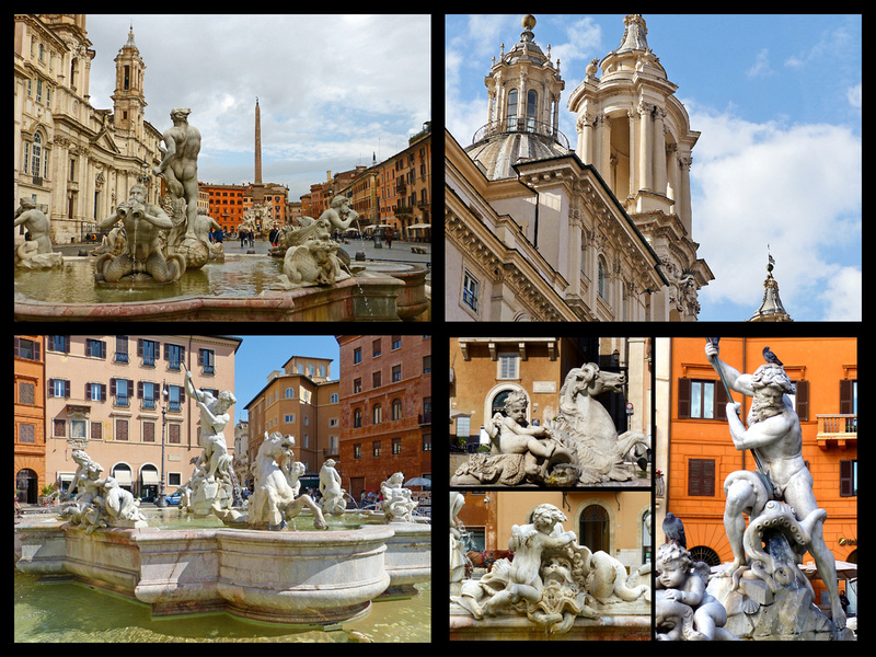
We then wound our way through the narrow streets and tiny Piazzettas towards the Tiber (one of my favorites is Piazzetta di S Simone)
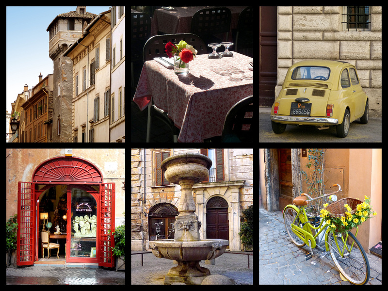
and up to Piazza del Popolo, one of Rome’s largest squares which was gorgeous in the late afternoon sun with blue sky and puffy white clouds. [another approximately 1 mile]. In the center is an Egyptian obelisk from the 13th C, brought to Rome during the reign of Augustus, surrounded by four of my favorite lion fountains. Surrounding the square are other statues and fountains. At one end is a pair of twin churches, Santa Maria del Miracoli and Santa Maria di Montesanto. At the other is another church, Santa Maria del Popolo (1442-47, Renaissance) and Porta del Popolo, the gateway in the 3rd C Aurelian wall. The gate was erected in 1561, and was one of the major gateways into the city.
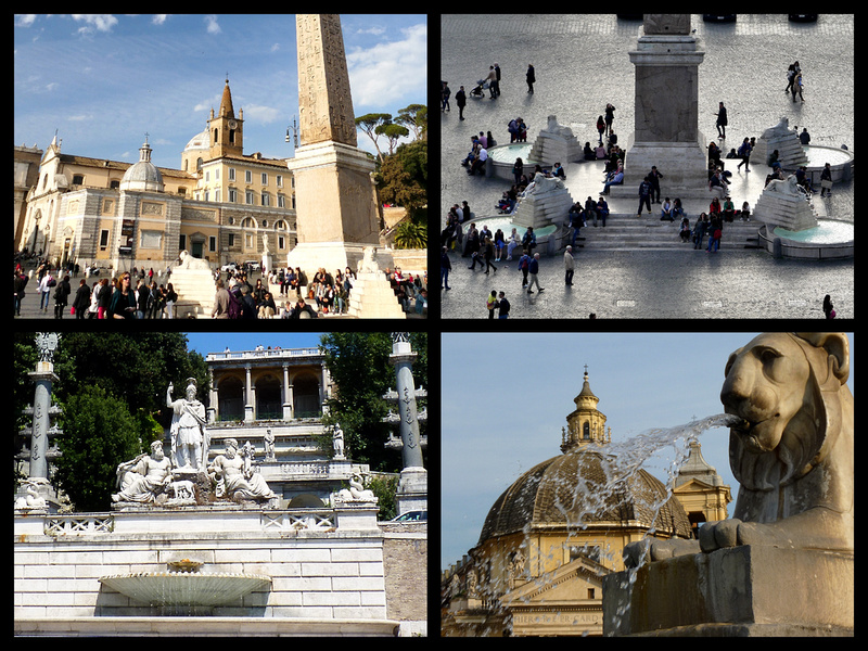 We climbed the Rampa del Pincio from Piazza del Popolo to the Pincio Terrace, in the Borghese Gardens. There is a spectacular view of the city from here. Everything was that gorgeous spring green color, there was wisteria, forsythia, and pink and white and purple flowering trees.
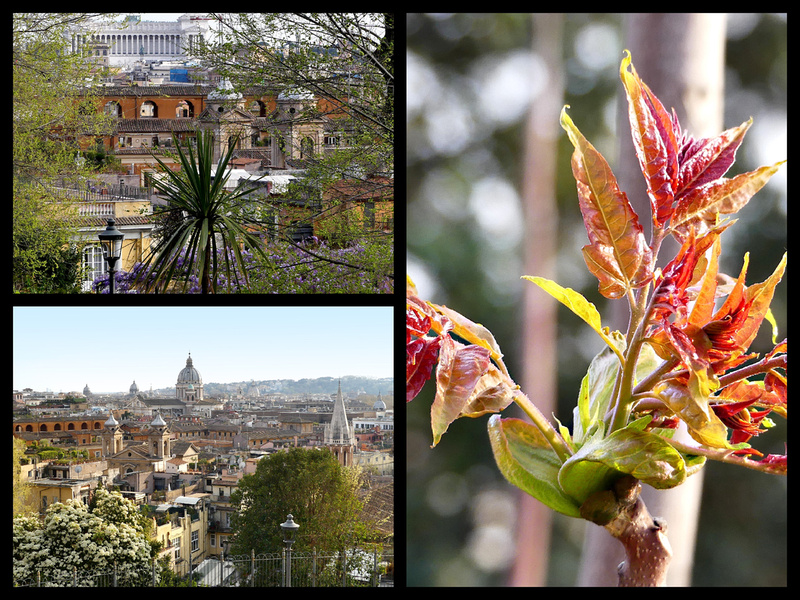
About a half a mile from there brings you to the top of the Spanish Steps. Guidebooks say the Spanish Steps are ‘one of the most famous images’ in the world, certainly it’s well featured in tons of books and movies but Crista managed to have never heard of it. Still, she managed to be impressed by it.
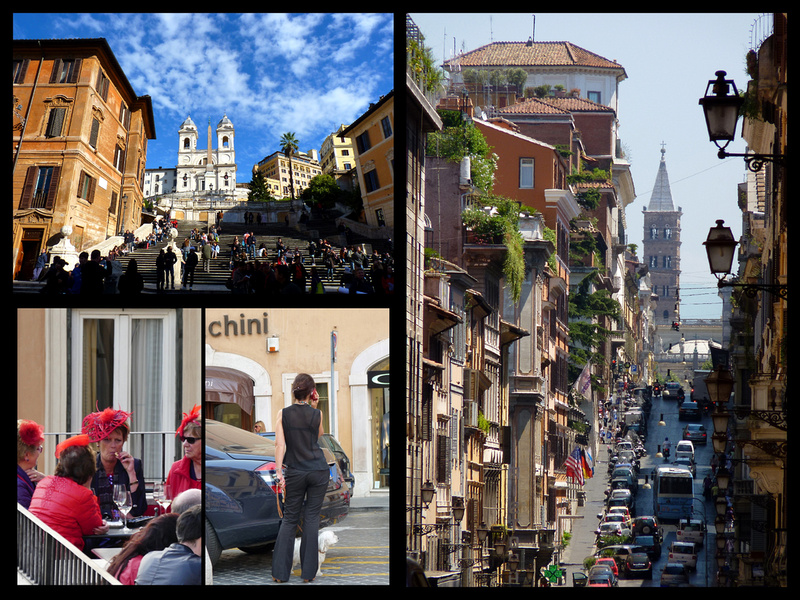
It is one of the most majestic urban monuments of Roman Baroque style. Designed in 1723, the Spanish steps (there are 135 of them) were funded by the French as a preface to the French church, Trinità dei Monti at the top of them. It was given the name Spanish Steps because the Spanish Ambassador lived at the bottom, in the Piazza di Spagna. It has long been one of the most popular tourist attractions in the city: attracting artists and writers and was full of elegant hotels. At the foot of the stairs, is the Barcaccia Fountain, the work of Bernini who went on to become the creator of some of the most important masterpieces of Baroque art in the city. In the form of a sinking ship, the fountain recalls the historic flood of the River Tiber in 1598 and refers to a folk legend whereby a fishing boat carried away by the flood of the river was found at this exact spot. In reality, the sinking boat was ably invented by Bernini to overcome a technical problem due to low water pressure. The sun and bee ornamentation is a symbol of the Barberini family and a reference to Pope Urban VIII who commissioned the work. The staircase is an architectural feat with its ramps and stairs that intersect and open out like a fan definitively providing a solution for connecting the square and the Trinità Church above.
Via Sistina is just a busy shopping street although I love the view of the bell tower of Santa Maria Maggiore in the distance. At the end of the street is Piazza Barberini, with the 1642 Triton Fountain (Fontana del Tritone) in the center. Another baroque masterpiece by Bernini ( as well as the Palazzo Barberini a block down the street), it features four dolphins holding up an open scallop shell in which a triton sits blowing into a conch.
Piazza Barberini is only about a tenth of a mile from our hotel, on via Rasella. So this whole walk is really only about 3 miles – although with little detours and such it took us considerably more (according to my fitbit).
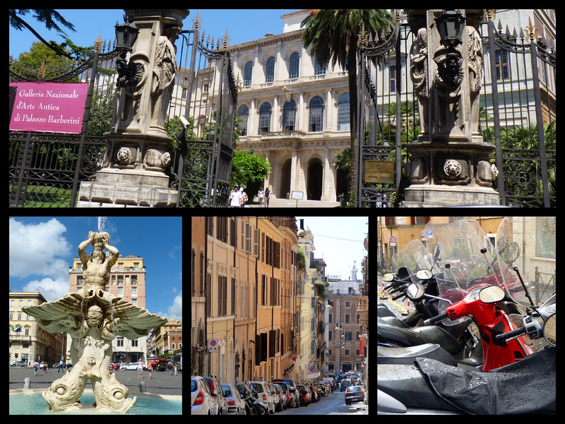
We had dinner at a restaurant on Piazza Barberini, got a bottle of wine and went back to the hotel.
Friday, March 24, 2017 - [Mostly sunny, 75] - We repeated the beginning of yesterday’s walk, this time getting to the Pantheon before the crowds. But from Piazza Navona we went in the other direction to Campo di Fiori.
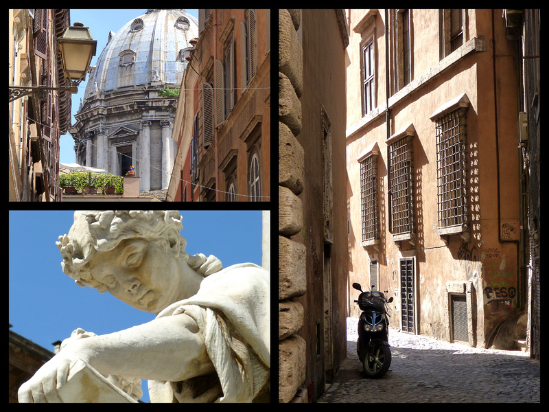 Streets in the area between Piazza Navona and Campo di Fiori
In ancient times the square was used as grazing land for cattle, hence the name, which means field of flowers. In those days buildings stood on one side of the square only, with a view over the Tiber on the other. During the 1500s, this square was the geographic and cultural center of secular Rome, with inns and the occasional burning at the stake of religious heretics. The hooded statue in the center is of a philosopher burned at the stake here in 1600. Today the campo hosts a morning open-air food market (Mon.-Sat. 8 AM-1 PM), Except for the pizzerias and gelaterias, it still looks much as it did in the early 1800s.
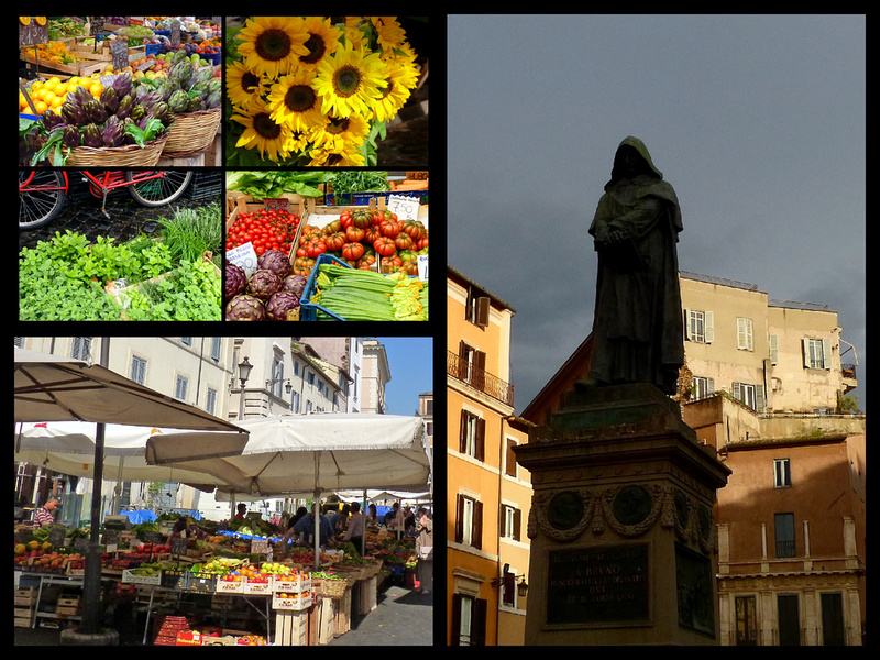
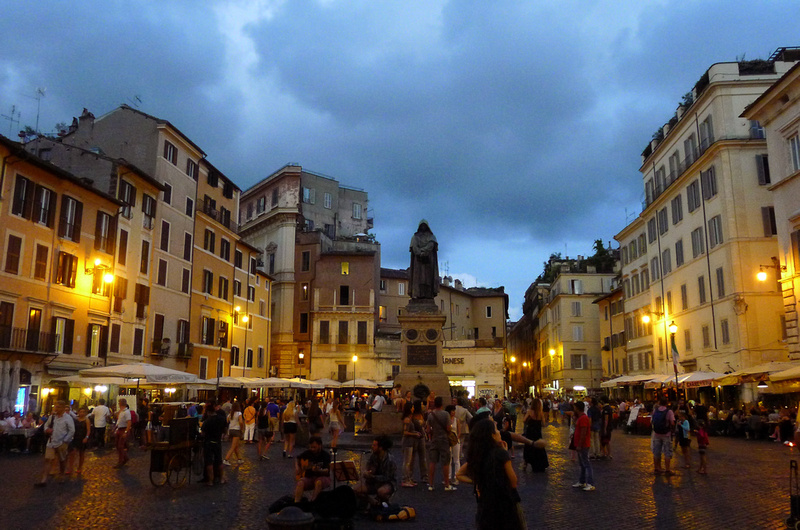
Next we stopped at the Torre Argentina / ‘Area Sacra’, site of the remains of four temples from 200-300 BC. A cat sanctuary, run by volunteers is in one corner and cats roam the area.
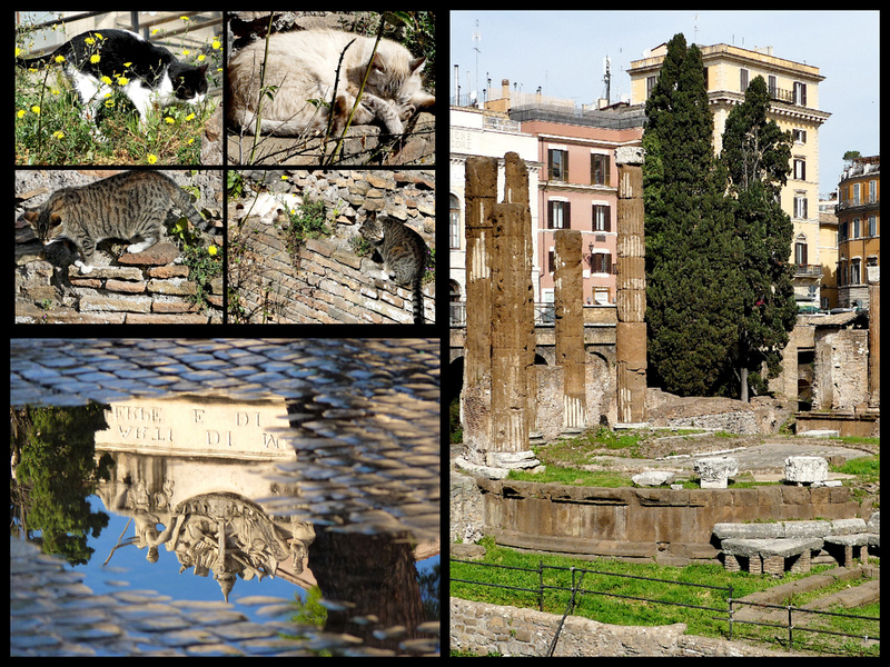
A few blocks further on is Piazza Venezia, sort of the central ‘hub’ of Rome – a very busy, traffic filled square in front of the Vittorio Emanule II Monument. The monument, to the first king of Italy (I think there is a monument and/or street named after him in absolutely every town in Italy) is a huge white building, with an enormous flight of stairs leading up to it. Totally covered in statues, and fountains and columns. Inside the building are museums, but on both sides are terraces with great views in all directions and those are free.
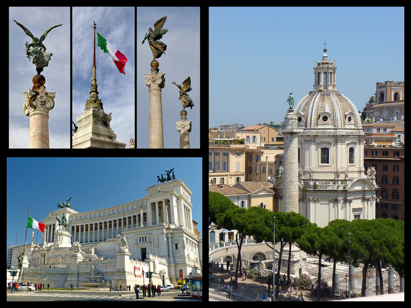
Across the street is Trajan’s Column sitting at the beginning of the Via dei Fori Imperiali. Mussolini cut through centuries of debris and junky buildings to reveal many archaeological treasures and carve out this boulevard linking Piazza Venezia to the Colosseum. The vistas over the ruins of Rome's Imperial Forums from the northern side of the street and the Roman Forum on the south side make this half mile one of the most fascinating walks in Rome. And it's mostly pedestrianized.
Begun by Julius Caesar as an answer to the overcrowding of Rome's older forums during the days of the empire, the Imperial Forums were, at the time of their construction, flashier, bolder, and more impressive than the old Roman Forum, and represented the unquestioned authority of the Roman emperors at the height of their absolute power. A good section of The “Roman Forum” can also be viewed from this street, and recently signs have been erected telling people what they’re looking at, and with drawings showing what the ruins would have looked like. The Roman Forum was the center of life in Rome, evidenced by the many remains of triumphal arches, temples and basilicas. Although fascinating just to look at, having a map or guidebook telling you what each ruin was is a good idea, although the new signs really do help. You also get a different feeling and perspective from walking around in the Forum and from viewing it from above (both on this street, and even better from behind Capitoline Hill).
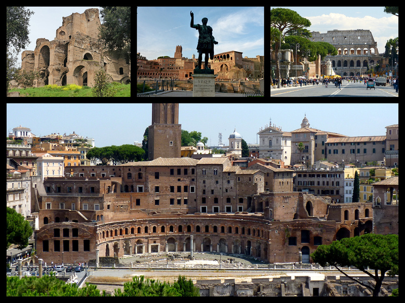 Back of Palatine Hill, the Imperial Forum from Via dei Fori Imperiali
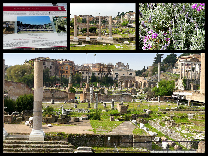 The Roman Forum as seen from via dei Fori Imperiali
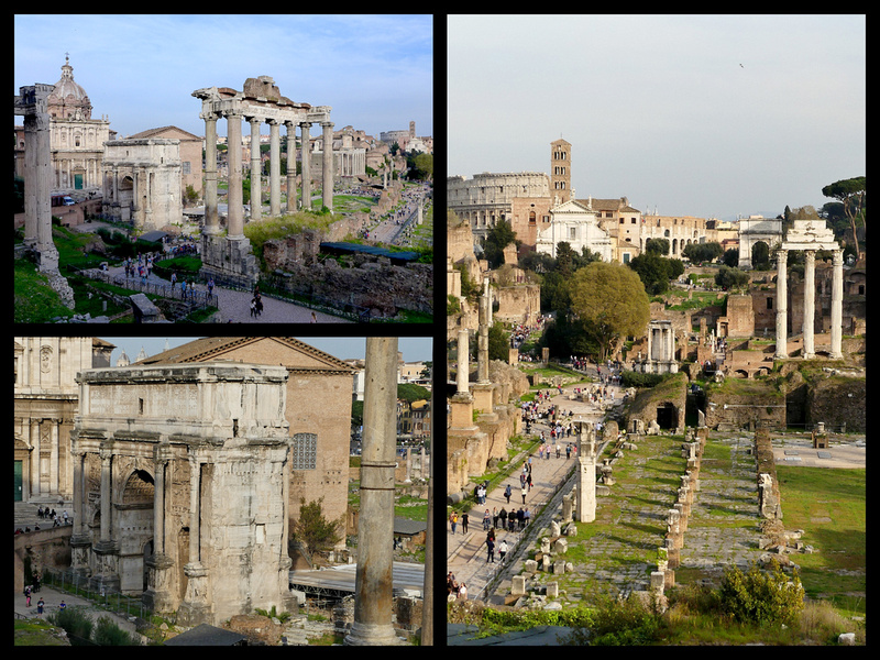 The Roman Forum as seen from behind Capitoline Hill
The Colosseum sits at the end of Via dei Fori Imperiali. The huge amphitheater was built on the site of an artificial lake, part of Nero's huge park in the center of Rome which also included the Golden House (Domus Aurea) and the nearby Colossus statue. This giant statue of Nero gave the building its current name. The Colosseum is gigantic and from pictures of it’s original appearance, clad in marble and covered with statues, it was really impressive. Especially from the outside. But it’s still really impressive even though most of the statues and marble were stolen over the centuries to build Renaissance era churches and palaces. Not that the inside isn’t also really interesting, but if time is limited, walking around the outside I think is better.
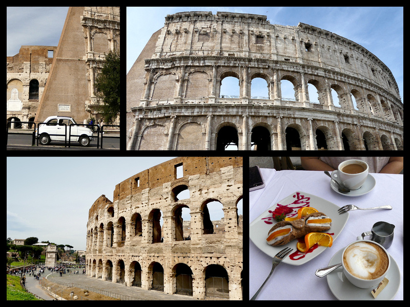
The Colosseum was the place of the grossest and best-organized perversity in all history. Gladiatorial contests were designed to make Romans better soldiers by rendering them indifferent to the sight of death. Exotic animals were shipped in from the far corners of the empire to satisfy jaded tastes (lion versus bear, 2 humans vs. hippopotamus). Not-so-mock naval battles were staged (the canopied Colosseum could be flooded), and the defeated combatants might have their lives spared if they put up a good fight. Many historians now believe that one of the most enduring legends about the Colosseum (that Christians were fed to the lions) is unfounded.
Tickets (which include the Forum, the Colosseum and Palatine Hill) can be bought at any of the three, and lines are always shorter at the other two. Even with a ticket, lines to get into the Colosseum can be crazy. We walked all the way around the Colosseum which I recommend. It really does look different from the ‘back’ as well as the ‘front’.
We stopped for cappuccinos and a snack at a café – horribly overpriced but worth it for the view.
Between the Colosseum and Palatine Hill, the biggest of the triumphal arches, the Arch of Constantine, 315 AD, spans the via Triumphalis, the way taken by the emperors when they entered the city in triumph. Today it’s lined with tour buses. We walked all the way down and around to the back of Palatine Hill through the Circus Maximus which was where chariot races were held. Today it just looks like an empty park. But seeing the Palatine Hill from the different angles is interesting. Palatine Hill is the center-most of the Seven Hills of Rome and is the ancient most part of the city. Imperial palaces were built here and it is from the name “Palatine” that the word palace/palazzo come from. It was on the Palatine Hill that Rome first became a city. Legend tells us that the date was 753 B.C. The new city originally consisted of nothing more than the Palatine, which was soon enclosed by a surprisingly sophisticated wall, remains of which can still be seen on the Circus Maximus side of the hill.
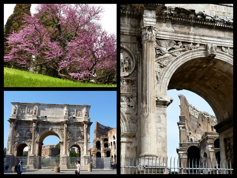
At the far end of Circus Maximus is the Church of Santa Maria in Cosmedin, with a Romanesque campanile (11th century), best known as the home of the “Mouth of Truth” (bocca della Verita), made famous in the movie “Roman Holiday” where Gregory Peck demonstrates to Audrey Hepburn that the mouth is supposed to chomp down on the hands of liars who insert their hands. Ninety percent of the tourists who come here stand in the long line to get their photo taken and never even venture into the church, one of the most unusual in Rome. The church, with a haunting, almost exotic interior is free, and for €2 you can go down into the crypt which is even more intriguing. Outside, on the Piazza della Bocca della Verita are two Roman era temples, the Temple of Hercules Victor (the round one) and the Temple of Portunus, a diety related to the ancient river harbor just across the street. There’s also the Fountain of the Tritons (1715) and around the corner from this piazza is another large arch, the Arch of Janus.
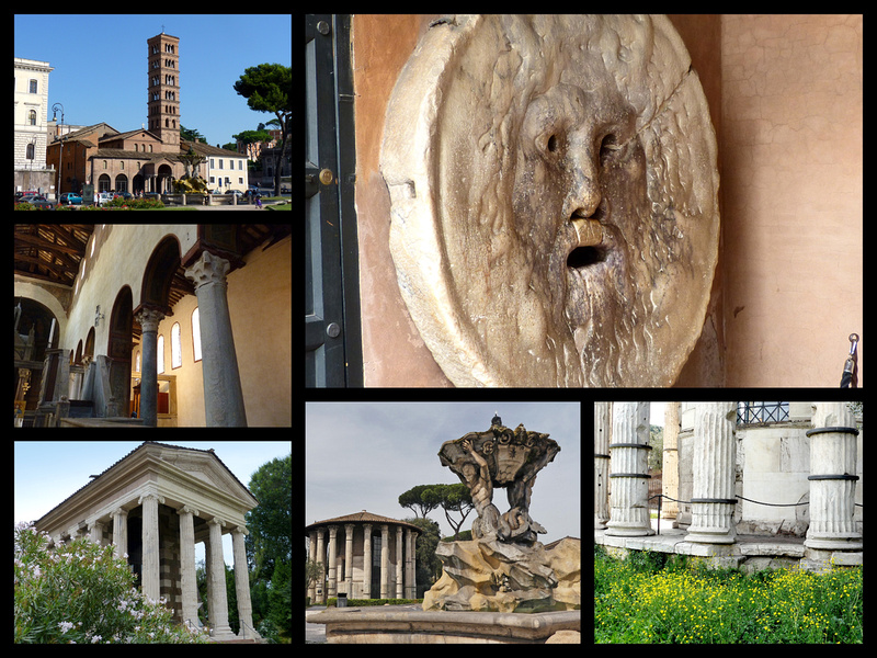
From the Piazza della Bocca della Verita we detoured across the street to have a look at Isola Tiberina (the island in the Tiber). The oldest bridge in Rome, the Ponte Fabricio (62 BC) connects the island to the Tiber’s eastern bank. The island is associated with the healing powers of the god Aesculapius, son of Apollo. Legend has it that in the 3rd C BC the Romans sent a boat to Epidaurus in Greece to discover a cure for the plague. On the return trip Esculapio left the ship in the shape of a serpent and swam to the island, indicating that a temple to the god of healing should be built here. The church of San Bartolomeo was built on the site. In the 1st C BC the Romans reshaped the island with slabs of travertine to form a “prow”.
Continuing on to Via del Teatro di Marcello you pass by the church of San Nicola in Carcere (St Nicolas in Prison), a typical example of Roman 11th C construction which was built within the ruins of three republican era temples. The temples were dedicated to the two-face god Janus, the goddess Juno and to the god Spes (hope). These Temples once overlooked the city of Rome’s fruit and vegetable market. The columns that once held these temples up can still be found embedded into the walls of the church and are easily seen just by walking by. This church also has a crypt that you can go down into, although we didn’t do that this trip.)
Another block or so is Teatro di Marcello, a small corner of the 2000 year old arcade has been restored to what presumably was the original look. Next to it are three Columns of Apollo and a smattering of other, smaller ruins.
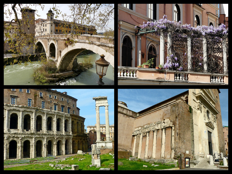
Another block or so brings you to the base of the steps leading up to Capitoline Hill (Campidogilo), the most sacred of Rome’s seven hills. It was once the epicenter of the Roman Empire. The city's archives were kept in the Tabularium (hall of records), the tall tufa structure that forms the foundation of today's city hall, the Palazzo Senatorio, which features a classic Renaissance Italian bell tower and double sided staircase.
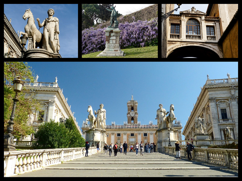
Michelangelo created the piazza with it’s slightly convex pavement, the staircase ramp, the buildings and facades on three sides, and the pedestal for the bronze equestrian statue of Marcus Aurelius. On the other two sides of the piazza, Palazzo dei Conservatori and Palazzo Nuoveo, have been incorporated into the Capitoline Museums, one of the oldest museums in the world. These museums house some of the greatest pieces of classical sculpture in the world including the renowned symbol of Rome, the Capitoline Wolf, a 6th C BC Etruscan bronze (the suckling twins were added during the Renaissance to adapt the statue to the legend of Romulus and Remus – there is a copy outside). As Michelangelo's preeminent urban set piece, the piazza sums up all the majesty of High Renaissance Rome. From behind the Palazzo Senatorio, a stairway leads down, offering the best overview of the roman Forum. The front of the piazza looks out over the Piazza Venezia.
The loop I just described (from Piazza Venezia and back) is about three miles (plus detours of course). From the Hotel and back we walked about six miles.
After a bit of siesta at the hotel, we headed to St Peter’s. The first stop was Ponte Sant'Angelo, pedestrianized and lined with ten stone angels it joins ‘the heart of Rome’ with the Vatican side and leads directly to Castel Sant'Angelo.
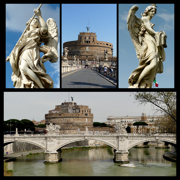
Castel Sant’Angelo - During its many years of existence, the building functioned as a mausoleum, became part of the city wall and later was turned into a fortress before it functioned as a papal residence and finally as a barracks and military prison. Emperor Hadrian chose this spot away from the city’s main area as the site for his tomb. From the top is one of the best views of Rome. The castle houses part of the Museo Nzionale Romano. In AD 590 Rome was stricken with the plague and Pope Gregory organized a procession to pray for the city’s release. As a result of the miracle the building was renamed Castel Sant’Angelo. In the 9th C it was linked to the nearby Vatican by building a high defensive wall. The spiral ramp inside the castle dates back to the time Hadrian’s mausoleum and part of it can still be climbed to the main courtyard where the statue of Archangel Michael, 1544, stands. There is another Archangel Michael, 18th C, at the top of the terrace along with the Bell of Mercy which in the past pealed to announce executions. The moats and gardens are a 20th Century addition.
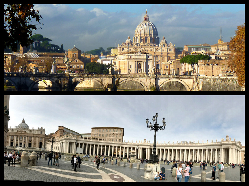
St Peter’s Basilica looks close from Castel Sant’Angelo but it’s actually more than half a mile. Piazza San Pietro is huge, with a massive Egyptian obelisk supported by bronze lions and two fountains in the center and surrounded by the ‘Tuscan Colonnades’, four columns deep which curve around the sides of the square from the Basilica. Bernini designed the piazza and the colonnades to be “the maternal arms of the mother church”. The whole ensemble is gorgeous and a definite ‘must see’ even if you have no interest in the catholic religion. The place is packed with tourists most of the day, some just taking it all in, the rest waiting in the long security line to get into the church. Given our limited time on this trip we didn’t go in but it is a really amazing space and worth the hour or so wait on line. Around the side of the piazza is the city wall, through which a gate leads to the entrance to the Vatican Museums (which always has an enormous line – every time I’ve been there – July, March, November, early in the morning, mid day, rain, shine).
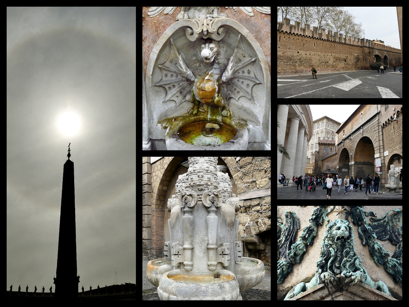
We took the Metro back, got a pizza to eat in room and took a short siesta before heading out for a drink and to see Rome lit up. The Piazzas are all beautifully lit – my favorite for evening ambiance are Trevi (if the crowds aren’t too bad), Rotunda and Narvona. We started the evening with a drink near Piazza di Pietra, strolled around the streets and piazzas as the sky turned dark blue and the buildings became beautifully gold colored, and finished the evening with a gelato at a café in Piazza Rotunda next to my favorite site in Rome – the Fontana della Rotunda backed by the Pantheon.
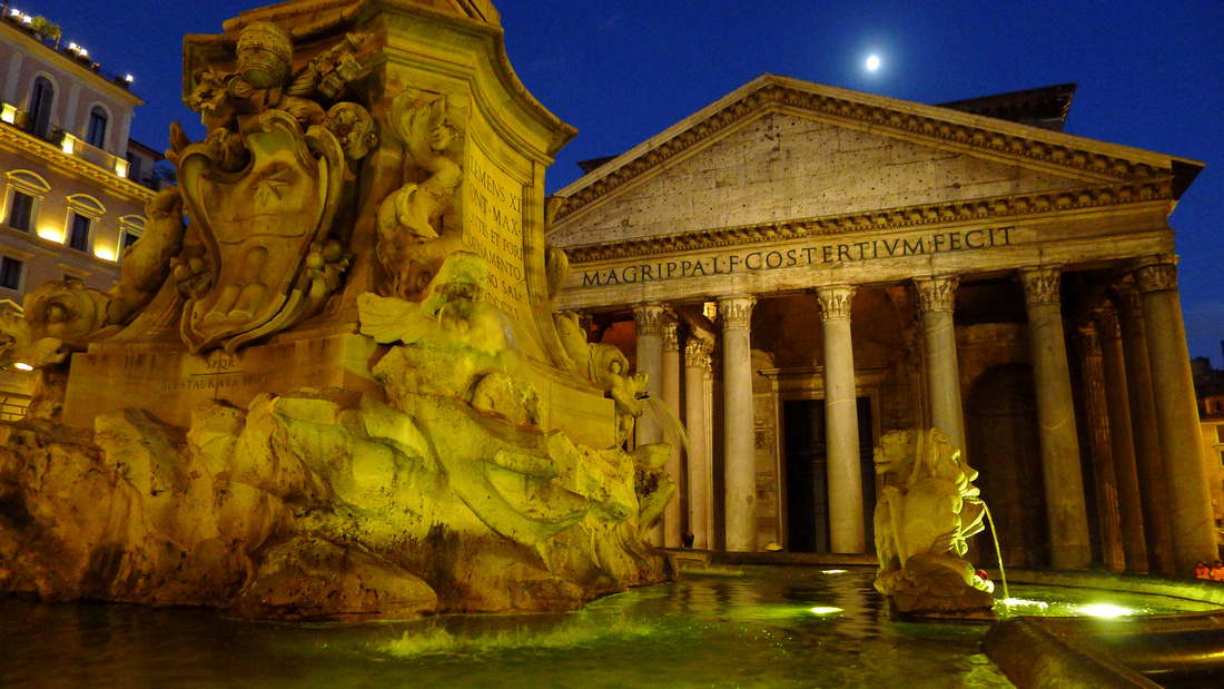
Saturday, March 25, 2017 [Sunny and 78] – Not a cloud in the sky. Best day yet and we had nothing really to do. We had condensed what we planned to do in two full days down to a day and a half since we discovered that there were demonstrations planned in Rome for the 60th anniversary of the European Union so stores were to be closed and they made it sound like pedestrian access to the center was going to be curtailed - they were expecting possible violence. We tried to get our train tickets changed to an earlier one but couldn’t (special price). So we went to S. Maria Maggiore (with our bags) and took turns going in and sitting in the sun. Then went to a café and sat in the sun there and age gelato. Had lunch at the train station, then comfortable 3-hour train trip to Milan.
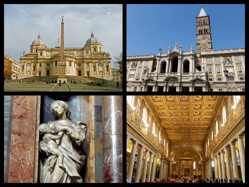
For the Venice, Florence, and Milan portions of our trip see parts 1, 2, and 4 of "Italy through new eyes: Chasing the Sun in Italy in March"
For more photos click on "All Photographs in the upper right corner and navigate to the Italy gallery.
]]>
Although I’d only been to Florence once, 9 years before, we easily found the Hotel Alba Palace on the street to the right of the train station. The street is not especially scenic, nor is exterior of the building. But lobby and breakfast room were quite nice, and there’s a bar with cold water, hot water – tea, coffee, etc. and cookies and savory snacks (pretzels, nuts, etc.) available all day. The room - #001 is right next to the breakfast room and elevator – but utterly quiet inside. And OMG – what an amazing room! The room is two stories high with a gigantic exposed stone and brick wall and another brick wall, arcaded ceiling, two story marble column. Queen size bed, beautiful painted armoire, matching small cabinet (hiding the mini-fridge), and bench (plus a wooden table/desk and two wooden end tables. 48” flat screen TV. And then ---- wood and iron spiral stair case leading to a loft with two twin beds, more great furniture and French doors leading to a large terrace with a table and chairs. And the bathroom is also huge, with full tub. So it’s clearly a ‘quad’ room. Only a 5 minute walk from the train station or Santa Maria Novella church/piazza (with several decent restaurants) and about 10 minutes from the Duomo. What a find. €125 a night. (Only drawback was a rather mediocre breakfast)
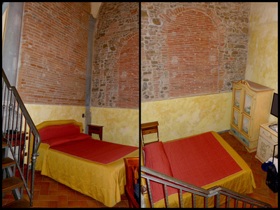
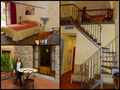
We dropped our stuff and went out to explore – Piazza del Duomo , Piazza Signoria, Pont Vecchio, Mercato Nuovo, San Lorenzo cloister, San Lorenzo Market. Florence center, another UNESCO World Heritage Site, is quite compact and very walkable and much of the center is pedestrianized.
On the way back to the room we stopped and got a bottle of wine and got some of the free snacks from the hotel and had ‘cocktails’ on the terrace. Then I ran out and got some early evening shots while Crista hung out in the room. Then went to one of the restaurants on Piazza Santa Maria Novella – pasta, risotto at an outside table (they had heater lamps).
Can you “see” Florence in one full day? Yes you can.
Wednesday, March 22, 2017 [Mostly cloudy, 70]
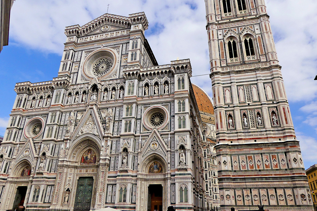
The buildings on the Piazza del Duomo – which include the Duomo, the Baptistery, and the Campanile di Giotto are among the most colorful buildings in Italy. The exteriors are composed of geometrically patterned bands of white, pink, and green marble, an interesting contrast to the sienna-colored fortress-like palazzi around the city. One description I read said they looked like “buildings in carnival wear”. Florence has a very heavy, somber and foreboding feel to its streets lined with dark, heavy stone palazzos so the ensemble on Piazza del Duomo really stands out. The Duomo is one of the largest (Europe’s 4th largest) and most impressive cathedrals and represents the “flowering of the Florentine Gothic style”. The dome, by Brunelleschi, was the largest when it was built (1296 to 1436) and he based it on the construction techniques used in the Pantheon. When Michelangelo was working on the design of the dome of St Peter’s he based it on the Florence dome. Opposite the Duomo is the small, octagonal shaped Baptistery. The exterior is clad in the same tricolor marble as the Duomo, but seems much more ‘plain’ – except for the famous bronze doors- which some say marks the beginning of the Renaissance. The actual building is much older than the Duomo, but during the same period that the Duomo was built, the interior was covered with glittering mosaics (by Venetian and Byzantine style artists). In addition to the ‘usual’ depictions of Christ, saints and sinners, there is an interesting monster like creature devouring a human.
The interior of the Cathedral can be entered for free, but the Baptistery as well as climbing the Campanile and the Dome of the Duomo require a ticket. One ticket (15€ covers all of them plus the cathedral museum). In addition, in order to climb the Duomo dome, you need a reservation. The building directly across from the Baptistery has tickets and a machine where you make your climb reservation.
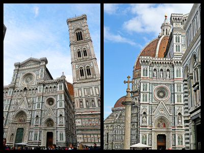
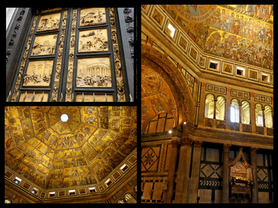
Duomo and Campanille Bronze doors and interior of Baptistery
We did the Baptistery first thing in the morning – amazing and wonderful to see but it doesn’t take long as it’s just one fairly small open space. The Duomo itself is of course much larger although most of the ‘decoration’ has been removed to the museum. The most impressive part is the view of the dome – which even from the ground floor is pretty amazing. With the ticket you are also allowed to go down into the crypt, which had some interesting displays.
At our reserved time we got on line for the Duomo climb. As they only let people in every half hour, you are accompanied by quite a crowd as you ascend the 463 steps. The frescoes are even more amazing up close – and the same ‘human eating monster’ featured on the Baptistery ceiling is also here. Unfortunately you have to look through Plexiglas, which does detract. It was a fairly orderly climb till just before the open area at the top where it became a zoo – mostly due to people who felt they needed to take selfies up there. After elbowing our way past the selfish selfie takers we did enjoy the view. I think the view from the top of the campanile (414 steps) is even better as it includes the Duomo (and is way less crowded and crazy so the climb is more enjoyable). But no frescoes. So you really do have to do both.
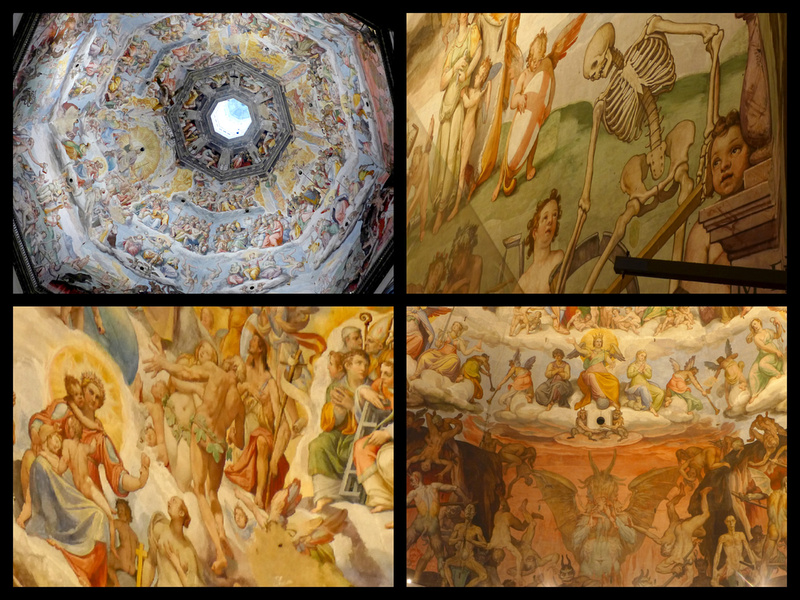
Close up of the frescoes on the Duomo ceiling including saints, sinners, skeletons and a human eating monster/devil creature.
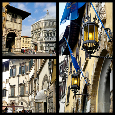 Around and beside the Duomo are Palazzos, stores and cafes.
A few blocks away, amidst more palazzos, is the Nouvo Mercato (now selling mostly leather goods to tourists) with the famous bronze boar, whose nose is shinny because people rub it for good luck.
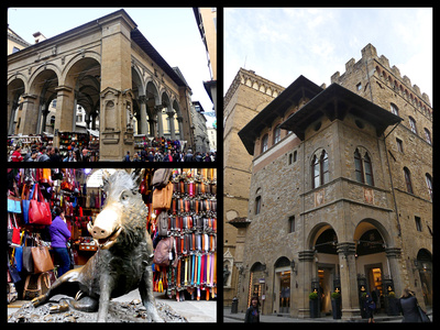
It’s only about a five minute walk to the other main piazza in Florence, the Piazza della Signoria which is home to the Palazzo Vecchio (town hall), the Loggia (originally built to shield dignitaries from the elements during speeches and ceremonies) and the Uffizi gallery, Florence’s major art museum. Guarding the entrance to the castle-looking Palazzo is a copy of Michelangelo’s “David”. I know many people feel you ‘need’ to see the original, but I actually think I prefer a copy in an original setting to an original in a museum. While David is pretty serene, just standing there looking good, most of the other sculpture is pretty violent. Perseus holds up the severed head of Medusa, The Sabine Virgins are Raped, Hercules slays the Centaur Nessus, and a large lion guards the whole area. Outside in the Piazza itself are Cosimo de Medici on his horse as well as Neptune and his fountain.
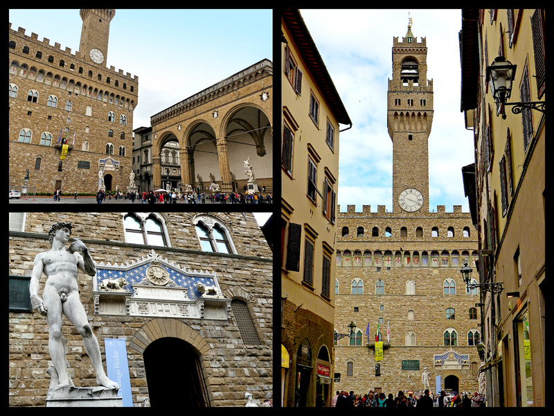
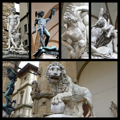
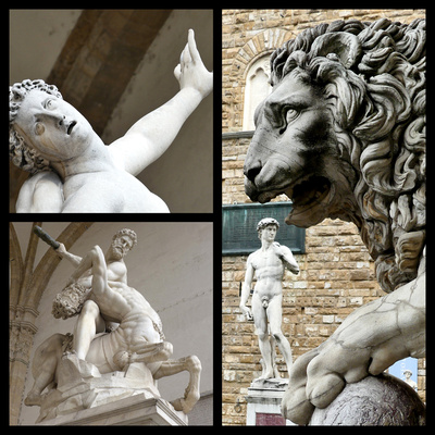
Just behind the Palazzo Vecchio is the U-shaped Uffizi Gallery (Italy’s top visited museum – long lines, reservations recommended. I had visited on my previous trip to Florence and we didn’t have time this trip). But the building itself is pretty impressive, and it opens out onto the Arno, with a view to the Tuscan Hills across the river, and the Ponte Vecchio, another of Florence’s ‘must sees’. The bridge was built in 1345 to replace an even earlier version and has characteristic overhanging houses lining both sides. In the 16th century, it was home to butchers until Cosimo moved into the Palazzo Pitti across the river. He couldn’t stand the stench, so he evicted the meat cutters and moved in the classier gold- and silversmiths, and jewelers occupy it to this day. Apparently there is a way to walk from the Uffizi (which was offices, Uffizi means office) over the top level of the Pont Vecchio to the Pitti Palace with out having to interact with the hoards of people. Today there are still hoards of people – tourists from the time the jewelry shops open till late evening. So walking across it is not as rewarding as viewing it – which can be done from both banks of the Arno as well as the next bridge up. Ponte Vecchio was the only bridge spared by the Nazzi’s as they retreated from Florence, deciding it was too beautiful to blow up.
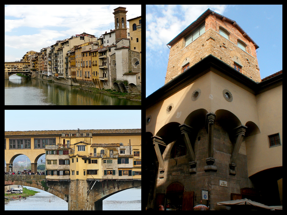
We walked to Santa Croce, another beautiful exterior (the Duomo buildings, Santa Maria Novello and Santa Croce are all pink/white/green marble and very ‘pretty’ compared to the dark Siena colored stone of most of the other buildings in Florence – made even darker and more somber looking by the fact that it was cloudy). Considered Florence’s second most important church after the Duomo it sits at the eastern edge of the centro storico in one of the most ‘genuine’ neighborhoods left in the center. It’s often referred to as Italy’s “Westminster Abbey’ for the number of it’s highly decorated chapels and the tombs of some of the most important Italians of their day: Michelangelo, Dante. Galileo, Machiavelli, Rossini. The side chapels, 16 of them, richly frescoes (many by Giotto), go on and on, as do the cloisters. There is also a leather school, which although no longer staffed solely by monks, does still produce leather products.
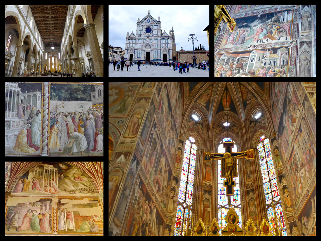
From Santa Croce we hiked up to Piazzale Michelangelo and Santa Maria al Monte above that. Great Views (despite the clouds). The church is quite dark inside and has a very different feel to most of the other churches in Florence.
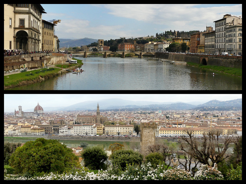
We got a great sandwich which we shared and two cappuccinos for €7 and ate on a bench in Piazzale Michelangelo.
Back in town we wandered over the Pont Vecchio but the jewelry was above our pay grade so we went back to the San Lorenzo market. I was tempted by the bags – Florence is pocketbook shopping heaven - Crista got a large light leather tote bag with matching bag inside and smaller pouch. But I resisted and only got a few smaller pouches for camera accessories etc.
We had dinner at a restaurant near the Pont Vecchio but it was quite decent pasta and grilled veggies.
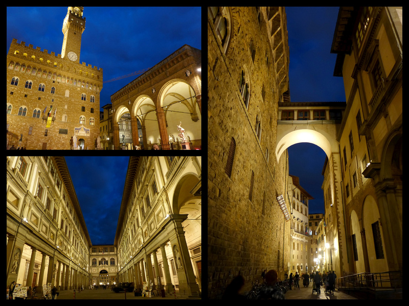
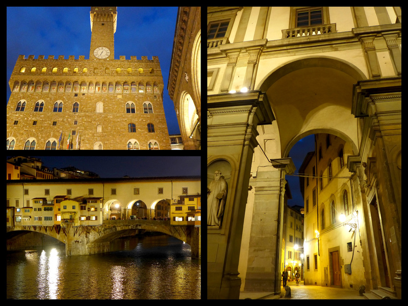
Thursday, March 23, 2017 [Cloudy in Florence, Mostly sunny, high 60s in Rome] - After breakfast we took a stroll around the historic center and climbed the Campanile.
Then Santa Maria Novella –the third of the ‘white, pink and green marble’ churches in Florence. There were some interesting cloisters. While not quite as impressive as Santa Croce in terms of amount of frescoes, the ones they did have were more interesting as they included scenes of Florence and surrounding areas.
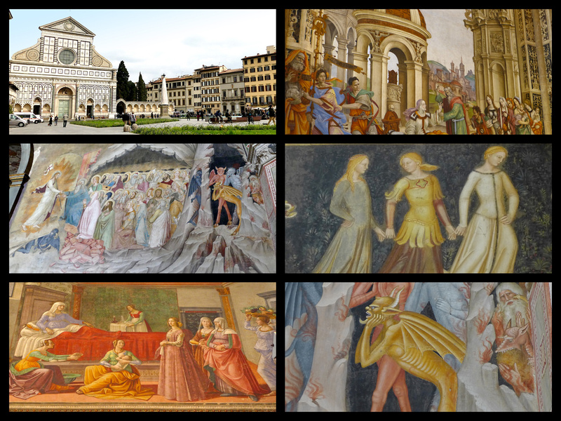
Just before the trip I had read a novel by Sarah Durant set in 15th century Florence which featured a family that hired a painter to paint the family’s palazzo’s chapel with frescoes. The painter used the family members as models for the faces of people in the frescoes, and scenes from the area. So this was apparently a common practice, at least in residential frescoes. I found it interesting to wander the streets of Florence and imagine what is in all those palazzos. Now I know many of them are carved up into apartments, or offices, etc. but originally they were ‘family homes’. Having read the novel, “The Birth of Venus” did certainly help to bring 15th century Florence alive. Sarah Durant has written numerous other historical novels set in various Italian cities (“In the Company of the courtesan” 16th Century Venice; “Sacred Hearts” 16th century Ferrara, etc.). Also watching movies set in places I’m going to visit is a good way to get a ‘feel’ for a place. For Florence one of the best is “Room with a View”. A more recent one is “Inferno” with Tom Hanks based on the Dan Brown novel.
For the Venice, Rome and Milan portions of our trip see parts 1,3, and 4 of "Italy through new eyes: Chasing the Sun in Italy in March"
For more photos click on "All Photographs in the upper right corner and navigate to the Italy gallery.
]]>
I decided to go to Italy for my spring trip for three reasons: first, well it’s Italy; I really didn’t need any other reasons. But two, I found a great fare from my local airport to Milan, and three, I wanted to continue my ‘research’ on Italy in the ‘off‘ season. I have been going to Europe every summer for about 15 years, always in the month of July, but some day I’ll be done with work and will be able to travel whenever I please, so am always looking for places where it will be ‘nice’ when it’s not ‘nice’ where I live (the US northeast).
When I told my friend Crista about the trip she decided to come with me. She’s never been to Italy and only once to visit a friend in Scotland so a real ‘newbie’. Our original plan was going to be Venice, Florence and Lake Como, but by mid week the forecast for Milan/Lake Como was rain so we made a last minute switch to Rome for a couple of days. Thus we ended up doing the itinerary that is so often posted on travel forums from newbies and mostly shot down by those of us ‘in the know’: 8 days Venice, Florence, Rome, Milan.
Crista only had time for 8 days but I had an additional 5 days for day trips from Milan. I did Pavia, Genoa, Lake Como, and Lake Lugano. The last day I stayed in Milan.
Part 1: The “Classic” One Week in Italy: Venice, Florence and Rome
We did all the things that many people (myself included) advise against. We flew in and out of Milan even thought that wasn't our destination. We tried to 'see' three major Italian cities in a week and took trains from Milan to Venice, Venice to Florence, Florence to Rome and Rome to Milan. Phew. Sounds like we'd spend all our time in trains and the whole thing would be very rushed. Well, I'm here to say it actually wasn't and Crista said she never felt rushed and loved it. So I think I'll be revising the advice I give people from now on.
It was a fast pace, no doubt about that. Crista walks a lot faster than most people, and doesn’t ‘require’ a lot of time to see things. For many people this wouldn’t be a very satisfying way to travel. She did a fair amount of “OK, what next?” and I’d say, “THIS IS what’s next – we’re here, just look around you”. Had to explain what a ‘passeggiata’ was and why doing that is fun. But everyone is different and goes at a different pace. This was my 13th trip to Italy, I’d been to Venice 5 times, and Rome 7 times (Florence only once before) so I was really just enjoying seeing things through her eyes and playing tour guide. Crista is a very smart, highly educated woman, but she had a pretty terrible grasp on geography and history and did zero research. I do such extensive research before trips (including reading novels set where I’m going, watching movies that took place there, etc.) that my husband says it’s almost ‘too much’. But my advice to new travelers will continue to be to at least read a good general guidebook before you go anywhere so you know what you’re seeing. And listen to us experience travelers when we tell you to stamp your train ticket before you get on!
Arrival Day - Saturday, March 18 [Sun and clouds, 60s] - We arrived only 20 minutes late into Milano Linate. Crista’s bag, which AerLigus made her gate check in Dublin, saying it was too large, arrived quickly. (BTW – last time I flew AerLingus to Italy they made me gate check my bag as they said I had ‘two’ pieces – this time they said nothing about my bag plus ‘personal item’ and it was the exact same two pieces - which goes to show it’s a crap shoot what is and is not OK). Anyway, her bag came through right away and we were outside, having bought our bus tickets to Milano Centrale, just before noon. I asked a man standing by the sign if the bus was the right one (it looked different) and he pointed and said yes. But we almost got on it and it was going to Slovenia!!! Turns out he was pointing to the space in front of that bus where the right one was about to arrive – fortunately he saw us and told us. We got to Centrale just about 12:45 so good thing I booked the 13:40 train and not the 12:40 as we would have just missed it. We had time to get a Panini and coffee and got to Venice just after four.

I had stayed at the Palazzo Odoni just last July – loved the hotel and didn’t even consider looking for anyplace else. It’s in the Santa Croce district, about 10 minute walk from the train station or Piazzele Roma, on a quiet canal, in what is – for Venice – an ‘un-touristy’ area. So what for most first timers – finding the hotel you booked – can be difficult when you are tired and jet-lagged, was for Crista just a short stroll since I knew where I was going. We were checked in and ready to head out by 5 for what we thought would be a short stroll to show her a few canals and find dinner. We ended up walking all the way to Piazza San Marco (and back). The adrenalin gets going and everything is so new and exciting. We were almost back to the hotel before we found a place we wanted to eat. I think there were actually mostly locals in there, and it was just a two-minute walk from the hotel.
Palazzo Odoni Entrance Courtyard
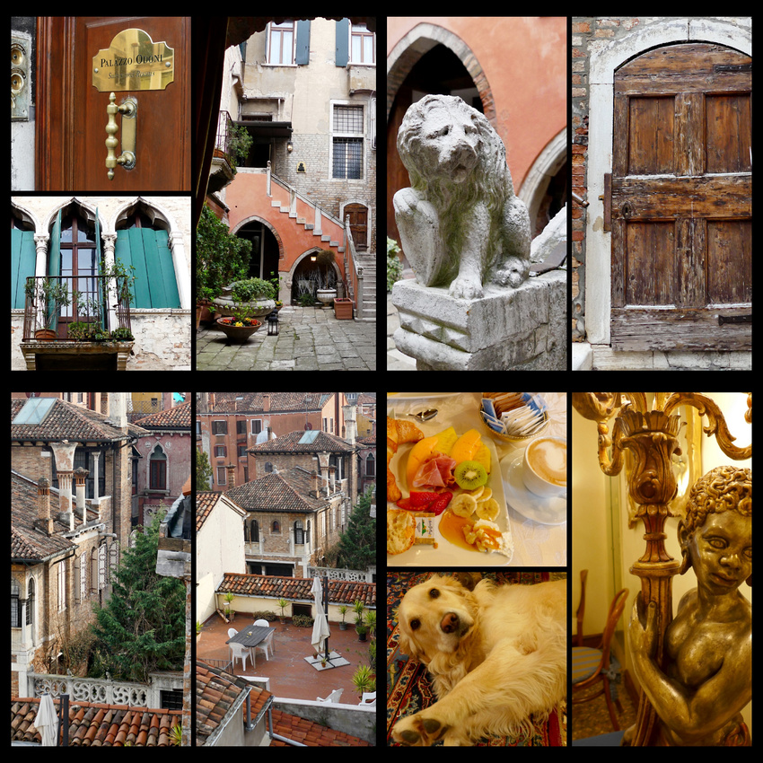 Palazzo Odoni - A 16th century palazzo that's been in the same family for generations, comes complete with antique furnishings, a very high quality breakfast (and a golden retriever).
Can you “see” Venice in one full day? Yes you can.
Sunday, March 19, 2017 [Sun and clouds, 60s] Great hotel breakfast – huge, delicious croissants, various meats and cheeses, fresh fruits (melon, pineapple, kiwi, strawberries, oranges, bananas), yogurts, breads, and of course cappuccino. After pigging out on that we walked to the train station and got a vapparetto day pass (€20 each) and took our first ride down the grand canal to San Marco with me pointing out most of the most important palazzos (at least the ones I could remember the names of). It was bright but overcast – no blue sky and the colors on the palazzos seemed really muted compared to summer. Crista was still duly impressed (though I don’t think as much as I was my first time on the Grand Canal).
Grand Canal March 2017 (above)
Grand Canal July 2016 (above)
Passing under the Rialto Bridge I noticed that it's renovation was completed, the scaffolding of recent years gone, all very clean and white. We considered getting off to explore the market but decided it made more sense to get to Piazza San Marco and the Doges Palace before it got crowded and visit the Rialto market later.
The stone Rialto Bridge was the first permanent bridge across the Grand Canal. The central path is full of shops – mask, glass, bead and souvenir, as are the calle leading to the bridge from both directions. The fondamenta on both sides of the grand canal are filled with restaurants and hotels. The Rialto Market is the city's main source of fruits, vegetables and fish. The Rialto Bridge and surrounding area are the second most crowded in Venice, and while not quite as bad in March as in July, it was still pretty bad. I think cruising under it in a vaparetto is a much more enjoyable way to experience it than walking across it, but he view from the bridge is the quintessential Grand Canal View (if you can get close enough to the edge to see it).
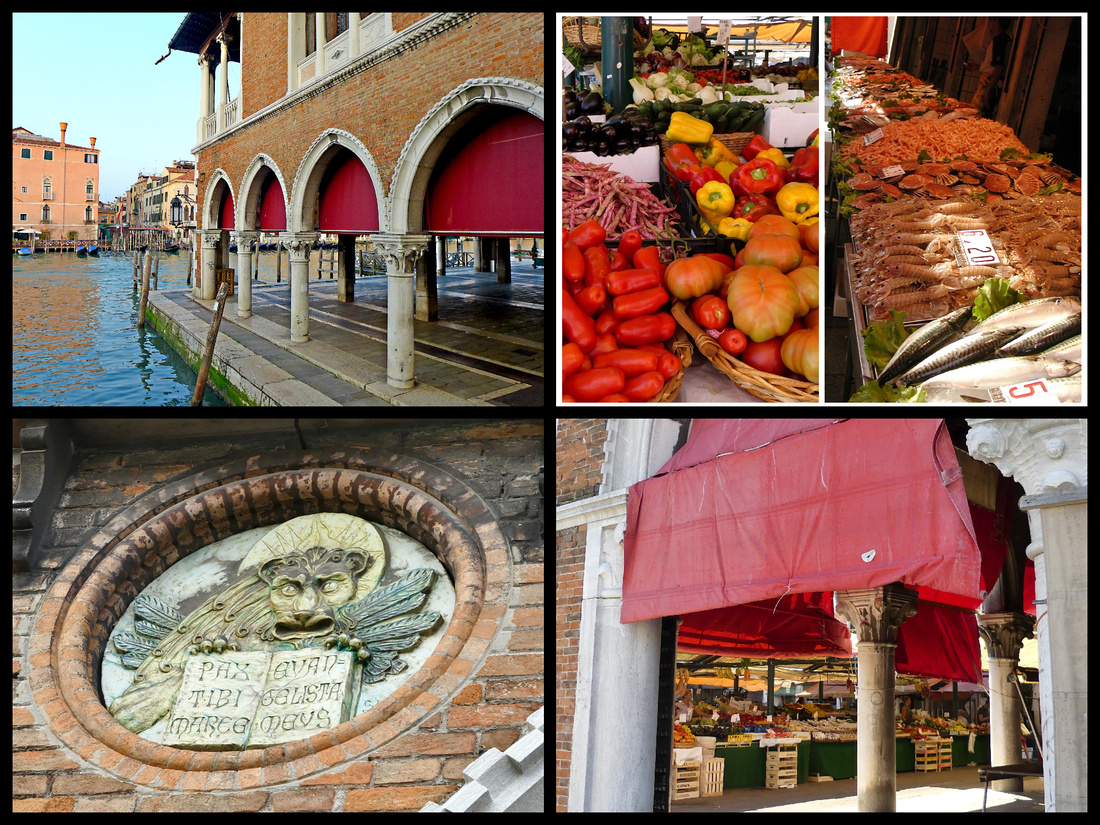
We got to San Marco about 9:45 (the ride takes just about 45 minutes).
Piazza San Marco is definitely the 'center' of Venice, one of the most famous squares in the world, much larger than any other in Venice, and the only one to be called a 'Piazza" - all others are 'campos' or 'piazzettas'. At one end sits Basilica San Marco, one of the most famous buildings in the world. The Basilica was built in 1063 to house the remains of St Mark the Evangelist. The façade is a mix of east and west. The doorways are massive European Romanesque. The mosaics are mostly Venetian designs but executed by Greek craftsmen. There is sculpture from Constantinople, columns from Alexandria, and Capitals from Sicily. The upper story has Gothic style arches and the whole thing is topped by Greek domes with onion shape caps. However, it comes together in a bizarre sort of harmony. It is simply the most unique church in Europe, which as Goethe said “can only be compared with itself”.
The Piazza is rectangular, but opens wider at the basilica end, enhancing the perspective and creating the illusion of being even larger than it is and flanked on three sides by arcaded buildings of apartments known as "Procurazie," once the official residences or offices of state ministers and now full of shops and cafes. In the summer the outside tables are full, and in the evening bands play at three of them. On this March day most of the tables were empty.
Piazzetta San Marco – is the smaller square between Piazza San Marco and the lagoon, with the Doges Palace along one side. Two granite (Egyptian) columns topped by Venetian-Byzantine capitals stand at the entrance to the piazzetta. One supports the famous statue of the winged lion of St Mark, the symbol of Venice The other column bears a statue of St. Theodore and his dragon. I believe there was a third column that fell off the boat as it was being delivered and still sits at the bottom of the Grand Canal.
The Doges’ Palace is a Gothic Renaissance building begun in 1173 which integrated walls and towers of an AD 810 castle, beautifully carved in pink and white marble. Architecturally, the Palazzo Ducale is a unique mixture: the style of its exterior, with its geometrically patterned stonework and continuous tracery walls, can only be called Islamicized Gothic, whereas the courtyards and much of the interior are based on Classical forms. It is one of the finest secular building of its era in Europe, and the central building of Venice.
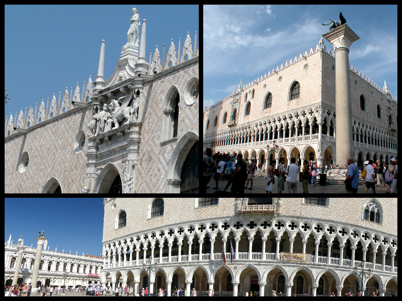
The line for the Doges Palace was about 10 minutes long.
Inside is a beautiful arcaded courtyard and finely sculpted grand stairway. Once the private home of the Doges (Venetian ruler elected for life), it is today a museum filled with art treasures, including Tintoretto’s “Paradise”, one of the largest paintings in the world, in the huge “Sala del Consiglio” where the city parliament met. Room after room of incredible wall and ceiling paintings and carved wood. We spent about 2 hours there and neither of us felt rushed or that we wanted more time. I do have one friend who said she spent 5 hours but you’d have to examine every single thing to do that. Another friend went on a (high end private) tour and said they were in there less than an hour. So I guess we were going at ‘average’ speed.
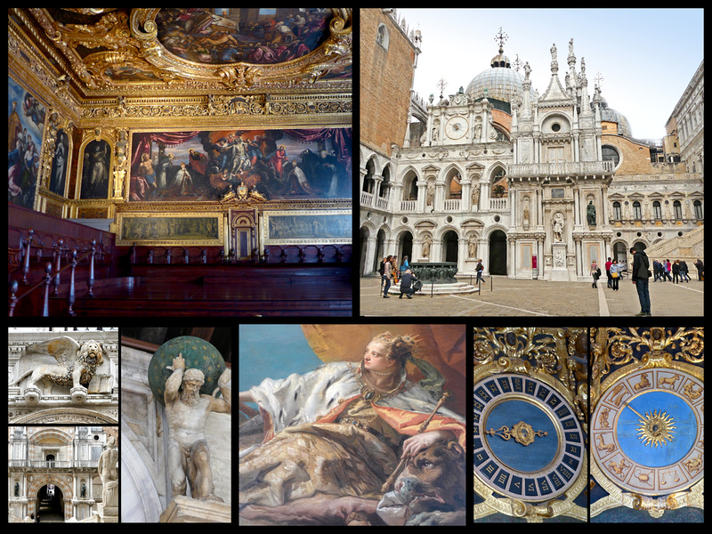
The best part was the prisons and walking through the bridge of sighs. The prisons were both more extensive and larger (and nicer) than I expected. Ponte dei Sospiri (Bridge of Sighs) connects the Doges Palace to the 16th Century Prigioni Nuove (new Prison). Those condemned to death had to pass over it on their way into the prison and back out again to be executed in the Piazzetta San Marco. The bridge was built in 1600 by Antonio Contino, and takes its popular name from the sighs of the prisoners who shuffled through its corridor.
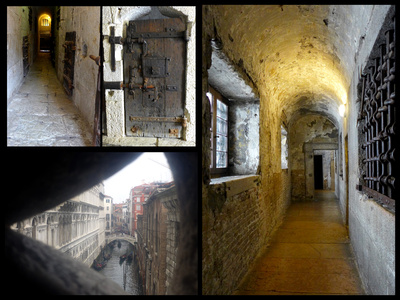
I’m glad I finally saw it, but I’m also glad I didn’t have to wait 2 or more hours in line in order to do it. And I don’t think it was a ‘highlight’ of Venice
At that point, now about 12:30, the line for the Loggia Museum in San Marco was about 10 minutes long. Nice views of the Piazza and the Piazzetta. The museum essentially consists of the loggia (with the fabulous views) and close ups of the horses (both the ones outside and the originals inside) and of the mosaics of the church.
Coming down from the loggia you entered the church itself, which was illuminated for the mass. We were allowed to walk around the sides, just roped off from where the parishioners were sitting. I think it would be much less impressive to tour the Basilica when it’s not illuminated (which is most of the time). It was a Sunday and there was a mass going on; the incense and the singing really added to the experience. So on my fifth trip to Venice I finally did what most people do on their first trip. Actually on my very first trip, which was 17 years ago, we did go inside the Basilica but it was not illuminated and therefore very dark.
Then we headed back behind the Bridge of Signs (the Castelo district) as I was looking for an old church with nice cloisters (St Apolonia). Took forever to find it despite it being literally behind the Bridge of Sighs. I had been there, I had a paper map, and we had the phone map and we asked two different people and it still took half an hour. That’s the fun of Venice. When we did find it, it was closed. Oh well, had a nice lunch with our ‘intro to Venice’ Bellini’s.
After exploring around San Marco we took the vaparetto as far as S. Toma and walked to the Ca’Rezzonico. (included on the Museum Pass with the Doges Palace – along with ten others which we didn’t have time for). Ca’Rezzonoco is an impressive palazzo filled with three floors of 17th and 18th century Venetian art. But we got over dosed on it after an hour or so. (The friend that spent 5 hours in the Doges Palace spent 3 hours here). Some nice views from the upper floors. Then we walked the rest of the way back to the hotel, got lost of course, but isn’t that the charm of Venice.
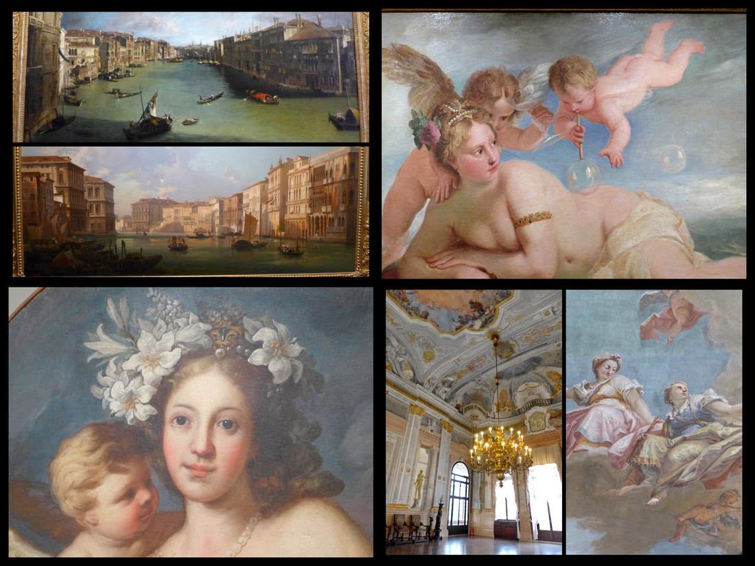
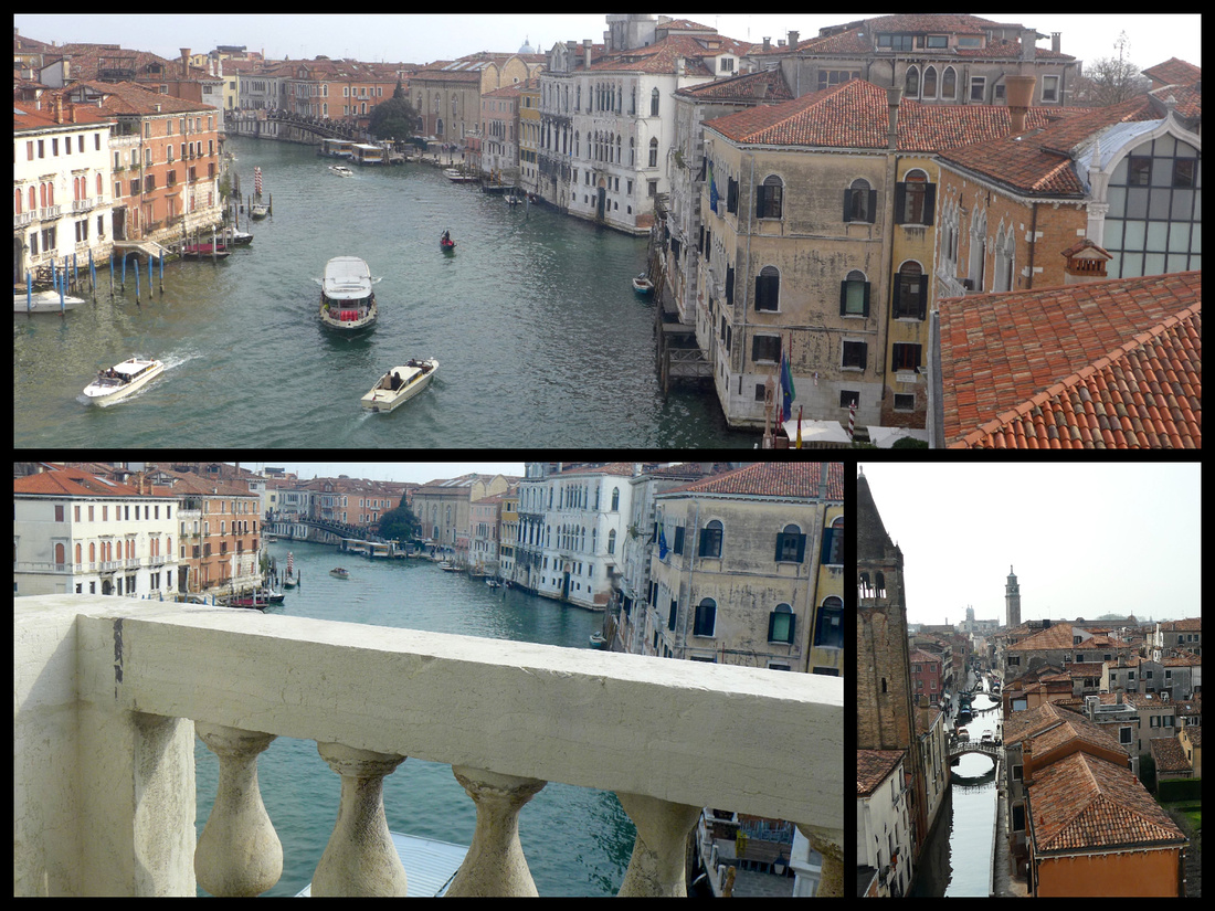
After an hour or so we decided we needed to make use of the remaining daylight and vaparetto pass so took another ride down the Grand Canal. This time we got front row seats! Just as we were leaving the train station stop a couple of boat ambulances whizzed in and took someone from the stop in front of us. Interesting to think about water ambulances. Second time we had an ambulance incidence on this trip. (first one was on the plane).
It was cool but sunny as we started but as we approached San Marco the fog literally rolled in. You could see (and feel) it rolling in. It was quite interesting. But would I choose the Grand Canal with front row seats, cold and fog – or crammed in like a sardine but with bright sun shinning on all those palazzos. I think I pick the sun.
Anyway, great views, but it was pretty cold. So we ended up eating dinner just past Piazza San Marco. A guy standing outside a restaurant as we paused to look at the menu started talking – in flawless English. He was ‘Venecian-American’ – from NY. Said his hospital on 18th street was now condos. I said the one I was born in was also condos. I had almost the same conversation (minus the hospital part) with a guy we dubbed “Mr Astoria” in Chania, Crete last summer. Apparently middle-aged men who have lived for most of their lives in the US are moving back to the homeland and working in the tourist trade. But he was nice and we were cold so we went in. The food was OK and they gave us free prosecos ‘since we were from NY’. Sure. After dinner it was cold and most of the stores were closed so we took the vaparetto back. It was cold and foggy but that made for really interesting light.
So – that’s what you can accomplish (and still have fun) if you move fairly quickly and you have someone with you to show you where to go (or have done your research). We did three and a half rides on the Grand Canal, 4 major sites (Doges Plalace, Basicila San Marco interior, Loggia Museum, and Museum Ca’Rezzencio), walked all the way from the train station end to Piazza San Marco and back, and had sit-down dinners and lunch. Did a bit of tourist shopping. And did not feel at all rushed. The whole of Venice is a UNESCO World Heritage Site so just wandering along the back canals and riding the vaparetto down the Grand Canal is really enough to make a trip to Venice worthwhile, and to know that you have seen it. Adding a couple of museums and the Basilica and the Doges Palace were just icing on the cake.
Monday, March 20, 2017 [Sun and clouds, 60s] On our other full day we spent the morning going to the Rialto market (bit of a disappointment, it wasn’t a ‘fish’ day so just produce) and then did a half day trip to Vicenza – partly to see a smaller town but mostly because Crista wanted to go to Jazzercise. She’s an instructor and it’s a ‘thing’ for jazzercise instructors to visit classes when traveling to foreign countries. She did it in Scotland last year. So she had made arrangements with Lucca of the Vicenza studio. I had been in Vicenza as a day trip quite a few years ago and remembered it as very, very quiet, pretty enough but not as interesting as other towns in the area such as Verona and Padua (and Mantua, Ferrera, Treviso). And it was the same this time. We were there on a Monday and lots of things were closed. We did a walking tour of the palazzos that the TI office gave out, and had some really good gelato but 3-4 hours was plenty. Crista went to her Jazzersize class and I went back to Venice.
Vicenza - The small city less than an hour from Venice, was home to Palladio in the 1500s, who, after studying architecture in Rome came here and developed the style named after him. Today the city, one of the wealthiest in Italy, is a living museum of his buildings and thus a UNESCO World Heritage Site.
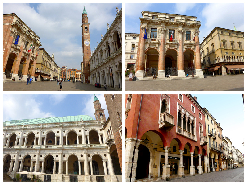 Left top: Piazza dei Signori, dominated by the most awesome of Palladio's creations, the Basilica Palladiana (bottom left) , also known as the Palazzo della Ragione. Top right Opposite the Basilica is the Loggia dei Capitaniato designed by Palladio in 1571 to replace the medieval residence of the "Capitanio", the Venetian Captain in Vicenza. Bottom right: Corso Palladio, home to many of the city's grandest palazzos.
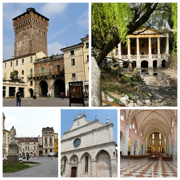 Vicenza - Top left: town gate and Torre Bissara, Top right: Palladian Loggia Valmarana in the Giardino Salvi
Bottom left: Palazzo Porto Breganze, designed by Palladio. Bottom center and right: Duomo
Back in Venice I walked from the train to Rialto (got lost a few times, but an area I had not explored – much more residential. Once large campo was full of locals having aperitifs or coffee and kids playing soccer, roller skating, dogs playing. Then to Piazza San Marco. Got a small pannini for dinner, ate while walking. Don’t do that in Piazza San Marco, a sea gull literally nipped at the food in my hand! The main ‘street’ between the Rialto and San Marco is like a mall with chain stores, including Disney, Benneton, Prada, etc. Managed to get back to the hotel from San Marco without getting lost – first time I did that! It took just over half an hour and about 2500 steps/1 mile (according to fitbit). But I was walking fast, not strolling.
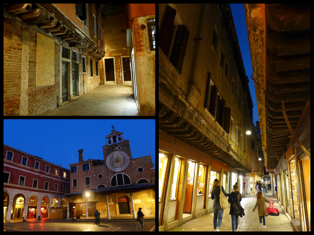
We checked the weather forecast for later in the week and it was for rain all three days we planned to spend in Lake Como - So – we decided to go to Rome instead! At this point it was 11 pm and we both had had a couple of Bellinis. But we managed to rebook our last night in Milan and book the other two at a hotel in Rome I’d been too previously. And booked the necessary train tickets. We ended up ‘eating’ one ticket which we no longer were going to use but we actually ended up saving money. But forecast for Rome is sun. And now Crista will get the ‘grand Italy tour of Venice, Florence and Rome’.
Thoughts on Venice in March. Well definitely less crowded but that doesn’t mean it wasn’t crowded in the touristy areas such as Rialto. Piazza San Marco was noticeably less crowded. We waited 10 minutes to get into the Doges Palace, about that for the Basilica. The line that in July stretched from the Basilica to almost the canal was about ¼ as long midday, same for the bell tower. So not ‘no lines’ but clearly shorter ones. Back ‘streets’ almost deserted, but the main streets to and from Rialto/Piazza San Marco etc. had enough people that you had to go around them or slow down. But overall, on a crowd basis it was almost like night and day the difference between July and March. Mid day on the vaparetto we easily stood by the side, at 5pm we even got a front row seat! There was a mix of sun and clouds and Sunday night it was super foggy (and cold). Very different from a full moon and bare legs weather. I wore a thin long sleeve shirt and half the time I had a down jacket on and the other half not. The light is definitely different, the water not as blue/green, the sun (even when it is out) doesn’t really get into the smaller canals and calles even at mid day. I’m guessing there is a tiny window of ‘good weather/ not terribly crowded’ that probably lasts a few days around late April but for most of the year I think you have to choose. This was interesting, and very glad I got to see Venice being more like a real city instead of ‘Disney World’ but I guess if I had to choose I’d pick the crowds over the poor light/cool temps. But that might be the photographer in me, I think others would choose the opposite. Piazza San Marco is nice to not be jammed, but the atmosphere is better in the summer.
I was in Venice last July and it was terribly crowded. I’d been before (in 2000, 04, & 08) and while there were certainly crowds in the main touristy areas of the Rialto, Accademia, and San Marco during midday, in the early and later hours and anywhere other than that main tourist stretch it was not at all crowded. But this last trip it was mobbed from 8 am to 10 pm and even on the smallest back canal. A friend had been first week of April last year and said it was wonderful, no crowds, great weather. So I decided I wanted to experience that for myself.
For the Florence, Rome and Milan portions of our trip see parts 2,3, and 4 of "Italy through new eyes: Chasing the Sun in Italy in March"
For more photos click on "All Photographs in the upper right corner and navigate to the Italy gallery.
]]>